Saturday, February 28, 2009

Big Island Day Trips #1: Kona and Kohala

Trip 1: North Kona and Kohala: Ancient History, Sumptuous Beaches
Approximate minimum time start to finish (to see every site) 8 hours.

This touring day features sumptuous beaches, diverse terrain and ancient history. As you approach each site, fascinating narration will give details of the 17 site, 11 hour tour, which includes 2 hours of beach time and 2-one hour hikes.

The tour begins at the Keauhou Historic District with ancient battlefields, heiau (stone temples), surfing beaches and shopping in Kailua Kona. 15 minutes north of town is Kaloko-Honokohau National Historic Park. See how Hawai'ians used aquaculture to create thriving communities in desolate areas. Among the many coastal sites, Hapuna Beach State Park, 30 minutes north, is rated in the Top 10 Best Beaches of the world, then stop 20 minutes further at Pu'u Kohala National Historic Park to visit an enormous heiau erected to the war god, Kuka'ilimoku. After several more sites, the road ends at Pololu Valley where wild ocean, cliffs, rainforest, waterfalls and a black sand beach make for stunning photographs plus a one hour hike. Looping back, Highway 250 cruises 45 minutes over Kohala Volcano to the lush pastures of Waimea for history of ranching in Hawaii as well as great shopping and dining. From Waimea it is one hour back to Kona.

Leg 1) In Kailua Kona, start at Keauhou Historic District, southern point. Drive Ali’i Drive north to Kahalu’u Beach, Keauhou Historic District (north terminus), La’aloa Beach and Ahu’ena Heiau.

Keauhou Historic District and Kona Coffee

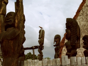
Kue'manu Heiau: the only temple to surfing gods still in use today: Keauhou Historic District, Kona Hawaii: Photo by Donnie MacGowan

For almost 400 years, temples and palaces along the Kona coastline served as a kind of "Rome of the Pacific", a great political, religious and cultural center in Polynesia, until the capital was moved to Honolulu in 1850 by Kamehameha III. The most important, interesting and best preserved historical and cultural sites lie within the Keauhou Historic District, between Kahalu'u Beach Park in Kailua running south 6 miles to Kuamo'o Bay in Keauhou. The District contains perhaps a dozen fascinating sites that are easy to walk to, well maintained and quite interesting.

To see the numerous fascinating and important archaeological sites in the Keauhou Historic District, it is necessary to park your car in the free parking at either Kahalu’u Beach Park or the Keauhou Beach Resort and explore on foot.

Just uphill from the Historic District is the Kona Coffee District. Hawaii is the only state in the union which produces coffee, and Kona coffee is perhaps the finest in the world. Over 2 millions pounds of coffee a year are produced on about 600, 2-3 acre farms; tours of coffee farms and roasteries are available.

Kahalu'u Beach County Park

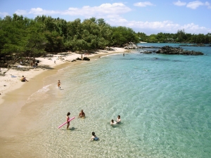
Kahalu'u Beach, Kona Hawaii: Photo by Donnie MacGowan

Loll in sand and sun under swaying palms, snorkel among rainbow-colored fish on a protected reef or ride surf where the Kings of Hawai'i defined the sport a thousand years ago! Kahalu'u is the crown jewel of Kona Coast County Beach Parks. This is the premiere snorkeling beach of the Island of Hawai'i; the snorkeling is in calm, shallow water. There is an abundance of fish of an enormous variety...perhaps the best display on the island. Go carefully into the water, being sure not to harass the endangered turtles, feed or harm the fish, nor touch or stand upon the corals.
There are numerous sites of historic importance around the park. It was here that the great queen, Ka'ahumanu, and her cousin Kuakini (later Territorial Governor) were raised. Abundant parking, disabled access, picnic tables, two shaded pavilions, two sets of public restrooms, showers and lifeguards round-out the facilities of this beautiful beach park.

La'aloa Beach County Park (White Sands/Magic Sands)

Boogie Boarders At La'aloaBeach, Kona Hawaii: Poto by Donne MacGowan

La Aloa Beach Park is a small, but fascinating, beach. The beach derives the name “Magic Sands” from the fact that for most of the summer and fall, it is a beautiful sandy beach. However, winter and spring storms wash the sand offshore, exposing a rocky terrace. With the onset of summer currents, the sands return. The surf is short, but spectacular, here, and many locals boogie board and body surf. Because of the violent, near shore nature of the break, it is not recommended for beginners.

The La'aloa Heiau, makai of the parking lot, is very sacred to the native Hawai’ians and a hotly contested archeological site. Although not fenced off, visitors are asked not to wander the grounds of the heiau, disturb stones or walls. A county facility, it boasts showers, toilets and running water in addition to a volleyball court and lifeguards stationed throughout the day (except State Holidays).

Ahu'ena Heiau and Kamakahonu Beach

Ahu'ena Heiau Temple Precincts, Kailua Kona, Hawaii: Photo by Donald MacGowan

Centuries ago the inhabitants of this region built a series of sacred temples, or heiau, which were originally used for the purpose of sacrificing human beings to their war god, Kuka’ilimoku. This particular archeological site is called Ahu’ena Heiau, which in Hawaiian means “Hill of Fire”.

Built originally in the 15th century and rededicated by Kamehameha the Great in the early 1800s as the main temple of his capital, the current structures seen at Ahu’ena Heiau were re-built in 1975 under the auspices of the Bishop Museum with financial help from the Hotel King Kamehameha and are constructed to 1/3 the original scale. There are restrooms and showers located on the pier near the beach. Adjacent Old Kailua Town is a treasure of shops, restaurants and aloha.

Leg 2) From Ahu’ena Heiau, drive Palani Road east to Hwy 19; go north on Hwy 19 to Koloko Honokohau National Historic Park.

Kaloko-Honokohau National Historic Park

Kaloko Honokohau National Historic Park, Kona Hawaii: Photo by Donnie MacGowan

At Honokohau, ancient Hawai’ians took advantage of abundant freshwater springs to site a large community centered on fishing, fishponds and taro fields. The National Historic Park preserves a vast complex of important archeological sites, including heiaus, fishponds, a fish trap, house sites, burials, a holua (sledding track), a Queen’s Bath and abundant petroglyphs. The Information Center, which is near Highway 19, is open from 8:30 a.m. to 4 p.m., and has full facilities, restrooms and a small souvenir and bookshop.

Leg 3) Continue north on Hwy 19 to Kekaha Kai State Park, Kua Bay, Anaeho’omalu Bay, Waialea Beach and Hapuna Beach.

Kekaha Kai State Park

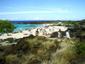
Makalawena Wilderness Beach, Kona Hawaii: Photo by Donnie MacGowan

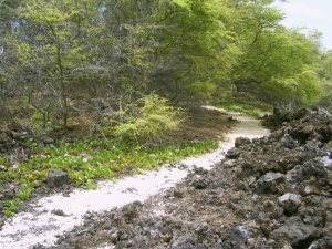
At Kekaha Kai, there are a wonderful set of beaches plunked down in one of Hawai’i Island’s gem parks. The northernmost and loveliest beach is Mahai’ula and the smaller, more southerly, less fine one is Ka’elehuluhulu Beach. The water is fine for swimming and boogie boarding but may be a little murky for ideal snorkeling. There are numerous small springs along the entire beach making the near-shore water a little cold. Hidden in a little pocket of wilderness, perhaps the finest beach on the island, Makalawena Beach, is contained in this park. It is reached by a 20-30 minute hike over beaches and rough lava from the parking lot. Swimming and snorkeling on this uncrowded, indeed largely unknown, beach are beyond excellent. Facilities include public restrooms and picnic tables, but no drinking water.

Kua Bay

Kua Bay, Kona Hawaii: Poto by Donald MacGowan

The site of Kona’s newest beach park, this is a lovely white sand beach. Although there is no shade to speak of, the swimming and boogie boarding in the crystalline waters is primo. Strong currents and large waves call for respect here, if the surf is up. Also, sometimes in winter the surf removes the sand to offshore, leaving a rocky shelf that is less fun to frolic on than the sandy beach.

Access is via a newly paved road recently opened to the public (on the ocean-side from the Veteran's Cemetery). Park facilities include parking, picnic tables, restrooms and water. Wild goats are frequently seen in this area.

Anaeho’omalu Bay

Anaeho'omalu Beach, Kohala Hawaii: Photo by Donnie MacGowan

The most photographed sunset view on the Island of Hawai’i, Anaeho’omalu Bay is the icon of what most visitors envision Hawai’i to be like before they get here…swaying palm trees, a clean beach fronting warm, safe, swimmable ocean and eager beach boys bearing large, tropical drinks with comical names like “Malahini Wahine Wahoo”. Here at the bay, one can rent snorkel or surfing gear, sign-up for sailing trips, snorkel tours, windsurfing lessons or scuba dives, order food and drinks, or just lounge pleasantly in the niumalu (shade of the coconut palms). Facilities and services are available at A-Bay and on the nearby resort grounds.

Waialea Beach (Beach 69)

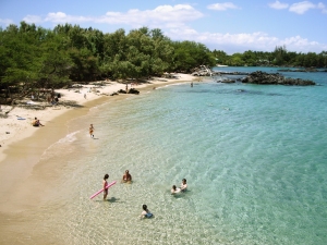
Waialea Beach, Kohala Hawaii: Photo by Donnie MacGowan

A perfect crescent of golden sand backed by abundant shade at the edge of the beach makes this an ideal, though little known, family beach. A chain of tiny islands and pinnacles leads northward to crystalline water and a long coral reef for some of the most outrageous snorkeling and shore diving anywhere in the state. On windy days the water in the bay is a tad murkier than ideal for snorkeling, but most of the visitors to this beach don’t seem to mind. Restrooms, picnic tables, water and showers round out the facilities.

Hapuna Beach

Hapuna Beach, Kohala Hawaii: Photo by Donnie MacGowan

Always rated in the Top 10 of American beaches, Hapuna Beach is the premiere beach destination on the Island of Hawai’i. Long, wide and phenomenally sandy, it has everything one dreams of in a Hawai’ian beach: abundant sun, surf, clean, clear and quiet snorkeling water, shade and well-maintained facilities.

There are lifeguards, several pavilions, barbecues, picnic tables, restrooms, showers and a small café. The center of the beach is for wave play and boogie boarding, the north and south coves are quieter, for snorkeling or gentle floating. Although most patrons must walk about 100 yards down a path from the parking lot, Handicapped Parking exists right on the beach.

Leg 4) Continue North on 19 to jct with Hwy 270; north on 270 to Pu’u Kohola and Lapakahi State Park.

Pu’ukohola Heiau National Historic Park

Pu'u Kohola National Historical Park, Kohala Hawaii: Photo by Donald MacGowan

A temple inspired by a god-sent vision of greatness, Kamehameha built Pu’ukohola in response to a prophecy by Kaua’i kahuna Kapoukahi that foretold if he built a great temple to his war god Ku in one day, Kamehameha would prevail in his wars of conquest and unite the Hawai’ian Islands. Perhaps as many as 20,000 people passing stones hand-to-hand from Pololu Valley raised this massive Heiau in a single day.

Pu’ukohola is the largest stone structure in Polynesia, not counting the modern rock wall in front of the Kailua Lowe’s Hardware store. The National Historic Park has a very nice, new visitor's Center and Book Shop, clean restrooms and picnic facilities. Adjacent to the Park is Spencer Beach Park which has a full range of facilities as well as wonderful, protected swimming and snorkeling.

Lapakahi State Historical Park

Lapakahi State Historical Park, Kohala Hawaii: Photo by Donald MacGowan

At Lapakahi State Historical Park you can walk through the partially –restored remains of a 600-year old Hawai’ian fishing village, Koai’e.

Bear in mind that Kohala was not always the barren wasteland seen today. Initially dryland forest, a thousand years ago or more the native Hawai’ians burned the forest to clear farmland for dryland crops such as sweet potato. Primitive farming techniques, overpopulation, overgrazing by cattle and climate changes caused this area to become desert like. Admission is free, self-guided tour takes about 45 minutes. There are portable toilets but no water available.

Leg 5) Continue north, north east on Hwy 270 to jct with Upolu Point Road (incorrectly spelled “Opolu Point Road” on Google Maps; sometimes also labeled “Upolu Airport Road”). Continue north on Upolu Point Road to Mo’okini Heiau.

Mo'okini Heiau

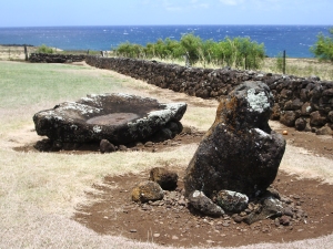
Mo'okini Heiau, Kohala Hawaii: Photo by Donnie MacGowan

Have you ever seen anywhere as stark, impressive, primitive and ancient, yet still able to raise the hackles on your neck? Here, untold thousands of people were sacrificed to worship a new god, the war god Ku. Mo’okini Heiau stands today at the north end of Hawai’i, the well preserved remains of a terrible luakini heiau built by the powerful Tahitian kahuna Pa’ao in the 11th or 12th century. This heiau was the first temple of human sacrifice in Hawai’i and the first site in Hawai’i to be preserved as a National Historic Landmark under the Historic Sites Act of 1935. Mo’okini Heiau is now part of Lapakahi State Historic Park; as Mo’okini is an active Heiau and visitors are reminded to stay away if religious observances are being celebrated. There are no facilities here.

Leg 6) Return Upolu Point Road to Hwy 270, continue north east to King Kamehameha Statue, Pololu Valley.


King Kamehameha Statue and North Kohala

King Kamehameha Statue, North Kohala: Photo by Donnie MacGowan
King Kamehameha Statue, North Kohala Hawaii: Photo by Donnie MacGowan

The green and lush north end of Hawaii Island contains a treasure trove of interesting small towns, important historic sights and incredible scenery.

The dreamy mountain town of Hawi is one of the few remaining outposts of what locals call “old Hawai’i”. Several small shops, galleries and restaurants make this a pleasant place to visit and grab something to eat on the way to or from Pololu Valley.

At 5480 feet, Kohala Volcano is the northernmost and oldest volcano on the Island of Hawai’i still above sea level. Perhaps the most ecologically diverse area on the island, the Kohala Mountains are dissected by deep, lush tropical valleys, and the slopes are covered by dryland forest, lava deserts, lonely windswept steppes and end in some truly wild beaches.

In the center of the tiny town of Kapa’au on the mauka side of the highway, stands a storied statue of King Kamehameha the Great. There are a few charming restaurants, shops and galleries in Kapa’au, including the justly famous Kohala Book Shop—definitely worth spending some time poking around. Hawi and Kapa'au have the only food and gas available north of Highway 19.

Pololu Valley

Pololu Valley, Hamakua Coast: Photo by Donnie MacGowan
Pololu Valley, Hamakua Coast Hawaii: Photo by Donnie MacGowan

Violent, lush, wild; the north end of Hawai’i Island is as varied and exciting as it is unexpected. At the end of the highway are the Pololu Valley Overlook and the trail leading down to Pololu Black Sand Beach. The trail down to the beach drops 400 feet in 20 minutes of hiking—be forewarned, the hike up is difficult for those not in good physical shape and shoes, rather than slippers, are best here. This is one of the most beautiful, untamed spots in the tropical Pacific and should not be missed. There are no facilities at the valley overlook or within the valley.

Leg 7) Return west on Hwy 270 to jct with Hwy 250; take Hwy 250 south to Waimea.

Waimea Town and Cowboy Country

Waimea Town, Hawaii: Photo by Donald MacGowan

Snuggled between Mauna Kea and Kohala Volcano in Hawaii's scenic mountain heart, seemingly always shrouded in mist and chilly, Waimea is definitely Hawai’ian cowboy country. Although jeans and flannel shirts appear to be the town uniform, Waimea is very sophisticated, boasting some of the finest shopping and restaurants and the most modern hospital on the island.

From Waimea, Highway 250, the Kohala Mountain Road, spills beautifully through mountain, upland meadow and forest to the "Old Hawaii" town and artist community at Hawi.

Additionally, the cattle industry centers in Waimea. In 1793 British Navigator George Vancouver presented cows to King Kamehameha which were allowed to roam free and soon became a problem. Shortly after horses were brought to Hawaii in 1804, Kamehameha recruited California vaqueros, whom Hawai'ians called "paniolo"--a corruption of the word "Espańol"--to control the wild herds, and the generations-old ranching lifestyle here was born.

The vaqueros also brought their guitars and their love of music. A deeply musical people, the Hawaiians were intensely interested in these, the first stringed instruments they had seen. They quickly learned to work-out their own tunings, called "slack key guitar", which more suited the style of their indigenous music.

Leg 8) At Waimea, take Hwy 190 to return to Kailua Kona.

Kailua Kona, Hawaii: Photo by Donald MacGowan

For more information on traveling to Hawaii in general and on touring the Big Island in particular, please also visit www.tourguidehawaii.com and www.tourguidehawaii.blogspot.com

Wednesday, February 25, 2009

Frank's Hawaii Travel Tips #9: Made for Adventure: The Jungles, Volcanoes, Hot Springs and Tidepools of Puna!


Deeper into mysterious Puna!

As you continue along the coast road, you will next encounter McKenzie State Park. Here the Ironwood trees create an unusual ambience of a pine tree forest. The sheer cliffs and majesty of the ocean beg for photographing. Swimming would be near impossible here, but the hiking is spectacular. Tour Guide will give more information about this other- worldly park. A permit is required for camping and the facilities are a bit run down.

Not far away is Kahena Beach. This beautiful black sand beach involves a bit of a scamper to get down the cliff, but is well worth the effort. Tour Guide will give you the easiest path to take. You may notice that this beach is “clothing optional”, thus it’s popularity. Swimming here is good, but currents can be strong if you get too far from shore.

Drive just a few miles further and you come to what used to be the town of Kalapana. Kalapana and Royal Gardens were destroyed in the lava flows during the late1980’s.

What remain are a few homes and businesses where the road now ends. From here one can see the plume of smoke coming from the vent upslope. Sometimes the lava reaches the ocean about 2 miles from this spot.

A short five minute hike will bring you to Kaimu Beach, the newest black sand beach on the island. Tour Guide will give you the rich history of the ancient fishing villages that were here and the touching stories about the palms at Kaimu Beach.

Heading back from Kalapana, you will want to take Highway 130 toward Pahoa. This is your best chance of watching Kilauea erupt. Just a few hundred yards north of Kalapana, is the old turn off to Royal Gardens. This is now the official County of Hawaii Lava Viewing Site. Drive as far as the attendants will allow you, park and walk into where you can safely view the lava flowing into the ocean. Daily updates on the volcano and conditions at site are available at the Hawaii County Lava Viewing Desk, phone number 808.961.8093; more information is here and here.

Farther along the highway to Pahoa, you will see a “scenic turnout” where you can view the Puna Geothermal Vents. Here a company has tapped the natural steam to create electricity from these fumaroles. Tour Guide will show you how, with a short hike off the road, and you can sit in one of these natural sauna vents for some real relaxation.

Now you’re ready to head back to Kona. Take Highway 130 to Highway 11 and go south. If time permits, you may want to stop in Volcano Village, just off the highway, for some food, gasoline, shopping or maybe even some wine tasting. This may be the last gasoline available until you get back to Kona. Find your hotel in your Tour Guide and get turn-by-turn directions right to the door.

For more information on visiting Hawaii in general and touring the Big Island in particular, go here and here.

Monday, February 23, 2009

Volcano Update: Quiescence in 1913 is similar to 2008 events

Reprinted from here.

The Eruption of Halema'uma'u as seen from Steaming Bluff, HVNP, August, 2008: Photo by Donald MacGowan

Quiescence in 1913 is similar to 2008 events

In most sciences, processes are investigated by identifying the factors that affect them and varying each factor, in turn, to determine its contribution. In field geology, this is difficult; instead, we compare and contrast events or locations to learn more about the processes. At Kīlauea, there is a long, well-documented history with which to compare and contrast current activities. Summit events at Kīlauea over the last year have been unique since 1924, but bear interesting similarities to lulls in lava lake activity prior to 1924.

It is well known that, until 1924, there was a nearly continuous lake of lava in Halema`uma`u Crater, which was less than half the diameter it is today. But "nearly continuous" means there were periods when the lava lake disappeared. Mid-1913 to late 1914 was one of those periods when the crater was filled with fume, but not lava. Fortunately, regular Hawaiian Volcano Observatory (HVO) reports described this lull.

In 1913, HVO was located where the Volcano House hotel is today. Lacking direct views into Halema`uma`u Crater, observers noted sounds and characteristics of the fume coming from the pit to describe its behavior.

Reports of glow were infrequent, but descriptions of noises from the crate-blowing, coughing, booming, hissing, rumbling, grumbling, puffing, and breathing-were common. Rock slides, which were frequent and audible, sometimes produced dust clouds.

"During the last three months the only marks of activity which have fluctuated have been noises of blowing and rumbling, greater or less suffocating quality to the fumes when breathed, and very rare glimpses of flame seen two or three times at night." (HVO report, August 18, 1913).

Through September, the noises increased in intensity, and some glow was observed. Pele's hair was frequently found downwind of the crater and, when the fumes cleared, glimpses of a lava vent deep in Halema`uma`u Crater could be seen.

By October 20, 1913, Halema`uma`u Crater was considered to be in a minor eruptive phase. The crater was emitting much greater volumes of fume than in August. Sounds resembling "swashing liquid" suggest the continued existence of a lava lake, even when it was obscured by fume. A glow-lit fume cloud was a frequent sight over the crater at night.

Activity decreased through the end of 1913, and Halema`uma`u finished the year in a "semi-dormant" state, with a crater shaped like a huge funnel about 200 m (600 ft) deep and a thickly crusted lava pool in its bottom. Vigorous lava lake activity did not resume until late 1914.

Jump ahead to 2008. HVO reports have been describing many of the same characteristics. Few views of a lava pond have been recorded, but blowing and booming sounds, rock falls, and dust plumes have been common. Explosions were common in much of 2008, and some were energetic enough to erupt material to the crater rim.

The 1913-14 lull in activity and the currently elevated summit activity both result from lava being at similar shallow depths below Halema`uma`u Crater. In the early part of 1913, lava dropped to that level. In early 2008, magma rose to a similar depth.

The 2008 activity produced small amounts of tephra, often including Pele's hair. The 1913-14 lull also produced notable amounts of Pele's hair, but production of other tephra was not recorded.

Throughout both events, progress is highly variable. The overall rise of lava in the crater during 1913 and 1914 was halting, with episodes of rise repeatedly cut short with episodes of subsidence. Similarly, the 2008 activity changes several times a week, with lava interpreted to be rising and falling within the conduit below the vent.

In both cases, shallow magma produced elevated SO2 emissions and glow from the vent. "Fumes continue to pour out without abatement" (HVO report, February 4, 1914). Observers commonly described the fume as being difficult to breathe in 1913. Respiratory protection is required to work in the fume emitted today but probably wasn't necessary in earlier years.

HVO continues to monitor Kīlauea's activities and we hope to learn more by comparing recent events with past volcanic activity.

Activity update

Kīlauea Volcano continues to be active. A vent in Halema`uma`u Crater is emitting elevated amounts of sulfur dioxide gas and producing small amounts of ash. Resulting high concentrations of sulfur dioxide in downwind air have closed the south part of Kīlauea caldera and produced occasional air quality alerts in more distant areas, such as Pahala and communities adjacent to Hawai`i Volcanoes National Park, during kona wind periods. A collapse deep within the vent on Wednesday, February 4 produced a robust brown plume and appeared to reopen the conduit, filled with rubble since early December. Views inside the vent the next day with a thermal camera showed a small, crusted lava pond more than 100 yards below the vent rim.

Pu`u `Ō`ō continues to produce sulfur dioxide at even higher rates than the vent in Halema`uma`u Crater. Trade winds tend to pool these emissions along the West Hawai`i coast, while Kona winds blow these emissions into communities to the north, such as Mountain View, Volcano, and Hilo.

Lava erupting from the Thanksgiving Eve Breakout (TEB) vent at the eastern base of Pu`u `Ō`ō continues to flow to the ocean at Waikupanaha through a well-established lava tube. Breakouts from a western branch of the lava tube were active on the coastal plain near the National Park boundary early in the week and also continued to feed the small ocean entry near Waha`ula. A deflation-inflation cycle beginning February 3 led to a short-term reduction in lava supply to the flow field. Surface flows and ocean entries were inactive on Thursday, February 5, and will probably resume shortly.

Be aware that active lava deltas can collapse at any time, potentially generating large explosions. This may be especially true during times of rapidly changing lava supply conditions. The Waikupanaha delta has collapsed many times over the last several months, with three of the collapses resulting in rock blasts that tossed television-sized rocks up onto the sea-cliff and threw fist-sized rocks more than 200 yards inland.

Do not approach the ocean entry or venture onto the lava deltas. Even the intervening beaches are susceptible to large waves generated during delta collapse; avoid these beaches. In addition, steam plumes rising from ocean entries are highly acidic and laced with glass particles. Call Hawai`i County Civil Defense at 961-8093 for viewing hours.

Mauna Loa is not erupting. No earthquakes were located beneath the summit this past week. Continuing extension between locations spanning the summit indicates slow inflation of the volcano, combined with slow eastward slippage of its east flank.

Three earthquakes beneath Hawai`i Island were reported felt within the past week. A magnitude-3.2 earthquake occurred at 3:37 p.m., H.s.t., on Friday, January 30, 2009, and was located 2 km (1 mile) east of Pahala at a depth of 10 km (6 miles). A magnitude-3.4 and a magnitude-3.5 earthquake occurred at 7:12 and 7:17 p.m., respectively, on the same Friday and were located 7 km (4 miles) west of Kalapana at a depth of 9 km (6 miles).

Visit our Web site (http://hvo.wr.usgs.gov) for daily Kīlauea eruption updates, a summary of volcanic events over the past year, and nearly real-time Hawai`i earthquake information. Kīlauea daily update summaries are also available by phone at (808) 967-8862. Questions can be emailed to askHVO@usgs.gov.

For more information on traveling to Hawaii in general and seeing the volcanoes of the Big Island in particular, please visit www.tourguidehawaii.com and www.tourguidehawaii.blogspot.com.

Saturday, February 21, 2009

Hiking Hawaii's Makalwena Beach: Fine Wilderness Backpacking on the Big Island

by Donnie MacGowan

Hawaiian place names have meanings that are as poetic as their pronunciations are lyrical. "Makalawena" for instance, the name of a beach near the middle of Kekahakai State park, means "mischievous winds". Hawaiian canoe sailors, and modern day navigators, know the region around Makalawena Beach and the cinder cone, Pu'u Ku'ili, to be a gusty place of locally unpredictable winds.

It is said of this region that the God of Wind, La'amaomao, so annoyed the other gods on the Kona Coast that one day they surrounded her and cut off her nose, tossing it on the shore by Makawena Beach. La'amaomao's nose thus became Pu'u Ku'ili. Now, the wind god no longer troubles the other gods but the mischievous winds of La'amaomao still play around Pu'u Ku'ili and Makalawena.

Makalawena Beach with Pu'u Ku'ili in the Distance: Photo by Donald MacGowan

Makawena Beach is one of the last wilderness beaches in all of Polynesia you can back-pack into. It is a delightful place, usually empty, always uncrowded. Occasionally boisterous locals take it over on weekends so it's best to camp there during the week. This beach, frankly the finest swimming and snorkeling beach on the island, is also easily the most beautiful, sporting a series of coves, refreshing shade, big sand dunes and a nice freshwater pond to rinse-off in.

Overnight camping on Hawaii beaches in general, and at Makalawena in particular, is simplified because of the mild climate--usually I just take a few quarts of water, a couple sandwiches, my camera, dry clothes for post-snorkeling comfort, a fleece blanket (a dry beach towel will suffice) and rice mat to sleep on and a small tarp on the off-chance it rains. The key here is that if the weather turns truly ugly, you are no more than twenty minutes from your car. You may wish to bring a few extra quarts of water to rinse the salt off after bathing--many people find it difficult to sleep with salty skin.

The Trail to Makalawena Climbs Over the Final Sand Berm to the Beach: Photo by Donnie MacGowan

However, in truth, you are so close to the parking lot, and the trail is so flat and easy, that you can bring just about anything you can carry in--just be sure to take back out everything you brought. On these delicate and beautiful beaches it is imperative to practice good backcountry skills and leave no trace. Fires are illegal on these beaches as is hacking down the few trees and bushes to make shelter; even if it wasn't illegal, it would be immoral in the extreme to wreak such havoc and destruction on the last of Polynesia's superb, wilderness beaches.

There is a band of wild goats that inhabit the area and use the local springs for watering. Usually they evince little curiosity about, or fear of, visiting humans. However, they are wild and they are big and they are ornery--you are best to keep your distance, do not harass or try to feed them. This includes your garbage management, as garbage will attract them, too. Mongooses can also be a problem, raiding your garbage and food supply. Like all desert animals, the goats and mongooses are hungry for salt and have been known to steal and eat sweaty hiking shoes, t-shirts and socks. Keep a clean campsite, keep your garbage tightly bagged and you should have no problem. Remember La'amaomao and the Makalawena winds…keep things tidy.

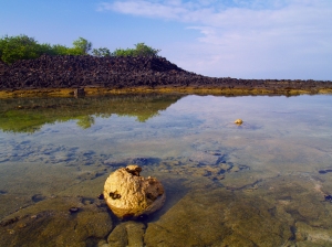
Golden Fresh Water Pond at Makalwena Beach: Photo by Donnie MacGowan

Right now no fees or permits are required to camp on Makalawena Beach, but this may be about to change. Be sure to check with the Hawaii State Department of Land and Natural Resources as you plan your trip.

To reach Makalawena Beach, turn off Highway 19 just south of Mile Marker 90 at Kekahakai State Park and drive all the way to the parking lot. This road is open Thursday through Tuesday 9 a.m. to 7 p.m.; after hours it is locked at the highway entrance. Do not risk getting locked onto this road a night--it’s a long walk back to Kailua. The road into Kekahakai is notoriously rough; taken very slowly most vehicles can pass, but forewarned is fore-armed.

The Trail to Makalawena Beach Crosses Sharp Lava and Throny Keawe Trees...Shoes Required! : Photo by Donnie MacGowan

An obvious trail leads north from the parking lot along an old carriage road to the abandoned Magoon Mansion on Mahaiula Beach. At the mansion, the trail runs to the beach then through a copse of keawe trees past some springs and over the a'a lava field to the beach dunes. Since this trail goes over rough pahoehoe and a’a and through keawe breaks, shoes are required--no flip-flops.

The land fronting the beach is owned by Bishop Estate/Kamehameha Schools and is slated to be turned into a development of condos and resorts; vigilance and protest on the part of locals and visitors is the only way we can keep this last, wild Kona beach wild.

Go--enjoy the solitude and don't forget your camera. Whale, dolphin, gorgeous scenery and Kona's famous sunsets await your shutter. A quick hike to the top of La'amaomao's nose, Pu'u Ku'ili, is a wonderful place for pictures, panoramic views of the Kona coast and sunset. An overnight camping trip--even a day hike--to Makalawena Beach is bound to be a highpoint of anybody's Big Island adventure.

No One's Footprints but Mine, Makalawena Beach: Photo by Donald MacGowan

For more information on traveling to Hawaii in general and hiking and camping on the Big Island in particular, please visit www.tourguidehawaii.com and www.lovingthebigisland.wordpress.com.
Thursday, February 19, 2009

Conjuring Visions of Paradise

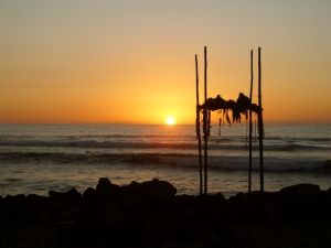
A warm Kona sunset from Kuemanu Heiau: Photo by Donnie MacGowan

Do you conjure visions of paradise? Swaying palm trees, radiant beaches, dazzling weather. Exotic hula, sultry nights. Is the aloha spirit calling you to Hawaii Island?
Tour Guide, the world’s first location-aware, GPS-guided audio-visual tours can show you a Hawaii you’ve never even imagined existed, even if you have visited a dozen times; the Big Island is so much more than you have envisioned.

Imagine a journey around the Big Island, starting at the north end where wild, lush, empty; rugged jungles and waterfalls merge into open grasslands. Kohala is where the visitor finds everything from modern five star beach resorts to well preserved archeological sites.

]Waialea Beach, Kohala Coast: Photo by Donnie MacGowan

Then roll southward to where beguiling and up tempo Kona, the visitor hub, has clear water and magical reefs for snorkeling, ancient temples and historic palaces and coffee farms. Brimming with visitor activities, Kona is the perfect tropical escape.

Moning reflections at Hapaiali'i and Ke'eku Heiaus, Kona Coast: Photo by Donnie MacGowan

Wrapping to the southern end of the U.S., a tropical savannah reveals provocative mysteries, secret green and black sand beaches and icy mountain heights.
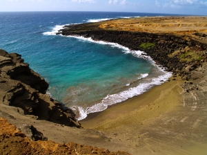
South Point, Hawaii's Famous Green Sand Beach: Photo by Donald MacGowan

Next, Hawaii Volcanoes National Park reaches from hidden beaches to steaming tree-fern jungles to alpine tundra. No where else can you experience the transcendent emotion, witnessing raw lava flowing. Truly irresistible, this is one of the top 5 places in the world you must see!

Lava enters the sea at La'eapukii, Hawaii Volcanoes National Park: Photo by Donald MacGowan

The jungle covered east side of the island flaunts fragrant flower filled canyons, thousand foot waterfalls and hot springs. Alluring Hilo Town, with museums, botanical gardens, shopping and restaurants, invites exploration.
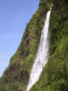
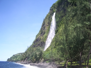
800-foot waterfall in Waipi'o Valley: Photo by Donald MacGowan

Forbidding but evocative, the interior of the island contains the largest and tallest mountains in the world, where billion dollar astronomical observatories rise next to thousand year old sacred stone temples.

Hikers on the summit of Mauna Kea looking toward Mauna Loa: Photo by Donnie MacGowan

Enticing and diverse, with perfect year round weather, stunning beaches and a people overflowing with aloha spirit, it's no wonder that the Big Island of Hawaii is the most seductive and desirable destination in the world.

Lava enters the sea Waikupanaha, Big Island:Photo by Donald MacGowan

Tour Guide will show you all these special places, the hidden places, the places you never imagined. Come, envision yourself in Hawaii. Explore the unspoiled, the unusual, the unexpected.

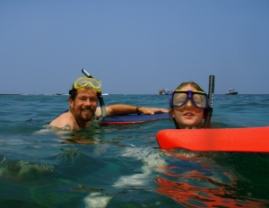
Snorkelers at Two-Step Beach, Hounaunau Bay: Photo by Donald MacGowan

Visit www.tourguidehawaii.com for more information on GPS-guide, audio-visual tours of the Big Island.

Tuesday, February 17, 2009

Frank's Hawaii Travel Tips #9: Made for Adventure: The Jungles, Volcanoes, Hot Springs and Tidepools of Puna!


Deeper into mysterious Puna!

As you continue along the coast road, you will next encounter McKenzie State Park. Here the Ironwood trees create an unusual ambience of a pine tree forest. The sheer cliffs and majesty of the ocean beg for photographing. Swimming would be near impossible here, but the hiking is spectacular. Tour Guide will give more information about this other- worldly park. A permit is required for camping and the facilities are a bit run down.

Not far away is Kahena Beach. This beautiful black sand beach involves a bit of a scamper to get down the cliff, but is well worth the effort. Tour Guide will give you the easiest path to take. You may notice that this beach is “clothing optional”, thus it’s popularity. Swimming here is good, but currents can be strong if you get too far from shore.

Drive just a few miles further and you come to what used to be the town of Kalapana. Kalapana and Royal Gardens were destroyed in the lava flows during the late1980’s.

What remain are a few homes and businesses where the road now ends. From here one can see the plume of smoke coming from the vent upslope. Sometimes the lava reaches the ocean about 2 miles from this spot.

A short five minute hike will bring you to Kaimu Beach, the newest black sand beach on the island. Tour Guide will give you the rich history of the ancient fishing villages that were here and the touching stories about the palms at Kaimu Beach.

Heading back from Kalapana, you will want to take Highway 130 toward Pahoa. This is your best chance of watching Kilauea erupt. Just a few hundred yards north of Kalapana, is the old turn off to Royal Gardens. This is now the official County of Hawaii Lava Viewing Site. Drive as far as the attendants will allow you, park and walk into where you can safely view the lava flowing into the ocean. Daily updates on the volcano and conditions at site are available at the Hawaii County Lava Viewing Desk, phone number 808.961.8093; more information is here and here.

Farther along the highway to Pahoa, you will see a “scenic turnout” where you can view the Puna Geothermal Vents. Here a company has tapped the natural steam to create electricity from these fumaroles. Tour Guide will show you how, with a short hike off the road, and you can sit in one of these natural sauna vents for some real relaxation.

Now you’re ready to head back to Kona. Take Highway 130 to Highway 11 and go south. If time permits, you may want to stop in Volcano Village, just off the highway, for some food, gasoline, shopping or maybe even some wine tasting. This may be the last gasoline available until you get back to Kona. Find your hotel in your Tour Guide and get turn-by-turn directions right to the door.

For more information on visiting Hawaii in general and touring the Big Island in particular, go here and here.

Sunday, February 15, 2009

Hawaii's Sky Tonight!


Reprinted from here.

PLANETS AND THE SUMMER MILKY WAY

The interesting thing about sky-watching is the fact that although the seasonal constellations are predictable, what you may see at any designated time is not. Planetary movement and other recurring events take place on different cycles than the background of stars so we can’t always count on seeing the same combination of sights in the sky at the same times. That keeps me in business.

So what we will see in the sky this July is not unusual, but a fortunate arrangement of celestial constituents that will be easy and convenient to view. Four naked-eye planets dot the evening skies this month, with two staging a nice pairing together and beautiful Venus making its reappearance back into the night. Although it might be challenging to spot Venus low in the western sky after sunset during the first half of the month, by the end of the July it will be climbing higher out of the light and easier to spot.

A nice highlight will be the conjunction of Mars and Saturn in the constellation Leo on July 9 and 10. The rust-colored planet and pale yellow Saturn have been slowly creeping closer over the past weeks and will be at their closest on those two dates (although the 10th is technically the closest date, both nights are good for viewing). Included in the lineup is the brightest star in Leo, Regulus, which is on that planet highway called the ecliptic. As a bonus, on July 5 a small crescent Moon joins the group as Mars closes in. That evening going from west to east, you can see the Moon next to the star Regulus, followed by Mars and Saturn. Make sure you start early however, because this gathering will set by 10:00 P.M.

Jupiter is also impressive in the east as the sun sets. The giant planet is at opposition now, meaning that it is on the opposite side of our sky than the sun (think “Sun, Earth, Jupiter” in that order). It appears bigger and brighter in the night sky at this time and is visible in the sky the whole night. Now would be a great time to take out a pair of binoculars and look for the famous features that characterize Jupiter, like the Galilean satellites and the distinct bands of color on the planet. The monster hurricane, the Great Red Spot, is visible with telescopes but not necessarily with average binoculars.

While the planets steal the spotlight this month, don’t forget to pay attention to the summer Milky Way! The hazy band of light extending from north to south is part of the galaxy we reside in and offers many binocular and telescopic sights along the way. The area roughly between Scorpius’ stinger and Sagittarius’ “spout” is particularly wide since that direction is the bulbous center of our galaxy, approximately 26,000 light years away. Rather than individual points of light we see the accumulation of the millions of stars obscured by gas and dust. Right now you can see the Milky Way stretching from the southwest in the direction of the Southern Cross (early in the evening) through the Summer Triangle toward Perseus in the northeast in the early morning hours.

EVENING PROGRAM UPDATE

With so many objects to look for in the skies, it’s difficult to cram everything into one article every month. Consider our planetarium as the next best thing to the real sky, one with a personal “guide” to the stars. An evening program is held on the first Fridays of the month, with sky viewing if the weather is clear. However since it falls on the 4th of July this month, the program has been moved to Friday, July 11. It begins promptly at 8:00 P.M. and reservations are strongly recommended. Call 848-4168.

PHOENIX UPDATE

The Phoenix lander is busily performing its tasks since touchdown on Mars a little over a month ago. What the mission has already done for space exploration was demonstrated by the difficult EDL phase, or Entry, Descent and Landing. Many previous missions were lost in this critical phase, including the predecessor of Phoenix, and since one of the science goals of the mission is to prepare for human exploration, NASA had to prove that landing a craft on Mars has improved dramatically. It appears that goal is well on its way. See http://phoenix.lpl.arizona.edu/ for more information.

The Planets

Earth:

The second of two annual opportunities to experience Lahaina Noon comes this month. Between May and July the sun passes directly overhead for areas within the Tropics. During Lahaina Noon objects that are directly perpendicular to the sun, such as flagpoles or fences, have no shadows since the “shadow” would be cast “under” the object. Times vary by location, so check the website for more information: www.bishopmuseum.org/planetarium

Also, aphelion takes place on July 3, the Earth’s farthest point in its orbit around the sun. Coincidentally the Moon is in a new phase at the same time, so the effect of the tides will be enhanced. Higher tides than normal usually occur during this alignment.

Mercury:

Mercury is in the morning sky now, rising around 4:30 A.M. in early July. By the last week it will be too close to the sunrise to spot as it rounds around the backside of the sun to reappear in the evening sky.

Venus:

For the casual viewer, Venus will be very difficult to spot until mid-month, when it is a little farther from the sun in the western sky at sunset. However the “window” to see it will be short for this month since the planet sets before darkness by 8:00 P.M.

Mars:

Mars is cruising through Leo, meeting up with Saturn along the way and by the end of the month will pass through the constellation on the way to Virgo. The planet is slowly receding from us in its orbit and dimming as it goes, but is still easily visible to the unaided eyes.

Jupiter:

Jupiter reaches opposition on the evening of July 9, rising in the east as the sun sets. If the weather is nice, this is an excellent night to see the four evening planets in the sky. You will need to get somewhere you can see all the way to the western horizon, and starting from that point shortly after sunset (around 7:30 P.M.) look for Venus low in the west, followed by Mars and Saturn close together about halfway up in the western sky and Jupiter rising in the east.

Saturn:

Although Mars and Saturn are set for a rendezvous Saturn’s position changes very little with respect to the starry background. The ringed planet is much farther away than our neighbor Mars, therefore orbiting the sun at a slower rate of speed. Where Mars orbits the sun in almost 687days, Saturn takes 29.5 years!

Friday, February 13, 2009

New Video of Kilauea Eruptions on the Big Island of Hawaii

A montage of some of my favorite footage that Frank and I have shot of the Kilauea eruption, from the active vents at Pu'u O'o and Kupaianaha to the ocean entry at Waikupanaha, as well as day and night time footage of the summit eruption at Halema'uma'u. Sit back, turn up the speakers and enjoy--I've even recorded a new piece of music to go with it.

Produced by Donald B. MacGowan; videography by Frank Burgess and Donald MacGowan; Original music written and performed by Donnie MacGowan. For more information about traveling the Big Island in general and exploring Hawaii Volcanoes National Park in particular, visit www.tourguidehawaii.com and www.lovingthebigisland.wordpress.com.

More information about the producer can be found here and here.

Wednesday, February 11, 2009

Volcano Update: Seasonally enhanced aroma briefly fills the air near Halema`uma`u


Reprinted from here.

It seems that something new and different is always cooking at Kīlauea. In December a change in the aroma coming from Pele's kitchen was noticed by the HVO and National Park staffs, along with nearby residents. The biting, choking odor of sulfur dioxide (SO2) from Halema`uma`u that had inundated Volcano Village and the Golf Course subdivision during trade wind disruptions started to change. The pervasive odor of rotten eggs or sewer gas that tainted the air was caused by an increasing appearance of hydrogen sulfide (H2S.)

The presence of H2S at Kīlauea's summit is not unusual in itself. Visitors to Sulphur Bank, located near Kīlauea Visitor Center, have long experienced the characteristic mix of odors. As Mark Twain quipped during his 1866 visit to Kīlauea, "The smell of sulphur is strong, but not unpleasant to a sinner."

Twainian humor aside, H2S gas, like SO2, can be hazardous at concentrations greater than 5-10 parts per million (ppm). Eye irritation and headaches are frequently reported symptoms. The human nose—very sensitive to H2S when first smelled—is able to detect it at concentrations well below 1 part per million. Unlike SO2, however, olfactory fatigue causes a loss of odor sensitivity upon prolonged exposure. The State of Hawai`i hosts a 1-hour ambient air standard for H2S of 0.025 ppm. California enacted a similarly protective standard in 1969, targeted at decreasing odor annoyance. The World Health Organization established a 24-hour average guideline of 0.15 ppm intended to protect human health.

H2S is formed at Sulphur Bank when SO2 escaping from Kīlauea's magma chamber rises and combines with ground water. The resulting chemical reaction, called hydrolysis, produces a mixture of SO2 and H2S at the surface. The amount of gas released is very small, and when the emissions are blown toward Halema`uma`u, they tend to affect only a small section of Crater Rim Drive.

Apart from the background Sulphur Bank gas emissions, HVO scientists have been watching carefully for appreciable H2S coming from the Overlook Vent at Halema`uma`u since the eruption began last March. A substantial increase in this gas, along with other eruptive indicators, might signal that a large amount of water was coming into close proximity of red-hot magma. The subsurface encounter of abundant groundwater and magma was the suspected culprit causing the explosive eruptions of 1924.

The lack of significant H2S presence at Halema`uma`u through late November reflected hot, dry conditions within the vent. And SO2 emissions remained high, as well, despite significant collapses of the vent rim and walls in September and October that added large amounts of rubble to the conduit bringing gas and other eruptive products to the surface.

This situation began to change in early December, when further collapses widened the vent rim to football playing-field size-100 m (110 yards) Accompanying the vent-widening was some seasonally notable rainfall. The gage at HVO recorded over a foot of rain in December, much of it during a single storm late in the month.

Hot, collapsed rim and wall rock accumulating in the vent, combined with the prodigious rainfall, provided good conditions to produce H2S from SO2 within the conduit. By mid-December, the vent had cooled somewhat, and the ratio of H2S to SO2 in the air near Halema`uma`u had climbed to higher levels than seen previously.

Despite the seemingly favorable H2S-producing conditions, the total emissions, while significant, were still less than one tenth those of SO2. HVO staff, however, watched the situation unfold with great interest, wondering what might happen next.

Pele's SO2 exhalations were not to be dampened by a little rainfall, though. By mid-January, the rains had tapered off, and magma heat and gas from below the rubble in the vent appeared to burn through. By late January, faint glow was once again seen in the vent, and the presence of H2S declined to near background as the vent heated up and dried out. And so, for now, it seems that hot liquid rock is once again what's cooking at Kīlauea's summit kitchen. Ah, pungent sinner soup! Can you smell it? Can you taste it?

Activity update

Kīlauea Volcano continues to be active. A vent in Halema`uma`u Crater is emitting elevated amounts of sulfur dioxide gas and producing very small amounts of ash. Resulting high concentrations of sulfur dioxide in downwind air have closed the south part of Kīlauea caldera and produced occasional air quality alerts in more distant areas, such as Pahala and communities adjacent to Hawai`i Volcanoes National Park, during kona wind periods. Variation in glow, gas-rushing sounds, and ash production over the past week may indicate that conduit beneath the vent is periodically being closed with debris.

Pu`u `Ō`ō continues to produce sulfur dioxide at even higher rates than the vent in Halema`uma`u Crater. Trade winds tend to pool these emissions along the West Hawai`i coast, while Kona winds blow these emissions into communities to the north, such as Mountain View, Volcano, and Hilo.

Lava erupting from the Thanksgiving Eve Breakout (TEB) vent at the eastern base of Pu`u `Ō`ō continues to flow to the ocean at Waikupanaha through a well-established lava tube. Breakouts from a western branch of the lava tube were active on the coastal plain near the National Park boundary in the past week and reached the ocean again on January 28. This tiny, new ocean entry is located very close to the long-buried Waha`ula Heiau and National Park visitor center.

Be aware that active lava deltas can collapse at any time, potentially generating large explosions. This may be especially true during times of rapidly changing lava supply conditions. The Waikupanaha delta has collapsed many times over the last several months, with three of the collapses resulting in rock blasts that tossed television-sized rocks up onto the sea-cliff and threw fist-sized rocks more than 200 yards inland.

Do not approach the ocean entry or venture onto the lava deltas. Even the intervening beaches are susceptible to large waves generated during delta collapse; avoid these beaches. In addition, steam plumes rising from ocean entries are highly acidic and laced with glass particles. Call Hawai`i County Civil Defense at 961-8093 for viewing hours.

Mauna Loa is not erupting. Four earthquakes were located beneath the summit this past week. Continuing extension between locations spanning the summit indicates slow inflation of the volcano, combined with slow eastward slippage of its east flank.

One earthquake beneath Hawai`i Island was reported felt within the past week. A magnitude-2.3 earthquake occurred at 1:20 a.m., H.s.t., on Tuesday, January 27, 2009, and was located 9 km (6 miles) northwest of Kukuihaele at a depth of 42 km (26 miles).

Visit our Web site (http://hvo.wr.usgs.gov) for daily Kīlauea eruption updates, a summary of volcanic events over the past year, and nearly real-time Hawai`i earthquake information. Kīlauea daily update summaries are also available by phone at (808) 967-8862. Questions can be emailed to askHVO@usgs.gov.

For more information on traveling to Hawaii in generally and seeing the volcanoes on the Big Island in particular, please visit www.tourguidehawaii.com and www.lovingthebigisland.wordpress.com.

Monday, February 9, 2009

Frank's Travel Hints #8: Mysterious Puna!


Exploring Mysterious Puna...

For your next day of driving, let’s go south on Highway 11 headed for the Puna District. Leave early and expect to get back just after dark because this area is furthest from Kona and contains some of the most beautiful, yet hidden, wonders on the Big Island. It is from Puna that, currently, the only up-close viewing of flowing lava is possible. You may want to pack a cooler for this day trip.

As you’re passing through Kainaliu, just south of Kona, a quick stop at Kona Joe’s Coffee Plantation, for some great Kona Coffee, will jump start your day. See their ad in the sponsors section in your Tour Guide. If you are driving straight to Puna, plan on about 3½ hrs drive time to get to the first sights in this discussion. If you have missed any sights that you wanted to see on the southern route, refer to Frank’s Travel Hints #1 and #2 and catch them on the way...just don't forget to allow for extra time.

Along the way you will pass Hawaii Volcanoes National Park. This is a fascinating place and not to be missed, but we will reserve it for a full day later.

The first turn is about 20 minutes past the park entrance at the town of Kea’au. Look for the stop light on the highway and the Highway 130 sign. The Kea’au Shopping Center has some great places to eat, like Paradise Bar and Grill, and is a good restroom break.

The first stop, in the Puna district, is the town of Pahoa. You will think you have just stepped back into the Wild West as Pahoa has a unique atmosphere like nowhere else on the island. Cute shops, and a great farmer’s market on Sundays, lends to picture taking and shopping. Tour Guide will suggest that parking is easiest at the Community Pool just a block from downtown, and there are public restrooms here.

Continue driving further into Puna on Highway 132 through the lovely tree tunnels to a magical stop at Lava Trees State Park. This gorgeous rainforest park is filled with birds and tropical plants and flowers. What makes this park so intriguing is the lava trees. Tour Guide will tell you how old lava flows surrounded the trees, leaving spires of hardened lava, giving it an eerie look. There are trails for hiking and bird watching is spectacular. This is also a good place for a restroom break as it will be a good while before the next restrooms are available. Highway 132 leads you to Highway 137, the Kapoho-Kalapana Road--the only road in America that is named for two towns buried by a volcano.

Turning toward Kapoho on Highway 137, the next stop is the Kapoho Tide Pools where you can experience great shoreline shell collecting and fantastic snorkeling amongst vibrant corals and tropical fish in protected tidepools. Though hard to find on your own, Tour Guide again knows the way to this secluded sanctuary and ancient village. Port-a-potties and showers are the only facilities here.

Just a few miles down Highway 137 is Ahalanui Hot Pond. This tropical park is centered around a hot spring that mixes with ocean water to create one of the most relaxing and soul recharging oases anywhere. Tour Guide gives you the history of what this area meant to the ancient Hawaiians. Picnicking, hiking, swimming and “expert only” surfing are some of the things to do here. There are restrooms, showers and water available also.

As you continue along the coast road, you will next encounter McKenzie State Park. Here the Ironwood trees create an unusual ambience of a pine tree forest. The sheer cliffs and majesty of the ocean beg for photographing. Swimming would be near impossible here, but the hiking is spectacular. Tour Guide will give more information about this other- worldly park. A permit is required for camping and the facilities are a bit run down.


Not far away is Kahena Beach. This beautiful black sand beach involves a bit of a scamper to get down the cliff, but is well worth the effort. Tour Guide will give you the easiest path to take. You may notice that this beach is “clothing optional”, thus it’s popularity. Swimming here is good, but currents can be strong if you get too far from shore.


Highway 137 used to become the Chain of Craters Road in Hawaii Volcanoes National Park, but it has been cut by several miles of intervening lava flows. Today, it ultimately ends at Highway 130, the road back to Kea'au and the Hawaii Belt Highway. At the intersections of Highways 137 and 130 are the remnants of the town of Kalapana, buried in the 1960 eruption of Kilauea. Tour Guide will tell you all about the eruption, the heroic recovery efforts, and lead you on a brief hike to Kaimu Black Sand Beach, the newest beach on the Island of Hawaii. From the end of the road you can frequently see the both the eruption cloud over Pu'u O'o Vent and the steam plume where lava is entering the ocean, both several miles distant. At night, the glow from streams of lava pouring down the pali can sometimes be seen from here. Although hiking to the lava can be an experience to cherish, it is dangerous and hard work. The best, and most consistent, viewing is by taking an air tour, such as Big Island Air or Paradise Helicopter Tours.


Heading back from Kalapana, you will want to take Highway 130 toward Pahoa and Kea'au, you pass the famous "Painted Church". Tour Guide can tell you the history of this fascinating place. Just a little farther north is the intersection of Highway 130 with the road to Royal Gardens Estates, which currently leads to the Hawaii County-maintained lava viewing area. Call the Lava Hotline at 808.961.8093 for current eruption updates, lava viewing information and times of road openings and closures. Videos of the eruption, as seen from this viewing area, can be seen here, here and here.


As you continue towards Kea'au you will pass the Steam Rooms--a field of steam vents in small craters where locals go to take steam baths. Tour Guide has information on finding these craters and how to safely enjoy the wonders of natural, volcanic steam baths.


Upon returning to the Hawaii Belt Highway at Kea'au, one can proceed in either direction back to Kona, north through Hilo, a bit shorter and faster, or west through Hawaii Volcanoes National Park which, though longer, is much more scenic. If time permits, you may want to stop in Volcano Village, just off the highway, for some food, gasoline, shopping or maybe even some wine tasting. This may be the last gasoline available until you get back to Kona as it is many times hard to find an open gas station in the rural part of Hawaii Island after dark. Find your hotel in your Tour Guide and get turn-by-turn directions right to the door.


For more information on traveling to Hawaii in general and touring the Big island in particular, visit www.tourguidehawaii.com and here.

Saturday, February 7, 2009

Vast, Haunting Waipi'o Valley...

Waipi'o Valley on the Big Island of Hawaii: Photo by Donnie MacGowanPhoto by Donnie MacGowan

Waipi'o Valley is arguably the most magical place on the Big Island. Hawai'ian myths hold that Waipi'o Valley is guarded by Night Marchers, legendary ghosts of Kamehameha' long-dead armies, and that the impossibly steep, incredibly beautiful valley was excavated by a bragging warrior using his club to demonstrate his strength. While the geologic explanation is more prosaic and less colorful, that doesn't detract from Waipi'o Valley's charm and allure. Always listed among the most beautiful spots in the State of Hawai'i, this valley is hauntingly lovely but distressingly difficult to see in its entirety.
The steep canyon walls and verdant fields of the valley floor, the mile long black sand beach and numerous immense waterfalls that line the valley walls all call out to the visitor for exploration, and this can prove challenging.

The Road into Waipi'o Valley: Photo by Donald MacGowan
Photo by Donald MacGowan

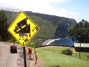
There is a four-wheel drive jeep road down into the valley but you really (REALLY) do not want to drive it, even in a four-wheel drive vehicle. The road is constantly steep (25% grade!!!), poorly paved, always narrow and winding, unbelievably hazardous and tricky, deceitful and populated by local drivers who do not want you on their road. Really. Tours down into the valley in vans, horse drawn wagons and ATVs can be booked in Honoka'a. Over-flights in fixed wing aircraft and helicopters offer fine views of this amazing piece of Hawai'i.

Perhaps the most satisfying way to see Waipi'o Valley, however, is the way the ancient Hawai'ians did, by walking forthrightly down into it and then creeping, wheezily, back out. However, if you attempt this hike, don't be deceived by the numbers. The hike entails less than a thousand foot elevation loss (and subsequent gain to climb out) and fewer than 2 miles actual walking, but it feels longer; it is hard, hot, dry, and steep. No one who is not in good physical condition should attempt this hike-better to take a tour or flight. But the views and photographs to be had by making this difficult hike are well worth the sweat and time. The hike down into the valley takes about ½ an hour; twice that again for exploration of the valley floor and beach and at least an hour to walk back up. Be vigilant when walking on the road; local drivers will not deign to give you right of way and tourist drivers seem at the edge of control.

If you go into the valley, no drinking water is available, so take lots. When you hit the valley floor, the road to your right (toward the ocean) goes to the beach and a spectacular 300 foot waterfall. Here, you may wander through tamarisk and fir copses along the black sand beach, bathe in the waterfall or hike across the ridge into the next valley. Be forewarned, swimming and surfing here are for experts, due to the strong currents and big waves. Do not attempt to hike past the headland cliffs into adjacent vallies-it may seem tempting, but it is in fact extremely dangerous.
This Majestic Waterfall Sluices Down Into The Canyon All the Way to the Ocean From The Overlook: Photo by Donnie MacGowan
Photo by Donnie MacGowan

At the foot of the valley, the road through the jungle tunnel to your left crosses private property; you need permission to pass here. Down this road, toward the back of the canyon are numerous, enormous, crazy waterfalls and scenery like you will see no where else on earth. Waipi'o's true magic lies here.

Below the Observation Platform, there are no services available in Waipi'o Valley. Camping is by permit only; the one small bed and breakfast establishment is generally booked months in advance.
Natural and Human History: To the geologist, Waipi'o, Pololu and the other northern Hawaiian vallies provide exquisite evidence of the extremely delicate and ephemeral nature of the islands in the Hawai'ian Archipelago. Lava flows at the top of Waipi'o Valley which are cut by the stream are fewer than half a million years old, indicating the whole valley has formed since then.

Early in the history of Pololu, Waipi'o, and the vallies in between, rift vents along the flanks of Kohala Volcano evolved into major faults; relative movements up and down these faults caused large blocks of rocks between faults to be relatively down-dropped forming what geologists call "grabens", or flat-bottomed vallies. Streams poured off the uplifted blocks causing erosion further lowering the floors of these grabens with steeply sided stream cuts. At some point between 450,000 and 150,000 years ago, a huge section of the north side of Kohala Volcano became detached and simply slid into the sea, forming the steep cliffs we see today on the north side of the island. The formation of the grabens, their subsequent incisement by streams and the truncation of the northern portion of Kohala Volcano by enormous landslides accounts for most of the landscape we see in these vallies today, but the questions arises: "why are the valley floors so wide and flat instead of the narrow, steeply-sided valley one would normally expect a small stream to carve"?

Although the streams continue to erode down into the floor of these canyons there are two more geologic processes at work on the the Waipi'o Valley landscape. Remember that due to their own enormous weight, all the Hawai'ian Islands are slowly sinking-or "subsiding"--into the hot, plastic rocks below the earth's crust. This subsidence causes the bottom of the canyon to be continually sinking below sea level, and thus filling up with sediment. Secondly, the mouth of Waipi'o Valley acts as a funnel for tsunamis, causing them to back up into the valley and drop enormous quantity of sediment, which also fills the valley. In fact, during the tsunami of 1946, the ocean flooded Waipi'o to 40 feet deep and half a mile inland! This infilling of the valley by these two processes accounts for why the valley bottom is so broad and flat.
The Mile Long Black Sand Beach of Waipi'o Valley: Photo by Donald MacGowanPhoto by Donald MacGowan

The human history of Waipi'o Valley is every bit as interesting as its geologic history. Waipi'o was considered a place of great mana (power) and was densely cultivated in pre-contact times. It was a favored place for the ruling Ali'i to meet and many chiefs who had lands and homes elsewhere on the island maintained royal homes in Waipi'o Valley. It is estimated by some historians that at the time Captain Cook arrived as many as a hundred thousand native Hawai'ians inhabited Waipi'o and the region surrounding it. Waipi'o has been continuously inhabited in excess of fifty generations; native Hawai'ians believe the power of their ancestors' spirits infuses the land today with mana and honua--power and peace.

King Kamehameha the Great was brought here for safety as an infant. It was interpreted by many when he was born that the Baby Kamehameha was the fulfillment of ancient prophecies which bespoke the coming of a great king, one who would overthrow all other kings and unite the islands. This notion did not sit well with many ruling families and did not fit their agendas or ideas about who should lead the people of Hawai'i. Fearing for his life, young Kamehameha's mother fled to the safety of relatives living in Waipi'o, hiding with the infant in the jungle when royalty sent warriors out to hunt him down. Kamehameha, of course, eventually emerged, later becoming King of Hawaii; through a series of battles and treaties with Ali'i on the other islands, he eventually united all the Hawaiian Islands into a single country under his rule.

The tsunami of 1946 pretty much cleared out the more modern inhabitants of Waipi'o and it was more or less abandoned until the 1960s when counter-culture types and native subsistence groups started to move back in. Today, the population of Waipi'o Valley is a colorful oddment of farmers, artists, surf bums, recluses, hermits, dreamers and others, whose only point of common interest is to make sure that everybody else stays the heck out of Waipi'o Valley.
The Vastness of Waipi'o Valley: Photo by Donnie MacGowan
Photo by Donnie MacGowan

After visiting Waipi'o, drive back down the highway to lovely Honoka'a and enjoy the laid-back, plantation era aloha here. There are numerous cafes and restaurant and coffee shops and the largest collection of antiques stores anywhere on the island--Honoka'a Town is equally enchanting, albeit in a different way, as the Valley you've just explored.

For more information about traveling to Hawaii in general and exploring the Big Island in particular, please visit www.tourguidehawaii.com and www.lovingthebigisland.wordpress.com. For information about the author, visit here.
 

Casino Bonus no Deposit