Snorkeling is fun, easy and safe...it is also the best way to become intimately acquainted with the turtles, reefs and fish of Hawaii. A popular leisure and adventure sport, snorkeling is one of the Big Island's primary tourist draws. Yet many come to the Island wanting to snorkel but with little real ideas about the techniques and tricks of the sport. Donnie MacGowan and Bart Hunt present a quick tutorial about snorkeling technique, some tricks and some practical advice.
Kilauea's Eruption Just Keeps Getting More Fantastic!
Aloha, I'm Donnie MacGowan--I live in the County of Hawaii, on the Island of Hawaii in the State of Hawaii...I just spent the last few days camped out at Hawaii Volcanoes National Park watching Kilauea Volcano erupt and I wanted to share some of the footage I shot.
When I was a college student back in the mid 1970's, I took a geology class just for kicks. One morning the professor burst in late and said “You guys have GOT to see this film—my friend in Hawaii just sent it to me…this is happening right now!” He loaded up the projector and showed us this film of a brand new eruption on Mauna Ulu in Hawaii Volcanoes National Park--that film changed my life. I declared myself a Geosciences major on the spot and even went on to earn a PhD. in Geochemistry. Although ultimately I did not pursue Volcanology as a discipline, my love affair with volcanoes as an avocation, and my spiritual connection to Hawaii Volcanoes National Park, has never waned.
Visitors to Hawaii Volcanoes National Park right now are being treated to a rare event. Kilauea Volcano is erupting in two places simultaneously! Up in the summit caldera, in Hale ma'uma'u Crater, a vent exploded open last March that has continued to thrill visitors with its billowing steam cloud and night-time glow. If this were the only volcano you were ever going to see, this would plenty spectacular. Current eruption activity updates are available from the National Park at 808.985.6000.
But hold on! The real action is down at the coast where lava from the East Rift Zone has broken out of lava tubes, flows across the open ground and into the sea. From the air, one can see the spectacular glow of a small lava lake in Pu'u O'o crater and from several breakouts along the 2007 Thanksgiving Eve Breakout tube system above the pali and near the top of Royal Gardens subdivision. Lava is currently flowing down the pali and entering the ocean at the Waikupanaha ocean entry where there are spectacular littoral explosions. Although this activity is usually quite vigorous, including a 10-15-m-high lava fountains, it can be sporadic on a day-to day basis.
Over the years, lava has mostly entered the ocean within the National Park boundaries. Park policy has been to allow tourists to approach flowing lava as closely as the visitor himself deemed safe. Surprisingly, a relatively small percentage of visitors were killed or maimed in this process and unparallel access to one of the great wonders of the world, the spectacle of the Earth remaking herself through volcanic eruption, was available on a very intimate basis to anyone who came to Hawaii. Every six or so years, for a period of several months, eruption flows go outside the park boundaries, as it is doing now.
The County of Hawaii, whose Civil Defense Department is responsible for visitor safety in these cases, is not so liberal in granting access to the lava flow. The county maintains a viewing area several hundred meters back from the actual flow and ocean entry areas and visitors are not allowed any closer. As of this writing, to see the lava flow one must find the County of Hawaii volcano viewing area. From the Hawaii Belt Road at Kea'au, proceed south on Highway 130 through Pahoa and toward the now-buried town of Kalapana. At the 20 mile marker the road splits; the right branch (helpfully marked "end of road") leads to a dirt-and-lava road a couple miles long at the end of which is the parking area for the County of Hawaii volcano viewing area. One really cannot miss the way during daylight hours, as the enormous explosion plume is clearly visible from miles away. The viewing area is open from 2 in the afternoon until 10 at night; no cars are allowed in after 8 p.m. Lava viewing and road information is available from the County of Hawaii at 808.961.8093.
A carnival atmosphere hovers over the parking lot, where several vendors hawk jewelry, t-shirts, drinks and snacks...port-a-potties are also available. The trail leading to the viewing area is largely flat but traverses a broken lava field. It is well marked with reflectors and reflective paint strips along the surface and is just a 15 to 20 minute stroll. The quality of viewing varies from week to week as the lava stream shifts nearer or farther from the viewing area, but seeing the orange glow of flowing lava, or the fiery red explosions, is one of the most amazing experiences a person can have, no matter how far from the flow one is.
It is hard to overstate the power, mystery and magic of this eruption, but upon occasion, transient local atmospheric phenomena such as waterspouts and lightning add even more spice to this already awe-inspiring spectacle. Other wonders abound here, too, if you look closely. The hardened lava over which you are walking contains numerous casts of logs, trees, coconuts and pandanas fruit. Lava viewing is best done at dusk and later, however, parking spaces fill up quickly on nice afternoons. I usually plan to arrive at the parking lot at about 3:30 or four then walk into the viewing area, spending the hours until dark reading, having a picnic and chatting with visitors who have come from all over the world to see this wonder. You should wear sturdy, close-toed walking shoes and a hat to shed rain and sun. The lava surface is sharp, so I recommend long pants and long-sleeved shirts, and a stout walking stick as well. Bring at least 2 liters of drinking water, snacks and perhaps a couple Band-Aids; definitely bring sun block. Because you are right on the ocean, short rain squalls should be expected; an umbrella and rain coat or poncho is suggested, as well as protective covering for camera gear.
If the wind shifts the explosion plume in your direction, discretion is the better part of valor; you should evacuate immediately. Those fume clouds are toxic, containing various gaseous sulphur compounds including sulphuric acid, as well as hydrochloric acid and fine particulate material. On this same topic, electronic and camera gear, as well as glasses, binoculars and other optics, will be exposed to a certain amount of these toxic gases and you should wipe them down thoroughly after your trip. Most people plan to stay on after dark and so you should bring a flashlight for each person in your group; be sure to check the batteries and bulb before you leave on the trip. Remember that food and gas are not always available after dark outside the immediate Hilo or Kailua Kona areas, so be sure to fill up your gas tank BEFORE you park, and to bring plenty to eat and drink along with you.
Viewing the lava is one of the most amazing, wondrous, moving experiences you can have, anywhere on earth. People stand in awe, openly weeping at the site of Mother Earth going through her rebirth. Each fiery explosion is met with a loud chorus of "OOOOOHS!" and "AHHHHHHS!" in a display that will make every subsequent Fourth of July fireworks spectacular seem pale by comparison. If you are coming to Hawaii, you must not miss this once-of-a-lifetime show...if you have never thought of Hawaii as a potential vacation spot, you should consider it simply for this rare, unique and entirely awe-inspiring, mystical, wondrous opportunity.
I'm Donald B. MacGowan--thank you for spending a little time with me and my volcano...aloha e a hui hou.
For more information on travel to Hawaii in general and visiting the Big Island in particular, visit www.tourguidehawaii.com and here.
Skywatch Article July 2008 By Carolyn Kaichi, Bishop Museum
PLANETS AND THE SUMMER MILKY WAY
The interesting thing about sky-watching is the fact that although the seasonal constellations are predictable, what you may see at any designated time is not. Planetary movement and other recurring events take place on different cycles than the background of stars so we can’t always count on seeing the same combination of sights in the sky at the same times. That keeps me in business.
So what we will see in the sky this July is not unusual, but a fortunate arrangement of celestial constituents that will be easy and convenient to view. Four naked-eye planets dot the evening skies this month, with two staging a nice pairing together and beautiful Venus making its reappearance back into the night. Although it might be challenging to spot Venus low in the western sky after sunset during the first half of the month, by the end of the July it will be climbing higher out of the light and easier to spot.
A nice highlight will be the conjunction of Mars and Saturn in the constellation Leo on July 9 and 10. The rust-colored planet and pale yellow Saturn have been slowly creeping closer over the past weeks and will be at their closest on those two dates (although the 10th is technically the closest date, both nights are good for viewing). Included in the lineup is the brightest star in Leo, Regulus, which is on that planet highway called the ecliptic. As a bonus, on July 5 a small crescent Moon joins the group as Mars closes in. That evening going from west to east, you can see the Moon next to the star Regulus, followed by Mars and Saturn. Make sure you start early however, because this gathering will set by 10:00 P.M.
Jupiter is also impressive in the east as the sun sets. The giant planet is at opposition now, meaning that it is on the opposite side of our sky than the sun (think “Sun, Earth, Jupiter” in that order). It appears bigger and brighter in the night sky at this time and is visible in the sky the whole night. Now would be a great time to take out a pair of binoculars and look for the famous features that characterize Jupiter, like the Galilean satellites and the distinct bands of color on the planet. The monster hurricane, the Great Red Spot, is visible with telescopes but not necessarily with average binoculars.
While the planets steal the spotlight this month, don’t forget to pay attention to the summer Milky Way! The hazy band of light extending from north to south is part of the galaxy we reside in and offers many binocular and telescopic sights along the way. The area roughly between Scorpius’ stinger and Sagittarius’ “spout” is particularly wide since that direction is the bulbous center of our galaxy, approximately 26,000 light years away. Rather than individual points of light we see the accumulation of the millions of stars obscured by gas and dust. Right now you can see the Milky Way stretching from the southwest in the direction of the Southern Cross (early in the evening) through the Summer Triangle toward Perseus in the northeast in the early morning hours.
EVENING PROGRAM UPDATE
With so many objects to look for in the skies, it’s difficult to cram everything into one article every month. Consider our planetarium as the next best thing to the real sky, one with a personal “guide” to the stars. An evening program is held on the first Fridays of the month, with sky viewing if the weather is clear. However since it falls on the 4th of July this month, the program has been moved to Friday, July 11. It begins promptly at 8:00 P.M. and reservations are strongly recommended. Call 848-4168.
PHOENIX UPDATE
The Phoenix lander is busily performing its tasks since touchdown on Mars a little over a month ago. What the mission has already done for space exploration was demonstrated by the difficult EDL phase, or Entry, Descent and Landing. Many previous missions were lost in this critical phase, including the predecessor of Phoenix, and since one of the science goals of the mission is to prepare for human exploration, NASA had to prove that landing a craft on Mars has improved dramatically. It appears that goal is well on its way. See http://phoenix.lpl.arizona.edu/ for more information.
The Planets
Earth:
The second of two annual opportunities to experience Lahaina Noon comes this month. Between May and July the sun passes directly overhead for areas within the Tropics. During Lahaina Noon objects that are directly perpendicular to the sun, such as flagpoles or fences, have no shadows since the “shadow” would be cast “under” the object. Times vary by location, so check the website for more information: www.bishopmuseum.org/planetarium
Also, aphelion takes place on July 3, the Earth’s farthest point in its orbit around the sun. Coincidentally the Moon is in a new phase at the same time, so the effect of the tides will be enhanced. Higher tides than normal usually occur during this alignment.
Mercury:
Mercury is in the morning sky now, rising around 4:30 A.M. in early July. By the last week it will be too close to the sunrise to spot as it rounds around the backside of the sun to reappear in the evening sky.
Venus:
For the casual viewer, Venus will be very difficult to spot until mid-month, when it is a little farther from the sun in the western sky at sunset. However the “window” to see it will be short for this month since the planet sets before darkness by 8:00 P.M.
Mars:
Mars is cruising through Leo, meeting up with Saturn along the way and by the end of the month will pass through the constellation on the way to Virgo. The planet is slowly receding from us in its orbit and dimming as it goes, but is still easily visible to the unaided eyes.
Jupiter:
Jupiter reaches opposition on the evening of July 9, rising in the east as the sun sets. If the weather is nice, this is an excellent night to see the four evening planets in the sky. You will need to get somewhere you can see all the way to the western horizon, and starting from that point shortly after sunset (around 7:30 P.M.) look for Venus low in the west, followed by Mars and Saturn close together about halfway up in the western sky and Jupiter rising in the east.
Saturn: Although Mars and Saturn are set for a rendezvous Saturn’s position changes very little with respect to the starry background. The ringed planet is much farther away than our neighbor Mars, therefore orbiting the sun at a slower rate of speed. Where Mars orbits the sun in almost 687days, Saturn takes 29.5 years!
Questions? Contact Carolyn Kaichi @ hokupaa@bishopmuseum.org or 847-8203.
For more information on visiting Hawaii in general or touring the Big Island in particular, go to www.tourguidehawaii.com or here.
A littoral explosion at dusk. Explosions such as this have been common throughout the last several weeks at the Waikupanaha entry. June 29, 2008.
One of the most surprising aspects of the current summit eruption at Kīlauea Volcano, which started in March of this year, is that there has been almost no change in surface deformation trends. Past summit eruptions have been accompanied by rapid inflation prior to the start of an eruption, followed by equally rapid deflation. During the present period, however, the summit of Kīlauea has shown no change from the trend of gradual deflation since July 21, 2007, when the eruption site migrated about 2 km (1.5 miles) downrift from Pu`u `Ō`ō. No change, that is, until just a few weeks ago.
On June 24, tiltmeters at Kīlauea's summit and at Pu`u `Ō`ō began showing inflation-the first time sustained inflation has occurred at both sites since July 21, 2007.
In addition to the change in ground deformation, other types of monitoring data indicated a shift in the style of eruptive activity. Throughout early and mid-June, the intensity of the glow from the summit vent had decreased, relative to the strong glow seen in April and May. In late June, however, the summit vent began glowing brighter.
The intensity of the glow, in fact, correlates with bursts of seismic tremor that occur every few minutes, with more glow during the tremor bursts and less between bursts. These tremor bursts also increased in magnitude and frequency in late June. The correlation between tremor and glow led HVO scientists to infer that gas bubbles were bursting through a crusted lava surface beneath the Halema`uma`u vent. Increases in the strength of both the glow and tremor bursts may have indicated rising of the lava surface.
Another late June change in activity was the occurrence of surface lava flows from the east rift zone for the first time in several weeks. Lava broke out of the tube system, both on the east rift zone and above the Royal Gardens subdivision. At the same time, enough lava was being transported through the tube system to result in spectacular littoral explosions at the ocean entry during early July. All of these signs point to a lava tube system that was full to the point of overflowing.
Taken together, this evidence suggests that Kīlauea was engorged with magma, starting in late June. Increased magma in the caldera and east rift areas resulted in inflation of the summit and Pu`u `Ō`ō and, possibly, rising of the lava column in the Hamema`uma`u vent. Magma was also being delivered to the eruption site at a greater rate than normal, resulting in the numerous surface lava flows.
What might be the result of such activity? It is conceivable that more magma within Kīlauea's plumbing system could result in a change in the east rift zone eruption site, much like that which occurred in mid-2007. Lava might even erupt from the Hamema`uma`u vent, forming a lava lake at the summit.
Of course, Pele seems to enjoy keeping us on our toes. On July 1, deformation at Pu`u `Ō`ō stabilized, and the summit began to deflate, suggesting that even more magma was being fed from the summit to the east rift zone eruption site. Lava flow activity on the east rift zone and above Royal Gardens continued to increase. On July 7, a spectacular fountain formed near the TEB (Thanksgiving Eve Breakout) vent, possibly due to partial blocking of the lava tube system. At the summit, however, the intensity of glow from the Halema`uma`u vent has waned, suggesting that, at least for the moment, volcanic activity will focus on the east rift zone.
The weeks since June 24 have been a significant departure from "normal" trends of deformation during the current summit eruption, and also saw the most surface lava flow activity in several months. What caused Kīlauea to suddenly fill with magma and, just as suddenly, begin to drain?
One explanation is that the lava supply to Kīlauea fluctuates on timescales of days to weeks, causing rapid changes in surface deformation and eruptive activity. Although the causes of these fluctuations are not clear, the variations obviously are an important control on the activity we observe at the surface.
HVO will remain vigilant for future changes in the amount of magma coursing through Kīlauea's veins. Such activity should be easy to detect, given the excellent seismic, deformation, gas, and visual monitoring of the volcano, both at the summit and along the east rift zone. We invite you to follow along by checking HVO's Webcams, data plots, and daily activity updates available at http://hvo.wr.usgs.gov.
Activity update
Kīlauea Volcano continues to be active. A vent in Halema`uma`u Crater is erupting elevated amounts of sulfur dioxide gas and very small amounts of ash. Resulting high concentrations of sulfur dioxide in downwind air have closed the south part of Kīlauea caldera and produced occasional air quality alerts in more distant areas, such as Pahala and communities adjacent to Hawai`i Volcanoes National Park, during kona wind periods.
Pu`u `Ō`ō continues to produce sulfur dioxide at even higher rates than the vent in Halema`uma`u Crater. Trade winds tend to pool these emissions along the West Hawai`i coast. Kona winds blow these emissions into communities to the north, such as Mountain View, Volcano and Hilo. As of this writing (July 10), the gas vent below the east rim of Pu`u `Ō`ō was spattering weakly, with some spatter reaching the crater rim. At least two other vents within the Pu`u `Ō`ō crater were also spattering. The one near the western end of the crater was spattering vigorously and sporadically, feeding a small lava pond on the crater floor.
Lava continues to erupt from fissure D of the July 21, 2007, eruption and is supplying several breakouts along the 2007 Thanksgiving Eve Breakout (TEB) tube system above the pali and near the top of Royal Gardens. Activity was quite vigorous early in the week, feeding multiple breakouts, including a 10-15-m-high lava fountain. By July 10, activity had diminished, with only sparse surface flows observed.
Lava also continues to flow through what remains of Royal Gardens and across the coastal plain to the ocean in a well-established lava tube active now for several months. When the surface activity intensified upslope early in the week, the Waikupanaha ocean entry diminished significantly and appeared nearly inactive. Full vigor had returned by July 10, with small explosions and a large plume.
Be aware that lava deltas could collapse at any time, potentially generating large explosions. This may be especially true during times of rapidly changing lava supply conditions, as have been seen lately. Do not venture onto the lava deltas. Even the intervening beaches are susceptible to large waves generated during delta collapse; avoid these beaches. In addition, steam plumes rising from ocean entries are highly acidic and laced with glass particles. Check Civil Defense Web site (http://www.lavainfo.us) or call 961-8093 for viewing hours.
Mauna Loa is not erupting. Two earthquakes were located beneath the summit this past week. Continuing extension between locations spanning the summit indicates slow inflation of the volcano.
Four earthquakes beneath Hawai`i Island were reported felt within the past week; all occurred on Tuesday, July 8, 2008. A magnitude-2.7 earthquake occurred at 00:06 a.m., H.s.t., and was located 2 km (1 mile) southwest of Kīlauea summit at a depth of 1 km (1 mile). A magnitude-3.2 earthquake occurred at 00:38 a.m. and was located 3 km (2 miles) southwest of Kīlauea summit at a depth of 400 m (0.2 miles). A magnitude-2.8 earthquake occurred at 7:36 a.m. and was located 5 km (3 miles) northwest of Pa`auilo at a depth of 9 km (5 miles). A magnitude-1.8 earthquake occurred at 10:09 p.m. and was located 3 km (2 miles) southeast of Captain Cook at a depth of 8 km (5 miles).
Visit our Web site (http://hvo.wr.usgs.gov) for daily Kīlauea eruption updates, a summary of volcanic events over the past year, and nearly real-time Hawai`i earthquake information. Kīlauea daily update summaries are also available by phone at (808) 967-8862. Questions can be emailed to askHVO@usgs.gov.
For more information on touring Hawaii in general, or visiting the Big Island in particular, go to www.tourguidehawaii.com and here.
On your way back to the highway from Akaka Falls, stop in Honomu for some local-style shopping and a snack. Handmade curios and ice creams will delight your senses. Once back on Highway 19, turn right toward Hilo, about 10 minutes away.
Hilo is one of the wettest cities in the U.S. averaging around 200 inches per year. This old-style Hawaii town is quaint and bustling. Lots of great shops line the waterfront drive and the largest farmer’s market on the island is situated there as well. Tour Guide will take you right into the heart of town and give you history and attractions, such as the Pacific TsunamiMuseum, and the Imiloa AstronomyCenter at the University of Hawaii, Hilo Campus. A little farther along the coast are some beautiful beach parks like Richardson and Onekahakaha. Great picnicking, swimming and some good snorkeling can be found here. The Suisan Fish Market is famous for the early morning old-style fish auction. Be sure to take your time in Hilo as the shopping food options are immense.
In Hilo, you will turn north onto Highway. 11 at the intersection near Ken’s Pancake House, a landmark eatery. You will see the airport and Prince Kuhio Plaza on your way out of town. Stop in and visit the mall and shop and eat if you missed it in town. Just a few miles north of the mall is the Panaewa Rainforest Zoo.Tour Guide will tell you how this is the only rainforest zoo in the United States of America. It is also free.
Super Tip: Gasoline in Hilo is typically 6-10 cents per gallon cheaper because it is the main port on the island. It is wise to fill up before heading back to Kona.
This completes this drive day. I suggest returning north through Hilo and back up the HamakuaCoast, through Waimea, and Highway 190 back to Kona.
Walk Right Up To Flowing Lava On The World’s Most Active Volcano, Kilauea On The BigIsland Of Hawaii
Can you believe this?It’s absolutely outstanding and amazing! You can actually walk right up to flowing lava here; see a volcano erupt before your eyes and the molten rock pour into the sea.This has to be one of the four or five most exciting, amazing, wonderful, mystical experiences on earth…you must not miss this!
Fire Fountain From ExplosiveSea Entry Of Lava From Kilauea Volcano (photo by Donald B. MacGowan).
Mauna Loa is active but not currently erupting. The summit area is slowly inflating, filling with magma and the flanks are subject to frequent minor earthquakes, but no obvious activity is apparent to the visitor.Kilauea, the most active volcano on Earth, started its current eruptive phase in 1983, the longest eruption in history.Since then it has ejected almost 3 billion cubic meters of lava.Flowing from various vents in the rift, most notably Pu’u O’o, in streams and tubes at over 1000 degrees Celsius, much of the lava makes its way into the sea in fiery, steamy explosions or the incredible incongruity of glowing hot lava pouring directly into the sea with little more apparent than a mere bubbling of the water.
Surface Flow From Kilauea Flowing Into The Sea (photo by Donald B. MacGowan).
Although surface flows and breakouts are frequent and common, there is no guarantee that over any given trip to the BigIsland they will be visible or easily accessible to the casual visitor.Since the flow of lava over the moonscape plains and into the roiling sea can be seen nowhere else on earth, it is certainly the most exciting, unique and moving highlight of any trip to Hawai’i.People stand at the edge of the flow and weep at the majesty and mystery of the earth remaking itself; it is wondrous, remarkable and unforgettable.Before planning a hike to see the lava, check with the Rangers at HawaiiVolcanoesNational Park for information on the hike length and location of surface flows and a review of safety information.
Over the months and years, the lava river issuing from Pu'u O'o winds its way back and forth across the lava plain of about 8 miles breadth, sometimes flowing into the sea within Hawaii Volcanoes National Park, sometime outside the eastern margin of the Park on County of Hawaii land, sometimes ponding behind the low lava hills for weeks at a time without entering the ocean at all.When you check with the rangers about flow conditions, they can tell you the best way to approach these flows.
The Short Hike Into The County Of Hawaii Viewing Platform Is Well Marked (photo by Donald B. MacGowan).
If the flows are toward the more western margin and within the HawaiiVolcanoesNational Park, the best approach is to drive to the end of Chain of Craters Road in the Park and ten hike in.This hike can be of a few minutes, or a few hours, duration, depending upon how far away the lava ocean entry is.Talk to the rangers beforehand so you can come prepared.The hike is over an uneven, rough surface, hot during the day even when it rains, cold at night and navigation can sometimes be counterintuitive.The trail at first is marked with cairns and reflectors, but after a few hundred meters you are on your own to navigate the basalt wilderness.The good news is, even if the hike is a couple hours duration, when the lava flow is in the National Park, you are allowed to walk right up to it; this is not true if the lava is flowing in the more eastern margin, onto County of Hawaii land.
In this case, viewing is from a County of Hawaii-maintained viewing platform.To reach this parking lot and observation point, drive south from Hilo 20 minutes, or southeast from Kona 2 hours, on the Hawaii Belt Road to the town of Kea'au. At Kea'au, turn south on Hawaii 130.There is a clearly marked intersection near the 20 mile marker on Highway 130 which leads to the county road and viewing area.After approximately 2 miles of driving over a flat, but alternating asphalt, gravel, basalt and dirt, road one reaches the parking lot at the end of the road and the beginning of a 15 minute hike to the viewing platform.The road opens at 2 in the afternoon, the last car is allowed in at 8 p.m. and the area is cleared of people and cars at 10 p.m.The trail is well marked with reflectors and paint and there are safety officers stationed all along the trail until closing at 10 p.m.
Afternoon Sunlight Makes The Eruption Cloud Glow Long Before The Lava Glow Is Visible At Night (photo by Donald B. MacGowan).
Regardless of where the lava is entering the ocean, this is as far as hikers are allowed to go on this side.Whether you approach the lava flows from the west or the east, bring at least 2 quarts of water, a flashlight for hiking out in the dark, camera, food, first aid kit, sun screen and a rain jacket; wear a sun hat, sturdy hiking shoes, long pants and a long-sleeved shirt--those rocks are sharp!Over the years, we have found a stout hiking stick and an umbrella to be of good use as well.Since photos and video are most spectacular at night, it is wise to bring a camera tripod.
The lava seems to glow with only a dull petulance during the day and may be less than inspiring until nightfall brings it alive and the madly glowing, fiery goddess within is revealed.Thus knowledgeable hikers plan their hike to commence in the afternoon, reaching their destination at dusk, and to hike back in the dark.Check your flashlights before you leave the car.Remember that you are hiking on a highly active volcano, if flowing streams of lava strand you, no rescue is practical or possible; plan, take care and pay strict attention accordingly.
There are other dangers to hiking on the lava plain that might not be obvious to the casual visitor.The steam clouds generated by the lava entering the sea contain fine, glassy particulate material as well as sulfuric and hydrochloric acids in concentration high enough to aggravate the very young and old, expectant mothers and people with respiratory and cardiac conditions.Over the past 20 years, a few adventurous people venturing too close to vents or the sea entries have asphyxiated from toxic gasses.The ocean near the lava entries is superheated and waves lapping on inviting black sand beaches can be scalding hot.Where explosive, the meeting of molten rock and sea can explode large, searing hot rocks hundreds of feet in the air and throw boiling water, splashing everywhere.
Visitor’s To Madam Pele’s Performance Await The Coming Of Darkness And The Best Part Of Her Show (photo by Donald B. MacGowan).
Methane explosions occur with no notice, dozens if not a hundred feet ahead of flows, flinging huge blocks hundreds of feet.Unstable benches that build up into the sea, and upon which the unwary hike and pause to photograph the scenery, are prone to collapse carrying all into the sea.Such collapses can cause local tidal waves which scour the landscape clean of everything as they pass.Thin lava crusts can hide lava tubes, caves, hollows and holes into which hikers occasionally fall and are caught.
A volcano is a naturally highly seismically active area and earthquakes are common (there are over 1200 measurable earthquakes a week on the BigIsland).Less common, but certainly a constant threat, are local tsunamis generated by these earthquakes.The Park Service has roughly marked the trail to the lava; follow it closely, turning around frequently to acquaint yourself with landmarks for the hike back.
Be sure to take extra film or memory cards for your camera and remember to wipe down all cameras, eyeglasses, binoculars, optics and electronics after your visit; the salt and volcano effluent-laden atmosphere is highly corrosive.Batteries may be drained faster than expected due to the high heat near the lava.
Despite the inherent dangers of hiking over liquid rock, steaming and unstable ground along the ever-restless sea, very few hikers are injured here, even fewer are killed.This is only because people enter the goddess’s home with a sense of awe and great caution, and the Rangers are very good about instilling fear and trepidation into the hearts of those who think themselves otherwise immune to the mortal dangers presented here.If you go, remain cautious and vigilant, plan for adversity, think ahead and pay attention.The rewards for this are a moving and amazing experience few ever have, a memory of mystery, awe and wonder to treasure always.
The Coming Of Dusk Makes The Glow Of The Lava Visible (photo by Donald B. MacGowan).
If you are planning on viewing the lava at night, be sure to remember that there will be no open gas stations or restaurants when you depart the Park until you reach either Kona or Hilo…plan accordingly, think ahead.
The Eruption Cloud Where Lava Is Flowing Into The Sea Is Visible Many Miles Away Down The Coast From Na'alehu (photo by Donald B. MacGowan).
View videos of the Kilauea eruption here and here; for more information on visiting Hawaii in general and touring the Big Island in particular, visit www.tourguidehawaii.com and here.
Tour Guide GPS-guided tours is the most revolutionary product ever offered the Hawaii visitor, putting the magic of Hawaii at your fingertips...turn-by-turn directions, over 600 video presentations for sites of interest, searchable database--this is one very handy and fun gadget!
Is travel to the Big Island of Hawaii on your horizon? Rent Tour Guide and Hawaii comes alive in the palm of your hand.
Traditional Hawaiian chant written and performed by Frank Burgess.
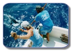
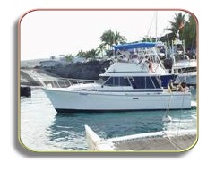
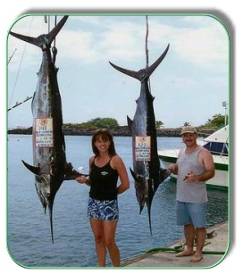
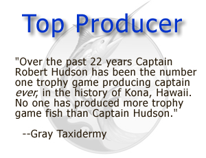
The Kona coast off the big island of Hawaii offers the best deep sea, big game sportfishing in the world, playing host to big game species such as the pacific blue marlin, mahi mahi (dorado, dolphin), ono (wahoo), ahi (yellow fin tuna), striped marlin, spearfish and many others. No other captain and crew in the Kailua Kona based Honokohau Harbor has caught more big game trophy fish than the Camelot. The professional crew onboard Camelot is well known for their ability to attract BIG fish and are very successful in doing so.
Don't just take a fishing trip when you can enjoy the best Hawaii has to offer, including majestic whalewatching excursions that bring you right into the action of giant whales leaping out of the ocean and putting on fabulous, breath-taking shows. During Camelot snorkeling and fishing trips you will get to see various dolphins putting on aerial displays, beautiful reef fish, and sharks (from a distance of course)!
Stereo trophies!
The Camelot is a custom-built, 34-foot state-of-the-art pleasure craft, providing the latest in amenities for your comfort and enjoyment. Among other things we can offer:
A fully loaded air conditioned cabin, with plenty or room for resting and sleeping
A large, attractive bridge
A very clean restroom
A Cellular phone
A Color T.V.
A Refrigerator
Families with kids of any age are welcome!
For more information on visiting Hawaii in general, and touring the Big Island, in particular, go to www.tourguidehawaii.com and here.
Kilauea Volcano continues to be active. A vent in Halema`uma`u Crater is erupting elevated amounts of sulfur dioxide gas and very small amounts of ash. Resulting high concentrations of sulfur dioxide in downwind air have closed the south part of Kilauea caldera and produced occasional air quality alerts in more distant areas, such as Pahala and communities adjacent to Hawaii Volcanoes National Park, during kona wind periods.
Pu`u `O`o continues to produce sulfur dioxide at even higher rates than the vent in Halema'uma'u Crater. Trade winds tend to pool these emissions along the West Hawai`i coast. Kona winds blow these emissions into communities to the north, such as Mountain View, Volcano and Hilo. The new gas vent observed on May 23 inside Pu`u `O`o remains active, and aerial images captured by thermal camera suggest that the vent may have enlarged slightly since last week. Thermal images peering through fume also show what looks like a small pad of new lava at the bottom of a deep pit on the floor of Pu`u `O`o crater.
The amount of lava erupting from fissure D of the July 21, 2007 eruption has increased fairly significantly over the past week. This excess lava is feeding several breakouts along the 2007 Thanksgiving Eve Breakout (TEB) tube system above the pali. Most of this lava is staying close to the breakout points resulting in an apparent resumption of rootless shield construction over the tube. This is similar to what was seen early in the year. Some active lava is reaching into the northeast corner of the Royal Gardens subdivision.
Lava also continues to flow through what remains of Royal Gardens and across the coastal plain to the ocean in a well-established lava tube active now for several months. The Waikupanaha ocean entry, where lava meets the water, was active throughout the last week, often showing off with small explosions and a vigorous plume. A small delta collapse, which likely occurred very early Wednesday morning, took a deep bite out of the front of the Waikupanaha delta.
Be aware that lava deltas could collapse at any time, potentially generating large explosions. This may be especially true during times of rapidly changing lava supply conditions, as have been seen lately. Do not venture onto the lava deltas. Even the intervening beaches are susceptible to large waves generated during delta collapse; avoid these beaches. In addition, steam plumes rising from ocean entries are highly acidic and laced with glass particles. Check Civil Defense Web site (http://www.lavainfo.us) or call 961-8093 for viewing hours.
Mauna Loa is not erupting. No earthquakes were located beneath the summit. Continuing extension between locations spanning the summit indicates slow inflation of the volcano.
Four earthquakes beneath Hawai`i Island were reported felt within the past week. A magnitude-3.6 earthquake occurred at 6:34 a.m., H.s.t., on Sunday, June 29, 2008, and was located 34 km (21 miles) southt of `Ulupalakua, Maui at a depth of 22 km (14 miles). A magnitude-2.9 earthquake occurred at 5:48 p.m. on that same day and was located 11 km (7 miles) northwest of Kailua at a depth of 11 km (7 miles). A magnitude-2.6 earthquake occurred at 8:41 a.m. on Monday, June 30, and was located 12 km (7 miles) northwest of Pahala at a depth of 9 km (5 miles). A magnitude-2.5 earthquake occurred at 1:54 p.m. on Tuesday, July 1, and was located 2 km (1 mile) northeast of Pu`ulena Crater, Puna, at a depth of 2 km (1 mile).
Visit our Web site (http://hvo.wr.usgs.gov) for daily Kilauea eruption updates, a summary of volcanic events over the past year, and nearly real-time Hawai`i earthquake information. Kilauea daily update summaries are also available by phone at (808) 967-8862. Questions can be emailed to askHVO@usgs.gov.
For more information on touring Hawaii in general, or visiting the Big Island in particular, go to www.tourguidehawaii.com and here.
For a third day of driving, it’s time to explore the east side of the BigIsland. Hilo is known to be one of the wettest cities in the U.S and tropical rainforest extends from the Puna district, south of Hilo, all the way to the northern tip of the island. Here, Tour Guide will show you the favorite sights and the out-of-the-way places as well.
Super tip: For this leg of your tour you should bring some rain gear. Umbrellas or panchos are the easiest ways to get a little protection. It tends to rain off and on throughout to day on the east side.
Leaving Kona, take Hwy 190 up the mountain for some panoramic views of the KohalaCoast. It’s about a 45 minute drive to Waimea, which is a good place to stop for breakfast or at the grocery store if you haven’t stocked your cooler already. Tour Guide will have all the info on museums, an arboretum as well as shopping and up-country activities in Waimea. Here you’ll also connect to Hwy 19.
Continue on Hwy 19 north and view the scenic rolling pasturelands of the Parker Ranch, one of the largest privately owned ranches in the U.S.About 20 minutes drive brings you to the town of Honoka’a. Turning left, and going through town, you’ll find more great shops, antique stores and restaurants. Nine miles on Hwy 240brings you to Waipi’o Valley. This is one of the most photographed areas in the state. This 20 mile stretch between Waipi’o and Pololu is often called “Hawaii untouched”, boasting the largest waterfalls in the state, but can only be viewed by air tours or multi-day hikes. Tour Guide will tell you why this area was sacred to the ancient Hawaiians. You can also find out about air tours in Tour Guide’s activities section.
Head back toward Honoka'a Hwy 19 and turn southbound toward Hilo along the HamakuaCoast. This area was once all sugar cane fields but now many diversified agricultural crops are grown here. The first crop you will see is eucalyptus. Acres and acres of this fragrant tree yield sap for medicines and perfumeries all around the world. There is a rainforest preserve, KalopaPark, just 3 miles upslope from the hwy. It’s tricky to find, but Tour Guidewill show you the way to this peaceful cabin camp spot with horseback riding and bird watching.
As you continue driving south, you cross many bridges over gorges and valleys, many of which have viewable waterfalls and rivers that empty into the ocean. Don’t forget to stop and get some pictures this unique scenery. The terrain is lush and green with a huge variety of tropical flowers. Other crops also come into view such as mangoes, papayas, ginger and bananas. Tour Guide will tell you about the trains that used to transport sugar cane to the mills near Hilo and you can stop and see the train museum along the way.
Next up is one of the most famous and beautiful waterfalls in Hawaii, AkakaFalls, a 420 ft. fall, which is just 3 miles off the hwy, but worlds away. The one mile hike on a paved trail through the rainforest will pass two smaller waterfalls as well as orchid, heleconia, plumeria and other tropical plants. Tour Guide will tell the history of this area as well.
For more information on visiting Hawaii in general and touring the Big Island in particular, go to www.tourguidehawaii.com and here.
Loll in sand and sun under swaying palms, watch humpback whales dance in an exotic Kona sunset, snorkel among rainbow-colored fish on a protected reef or ride surf where the Kings of Hawai'i defined the sport a thousand years ago.
Kahalu’u Beach is the most popular snorkeling beach on the Island of Hawai'i with good reason; protected from the open ocean by a seawall, the reef is also protected against commercial aquarium fishing. The snorkeling is in calm, shallow water; there is an abundance of fish of an enormous variety…perhaps the best display on the island. Dozens of Hawaiian Green Sea Turtles call this bay home, eating the limu and thrilling the snorkelers. Numerous freshwater springs and shallow water bathers make the near-shore snorkeling unpleasantly cloudy, but about 100 feet offshore the water turns crystal clear and the display of coral is nothing short of amazing.
Outside the seawall is an excellent surf break that is for intermediate or better surfers and boogie boarders. There is a fair current north out of the bay and along the coast…swimmers caught in this current should relax and swim with the current, angling towards land.
Adjacent to Kahalu’u Beach is St. Peter’s Church, locally know as “The Little Blue Church”; it is the most photographed church in the State of Hawai’i. The history the St. Peter’s is fascinating and takes longer to tell than a tour of its Spartan interior and dozen pews. Originally built in 1880 on the site of La Aloa (Magic Sands) beach, the church was dismantled and hand carried piece by piece to its current location at Ku’emanu Heiau in 1912. In 1938, Father Benno of St. Michael’s added the belfry and the porch. Twice since it was situated here, St.Peters has been moved off its foundations by tsunami, but due to its small size and sturdy construction, has survived long in a harsh environment.
The Hawai'ian word Kahalu'u can be translated as "the place where people go into the water"; in ancient, as well as modern times, Kahalu'u was a place of recreation, relaxation and restoration. There are numerous sites of historic importance around the park, such as the breakwater, Paokamenehune, which predates the 15th century temple complexes in the area and is widely said to have been built by the menehune (sort of the Hawai'ian equivalent to leprechauns), but building was actually initiated to enclose the bay as a fishpond. Whether the work became beyond the powers of the Ali'i at the time to administrate or the surfing faction won-out in the battle over use of Kahalu'u Bay is not known, but the breakwater was already in disarray at the time of European contact in the 18th century. The springs on the northern edge of the park, at Ku'emanu Heiau, Waikui Punawai, where luakini sacrifices were ritually cleansed and today surfers rinse ocean water off themselves after surfing. Between St. Peters and the northern restroom is the Awa pae Wai O Keawaiki canoe landing which figured prominently in the Maui-Hawaii wars of the 16th Century. The large pond between the northern restrooms and the small pavilion, Wai Kua'a'la loko, was the private bathing pond of Hawai'ian Ali'i in residence at Kahalu'u.
Between the two pavilions is another ancient canoe landing and even into historic times, a halau wa'a, or canoe storage house, was situated here. An important heiau and royal residence, Mokuahi'ole, stood where the large pavilion is today. It was at this site that the great queen and wife of Kamehameha the Great, Ka'ahumanu, and her cousin Kuakini (later Territorial Governor) were raised.
Most days there is a food wagon selling sandwiches, burgers, shave ice and cold drinks at reasonable prices and a vendor renting snorkeling gear and boogie boards.
Since Kahalu’u Beach is where most people go to snorkel, let’s take a moment to talk about reef etiquette and the animals which inhabit the coral reefs. Please do not feed the fish, it disrupts their natural feeding habits and you may be injured. Reef fish do occasionally “nip”, so do not chase, harass or touch them (this includes octopi). The oils on your fingers will injure their skin and they may carry diseases which they can pass to you on your hands.
No discussion of Kahalu’u would be complete without a word about Hawaii’s Green Sea Turtles. Called Honu by Hawaii's natives, the Hawaiian Green Sea turtle is beautiful, serene and seeming wise. Though they have swum the oceans for over 200 million years, peacefully feeding on algae and invertebrates, this highly successful product of amphibian evolution is in grave danger. Loss of habitat, hunting and molestation by humans has conspired to push the Hawaiian Green Sea Turtle to the very verge of extinction.Protected now by state and federal law, the population of once millions of individuals has been decimated to just a few hundred thousand; although they are making a comeback, Hawaii's honu are still very much endangered.Honu may grow up to 45 inches and weigh as much as 400 pounds at maturity, reached at 25 years of age.
Hawaiian Green sea turtles can easily be differentiated from the other near shore sea turtle in Hawaii, the much less common Hawksbill turtle, by counting the scales between the eyes. Hawksbills have four scales between the eyes and Hawaiian Green Sea turtles have two.Lady honu crawl on shore to lay their eggs, generally after migration to the quieter shores of the French Frigate Shoals, 800 miles northwest of Hawaii, or the black sand beaches on the south end of the Big Island of Hawaii.
Do not approach basking turtles closely, never touch or pick them up. Harassing turtles carries a stiff fine and in any case, touching the turtle is a good way to get a raging salmonella infection. If honu are swimming near where you are, do not approach or chase them; always swim to the side of them, never above (as a predatory shark would) nor below them (so they won't feel that their soft belly is at risk).
Anyone who observes their beauty and grace underwater easily understands why the Hawai'ians base their word for "peace", "honua", on their name for the green sea turtle, "honu".
Snorkeling etiquette calls for protecting not only the reef fish, but also the fragile corals growing on the reef. Corals, actually colonies of very small animals, take hundreds of years to form the structures visible today; they feed, shelter and provide habitats for other reef animals. Coral reefs also protect the lagoons and shoreline from waves and sand erosion. Corals are at the very root of Hawai’ian history and culture; the Hawaiian creation chant places the origin of life at the sea, beginning with a coral polyp.
Simply touching corals to see what they feel like can cause the death of an entire colony. Oils from your skin can disturb the delicate mucous membranes which protect the animals from disease. Please don't walk upon or stand on coral, as this can kill the living coral polyps which, as the builders of the entire reef structure, are the very foundation of the reef ecosystem. Sunscreen washing off your body can kill coral; wear a t-shirt and a swim cap for UV protection.
For more information on visiting Hawaii in general and touring the Big Island in particular, go to www.tourguidehawaii.com as well as here.
For nearly a thousand years sites around the Keauhou Historic District served as the political, cultural and religious centers for the people of the Hawaiian Islands. Many of the most important, best preserved and certainly the most interesting historical, pre-historical and cultural sites lie within the Keauhou Historic District, which stretches from Kahalu’u Beach Park south to Kuamo’o Bay. There are more than a dozen fascinating archeological features and sites that are easy to walk to, well maintained and quite interesting. Starting on Ali’i Drive just north of Kahalu’u Beach, let’s work our way south through this incredibly rich region.
Ku’emanu Heiau is located just south of Ali’i Drive mile marker 4.5 and just north of Kahalu’u. It is perhaps the only ancient temple in the world dedicated solely to the sport of surfing. This was a luakini heiau(a temple where human sacrifice was practiced) and on the north side of the site is a laupa’u, or bone pit where the remains of the sacrificed were discarded. The temple is still sacred to native Hawai’ians so remember to be especially respectful of this unique site. Do not disturb, nor take as souvenirs, offerings left upon the lele platform. Remember: take nothing but photographs, leave nothing but footprints; Ku’emanu Heiau is a particularly striking place to photograph the sunset.
Those vine covered ruins across the street from Kahalu’u Beach are the remains of Old Helani Church, built by the Rev. John D. Paris in 1861. The church, however, was erected on a the grounds of the ‘Ohi’a-Mukumuku Heiau; a powerful and holy religious temple around which swirls some of the darkest folklore and ghosts stories told around the Hawai’ian Islands.
Held in Hawai’ian folktales to have been built by the gods, ‘Ohi’a-Mukumuku Heiau was re-dedicated to the war god, Kuka’ilimoku, by the Hawai’i Ali’i Lonoikamakakahiki so that he might vanquish his foe, the Ali’i of the Maui, Kamalalawalu, during their 16th century battles. It is said of these battles that when the Maui attacked the Hawai’i, the numbers of warriors was so vast that just as the first of the Maui war canoes were landing on Hawai’i, the last of their canoes were still leaving Maui. Ultimately victorious over the Maui, Lonoikamakakahiki took Kamalalawalu over to the nearby Ke’eku Heiau and sacrificed him alive to celebrate his great victory. Local ghost tales tell of Kamalalawalu and his war dogs still haunting both Ohi’a-Mukumuku and Ke’eku Heiaus.
Paokamenehune Seawall, is partly a natural and partly man-made feature enclosing the southern end of Kahalu’u Bay. Paokamenehune predates the 15th century temple complexes in the area and is held in legend to have been built by the menehune (sort of the Hawai'ian equivalent to leprechauns). However, building was actually initiated by Hawaiian leaders to enclose the bay as a large fishpond. Whether the work became beyond the powers of the Ali'i at the time to administer or the surfing faction won-out in the battle over use of Kahalu'u Bay is not known, but the breakwater was already in disrepair and disarray at the time of European contact in the 18th century.
Kapua Noni Heiau, located on a small point of land between the Outrigger Keauhou Beach Hotel’s pool and the sea, was built by the Ali’i Kalanio’pu’u. This walled enclosure was dedicated to ensuring the abundance of fish. Just north of the Heiau is a canoe landing and the sacred bathing pool, Poho'okapo. Po’o Hawaii Pond, a few dozen meters to the east, is a rare freshwater spring that was strictly reserved for the use of the Ali’i as a fish and bathing pond. Near the pond is the homesite of King Kalakaua. The original Hale Kahakai O Kalakaua, or seashore home of King Kalakaua, was built here in the 1880s; King Kalakaua built his own house and an exact replica for his friend the Court Jester. Both were destroyed in 1950; this replica was erected in 1980, about a century after the original had been built.
Between the canoe landing and the Po’o Hawai’i Pond (King’s Pond) are two sacred ku’ula stones. Carved or natural, large or small, stones used to attract fish are referred to as pohaku ku’ula. These two ku’ula are named Kanaio and Ulupalakua and were brought by voyaging canoe from Maui in 1751.
Look at the larger stone to see the images of a turtle, a fishhook and shark represented on it, using a combination of the natural lines of the stone and engraving. The round hole near the top indicates that this was also a “luakini” stone, or stone for human sacrifice. A loop of rope was passed through the hole, around the victim’s neck, and tightened until strangulation was complete. It is not known if human sacrifice at this stone was used as punishment, to propitiate the gods for good fishing, to dispatch enemy combatants for ritual cannibalism, or some combination of these.
On opposite sides of the Outrigger Keauhou Beach Hotel Tennis Courts lie the homesite of the legendary Mo’o Twins and Punawai Spring. The fertility pit at Punawai Spring is an example of the rare freshwater springs in this area which were the only source of drinking water and were the only reasons villages could survive in Kona. In modern times, the Hotel has promoted wedding ceremonies in the glade around Punawai springs, a Western reflection of the ancient practice of Hawai’ian girls bathing in them to insure fertile child-bearing years. Legend tells us that the Mo’o Twins were prophetesses of the lizard goddess who, through time, became goddesses in their own right. Learned in medicine, storytelling and song, the Mo’o Twins were revered and beloved of the local population they served.
The reconstructed Hapaiali’i Heiau (Temple for Elevating Chiefs), a temple associated with ceremonies involving changes in rank of Ali’i and as a calendric and astronomical observatory, lies on the grounds of the Outrigger Keauhou Beach Resort, across the narrow tidal inlet from Ke’eku Heiau. Not much is known about this Heiau; some traditions hold that it predates Ke’eku Heiau, others maintain it was built around 1812 by Kamehameha the Great. Rebuilt in 2007 and rededicated on the Winter Solstice of 2007, Hapaiali’i Heiau today is perhaps the best standing example of ancient Hawai’ian temple architecture
Immediately south of the grounds of the Keauhou Beach Hotel are the remains of a heiau that served as both a luakini heiau (place of human sacrifice) and pu’uhonua (place of refuge). Built by the Hawai’ian Ali’i Lonoikamakakahiki in the 16th century, Ke’eku Heiau is one of the most famous religious sites in the State of Hawai’i because of its veneration in folk tales involving the 16th century wars between the Hawai’i and the Maui. Ke’eku is where the victorious Hawaii Ali’i, Lonoikamakakahiki, is said to have sacrificed the defeated Maui Ali’i, Kamalalawalu, in celebration of the great victory. The Heiau has walls an impressive 6 to 11 feet thick, and measures 150 by 100 feet in area and is currently undergoing restoration.
Carved into the rock in the inter-tidal region in front of Ke’eku Heiau is an impressive set of ki’i pohaku (petroglyphs). Due to geological subsidence of the island over the past several hundred years, these petroglyphs are visible only at low tide; be wary of the rocks when wet—they are extremely slippery. There is one large anthropomorphic petroglyph in particular that is said to represent the sacrificed Maui Ali’i, Kamalalawalu.
Lonoikamakakahiki Homesite, on the grounds of the Kona Surf and Racquet Club, is a good example of the ravaging of archaeological heritage in West Hawai’i, and the disrespectful and wasteful way in which we deal with these important resources.
Here at Lonoikamakakahiki Residence is a king’s palace, 500 years old, and built by one of Hawai’i’s greatest kings, Umi. This site was later inhabited by at least two other important kings (Lonoikamakakahiki and Kalanio’pu’u) as well as Kamehameha the Great. In any other state this would be an archaeological treasure, a park or preserve, but certainly showcased and cared for. In this case, in Hawai’i, a few remnant walls were grudgingly reprieved from the bulldozer’s blade when the Kona Surf and Racquet Club was built by the Bishop Estate (Kamehameha Schools); the rest of this historical treasure was bulldozed into oblivion for all time. It is not even generally available for causal viewing, locked away behind the Kona Surf and Racquet Club’s iron gates where only paying Club guests and pedestrian visitors can see it. Of course, there is no available (legal) parking nearby.
The history of the temple and palace precincts of Lonoikamakakahiki Residence is deeply intertwined with some of the greatest events in the history of the Island. During the 16th Century, when Hawai’i was threatened by the attack of the Maui, Chief Lonoikamakakahiki was in residence here. Historic events again overtook this location late in the 17th Century when Captain Cook was killed at Kealakekua. Kalanio’pu’u, who was then Chief of all the Island of Hawai’i, fled here to hide from British sailors bent on vengeance. Kalanio’pu’u survived the days of battle and revenge and became a figurehead elder statesman, helping to shape his fellow Hawai’ians attitudes towards the newcomers, their incredible wealth and their new religion. Kalanio’pu’u was fond of hula and built the sacred hula grounds here which today lie under the tennis courts. Here, Kalanio’pu’u passed his latter years and divided his lands between his son, Kiwalao and his nephew, Kamehameha, passing his political power on to Kiwalao and his control of the warriors, along with the war god, Kuka’ilimoku, to Kamehameha.
After years of warfare and ruling his island kingdom, the elderly Kamehameha the Great moved his Royal Court from O’ahu to Kailua in the second decade of the 19th Century. He passed a year here at Lonoikamakakahiki Residence while his palace and temples at 'Ahu'ena Heiau were re-built and re-dedicated. The royal residence has been uninhabited since Kamehameha moved to 'Ahu'ena Heiau.
Anybody wishing to view these important and impressive archeological ruins must park at the Outrigger Keauhou Beach Resort or Kahalu’u County Beach Park and walk more than half a mile south along Ali’i drive to the “Public Shoreline Access” at the Surf and Racquet Club.
The scenic pullout on the Kamehameha III Highway at Ohi’a Lava Caves overlooks the Kona Coastline from Keauhou Bay north past Kailua Bay to Keahole Point. This is one of the best places to watch sunset in all of Kona and is also a grand spot for spotting whale spouts, watching sunsets and canoe races.
Directly below the scenic overlook is the Ohi'a Lava Tube cave complex. These caves were used at various times as general living quarters, shade during the blazing summers and cover from infrequent storms; springs deep with in the caves also augmented scarce supplies of fresh water for Kona residents. The caves also served as places for sacred ritual and burial of important Ali’i.
Today, exploration of the caves is unsafe and most of the accessible entrances are gated or sealed; visitors are asked to refrain from entering the caves to preserve the sanctity of native burials.
A lovely natural harbor backed by volley ball courts, canoe halau and lawn, the County Park and pier at Keauhou Bay is a lovely place to spend a few moments in quiet contemplation, eat a picnic lunch, or dive into the invitingly cool waters at the end of a hot day.
Along the cliffs fronting the bay is a nature trail planted with native Hawai’ian healing plants with explanatory signs which runs to the birthplace of Kalani Kauikeaouli, who later became King Kamehameha III when his older brother Liholiho (Kamehameha II) died of measles in England. Legend has it that Kalani was still born, but the kahuna attending the royal birth immediately immersed him in the cold waters of a nearby spring, where he was at once revived. There are not many places in America where one can easily walk to the exact birthplace of a King, and this pleasant spot is one such, not to be missed.
In ancient times, the Ali’i competed with each other in the sport of Holua, or sledding. A long, steep, track way paved with stones would be constructed down slope and then covered with tamped dirt and topped with dried grass. The Ali’i would race down these tracks on wooden sleds, or “holua” as competition. These races were very dangerous and only the Ali’i were allowed to compete. This particular holua is unique because, not only is it the largest and longest and best preserved in Hawai’i, but also because when constructed it went all the way into the sea at Keauhou Bay. Despite this important archeological site being a National Historic Landmark, much of it was bulldozed by developers building resorts and a golf course. The nearby village of Holualoa is named after this sled way; “holua” meaning “sled” and “loa” meaning “long”.
The Historic Landmark is best viewed from Ali’i Drive, directly across from the Kona Country Club parking lot.
Melancholy, lonely, desolate; this lava bench cut into the fresh scar of an a’a flow by the relentless ocean marks the place where the Hawai’ian gods died at the battle of Kuamo’o. In 1819, the year before the Christian missionaries arrived in Hawai’i, forces loyal to Kamehameha II and Queen Ka’ahumanu fought to overturn the kapu system and the pagan Hawai’ian religion in favor of Christianity. Kahuna Kekuaokalani led the last supporters of the old ways and the old gods and fought a desperate battle here to preserve their ancient way of life, and lost. Their graves, numbering in the several hundreds despite the official-looking marker at the site, are under the numerous, large stone altars erected by the victors over the very spots the warriors fell.
A walk along the dirt road that bisects the battlefield is ineffably sad and a little creepy. However, the road soon climbs into dry land forest along the lava ocean cliffs and provides some memorable hiking and sunset views.
For more information on visiting Hawaii in general, and the Big Island in particular, go to www.tourguidehawaii.com, and here.
Tour Guide is the most innovative travel product ever offered to Hawaii visitors. More than a simple navigational GPS, Tour Guide contains over 500 points of interest, thousands of photographs and hours of interesting, fun and informative audio.
In addition to turn-by-turn directions to everywhere on the Big Island, Tour Guide provides geographically-queued video presentations about every site of interest along the way, and tells you what to expect when you arrive. Tour Guide will even help you find the nearest restroom anywhere. Best of all, Tour Guide is very easy to use; just push a button and go! Want to plan your trips in the comfort of your hotel room? In Browse Mode, Tour Guide makes it as easy as watching TV. ENJOY!
For more information, visit: www.tourguidehawaii.com.