Showing posts with label history. Show all posts

Sunday, November 1, 2009

Kona's Fscinating History: Hulihe'e Palace

by Donald B. MacGowan

iPhone and iPod Touch Video Tour Guide for Hawaii-fully GPS and WiFi Enabled, fully interactive. Hours of interesting and compelling content. Available from iTunes or at www.tourguidehawaii.com.
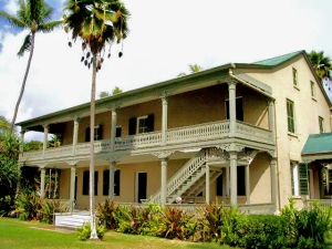
Hulihe'e Palace in the Heart of Old Kailua Town, Hawaii: Photo by Donnie MacGowan
Whether you visit the Big Island for a few days, a couple weeks or a few months, you want to make the most of your time in Paradise. With such a wide variety of natural and commercial attractions, it is natural for the visitor to get a little overwhelmed in the “Option Overload” and not be able to make a balanced and informed decision on what they want to do and how best to spend their time.

Choosing which beach you want to spend time on, or where you want to hike or drive can be an exercise in confusion and conflicting advice. Even more so, finding quality information on the history, culture, geology and natural history of the area can be almost impossible--and much of what you do find is inaccurate, or third-hand retellings that are, well, better stories than histories. Clearly, visitors to Hawaii could use help making quality decisions about how best to spend their time and understanding what they are seeing, the culture they are visiting.

This is why Tour Guide Hawaii is so excited and proud to announce the release of their new GPS/WiFi enabled App for iPhone and iPod video tour that helps you navigate your trip to Hawaii with hours of informative, location-aware video and information. Although our video guide will lead you to dozens of unusual, untamed and unspoiled spots, as an example of the fabulous coverage our App for iPhone and iPod provides, let's look at a fascinating historical site in the heart of Old Kailua Town itself, one which you might pass by, uninterested and uninformed, if you did not have Tour Guide Hawaii's new App.

Hulihe'e Palace

iPhone and iPod Touch Video Tour Guide for Hawaii-fully GPS and WiFi Enabled, fully interactive. Hours of interesting and compelling content. Available from iTunes or at www.tourguidehawaii.com.
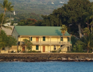
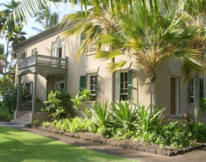
Hulihe'e Palace on Ali'i Drive in Kailua Kona, Hawaii: Photo by Donnie MacGowan
It is said that ghosts of Hawai’ian monarchs still haunt this palace, walking up and down the grand staircase and around the grounds. Built by Governor James Kuakini in 1838 as a home, it was used for many years by Hawai’ian royalty as a summer get-away palace, a place of great galas and parties. Abandoned to ruin in 1914, since 1928 the Palace has been operated as a museum by the Daughters of Hawai’i.
iPhone and iPod Touch Video Tour Guide for Hawaii-fully GPS and WiFi Enabled, fully interactive. Hours of interesting and compelling content. Available from iTunes or at www.tourguidehawaii.com.
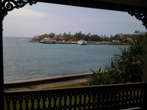
View off the back lanai at Hulihe'e Palace, Kailua Kona, Hawaii: Photo by Eric Carr
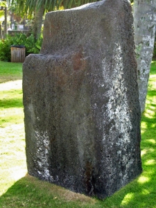
Also on the Palace grounds are the Pohaku Likanaka, a ceremonial execution stone, a fishpond and the Palace Gift Store, which has many fine art items and hard-to-find books on Hawai’iana.

The museum is open Monday-Friday, 9 a.m. to 4 p.m. and Saturday and Sunday, 10 a.m. to 4 p.m. There are friendly and knowledgeable docents who give free tours, which last about 45 minutes. Admission is $5 for adults, $4 for seniors and $1 for students; photographing inside the museum is forbidden.

iPhone and iPod Touch Video Tour Guide for Hawaii-fully GPS and WiFi Enabled, fully interactive. Hours of interesting and compelling content. Available from iTunes or at www.tourguidehawaii.com.
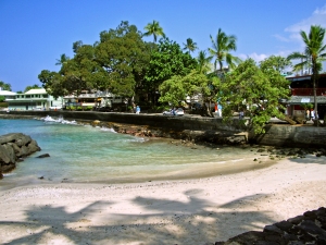
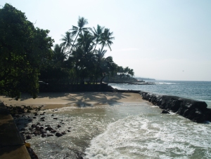
Tiny Nimalu Beach (meaning = "shade of the coconut tress") at Hulihe'e Palace in Kailua Kona, Hawaii: Photo by Donald B. MacGowan
One of the more interesting things about the Palace is the derivation of its name, Hulihe’e. Huli means “to turn or spin” and comes from the same root as “hula” the “dance of turns”. He’e is a generic term for cephalopods (octopus and squid). The term “spinning octopus” refers not to an aquatic species, but rather to a form of tactical defense employed by the Hawai’ians when defending coastline against superior attacking forces. The defenders are spread-out in arms, or tentacles, which rotate from area to area as waves of attackers come ashore.
iPhone and iPod Touch Video Tour Guide for Hawaii-fully GPS and WiFi Enabled, fully interactive. Hours of interesting and compelling content. Available from iTunes or at www.tourguidehawaii.com.
Luakini Stone; a plae of human sacrifice at Hulihe'e Palace, Kailua Kona, Hawaii: Photo by Donald B. MacGowan
Hulihe’e Palace was built by High Chief (later Governor) James Kuakini in 1838 as a home. After his death, Princess Ruth Ke’elikolani lived in a grass house (hale pili) on the grounds, the foundations of which are still visible. The Palace next reverted to a summer party palace for the Hawai’ian Royalty, then residing in Honolulu, especially King Kalakaua--The Merrie Monarch--until it was abandoned to ruin in 1914. Prince Kuhio, the first delegate to Congress from Hawai’i, inherited the Palace from his father and in the 1920’s decided to auction-off all the furnishings. The Palace staff numbered every piece and noted who the buyers were.
iPhone and iPod Touch Video Tour Guide for Hawaii-fully GPS and WiFi Enabled, fully interactive. Hours of interesting and compelling content. Available from iTunes or at www.tourguidehawaii.com.
Hulihe'e Palace from the Kailua Pier, Kailua Kona, Hawaii: Photo by Donald B. MacGowan
Around the turn of the century, the Palace fell into disrepair and provided a discreet spot for men to gather in the evenings, play poker and drink by the light of kerosene lanterns. The Daughter’s of Hawai’i, when they learned in 1920 that the Inter Island Steamship Company planned to acquire and tear-down the Palace to build a luxury resort on the royal grounds, rescued the Palace and have operated it as a museum ever since. The Daughters of Hawai’i found the old list of purchasers of the furnishings Prince Kuhio had auctioned and persuaded many of the owners to return, re-sell or permanently lend these priceless pieces to the Museum.
iPhone and iPod Touch Video Tour Guide for Hawaii-fully GPS and WiFi Enabled, fully interactive. Hours of interesting and compelling content. Available from iTunes or at www.tourguidehawaii.com.
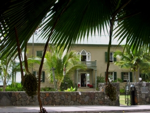
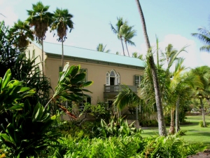
Hulihe'e Palace from behind, Kailua Kona, Hawaii: Photo by Donnie MacGowan
Today the museum contains an impressive array of native Hawai’ian artifacts from fishhooks to clubs to combs. The walls are hung with many portraits of Ali’i and westerners important to Hawai’ian history. Also there are intricately carved pieces of furniture by local and European masters such as Wilhelm Fisher, including massive beds, impressive armoires and a 6-foot diameter table carved from a single koa log.

iPhone and iPod Touch Video Tour Guide for Hawaii-fully GPS and WiFi Enabled, fully interactive. Hours of interesting and compelling content. Available from iTunes or at www.tourguidehawaii.com.
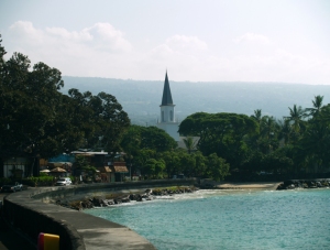
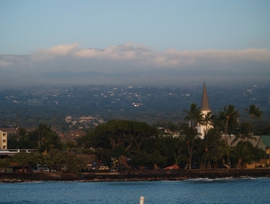
Hulihe'e Palace From Mokuaikawa Church, Kailua Kona, Hawaii: Photo by Donnie MacGowan
To see the new iPhone/iPod Touch App, please visit http://www.tourguidehawaii.com/iphone.html. The best of Tour Guide Hawaii's free content about traveling to, and exploring, the Big island, can be found here. For more information on traveling to Hawaii in general and on touring the Big Island in particular, please also visit www.tourguidehawaii.com and www.lovingthebigisland.wordpress.com.

iPhone and iPod Touch Video Tour Guide for Hawaii-fully GPS and WiFi Enabled, fully interactive. Hours of interesting and compelling content. Available from iTunes or at www.tourguidehawaii.com.
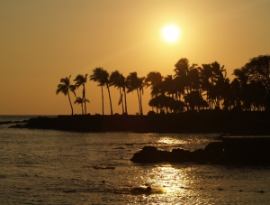
Sunset over Kailua Kona, Hawaii: Photo by Donnie MacGowan
Copyright 2009 by Donald B. MacGowan. All rights reserved.


Friday, October 30, 2009

Kona's Fascinating History: Kamakahonu Rock, the Kailua Pier and Seawall

by Donald B. MacGowan

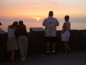
Sunset from the Kailua Seawall, Kailua Kona, Hawaii: Photo by Donnie MacGowan

Whether you visit the Big Island for a few days, a couple weeks or a few months, you want to make the most of your time in Paradise. With such a wide variety of natural and commercial attractions, it is natural for the visitor to get a little overwhelmed in the “Option Overload” and not be able to make a balanced and informed decision on what they want to do and how best to spend their time.

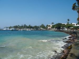
Along the Seawall from the Kailua Pier, Kailua Kona, Hawaii: Photo by Donnie MacGowan

Choosing which beach you want to spend time on, or where you want to hike or drive can be an exercise in confusion and conflicting advice. Even more so, finding quality information on the history, culture, geology and natural history of the area can be almost impossible--and much of what you do find is inaccurate, or third-hand retellings that are, well, better stories than histories. Clearly, visitors to Hawaii could use help making quality decisions about how best to spend their time and understanding what they are seeing, the culture they are visiting.

Hualalai Looms over the sleepy fishing village of Kailua Kona, protected by it's seawall, Hawaii Photo by Donnie MacGowan

This is why Tour Guide Hawaii is so excited and proud to announce the release of their new GPS/WiFi enabled App for iPhone and iPod video tour that helps you navigate your trip to Hawaii with hours of informative, location-aware video and information. Although our video guide will lead you to dozens of unusual, untamed and unspoiled spots, as an example of the fabulous coverage our App for iPhone and iPod provides, let's look at a fascinating, but perhaps mundane-appearing couple of places in the heart of Old Kailua Town itself, but might not be able to find from maps and guidebooks and would otherwise miss if you did not have Tour Guide Hawaii's new App.

Kamakahonu Rock, Kailua Pier and Sea Wall

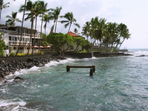
The Old Seawall Behind the Kona Inn, Kailua Kona, Hawaii: Photo by Donnie MacGowan

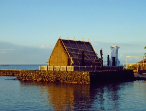
In the heart of Old Kailua Town's downtown section, amidst the many shops and restaurants, lies the old Kailua Pier and Seawall. As they excitedly trek from the pre-contact Hawaiian temple at Ahu'ena Heiau, to Hulihe'e the Hawaii Royal Palace and Moku'aikaua, the first Christian Church in the state of Hawaii, tourists busy shopping, dining and snapping photos often do not even notice these historic constructions. But the pier and the seawall have an ancient, complex and fascinating history, the stones recycled from gun-turreted forts and ancient Hawaiian royal palace walls over the centuries.

Mokuaikawa Church and Hulihee Palace stand above the seawall, Kailua Kona, Hawaii: Photo by Donnie MacGowan

Congregationalist missionaries from Boston crossed the Atlantic Ocean, fought the frigid, turbulent waters off Cape Horn, endured 5 months of intense stormy weather and unimaginably cramped and filthy quarters below decks on the Brig Thaddeus, and headed for a new life in Hawai’i. In March of 1820, the missionaries sailed into the balmy waters of Kailua Bay and landed at Kamakahonu Rock, the “Plymouth Rock” of Hawai’i, in 1820.

Along the Seawall, Kailua Kona, Hawaii: Photo by Donnie MacGowan

First constructed in 1900 and then rebuilt in 1950, stones for the pier and the seawall that runs from the pier to the Old Kona Inn were scavenged from the immense stonewall that once surrounded the Ahu’ena Heiau Temple complex and from the massive stone fort erected after the destruction of the heiau during the reign of Kamehameha II. The large stone fort once boasted a dozen 18-inch naval cannon and was nick-named “The Rock” by passing whalers; today, that appellation is universally applied by locals to the entirety of the Big Island.

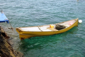
A Hand-Built Boat Tied-up at Kailua Pier, Kailua Kona, Hawaii Photo by Donnie MacGowan

The pier originally was built to facilitate loading cattle onto steam freighters bound for Honolulu. Before the advent of the pier, horseback cowboys used to rope and drag individual steers from Kaiakeakua Beach (the miniscule beach just south of the pier), plunge them into the surf and swim them out to waiting whaleboats. There, the cows were lashed to the gunwales of the whaleboat and, with their backs awash, ferried farther out to the steamer offshore. The cows were then, unceremoniously, by means of sling and crane hoisted aboard the steamer

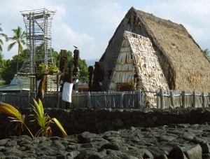
Morning at Ahu'ena Heiau, Kailua Kona, Hawaii: Photo by Donnie MacGowan

The pier sat on Kamakahonu rock and pilings until 1950 when concrete pylons were poured. From around the turn of the last century until the 1970’s the pier was covered by various sheds and warehouses that served to protect 100 pound coffee bags, sugar and other goods ready for shipment. Renovators in the early 1950s even planted trees along the pier in an effort to beautify the downtown area. The modern shape and configuration of the pier resulted from a year and a half’s renovations during 2003-2004.

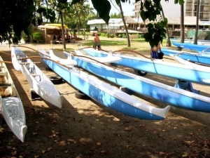
Canoes Parked at Kamakahonu Beach, Kailua Kona, Hawaii: Photo by Donnie MacGowan

Back in the day, at the entrance to the pier sat H. Hackfield And Company, the largest business concern in Kona at the turn of the last century; in 1917, H. Hackfield was bought by American Factors which became AmFac in 1960. Hackfield’s buildings contained a general store, post office, coffee mill and an ice factory as well as serving as the company’s headquarters. Standard Oil stock tanks sat on the shore of Kamakahonu Beach in the 1950s and 1960s until the construction of the original Hotel King Kamehameha in the 1960s. This original hotel was rebuilt as the current King Kamehameha Beach Resort in the 1970s.

Ahu'ena Heiau Surrounded by its Ancient Stone Walls. Kailua Kona, Hawaii: Photo by Donnie MacgGawn
Ahu'ena Heiau Surrounded by its Ancient Stone Walls. Kailua Kona, Hawaii: Photo by Donnie MacGowan

In several places along the seawall, if you look 20-60 feet offshore, you will observe the distinct “boil” associated with undersea fresh water springs discharging into the ocean. These springs result from the discharge of aquifers that collect fresh water far up the mountain slopes and transport it down to where they intersect the seafloor. The Hawai’ians used to dive under the surface of the ocean with a sealed gourd, down to the springs, turn the gourd mouth-end down, uncork it and fill the gourd with fresh water. This was a necessary task to obtain fresh water, as fresh water springs are scarce in the Kona district. Today, one can often spot honu (sea turtles) languorously swimming through the springs, trying to kill parasites and algae that grow on their shells and skin.

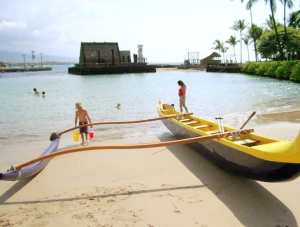
Kamakahonu Beach, Kailua Kona, Hawaii: Photo by Donnie MacGowan

Today, Kamakahonu Rock (eye of the turtle) lies underneath the modern-day Kailua Pier, where it serves as a footing for it. It is not uncommon to observe dolphin, sea turtles and whale off the pier.

Kaiakeakua Beach, Kailua Kona, Hawaii: Photo by Donnie MacGowan

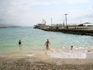
Even many locals will be surprised to learn that the tiny beach adjacent to, and south of, the pier and the little beach associated with Hulihe’e Palace both have names; respectively they are Kaiakeakua (the god of the sea) and Niumalu (“in the shade of the coconut trees”) Beaches. Snorkeling from Kamakahonu, Kaiakeakua or Niumalu beaches is spectacular and strangely uncommon. A beautiful coral garden and abundant fish are to be seen snorkeling along the shoreline of Ahu’ena Heiau and fish, turtles, moray eels and the occasional sunken boat are abundant in Kailua Bay. Be wary of boat traffic to and from the pier, don’t go in on boat days, when careless lighter pilots ignore the marked swim channels.

Niumalu Beach, Kailua Kona, Hawaii: Photo by Donnie MacGowan

Many commercial ocean-going enterprises use the Kailua Pier as their departure point, lighters from large cruise ships land here and fishing captains on charter boats still bring their catches of marlin and tuna to be weighed at the scale at the pier. During the 2nd or 3rd weekend of October, the Kailua Pier serves as the staging grounds for the first leg and finish line of the Ironman World Championship Triathlon.

Kamehameha's view of his taro fields, Kailua Kona, Hawaii: Photo by Donnie MacGowan

Good fishing is to be had all along the pier and the seawall, but the best is behind the Hulihe'e Palace and the Old Kona Inn. During heavy seas and big storms, waves up to 20 feet high explode over the seawall and surge across Ali’i drive.

Ahu'ena Heiau Sacred Iki, Kialua Kona Hawaii: Photo by Donnie MacGowan

Views from the pier are spectacular, particularly at sunset; it is worth the time to stop, explore the pier and the adjacent Ahu’ena Heiau.

The Seawall at Hale Halawai Beach, Kailua Kona, Hawaii: Photo by Donnie MacGowan

Facilities include showers, restrooms, changing rooms, drinking water, public telephones and a boat ramp; Kailua Pier and seawall lie in the heart of Old Kailua Town's many shops and restaurants so anything the visitor could wish for is in easy walking distance.

To see the new iPhone/iPod Touch App, please visit http://www.tourguidehawaii.com/iphone.html. The best of Tour Guide Hawaii's free content about traveling to, and exploring, the Big island, can be found here. For more information on traveling to Hawaii in general and on touring the Big Island in particular, please also visit www.tourguidehawaii.com and www.tourguidehawaii.blogspot.com.

A Vog-Tinted Sunset from the Kailua Pier, Kailua Kona, Hawaii Photo by Donnie MacGowan

Copyright 2009 by Donald B. MacGowan. All rights reserved.

Sunday, August 30, 2009

Best Scenic Drives in Hawaii #5: Kailua Kona to Hawaii Volcanoes National Park, Puna and Lava Viewing

Trip 4: Hawaii Volcanoes National Park and Lava Viewing Approximate minimum time start to finish (to see every site): 14 hours (return drive in the dark).

From Kona, connect to Highway 11 south 2 1/2 hours to Ka'u Desert Trail. A 40 minute round trip hike leads to footprints of ancient warriors who where caught in a sudden, ferocious eruption. Continue on Highway 11 to Hawai'i Volcanoes National Park. Park Rangers at the Visitor Center will have the latest lava information. Chain of Craters Road has numerous craters, tons of hiking trails and several breathtaking vistas for great photographs. Upon exiting the Park, continue to Kea'au and Highway 130 (food stop). Proceed to Pahoa and the junction to Highway 132 and Lava Trees State Park. Here trees were inundated with fast flowing lava. When the trees rotted, it left these Lava Trees. Then on to Highway 137, following the coast to Kalapana and a 20 minute hike to the lava viewing area at Waikupanaha. (Arrive about dusk for optimal viewing.) From Kalapana back to Kona is a 3 1/2 hour drive (after dark).

Leg 1) Start at north end of Keauhou Historic District on Ali’i Drive, head south on Ali’i Drive to jct with Kamehameha II Hwy; east on Kamehameha III to Hwy 11. Take Hwy 11 south to Ka’u Desert/Warrior Footprints Trail.
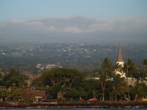
Evening Light on Hualalai and Kailua Kona: Photo by Donnie MacGowan

Keauhou Historic District and Kona Coffee

For almost 400 years, temples and palaces along the Kona coastline served as a kind of "Rome of the Pacific", a great political, religious and cultural center in Polynesia, until the capital was moved to Honolulu in 1850 by Kamehameha III.

The most important, interesting and best preserved historical and cultural sites lie within the Keauhou Historic District, between Kahalu'u Beach Park in Kailua running south 6 miles to Kuamo'o Bay in Keauhou. The District contains perhaps a dozen fascinating sites that are easy to walk to, well maintained and quite interesting. To see the numerous fascinating and important archaeological sites in the Keauhou Historic District, it is necessary to park your car in the free parking at either Kahalu’u Beach Park or the Keauhou Beach Resort and explore on foot.

Just uphill from the Historic District is the Kona Coffee District. Hawaii is the only state in the union which produces coffee, and Kona coffee is perhaps the finest in the world. Over 2 millions pounds of coffee a year are produced on about 600, 2-3 acre farms; tours of coffee farms and roasteries are available.
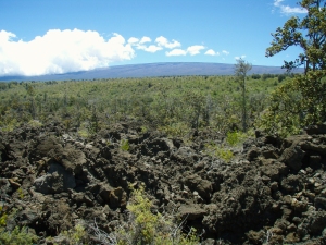

Mauna Loa Rises Above the Ka'u Desert at Warriror Footprints: Photo by Donald B. MacGowan

Ka’u Desert Trail and Warrior Footprints, Hawai’i Volcanoes National Park

Just where Hawai’i Belt Road enters Hawaii Volcanoes National Park from the West, is a small parking strip that is the gateway to a host of wonders within the Ka’u Desert section of Hawaii Volcanoes National Park. Although eruptions here are generally characterized by leisurely outpouring of lava, it is not unknown for Kilauea to violently erupt in a blast of steam and ash. It is this ash that preserves some human footprints, believed to have been formed in 1790 when enemies of Kamehameha the Great were caught by one such massive, explosive eruption. Perhaps as many as 400 men died in this eruption. An emergency phone is available here; there are no other services. Do not venture from your car here without carrying water.

Leg 2) Continue south on Hwy 11 to Hawaii Volcanoes National Park Entrance and jct with Crater Rim Drive; Crater Rim Drive west to Kilauea Visitor’s Center to Jagger Museum, then back around Crater Rim Drive to Kilauea Iki Crater.
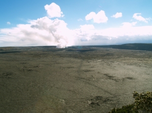
Kilauea Crater and the Current Halema'uma'u Eruption As Seen from Waldron Ledge, Hawaii Volcanoes National Park: Photo by Donnie MacGowan

Hawai’i Volcanoes National Park

Hawai’i Volcanoes National Park is a magical, spiritual, wondrous, strange and beautiful place comprised of great contrasts and contradictions: dry as dust desert to teeming tropical jungle; frigid sub-arctic wasteland to steaming black sand beaches to rivers of flowing lava.

The star attractions in the Park are a pair of active volcanoes; Mauna Loa is the largest mountain on earth and Kilauea is most active volcano on earth. However, there are numerous other wonders from lava tubes to crawl down, black sand beaches with sea turtles to watch, mysterious petroglyph fields to explore, tropical jungles to hike through, endangered bird species to find, happy-face spiders to amuse and an otherworldly volcanic landscape so fresh it’s still steaming.

Hawaii Volcanoes National Park is open 24 hours a day, 365 days a year. During daylight hours, an access fee is charged. The Visitor Center has a 24-hour information line at 808.985.7017 and there is a 24-hour eruption hotline at 808.985.6000. Within the Park tune to A.M. radio 530 for continuous information broadcast. There tourist items available for sale and one restaurant and in the park, however generally shopping, restaurants and gasoline are only available in the nearby village of Volcano.
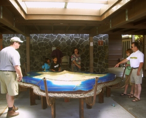

Kilauea Visitors Center at Hawaii Volcanoes National Park: Photo by Kilgore Trout

Kilauea Visitor Center

Newly remodeled and updated, the Kilauea Visitor’s Center is an outstanding resource of information on Hawaii’s volcanoes and the National Park; the not-to-be-missed first stop in the park you must make. The Center is run by enthusiastic and knowledgeable staff that has the most up-to-date information on viewing the eruption, hiking and camping, bird watching, stargazing and just about any other topic of interest to Park visitors.

Available for sale in the Center are maps, guidebooks, books and videos about the volcanoes, Hawai’iana, history, plants and every topic you can imagine pertinent to the Park, even souvenirs. There are free brochures and pamphlets on various trails, attractions, hiking safety and lava viewing hazards and precautions. The Visitor Center is open daily from 7:45 a.m. to 5 p.m.; there are public restrooms, water and pay phones available. Starting at 9 a.m. and showing every hour on the hour is a 20 minute informative movie about the Park; the film changes from time to time, but always contains spectacular footage of eruptions, information on volcanology and the natural and human history of the Park.
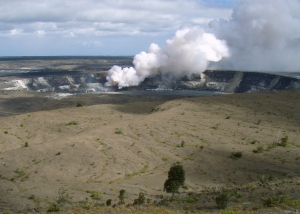
View of Halema'uma'u from Jagger Museum, HVNP: Photo by Donald MacGowan

Jagger Museum and Hawai’i Volcano Observatory

Famed for its fabulous views of Mauna Loa and Kilauea as much as for its interesting exhibits, The Jagger Museum (named for geologist Thomas A. Jagger) is open daily from 8:30a.m. to 5:00p.m. Exhibits include murals by Herb Kawainui Kane, seismograph charts of eruptions and earthquakes, geological displays and display about the natural and human history of the Park.

When entering the parking lot of the Museum/Observatory, be especially careful of the Federally-protected Hawaii Goose, the Nene, who seem to congregate here. The Nene is the State Bird of Hawai’i, and this parking lot and its surrounding area constitute one of the best places for viewing them.
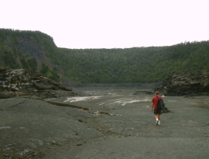
Frank Burgess On Kilauea Iki Trail: Photo by Donnie MacGowan

Kilauea Iki Trail

Perhaps the finest short day hike in the park, a four-mile, 2-3 hour trip down into, across and back out of Kilauea Iki Crater gives one an intimate feel for volcanoes, Hawaiian-Style. Along one side, thick fern and ohi’a forest skirts along the rim and on the other, lush tropical rainforest crowds to the very brink of the crater; bleak volcanic desert lines the crater walls and covers the floor. The start and finish of the hike are along well marked, wide trails. The remainder is an easily followed, well marked trail with stone ahu (cairns) over the crater floor. As always when hiking in the Park, it is wise to avoid the noonday sun, and to remember that afternoon showers are common, especially near where this hike meets the crater rim.

Leg 3) Crater Rim Drive to intersection with Chain of Craters Road; Chain of Craters Road to End of Road.
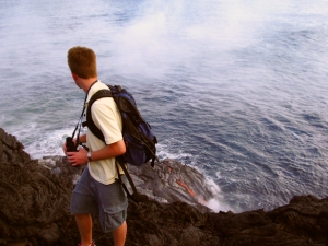
Hiking from the End of Chain of Craters Road to the Lava Ocean Entry at La'epuki: Photo by Donald MacGowan

End of Chain of Craters Road

The end of Chain of Craters Road is currently at the 19 mile marker near the Holei Sea Arch. This is where the road was cut off by flowing lava and destroyed the 2 million dollar visitor center. When the lava is near the road, one can walk right up to it. There are displays about the volcano and natural history of the area, as well as a wealth of information on hiking to, and viewing, the lava, available here.

Hiking all the way out to the active flows is one of the most spiritually rewarding, awe-inspiring, curiosity quenching and amazing things one can do anywhere in the world—but it is neither for the physically unfit nor the meek of spirit. It is a long, hot hike (currently seven miles) over broken ground and glass-sharp rocks; the heat from the volcano is savage; the weather, if clear, is sweltering…frequent squalls blow in off the ocean and the rain and wind can get pretty wild out on the lava plain where there is absolutely no cover or shelter to protect you. No water or shade is available anywhere along the hike.

Leg 4) Follow Chain of Craters Road back uphill to Crater Rim Drive, follow Crater Rim Drive back to Park Entrance and then to Hwy 11. Go east on Hwy 11 to jct with Hwy 130 at Kea’au; take Hwy 130 south to Pahoa.
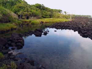
In Hawaiian, "Puna" means "Spring" and Puna District in General, and the Area Around Pahoa in Particular, Is Dotted With Hot, Warm and Cold Springs: Photo by Donnie MacGowan

Puna District and Pahoa Town

Uncrowded, off the beaten track and largely undiscovered by tourists, Puna District is a magnificent wonderland; from incredible tree-tunneled roads, geothermal fields of steam vents, lovely beach parks, hot ponds, hikes on raw lava flows and jungle trails, and unequaled snorkeling, the land cries out for the visitor to explore a little bit.

At the center of Puna is Pahoa Town; wild, untamed and even a bit unruly, with its false-front, western-style buildings and raised wooden sidewalks, Pahoa looks more like it belongs in Wyoming. But Wild West isn’t the only subculture evident here…tie-dye banners and the general “flower-power” ambience some businesses and citizens lend Pahoa give it a decidedly “’60’s” feel.

It has been said of Pahoa that if it weren’t for counter-cultural influences, it would have no cultural influences at all. The charm and allure of this way of living is evident when you consider that the region around Pahoa is the fastest growing portion of the island. Pahoa has some of the best restaurants on the island, THE best natural foods store and a great public pool.

Leg 5) At Pahoa, get on Hwy 132 to Lava Trees State Park.
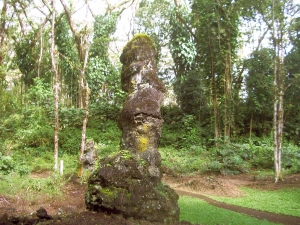
Lava Trees State Park: Photo by Donnie MacGowan

Lava Trees State Monument

Under a lacey canopy of monkeypod trees, casts of ohi'a trees stand as monuments to a fast-moving pahoehoe lava flow that passed through here in 1790. When the lava hit the water-saturated ohi'a trees, it cooled and began to congeal around them. The original ohi'a trees burned away but the quickly cooled lava around them stands here today, hollow, with imprints of the tree bark inside. Lava Trees Park offers trails to hike and a restful, bird-filled jungle to sit and listen to. You can spend between 20 minutes to an hour wandering the trails, here, exploring and discovering. Be careful, however, the area is riddled with hidden cracks in the ground which can make exploring hazardous. You may wish to avail yourself of the restrooms here; they are the last public facilities for some distance.

Leg 6) From lava Trees State Park take Hwy 132 to jct with Hwy 137 at Kapoho; take Hwy 137 southwest to Ahalanui Pond then to Kaimu Black Sand Beach and Kalapana Disaster of 1990.
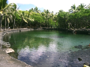
Ahalanui Hot Pond: Photo by Donald MacGowan

Ahalanui Pond

Also called “Secrets Beach”, this spring and ocean-fed, manmade pool was initially constructed when the springs ran chilly cold. Eruptions in Puna during the ‘50s and 60’s reworked the subterranean waterworks and now the springs run hot and the pool is a comfortably warm 90-95 degrees. The open connection to the ocean, keeps the water fresh. With the gentle aloha breezes, swaying palms and surf whooshing against the, it can be really hard to drag oneself out. Soak for a while. Picnic tables, pavilions, pit barbecues, showers, lawns and all the pleasantries of a civilized park are available at Ahalanui Pond. Leave no valuables in your car and be vigilant if you stay soaking here, after dark.
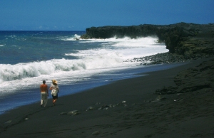
Kaimu Beach near Kalapana, Puna Hawaii: Photo by Donnie MacGowan

Kalapana Disaster of 1990/Kaimu Black Sand Beach

In 1990 the volcano goddess Pele determined it was time for some serious housecleaning in Puna. Lava flows from Kilauea’s East Rift engulfed the villages of Royal Gardens, Kaimu and Kalapana, destroying virtually everything.

Buried were a centuries old fishing village and a world famous black sand beach. When the lava came, it wiped out not just material possessions; it wiped out a way of life and a landscape cherished by generations. The Big Island's newest black sand beach, Kaimu Beach, is a lovely if barren crescent of sand at the end of an unforgiving expanse of lava from the 1990 flows. The trail to the new black sand beach is marked with hundreds of young palms, numerous lava casts which include palms, pandanas fruit and even some fish that were caught in tide pools.

From the lava hillocks along the trail you can get nice views of the eruption plume at Pu’u O’o, up on the flank of Kilauea, as well as the steam clouds down a few miles along the coast where the lava enters the sea. Restrooms and fast food are available at the end of the road.

Leg 7) From Kalapana, take Hwy130 (Ahia Road) just a tweak to the jct with old HWY 130; go west on old the highway to Waikupanaha Lava Viewing.
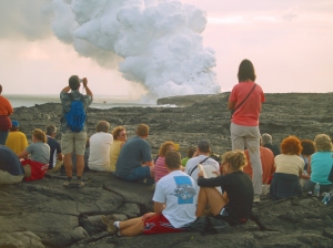
Lava Viewing At Waikupanaha, Puna Hawaii: Photo by Donald MacGowan

Lava Viewing Near Kalapana

Nowhere else can you see lava flowing from a volcano into the sea; no Big Island visit is complete without seeing this awe-inspiring show. Currently lava is only flowing into the sea outside the Park. Drive south on Highway 130 through Pahoa to the 20 mile marker and take the right branch about two miles to the parking area. Port-a-potties are available here. The road is open from 2 p.m. until 10; no cars allowed in after 8. Lava viewing information is available from Hawaii County at 808.961.8093; check conditions before you go.

The easy trail, a 20 minute stroll to the viewing area, is well-marked. The viewing varies as lava flows nearer or farther from the trail. Viewing is best at dusk so bring flashlights for the hike out. Take close-toed walking shoes and a hat, long pants and long-sleeved shirt, at least 2 liters of water and sun block and a rain jacket and camera. Remember food and gas are not available anywhere nearby after dark, so fill up BEFORE you park, bring snacks and drinks. There are port-a-potties available at the parking lot.

Leg 8) Return to Hwy 130; Hwy 130 north through Pahoa to Kea’au and jct with Hwy 11. Hwy 11 west to Kailua Kona. Take Hwy 11 west to Kailua Kona.

For more information on visiting Hawaii in general and touring the Big Island in particular, please visit www.touruidehawaii.com and www.lovingthebigisland.wordpress.com. For information about the author, please go here.

Sunset Over Oneoneo Bay, Kailua Kona Hawaii: Photo by Donald MacGowan

Wednesday, July 29, 2009

Volcano Update: 2009—A year of noteworthy volcano anniversaries in Hawai`i

Reprinted from here.

2009—A year of noteworthy volcano anniversaries in Hawai`i

Thomas Jaggar (second from left) prepares to measure the temperature of the Halema`uma`u lava lake in 1917.  Pictured, left to right, Norton Twigg-Smith, Thomas Jaggar, Lorrin Thurston, Joe Monez, and Alex Lancaster.
Thomas Jaggar (second from left) prepares to measure the temperature of the Halema`uma`u lava lake in 1917. Pictured, left to right, Norton Twigg-Smith, Thomas Jaggar, Lorrin Thurston, Joe Monez, and Alex Lancaster.

Thomas A. Jaggar, founder of the Hawaiian Volcano Observatory (HVO), first visited Hawai`i 100 years ago during a decade-long period of exploration in which he witnessed first-hand the destructive power of volcanic processes.

His quest began in 1902, when Jaggar traveled to the West Indies just 13 days after two volcanoes there erupted with devastating consequences. The first eruption at La Soufriere on the island of Saint Vincent resulted in 1,500 deaths. It was followed only a few hours later by a second, more tragic, eruption at Mount Pelee on Martinique, in which 28,000 people perished. Jaggar's experience at Martinique set the stage for his work on volcanoes and earthquakes during the next half century.

After Martinique, Jaggar's expeditions took him to the scenes of earthquakes and volcanic eruptions in the Aleutians, Central America, and Japan. In 1908, an earthquake near Mount Etna in Italy killed 125,000 people. Following that natural disaster, Jaggar declared that "something must be done" to support systematic studies of volcanic and seismic activity.

The next year, in 1909, he traveled at his own expense to Hawai`i, where he determined that Kīlauea was to be the home of the first American volcano observatory. His vision was to "protect life and property on the basis of sound scientific achievement."

In 1912, construction began on the new Hawaiian Volcano Observatory with support from Hawai`i businesses, private endowments through the Hawaiian Volcano Research Association, and funding from the Massachusetts Institute of Technology. HVO has since been managed by the U.S. Weather Bureau (1919-1924), U.S. Geological Survey (1924-1935), and National Park Service (1935-1947). The USGS became the permanent administrator of HVO in 1947.

In 2012, HVO will celebrate its centennial anniversary, a milestone made possible through the vision and efforts of Thomas A. Jaggar.

Today, in 2009, as we look back at Jaggar's first visit to Kīlauea 100 years ago, we also reflect on the landmark anniversaries of several significant eruptions on Kīlauea and Mauna Loa:

25th1984 Mauna Loa summit and northeast rift zone eruption
40th — start of the 1969-74 Kīlauea east rift zone eruption (Mauna Ulu)
50th — 1959 Kīlauea summit eruption (Kīlauea Iki)
60th1949 Mauna Loa summit eruption
90th1919 Mauna Loa southwest rift zone eruption
150th1859 Mauna Loa northwest flank eruption

Sunday, June 14, 2009

Kona Heritage Corridor Scenic Drive: An Exceptional Day Trip Exploration of Historical, Lovely, Up-Country Kona!

Historical Kona Heritage Corridor

Up-Country Kona is A Charming Amalgamation of True Old Hawaii and Counter Culture Weirdness--All With Stunning Views of the Ocean: Photo by Donnie MacGowan

Up-Country Kona is A Charming Amalgamation of True Old Hawaii and Whimsical Counter Culture Weirdness--All With Stunning Views of the Ocean: Photo by Donnie MacGowan

When the Kona Coast becomes too hot and humid upon a torrid afternoon, or post-littoral torpor sets in from sunbathing overindulgence at the beach, visitor's to the Big Island Kona side should take a cue from locals and head up-country for the fresh, cool afternoon air. The Old Road, a 12 mile long remnant of the Mamalahoa Highway, runs through a beautiful slice of Old Hawai'i; coffee farms, fruit orchards, historical buildings, small towns and an old sugar mill grace the sunny slopes of Hualalai Volcano here.

Mauka, or Up-Country, Kona as this area is called, was once the beating financial heart of Hawai'i Island-along this road were built the first newspaper press, bottling company and telephone exchange on Hawai'i. Today, the road runs through the artist enclave of Holualoa, famed for its art galleries and coffeehouses. Sweeping views of the Kona coastline, the upper slopes of Hualalai Volcano and even Maui on vog-free days, make this road a trip a not to be missed treat. Let's take a quick tour of the section of the Kona Heritage Corridor that runs along Highway 180 from it's intersection with Highway 190 north through Holualoa, past the intersection with Highway 19 and into the town of Kainaliu.

Kona Mauka Offers Stunning Views Along The Coast and Of Sunsets: Photo by Donald B. MacGowan

M. Onizuka Store

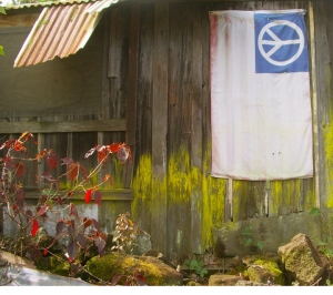
Starting at the intersection of the Mamalahoa Highway (Hwy 180) and Highway 190 (Palani Road) and heading approximately South on the Mamalahoa Highway, one passes through tropical to temperate rainforest and comes to the verge of the cloud forest that softens the upper slopes of Hualalai Volcano. At about the 7 mile maker one passes the old M. Onizuka Store, the boyhood home of Astronaut Elisson Onizuka, who died in the Challenger space shuttle disaster. The M. Onizuka Store was founded in 1933 by Masamitsu Onizuka in 1933 who provided the residents of his community with general merchandise and means of transporting their purchases through the store's one-man taxi service. Following her husband's death, Mitsue Nagata Onizuka continued to run the store until the day she died in 1990. "May Peace On Earth Prevail" proclaims the post outside the residence where Elisson Onizuka, who had the honor of being the first astronaut of Japanese-American descent, grew up. History buffs are invited to explore Hawai'i's rich involvement in man's exploration of space at the Onizuka Space Museum at Kona International Airport.

Kona Mauka Was Once the Beating Financial Center of Hawaii Island:Photo by Donnie MacGowan

K. Komo Store

Boasting but a few necessary concessions to the march of time, the charming comfort of the family store of yesteryear lives on in the form of the K. Komo Store. Gasoline, sundries and good conversation are always available at this for real slice of "Old Hawai'i". Serving the people of Keopu since the early 1900's, and operated by the third generation of Komo family, K. Komo Store still grows, roasts, brews and sells their own brand of coffee. The store is registered on the National Register of Historic Places.

Holualoa Town

When the Dryland Forest on the Slopes of Hualalai Volcano Open Up Near Holualoa Town, There Are Amazing Views of the Kona Coast
When the Dryland Forest on the Slopes of Hualalai Volcano Open Up Near Holualoa Town, There Are Amazing Views of the Kona Coast: Photo by Donald MacGowan
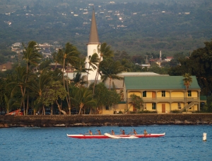
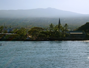
With a name that means "the long sled track", its position at the apex of Kona coffee country and its modern day eclectic profusion of art galleries, schools and studios, it's easy to see that Holualoa, once the bustling center of North Kona commerce, has been through some changes in the past 200 years. Initially, Hawai'ians grew taro and sweet potato in small family farm plots called "kuleana" around Holualoa. It is interesting to note that today the word "kuleana" in Hawai'ian pidgin has taken on the meaning of "personal responsibility". In any case, early in the nineteenth century, Japanese, Portuguese and Chinese immigrants settled here and began planting large fields of oranges, breadfruit, coffee and cotton among other crops. A large sisal plantation for making ropes for sailing vessels was located just northwest of Holualoa...today, now-wild sisal plants, looking a bit alien with their tall, single stalk of blossoms, can be seen in profusion along Palani Road between Kailua and Kealekehe. Early in the 20th century the fields were turned over almost entirely to sugar production and Holualoa became the financial center of the Kona District. Luther Aungst established the Kona Telephone Co here in the 1890s, the first regional newspaper The Kona Echo was established at Holualoa by Dr. Harvey Hayashi, one of Kona's first full time resident doctors. Many other schools, churches and industries, including the Kona Bottling Works, located here in the first half of the 20th century, but the collapse of the sugar industry brought financial doom that coffee growing only partially staved off. The community shrank drastically in population and commercial importance and by 1958 only about 1000 people lived in the Holualoa area. In a dreamy, upcountry Kona backwater, a community of artists, recluses, writers and seekers of the "Old Hawai'i Lifestyle" thrived here. Recently, an infusion of money from the newly invigorated "boutique coffee" industry has sparked a revival of commercial life in Holualoa, anchored in coffeehouses and art galleries.

Kona Sugar Company and West Hawai'i Railway Company

eKona Sugar Mill 2
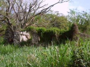
The Jungle Has Nearly Reclaimed the Old Kona Sugar Mill Below Holualoa Town: Photo by Donnie MacGowan

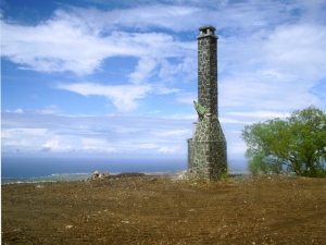
Such was the seductive lure of easy riches to be gained by growing sugar in Hawai'i at the beginning of the 20th Century, that investment capital for a large sugar plantation, sugar mill and railroad in Kona could be raised not once, but three times. The Kona Sugar Company plantation was established in 1899 and every available scrap of land was stripped of whatever crops had grown there previously and planted in cane. Although the sugar grew well enough above about 500 feet elevation, a notable lack of fresh water in Kona's semi-arid landscape made Wai'aha Stream the only logical choice for the mill site. Unfortunately, the stream flow is vastly insufficient for year-round cane milling and the mill, built in 1901, went broke in 1903. Kona Sugar was bought by investors; renamed Kona Development Company, the plantation again went broke in 1916 and was in turn bought by investors in Tokyo. This group managed to eek out a profit until the industry imploded in 1926. Originally planned to run 30 miles, the railroad was only built to total length of 11 miles in the 27 years of sugar plantation operation. Work camps, communal baths, stables, workshops and all the requisite infrastructure of a giant agricultural plantation lay abandoned in the Mauka Kona countryside. During World War II, the U.S. Army used the mill site as a training camp to acclimate troops to warfare on their way to the tropical Pacific Theater. Fearing the tall smokestack of the mill would act as an artillery landmark for any invading forces, the Army pulled it down and Kona lost one of its first post-contact, industrial landmarks. Traces of the rail bed can still be seen from the top of Nani Kailua and Aloha Kona residential neighborhoods. Located just west of the town of Holualoa along Hualalai Road (the major intersection just south of town), near the intersection with Hienaloli Road, are impressive stone breastworks and trestles for the railroad. Built by hand but still strong today, the rail bed can be explored and hiked from here. Further up Hienaloli Road from the intersection with Hualalai Road, the old mill site remnants are still visible.

Keauhou Store

The Old Keauhou Store in the Kona Heritage Corridor: Photo by Donnie MacGowan

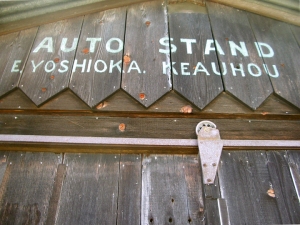
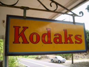
Originally Sasaki Store, Keauhou Store was founded by noted carpenter, coffee farmer and prominent local business man Yoshisuki Sasaki in 1919, and remains one of the great neighborhood stores of Kona. Run most recently by Yoshiuki's son, Rikiyo, they once offered gas, sundries, fresh coffee and local produce; today, however, the Keauhou Store stands closed by the roadway, as traffic that used to pass by the front door now travels the makai highway. However, the front porch of Keauhou Store still serves as a gathering place for local coffee farmers and neighborhood children. A true remnant of Old Kona, Keauhou Store is worth a visit, especially to history buffs and photographers.Tong Wo Tong Cemetery

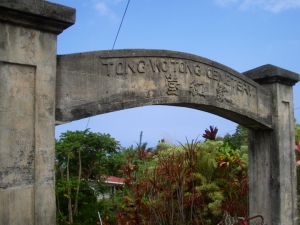
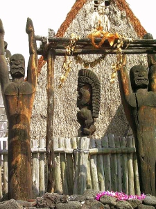
Although Chinese have lived in the Islands since the turn of the 19th Century, the first large scale immigration of Chinese came when they were brought over to work the cane fields in 1852. There was soon a burgeoning population of Chinese field workers and shopkeepers; by 1860 Chinese outnumbered Caucasians in Hawai'i. This community established the Tong Wo Tong Cemetery to honor their ancestors and commissioned Yoshisuki Sasaki, a noted local carpenter and prominent business man, to build the ornate gate in 1902. In English and Chinese the inscription on the gate reads "Tong Wo Tong Cemetery".

Gateway to Tong Wo Tong Cemetery, Kona Heritage Corridor: Photo By Donald MacGowan
Daifukuji Soto Mission

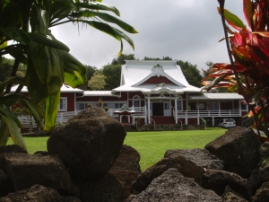
This Buddhist Temple has served the Mauka Kona community as a site for worship and retreat since opening on May 27, 1921. Reverend Kaiseki Kodama, who, since founding the first Kona Soto Mission in 1914, for years had held services at Hanato Store and other sites, planned the original mission building which was designed and built by Yoshisuki Sasakai. Reverend Hosokawa opened a Japanese Language School here in 1926; the school, living quarters and social hall all enlarged upon the original structure. The traditional Japanese music and dance-filled O Bon Festival is held here each July; visitors are welcome.

The Daifukuji Mission Near Kainaliu: Photo by Donnie MacGowan

Lanakila Church/Kaona Uprising

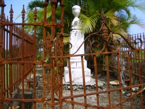
Lanakila Church was the beginning and focal point for one of the strangest and more interesting episodes in Mauka Kona history during the latter half of the 19th Century. This, the last church built by the ubiquitous Reverend John D. Paris, was finished in 1867. Lanakila Church is still today a vibrantly strong, active parish of Congregationalists. The quiet country setting of this church gives little indication that it was in the center of a violent, deadly uprising in the late 1860s. Called the Kaona Uprising, the events of 1867 and 1868 comprised a perhaps natural reaction of the native Hawai'ians to having been so recently, and completely, dispossessed of their way of life, their naturist religion and their ancient traditions. The uprising started peaceably enough; in 1867 a man named Kaona introduced himself to the Reverend Paris, saying he had a great quantity of Hawai'ian Bibles he wished to distribute and asked permission to store them in the as-yet-unfinished Lanakila Church building. The Church elders assented and the Bibles were stored. However, Kaona and his followers tried to usurp the church building and its land for living space and at the pleas of Reverend Paris the Governor, Princess Ke'elikolani, eventually evicted them. Kaona moved his growing group of malcontents onto a neighbor's property until rain and cold forced them to seek warmer lands downslope by the ocean. Growing more powerful with each new cult member, Kaona resisted the efforts of the local law enforcement, in the person of Sheriff Neville, to evict them, reportedly spitting on and destroying the first eviction order. Preaching Hellfire and Brimstone, and aided considerably by a rash of large earthquakes early in 1868, Kaona convinced his followers that he was the only true Prophet of God and that the earthquakes would destroy all but his most loyal followers. Sensing a mood of violence, Sheriff Neville determined to use force if necessary to evict Kaona and his band from their squatter's camp. In the ensuing melee, Neville and one native policeman were killed. Kaona then whipped his band into a religious frenzy of blood lust, exhorting them to go forth, slay the white people and set fire to their farms and homes. Such was the violence and threat that the South Kona Magistrate organized a volunteer militia to for the protection of citizens, but the uprising wasn't put down until the Steamer Kilauea brought troops from Honolulu to round up the violent mob several days later. Kaona was sentenced to 20 years imprisonment but was later pardoned and freed by King Kalakaua. He died a free man in Kona in 1883.

Graveyard at Lanakila Church, Kainaliu: Photo by Donald B. MacGowan

Aloha Theater

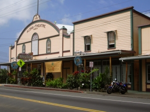
The Aloha Theater and its cafe, serve as a gathering place for the community and the home of independent, classic and second run films as well as the Hawaiian International Film Festival and various community events. Construction of the Aloha Theater began in 1929 and was finished in 1932, long before Hawai'i was a state. Starting life as a silent movie theater, it survived the changeover to 'talkies' as well as the great fire of 1948 that destroyed much of it's side of town. Still in use today as a performing arts center by the Kona Association for the Performing Arts; their performances feature live music and dance as well as film. The Quonset-hut shaped original theater building and the original marquee still in use are very typical of the style used in other theaters of the plantation era in Hawaii. The Aloha Angel Café associated with the theater is a gustatory revelation and offers a wide-ranging menu of entrees, baked goods and deserts and is open daily for breakfast, lunch, and dinner.

The World Famous Aloha Theater and Aloha Angel Cafe in Kainaliu: Photo by Donnie MacGowan

Kainaliu Town

Napping gently on either side of the Hawaii Belt Road, Kainaliu Town is one of the principle commercial centers of Mauka Kona. Kainaliu grew up at the intersection of two donkey tracks which servicee the sugar, coffee and ranching industries, sometime after the construction of Lanakila Church in 1867. The star attraction in Kainaliu is, by far, the Aloha Theater and Aloha Angel Café. This historic and beautiful theater is still the center for stage productions of all kinds as well as cinematic shows; it is the centerpiece for the Kona Association for the Performing Arts (KAPA). Another of the towns interesting attractions is the amazing Oshima Grocery and Dry Goods Store ("If we don't have it, you don't need it"). In addition the town boasts numerous other businesses, galleries, furniture, thrift, herbal medicine shops as well as several wonderful restaurants and coffee houses. Donkey Balls has a candy factory that offers fun tours and tasty samples and Captain Cook Coffee has a roasting house right in town that gives weekday tours. When the weather turns wet in West Hawai'i, or you need a relief from the heat on the beach, a day spent browsing and eating in cool, shady Kainaliu is a real treat.

Kainaliu Town Is Full Of Interesting Boutiques, Shops and Restaurants: Photo By Donald MacGowan
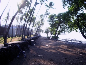
To celebrate the conclusion of our Historical Soirée, as long as you are in Kainaliu Town, you really ought to stop in for a cup of famous Kona Coffee at any one of a number of local coffee shops...not the harsh sameness of the ubiquitously monotonous Starbuck's, each individually special Kona coffee cafe reflects the personality of the local growers and roasters who produce Kona Coffee, widely held to be the best in all the world. Also, the singular and exclusive galleries and stores in Kainaliu makes erfect shopping for completely unique gifts to take home.

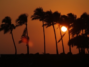
Sunset Over Keauhou From the Kona Historic District: Photo by Donnie MacGowan

For more information about touring Hawaii in general an exploring the Big Island in particular, please also visit www.tourguidehawaii.com and www.lovingthebigisland.wordpress.com. Information about the author can be found here.

All media copyright 2009 by Donald B. MacGowan


Casino Bonus no Deposit