Reprinted from here. Brought to you by Tour Guide and our new, comprehensive GPS/Internet/3G navigation App for iPhones and iPod Touch available today at iTunes!
 | |
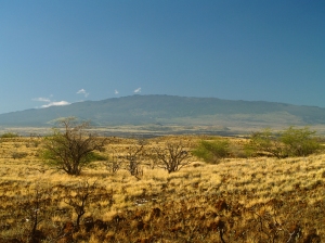
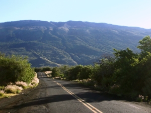
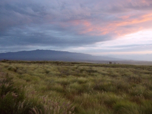
| View of Hualalai Volcano, Hawai`i, looking SE. Photograph by J. Kauahikaua on December 30, 1996. | |
The West Hawai`i Today issue for September 11, 2009, contained a letter to the editor titled "Hualalai is a real and present threat." The writer's main point was that "Hualalai is the 'secret in the closet' that nobody wants to talk about," that Hualalai is under-monitored, and that, should Hualalai erupt, there is no evacuation plan.
The letter writer's concerns about Hualalai were valid, but he was not aware of HVO's current efforts and plans to improve the monitoring of Hualalai. We hope to shed some light on recent and future activities planned for Hualalai.
Hualalai is the third most active volcano on Hawai`i Island behind Kīlauea and Mauna Loa, according to the Hawaiian Volcano Observatory's (HVO) Web site (http://hvo.wr.usgs.gov/), and attained national ranking of "High Threat" for active volcanoes in the U.S. (see http://pubs.usgs.gov/of/2005/1164/).
In the ranking, there were 37 volcanoes nation-wide that were highest-priority targets for improved monitoring; Kīlauea and Mauna Loa were included in this group. Furthermore, 21 additional volcanoes were found to be under-monitored and were regarded high priority for improved monitoring; Hualalai is in this group.
What is the basis for this ranking? Hualalai has erupted three times in the last 1,000 years, the most recent eruption occurring in 1801. An intense and damaging seismic swarm in 1929 marked a failed eruption. In the same interval, Mauna Loa and Kīlauea have each erupted more than 150 times, and Haleakala has erupted at least 10 times. Hualalai was rated a higher threat than Haleakala, due to the extent of development (airport, power station, etc.) and the larger population living on the volcano's flanks.
Is Hualalai under-monitored? In 2005, HVO and the Pacific Tsunami Warning Center (PTWC) each had one seismometer on the volcano, and bi-annual deformation surveys were conducted by our staff. With the permission of Kamehameha Schools, a continuous GPS receiver was installed near the summit in late 2006. In 2009, HVO still has one seismometer and uses two instruments operated by PTWC for eruption monitoring, and we continue the bi-annual surveys. Plans for the next two years include upgrading our seismic site and adding a new one.
We routinely scrutinize all available satellite imagery daily, including visual and thermal images to indicate any significant visual and temperature changes, or increased gas emissions. Moreover, radar scans several times each year can pinpoint any ground deformation that may be a precursor to volcanic activity. The radar scans are so sensitive that several small areas of subsidence were detected after the October 15, 2006, Kiholo earthquakes.
The conclusion from evaluating all of these data is that there have been no signs of swelling, major subsidence, temperature changes, gas emissions, or unusual seismic activity on Hualalai that would indicate volcanic activity in the near future. Nevertheless, we continue to look for any changes.
If the rankings were done today, Hualalai would be nearly fully monitored.
We agree with the letter writer that "the more people know about Hualalai, the more will be prepared." In 2004, University of Hawai`i at Manoa (UHM) scientists published two studies on Kona community's perception of volcanic risk and preparedness for lava flows from Hualalai and Mauna Loa. They concluded that "current community understanding and preparedness… falls short of that required for a volcanic crisis, particularly for those eruptions with short onset and high effusion rates on steep slopes that would impact Kona in just a few hours…"
There are several reasons for the lack of understanding, but foremost may be the constant influx of new residents who haven't educated themselves about volcanic hazards. The primary mission of the U.S. Geological Survey's Hawaiian Volcano Observatory is to monitor the active volcanoes in the State of Hawai`i. Through our Web site, public forums, and newspaper articles, we strive to disseminate information on the volcanoes and their hazards.
The people of Kona should know that we are keeping an eye on Hualalai and that if there are any changes (in its eruption status), we will let the public know!
Kīlauea Activity Update
Lava continues to erupt from the TEB vent, on Kīlauea's east rift zone and flow through tubes to the ocean at Waikupanaha. A deflation-inflation cycle this past week resulted in a reduction of lava supply for several days, followed by a resumption of flow on Wednesday, Sept. 30. Breakouts from the tube system started at that time, and these surface flows remain active at the top of Royal Gardens subdivision. The flows are mostly staying close to the breakout point along the east margin of the flow field.
Faint glow above the vent at Kīlauea's summit has been visible at night. A portion of the Halema`uma`u vent cavity collapsed on Saturday, Sept. 26, followed by the appearance of an active lava pond deep within the vent cavity on the night of Tuesday, Sept. 29. Volcanic gas emissions remain elevated, resulting in high concentrations of sulfur dioxide downwind.
Four earthquakes beneath Hawai`i Island were reported felt this past week. A magnitude-2.3 earthquake occurred at 12:30 p.m., H.s.t., on Friday, September 25, 2009, beneath Kilauea's summit at a depth of 6 km (4 miles). Two earthquakes occurred on Sunday, September 27-a magnitude-2.1 earthquake at 9:52 a.m., H.s.t., located 7 km (4.3 miles) N of Kailua at a depth of 8 km (5 miles) and a magnitude-2.3 earthquake at 10:22 p.m., H.s.t., located 7 km (4.3 miles) ENE of Honaunau at a depth of 6 km (3.7 miles). A 1.6-magnitude earthquake at 7:11 p.m. H.s.t., on Wednesday, September 30, was located 15 km (10 miles) NW of Mauna Kea's summit at a depth of 25 km (16 miles).
Visit our Web site (http://hvo.wr.usgs.gov) for detailed Kīlauea and Mauna Loa activity updates, recent volcano photos, recent earthquakes, and more; call (808) 967-8862 for a Kīlauea activity summary; email questions to askHVO@usgs.gov.
-------------
Planning on visiting the Big Island Volcanoes, hiking the beautiful summits or going to see the flowing lava? Tour Guide Hawaii is proud to announce the release of their new iPhone and iPod Touch App available at iTunes...this App will help you plan your trip to Hawaii, help you decide what you want to see, how you want to see it and help you get there with GPS, interactive maps and on-board driving instructions. In addition to concentrating on Hawaii's volcanoes, beaches and waterfalls, the Tour Guide App presents hours of interesting videos and information about many other places of historical, cultural and recreational interest, giving you a sense of the people, the natural history and the unique specialness of each destination. The information is so comprehensive and complete they even tell you where all the public restrooms are!
We highly recommend all Big Island visitor's who have iPhones or an iPod Touch check out our App on iTunes; we think you'll agree it's far better than old-fashioned, cumbersome maps or expensive guide books that seem to be out of date before they are printed. See it today!
