Monday, March 30, 2009

A Scenic Drive on the Hamakua Coast--A Photo Diary

Photos and Text by Donald MacGowan

The Men of Tour Guide decided to take some much needed time away from the office and take a scenic drive to the Hamakua Coast of the Big Island.

The Men of Tour Guide on the Road: Photo by Donnie MacGowan

We left Kailua Kona in the early morning and drove Highway 190 towards Waimea Town.

 Along Highway 190 Looking Toward Kohala Mountain: Photo by Donnie MacGowan
Along Highway 190 Looking Toward Kohala Mountain: Photo by Donnie MacGowan

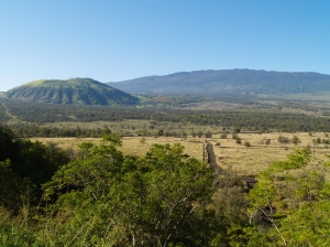
We past by the spectacular over looks of the Kohala Coastline and on up the hills towards Pu'uanahulu.

Hualalai Volcano and Pu'uananhulu from Hwy-190--Note Yellow Blossoms on Silver Oaks: Photo by Donnie MacGowan

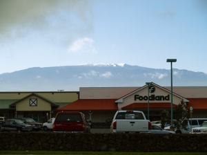
When we reached Waimea, snow covered Mauna Kea was standing tall in the morning sun to greet us.

Snow on Mauna Kea Waimea, Hawaii: Photo by Donald MacGowan
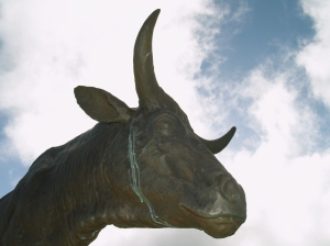
Statue of Heroic Paniolo Ikua Purdy, Waimea Hawaii: Photo by Donald MacGowan

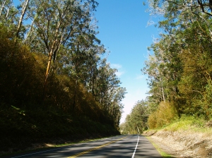
Dropping down to the Hamakua Coast from Waimea on Highway 19, we past through the fragrant and beautiful eucalyptus forest, with more views of Mauna Kea.

Driving through the Eucalyptus Forest on Highhway 19 Between Honoka'a and Waimea: Photo by Donald MacGowan
Snow on Mauna Kea from Hwy 19: Photo by Donnie MacGowan

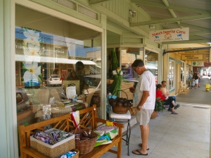
We paused in Honoka'a Town for a much needed cup of coffee and to take a moment to stroll the enchanting shops along the main street of town.

Honoka'a Town is Lined With Intersting and Wonderful Shops and Restaurants--Including Some of Hawaii's Best Antique Stores: Photo by Donald MacGowan
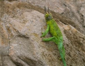
Like a Miniature Triceratops, This Jackson's Chameleon Unconcernedly Strolls the Streets of Honaka'a: Photo by Donnie MacGowan

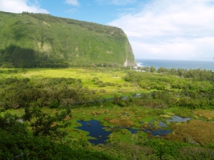
Driving north, we headed toward Waipi'o Valley with the idea of hiking down to the beach.

Waipi'o Valley, Hamakua Coast, Big Island of Hawaii: Photo by Donald MacGowan

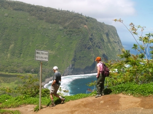
Loading up the cameras and gear, Frank and I headed down, while Everett explored around the top of the canyon.

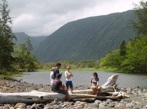
Waipi'o Valley Day Hikers: Photo by Donald MacGowan

Reaching the floor of the canyon, we explored the beach, the mouth of the river and the waterfalls--Waipi'o is a place of magic, myth and great beauty--it was absolutely lovely to have an unhurried morning to poke around and explore.

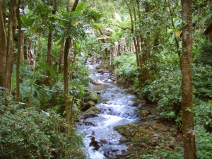
Mouth of Waipi'o Stream: Photo by Donald MacGowan
Waipi'o Stream from the Mouth of Waipi'o Valley: Photo by Donnie MacGowan

After shooting as many pictures as our batteries could stand, we climbed up out of the canyon..it's only a mile and less than a thousand feet, but it's a hike that'll get your full attention! And it's gorgeous and awe-inspiring the whole way back up...out of breath? Stop and enjoy the view!

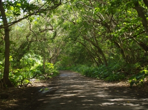
The Road in Waipi'o Valley: Photo by Donnie MacGowan
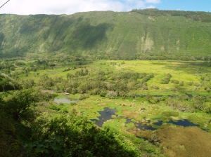
View Down into Waipio Valley Floor: Photo by Donnie MacGowan
View Down into Waipi'o Valley Floor: Photo by Donnie MacGowan

Catching our breath and having a bite of lunch, we continued our Soiree down the Hamakua Coast, next stop--Laupahoehoe Park and Tsunami Memorial.

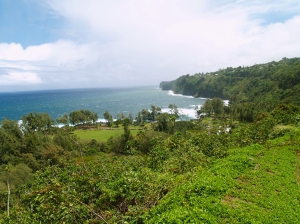
Overview of Laupahoehoe Park, Hamakua Coast, Big Island: Photo by Donnie MacGowan
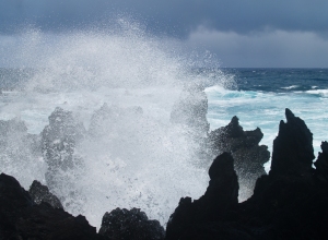
Explosive Wavespray at Laupahoehoe Park, Hamakua Coast, Big Island of Hawaii: Photo by Donnie MacGowan

Next, we took a small restroom break at Kolekole Park and wound up exploring the river and canyon there.

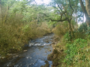
Kolekole Stream Near Kolekole Beach: Photo by Donald MacGowan

Kolekole Stream leaps heroically off Akaka Falls and flows through one of the most amazing jungle Canyons on the Island of Hawaii.

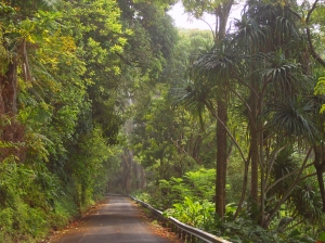
Kolekole Canyon Road: Photo by Donald MacGowan

Since we'd seen Kolekole Stream flowing into the sea, we decided to drive through the town of Honomu (fabulous ice cream!) and visit Akaka Falls to see how the park renovations were coming along.

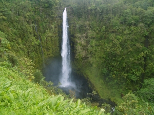
Akaka Falls: Photo by Donnie MacGowan
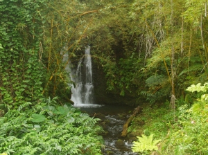
Numerous Small Waterfalls Dot the Fern Grottos Around Akaka Falls: Photo by Donald MacGowan
Numerous Small Waterfalls Dot the Fern Grottoes Around Akaka Falls: Photo by Donald MacGowan

Finally, we decided to drive the Pe'epekeo Scenic Drive--an old and very scenic section of the Mamalahoa Highway--before heading home to Kailua Town.

Along the Pepe'ekeo Scenic Drive: Photo by Donald MacGowan

At this point, we decided to hustle home--we just had time to get back to Kailua Town and catch the Taco's el Pastor special at Habeneros!

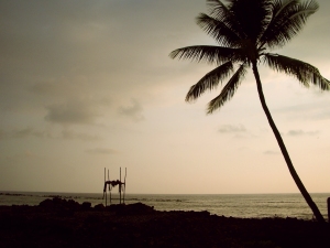
Sunset over the Ancient Surfing Temple of Ku'emanu Heiau, Kona Hawaii: Photo by Donald MacGowan
Sunset over the Ancient Surfing Temple of Ku'emanu

For more information on exploring Hawaii in general and scenic drives on the Big Island in particular, please visit www.tourguidehawaii.com and www.lovingthebigisland.wordpress.com.

Saturday, March 28, 2009

Rival Kings, Epic Battles and Ghostly Dogs, Kona, Hawaii


Written and produced by Donnie MacGowan; original musical score and videography by Donald B. MacGowan.

Helani Church/'Ohi'a-Mukumuku Heiau

Those vine covered ruins across the street from St. Peter's are the remains of Helani Church, built by the Rev. John D. Paris in 1861 of basalt block and lime mortar. When the local population moved inland about the turn of the century, a new Helani Church was established mauka (uphill) near the Mamalohoa Highway.

The church, however, was erected on a the grounds of the 'Ohi'a-Mukumuku Heiau; a powerful and holy religious temple around which swirls some of the darkest folklore and ghosts stories told around the Hawai'ian Islands. When you hear ghost stories about a white dog and a black dog, they are about the happenings on the grounds of the 'Ohi'a-Mukumuku and Ke'eku Heiaus, during the time when the Ali'i of Hawai'i, Lonoikamakakahiki, was battling for supremacy with the Ali'i of the Maui, Kamalalawalu, in the 16th century.

Beneath the ruins of Helani Church lie the ruins of 'Ohi'a-Mukumuku Heiau, a place of dark legend and lore. Held in Hawai'ian folktales to have been built by the gods, 'Ohi'a-Mukumuku Heiau was re-dedicated to the war god, Kuka'ilimoku, by the Hawai'i Ali'i Lonoikamakakahiki, so that he might vanquish his foe, the Ali'i of the Maui, Kamalalawalu, during their 16th century battles. It is said of these battles that when the Maui attacked the Hawai'i, the numbers of warriors was so vast that just as the first of the Maui war canoes were landing on Hawai'i, the last of their canoes were still leaving Maui.

Lonoikamakakahiki had a particular disagreement with Kamalalawalu when the invading Maui captured his leading general, had his eyes gouged out and ran spears through the eye sockets. Lonoikamakakahiki vowed a bloody revenge.

When Lonoikamakakahiki vanquished the Chief of the Maui, he took Kamalalawalu over to the nearby Ke'eku Heiau and sacrificed him alive to celebrate his great victory. The method of sacrifice was slow and graphic. Kamalalawalu was staked to the ground for several days, then taken to a nearby flat rock and butchered. The body was then towed to sea and fed to the sharks (some versions of the folktale have Kamalalawalu impaled on a pole for several days before being butchered on the flat rock).

Hawai'ian folktales hold that Kamalalawalu brought with him into battle two large, fierce war dogs, a white one (Kapapako) and a black one (Kauakahiok'oka). The dogs are said to have lain down and died on the spot of Kamalalawalu's execution. Although buried beneath the heiau luakini platform, it is said that these dogs can still be seen roaming, and heard howling, in the night searching the underworld for their fallen master. Two stone features found on the makai side of Ke'eku Heiau stone platform represent the two dogs.

Petroglyphs along the rocks, visible at low tide between Kahalu'u Beach Park and Keauhou O'hana Beach Resort, commemorate the sacrifice of Kamalalawalu by Lonoikamakakahiki.

For more information visit www.tourguidehawaii.com and www.lovingthebigisland.wordpress.com.

Thursday, March 26, 2009

Frank's Travel Hints # 10: Hawaii Volcanoes National Park!


Let's Go to Hawaii Volcanoes National Park!

About a two hour straight drive from Kona, going south, brings you to the Hawaii Volcanoes National Park. If you have a Golden Eagle Pass your entrance is free. If not, it is only $10.00 per carload to enter the park. The rangers at the gate will give you detailed maps of the area.

Super tip: Your receipt will give you free access to the National Park for seven days.


My first suggestion is to go to the Kilauea Visitors Center and the Jagger Museum. To see a video of the Jaggar Museum, go here. This will give you a nice overview of the park and rangers are there to answer questions. This spot also looks over the majestic Halemaumau Crater. At the time of this writing, the portion of Crater Rim Drive from Jaggar Museum to Chain of Craters Road is closed due to a gaseous explosion in the Halemaumau Crater. To see video of this eruption, go here. Tour Guide will get you to the park and lead you to the Museum and more than 50 sites. It is also possible that our state bird, the Nene Goose, will be huddled in the parking lots. They are protected as an endangered species, so be careful when parking nearby.

Another great place to visit is the Volcano Art Center. It may seem a strange, but the Volcano Art Center boasts one of the best collections of art in the whole state. World renowned artist in various media are on display as well as theatrical and musical performances.

There is only one restaurant in the park proper, and that is the Volcano House. Built as a lodge in the mid 1800’s, the Volcano House has hosted dignitaries, politicians, sports heroes and movie stars from all over the world. This grand edifice sits right on the lip of Halemaumau Crater and the views from her restaurant are stunning. Tour Guide will give a complete history of how it came to be. The food is good and the prices are reasonable. To see a is a video of the Volcano House go here. Bicycle rentals are also available near the lodge.

Crater Rim Drive is a great driving introduction to the park. It encircles the Halemaumau Crater and, for only an 11 mile drive, passes through several dramatic climate zones. You will encounter arid desert, grass savannah, and into tropical rainforest; this loop can easily be done in forty minutes. However, you will want to take more time to appreciate the beauty and majesty of one nature’s most awesome wonders. Tour Guide will suggest short to medium hikes and bicycle trails as well as over 50 historic and geologic sites to visit within the park.

If you are up for some hiking, Tour Guide will lead you to the trail for Waldron Ledge Overlook. This short hike is through the Ohia and fern jungles, shaded most of the way, and can be done on bicycle as well. From this vantage point one can see the active vent, Kilauea Iki, and breathtaking views of the coast. Video of the overlook at Kilauea Iki is available here; a video about the hike through the bottom of Kilauea Iki is here.

Along the Crater Rim Drive you will also see many steam vents and sulfur banks. This is where water seeps into crevices and meets the molten magma about a half mile below the surface, is super heated, and returns to the surface as steam. These vents are often accompanied by a “rotten egg” smell common where sulfur is rising with the steam, turning the ground around the vents hues of yellow, green and white. A video about the Sulfur Banks is available here.

For more information on visiting Hawaii and the Big Island in general, and touring Hawaii Volcanoes National Park in general, go to tourguidehawaii.com and lovingthebigisland.wordpress.com.

Tuesday, March 24, 2009

After one year, Kīlauea's summit eruption is still going strong

Reprinted from here.

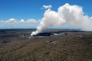
Halema`uma`u March 24

A plume of volcanic gas and ash rises from a vent on the east side of Halema`uma`u Crater, at the summit of Kīlauea caldera. The Hawaiian Volcano Observatory and Jaggar Museum of Volcanology are in the foreground.

After one year, Kīlauea's summit eruption is still going strong

(To see a recent video of Halema'uma'u eruption, go here)

It seems like only yesterday when the Hawaiian Volcano Observatory (HVO) monitored a several-week build-up in seismic tremor levels and sulfur dioxide emissions in early 2008. While some staff members speculated that a small summit eruption might be on the way, others were convinced, from the lack of earthquake activity and deformation, that Pele was just restless, and that a summit eruption was unlikely.

Then, on March 12, 2008, an area of gas emission formed on the east wall of Halema`uma`u Crater, within Kīlauea's caldera. The extreme temperature of the gases caused the vent to glow at night, attracting tourists and locals alike to the viewpoint at the Jaggar Museum of Volcanology. Hawai`i Volcanoes National Park closed the south part of the caldera to visitors in response to the increased concentrations of hazardous gases—a closure which remains in effect today.

The real surprise occurred at 2:58 a.m. on March 19, 2008, when a small explosion occurred from the site of the gas emission. The explosion—the first at Kīlauea's summit since 1924-threw rocks and boulders over about 40 hectares (100 acres), destroying the Halema`uma`u tourist overlook, blanketing the Halema`uma`u parking lot with rocks and ash, and marking the start of the summit eruption that continues to this day.

Since that event almost one year ago, thousands of tonnes of sulfur dioxide and other volcanic gases have issued from the March 19 explosion crater. The gas has had a tremendous impact on the residents of Hawai`i Island, damaging crops on the south part of the island and worsening existing health problems for people from Hilo to Kona.

Despite the widespread effects of the gas emissions, very little lava has erupted from the vent. A small amount of ash is produced every day, but the bulk of the lava that erupted has been the result of occasional explosions that occurred throughout 2008 (none have occurred in 2009-yet). Near-daily ash collection and mapping of explosive deposits reveal that the total amount of lava and ash erupted is too small to even fill your local supermarket! In fact, the amount of lava and ash produced by the summit eruption is equivalent to what is erupted from Kīlauea's east rift zone in just five hours.

Even though only a small amount has actually erupted, lava has been seen within the vent. Visual observations identified a lava lake about 300 feet below the vent rim in September and October 2008. In February 2009, images from an infrared camera, which is able to see through much of the gas plume, saw a lava lake at a greater depth, about 450 feet below the rim. This lake has recently been replaced by a series of small, spattering vents, still well below the floor of Halema`uma`u Crater.

The current summit eruption has already surpassed the length of all previous summit eruptions at Kīlauea since 1924. In December 2008, HVO scientists thought that the eruption actually might be coming to a close, since activity diminished markedly. Instead of dense, white, roiling, emissions, the plume was wispy, thin, and lazy. Glow disappeared from the vent, and seismic tremor levels dropped considerably.

Of course, Pele was just being her usual, devious self. In January, the return of weak glow and a strong, white plume signaled the renewal of the summit eruption. One year in, there are no signs that the eruption will be ending anytime soon.

The past year has been one of surprises, to say the least. The type of activity currently on display at Kīlauea's summit is unprecedented in the nearly 200 years of recorded eruptions. HVO will continue to closely monitor the eruption to improve our knowledge of how Kīlauea works and to watch for signs of clearing air that might signify the end of this chapter of Kīlauea's history.

Activity update

The Waikupanaha ocean entry remains active, and a small collapse early Wednesday morning (3/11) removed part of the delta there. West of the ocean entry, lava flows were active on the coastal plain and had reached to within 180 m (200 yds) of the ocean near Kupapa`u by mid-morning on Wednesday.

At Kīlauea's summit, the vent within Halema`uma`u Crater continues to emit elevated amounts of sulfur dioxide gas, resulting in high concentrations of sulfur dioxide downwind. Lava remains just out of sight more than 90 m (100 yds) below the vent rim.

Visit our Web site (http://hvo.wr.usgs.gov) for detailed Kīlauea and Mauna Loa activity updates, recent volcano photos, recent earthquakes, and more; call (808) 967-8862 for a Kīlauea summary; email questions to askHVO@usgs.gov. skip past bottom navigational bar

For more information on traveling to Hawai in general and seeing the volcanoes of the Big Island in particular, please visit www.tourguidehawaii.com and www.lovingthebigisland.wordpress.com.

Sunday, March 22, 2009

A Photo Diary of the First Day of Spring in Kohala

By Donnie MacGowan

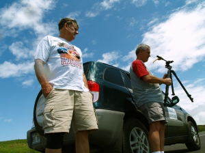
The Men of Tour Guide--Everett Maynard and Frank Burgess: Photo by Donnie MacGowan

On Friday, in observance of the first day of Spring (or perhaps in simple surrender to an early bout of Spring Fever), the Men of Tour Guide decided to ditch the office and go do some field work in Kohala (he means they loaded up the Rav 4 and went on a Road Trip). You can read a site-by-site description of this road trip here.

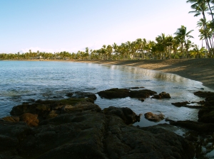
Before the morning sun had even cleared Hualalai Volcano, we headed north on Highway 19, the Queen Ka'ahumanu Highway. Waiting for the first blush of spring warmth of the day to arrive, we passed through Kailua Kona,drove by Kaloko Honokohau National Historic Park and past Kekahakai State Bach Park hoping to find some early morning light on Anaeho'omalu Bay, near the Hilton Waikoloa Resort.

Anaeho'omalu Bay from the south: Photo by Donald MacGowan

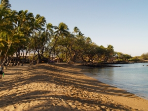
Anaeho'omalu (or "A-Bay" as the locals call it) is a stunningly long, perfect crescent of coral sand and is an iconic Hawaii Sunset Photo site. Being there early in the morning the beach was welcoming in its emptiness.

Anaeho'omalu Bay From The North: Photo by Donnie MacGowan

Heading back into the now bright morning sunlight, both Mauna Kea and Mauna Loa, topped with snow, were soaring up in to the spring air. Although we wanted to capture some video and still photos of the snowy peaks, we pressed on to our next destination, Waialoa Beach (or Beach 69, named after the number on the telephone pole at the parking lot).

Anaeho'omalu Bay From The North: Photo by Donnie MacGowan
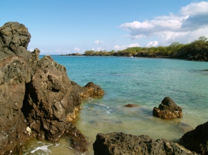
Waialea Bay From The South: Photo by Donnie MacGowan
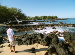
Everett on Waialea Beach, looking south: Photo by Donnie MacGowan

Waialea is a more interesting beach than Anaeho'omalu, with clearer water for snorkeling, fewer people and lots of rocks and cliffs to explore.

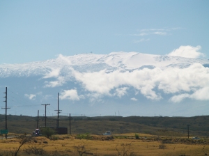
Leaving Waialea, we took some time to shoot the big, snow-covered volcanoes--out pictures do not do justice to the majesty and uniqueness of snow clad peaks on a tropical island.

Mauna Kea From Pu'u Kohola; note observatories on the summit,almost 14,000 feet above: Photo by Donald MacGowan
Mauna Loa From Kohola: Photo by Donnie MacGowan

Our next stop was at Hapuna Beach--widely regarded as the finest beach o the island of Hawaii.

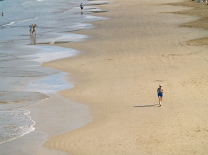
Hapuna Beach from the south: Photo by Donnie MacGowan

The beach is over a mile long and the water here is turquoise and very clear. Except at either end where there are rocks, however, the snorkeling is disappointing, as there are few fish (they don't live over sand--nothing to eat).

Hapuna, Hawai'i's busiest and most popular beach: Photo by Donnie MacGowan

But for a restful day sunbathing, swimming and just enjoying the water, you cannot beat Hapuna...

Our next stop was at Pu'u Kohola, but we didn't take any pictures--we just used the restrooms at the National Park. You can see a short video about the temples and the park here. From Pu'u Kohola we went to Lapakahi State Historic Park, the site of a 600 year old Hawaiian Fishing village...again, we didn't take pictures, but you can see a short video about it here (that's also me playing ukulele, guitar, bass and tambourine in a early attempt of mine at recording and stacking several tracks of music...).

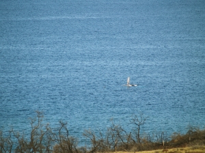
We pressed on up the Kohala Coast, seeing many Humpback Whales--because they were a ways out to sea, we only got very marginal pictures of them.

Kohala, a Humpback Whale from shore: Photo by Donnie MacGowan

Next we drove into the Hawi-Kapa'au Twin City Metro Area to visit Everett's friend Richard and take some photos.

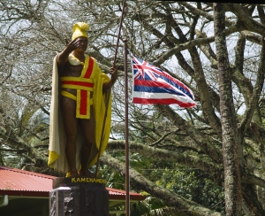
King Kamehameha Statue, Kapa'au: Photo by Donald MacGowan
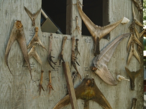
Hawi Fisherman's Trophies: Photo by Donald MacGowan

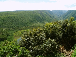
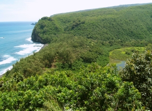
We next drove out to the end of the road to look at Pololu Valley, and although we didn't need the photos, we couldn't help taking some.

The Head of Pololu Canyon on Kohola Mountain: Photo by Donnie MacGowan
Pololu Canyon and Beach: Photo by Donald MacGowan

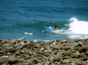
From Pololu Valley we drove out to Keokea State Park--the nearest public restrooms--to eat lunch and there was this incredible surfer dude riding wild waves in very shallow water and not 30 feet from the rock sea wall--seeming very dangerous, his rides were both skillful and beautiful to watch.

Keokea Park and a Very Brave Surfer Dude: Photo by Donald MacGowan

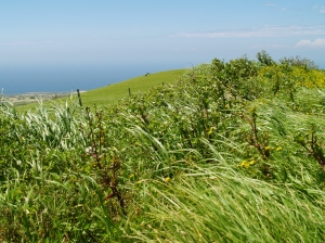
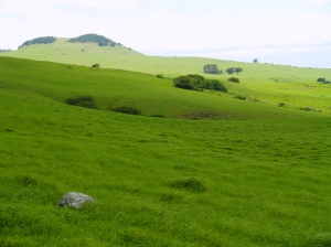
The next leg of our drive took us up Kohala Mountain on the Kohala Mountain Road...this is actually the place we really needed some photo coverage (it's usually raining) and we had just stunning weather and views.

Kohala Mountain Road: Photo by Donnie MacGowan
Kohala Mountain Road boulder and field: Photo by Donnie MacGowan

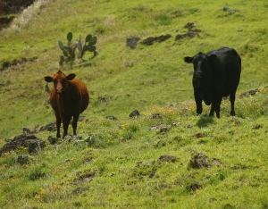
We drove down the mountain through the cow pastures, decided to skirt Waimea town and headed to the coast where we checked in at Kua Bay to see what was cookin'.

Kohala Mountain Road Sentinels: Photo by Donald MacGowan
Kua Bay from the north: Photo by Donald MacGowan

Kua Bay is a lovely, but tiny, dot of white sand caught in a crescent-shaped pocket along the rough, raw lava coastline of North Kona. It wasn't quite time to light the barbecues when we got there, but we definitely found "what's cookin'"

Kua Bay Sunbathers: Photo by Donald MacGowan

As the locals say: "Lucky we live Hawaii", eh?

For more information on touring Hawaii in general and touring the Big Island in particular, please visit www.tourguidehawaii.com and www.lovingthebigisland.wordpress.com.

Thursday, March 19, 2009

Pu'u Loa Petroglyph Field, Hawaii Volcanoes National Park


Written and produced by Donnie MacGowan; narrated by Frank Burgess. Videography by Donnie MacGowan and Frank Burgess.

Along the side of the centuries-old Ka'u-Puna trail, worn smooth by generations of travelers, in the area of the Hill of Long Life (Pu'u Loa) lies the largest petroglyph field in Polynesia It is estimated that the Pu'u Loa field contains in excess of 15,000 carvings. A one mile segment of this ancient trail, from the parking lot along the Chain of Craters Road to the petroglyphs, has been marked with cairns (or "ahu") by the Park staff to lead visitors to the petroglyphs. As you hike along this trail, notice the smoothness of the lava, the sheen on the trail worn by generations of travelers' feet.

There are many theories concerning the origin and meanings of these carvings but one thing is certain. People stopped here for hundreds of years and left their mark on the stone. Among the designs are simple holes, spirals, concentric circles, human forms and others which are unrecognizable geometric shapes. The hills and swales of pahoehoe surrounding the boardwalk contain thousands more petroglyphs, but due to their fragility, you are advised to remain on the boardwalk to keep from damaging them.

Pu'u Loa, the hill at the margin of the boardwalk, is the place where Hawai'ians came to bury the umbilical chord of their children. People came from all over the Hawai'ian Islands to bury their child's piko, or umbilical chord stump, in this place of "mana" (Hawai'ian for power), the home of the Goddess Pele. Grinding out a cup-shaped hole, the Hawai'ians would place the piko in the ground to insure long life, and good grace from the Goddess, for their child.

Remember that these carvings, though many hundreds of years old, are extremely fragile so remain on the boardwalk—do not step into the petroglyph field, even for a better view, or onto the carvings themselves. The boardwalk passes by hundreds of carvings near enough for you to examine them minutely and photograph the completely. This self-guided tour takes about 1 hour.

For more information about touring Hawaii in general or visiting the Big Island in particular, go to www.tourguidehawaii.com and www.lovingthebigisland.wordpress.com.

Tuesday, March 17, 2009

Tips on Snorkeling the Big Island of Hawaii


Internationally famous snorkel bums and renowned Fun Hogs Donnie MacGowan and Bart Hunt say a few choice words about getting into the electrifying, high stakes world of Extreme Snorkeling.

For more information on how to snorkel, snorkeling gear, safety, reef etiquette, Big Island snorkel spots and wilderness snorkeling in Hawaii, check out these informative and fun articles by eZines Expert Author Donald B. MacGowan here, here, here, here, here and here.

Featuring Donnie MacGowan and Bart Hunt; Videography by Bart Hunt and Donnie MacGowan, Original Musical Score written, performed and recorded by Donnie MacGowan; Produced by Donnie MacGowan.
For more information on traveling to Hawaii in general and touring the Big Island in particular, please visit www.tourguidehawaii.com and www.lovingthebigisland.wordpress.com.

Sunday, March 15, 2009

Eruption Update: Why all the fuss about Mauna Loa this month?

Reprinted from here.

Why all the fuss about Mauna Loa this month?

 The Mauna Loa 1984 summit eruption.
The Mauna Loa 1984 summit eruption (USGS Photo).

As noted in Volcano Watch a few weeks ago, this month marks the 25th anniversary of Mauna Loa's most recent eruption—a 22-day event that began on March 25, 1984. The article also mentioned a series of public programs that will be conducted in recognition of this anniversary.

Mauna Loa has been quiet for a quarter of a century, and considering the current lack of shallow seismicity that typically precedes volcanic activity by months or years, it is not expected to erupt any time soon. So, why all the fuss about this volcano?

A look at Mauna Loa's eruption frequency over the past 2,000 years shows that it has erupted, on average, once every 10 years. The volcano's short-term average is even more remarkable. Between 1843 and 1950, Mauna Loa erupted every 4 to 7 years. Based on this eruption history, you could easily conclude that the volcano is overdue for its next eruption.

During the 166 years that Mauna Loa's activity has been documented in writing, there's only one other time when the volcano remained quiet for 25 years—the period between its June 1, 1950, and July 5, 1975, eruptions. Mauna Loa's repose since 1984 will soon match that record.

A third of Hawai`i Island's current population was not yet born in 1984. There's also been an influx of malihini (newcomers) who moved to the island after Mauna Loa erupted. Given these two facts, a significant number of island residents may not be aware that Mauna Loa is an active volcano.

Even people who witnessed the 1984 eruption may not know—or remember—the full potential of volcanic hazards posed by Mauna Loa. A lot can be forgotten in 25 years.

The silver anniversary of Mauna Loa's last eruption affords an ideal occasion to remind us all of these concerns. Thus, the Hawaiian Volcano Observatory (HVO) is planning a series of public programs about past, present, and future activity on the world's largest volcano.

Two talks will be presented as After Dark in the Park programs in Hawai`i Volcanoes National Park. On Tuesday, March 17, HVO geologist Frank Trusdell, who has been mapping and studying Mauna Loa for nearly two decades, will speak about the volcano's eruptive history and current status. On Tuesday, March 24, Jack Lockwood, a former HVO volcanologist, will describe events leading up to, and during, Mauna Loa's 1984 eruption.

Both talks will be in the Kilauea Visitor Center auditorium, starting at 7:00 p.m. For more information, call (808) 985-6011 or go to the Park Web site (http://www.nps.gov/havo/planyourvisit/events_adip.htm).

HVO will also provide outreach programs in three communities around the island in collaboration with the University of Hawai`i at Hilo's Center for the Study of Active Volcanoes, Hawai`i County Civil Defense, and Hawai`i Volcanoes National Park.

These community programs will begin with a brief introductory presentation, followed by an informal "talk story" session, during which you can meet and interact with scientists, public safety officials, and park rangers. The programs are designed so that you can come and go at your leisure to talk story, but to hear the introductory presentation, you should arrive at the starting time.

Two programs are scheduled for Saturday, March 28—from 9:00 to 11:00 a.m. at UH-Hilo in UCB 100/127, and from 3:00 to 5:00 p.m. at St. Jude's Church in Ocean View. On Saturday, April 4, a program will be held at the Konawaena Elementary School cafeteria in Kealakekua from 10:00 a.m. to 12:00 p.m.

Displays set up for the talk story session will address frequently asked questions about Mauna Loa—such as, "Will it erupt soon?"—but you are welcome to bring any and all questions that you'd like to ask about the volcano. Children can engage in activities and demonstrations set up just for them.

Mauna Loa will erupt again—and chances are good that it will happen during your lifetime-so you are encouraged to attend one of the community programs. There's no better time than now to educate yourself about the massive volcano in your backyard.

Activity update

Kīlauea Volcano continues to be active. A vent in Halema`uma`u Crater is emitting elevated amounts of sulfur dioxide gas and producing small amounts of ash. Resulting high concentrations of sulfur dioxide in downwind air have closed the south part of Kīlauea caldera and produced occasional air quality alerts in more distant areas, such as Pahala and communities adjacent to Hawai`i Volcanoes National Park, during kona wind periods. Using a thermal camera, a small, puffing cone, varying in shape and size over the past week, has been visible about 100 yards below the vent rim.

Pu`u `Ō`ō also continues to produce significant amounts of sulfur dioxide. Trade winds tend to pool these emissions along the West Hawai`i coast, while Kona winds blow these emissions into communities to the north, such as Mountain View, Volcano, and Hilo.

A deflation/inflation (DI) event at Kilauea's summit early in the week caused no reported disruption in the supply of lava erupting from the Thanksgiving Eve Breakout (TEB) vent at the eastern base of Pu`u `O`o. Lava continues to enter the ocean at Waikupanaha and is rebuilding the delta there, which collapsed last Saturday (February 28). Thursday (March 5) marked the one-year anniversary of the start of the Waikupanaha ocean entry. Lava was also active on the coastal plain a few hundred yards from the ocean near Waha'ula in the National Park.

Be aware that active and recently inactive lava deltas can collapse at any time, potentially generating large explosions. This may be especially true during times of rapidly changing lava supply conditions. The Waikupanaha delta has collapsed several times in the past year, with at least four of the collapses resulting in rock blasts. These blasts have tossed television-sized rocks up onto the sea-cliff and have thrown fist-sized rocks more than 275 yards inland. It is unclear whether the February 28 collapse was accompanied by an explosion.

Do not approach the ocean entry or venture onto lava deltas. Even the intervening beaches are susceptible to large waves generated during delta collapse; avoid these beaches. In addition, steam plumes rising from ocean entries are highly acidic and laced with glass particles. Call Hawai`i County Civil Defense at 961-8093 for viewing hours.

Mauna Loa is not erupting. Three earthquakes were located beneath the summit this past week. Continuing extension between locations spanning the summit indicates slow inflation of the volcano, combined with slow eastward slippage of its east flank.

Four earthquakes beneath Hawai`i Island were reported felt within the past week. A magnitude-2.2 earthquake occurred at 12:06 p.m., H.s.t, on Thursday, February 26, 2009, and was located 12 km (8 miles) north of Kailua at a depth of 36 km (22 miles). A magnitude-2.2 earthquake occurred at 4:59 p.m. on Saturday, February 28, and was located 9 km (6 miles) west of Kailua at a depth of 11 km (7 miles). A magnitude-3.0 earthquake occurred at 9:20 a.m. on Wednesday, March 4, and was located 26 km (16 miles) southwest of Kailua at a depth of 38 km (24 miles). A magnitude-2.9 earthquake occurred at 8:25 a.m. on Thursday, March 5, and was located 3 km (2 miles) northeast of Pu`ulena Crater at very shallow depth.

Visit our Web site (http://hvo.wr.usgs.gov) for daily Kīlauea eruption updates, a summary of volcanic events over the past year, and nearly real-time Hawai`i earthquake information. Kīlauea daily update summaries are also available by phone at (808) 967-8862. Questions can be emailed to askHVO@usgs.gov. skip past bottom navigational bar

For more information on touring Hawaii in general and seeing the volcanoes of the Big Island in particular, please visit www.tourguidehawaii.com and www.lovingthebigisland.wordpress.com.

Friday, March 13, 2009

Frank's Travel Hints # 10


Let's Go to Hawaii Volcanoes National Park!

About a two hour straight drive from Kona, going south, brings you to the Hawaii Volcanoes National Park. If you have a Golden Eagle Pass your entrance is free. If not, it is only $10.00 per carload to enter the park. The rangers at the gate will give you detailed maps of the area.

Super tip: Your receipt will give you free access to the National Park for seven days.


My first suggestion is to go to the Kilauea Visitors Center and the Jagger Museum. To see a video of the Jaggar Museum, go here. This will give you a nice overview of the park and rangers are there to answer questions. This spot also looks over the majestic Halemaumau Crater. At the time of this writing, the portion of Crater Rim Drive from Jaggar Museum to Chain of Craters Road is closed due to a gaseous explosion in the Halemaumau Crater. To see video of this eruption, go here. Tour Guide will get you to the park and lead you to the Museum and more than 50 sites. It is also possible that our state bird, the Nene Goose, will be huddled in the parking lots. They are protected as an endangered species, so be careful when parking nearby.

Another great place to visit is the Volcano Art Center. It may seem a strange, but the Volcano Art Center boasts one of the best collections of art in the whole state. World renowned artist in various media are on display as well as theatrical and musical performances.

There is only one restaurant in the park proper, and that is the Volcano House. Built as a lodge in the mid 1800’s, the Volcano House has hosted dignitaries, politicians, sports heroes and movie stars from all over the world. This grand edifice sits right on the lip of Halemaumau Crater and the views from her restaurant are stunning. Tour Guide will give a complete history of how it came to be. The food is good and the prices are reasonable. To see a is a video of the Volcano House go here. Bicycle rentals are also available near the lodge.

Crater Rim Drive is a great driving introduction to the park. It encircles the Halemaumau Crater and, for only an 11 mile drive, passes through several dramatic climate zones. You will encounter arid desert, grass savannah, and into tropical rainforest; this loop can easily be done in forty minutes. However, you will want to take more time to appreciate the beauty and majesty of one nature’s most awesome wonders. Tour Guide will suggest short to medium hikes and bicycle trails as well as over 50 historic and geologic sites to visit within the park.

If you are up for some hiking, Tour Guide will lead you to the trail for Waldron Ledge Overlook. This short hike is through the Ohia and fern jungles, shaded most of the way, and can be done on bicycle as well. From this vantage point one can see the active vent, Kilauea Iki, and breathtaking views of the coast. Video of the overlook at Kilauea Iki is available here; a video about the hike through the bottom of Kilauea Iki is here.

Along the Crater Rim Drive you will also see many steam vents and sulfur banks. This is where water seeps into crevices and meets the molten magma about a half mile below the surface, is super heated, and returns to the surface as steam. These vents are often accompanied by a “rotten egg” smell common where sulfur is rising with the steam, turning the ground around the vents hues of yellow, green and white. A video about the Sulfur Banks is available here.

For more information on visiting Hawaii and the Big Island in general, and touring Hawaii Volcanoes National Park in general, go to tourguidehawaii.com and lovingthebigisland.wordpress.com.
 

Casino Bonus no Deposit