Showing posts with label hamakua. Show all posts

Tuesday, October 20, 2009

Hiking Down Into Pololu Valley, Big Island of Hawaii

by Donald B. MacGowan

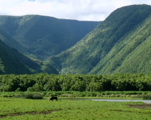
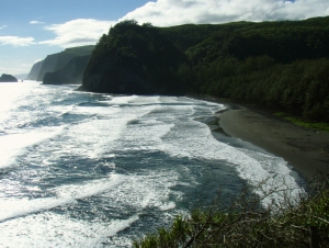
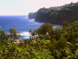
Majestic Pololu Valley on the Hamakua Coast of Hawaii: Photo by Donnie MacGowan

Whether you visit the Big Island for a few days, a couple weeks or a few months, you want to make the most of your time in Paradise. With such a wide variety of natural and commercial attractions, it is natural for the visitor to get a little overwhelmed in the “Option Overload” and not be able to make a balanced and informed decision on what they want to do and how best to spend their time.

At Pololu Valley, Hamakua Coast, Big Island, Hawaii: Photo by Donald B. MacGowan

Even choosing the beach you want to spend time on...which beach? How do you find the right beach for your particular needs? Are you going just to relax and sunbathe? Or is the trip to snorkel, boogie board or to explore? Do you want a beach that's alive with fun people or one hidden, secluded and empty? Do you want a beach near your resort or one that's at the end of a day of delicious wandering?

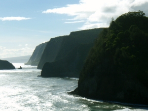
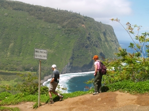
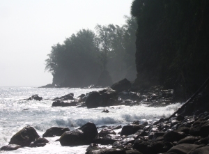
The Cliffs at Pololu: Photo by Donald B. MacGowgan
The Cliffs at Pololu: Photo by Donald B. MacGowan

Tour Guide Hawaii is excited and proud to announce the release of their new GPS/WiFi enabled App for iPhone and iPod that helps you navigate your trip to Hawaii with hours of informative, location-aware video and information. Although our video guide will lead you to dozens of unusual, untamed and unspoiled spots, let's look at one, hidden but gorgeous, beach hike you would otherwise not find if you did not have Tour Guide Hawaii's new App.

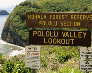
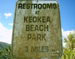
Bad News for Antsy Travelers at Pololu Valley; Tour Guide's New, GPS/WiFi Enabled, Video Travel App for iPhone and iPod Finds Everything For You in Hawaii--Even the Public Restrooms!: Photo by Donnie MacGowan

Hiking into Pololu Valley

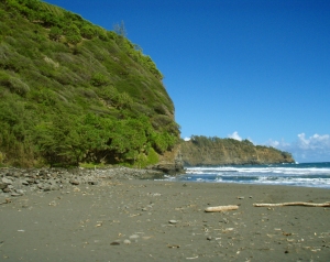
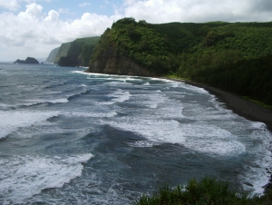
Violent, lush, wild; the north end of Hawai’i Island is as varied and exciting as it is unexpected. At the end of the highway are the Pololu Valley Overlook and the trail leading down to Pololu Beach. This is one of the most untamed, beautiful spots in the tropical Pacific and should not be missed. The trail down to the beach drops 400 feet in 20 minutes of hiking—be warned, the hike up is difficult for those not in good physical shape and the hike down should not be attempted if you have doubts about being able to hike back up.

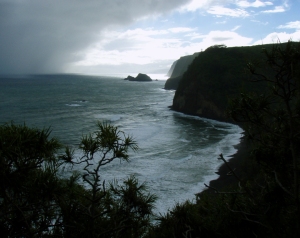
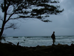
Approaching Storm at Pololu Valley; Due to Frequent Rain Squalls Off the Pacific Ocean, Rain Gear is Highly Recommended For This Hike: Photo by Donald B. MacGowan
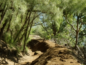
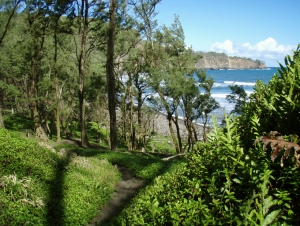
The Trail to Pololu Beach is dusty when dry, muddy when wet and a running creek in the rain.  Try to minimize trail erosion by staying on the trail, walking on rocks where possible and not cutting switchbacks: Photo by Donnie MacGowan
The Trail to Pololu Beach is dusty when dry, muddy when wet and a running creek in the rain. Try to minimize trail erosion by staying on the trail, walking on rocks where possible and not cutting switchbacks: Photo by Donnie MacGowan

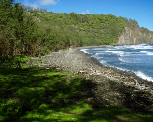
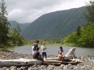
Pololu Valley Itself is Private Land so Stay Close To the Beach: Photo by Donald B. MacGowan

The valley itself is private land, so stay close to the beach. The best place to cross the stream is usually about 80-120 feet inland and during either slack or high tide; spend a few minutes to find the stone ford for an easier crossing.

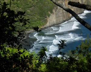
The Beach at Pololu Valley.  The Channel Here Between Hawaii and Maui Has The Third Highest Discharge of Water in the World, Behind the Bay of Fundy and the Straights of Magellan.  Because of the Unbelievable Ocean Currents This Generates, and Strong Rip Tides, We Do Not Recommend Swimming or Surfing at Pololu: Photo by Donnie MacGowan
The Beach at Pololu Valley. The Channel Here Between Hawaii and Maui Has The Third Highest Discharge of Water in the World, Behind the Bay of Fundy and the Straights of Magellan. Because of the Unbelievable Ocean Currents This Generates, and Strong Rip Tides, We Do Not Recommend Swimming or Surfing at Pololu: Photo by Donnie MacGowan
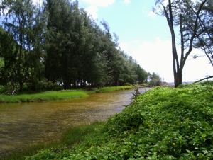
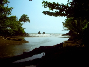
The Slow Running Stream in Pololu Valley is Rarely High Enough To Cut Through the Storm Berm; Therefore These Dry, Back Dunes Are The Best Place to Cross the Beach: Photo by Donald B. MacGowan

The beach is not usually swimmable due to the violent surf and ocean currents, but makes a wonderful place to picnic and contemplate the awesome power and violence of nature.

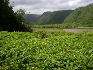
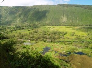
Although It's Tempting to Explore, the Lush Meadows of the Interior of Pololu Valley Are Annoyingly Boggy AND Privately Owned: Photo by Donald B. MacGowan

For the adventurous, the hike down to Pololu Valley may not be enough—for them may we suggest further hiking in this lightly-traveled area. Pololu is the starting point for over 40 miles of interconnecting tails, as well as the Kohala Ditch. Trails in this area are steep, unmaintained, crumbling and frequently quite slick, so caution is advised, particularly on hillslopes and in the rain, when trails may turn into streambeds and hillsides into waterfalls.

The hike over intervening ridges east into Honokane Nui Valley and Honokane Iki Valley provides spectacular views of this untamed, but private land. Climbing 600 muddy feet over the ridge, the trail then drops breathtakingly down to the valley floor. Before the stream, the trail divides at a bamboo grove—if you are proceeding on to Honokane Iki, follow the fork to the right through the bamboo, otherwise go left on to the wonderful, lonely, private, boulder beach.

Looking Back West Across Pololu Beach From the Start of the Honokane Nui Valley Trail: Photo by Donnie MacGowan
Along the Honokane Nui Trail, Climbing East Out Of Pololu Valley: Photo by Donnie MacGowan

Going on farther east into Honokane Iki Valley from Honokane Nui is very rewarding and easier than the hop from Pololu to Honokane Nui, climbing just 400 muddy feet over the ridge. There are numerous ruins from previous eras of population, ancient to recent, to explore in both these valleys. It is possible to wander the intersecting, disappearing, maddening trails all the way into Waipi’o Valley, 14 canyons and about 15 bushwhacking, stream-fording, slope-slipping, rain-slogging, breathtaking, aggravating, wonderful miles away. This is definitely a trip for more than a single day and permission must be gained to cross the private land.

The Beach at Pololu Valley From the Ridge Between Pololu and Honokane Iki Valleys: Photo by Donald B. MacGowan

Under no circumstances should the hiker be seduced by the thought of an easy return back into Pololu Valley by skirting the headlands along the ocean. This is longer and much more difficult than it appears and has proven fatal to the unwary.

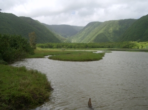
During the Wet Season The Stream in Pololu Valley Turns Into a Seasonal Lake: Photo by Donald B. MacGowan


Bart Hunt at Pololu--Numerous Squall and Storms Coming Off the Ocean Make the Weather at Pololu Very Exciting: Photo by Donald B. MacGowan

Bring good insect repellent and wear hiking boots, with tabis in your pack for stream fording and beach walking. Stream water in the valleys is infected with leptospirosis bacteria, so bring plenty of water (at least two liters per person) in your pack. A camera is a must and due to frequent squalls off the ocean, rain gear is highly recommended.

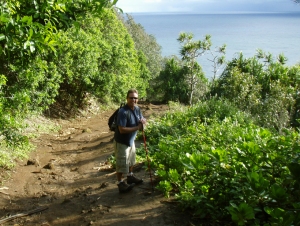
Bart Hunt at Pololu Valley--The Trail Back Up Out of The Valley Seems Much Longer and Steeper than On the Way Down; Be Sure To Leave Plenty Of Time and Energy To Climb Back Up: Photo by Donnie MacGowan

To see the new iPhone/iPod Touch App, please visit http://www.tourguidehawaii.com/iphone.html. The best of Tour Guide Hawaii's free content about traveling to, and exploring, the Big island, can be found here. For more information on traveling to Hawaii in general and on touring the Big Island in particular, please also visit www.tourguidehawaii.com and www.lovingthebigisland.wordpress.com.

A Sweeping View of Magnificent Pololu Valley: Photo by Donald B. MacGowan

Copyright 2009 by Donald B. MacGowan. All rights reserved.

Monday, March 30, 2009

A Scenic Drive on the Hamakua Coast--A Photo Diary

Photos and Text by Donald MacGowan

The Men of Tour Guide decided to take some much needed time away from the office and take a scenic drive to the Hamakua Coast of the Big Island.

The Men of Tour Guide on the Road: Photo by Donnie MacGowan

We left Kailua Kona in the early morning and drove Highway 190 towards Waimea Town.

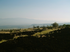
 Along Highway 190 Looking Toward Kohala Mountain: Photo by Donnie MacGowan
Along Highway 190 Looking Toward Kohala Mountain: Photo by Donnie MacGowan

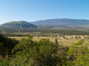
We past by the spectacular over looks of the Kohala Coastline and on up the hills towards Pu'uanahulu.

Hualalai Volcano and Pu'uananhulu from Hwy-190--Note Yellow Blossoms on Silver Oaks: Photo by Donnie MacGowan

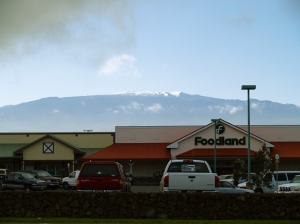
When we reached Waimea, snow covered Mauna Kea was standing tall in the morning sun to greet us.

Snow on Mauna Kea Waimea, Hawaii: Photo by Donald MacGowan
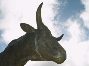
Statue of Heroic Paniolo Ikua Purdy, Waimea Hawaii: Photo by Donald MacGowan

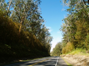
Dropping down to the Hamakua Coast from Waimea on Highway 19, we past through the fragrant and beautiful eucalyptus forest, with more views of Mauna Kea.

Driving through the Eucalyptus Forest on Highhway 19 Between Honoka'a and Waimea: Photo by Donald MacGowan
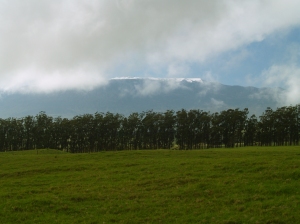
Snow on Mauna Kea from Hwy 19: Photo by Donnie MacGowan

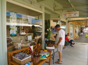
We paused in Honoka'a Town for a much needed cup of coffee and to take a moment to stroll the enchanting shops along the main street of town.

Honoka'a Town is Lined With Intersting and Wonderful Shops and Restaurants--Including Some of Hawaii's Best Antique Stores: Photo by Donald MacGowan
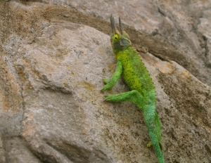
Like a Miniature Triceratops, This Jackson's Chameleon Unconcernedly Strolls the Streets of Honaka'a: Photo by Donnie MacGowan

Driving north, we headed toward Waipi'o Valley with the idea of hiking down to the beach.

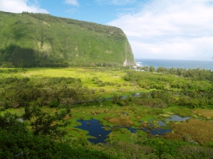
Waipi'o Valley, Hamakua Coast, Big Island of Hawaii: Photo by Donald MacGowan

Loading up the cameras and gear, Frank and I headed down, while Everett explored around the top of the canyon.

Waipi'o Valley Day Hikers: Photo by Donald MacGowan

Reaching the floor of the canyon, we explored the beach, the mouth of the river and the waterfalls--Waipi'o is a place of magic, myth and great beauty--it was absolutely lovely to have an unhurried morning to poke around and explore.

Mouth of Waipi'o Stream: Photo by Donald MacGowan
Waipi'o Stream from the Mouth of Waipi'o Valley: Photo by Donnie MacGowan

After shooting as many pictures as our batteries could stand, we climbed up out of the canyon..it's only a mile and less than a thousand feet, but it's a hike that'll get your full attention! And it's gorgeous and awe-inspiring the whole way back up...out of breath? Stop and enjoy the view!

The Road in Waipi'o Valley: Photo by Donnie MacGowan
View Down into Waipio Valley Floor: Photo by Donnie MacGowan
View Down into Waipi'o Valley Floor: Photo by Donnie MacGowan

Catching our breath and having a bite of lunch, we continued our Soiree down the Hamakua Coast, next stop--Laupahoehoe Park and Tsunami Memorial.

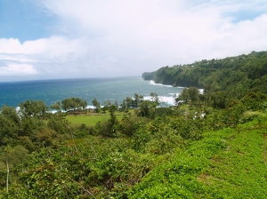
Overview of Laupahoehoe Park, Hamakua Coast, Big Island: Photo by Donnie MacGowan
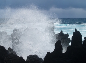
Explosive Wavespray at Laupahoehoe Park, Hamakua Coast, Big Island of Hawaii: Photo by Donnie MacGowan

Next, we took a small restroom break at Kolekole Park and wound up exploring the river and canyon there.

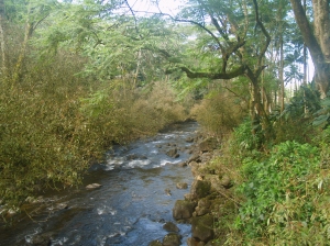
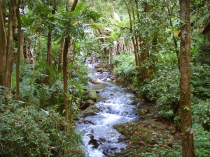
Kolekole Stream Near Kolekole Beach: Photo by Donald MacGowan

Kolekole Stream leaps heroically off Akaka Falls and flows through one of the most amazing jungle Canyons on the Island of Hawaii.

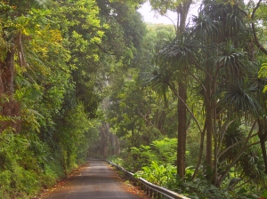
Kolekole Canyon Road: Photo by Donald MacGowan

Since we'd seen Kolekole Stream flowing into the sea, we decided to drive through the town of Honomu (fabulous ice cream!) and visit Akaka Falls to see how the park renovations were coming along.

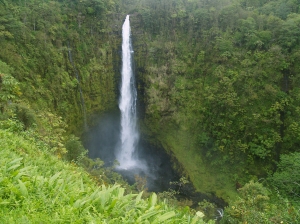
Akaka Falls: Photo by Donnie MacGowan
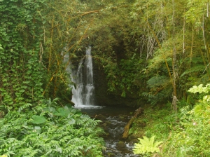
Numerous Small Waterfalls Dot the Fern Grottos Around Akaka Falls: Photo by Donald MacGowan
Numerous Small Waterfalls Dot the Fern Grottoes Around Akaka Falls: Photo by Donald MacGowan

Finally, we decided to drive the Pe'epekeo Scenic Drive--an old and very scenic section of the Mamalahoa Highway--before heading home to Kailua Town.

Along the Pepe'ekeo Scenic Drive: Photo by Donald MacGowan

At this point, we decided to hustle home--we just had time to get back to Kailua Town and catch the Taco's el Pastor special at Habeneros!

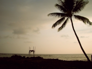
Sunset over the Ancient Surfing Temple of Ku'emanu Heiau, Kona Hawaii: Photo by Donald MacGowan
Sunset over the Ancient Surfing Temple of Ku'emanu

For more information on exploring Hawaii in general and scenic drives on the Big Island in particular, please visit www.tourguidehawaii.com and www.lovingthebigisland.wordpress.com.

Monday, March 2, 2009

Big Island Day Trips #2: Kona to Hamakua and Hilo

Trip 2: Kona to Hamakua Coast: Spectacular Waterfalls, Incredible Canyons and Lush Rainforest

Approximate minimum time start to finish (to see every site): 9 hours.

This day offers spectacular waterfalls, lush rainforest and beautiful canyons, shopping, dining and 2-one hour hikes.

Highway 190 leaves Kona north to Waimea then on to Honoka'a and Waipi'o Valley in about 1 1/2 hours driving. The photos from the valley overlook are postcard gorgeous and Honoka'a has cute shops and restaurants. After a 1 hour drive, seeing several sites along the Hamakua Coast, Highway 220 branches to Akaka Falls. Follow the paved loop through the tropical jungle and smell exotic flowers along this not-to-be-missed, easy 1 hour waterfall hike. Be sure to stop in Honomu for the unique shops. Proceeding south on Highway 19, ten minutes, is the Pepe'ekeo Scenic Drive (4 Mile). Along this road is Onomea Bay Trail, a 1 hour round trip hike, down to the ruggedly picturesque coastline. From there it's 20 minutes to Rainbow Falls, Hilo's signature waterfall. Hilo is the largest city on the island and has numerous shops, malls, museums, restaurants and beaches, such as Richardson Beach, near downtown. From Hilo, it is a 2 1/2 hour drive back to Kona.

Leg 1) In Kailua Kona, start at Ahu’ena Heiau, take Palani Road east to Hwy 190; take Hwy 190 through Waimea to Honoka’a.
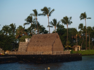
Morning at Ahu'ena Heiau, Kailua Kona Hawaii: Photo by Donnie MacGowan

Ahu'ena Heiau and Kamakahonu Beach
Centuries ago the inhabitants of this region built a series of sacred temples, or heiaus, which were originally used for the purpose of sacrificing human beings to their war god, Kuka’ilimoku. This particular archeological site is called Ahu’ena Heiau, which in Hawaiian means “Hill of Fire”.

Built originally in the 15th century and rededicated by Kamehameha the Great in the early 1800s as the main temple of his capital, the current structures seen at Ahu’ena Heiau were re-built in 1975 under the auspices of the Bishop Museum with financial help from the Hotel King Kamehameha and are constructed to 1/3 the original scale. There are restrooms and showers located on the pier near the beach. Adjacent Old Kailua Town is a treasure of shops, restaurants and aloha.
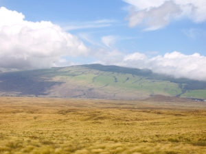
Waimea Town Nestled Against Kohala Mountain: Photo by Donald MacGowan

Waimea Town and Cowboy Country

Snuggled between Mauna Kea and Kohala Volcano in Hawaii's scenic mountain heart, seemingly always shrouded in mist and chilly, Waimea is definitely Hawai’ian cowboy country. Although jeans and flannel shirts appear to be the town uniform, Waimea is very sophisticated, boasting some of the finest shopping and restaurants and the most modern hospital on the island.

From Waimea, Highway 250, the Kohala Mountain Road, spills beautifully through mountain, upland meadow and forest to the "Old Hawaii" town and artist community at Hawi.

Additionally, the cattle industry centers in Waimea. In 1793 British Navigator George Vancouver presented cows to King Kamehameha which were allowed to roam free and soon became a problem. Shortly after horses were brought to Hawaii in 1804, Kamehameha recruited California vaqueros, whom Hawai'ians called "paniolo"--a corruption of the word "EspaƄol"--to control the wild herds, and the generations-old ranching lifestyle here was born.

The vaqueros also brought their guitars and their love of music. A deeply musical people, the Hawaiians were intensely interested in these, the first stringed instruments they had seen. They quickly learned to work-out their own tunings, called "slack key guitar", which more suited the style of their indigenous music.
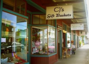
The Main Street of Honoka'a is Lined With Fun and Interesting Shops: Photo by Donald MacGowan

Honoka’a Town

Built in the era of sugar great plantations and left culturally and economically isolated after the industry collapse, until recently Honoka’a was content to drowse along through the decades. A boom in real estate and return of vital human energy to the area has made a literal renaissance of the town. It boasts numerous wonderful restaurants, gift and boutique shops and the highest density of antique shops on the island. Be sure to stop to explore a little on your way to or from Waipi’o Valley…it’s a fun, happening kind of place and always steeped with aloha.

Driving north or south out of Honoka'a, remnants of old sugar mills, fields and wild cane can still be seen. When Captain Cook arrived in 1778, only wild sugar cane was growing; at its height in the mid-1960's one in 12 people were employed in the sugar industry which produced in excess of a million tons of sugar annually. Though the business is gone, what is left are the people who once worked the fields and mills. The melding of the rich cultures of Japanese, Chinese, Filipinos, Portuguese, and others is what gives today's unique Hawaii lifestyle its sweet flavor.

Leg 2) At Honoka’a, turn north on Hwy 240 to Waipi’o Valley.
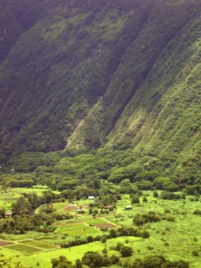
Deep and Mysterious Waipi'o Valley: Photo by Donald MacGowan

Waipi’o Valley

Waipi’o Valley is arguably the most magical place on the Big Island. The steep canyon walls and verdant fields of the valley floor, the mile long black sand beach and numerous immense waterfalls that line the valley walls all call out to the visitor for exploration.

Always listed among the most beautiful spots in the State of Hawai’i, this valley is as hauntingly lovely as it is difficult to see in its entirety.

Tours down into the valley in vans, on horse drawn wagons and ATVs can be booked in Honoka’a. Over-flights in fixed wing aircraft and helicopters also offer fine venues from which to see this amazing piece of Hawai’i. Hiking down and wandering the immense black sand beach, exploring the ironwood copses and sand dunes and discovering the hidden waterfalls is also a popular way to see the canyon. Although the hike down is only a little over 1 mile and a thousand feet elevation loss, the climb back up is sweltering in the ferocious sun and heat. Think twice before hiking down. Facilities at the Scenic Overlook include a pavilion and restrooms; there are none within the valley itself.

Leg 3) From Waipi’o Valley, return to Honoka’a on Hwy 240, get on Hwy 19 and head south.

Leg 4) Take Hwy 19 south to Laupahoehoe then Kolekole, continue south to Hwy 220; west on Hwy 220 to Honomu, then to Akaka Falls.
Laupahoehoe on the Hamakua Coast: Photo by Donald MacGowan

Laupahoehoe Park

A place of great beauty, of awesome displays of oceanic power and of tragic memories, Laupahoehoe Park stands where 20 children and teachers at the Laupahoehoe School were killed in the tsunami of 1946. Inside the park on a small hill overlooking the jetty is a memorial stone inscribed with the names of those who died in the tsunami. There are restrooms, campgrounds, picnic facilities, pit barbecues and ball fields. The pounding of the raw ocean on the jetty reminds one that not every beach in Hawaii is made for swimming, however the fishing here is excellent.
Kolekole Beach Park, Hamakua Coast Hawaii Photo by Donnie MacGowan

Kolekole Beach County Park

The river you saw magnificently jumping with such abandon off the cliff at Akaka Falls ends its journey to the sea by sluicing through this Koa-tree filled canyon and smashing into the surf at Kolekole Beach Park. A wild beach, a jungle canyon and a waterfall swimming hole are fun things to do at Kolekole Park.

The visitor is advised to admire the ocean, but not go in. The currents and tides are lethally treacherous here.

Facilities at Kolekole Beach Park include picnic pavilions and tables, pit barbecues, showers, restrooms and drinking water.

Akaka Falls from the Air: Photo by Donald MacGowan

Akaka Falls

There is a reason that Akaka Falls rates as the most visited tourist site on the Island of Hawai’i. Simply put, the 420 foot, free falling plunge of clear water down a fern festooned cliff is an amazing and beautiful site. Leaving the parking lot, the paved loop trail of about one mile, winds through a wonderful jungle of exotic flowers, ferns, orchids, ginger and bamboo. Two smaller falls are also seen along the way to the stellar Akaka Falls. Akaka Falls has restrooms but no other facilities.

When visiting Akaka Falls, be sure to save some time to explore the shops, galleries and cafes of Honomu on the way back to the highway; it’s unlike anywhere you’ve ever been before…guaranteed.

Leg 5) Return Hwy 220 through Honomu to Hwy 19, then south on Hwy 19 to Old Mamalahoa Highway (or Kulaimano Road to Old Mamalahoa Hwy); this is the Pe’epekeo Scenic Drive. South and east on Old Mamalahoa Hwy to Onomea Bay; continue on Old Mamalahoa Hwy south to southern jct with Hwy 19.
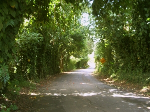
Pe'epekeo Scenic Drive, Hamakua Hawaii: Photo by Donald MacGowan

Pepe'ekeo Scenic Drive

Located just a few minutes north of Hilo on Highway 19, this “Old Road through Old Hawai'i”, a four-mile-half hour scenic wander, parallels Highway 19 but is removed worlds away from the traffic and hustle along the main road. Rolling along old cane fields, jungle-canopied in places, passing waterfalls and crossing creeks, the Pepe’ekeo Scenic Drive is a special treat for the visitor who may be thinking they waited a century too long to visit Hawai'i. On a sunny day, on a rainy day, it doesn’t matter; this scenic drive is a joy. There are no services available along the scenic drive.
Onomea Bay, Hamakua Coast Hawaii: Photo by Donald MacGowan

Onomea Beach Trail

Only a few miles north of tame and sedate Hilo Bay, Onomea Bay is subject to the full fury and magic of the open Pacific Ocean. Rugged, jagged, majestic, the wickedly sculpted cliffs along the bay belie the easy 15 minute walk down to the beach. Accessible to most walkers of even marginal condition, the trail leads alongside a botanical garden (be sure not to wander through any of their gates unless you are a paying customer) and meanders down to the canyon mouth, past a tiny waterfall at the end of the stream and to the beach. There are awesome opportunities for photo

Leg 6) South on HWY 19 to Hilo; get on Hwy 200 (Waianuenue Avenue), head south-southeast to Rainbow Drive and Rainbow Falls.
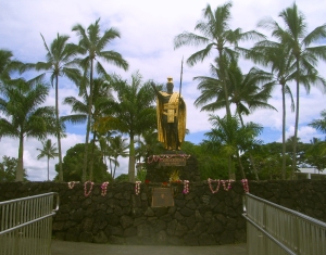
King Kamehameha Statue, Hilo Hawaii: Photo by Kilgore Trout

Hilo Town

Beautiful but wet, metropolitan but decrepit, bustling but laid back, Hilo is a lovely, maddening, heartbreaking, addictive study in contrasts. In can rain all day long for 50 days in a row, yet when the sun does shine, the views of Mauna Loa and Mauna Kea from the Lilioukalani Gardens, or of Hilo Bay as you drive down from the mountains, or the rain-forest and waterfall choked gulches with lovely beaches along the highway north of town, make Hilo one of the most truly, achingly-lovely spots on earth.

More laid back and sleepier than bustling Kailua Kona, Hilo is the largest town on the island, and the county seat. The Imiloa Astronomy Center of Hawaii, Tsunami Museum, Lyman House Missionary Museum and the Panaewa Rainforest Zoo are all wonderful places to learn about various aspects of Hawaii. There are numerous shopping districts, two large malls and the Historic Old Hilo downtown shops to browse through, a variety of sprawling green parks, a fabulous tropical arboretum right downtown and a mile-long black-sand beach fronting the bay to explore. Hilo's Farmer's Market is a "must see" for any visitor who is spending time on this side of the island.

Rainbow Falls, Hilo Hawaii: Photo by Prescott Ellwood

Rainbow Falls and Wailuku River Park

The subject of recent and ancient legend, Rainbow Falls is the lovely emblem of Hilo town. The characteristic wishbone shape of Rainbow Falls is best seen at moderate river flows…too little water and only a single drizzle remains, too much runoff and the falls merge into a single, roaring flume. At any time, however, it’s a beautiful place and worthwhile to visit. The rainbows within the falls are best seen in the mid to late morning. Follow the trail to the left along the river bank to delightful swimming and wandering; please note, however, that swimming in rivers and near falling water is dangerous. Don’t go in if the current is swift or if recent rains have swollen the river.

Restrooms are by the parking lot and a souvenir shop is located across the street.

Leg 7) Return Hwy 200 (Waianuenue Road) to HWY 19, then east on 19 to Jct with Kamehameha Ave; Kamehameha Ave east to jct with Kalanianaole Ave to Richardson Beach Park.

Richardson Beach Park, Hilo Hawaii: Photo by Donnie MacGowan

Richardson Beach Park

Richardson Beach Park, with its towering palms, fresh water pools, delightful surf, secluded and calm tidepools, lawns and general ambience of tropical paradise, is almost certainly very close to what most visitors expect from Hawai’i—hence it popularity.

Views of Mauna Kea at sunrise and sunset from this beach are unparalleled. The snorkeling here along the small black sand beach is the best of the Hilo area and the surf is a busy mix of beginner to intermediate level waves. Restrooms, showers, water, picnic tables and a lifeguard round-out the amenities of this wonderful place. There is also a Hawai'i County Police Department substation here.

Leg 8) Return on Kalanianaole Ave to Kamehameha Ave to Hwy 19; take Hwy 19 north to Honoka’a and jct with Hwy 190; drive Hwy 190 west to Kailua Kona.
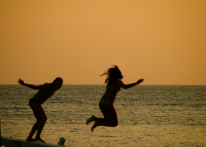
Off the Pier in Old Kailua Town: Photo by Donnie MacGowan

For more information on traveling to Hawaii in general and touring the Big Island in particular, please also visit www.tourguidehawaii.com and www.tourguidehawaii.blogspot.com.
 

Casino Bonus no Deposit