Showing posts with label archeology. Show all posts

Sunday, November 1, 2009

Kona's Fscinating History: Hulihe'e Palace

by Donald B. MacGowan

iPhone and iPod Touch Video Tour Guide for Hawaii-fully GPS and WiFi Enabled, fully interactive. Hours of interesting and compelling content. Available from iTunes or at www.tourguidehawaii.com.
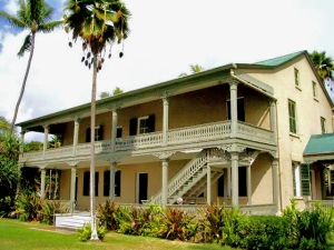
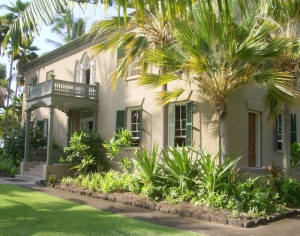
Hulihe'e Palace in the Heart of Old Kailua Town, Hawaii: Photo by Donnie MacGowan
Whether you visit the Big Island for a few days, a couple weeks or a few months, you want to make the most of your time in Paradise. With such a wide variety of natural and commercial attractions, it is natural for the visitor to get a little overwhelmed in the “Option Overload” and not be able to make a balanced and informed decision on what they want to do and how best to spend their time.

Choosing which beach you want to spend time on, or where you want to hike or drive can be an exercise in confusion and conflicting advice. Even more so, finding quality information on the history, culture, geology and natural history of the area can be almost impossible--and much of what you do find is inaccurate, or third-hand retellings that are, well, better stories than histories. Clearly, visitors to Hawaii could use help making quality decisions about how best to spend their time and understanding what they are seeing, the culture they are visiting.

This is why Tour Guide Hawaii is so excited and proud to announce the release of their new GPS/WiFi enabled App for iPhone and iPod video tour that helps you navigate your trip to Hawaii with hours of informative, location-aware video and information. Although our video guide will lead you to dozens of unusual, untamed and unspoiled spots, as an example of the fabulous coverage our App for iPhone and iPod provides, let's look at a fascinating historical site in the heart of Old Kailua Town itself, one which you might pass by, uninterested and uninformed, if you did not have Tour Guide Hawaii's new App.

Hulihe'e Palace

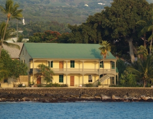
iPhone and iPod Touch Video Tour Guide for Hawaii-fully GPS and WiFi Enabled, fully interactive. Hours of interesting and compelling content. Available from iTunes or at www.tourguidehawaii.com.
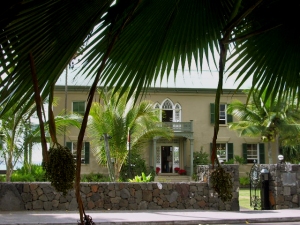
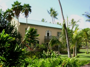
Hulihe'e Palace on Ali'i Drive in Kailua Kona, Hawaii: Photo by Donnie MacGowan
It is said that ghosts of Hawai’ian monarchs still haunt this palace, walking up and down the grand staircase and around the grounds. Built by Governor James Kuakini in 1838 as a home, it was used for many years by Hawai’ian royalty as a summer get-away palace, a place of great galas and parties. Abandoned to ruin in 1914, since 1928 the Palace has been operated as a museum by the Daughters of Hawai’i.
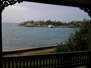
iPhone and iPod Touch Video Tour Guide for Hawaii-fully GPS and WiFi Enabled, fully interactive. Hours of interesting and compelling content. Available from iTunes or at www.tourguidehawaii.com.
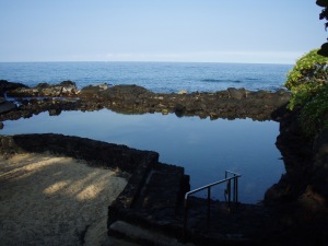
View off the back lanai at Hulihe'e Palace, Kailua Kona, Hawaii: Photo by Eric Carr
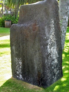
Also on the Palace grounds are the Pohaku Likanaka, a ceremonial execution stone, a fishpond and the Palace Gift Store, which has many fine art items and hard-to-find books on Hawai’iana.

The museum is open Monday-Friday, 9 a.m. to 4 p.m. and Saturday and Sunday, 10 a.m. to 4 p.m. There are friendly and knowledgeable docents who give free tours, which last about 45 minutes. Admission is $5 for adults, $4 for seniors and $1 for students; photographing inside the museum is forbidden.

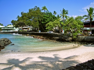
iPhone and iPod Touch Video Tour Guide for Hawaii-fully GPS and WiFi Enabled, fully interactive. Hours of interesting and compelling content. Available from iTunes or at www.tourguidehawaii.com.
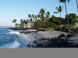
Tiny Nimalu Beach (meaning = "shade of the coconut tress") at Hulihe'e Palace in Kailua Kona, Hawaii: Photo by Donald B. MacGowan
One of the more interesting things about the Palace is the derivation of its name, Hulihe’e. Huli means “to turn or spin” and comes from the same root as “hula” the “dance of turns”. He’e is a generic term for cephalopods (octopus and squid). The term “spinning octopus” refers not to an aquatic species, but rather to a form of tactical defense employed by the Hawai’ians when defending coastline against superior attacking forces. The defenders are spread-out in arms, or tentacles, which rotate from area to area as waves of attackers come ashore.
iPhone and iPod Touch Video Tour Guide for Hawaii-fully GPS and WiFi Enabled, fully interactive. Hours of interesting and compelling content. Available from iTunes or at www.tourguidehawaii.com.
Luakini Stone; a plae of human sacrifice at Hulihe'e Palace, Kailua Kona, Hawaii: Photo by Donald B. MacGowan
Hulihe’e Palace was built by High Chief (later Governor) James Kuakini in 1838 as a home. After his death, Princess Ruth Ke’elikolani lived in a grass house (hale pili) on the grounds, the foundations of which are still visible. The Palace next reverted to a summer party palace for the Hawai’ian Royalty, then residing in Honolulu, especially King Kalakaua--The Merrie Monarch--until it was abandoned to ruin in 1914. Prince Kuhio, the first delegate to Congress from Hawai’i, inherited the Palace from his father and in the 1920’s decided to auction-off all the furnishings. The Palace staff numbered every piece and noted who the buyers were.
iPhone and iPod Touch Video Tour Guide for Hawaii-fully GPS and WiFi Enabled, fully interactive. Hours of interesting and compelling content. Available from iTunes or at www.tourguidehawaii.com.
Hulihe'e Palace from the Kailua Pier, Kailua Kona, Hawaii: Photo by Donald B. MacGowan
Around the turn of the century, the Palace fell into disrepair and provided a discreet spot for men to gather in the evenings, play poker and drink by the light of kerosene lanterns. The Daughter’s of Hawai’i, when they learned in 1920 that the Inter Island Steamship Company planned to acquire and tear-down the Palace to build a luxury resort on the royal grounds, rescued the Palace and have operated it as a museum ever since. The Daughters of Hawai’i found the old list of purchasers of the furnishings Prince Kuhio had auctioned and persuaded many of the owners to return, re-sell or permanently lend these priceless pieces to the Museum.
iPhone and iPod Touch Video Tour Guide for Hawaii-fully GPS and WiFi Enabled, fully interactive. Hours of interesting and compelling content. Available from iTunes or at www.tourguidehawaii.com.
Hulihe'e Palace from behind, Kailua Kona, Hawaii: Photo by Donnie MacGowan
Today the museum contains an impressive array of native Hawai’ian artifacts from fishhooks to clubs to combs. The walls are hung with many portraits of Ali’i and westerners important to Hawai’ian history. Also there are intricately carved pieces of furniture by local and European masters such as Wilhelm Fisher, including massive beds, impressive armoires and a 6-foot diameter table carved from a single koa log.

iPhone and iPod Touch Video Tour Guide for Hawaii-fully GPS and WiFi Enabled, fully interactive. Hours of interesting and compelling content. Available from iTunes or at www.tourguidehawaii.com.
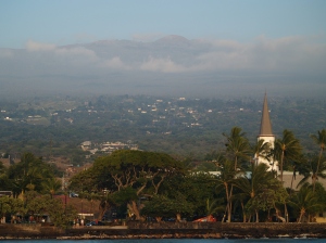
Hulihe'e Palace From Mokuaikawa Church, Kailua Kona, Hawaii: Photo by Donnie MacGowan
To see the new iPhone/iPod Touch App, please visit http://www.tourguidehawaii.com/iphone.html. The best of Tour Guide Hawaii's free content about traveling to, and exploring, the Big island, can be found here. For more information on traveling to Hawaii in general and on touring the Big Island in particular, please also visit www.tourguidehawaii.com and www.lovingthebigisland.wordpress.com.

iPhone and iPod Touch Video Tour Guide for Hawaii-fully GPS and WiFi Enabled, fully interactive. Hours of interesting and compelling content. Available from iTunes or at www.tourguidehawaii.com.
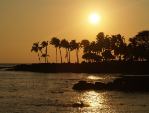
Sunset over Kailua Kona, Hawaii: Photo by Donnie MacGowan
Copyright 2009 by Donald B. MacGowan. All rights reserved.


Sunday, August 30, 2009

Best Scenic Drives in Hawaii #5: Kailua Kona to Hawaii Volcanoes National Park, Puna and Lava Viewing

Trip 4: Hawaii Volcanoes National Park and Lava Viewing Approximate minimum time start to finish (to see every site): 14 hours (return drive in the dark).

From Kona, connect to Highway 11 south 2 1/2 hours to Ka'u Desert Trail. A 40 minute round trip hike leads to footprints of ancient warriors who where caught in a sudden, ferocious eruption. Continue on Highway 11 to Hawai'i Volcanoes National Park. Park Rangers at the Visitor Center will have the latest lava information. Chain of Craters Road has numerous craters, tons of hiking trails and several breathtaking vistas for great photographs. Upon exiting the Park, continue to Kea'au and Highway 130 (food stop). Proceed to Pahoa and the junction to Highway 132 and Lava Trees State Park. Here trees were inundated with fast flowing lava. When the trees rotted, it left these Lava Trees. Then on to Highway 137, following the coast to Kalapana and a 20 minute hike to the lava viewing area at Waikupanaha. (Arrive about dusk for optimal viewing.) From Kalapana back to Kona is a 3 1/2 hour drive (after dark).

Leg 1) Start at north end of Keauhou Historic District on Ali’i Drive, head south on Ali’i Drive to jct with Kamehameha II Hwy; east on Kamehameha III to Hwy 11. Take Hwy 11 south to Ka’u Desert/Warrior Footprints Trail.
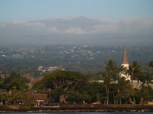
Evening Light on Hualalai and Kailua Kona: Photo by Donnie MacGowan

Keauhou Historic District and Kona Coffee

For almost 400 years, temples and palaces along the Kona coastline served as a kind of "Rome of the Pacific", a great political, religious and cultural center in Polynesia, until the capital was moved to Honolulu in 1850 by Kamehameha III.

The most important, interesting and best preserved historical and cultural sites lie within the Keauhou Historic District, between Kahalu'u Beach Park in Kailua running south 6 miles to Kuamo'o Bay in Keauhou. The District contains perhaps a dozen fascinating sites that are easy to walk to, well maintained and quite interesting. To see the numerous fascinating and important archaeological sites in the Keauhou Historic District, it is necessary to park your car in the free parking at either Kahalu’u Beach Park or the Keauhou Beach Resort and explore on foot.

Just uphill from the Historic District is the Kona Coffee District. Hawaii is the only state in the union which produces coffee, and Kona coffee is perhaps the finest in the world. Over 2 millions pounds of coffee a year are produced on about 600, 2-3 acre farms; tours of coffee farms and roasteries are available.
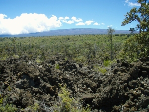

Mauna Loa Rises Above the Ka'u Desert at Warriror Footprints: Photo by Donald B. MacGowan

Ka’u Desert Trail and Warrior Footprints, Hawai’i Volcanoes National Park

Just where Hawai’i Belt Road enters Hawaii Volcanoes National Park from the West, is a small parking strip that is the gateway to a host of wonders within the Ka’u Desert section of Hawaii Volcanoes National Park. Although eruptions here are generally characterized by leisurely outpouring of lava, it is not unknown for Kilauea to violently erupt in a blast of steam and ash. It is this ash that preserves some human footprints, believed to have been formed in 1790 when enemies of Kamehameha the Great were caught by one such massive, explosive eruption. Perhaps as many as 400 men died in this eruption. An emergency phone is available here; there are no other services. Do not venture from your car here without carrying water.

Leg 2) Continue south on Hwy 11 to Hawaii Volcanoes National Park Entrance and jct with Crater Rim Drive; Crater Rim Drive west to Kilauea Visitor’s Center to Jagger Museum, then back around Crater Rim Drive to Kilauea Iki Crater.
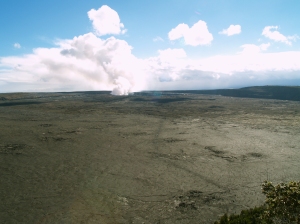
Kilauea Crater and the Current Halema'uma'u Eruption As Seen from Waldron Ledge, Hawaii Volcanoes National Park: Photo by Donnie MacGowan

Hawai’i Volcanoes National Park

Hawai’i Volcanoes National Park is a magical, spiritual, wondrous, strange and beautiful place comprised of great contrasts and contradictions: dry as dust desert to teeming tropical jungle; frigid sub-arctic wasteland to steaming black sand beaches to rivers of flowing lava.

The star attractions in the Park are a pair of active volcanoes; Mauna Loa is the largest mountain on earth and Kilauea is most active volcano on earth. However, there are numerous other wonders from lava tubes to crawl down, black sand beaches with sea turtles to watch, mysterious petroglyph fields to explore, tropical jungles to hike through, endangered bird species to find, happy-face spiders to amuse and an otherworldly volcanic landscape so fresh it’s still steaming.

Hawaii Volcanoes National Park is open 24 hours a day, 365 days a year. During daylight hours, an access fee is charged. The Visitor Center has a 24-hour information line at 808.985.7017 and there is a 24-hour eruption hotline at 808.985.6000. Within the Park tune to A.M. radio 530 for continuous information broadcast. There tourist items available for sale and one restaurant and in the park, however generally shopping, restaurants and gasoline are only available in the nearby village of Volcano.
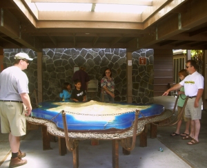

Kilauea Visitors Center at Hawaii Volcanoes National Park: Photo by Kilgore Trout

Kilauea Visitor Center

Newly remodeled and updated, the Kilauea Visitor’s Center is an outstanding resource of information on Hawaii’s volcanoes and the National Park; the not-to-be-missed first stop in the park you must make. The Center is run by enthusiastic and knowledgeable staff that has the most up-to-date information on viewing the eruption, hiking and camping, bird watching, stargazing and just about any other topic of interest to Park visitors.

Available for sale in the Center are maps, guidebooks, books and videos about the volcanoes, Hawai’iana, history, plants and every topic you can imagine pertinent to the Park, even souvenirs. There are free brochures and pamphlets on various trails, attractions, hiking safety and lava viewing hazards and precautions. The Visitor Center is open daily from 7:45 a.m. to 5 p.m.; there are public restrooms, water and pay phones available. Starting at 9 a.m. and showing every hour on the hour is a 20 minute informative movie about the Park; the film changes from time to time, but always contains spectacular footage of eruptions, information on volcanology and the natural and human history of the Park.
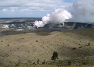
View of Halema'uma'u from Jagger Museum, HVNP: Photo by Donald MacGowan

Jagger Museum and Hawai’i Volcano Observatory

Famed for its fabulous views of Mauna Loa and Kilauea as much as for its interesting exhibits, The Jagger Museum (named for geologist Thomas A. Jagger) is open daily from 8:30a.m. to 5:00p.m. Exhibits include murals by Herb Kawainui Kane, seismograph charts of eruptions and earthquakes, geological displays and display about the natural and human history of the Park.

When entering the parking lot of the Museum/Observatory, be especially careful of the Federally-protected Hawaii Goose, the Nene, who seem to congregate here. The Nene is the State Bird of Hawai’i, and this parking lot and its surrounding area constitute one of the best places for viewing them.
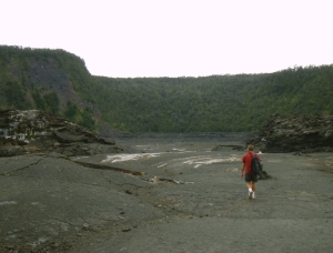
Frank Burgess On Kilauea Iki Trail: Photo by Donnie MacGowan

Kilauea Iki Trail

Perhaps the finest short day hike in the park, a four-mile, 2-3 hour trip down into, across and back out of Kilauea Iki Crater gives one an intimate feel for volcanoes, Hawaiian-Style. Along one side, thick fern and ohi’a forest skirts along the rim and on the other, lush tropical rainforest crowds to the very brink of the crater; bleak volcanic desert lines the crater walls and covers the floor. The start and finish of the hike are along well marked, wide trails. The remainder is an easily followed, well marked trail with stone ahu (cairns) over the crater floor. As always when hiking in the Park, it is wise to avoid the noonday sun, and to remember that afternoon showers are common, especially near where this hike meets the crater rim.

Leg 3) Crater Rim Drive to intersection with Chain of Craters Road; Chain of Craters Road to End of Road.
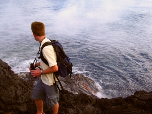
Hiking from the End of Chain of Craters Road to the Lava Ocean Entry at La'epuki: Photo by Donald MacGowan

End of Chain of Craters Road

The end of Chain of Craters Road is currently at the 19 mile marker near the Holei Sea Arch. This is where the road was cut off by flowing lava and destroyed the 2 million dollar visitor center. When the lava is near the road, one can walk right up to it. There are displays about the volcano and natural history of the area, as well as a wealth of information on hiking to, and viewing, the lava, available here.

Hiking all the way out to the active flows is one of the most spiritually rewarding, awe-inspiring, curiosity quenching and amazing things one can do anywhere in the world—but it is neither for the physically unfit nor the meek of spirit. It is a long, hot hike (currently seven miles) over broken ground and glass-sharp rocks; the heat from the volcano is savage; the weather, if clear, is sweltering…frequent squalls blow in off the ocean and the rain and wind can get pretty wild out on the lava plain where there is absolutely no cover or shelter to protect you. No water or shade is available anywhere along the hike.

Leg 4) Follow Chain of Craters Road back uphill to Crater Rim Drive, follow Crater Rim Drive back to Park Entrance and then to Hwy 11. Go east on Hwy 11 to jct with Hwy 130 at Kea’au; take Hwy 130 south to Pahoa.
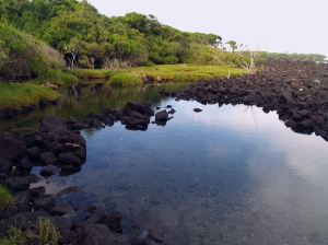
In Hawaiian, "Puna" means "Spring" and Puna District in General, and the Area Around Pahoa in Particular, Is Dotted With Hot, Warm and Cold Springs: Photo by Donnie MacGowan

Puna District and Pahoa Town

Uncrowded, off the beaten track and largely undiscovered by tourists, Puna District is a magnificent wonderland; from incredible tree-tunneled roads, geothermal fields of steam vents, lovely beach parks, hot ponds, hikes on raw lava flows and jungle trails, and unequaled snorkeling, the land cries out for the visitor to explore a little bit.

At the center of Puna is Pahoa Town; wild, untamed and even a bit unruly, with its false-front, western-style buildings and raised wooden sidewalks, Pahoa looks more like it belongs in Wyoming. But Wild West isn’t the only subculture evident here…tie-dye banners and the general “flower-power” ambience some businesses and citizens lend Pahoa give it a decidedly “’60’s” feel.

It has been said of Pahoa that if it weren’t for counter-cultural influences, it would have no cultural influences at all. The charm and allure of this way of living is evident when you consider that the region around Pahoa is the fastest growing portion of the island. Pahoa has some of the best restaurants on the island, THE best natural foods store and a great public pool.

Leg 5) At Pahoa, get on Hwy 132 to Lava Trees State Park.
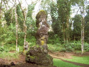
Lava Trees State Park: Photo by Donnie MacGowan

Lava Trees State Monument

Under a lacey canopy of monkeypod trees, casts of ohi'a trees stand as monuments to a fast-moving pahoehoe lava flow that passed through here in 1790. When the lava hit the water-saturated ohi'a trees, it cooled and began to congeal around them. The original ohi'a trees burned away but the quickly cooled lava around them stands here today, hollow, with imprints of the tree bark inside. Lava Trees Park offers trails to hike and a restful, bird-filled jungle to sit and listen to. You can spend between 20 minutes to an hour wandering the trails, here, exploring and discovering. Be careful, however, the area is riddled with hidden cracks in the ground which can make exploring hazardous. You may wish to avail yourself of the restrooms here; they are the last public facilities for some distance.

Leg 6) From lava Trees State Park take Hwy 132 to jct with Hwy 137 at Kapoho; take Hwy 137 southwest to Ahalanui Pond then to Kaimu Black Sand Beach and Kalapana Disaster of 1990.
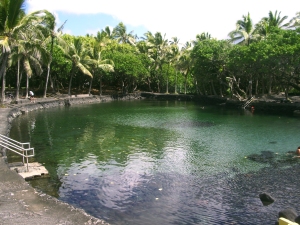
Ahalanui Hot Pond: Photo by Donald MacGowan

Ahalanui Pond

Also called “Secrets Beach”, this spring and ocean-fed, manmade pool was initially constructed when the springs ran chilly cold. Eruptions in Puna during the ‘50s and 60’s reworked the subterranean waterworks and now the springs run hot and the pool is a comfortably warm 90-95 degrees. The open connection to the ocean, keeps the water fresh. With the gentle aloha breezes, swaying palms and surf whooshing against the, it can be really hard to drag oneself out. Soak for a while. Picnic tables, pavilions, pit barbecues, showers, lawns and all the pleasantries of a civilized park are available at Ahalanui Pond. Leave no valuables in your car and be vigilant if you stay soaking here, after dark.
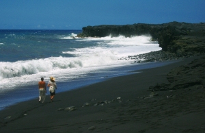
Kaimu Beach near Kalapana, Puna Hawaii: Photo by Donnie MacGowan

Kalapana Disaster of 1990/Kaimu Black Sand Beach

In 1990 the volcano goddess Pele determined it was time for some serious housecleaning in Puna. Lava flows from Kilauea’s East Rift engulfed the villages of Royal Gardens, Kaimu and Kalapana, destroying virtually everything.

Buried were a centuries old fishing village and a world famous black sand beach. When the lava came, it wiped out not just material possessions; it wiped out a way of life and a landscape cherished by generations. The Big Island's newest black sand beach, Kaimu Beach, is a lovely if barren crescent of sand at the end of an unforgiving expanse of lava from the 1990 flows. The trail to the new black sand beach is marked with hundreds of young palms, numerous lava casts which include palms, pandanas fruit and even some fish that were caught in tide pools.

From the lava hillocks along the trail you can get nice views of the eruption plume at Pu’u O’o, up on the flank of Kilauea, as well as the steam clouds down a few miles along the coast where the lava enters the sea. Restrooms and fast food are available at the end of the road.

Leg 7) From Kalapana, take Hwy130 (Ahia Road) just a tweak to the jct with old HWY 130; go west on old the highway to Waikupanaha Lava Viewing.
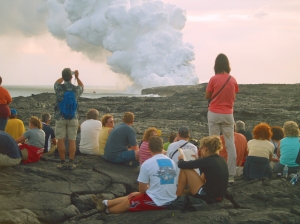
Lava Viewing At Waikupanaha, Puna Hawaii: Photo by Donald MacGowan

Lava Viewing Near Kalapana

Nowhere else can you see lava flowing from a volcano into the sea; no Big Island visit is complete without seeing this awe-inspiring show. Currently lava is only flowing into the sea outside the Park. Drive south on Highway 130 through Pahoa to the 20 mile marker and take the right branch about two miles to the parking area. Port-a-potties are available here. The road is open from 2 p.m. until 10; no cars allowed in after 8. Lava viewing information is available from Hawaii County at 808.961.8093; check conditions before you go.

The easy trail, a 20 minute stroll to the viewing area, is well-marked. The viewing varies as lava flows nearer or farther from the trail. Viewing is best at dusk so bring flashlights for the hike out. Take close-toed walking shoes and a hat, long pants and long-sleeved shirt, at least 2 liters of water and sun block and a rain jacket and camera. Remember food and gas are not available anywhere nearby after dark, so fill up BEFORE you park, bring snacks and drinks. There are port-a-potties available at the parking lot.

Leg 8) Return to Hwy 130; Hwy 130 north through Pahoa to Kea’au and jct with Hwy 11. Hwy 11 west to Kailua Kona. Take Hwy 11 west to Kailua Kona.

For more information on visiting Hawaii in general and touring the Big Island in particular, please visit www.touruidehawaii.com and www.lovingthebigisland.wordpress.com. For information about the author, please go here.

Sunset Over Oneoneo Bay, Kailua Kona Hawaii: Photo by Donald MacGowan

Thursday, May 7, 2009

Pu'u Kohola National Historic Park and Spencer Beach Park, Big Island Hawaii


Pu'u Kohola National Historic Park and Spencer Beach Park are two of the most interesting and fun visitor attractions on the Kohala Coast of the Big Island of Hawaii.


Produced by Donnie MacGowan and Frank Burgess and presented by Tour Guide Hawaii...Aloha!

For more information, visit www.tourguidehawaii.com or www.lovingthebigisland.wordpress.com.


All media copyright 2009 by Frank Burgess and Donald B. MacGowan

Sunday, May 3, 2009

Historic Kailua Kona Town on the Big Island of Hawaii: A Walking Tour

Evening Sunshine Glows on Old Kailua Town: Photo by Donnie MacGowan

The town of Kailua Kona is the crown jewel on the island of Hawaii and the beating heart of the Kona Coast. A sleepy fishing village not so long ago, Kailua Kona is now the metropolitan center of West Hawaii’s burgeoning economy and exploding population. Founded by King Umi in the 1500’s, Kailua Kona served as the social, religious and political capital of Hawaii for several hundred years. Deeming it the loveliest spot in all the Hawaiian Islands, King Kamehameha the Great ruled his island empire during the final years of his reign from here.

Exploring the downtown area from the King Kamehameha Beach Resort to the Honl’s Beach on the south provides a couple hours pure enjoyment: easy walking along the incomparable turquoise Kona Coast under the warm, sapphire Hawaii sky, past ancient temples, missionary churches, intriguing and unique shops and wonderful restaurants. It is easy, walking here, to understand how one can be completely seduced by the magic of the Big Island.

Kailua Kona is a town made for walking, so start by parking your car. On the north side of town, abundant for-pay parking is available at the King Kamehameha Beach Hotel. Free parking on this end of town is available at Triangle Parking, between Kuakini Highway and Ali’i Drive. About half-way through town, by the Farmer’s Market and Hale Halawai Park, is a large area of free parking. On the south side of town there is abundant free parking at the Coconut Grove shopping area, and at Honl’s Beach.

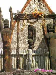
Let’s start exploring Kailua Kona on the north and work our way south. The thatched structure surrounded by carved wooden idols across from the pier is ‘Ahu’ena Heiau, an ancient and sacred temple site. A temple (or Heiau) has existed on this spot since at least the first millennium, and as recently as the 15th century was occupied by a temple of human sacrifice (or luakini Heiau) dedicated to the war god Kuka’ilimoku. In 1812, King Kamehameha I ordered the heiau enlarged, rebuilt, rededicated as 'Ahu’ena Heiau (“hill of fire”), a temple of peace and prosperity dedicated to the fertility god Lono.

Ahu'ena Heiau, Kailua Kona: Photo by Donald MacGowan

The current structures seen at 'Ahu’ena Heiau were re-built in 1975 under the auspices of the Bishop Museum with financial help from the Hotel King Kamehameha and are constructed to 1/3 the original scale. Here, there is a veritable forest of of carved, wooden sacred images in the “Kona Style”, considered the most refined in all Polynesia.

Three delightful, but tiny, beaches grace the immediate downtown area; from north to south they are named Kamakahonu, Keakaiakua and Niumalu--many locals do not even know thy have names. The snorkeling from these small beaches is spectacular and strangely uncommon. A beautiful coral garden and vibrant reef fish can be seen snorkeling along the shoreline off 'Ahu’ena Heiau where fish, turtles and eels are abundant in Kailua Bay.

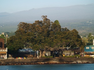
Pao Umi Rock and the Moreton Fig Tree in Kailua's Evening Light: Photo by Donnie MacGowan
Pa’o Umi, a point of rock between the pier and Hulihe'e Palace and mostly buried under Ali’i Drive, is where High Chief Umi is thought to have landed when he moved his court from Waipi’o Valley to Kailua in the 1500’s. Umi consolidated and centralized religious and secular power of Hawai’i Island in Kona and built a number of temples, most notably on the current sites of Ahu’ena Heiau, Moku’aikaua Church and Kona Inn. Umi founded the political landscape which ultimately fostered King Kamehameha’s regime and led to the unification of the Hawai’ian Islands into a single nation.

Across Ali’i Drive from Pa’o Umi is a large Moreton Fig tree that appears in photographs of downtown Kailua since before the turn of the last century; as such, this tree is at least 140 years old.

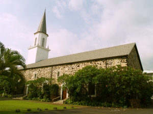
Mokuaikawa; the First Christian Church in Hawaii: Photo by Donald B. MacGowan
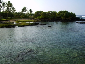
During the winter of 1819 to 1820, Congregationalist missionaries from Boston crossed the Atlantic Ocean enduring 5 months of intense stormy weather while headed for a new life in Hawai’i. In March of 1820, the missionaries sailed into the balmy waters of Kailua Bay and landed at Kamakahonu Rock (eye of the turtle"), the “Plymouth Rock” of Hawai’i, which now supports the Kailua Pier..

Mokuaikaua Church, built under the leadership of missionary Asa Thurston between 1835 and 1837, was specifically aligned so that the prevailing breezes would pass through it, but also so that it presented a strong, stone façade to the south and west, the direction from which strong Kona Winds, large storms and hurricanes come. The 112-foot steeple was for many decades the highest structure in Kailua and served as a navigation landmark both for ships at sea and people on land.

The church is constructed of rough-hewn basalt blocks mortared with lime made from burnt coral and bound with kukui nut oil. The corner stones were taken from a heiau built on the same spot by King Umi in the fifteenth century. The interior beams and woodwork are of koa wood. The joints were painstakingly joined with ohi’a wood pins; this is a magnificent example of the architectural style brought to Hawai’i by the missionaries in the 19th century.

The inside of the church is beautiful, cool and inviting, and visitors are welcome between services and on weekdays between sunrise and sunset; admission is free. There is a fascinating mini-museum, small but informative, which is open daily from sunrise to sunset and free tours are conducted from 10 a.m. to noon and 1 to 3:30 p.m. The Museum features exhibits about Hawai’i, the life of the missionaries and contains a scale model of the Brig Thaddeus.

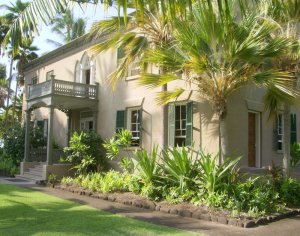
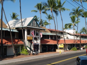
Hulihe'e Palace, Kailua Kona Hawaii: Photo by Donnie MacGowan
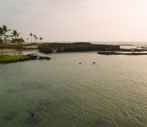
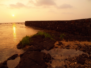
Hulihe’e Palace was built by High Chief (later Governor) James Kuakini in 1838 as a home. For many years, the Palace was used by Hawai’ian royalty as an official residence and summer get-away palace, a place of great galas and parties, but was abandoned to ruin in 1914. Since 1928 the Palace has been operated as a museum by the Daughters of Hawai’i. The Palace Gift Store has many fine art items and hard-to-find books on Hawai’iana.

The museum is open Monday-Friday, 9 a.m. to 4 p.m. and Saturday and Sunday, 10 a.m. to 4 p.m. There are friendly and knowledgeable docents who give free tours, which last about 45 minutes. Admission is $5 for adults, $4 for seniors and $1 for students; photographing inside the museum is forbidden. The palace sustained considerable damage during the earthquake of 2007 and is currently undergoing renovation.

Kona Inn Shops: Photo by Donald B. MacGowan
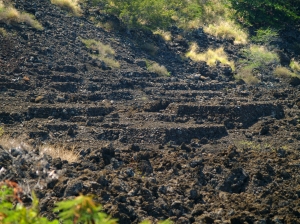
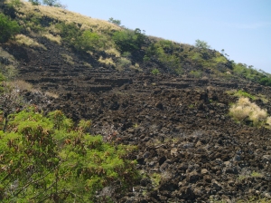
The Kona Inn is of particular historic significance, as it was the first destination resort to open in West Hawai’i and it ushered in the era of tourism along the Kona Coast. Built on the site of Papa ‘Ula (red flats) where a temple of human sacrifice was built by High Chief Umi, today the Kona Inn features many unique and interesting shops and fine restaurants.
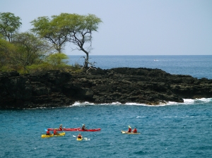
The Inn fronts on a large, palm-shaded lawn that leads to a seawall and the ocean. This area is open to the public and is a really grand place for picnicking, watching whales and dolphin and the fabulous Kona sunsets.

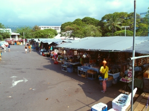
The Kailua Farmer’s Market, open Wednesday through Sunday, lies in the parking lot at the corner of Ali’i Drive and Hualalai Road between the Public Library and Hale Halawai Park. The market offers a wide and intriguing variety of fresh produce, hand-made local arts and crafts, Hawai’iana and other types of souvenirs.

Kailua Famer's Market: Photo by Harvey Bird Watching
Kailua Farmer's Market: Photo by Harvey Bird Watching

The grounds and oceanfront of Hale Halawai Park offer a peaceful, shady place for taking a rest from a busy tour of bustling downtown Kailua, or watching whales and dolphin and the unmatched Kona sunsets. Frequently honu (sea turtles) and boogey boarders can be watched from the seawall. Featuring coconut palms, a neatly manicured lawn, picnic tables and a seawall, the large, Polynesian-style pavilion is used for everything from community gatherings to orchid shows to wedding receptions.

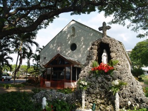
Saint Michael the Arch Angel Catholic Church, Kailua Kona Hawaii: Photo by Donnie MacGowan

Historic St. Michael’s Church was the first Catholic Church in West Hawai’i. The church offers services in English and Spanish throughout the week, but is primarily of historic interest; the burial plots in the cemetery date from 1855. In 1940, during less “ecologically aware” times, resident priest Father Benno Evers had his parishioners gather 2500 coral heads to build the grotto in front of the church, which covers the church’s original well. The seafloor in Kailua Bay has yet to recover from this pillaging of coral heads.

Coconut Grove and Waterfront Row cap the southern end of the Kailua Village shopping district along Ali’i Drive, starting next to the Hale Halawai County Park and ending at the Royal Kona Resort. Newer and more metropolitan that its sister shopping district to the north, Coconut Grove and Waterfront Row have almost everything, from tattoos to souvenirs to Hawai’iana, fine art, musical instruments, sundries, groceries and clothing. The range of cuisines available from restaurants here sweeps from local flavor to Thai, the Hard Rock Cafe to poi crepes to pizza and burgers

Public Queensbath Tidepool: Photo by Donald B. MacGowan

Between the Royal Kona Resort and Hale Kona Kai Resort is a fabulous tide pool that is completely protected from all but the most vicious winter surf. It boasts a moderate population of reef fish and even the occasional turtle! The water sometimes can be a bit murky, but it makes a nice place to take small children or beginning snorkelers. Drive into the entrance for the Royal Kona Resort and continue south past it until you see the blue and white Shoreline Access sign; find a place to park, go down the stairs to the tiny beach and enjoy!

Honl's Beach in Kailua Kona: Photo by Donald B. MacGowan

Lovely but compact, Honl’s County Beach Park is a small beach on the southern outskirts of Old Kailua Town. A favorite spot for surfers and boogie boarders it also has very nice snorkeling and is an excellent place to view the sunset and picnic. Remember when going into the water here, there is a fairly strong current to the north, so stay in the shallow reef area close to the beach. Parking is located on both sides of Ali’i Dr., but can be tight here in times of good surf, and crossing Ali’i Dr. drive can be a bit dangerous at certain times of the day. A new bathroom with showers and running water has recently been constructed on the mauka—uphill--side of the road.

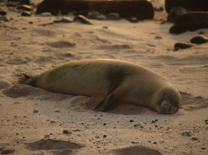
Monk Seal on Honl's Beach at Sunset: Photo by Donald B. MacGowan


For more information on traveling to Hawaii in general and touring the Big Island in particular, please also visit www.tourguidehawaii.com and www.lovingthebigisland.wordpress.com.

All media copyright 2009 by Donald B. MacGowan; all rights reserved.


Friday, May 1, 2009

Rising from Ruin: Hapaiali'i Heaiu in the Keauhou Historic District, Kona Hawaii

The recently restored Hapaiali'i Heiau (Temple for Elevating Chiefs), a heiau associated with ceremonies involving changes in rank of Ali'i, lies on the grounds of the Keauhou Ohana Beach Resort, across the narrow tidal inlet from Ke'eku Heiau. Until recently, the temple appeared to be noting more than a disorganized pile of rocks in a tangle of mangrove and keawe. Not much is known about this Heiau and oral traditions in the area are contradictory; some local stories hold that it predates Ke'eku Heiau; other family traditions maintain it was built around 1812 by Kamehameha the Great. During restoration, carbon dating of material recovered indicated that the Heaiu may have been erected, or substantially rebuilt, between 1411 and 1465. According to cultural kahuna overseeing the reconstruction it took thousands of commoners about 10 years to build the original temple.

The Ruins of Hapaiali'i Heaiu in Spring 2006, Before Reconstruction; Photo by Donnie MacGowan

The temple was reconstructed by using survey maps made of the area in 1906 and 1952 and currently measures 100 feet by 150 feet. Completely surrounded by the sea at high tide and constructed entirely by dry-stack masonry, this reconstruction reminds us of the engineering sophistication of the Hawai'ians and the grandeur and beauty of the temples they erected.

Hapaiali'i Heiau During Reconstruction; note Ke'eku Heiau in Background: Photo by Donnie MacGowan

During the restoration project, funded by Kamehameha Schools, it was discovered that Hapaiali'i Heiau also served as a solar calendar. On the winter solstice, from a vantage point directly behind the temples center stone, the sun sets directly off the southwest corner of the heiau; at the vernal equinox, the sun sets directly along the centerline of the temple and at summer solstice, it sets off the northwest corner. If you are visiting Hawaii during any of these seasons it is worth the trip to Hapaiali'i Heiau to see how well this ancient astronomical observatory still serves its function. More information about the Keauhou Historic District can be found by visiting the Keauhou Kahalu'u Heritage Center at the Keauhou Shopping Center, open daily from 10 a.m. to 5 p.m.

Vog Tinged Sunset around Winter Solstice at the Reconstructed Hapaiali'i Heiau: Photo by Donald B. MacGowan

From Kahalu'u Beach, walk onto the Keauhou Ohana Beach Resort property through the gateway in the fence between them and follow the asphalt path to the pool deck, through the lobby of the resort and join the paved path that runs along the end of the Resort driveway. From the Resort parking lot, walk up the drive to the paved path that runs along the end of the driveway. Following along this path, one passes Punawai Spring first, then, where the path runs around the end of the tennis courts the homesite of the Mo'o Twins. Continuing on the path until it ends at a large tidal pool, the Hapaiali'i Heiau is immediately between you and the ocean. Across the tidal pool is the equally fascinating Ke'eku Heiau and the nearly deserted Makole'a black sand beach. Take a moment to stroll south and seaward over the tidal flats from Ke'eku Heiau and search out the large and fascinating petroglyph field at low tide (more information here). Remember that these are holy religious sites to modern native Hawai'ians; to not trespass, walk or climb on the temple proper; take nothing but photographs, leave nothing but footprints.
[youtube=http://www.youtube.com/watch?v=bcqFeWHHuyU]

For more information on traveling to Hawaii in general, and exploring the ancient temples of the Big Island in particular, please also visit www.tourguidehawaii.com and www.tourguidehawaii.blogspot.com.

Video written and produced by Donald B. MacGowan; all media copyright 2009 by Donald B. MacGowan, all rights reserved.

Wednesday, April 29, 2009

Kuamo'o Battlefield: Heartbreak of the Gods

Melancholy, lonely, desolate; this bench cut into the fresh scar of an a’a flow marks the place where the Hawai’ian gods died at the battle of Kuamo’o. Contact with Europeans, especially the whaling and trade fleets, had introduced the Christian religion to Hawai'ians.

Burial Mounds at Kuamo'o Battlefield: Photo by Donald B. MacGowan

Since the Europeans possessed many things; iron, tools, firearms, and much practical and scientific knowledge which the Hawai'ians had never even dreamed of, the ruling class of Hawai'ians considered the European god to be much stronger than their own gods, and began converting to Christianity in the early 19th Century. In 1819, the year before the Christian missionaries arrived in Hawai’i, forces loyal to Kamehameha II (Liholiho), his mother Kepiolani and the dowager Queen Ka’ahumanu began a social movement to overturn the kapu system and the pagan Hawai’ian religion in favor of Christianity.

Many Hawai'ians were unhappy with the abandonment of the old customs, laws and the old gods. Among the priestly class of Kahuna, Kuaiwa and Holoialena were particularly outraged and traveled the countryside haranguing and inciting the Hawaiians to rebellion against the young King Kamehameha II. The son of Kamehameha I's younger brother, the Ali'i Kekuaokalani (Liholiho's cousin), led the rebellious warriors and fought a desperate battle here at Kuamo'o to preserve their ancient way of life and to honor their ancient gods. Although both sides used Western weaponry, Kekuaokalani and his forces lost decisively. Both Kekuaokalani and his wife Manono, who fought beside him, died here. Their graves, along with the graves of warriors numbering in the several hundreds, lie under the numerous, large stone altars erected by the victors over the very spots the warriors fell, here at Lekeleke Graveyard.

Kuamo'o Battlefield and Lekeleke Graveyard: Photo by Donnie MacGowan

Those rebels willing to accept the new god and pledge allegiance to the young King Liholiho were pardoned, but resistance among many lingered. Kamehameha II despatched Hoapili to Waimea to battle the last rebels and his victory over them effectively ended all opposition to the overthrow of the gods. Little did the Hawai'ian people realize that this was not just another of the interminable internecine wars between rival Ali'i, but in fact marked the beginning of the end of Hawai'ian culture as they had known it.

Kayakers Explore Caves and Arches Offshore from Kuamo'o Battlefield: Photo by Donnie MacGowan

A walk along the dirt road that bisects Kuamo'o Battlefield is ineffably sad and a little creepy. However, the road soon climbs into dryland forest along the lava ocean cliffs and provides some memorable hiking and mountain biking. The shoreline at Kuamo'o is a great place for whale watching, a picnic in the rough, watching waves batter the headland and sunset views. The little bay here is a great fishing spot and kayak destination...numerous small caves and arches, inconspicuous from shore, call out for the kayaker to explore. Kuamo’o Battlefield is located at the very end of Ali’i Drive at an area know by locals, somewhat appropriately, as "The End of the World". There are no facilities.

Kayakers Explore Caves and Arches Offshore from Kuamo'o Battlefield: Photo by Donnie MacGowan
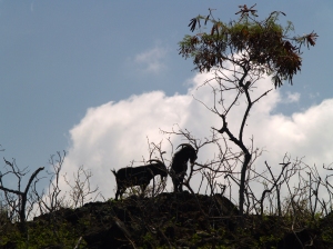
Feral Goats are a Common Sight at Kuamo'o Battlefield: Photo by Donald B. MacGowan

A video about Kuamo'o Battlefield is available here.

For more information on traveling to Hawaii in general and touring the Big Island in particular, please also visit www.tourguidehawaii.com and www.lovingthebigisland.wordpress.com.

All media copyright 2009 by Donald B. MacGowan, all rights reserved.

Thursday, April 9, 2009

Ku'emanu Heiau, Keauhou Historic District: Ancient temple to the Surfing Gods, Big Island HI


Located just south of mile marker 4.5 on Ali'i Drive, adjacent to Kahalu'u Beach Park, stands perhaps the only ancient temple in the world dedicated solely to the sport of surfing. This heiau is part of the greater Keauhou Historic Area of heiau and temple precincts. Ku'emanu was a luakini heiau (a temple where human sacrifice was practiced) and on the north side of the site is a laupa'u, or bone pit where the remains of the sacrificed were discarded. After surfing, Ali'i washed themselves of saltwater in a nearby brackish pool called Waiku'i (pounding waters); the pond has become brackish and stagnant in recent times. This is a particularly striking place to photograph the sun or moonset, through the legs of the upraised anu'u platform.

Parking can be tight during times of good surf, and Ali'i Drive can be hazardous to cross.

This place is still sacred to native Hawai'ians so remember to be especially respectful of this unique site. Do not disturb, nor take as souvenirs, offerings left upon the anu'u platform. Remember: take nothing but photographs, leave nothing but footprints.

For more information on exploring the Big Island of Hawaii in general, and ancient temples, beaches and surfing there in particular, visit: www.tourguidehawaii.com
and www.lovingthebigisland.wordpress.com.

Produced by Donnie MacGowan; written, directed and filmed by Donald MacGowan; original musical score by Donald B. MacGowan. All media copyright 2008 by Donald B. MacGowan; all rights reserved.

Saturday, March 28, 2009

Rival Kings, Epic Battles and Ghostly Dogs, Kona, Hawaii


Written and produced by Donnie MacGowan; original musical score and videography by Donald B. MacGowan.

Helani Church/'Ohi'a-Mukumuku Heiau

Those vine covered ruins across the street from St. Peter's are the remains of Helani Church, built by the Rev. John D. Paris in 1861 of basalt block and lime mortar. When the local population moved inland about the turn of the century, a new Helani Church was established mauka (uphill) near the Mamalohoa Highway.

The church, however, was erected on a the grounds of the 'Ohi'a-Mukumuku Heiau; a powerful and holy religious temple around which swirls some of the darkest folklore and ghosts stories told around the Hawai'ian Islands. When you hear ghost stories about a white dog and a black dog, they are about the happenings on the grounds of the 'Ohi'a-Mukumuku and Ke'eku Heiaus, during the time when the Ali'i of Hawai'i, Lonoikamakakahiki, was battling for supremacy with the Ali'i of the Maui, Kamalalawalu, in the 16th century.

Beneath the ruins of Helani Church lie the ruins of 'Ohi'a-Mukumuku Heiau, a place of dark legend and lore. Held in Hawai'ian folktales to have been built by the gods, 'Ohi'a-Mukumuku Heiau was re-dedicated to the war god, Kuka'ilimoku, by the Hawai'i Ali'i Lonoikamakakahiki, so that he might vanquish his foe, the Ali'i of the Maui, Kamalalawalu, during their 16th century battles. It is said of these battles that when the Maui attacked the Hawai'i, the numbers of warriors was so vast that just as the first of the Maui war canoes were landing on Hawai'i, the last of their canoes were still leaving Maui.

Lonoikamakakahiki had a particular disagreement with Kamalalawalu when the invading Maui captured his leading general, had his eyes gouged out and ran spears through the eye sockets. Lonoikamakakahiki vowed a bloody revenge.

When Lonoikamakakahiki vanquished the Chief of the Maui, he took Kamalalawalu over to the nearby Ke'eku Heiau and sacrificed him alive to celebrate his great victory. The method of sacrifice was slow and graphic. Kamalalawalu was staked to the ground for several days, then taken to a nearby flat rock and butchered. The body was then towed to sea and fed to the sharks (some versions of the folktale have Kamalalawalu impaled on a pole for several days before being butchered on the flat rock).

Hawai'ian folktales hold that Kamalalawalu brought with him into battle two large, fierce war dogs, a white one (Kapapako) and a black one (Kauakahiok'oka). The dogs are said to have lain down and died on the spot of Kamalalawalu's execution. Although buried beneath the heiau luakini platform, it is said that these dogs can still be seen roaming, and heard howling, in the night searching the underworld for their fallen master. Two stone features found on the makai side of Ke'eku Heiau stone platform represent the two dogs.

Petroglyphs along the rocks, visible at low tide between Kahalu'u Beach Park and Keauhou O'hana Beach Resort, commemorate the sacrifice of Kamalalawalu by Lonoikamakakahiki.

For more information visit www.tourguidehawaii.com and www.lovingthebigisland.wordpress.com.

Tuesday, April 22, 2008

Kuamo'o: Where the Hawai'ian Gods Died on the Kona Coast of the Big Island, Hawaii

Kuamo'o Battle Field and Lekeleke Burial Ground

Melancholy, lonely, desolate; this beach cut into the fresh scar of an a'a flow marks the place where the Hawai'ian gods died at the battle of Kuamo'o. In 1819, the year before the Christian missionaries arrived in Hawai'i, forces loyal to Kamehameha II and Queen Ka'ahumanu fought to overturn the kapu system and the pagan Hawai'ian religion in favor of Christianity. Kahuna Kekuaokalani led the last supporters of the old ways and the old gods and fought a desperate battle here to preserve their ancient way of life, and lost. Their graves, numbering in the several hundreds despite the official-looking marker at the site, are under the numerous, large stone altars erected by the victors over the very spots the warriors fell.

A walk along the dirt road that bisects the battlefield is ineffably sad and a little creepy. However, the road soon climbs into dryland forest along the lava ocean cliffs and provides some memorable hiking and sunset views.

Kuamo'o Battlefield is located at the very end of Ali'i Drive, somewhat appropriately. No facilities.

For more information on exploring the Big Island of Hawaii in general, and the ancient villages and temples of Kona in particular, visit: www.tourguidehawaii.com
and www.lovingthebigisland.wordpress.com.

Produced by Donnie MacGowan.

Wednesday, February 27, 2008

Koloko-Honokahau National Historic Park, Big Island, Hawaii


A thriving Hawai'ian community out here in the middle of the desert? At Honokohau, ancient Hawai'ians took advantage of abundant freshwater springs to site a large community centered around fishing, fishponds and taro fields. The National Historic Park preserves a vast complex of important archeological sites, including heiaus, fishponds, a fishtrap, house sites, burials, a holua (sledding track), a Queen's Bath and abundant petroglyphs. An information center and bookshop is located between the two access roads off the highway and the best place to start any exploration of the National Park. As a beach, Ai'iopio Beach is one of Kona s finest, most protected and fun places to swim. Abundant shade along a long wide beach and a protected reach make this is perfect to take children though the water is a little murky for ideal snorkeling.

Located along the scenic Kona coast, Koloko-Honokohau National Park has wonderfully secluded and remote beaches, great hiking, offers opportunities for dolphin and
whale watching, wild-life viewing and cultural and historical immersion.

For more information, visit www.tourguidehawaii.com.
 

Casino Bonus no Deposit