Showing posts with label photography. Show all posts

Wednesday, September 16, 2009

New at iTunes: Hawaii Dream Vacation iPhone/iPod Touch App Puts the Magic of Hawaii in the Palm of Your Hand

Tour Guide Hawaii is excited and proud to announce the launch of their incredible, affordable, fabulous new Hawaii Travel iPhone/iPod Touch App

Tour Guide Hawaii's Brand New iPhone/iPod Touch App Puts Paradise in the Palm of Your Hand!

Navigate to all the most popular visitor destinations, the most interesting attractions, the most romantic and secluded beaches; effortlessly find hikes, snorkel spots, historical and cultural landmarks, shopping and dining. And of course, our new App includes directions to, and rating of, all the public restrooms! Learn all about it, here. In addition to real GPS navigation, this app also allows you to navigate using Google Maps or, if no internet or phone service available, with on-board maps and driving directions! Our App is crammed full of entertaining and informative video presentations about how and where to snorkel, the best trails and beaches, what to pack to bring to Hawaii, cultural orientation and language tips!

Using the Tour Guide Hawaii iPhone/iPod Touch App will save you time, save you money and allow you to see and do more with your Hawaii vacation; this quick video tells you how.

Interested in seeing what kind of information our App contains? In celebration of the release of our new App, we proudly present this list of blogs and web articles on Hawaii Travel, with URLs, of the unique and comprehensive Tour Guide Hawaii content. Enjoy this free information at your leisure, and order your App from iTunes, today!

Tour Guide Hawaii proudly presents the best, the most interesting, the most comprehensive material on Hawaii travel ever gathered in one place!

Best About Planning Your Hawaii Trip

What To Pack And Take To Hawaii: What You Need, What You Want, What You Can Leave Out Of Your Luggage: http://lovingthebigisland.wordpress.com/2009/07/13/what-to-pack-and-take-to-hawaii-what-you-need-what-you-want-what-you-can-leave-out-of-your-luggage/

Getting To Hawaii, Getting Around Hawaii, Getting the Most From Hawaii: http://lovingthebigisland.wordpress.com/2009/06/04/getting-to-and-getting-around-the-big-island-of-hawaii/

Frank's Guide to Pronouncing Hawaiian Words: http://lovingthebigisland.wordpress.com/2009/07/01/franks-guide-to-pronouncing-the-hawaiian-langauge/

Best Beaches on Hawaii

A Quick Guide to The Best Beaches of Hawaii Island: Sun, Surf, Solitude: http://lovingthebigisland.wordpress.com/2009/06/25/the-top-beaches-of-hawaii-island/

The Best Beaches in Hawaii: Part 1, The Main Kohala Coast: http://lovingthebigisland.wordpress.com/2009/08/03/the-best-beaches-in-hawaii-part-1-the-main-kohala-coast/

The Best Beaches in Hawaii: Part 2, The Kona and South Kohala Coasts: http://lovingthebigisland.wordpress.com/2009/08/05/the-best-beaches-in-hawaii-part-2-the-kona-and-south-kohala-coasts/

Best Beaches in Hawaii: Part 3, Unusual, Uncrowded and Untamed Beaches of South Hawaii: http://lovingthebigisland.wordpress.com/2009/08/07/best-beaches-in-hawaii-part-3-unusual-uncrowded-and-untamed-beaches-of-south-hawaii/

Best Beaches in Hawaii: Part 4, Wilderness Beaches of the Big Island: http://lovingthebigisland.wordpress.com/2009/08/09/best-beaches-in-hawaii-part-4-wilderness-beaches-of-the-big-island/

Best Beaches in Hawaii Part 5--Best Beaches for Snorkeling: http://lovingthebigisland.wordpress.com/2009/08/11/best-beaches-in-hawaii-part-5-best-beaches-for-snorkeling/

Best Scenic Drives on Hawaii

My Favorite Scenic Drive: Hawaii's Wild and Scenic Saddle Road!: http://lovingthebigisland.wordpress.com/2009/09/02/my-favorite-scenic-drive-hawaiis-wild-and-scenic-saddle-road/

Big Island Whirlwind Road Trip: I have to see the whole Big Island all in one day!http://lovingthebigisland.wordpress.com/2009/09/15/big-island-whirlwind-road-trip-i-have-to-see-the-whole-big-island-all-in-one-day/

Kona Heritage Corridor Scenic Drive: An Exceptional Day Trip Exploration of Historical, Lovely, Up-Country Kona!:http://lovingthebigisland.wordpress.com/2009/06/14/kona-heritage-corridor-scenic-drive-an-exceptional-day-trip-exploration-of-historical-lovely-up-country-kona/

Best Scenic Drives on Hawaii #1: The Saddle Road...Kona to the Summit of Mauna Kea, Kaumana Cave and Hilo:http://lovingthebigisland.wordpress.com/2009/08/17/best-scenic-drives-on-hawaii-1-the-saddle-road-kona-to-the-summit-of-mauna-kea-kaumana-cave-and-hilo/

Best Scenic Drives on Hawaii #2: North Kona and Kohala, Ancient History, Sumptuous Beaches: http://lovingthebigisland.wordpress.com/2009/08/21/best-scenic-drives-on-hawaii-2-north-kona-and-kohala-ancient-history-sumptuous-beaches/

Best Scenic Drives on Hawaii #3: Kona to Hamakua and Hilo: http://lovingthebigisland.wordpress.com/2009/08/23/best-scenic-drives-on-hawaii-3-kona-to-hamakua-and-hilo/

Best Scenic Drives in Hawaii #4: Kona Coast to South Point and Ka'u http://lovingthebigisland.wordpress.com/2009/08/26/best-scenic-drives-in-hawaii-4-kona-coast-to-south-point-and-kau/

Best Scenic Drives in Hawaii #5: Kailua Kona to Hawaii Volcanoes National Park, Puna and Lava Viewing: http://lovingthebigisland.wordpress.com/2009/08/30/best-scenic-drives-in-hawaii-5-kailua-kona-to-hawaii-volcanoes-national-park-puna-and-lava-viewing/

What Do I Do on the Big Island? Explore Hawaii's Incomparable, Fantastic and Wild South Coast!: http://lovingthebigisland.wordpress.com/2008/12/20/what-do-i-do-on-the-big-island-explore-hawaiis-incomparable-fantastic-and-wild-south-coast/

Road Trip Through Keauhou Historic District, Big Island, Hawaii: http://lovingthebigisland.wordpress.com/2008/07/10/wwwtourguidehawaicom-presents-a-road-trip-through-keauhou-historic-district-big-island-hawaii/

Best About Hiking:

The Best Short Hikes on Hawaii Island: http://lovingthebigisland.wordpress.com/2009/06/29/the-best-short-hikes-on-hawaii-island/

The Adventure and Romance of Hiking To Kilauea Volcano's Active Lava Flows: http://lovingthebigisland.wordpress.com/2008/07/20/tour-guide-hawaii-presents-the-adventure-and-romance-of-hiking-to-kilauea-volcanos-active-lava-flows/

Historic Kailua Kona Town on the Big Island of Hawaii: A Walking Tour: http://lovingthebigisland.wordpress.com/2009/05/03/historic-kailua-kona-town-on-the-big-island-of-hawaii-a-walking-tour/

Hiking and Camping at Hawaii's Last Wilderness Beach: La'amaomao the Wind God and Makalawena Beach: Advice: http://lovingthebigisland.wordpress.com/2009/02/21/hiking-and-camping-at-hawaiis-last-wilderness-beach-laamaomao-the-wind-god-and-makalawena-beach/

Driving and Hiking to the Summit of Mauna Kea, Big Island of Hawaii: http://lovingthebigisland.wordpress.com/2009/07/26/advice-driving-and-hiking-to-the-summit-of-mauna-kea-big-island-of-hawaii/

Hidden Secrets of Hawaii: The Golden Ponds of Ke-awa-iki: http://lovingthebigisland.wordpress.com/2009/04/21/hidden-secrets-of-hawaii-the-golden-ponds-of-ke-awa-iki/

Hiking at Kilauea Volcano on the Big Island of Hawaii: http://lovingthebigisland.wordpress.com/2009/01/07/hiking-at-kilauea-volcano-on-the-big-island-of-hawaii/

Best About Snorkeling

The Best Snorkeling Spots on Hawaii Island: http://lovingthebigisland.wordpress.com/2009/06/27/the-best-snorkeling-spots-on-hawaii-island/

Hawaii Island Snorkeling Tips, Part I: Gear: http://lovingthebigisland.wordpress.com/2009/05/16/hawaii-island-snorkeling-tips-part-i-gear-2/

Hawaii Island Snorkeling Tips, Part II: Technique : http://lovingthebigisland.wordpress.com/2009/05/18/hawaii-island-snorkeling-tips-part-ii-technique-2/

Hawaii Island Snorkeling Tips, Part III: Protecting the Reef and Reef Animals: http://lovingthebigisland.wordpress.com/2009/05/20/hawaii-island-snorkeling-tips-part-iii-reef-etiquette-2/

Hawaii Island Snorkeling Tips, Part IV: Snorkeling Safety: http://lovingthebigisland.wordpress.com/2009/05/26/hawaii-island-snorkeling-tips-part-iv-snorkeling-safety-2/

Hawaii Island Snorkeling Tips, Part V: Best Snorkeling Beaches of the Big Island: http://lovingthebigisland.wordpress.com/2009/05/28/hawaii-island-snorkeling-tips-part-v-best-snorkeling-beaches-of-the-big-island-2/

Hawaii Island Snorkeling Tips Part VI: Wilderness Beaches of the Big Island!: http://lovingthebigisland.wordpress.com/2009/05/30/hawaii-island-snorkeling-tips-part-vi-wilderness-beaches-of-the-big-islanda/

Frank's Big Island Travel Hints

Frank's Big Island Travel Hints #1: North Kona and Kohala, Ancient History, Sumptuous Beaches: http://lovingthebigisland.wordpress.com/2009/02/28/kona-day-trips-1-north-kona-and-kohala-ancient-history-sumptuous-beaches/

Frank's Big Island Travel Hints #2: Kona to Hamakua and Hilo: http://lovingthebigisland.wordpress.com/2009/03/02/big-island-day-trips-2-kona-to-hamakua-and-hilo/

Frank's Big Island Travel Hints # 3: Kona Coast to South Point and Ka'u: http://lovingthebigisland.wordpress.com/2009/03/04/big-island-day-trips-3-kona-coast-to-south-point-and-kau/

Frank's Big Island Travel Hints #4: Kailua Kona to Hawaii Volcanoes National Park, Puna and Lava Viewing: http://lovingthebigisland.wordpress.com/2009/03/06/big-island-day-trips-4-kailua-kona-to-hawaii-volcanoes-national-park-puna-and-lava-viewing/

Frank's Big Island Travel Hints #5: A Trip From Kona Across the Top of Hawaii; Mauna Kea Summit, Kaumana Cave and Hilo via the Saddle Road: http://lovingthebigisland.wordpress.com/2009/03/08/big-island-day-trips-5-a-trip-from-kona-across-the-top-of-hawaii-mauna-kea-summit-kaumana-cave-and-hilo-via-the-saddle-road/

Frank's Big Island Travel Hints #6: Waimea and the Hamakua Coast: http://lovingthebigisland.wordpress.com/2009/03/13/franks-big-island-travel-hints-6-waimea-and-the-hamakua-coast-3/

Frank's Big Island Travel Hints # 7: Around Hilo: http://lovingthebigisland.wordpress.com/2009/03/26/franks-big-island-travel-hints-7-around-hilo-3/

Frank's Big Island Travel Hints #8: Mysterious Puna!: http://lovingthebigisland.wordpress.com/2009/04/03/franks-travel-hints-8-mysterious-puna-3/

Frank's Big Island Travel Hints #9: Made for Adventure: The Jungles, Volcanoes, Hot Springs and Tidepools of Puna!: http://lovingthebigisland.wordpress.com/2008/10/26/franks-hawaii-travel-tips-9-made-for-adventure-the-jungles-volcanoes-hot-springs-and-tidepools-of-puna-2/

Frank's Big Island Travel Hints #10: Hawaii Volcanoes National Park: http://lovingthebigisland.wordpress.com/2009/04/19/franks-travel-tips-10-hawaii-volcanoes-national-park/

Frank's Travel Hints # 11: Exploring Deeper Into Hawaii Volcanoes National Park, Big Island, Hawaii: http://lovingthebigisland.wordpress.com/2009/04/27/franks-travel-hints-11-exploring-deeper-into-hawaii-vocanoes-national-park-big-island-hawaii-2/

Frank's Big Island Travel Hints #12: More fun in Hawaii Volcanoes National Park, Big Island, Hawaii: http://lovingthebigisland.wordpress.com/2009/06/12/franks-big-island-travel-hints-12-more-fun-in-hawaii-volcanoes-national-park-big-island-hawaii-3/

Frank's Big Island Travel Hints #13: Hawaii Volcanoes National Park: Chain of Craters Road: http://lovingthebigisland.wordpress.com/2009/06/16/franks-big-island-travel-hints-13-4/

Best Interesting Stories and General Reading about Hawaii

The Beautiful, Enigmatic and Cryptic Petroglyphs of Hawaii Island: http://lovingthebigisland.wordpress.com/2009/04/23/the-beautiful-enigmatic-and-cryptic-petroglyphs-of-hawaii-island/

Hawaii's Amazing Lava Fossils: http://lovingthebigisland.wordpress.com/2009/08/24/hawaiis-amazing-lava-fossils/

The Sugar Industry in Hawaii: Kona Sugar Company and West Hawai’i Railway Company: http://lovingthebigisland.wordpress.com/2009/04/25/the-sugar-industry-in-hawaii-kona-sugar-company-and-west-hawai%E2%80%99i-railway-company/

Captain Cook's Legacy: Exploring the History and Waters of Kealakekua Bay: http://lovingthebigisland.wordpress.com/2009/04/07/949/

Kilauea's Eruption Just Keeps Getting More Fantastic!: http://lovingthebigisland.wordpress.com/2008/07/31/wwwtourguidehawaiicom-presents-new-video-of-kilauea-volcano-erupting/

Kalapana, Hawaii: From the Fires of Hades to the Eden of Rebirth: http://lovingthebigisland.wordpress.com/2009/01/17/kalapana-hawaii-from-the-fires-of-hades-to-the-eden-of-rebirth/

Pu'u Loa Petroglyph Field, Hawaii Volcanoes National Park: http://lovingthebigisland.wordpress.com/2009/03/17/823/

Hawaiian Green Sea Turtles: Honu of the Big Island: http://lovingthebigisland.wordpress.com/2009/01/09/hawaiian-green-sea-turtles-honu-of-the-big-island-2/

A Brief History of Ranching in Hawaii: http://lovingthebigisland.wordpress.com/2009/05/24/rodeo-to-rock-and-roll-a-brief-history-of-ranching-in-hawaii/

Rising From The Past: The Rebirth of Hapaiali'i Heiau, a Hawaiian Temple for Honoring Royalty: http://lovingthebigisland.wordpress.com/2009/05/01/1118/

The Hawaiian Snow Goddess Poliahu and the Summit of Mauna Kea...: http://lovingthebigisland.wordpress.com/2009/02/05/the-hawaiian-snow-goddess-poliahu-and-the-summit-of-mauna-kea/

Mo'okini Heiau: Warrior Kings and Human Sacrifice on Hawai'i: http://lovingthebigisland.wordpress.com/2009/01/03/mookini-heiau-warrior-kings-and-human-sacrifice-on-hawaii-2/

The Call of Aloha...:http://lovingthebigisland.wordpress.com/2009/08/13/the-call-of-aloha/

Why I love Hawaii...: http://lovingthebigisland.wordpress.com/2009/01/13/why-i-love-hawaii/

Conjuring Visions of Paradise: http://lovingthebigisland.wordpress.com/2009/02/19/conjuring-visions-of-paradise/

Volcano Art Center—A Kipuka of Creativity on the Rim of Madam Pele's Home: http://lovingthebigisland.wordpress.com/2009/06/01/volcano-art-center-hawaii-volcanoes-national-park/

Jagger Museum, Hawaii Volcanoes National Park: http://lovingthebigisland.wordpress.com/2009/04/01/jagger-museum-hawaii-volcanoes-national-rark/

Monday, August 17, 2009

Best Scenic Drives on Hawaii #1: The Saddle Road...Kona to the Summit of Mauna Kea, Kaumana Cave and Hilo

Across the Roof of Hawaii

by Donnie MacGowan

Recent improvements to the Saddle Road make it no longer the grinding, intimidating drive it once was and open hundreds of square miles of unimaginably beautiful, strange and wondrous landscape to the Hawaii Island Visitor.

Approximate minimum time start to finish (to see every site): 12 hours

From Kona take Highway 190 to Highway 200 in 45 minutes of driving. Saddle Road, which cuts between the "saddle" of Mauna Loa on the south and Mauna Kea to the north, passes through ranch lands and the Pohakuloa Military Training Facility, for another 45 minutes, to the turn for Mauna Kea Access Road (John Burns Way). Nearby, Kipuka Huluhulu, or "shaggy hill", is a 20 minute hike to the top and back. From here it is a 30 minute drive to the Mauna Kea Visitor Information Center. The small village is home to scientists and astronomers that work in the observatories and an amazing place to learn what their research tells us about our universe. Returning to Hwy 200, drive 45 minutes to the amazing Kaumana Cave lava tube, a short hike and a wonderful exploration. A further 30 minutes down Hwy 200 brings one to downtown Hilo, where there are shops, restaurants, fine museums, gorgeous waterfront beach parks and a fabulous Farmers Market. From Hilo, it is approximately three hours to return to Kailua Kona over Hwy 200; alternately one can take the faster though less scenic Hwy 19 to Waimea and then Hwy 190 into Kailua Kona, about a 2 1/2 hour drive.

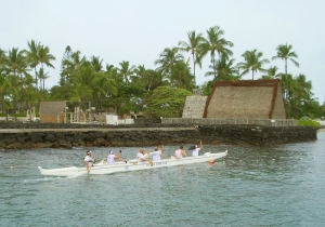
Ahu'ena Heiau, Kailua Kona Hawaii: Photo by Donnie MacGowan

Leg 1) In Kailua Kona, start at Ahu’ena Heiau; take Palani Road east to Hwy 190; take Hwy 190 to jct with Hwy 200, The Saddle Road

Ahu'ena Heiau and Kamakahonu Beach

Centuries ago the inhabitants of this region built a series of sacred temples, or heiau, which were originally used for the purpose of sacrificing human beings to their war god, Kuka’ilimoku. This particular archeological site is called Ahu’ena Heiau, which in Hawaiian means “Hill of Fire”.

Built originally in the 15th century and rededicated by Kamehameha the Great in the early 1800s as the main temple of his capital, the current structures seen at Ahu’ena Heiau were re-built in 1975 under the auspices of the Bishop Museum with financial help from the Hotel King Kamehameha and are constructed to 1/3 the original scale. There are restrooms and showers located on the pier near the beach. Adjacent Old Kailua Town is a treasure of shops, restaurants and aloha.

Hualalai Volcano from Saddle Road, Big Island Hawaii: Photo by Donnie MacGowan

Leg 2) Take Hwy 200, The Saddle Road, east to jct with John Burns Way (also called Mauna Kea Access Road).

Looking West from Highway 190 to Haualai Volcano Halfway between Kona and Waimea, Big Island of Hawaii: Photo by Donald B. MacGowan
Looking West from Highway 190 to Hualalai Volcano Halfway between Kona and Waimea, Big Island of Hawaii: Photo by Donald B. MacGowan

Saddle Road

Crossing the spectacular saddle between the towering bulk of the volcanoes Mauna Kea and Mauna Loa at about 6600 feet, The Saddle Road runs through brush, grass and forest lands, over lava fields and through some of the wildest and most breath-taking scenery on the Island. From this roadway, four of the 5 principal volcanoes that form The Big Island may be seen: Hualalai, Kohala, Mauna Loa, and Mauna Kea. Because the western half of the road is in notoriously poor condition and consists, in reality, of only one operable lane for much of its descent from the saddle to the Mamalahoa Highway.

However, this road provides the only road access to the Mauna Kea Summit Area and Visitor Information Center, Mauna Kea State Park, Pohakuloa Training Area, Mauna Kea Astronomical Observatory Complex, Waiki'i Ranch and the Kilohana Girl Scout Camp. The Saddle Road also provides the only access to thousands of acres of public forest and open grass lands. Connecting Hilo from about milepost 7.8 on the Hawai’i Belt Road to the Mamalahoa Highway approximately 6 miles south of Waimea, the Saddle Road is widely used by island residents for cross-island travel, despite its somewhat poor condition and undeserved, evil reputation.

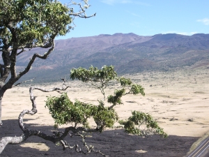
Mauna Kea From Mauna Kea State Park; Note V-Shaped Stream Valleys and Glacial Cirques: Photo by Donald B. MacGowan

The Saddle Road frequently has perfect weather, but also fairly routine are patches of intense rain, fog and high winds. It’s takes about 2 ½ to 3 hours straight driving time, depending upon weather, to make the full traverse from Kailua Kona to Hilo; however, one should be sure to leave time in the schedule to drive up to Mauna Kea Visitor Information Station or hike the Pu’u Huluhulu nature trails.

Along its entire 53 mile length between the turn-off from the highway just 6 miles west of Waimea and where it meets Hawaii Belt Road just north of Hilo, there is no gas and there are no services available; plan accordingly. Some food, water and restrooms may be available at the Mauna Kea Visitor Information Station which is a 30 minute drive up a side road off the Saddle Road about half way.

Kipuka Huluhulu from Saddle Road: Photo by Donald MacGowan

Leg 3) Off a Spur road at the jct of John Burns Way and Hwy 200, on the south side, is Kipuka Huluhulu ("Shaggy Hill") Nene Sanctuary.

Pu’u Huluhulu Nature Trails/Kipuka Aina Hou

Frequently described as simultaneously the most noticeable and the most overlooked landmark along the Saddle Road, Kipuka Pu'u Huluhulu rises more than 200 feet out of the surrounding lava flows. It’s name meaning “furry hill”, this forested cinder cone has multiple trails winding up through rare native koa trees to breathtaking 360° views of Hualalai, Mauna Kea and Mauna Loa at the top, where you can also wander a meadow of native Hawaiian plants recently reintroduced in this protected natural habitat. By whatever trail, the summit of Kipuka Huluhulu is only about 20 minutes walk from the car.

Owing to the encapsulated nature of the kipuka, bird watching here is particularly fabulous; the Ā'akepa, Nene and the Ā'akiapola Ā'au, as well as the Kalij pheasants, pueo, i’o and turkeys are among the rare, endangered or just plain beautiful birds you will see here. The numerous roads and trails through the hundreds of square miles of adjacent lava flows makes for interesting, if hot and dry, mountain biking and hiking.

Parking and a unisex pit toilet are the only amenities available at Kipuka Pu’u Huluhulu.

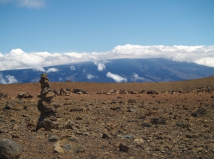
Mauna Kea From Kipuka Huluhulu Nene Sanctuary: Photo by Donald MacGowan
Looking South from Mauna Loa to Mauna Kea from Near Lake Wai'au: Photo by Donnie MacGowan

Leg 4) Go north on John Burns Way to Mauna Kea Visitor Information Station.


Mauna Kea Visitor Information Station

The Visitor Information Station is open daily from 8 a.m. to 5 p.m. During the day there are interactive computer exhibits about Mauna Kea, the observatories and astronomical research, plus there are video presentations and nature trails to hike. Many evenings after dark National Park personnel and astronomers put on public programs and discuss what the latest astronomical findings tell us about the nature of our universe. The souvenir shop has some food items, including hot chocolate, coffee and hot soup, for sale.

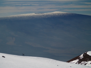
Hikers on Mauna Kea Summit Looking at Mauna Loa Summit: Photo by Donnie MacGowan

Leg 5) John Burns Way to Mauna Kea Summit

Mauna Kea Summit

Before you decide to go to the summit of Mauna Kea, stop, think, plan. Are you prepared for cold and high altitude? Do you understand the nature and dangers of altitude sickness and UV radiation? Are you experienced at traveling icy dirt roads? Is you car safe for the trip (many car rental agencies on the island forbid you to drive this road)? The Rangers at the Visitor's center can brief you on altitude sickness, UV radiation preparedness, the condition of the road and all other information you need to decide whether to visit the summit (see a video here).

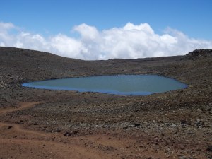
Lake Wai'au--the Seventh Highest Lake in the US--Whose Name Means "Swirling Water", Perches Near the Summit of Mauna Kea On The Big Island of Hawaii: Photo by Donnie MacGowan

The summit of Mauna Kea is truly an amazing place. Beautiful, awe-inspiring, 360 degree views of the entire Big Island, the summit is also culturally and religiously important to the native Hawai’ians and is home to several, world-class astronomical observatories and their support buildings. Because of the extremity of the altitude and the poor quality of the road above the Visitor's Center, it is advised that extreme caution be exercised in deciding to visit Mauna Kea's Summit. From the road's end very near the summit, a short, 10 minute trail leads up Pu'u Weiku cinder cone to the actual mountain top and a Hawaiian religious shrine. Also near the summit is the 1-mile hike to Lake Waiau, the 7th highest lake in the US, as well as numerous archeological sites. Moving at altitude is strenuous, so conserve energy. Do not over-tax yourself, be sure to drink plenty of fluids and protect yourself from the sun, wind and cold. Leave the summit area and return to the paved road long before you are tired.

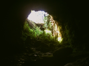
Kaumana Cave, Hilo Hawaii: Photo by Donnie MacGowan

Leg 6) Return John Burns Way to Hwy 200; take Hwy 200 east to Kaumana Caves

Kaumana Caves

A skylight opening to 25-mile long Kaumana Cave is located at the county park near the 4-mile marker on the Hilo side of the Saddle Road. Concrete stairs take you down through the rain forest jungle to the bottom of a collapse pit forming two entrances to the cave. Most people are drawn to the entrance on the right, a large, opening leading to cavernous rooms. In this entrance, graffiti from hundreds of years ago to the present is preserved, scratched into the rocks. The entrance on the left, however, is more interesting, leading through squeezes and low spots to numerous rooms with fascinating speleo-architecture and cave formations. Both caves go to true dark in fewer than 300 feet in either direction. There are more than 2 miles of easily accessible, wild cave to explore here, but if you intend more than just a cursory inspection near the entrances, bring a hard hat, water and at least 3 sources of light. A quick tour of the caves takes fewer than 20 minutes.

Kaumana Cave's Skylight Entrance: Photo by Donnie MacGowan

Parking for the caves is located across the highway from the park; extreme care should be taken when crossing he road. Public restrooms, water and picnic tables are available at the park. As you approach Hilo from Kaumana Caves, Hwy 200 becomes variously called Kaumana Drive, then Waianuenue Avenue.

Astronomical Observatories on the Summit of Mauna Kea, From Downtown Hilo: Photo by Donnie MacGowan

Leg 7) Take Hwy 200 into Hilo Town.

Hilo Town

Beautiful but wet, metropolitan but decrepit, bustling but laid back, Hilo is a lovely, maddening, heartbreaking, addictive study in contrasts. In can rain all day long for 50 days in a row, yet when the sun does shine, the views of Mauna Loa and Mauna Kea from the Liliuokalani Gardens, or of Hilo Bay as you drive down from the mountains, or the rain-forest and waterfall choked gulches with lovely beaches along the highway north of town, make Hilo one of the most truly, achingly-lovely spots on earth.

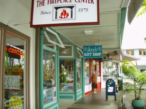
Hilo's Charming Bayfront Shops: Photo by Donald MacGowan

More laid back and sleepier than bustling Kailua Kona, Hilo is the largest town on the island, and the county seat. The Imiloa Astronomy Center of Hawaii, Tsunami Museum, Lyman House Missionary Museum and the Panaewa Rainforest Zoo are all wonderful places to learn about various aspects of Hawaii. There are numerous shopping districts, two large malls and the Historic Old Hilo downtown shops to browse through, a variety of sprawling green parks, a fabulous tropical arboretum right downtown and a mile-long black-sand beach fronting the bay to explore. Hilo's Farmer's Market is a "must see" for any visitor who is spending time on this side of the island.

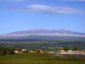
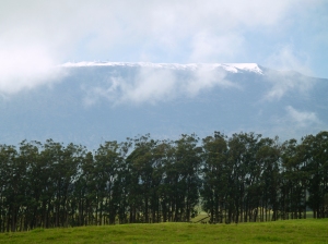
Mauna Kea's Summit  from Highway 19 Near Waimea Town: Photo by Donald MacGowan
Mauna Kea's Summit from Highway 19 Near Waimea Town: Photo by Donald MacGowan

Leg 8) Return Waianuenue Avenue to Kaumana Drive to Hwy 200; take Hwy 200 west to jct with Hwy 190; take Hwy 190 west to Kailua Kona.

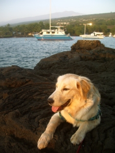
Trogdor at Keauhou Bay, Kona Hawaii: Photo by Donnie MacGowan

For more information on traveling to Hawaii in general and touring the Big Island in particular, please visit www.tourguidehawaii.com and www.lovingthebigisland.wordpress.com Information about the author is available here.

All media copyright 2009 by Donald B. MacGowan


Sunday, August 9, 2009

Best Beaches in Hawaii: Part 4, Wilderness Beaches of the Big Island

by Donnie MacGowan
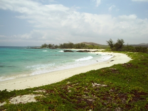
Waialea Beach in Kohala is the gateway to many small, secluded secret beaches on the Big Island...but why go any farther than this?  It's perfect! Photo by Donnie MacGowan
Waialea Beach in Kohala is the gateway to many small, secluded secret beaches on the Big Island...but why go any farther than this? It's perfect! Photo by Donnie MacGowan

Of all the Hawaiian Islands, because it is the youngest, the Big Island has the fewest and smallest beaches…this leads to crowding during the height of tourist season at some beaches. Because Hawaii is still rural, there are still some wilderness (hike-to-only) beaches; a few of them are among the best on the island.

Many wild beaches may be camped upon but you must apply for a permit from the appropriate land owner or agency. Overnight camping on Hawaii beaches in general is simplified because of the mild climate--preferring a more intimate camping experience that is facilitated by Hawaii's generally warm, calm weather, usually I just take a few quarts of water, a couple sandwiches, my camera, dry clothes for post-snorkeling comfort, a fleece blanket (a dry beach towel will suffice--generally there is no need for a sleeping bag) and rice mat to sleep on and a small tarp on the off-chance it rains. You may wish to bring a few extra quarts of water to rinse the salt off after bathing--many people find it difficult to sleep with salty skin.

The Trail to Makalawena Climbs Over the Final Sand Berm to the Beach: Photo by Donnie MacGowan

However, in truth, you are usually so close to the parking lot, and most trails are short and easy (exceptions: Green Sand Beach and Waipi'o), that you can bring just about anything you can carry in--just be sure to take back out everything you brought. On these delicate and beautiful beaches it is imperative to practice good backcountry skills and leave no trace. Fires are illegal on these beaches as is hacking down the few trees and bushes to make shelter; even if it wasn't illegal, it would be immoral in the extreme to wreak such havoc and destruction on the last of Polynesia's superb, wilderness beaches.

There are wild goats that inhabit the areas around backcountry beaches and use the local springs for watering. Usually they evince little curiosity about, or fear of, visiting humans. However, they are wild and they are big and they are ornery--you are best to keep your distance, do not harass or try to feed them. This includes your garbage management, as garbage will attract them, too. Mongooses can also be a problem, raiding your garbage and food supply. Like all desert animals, the goats and mongooses are hungry for salt and have been known to steal and eat sweaty hiking shoes, t-shirts and socks. Keep a clean campsite, keep your garbage tightly bagged and you should have no problem. Remember La'amaomao, God of the Winds…keep things tidy. Remember to treat all water by boiling, filtering or chemical disinfection: leptospirosis, giardia and liver flukes infect many bodies of fresh water here.

Two things to bear in mind—although is sometimes doesn’t seem it, Hawaii DOES have tides…camp well back of the beach area. Secondly, beach fires are not only illegal, they are hugely dangerous on most beaches on the west side.

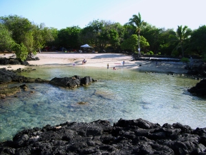
Golden Fresh Water Pond at Makalwena Beach: Photo by Donnie MacGowan
Golden Fresh Water Pond at Makalwena Beach. On Hawaii, All Fresh Water Sources Should Be Treated As Suspect...Giardia, Leptospirosis and Liver Flukes Infect Many Of The Springs, Creeks and Lakes: Photo by Donnie MacGowan

Some beaches require fees or permits to camp, others may not, but all are subject to change. Be sure to check with the Hawaii State Department of Land and Natural Resources as you plan your trip.

Pololu Valley Beach

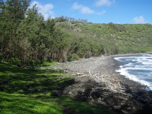
Looking Across the Black Sand Beach at Polulu Valley Towards Pololu Overlook At The End Of Highway 19: Photo by Donald B. MacGowan

Violent, lush, wild; the north end of Hawai’i Island is as varied and exciting as it is unexpected. At the end of Highway 19 are the Pololu Valley Overlook and the trail leading down to Pololu Beach. This is one of the most untamed, beautiful spots in the tropical Pacific and should not be missed. The trail down to the beach drops 400 feet in 20 minutes of hiking—be warned, the hike up is difficult for those not in good physical shape and the hike down should not be attempted if you have doubts about being able to hike back up.

The beach is not usually swimmable due to the violent surf and ocean currents, but makes a wonderful place to picnic and contemplate the awesome power and violence of nature.

For the adventurous, the hike down to Pololu Valley may not be enough—for them may we suggest further hiking in this lightly-traveled area. Pololu is the starting point for over 40 miles of interconnecting tails, as well as the Kohala Ditch. There are also trails to spectacular waterfalls at the back of Pololu. Valley. Trails in this area are steep, unmaintained, crumbling and frequently quite slick, so caution is advised, particularly on hillslopes and in the rain, when trails may turn into streambeds and hillsides into waterfalls.

The valley itself is private land, so stay close to the beach. The best place to cross the stream is usually about 80-120 feet inland and during either slack or high tide; spend a few minutes to find the stone ford for an easier crossing.

Bring good insect repellent and wear hiking boots, with tabis in your pack for stream fording and beach walking. Stream water in the valleys is infected with leptospirosis bacteria, so ring plenty of water (at least two liters per person) in your pack. A camera is a must.

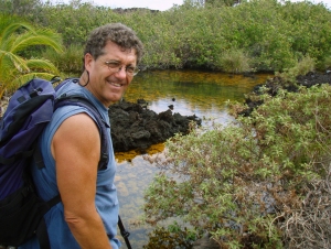
Donnie MacGowan At The Golden Ponds Near Ke-awa-iki Beach: Photo by Bart Hunt

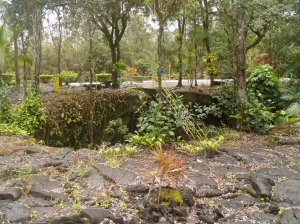
Ke-awa-iki Beach (park off Highway 19 just north of Mile 79; walk along gravel road towards the ocean to a fence and foot trail; about 15 minutes to beach): A little walking over a lava road and a’a rewards you with a beautiful beach many locals don’t know about. This tiny black-sand beach has good snorkeling on the south side, where there is still a pocket of white sand. This unique black and white sand beach was created after the 1859 eruption of Mauna Loa, when lava reached the north end of the beach, where the black sand is today. Further south along the beach, the recent black sand has not had time to thoroughly mix with the pre-existing white sand.

If one continues south there are numerous tide pools to explore.

Hiking north, one comes to Pueo Bay, where freshwater springs make the snorkeling interesting but weird, with large temperature and salinity gradients. If one takes the trail heading inland towards a conspicuous growth of hala trees, one comes to a pair of lovely golden pools. A golden algae gives these pools their distinctive color, but be sure not to damage the growth by walking on it. Finish the trek by hiking back across the a’a…approximately 4 miles, round trip.

Photo by Donald MacGowan
Makalawena Beach on the Big Island is the epitome of Hawaiian white sand beaches...and it's always uncrowded: Photo by Donald MacGowan

Makalawena Beach (turn off Highway 19 south of Mile 90 at Kekahakai State Park; at the end of the road, take obvious trail north over lava field; the trail traverses rough lava and keawe breaks, so shoes are required): Makalawena is the finest swimming and snorkeling beach on the island and the most beautiful beach setting. This beach sports a series of coves, refreshing shade, big sand dunes and a nice freshwater pond to rinse-off in. A great backpacking getaway, a one-way through hike along the Ala Ali'i trail from Kekahakai State Park, past Makalawena to Kual Bay is a fabulous trip. Do not forget your camera; this hike will be a major highlight of your trip to the Big Island.

The land fronting the beach is owned by Bishop Estate and is slated to be turned into a development of condos and resorts; vigilance and protest on the part of locals and visitors is the only way we can keep this last, wild Kona beach wild.

Looking Back Toward The Beach at Pawai Bay: Photo by Donnie MacGowan

Pawai Bay (in Kailua Kona, drive to the end of the Old Airport County Beach Park; hike along the ocean to the first, obvious, sandy bay): Spectacular, secluded, secret; Pawai Bay is perhaps the most interesting snorkeling spot on the island. Walk along the sea cliffs and coves about 15-20 minutes north, to the Queen Liliuokalani Children’s Camp at Pawai Bay. Remember, non-Hawaiians are restricted to travel along the tidal zone and only the edge of the shoreline…to venture even a few feet inland is trespassing. The ever-watchful security guards will remind you of this. Repeatedly.

Pawai Bay hosts a choice sandy beach with a small channel leading to open ocean and exciting snorkeling. Many charter snorkel tours bring clients here, but you can visit free by making the short hike in. Submerged caverns, arches and caves are filled with fish and coral and pristine water. From the shore, this is not a snorkel adventure for rank beginners.

Swim through the sandy bay to the channel and out to the cliffs. Be wary of surginess and don’t go in when the surf is big. Once in the larger bay, look back toward shore where numerous small channels lead shoreward but dead-end in cliffs; your passage back is the only channel through which you can see sand at the end. Remember this when trying to get back into the little bay.

The bay itself lies on Queen Liliuokalani Trust lands. Non-native Hawai’ians are not allowed on the land or to use the facilities. State beach access laws allow you to visit as long as you stay immediately along the shoreline; the beach is patrolled 24/7.

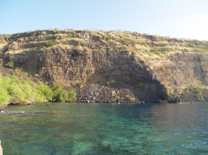
Kealakekua Bay from the Captain Cook Monument. Simply the finest snorkeling.  Ever.  Photo by Donald MacGowan
Kealakekua Bay from the Captain Cook Monument. Simply the finest snorkeling. Ever. Photo by Donald MacGowan

Captain Cook Monument (The trail leaves the Napo’opo’o Road right at telephone pole number 4, just 500 feet below where it drops off Highway 11; parking is tight, but safe): This hike is a fine walk through tall grass, open lava fields and dryland forest, opening onto one of the most pristine ocean beaches in the world. Hiking down to the Monument is great fun—the return is hot, thirsty and strenuous but rewards you with panoramic views of the coast. The 2.5-mile hike takes about an hour down, somewhat more to return. The trail runs straight down the left side of a rock wall toward the sea. As the pitch straightens out, keep to the left at the fork and proceed to the beach through the abandoned village. You strike shore several hundred feet northwest of the monument—remember to bear right at the trail junction when returning, or you face a long and unpleasant time wandering the a’a fields.

Snorkeling at the monument is wild and scenic, from shallow tidepools north of the wharf to the steep drop-off under the cliffs. There is a concrete marker in the tidal zone denoting the exact spot Cook fell somewhat north of the actual monument.

Honomalino Beach (turn off Highway 11 just south of mile marker 89, drive through Miloli’i; start hiking between the county park and a yellow church. Keep along the right at forks in the trail, in and out of the surf line, to avoid private property): A true gem of West Hawai’i and rarely crowded, Honomalino Bay is reached by a 20 minute hike from the south end of Miloli’i Beach County Park. Snorkeling is very interesting on the north side in the rocks, when the surf is low. The water, though very clear, is sometimes quite cold due to spring discharge in the sand on the beach.

Photo by Donnie MacGowan
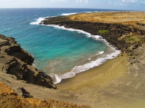
Mahana Green Sand Beach at South point on the Big Island: Photo by Donnie MacGowan

Mahana Green Sand Beach (Turn off Highway 11 to South Point, follow signs to Mahana Boat Launch. Park just above the boat ramp for the 2 1/4 mile hike to the Green Sand Beach): Absolutely unique to Hawai’i, beautiful and strange, are the green sand. The green sand beach at South Point is the best known, largest and most accessible of these. The sand grains here are olivine crystals, washed out of a cinder cone that has been partially breached by the sea.

When you reach the end of the trail, you are a hundred or so feet above the beach on the rim of the remnant of the crater. At the start, there is a tricky spot edging over a 3-foot ledge, but below this the trail is wide and clear One can also easily scramble down middle of the cone, but this can be slippery. Although tricky to spot on the way down, from the beach looking up the way back to the crater rim is easy to follow.

The beach lies in the interior of the cone, and the protected cove makes for a wonderful swimming/snorkeling spot but be wary of currents. Do not go out far, nor in at all in high surf or strong winds. The bizarre color of the water shrieks for color photographs, particularly underwater photographs taken while snorkeling.

Waipio Valley Beach

Waipi’o Valley is arguably the most magical place on the Big Island. Hawai’ian myths hold that the fastness of Waipi’o Valley is guarded by Night Marchers, legendary ghosts of Kamehameha’ long-dead armies, and that the impossibly steep, incredibly beautiful valley was excavated by a bragging warrior using his club to demonstrate his strength.

The steep canyon walls and verdant fields of the valley floor, the mile long black sand beach and numerous immense waterfalls that line the valley walls all call out to the visitor for exploration, but this can prove challenging.

There is a four-wheel drive jeep road down into the valley but you really (and I mean REALLY) do not want to drive it, even in a four-wheel drive vehicle. Perhaps the most satisfying way to see Waipi’o Valley, however, is the way the ancient Hawai’ians did, by walking forthrightly down into it and then creeping, wheezily, back out. However, if you attempt this hike, don’t be deceived by the numbers. The hike may entail less than a thousand foot elevation loss (and subsequent gain to climb out) and fewer than 2 miles actual walking, but it feels much longer; it is hard, hot, dry, steep and, oh yes, did we mention hard? The hike down into the valley takes about ½ an hour. Allow twice that again for exploration of the valley floor and beach and at least an hour to walk back up.

If you do go down into the valley, no fresh drinking water is available, so take lots. When you hit the valley floor, the road to your right (toward the ocean) goes to the beach and a spectacular 300 foot waterfall. Here, you may wander through tamarisk and fir copses along the black sand beach, bathe in the waterfall or hike across the ridge into the next valley. Be forewarned, swimming and surfing here are for experts only, due to the strong currents and big waves. Do not attempt to hike past the headland cliffs into adjacent valleys—it may seem passable, even tempting, but it is in fact impossible and extremely dangerous.

At the intersection at the foot of the valley, the road through the jungle tunnel to your left crosses private property; you should have permission to drive or walk here. Down this road, toward the back of the canyon are numerous, enormous, crazy waterfalls and scenery like you will see no where else on earth. Waipi’o Valley is truly a magical place.

Camping here is by permission of the Bishop Estate/Kamehameha Schools Land Asset Division (808.534.3935).

Hikers Pause at the Stream Along the Beach, near the Mouth of Waipi'o Valley: Photo by Donald B. MacGowan

A video covering snorkeling topics is available here.

For more information about visiting and touring Hawaii in general, and exploring the fabulous snorkeling on the Big Island in particular, please visit www.tourguidehawaii.com and www.lovingthebigisland.wordpress.com. For information about the author, go here.

All media copyright 2009 by Donald B. MacGowan

Wednesday, July 29, 2009

Volcano Update: 2009—A year of noteworthy volcano anniversaries in Hawai`i

Reprinted from here.

2009—A year of noteworthy volcano anniversaries in Hawai`i

Thomas Jaggar (second from left) prepares to measure the temperature of the Halema`uma`u lava lake in 1917.  Pictured, left to right, Norton Twigg-Smith, Thomas Jaggar, Lorrin Thurston, Joe Monez, and Alex Lancaster.
Thomas Jaggar (second from left) prepares to measure the temperature of the Halema`uma`u lava lake in 1917. Pictured, left to right, Norton Twigg-Smith, Thomas Jaggar, Lorrin Thurston, Joe Monez, and Alex Lancaster.

Thomas A. Jaggar, founder of the Hawaiian Volcano Observatory (HVO), first visited Hawai`i 100 years ago during a decade-long period of exploration in which he witnessed first-hand the destructive power of volcanic processes.

His quest began in 1902, when Jaggar traveled to the West Indies just 13 days after two volcanoes there erupted with devastating consequences. The first eruption at La Soufriere on the island of Saint Vincent resulted in 1,500 deaths. It was followed only a few hours later by a second, more tragic, eruption at Mount Pelee on Martinique, in which 28,000 people perished. Jaggar's experience at Martinique set the stage for his work on volcanoes and earthquakes during the next half century.

After Martinique, Jaggar's expeditions took him to the scenes of earthquakes and volcanic eruptions in the Aleutians, Central America, and Japan. In 1908, an earthquake near Mount Etna in Italy killed 125,000 people. Following that natural disaster, Jaggar declared that "something must be done" to support systematic studies of volcanic and seismic activity.

The next year, in 1909, he traveled at his own expense to Hawai`i, where he determined that Kīlauea was to be the home of the first American volcano observatory. His vision was to "protect life and property on the basis of sound scientific achievement."

In 1912, construction began on the new Hawaiian Volcano Observatory with support from Hawai`i businesses, private endowments through the Hawaiian Volcano Research Association, and funding from the Massachusetts Institute of Technology. HVO has since been managed by the U.S. Weather Bureau (1919-1924), U.S. Geological Survey (1924-1935), and National Park Service (1935-1947). The USGS became the permanent administrator of HVO in 1947.

In 2012, HVO will celebrate its centennial anniversary, a milestone made possible through the vision and efforts of Thomas A. Jaggar.

Today, in 2009, as we look back at Jaggar's first visit to Kīlauea 100 years ago, we also reflect on the landmark anniversaries of several significant eruptions on Kīlauea and Mauna Loa:

25th1984 Mauna Loa summit and northeast rift zone eruption
40th — start of the 1969-74 Kīlauea east rift zone eruption (Mauna Ulu)
50th — 1959 Kīlauea summit eruption (Kīlauea Iki)
60th1949 Mauna Loa summit eruption
90th1919 Mauna Loa southwest rift zone eruption
150th1859 Mauna Loa northwest flank eruption


Casino Bonus no Deposit