Showing posts with label road trip. Show all posts

Sunday, August 23, 2009

Best Scenic Drives on Hawaii #3: Kona to Hamakua and Hilo

Kona to Hamakua Coast: Spectacular Waterfalls, Incredible Canyons and Lush Rainforest

Approximate minimum time start to finish (to see every site): 9 hours.

This day offers spectacular waterfalls, lush rainforest and beautiful canyons, shopping, dining and 2-one hour hikes.

Highway 190 leaves Kona north to Waimea then on to Honoka'a and Waipi'o Valley in about 1 1/2 hours driving. The photos from the valley overlook are postcard gorgeous and Honoka'a has cute shops and restaurants. After a 1 hour drive, seeing several sites along the Hamakua Coast, Highway 220 branches to Akaka Falls. Follow the paved loop through the tropical jungle and smell exotic flowers along this not-to-be-missed, easy 1 hour waterfall hike. Be sure to stop in Honomu for the unique shops. Proceeding south on Highway 19, ten minutes, is the Pepe'ekeo Scenic Drive (4 Mile). Along this road is Onomea Bay Trail, a 1 hour round trip hike, down to the ruggedly picturesque coastline. From there it's 20 minutes to Rainbow Falls, Hilo's signature waterfall. Hilo is the largest city on the island and has numerous shops, malls, museums, restaurants and beaches, such as Richardson Beach, near downtown. From Hilo, it is a 2 1/2 hour drive back to Kona.

Leg 1) In Kailua Kona, start at Ahu’ena Heiau, take Palani Road east to Hwy 190; take Hwy 190 through Waimea to Honoka’a.

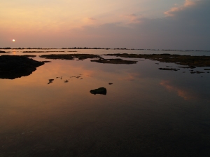
Morning at Ahu'ena Heiau, Kailua Kona Hawaii: Photo by Donnie MacGowan

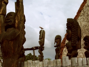
Ahu'ena Heiau and Kamakahonu Beach
Centuries ago the inhabitants of this region built a series of sacred temples, or heiaus, which were originally used for the purpose of sacrificing human beings to their war god, Kuka’ilimoku. This particular archeological site is called Ahu’ena Heiau, which in Hawaiian means “Hill of Fire”.

Built originally in the 15th century and rededicated by Kamehameha the Great in the early 1800s as the main temple of his capital, the current structures seen at Ahu’ena Heiau were re-built in 1975 under the auspices of the Bishop Museum with financial help from the Hotel King Kamehameha and are constructed to 1/3 the original scale. There are restrooms and showers located on the pier near the beach. Adjacent Old Kailua Town is a treasure of shops, restaurants and aloha.

Waimea Town Nestled Against Kohala Mountain: Photo by Donald MacGowan

Waimea Town and Cowboy Country

Snuggled between Mauna Kea and Kohala Volcano in Hawaii's scenic mountain heart, seemingly always shrouded in mist and chilly, Waimea is definitely Hawai’ian cowboy country. Although jeans and flannel shirts appear to be the town uniform, Waimea is very sophisticated, boasting some of the finest shopping and restaurants and the most modern hospital on the island.

From Waimea, Highway 250, the Kohala Mountain Road, spills beautifully through mountain, upland meadow and forest to the "Old Hawaii" town and artist community at Hawi.

Additionally, the cattle industry centers in Waimea. In 1793 British Navigator George Vancouver presented cows to King Kamehameha which were allowed to roam free and soon became a problem. Shortly after horses were brought to Hawaii in 1804, Kamehameha recruited California vaqueros, whom Hawai'ians called "paniolo"--a corruption of the word "Espańol"--to control the wild herds, and the generations-old ranching lifestyle here was born.

The vaqueros also brought their guitars and their love of music. A deeply musical people, the Hawaiians were intensely interested in these, the first stringed instruments they had seen. They quickly learned to work-out their own tunings, called "slack key guitar", which more suited the style of their indigenous music.

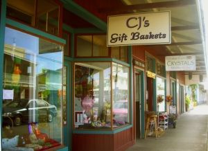
The Main Street of Honoka'a is Lined With Fun and Interesting Shops: Photo by Donald MacGowan

Honoka’a Town

Built in the era of sugar great plantations and left culturally and economically isolated after the industry collapse, until recently Honoka’a was content to drowse along through the decades. A boom in real estate and return of vital human energy to the area has made a literal renaissance of the town. It boasts numerous wonderful restaurants, gift and boutique shops and the highest density of antique shops on the island. Be sure to stop to explore a little on your way to or from Waipi’o Valley…it’s a fun, happening kind of place and always steeped with aloha.

Driving north or south out of Honoka'a, remnants of old sugar mills, fields and wild cane can still be seen. When Captain Cook arrived in 1778, only wild sugar cane was growing; at its height in the mid-1960's one in 12 people were employed in the sugar industry which produced in excess of a million tons of sugar annually. Though the business is gone, what is left are the people who once worked the fields and mills. The melding of the rich cultures of Japanese, Chinese, Filipinos, Portuguese, and others is what gives today's unique Hawaii lifestyle its sweet flavor.

Leg 2) At Honoka’a, turn north on Hwy 240 to Waipi’o Valley.

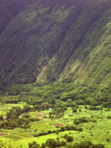
Deep and Mysterious Waipi'o Valley: Photo by Donald MacGowan

Waipi’o Valley

Waipi’o Valley is arguably the most magical place on the Big Island. The steep canyon walls and verdant fields of the valley floor, the mile long black sand beach and numerous immense waterfalls that line the valley walls all call out to the visitor for exploration.

Always listed among the most beautiful spots in the State of Hawai’i, this valley is as hauntingly lovely as it is difficult to see in its entirety.

Tours down into the valley in vans, on horse drawn wagons and ATVs can be booked in Honoka’a. Over-flights in fixed wing aircraft and helicopters also offer fine venues from which to see this amazing piece of Hawai’i. Hiking down and wandering the immense black sand beach, exploring the ironwood copses and sand dunes and discovering the hidden waterfalls is also a popular way to see the canyon. Although the hike down is only a little over 1 mile and a thousand feet elevation loss, the climb back up is sweltering in the ferocious sun and heat. Think twice before hiking down. Facilities at the Scenic Overlook include a pavilion and restrooms; there are none within the valley itself.

Leg 3) From Waipi’o Valley, return to Honoka’a on Hwy 240, get on Hwy 19 and head south.

Leg 4) Take Hwy 19 south to Laupahoehoe then Kolekole, continue south to Hwy 220; west on Hwy 220 to Honomu, then to Akaka Falls.

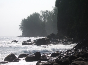
Laupahoehoe on the Hamakua Coast: Photo by Donald MacGowan

Laupahoehoe Park

A place of great beauty, of awesome displays of oceanic power and of tragic memories, Laupahoehoe Park stands where 20 children and teachers at the Laupahoehoe School were killed in the tsunami of 1946. Inside the park on a small hill overlooking the jetty is a memorial stone inscribed with the names of those who died in the tsunami. There are restrooms, campgrounds, picnic facilities, pit barbecues and ball fields. The pounding of the raw ocean on the jetty reminds one that not every beach in Hawaii is made for swimming, however the fishing here is excellent.

Kolekole Beach Park, Hamakua Coast Hawaii Photo by Donnie MacGowan

Kolekole Beach County Park

The river you saw magnificently jumping with such abandon off the cliff at Akaka Falls ends its journey to the sea by sluicing through this Koa tree-filled canyon and smashing into the surf at Kolekole Beach Park. A wild beach, a jungle canyon and a waterfall swimming hole are fun things to do at Kolekole Park.

The visitor is advised to admire the ocean, but not go in. The currents and tides are lethally treacherous here.

Facilities at Kolekole Beach Park include picnic pavilions and tables, pit barbecues, showers, restrooms and drinking water.

Akaka Falls from the Air: Photo by Donald MacGowan

Akaka Falls

There is a reason that Akaka Falls rates as the most visited tourist site on the Island of Hawai’i. Simply put, the 420 foot, free falling plunge of clear water down a fern festooned cliff is an amazing and beautiful site. Leaving the parking lot, the paved loop trail of about one mile, winds through a wonderful jungle of exotic flowers, ferns, orchids, ginger and bamboo. Two smaller falls are also seen along the way to the stellar Akaka Falls. Akaka Falls has restrooms but no other facilities.

When visiting Akaka Falls, be sure to save some time to explore the shops, galleries and cafes of Honomu on the way back to the highway; it’s unlike anywhere you’ve ever been before…guaranteed.

Leg 5) Return Hwy 220 through Honomu to Hwy 19, then south on Hwy 19 to Old Mamalahoa Highway (or Kulaimano Road to Old Mamalahoa Hwy); this is the Pe’epekeo Scenic Drive. South and east on Old Mamalahoa Hwy to Onomea Bay; continue on Old Mamalahoa Hwy south to southern jct with Hwy 19.

Pe'epekeo Scenic Drive, Hamakua Hawaii: Photo by Donald MacGowan

Pepe'ekeo Scenic Drive

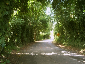
Located just a few minutes north of Hilo on Highway 19, this “Old Road through Old Hawai'i”, a four-mile-half hour scenic wander, parallels Highway 19 but is removed worlds away from the traffic and hustle along the main road. Rolling along old cane fields, jungle-canopied in places, passing waterfalls and crossing creeks, the Pepe’ekeo Scenic Drive is a special treat for the visitor who may be thinking they waited a century too long to visit Hawai'i. On a sunny day, on a rainy day, it doesn’t matter; this scenic drive is a joy. There are no services available along the scenic drive.

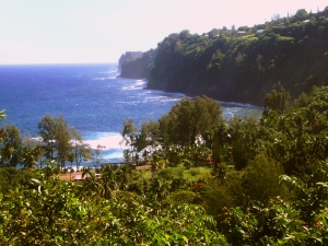
Onomea Bay, Hamakua Coast Hawaii: Photo by Donald MacGowan

Onomea Beach Trail

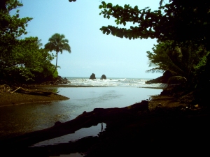
Only a few miles north of tame and sedate Hilo Bay, Onomea Bay is subject to the full fury and magic of the open Pacific Ocean. Rugged, jagged, majestic, the wickedly sculpted cliffs along the bay belie the easy 15 minute walk down to the beach. Accessible to most walkers of even marginal condition, the trail leads alongside a botanical garden (be sure not to wander through any of their gates unless you are a paying customer) and meanders down to the canyon mouth, past a tiny waterfall at the end of the stream and to the beach. There are awesome opportunities for photo

Leg 6) South on HWY 19 to Hilo; get on Hwy 200 (Waianuenue Avenue), head south-southeast to Rainbow Drive and Rainbow Falls.

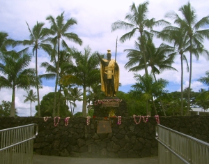
King Kamehameha Statue, Hilo Hawaii: Photo by Kilgore Trout

Hilo Town

Beautiful but wet, metropolitan but decrepit, bustling but laid back, Hilo is a lovely, maddening, heartbreaking, addictive study in contrasts. In can rain all day long for 50 days in a row, yet when the sun does shine, the views of Mauna Loa and Mauna Kea from the Liliuokalani Gardens, or of Hilo Bay as you drive down from the mountains, or the rain-forest and waterfall choked gulches with lovely beaches along the highway north of town, make Hilo one of the most truly, achingly-lovely spots on earth.

More laid back and sleepier than bustling Kailua Kona, Hilo is the largest town on the island, and the county seat. The Imiloa Astronomy Center of Hawaii, Tsunami Museum, Lyman House Missionary Museum and the Panaewa Rainforest Zoo are all wonderful places to learn about various aspects of Hawaii. There are numerous shopping districts, two large malls and the Historic Old Hilo downtown shops to browse through, a variety of sprawling green parks, a fabulous tropical arboretum right downtown and a mile-long black-sand beach fronting the bay to explore. Hilo's Farmer's Market is a "must see" for any visitor who is spending time on this side of the island.

Rainbow Falls, Hilo Hawaii: Photo by Prescott Ellwood

Rainbow Falls and Wailuku River Park

The subject of recent and ancient legend, Rainbow Falls is the lovely emblem of Hilo town. The characteristic wishbone shape of Rainbow Falls is best seen at moderate river flows…too little water and only a single drizzle remains, too much runoff and the falls merge into a single, roaring flume. At any time, however, it’s a beautiful place and worthwhile to visit. The rainbows within the falls are best seen in the mid to late morning. Follow the trail to the left along the river bank to delightful swimming and wandering; please note, however, that swimming in rivers and near falling water is dangerous. Don’t go in if the current is swift or if recent rains have swollen the river.

Restrooms are by the parking lot and a souvenir shop is located across the street.

Leg 7) Return Hwy 200 (Waianuenue Road) to HWY 19, then east on 19 to Jct with Kamehameha Ave; Kamehameha Ave east to jct with Kalanianaole Ave to Richardson Beach Park.

Richardson Beach Park, Hilo Hawaii: Photo by Donnie MacGowan

Richardson Beach Park

Richardson Beach Park, with its towering palms, fresh water pools, delightful surf, secluded and calm tidepools, lawns and general ambiance of tropical paradise, is almost certainly very close to what most visitors expect from Hawai’i—hence it popularity.

Views of Mauna Kea at sunrise and sunset from this beach are unparalleled. The snorkeling here along the small black sand beach is the best of the Hilo area and the surf is a busy mix of beginner to intermediate level waves. Restrooms, showers, water, picnic tables and a lifeguard round-out the amenities of this wonderful place. There is also a Hawai'i County Police Department substation here.

Leg 8) Return on Kalanianaole Ave to Kamehameha Ave to Hwy 19; take Hwy 19 north to Honoka’a and jct with Hwy 190; drive Hwy 190 west to Kailua Kona.

Off the Pier in Old Kailua Town: Photo by Donnie MacGowan

For more information on traveling to Hawaii in general and touring the Big Island in particular, please also visit www.tourguidehawaii.com and www.lovingthebigisland.wordpress.com. For information about the author, please go here.

All media copyright 2009 by Donald B. MacGowan; all rights reserved.
Friday, August 21, 2009

Best Scenic Drives on Hawaii #2: North Kona and Kohala, Ancient History, Sumptuous Beaches

North Kona and Kohala: Ancient History, Sumptuous Beaches
Approximate minimum time start to finish (to see every site) 8 hours.

by Donnie MacGowan

The tour begins at the Keauhou Historic District with ancient battlefields, heiau (stone temples), surfing beaches and shopping in Kailua Kona. 15 minutes north of town is Kaloko-Honokohau National Historic Park. See how Hawai'ians used aquaculture to create thriving communities in desolate areas. Among the many coastal sites, Hapuna Beach State Park, 30 minutes north, is rated in the Top 10 Best Beaches of the world, then stop 20 minutes further at Pu'u Kohala National Historic Park to visit an enormous heiau erected to the war god, Kuka'ilimoku. After several more sites, the road ends at Pololu Valley where wild ocean, cliffs, rainforest, waterfalls and a black sand beach make for stunning photographs plus a one hour hike. Looping back, Highway 250 cruises 45 minutes over Kohala Volcano to the lush pastures of Waimea for history of ranching in Hawaii as well as great shopping and dining. From Waimea it is one hour back to Kona.

Leg 1) In Kailua Kona, start at Keauhou Historic District, southern point. Drive Ali’i Drive north to Kahalu’u Beach, Keauhou Historic District (north terminus), La’aloa Beach and Ahu’ena Heiau.

Keauhou Historic District and Kona Coffee

Kue'manu Heiau: the only temple to surfing gods still in use today: Keauhou Historic District, Kona Hawaii: Photo by Donnie MacGowan

For almost 400 years, temples and palaces along the Kona coastline served as a kind of "Rome of the Pacific", a great political, religious and cultural center in Polynesia, until the capital was moved to Honolulu in 1850 by Kamehameha III. The most important, interesting and best preserved historical and cultural sites lie within the Keauhou Historic District, between Kahalu'u Beach Park in Kailua running south 6 miles to Kuamo'o Bay in Keauhou. The District contains perhaps a dozen fascinating sites that are easy to walk to, well maintained and quite interesting.

To see the numerous fascinating and important archaeological sites in the Keauhou Historic District, it is necessary to park your car in the free parking at either Kahalu’u Beach Park or the Keauhou Beach Resort and explore on foot.

Just uphill from the Historic District is the Kona Coffee District. Hawaii is the only state in the union which produces coffee, and Kona coffee is perhaps the finest in the world. Over 2 millions pounds of coffee a year are produced on about 600, 2-3 acre farms; tours of coffee farms and roasteries are available.

Kahalu'u Beach County Park

Kahalu'u Beach, Kona Hawaii: Photo by Donnie MacGowan

Loll in sand and sun under swaying palms, snorkel among rainbow-colored fish on a protected reef or ride surf where the Kings of Hawai'i defined the sport a thousand years ago! Kahalu'u is the crown jewel of Kona Coast County Beach Parks. This is the premiere snorkeling beach of the Island of Hawai'i; the snorkeling is in calm, shallow water. There is an abundance of fish of an enormous variety...perhaps the best display on the island. Go carefully into the water, being sure not to harass the endangered turtles, feed or harm the fish, nor touch or stand upon the corals.
There are numerous sites of historic importance around the park. It was here that the great queen, Ka'ahumanu, and her cousin Kuakini (later Territorial Governor) were raised. Abundant parking, disabled access, picnic tables, two shaded pavilions, two sets of public restrooms, showers and lifeguards round-out the facilities of this beautiful beach park.

La'aloa Beach County Park (White Sands/Magic Sands)

Boogie Boarders At La'aloaBeach, Kona Hawaii: Poto by Donne MacGowan

La Aloa Beach Park is a small, but fascinating, beach. The beach derives the name “Magic Sands” from the fact that for most of the summer and fall, it is a beautiful sandy beach. However, winter and spring storms wash the sand offshore, exposing a rocky terrace. With the onset of summer currents, the sands return. The surf is short, but spectacular, here, and many locals boogie board and body surf. Because of the violent, near shore nature of the break, it is not recommended for beginners.

The La'aloa Heiau, makai of the parking lot, is very sacred to the native Hawai’ians and a hotly contested archeological site. Although not fenced off, visitors are asked not to wander the grounds of the heiau, disturb stones or walls. A county facility, it boasts showers, toilets and running water in addition to a volleyball court and lifeguards stationed throughout the day (except State Holidays).

Ahu'ena Heiau and Kamakahonu Beach

Ahu'ena Heiau Temple Precincts, Kailua Kona, Hawaii: Photo by Donald MacGowan

Centuries ago the inhabitants of this region built a series of sacred temples, or heiau, which were originally used for the purpose of sacrificing human beings to their war god, Kuka’ilimoku. This particular archeological site is called Ahu’ena Heiau, which in Hawaiian means “Hill of Fire”.

Built originally in the 15th century and rededicated by Kamehameha the Great in the early 1800s as the main temple of his capital, the current structures seen at Ahu’ena Heiau were re-built in 1975 under the auspices of the Bishop Museum with financial help from the Hotel King Kamehameha and are constructed to 1/3 the original scale. There are restrooms and showers located on the pier near the beach. Adjacent Old Kailua Town is a treasure of shops, restaurants and aloha.

Leg 2) From Ahu’ena Heiau, drive Palani Road east to Hwy 19; go north on Hwy 19 to Koloko Honokohau National Historic Park.

Kaloko-Honokohau National Historic Park

Kaloko Honokohau National Historic Park, Kona Hawaii: Photo by Donnie MacGowan

At Honokohau, ancient Hawai’ians took advantage of abundant freshwater springs to site a large community centered on fishing, fishponds and taro fields. The National Historic Park preserves a vast complex of important archeological sites, including heiaus, fishponds, a fish trap, house sites, burials, a holua (sledding track), a Queen’s Bath and abundant petroglyphs. The Information Center, which is near Highway 19, is open from 8:30 a.m. to 4 p.m., and has full facilities, restrooms and a small souvenir and bookshop.

Leg 3) Continue north on Hwy 19 to Kekaha Kai State Park, Kua Bay, Anaeho’omalu Bay, Waialea Beach and Hapuna Beach.

Kekaha Kai State Park

Makalawena Wilderness Beach, Kona Hawaii: Photo by Donnie MacGowan

At Kekaha Kai, there are a wonderful set of beaches plunked down in one of Hawai’i Island’s gem parks. The northernmost and loveliest beach is Mahai’ula and the smaller, more southerly, less fine one is Ka’elehuluhulu Beach. The water is fine for swimming and boogie boarding but may be a little murky for ideal snorkeling. There are numerous small springs along the entire beach making the near-shore water a little cold. Hidden in a little pocket of wilderness, perhaps the finest beach on the island, Makalawena Beach, is contained in this park. It is reached by a 20-30 minute hike over beaches and rough lava from the parking lot. Swimming and snorkeling on this uncrowded, indeed largely unknown, beach are beyond excellent. Facilities include public restrooms and picnic tables, but no drinking water.

Kua Bay

Kua Bay, Kona Hawaii: Photo by Donald MacGowan

The site of Kona’s newest beach park, this is a lovely white sand beach. Although there is no shade to speak of, the swimming and boogie boarding in the crystalline waters is primo. Strong currents and large waves call for respect here, if the surf is up. Also, sometimes in winter the surf removes the sand to offshore, leaving a rocky shelf that is less fun to frolic on than the sandy beach.

Access is via a newly paved road recently opened to the public (on the ocean-side from the Veteran's Cemetery). Park facilities include parking, picnic tables, restrooms and water. Wild goats are frequently seen in this area.

Anaeho’omalu Bay

Anaeho'omalu Beach, Kohala Hawaii: Photo by Donnie MacGowan

The most photographed sunset view on the Island of Hawai’i, Anaeho’omalu Bay is the icon of what most visitors envision Hawai’i to be like before they get here…swaying palm trees, a clean beach fronting warm, safe, swimmable ocean and eager beach boys bearing large, tropical drinks with comical names like “Malahini Wahine Wahoo”. Here at the bay, one can rent snorkel or surfing gear, sign-up for sailing trips, snorkel tours, windsurfing lessons or scuba dives, order food and drinks, or just lounge pleasantly in the niumalu (shade of the coconut palms). Facilities and services are available at A-Bay and on the nearby resort grounds.

Waialea Beach (Beach 69)

Waialea Beach, Kohala Hawaii: Photo by Donnie MacGowan

A perfect crescent of golden sand backed by abundant shade at the edge of the beach makes this an ideal, though little known, family beach. A chain of tiny islands and pinnacles leads northward to crystalline water and a long coral reef for some of the most outrageous snorkeling and shore diving anywhere in the state. On windy days the water in the bay is a tad murkier than ideal for snorkeling, but most of the visitors to this beach don’t seem to mind. Restrooms, picnic tables, water and showers round out the facilities.

Hapuna Beach

Hapuna Beach, Kohala Hawaii: Photo by Donnie MacGowan

Always rated in the Top 10 of American beaches, Hapuna Beach is the premiere beach destination on the Island of Hawai’i. Long, wide and phenomenally sandy, it has everything one dreams of in a Hawai’ian beach: abundant sun, surf, clean, clear and quiet snorkeling water, shade and well-maintained facilities.

There are lifeguards, several pavilions, barbecues, picnic tables, restrooms, showers and a small café. The center of the beach is for wave play and boogie boarding, the north and south coves are quieter, for snorkeling or gentle floating. Although most patrons must walk about 100 yards down a path from the parking lot, Handicapped Parking exists right on the beach.

Leg 4) Continue North on 19 to jct with Hwy 270; north on 270 to Pu’u Kohola and Lapakahi State Park.

Pu’ukohola Heiau National Historic Park

Pu'u Kohola National Historical Park, Kohala Hawaii: Photo by Donald MacGowan

A temple inspired by a god-sent vision of greatness, Kamehameha built Pu’ukohola in response to a prophecy by Kaua’i kahuna Kapoukahi that foretold if he built a great temple to his war god Ku in one day, Kamehameha would prevail in his wars of conquest and unite the Hawai’ian Islands. Perhaps as many as 20,000 people passing stones hand-to-hand from Pololu Valley raised this massive Heiau in a single day.

Pu’ukohola is the largest stone structure in Polynesia, not counting the modern rock wall in front of the Kailua Lowe’s Hardware store. The National Historic Park has a very nice, new visitor's Center and Book Shop, clean restrooms and picnic facilities. Adjacent to the Park is Spencer Beach Park which has a full range of facilities as well as wonderful, protected swimming and snorkeling.

Lapakahi State Historical Park

Lapakahi State Historical Park, Kohala Hawaii: Photo by Donald MacGowan

At Lapakahi State Historical Park you can walk through the partially –restored remains of a 600-year old Hawai’ian fishing village, Koai’e.

Bear in mind that Kohala was not always the barren wasteland seen today. Initially dryland forest, a thousand years ago or more the native Hawai’ians burned the forest to clear farmland for dryland crops such as sweet potato. Primitive farming techniques, overpopulation, overgrazing by cattle and climate changes caused this area to become desert like. Admission is free, self-guided tour takes about 45 minutes. There are portable toilets but no water available.

Leg 5) Continue north, north east on Hwy 270 to jct with Upolu Point Road (incorrectly spelled “Opolu Point Road” on Google Maps; sometimes also labeled “Upolu Airport Road”). Continue north on Upolu Point Road to Mo’okini Heiau.

Mo'okini Heiau

Mo'okini Heiau, Kohala Hawaii: Photo by Donnie MacGowan

Have you ever seen anywhere as stark, impressive, primitive and ancient, yet still able to raise the hackles on your neck? Here, untold thousands of people were sacrificed to worship a new god, the war god Ku. Mo’okini Heiau stands today at the north end of Hawai’i, the well preserved remains of a terrible luakini heiau built by the powerful Tahitian kahuna Pa’ao in the 11th or 12th century. This heiau was the first temple of human sacrifice in Hawai’i and the first site in Hawai’i to be preserved as a National Historic Landmark under the Historic Sites Act of 1935. Mo’okini Heiau is now part of Lapakahi State Historic Park; as Mo’okini is an active Heiau and visitors are reminded to stay away if religious observances are being celebrated. There are no facilities here.

Leg 6) Return Upolu Point Road to Hwy 270, continue north east to King Kamehameha Statue, Pololu Valley.


King Kamehameha Statue and North Kohala

King Kamehameha Statue, North Kohala: Photo by Donnie MacGowan
King Kamehameha Statue, North Kohala Hawaii: Photo by Donnie MacGowan

The green and lush north end of Hawaii Island contains a treasure trove of interesting small towns, important historic sights and incredible scenery.

The dreamy mountain town of Hawi is one of the few remaining outposts of what locals call “old Hawai’i”. Several small shops, galleries and restaurants make this a pleasant place to visit and grab something to eat on the way to or from Pololu Valley.

At 5480 feet, Kohala Volcano is the northernmost and oldest volcano on the Island of Hawai’i still above sea level. Perhaps the most ecologically diverse area on the island, the Kohala Mountains are dissected by deep, lush tropical valleys, and the slopes are covered by dryland forest, lava deserts, lonely windswept steppes and end in some truly wild beaches.

In the center of the tiny town of Kapa’au on the mauka side of the highway, stands a storied statue of King Kamehameha the Great. There are a few charming restaurants, shops and galleries in Kapa’au, including the justly famous Kohala Book Shop—definitely worth spending some time poking around. Hawi and Kapa'au have the only food and gas available north of Highway 19.

Pololu Valley

Pololu Valley, Hamakua Coast: Photo by Donnie MacGowan
Pololu Valley, Hamakua Coast Hawaii: Photo by Donnie MacGowan

Violent, lush, wild; the north end of Hawai’i Island is as varied and exciting as it is unexpected. At the end of the highway are the Pololu Valley Overlook and the trail leading down to Pololu Black Sand Beach. The trail down to the beach drops 400 feet in 20 minutes of hiking—be forewarned, the hike up is difficult for those not in good physical shape and shoes, rather than slippers, are best here. This is one of the most beautiful, untamed spots in the tropical Pacific and should not be missed. There are no facilities at the valley overlook or within the valley.

Leg 7) Return west on Hwy 270 to jct with Hwy 250; take Hwy 250 south to Waimea.

Waimea Town and Cowboy Country

Waimea Town, Hawaii: Photo by Donald MacGowan

Snuggled between Mauna Kea and Kohala Volcano in Hawaii's scenic mountain heart, seemingly always shrouded in mist and chilly, Waimea is definitely Hawai’ian cowboy country. Although jeans and flannel shirts appear to be the town uniform, Waimea is very sophisticated, boasting some of the finest shopping and restaurants and the most modern hospital on the island.

From Waimea, Highway 250, the Kohala Mountain Road, spills beautifully through mountain, upland meadow and forest to the "Old Hawaii" town and artist community at Hawi.

Additionally, the cattle industry centers in Waimea. In 1793 British Navigator George Vancouver presented cows to King Kamehameha which were allowed to roam free and soon became a problem. Shortly after horses were brought to Hawaii in 1804, Kamehameha recruited California vaqueros, whom Hawai'ians called "paniolo"--a corruption of the word "Espańol"--to control the wild herds, and the generations-old ranching lifestyle here was born.

The vaqueros also brought their guitars and their love of music. A deeply musical people, the Hawaiians were intensely interested in these, the first stringed instruments they had seen. They quickly learned to work-out their own tunings, called "slack key guitar", which more suited the style of their indigenous music.

Leg 8) At Waimea, take Hwy 190 to return to Kailua Kona.

Kailua Kona, Hawaii: Photo by Donald MacGowan

For more information on traveling to Hawaii in general and on touring the Big Island in particular, please also visit www.tourguidehawaii.com and www.lovingthebigisland.wordpress.com. For information about the author, please go here.

All media copyright 2009 by Donald B. MacGowan; all rights reserved.
Sunday, July 26, 2009

Advice: Driving and Hiking to the Summit of Mauna Kea, Big Island of Hawaii


Aloha! I'm Donnie MacGowan and I live on the Big Island of Hawaii. Today, I'd like to take you to the top of Mauna Kea. At 13, 796 feet above sea level, Mauna Kea's summit is the highest point in the State of Hawaii; since its base lies at 19000 feet below sea level, its has a base-to-summit height of 33,000 feet, making it the tallest mountain on earth. It's also one of my most favorite places on earth.

Mauna Kea began forming on the sea floor about one million years ago. Its name means "White Mountain" in the Hawaiian language and it is snow-capped much of the winter, and the summit is covered with permafrost 35 feet deep. During the ice ages, Mauna Kea's summit was glaciated 3 times, starting about 200000 years ago and ending only 11000 years ago. One can see the U-shaped valleys and cirques, striated bedrock, glacial tills covering the summit area and remnants of ice-damned lava flows from those times. There are even the remains of extinct rock glaciers near the summit.

The Visitor's Information Station and summit are reached via a road which turns off Saddle Road at about 6600 feet elevation near the 28 mile marker and tortuously stumbles its way up the south side of Mauna Kea to the Visitor Information Station at about 9300 feet. The road, though steep, is paved to the Visitor's Information Station. Above that, the road is graded dirt for about 5 miles, returning to asphalt paving for the final sprint to the rim of the summit crater. Road conditions for the summit road are available at 808.935.6263.

The Visitor Information Station is open from 9 a.m. until 10 p.m. 365 days a year. Informational multimedia presentations, souvenirs, and some food items are available here, as well as clean restrooms and drinking water. Every evening after dark the center allows visitors to stargaze through several telescopes and informational talks by visiting scientists are occasionally scheduled. Saturday and Sunday the staff lead escorted summit field trips, but visitors must provide their own vehicle. Call 808.961.2180 for information. It is suggested that summit-bound visitors stop at the Visitor's Information Station for at least half an hour before heading to the summit so they can acclimate. The rangers there can help you decide if you and your vehicle are fit for the trip to the summit.

A wonderful, easy road trip that includes a visit to the summit of Mauna Kea can be made a memorable part of any visit to the Big Island. Directions for a 1-day scenic drive from Kailua Kona to the top of Mauna Kea and on to Hilo (with stops along the way) can be found here. More information on the summit drive and hike is available here; information about the Hawaiian mythology surrounding Mauna Kea can be found here.

Produced by Donnie MacGowan; original musical score written and performed by Donald B. MacGowan; videography by Donnie MacGowan and Frank Burgess.

For more information on visiting Hawaii in general, or touring the Big Island in particular, please visit www.tourguidehawaii.com and www.lovingthebigisland.wordpress.com. Information about the author can be found here.


Casino Bonus no Deposit