Showing posts with label best scenic drive. Show all posts

Sunday, August 23, 2009

Best Scenic Drives on Hawaii #3: Kona to Hamakua and Hilo

Kona to Hamakua Coast: Spectacular Waterfalls, Incredible Canyons and Lush Rainforest

Approximate minimum time start to finish (to see every site): 9 hours.

This day offers spectacular waterfalls, lush rainforest and beautiful canyons, shopping, dining and 2-one hour hikes.

Highway 190 leaves Kona north to Waimea then on to Honoka'a and Waipi'o Valley in about 1 1/2 hours driving. The photos from the valley overlook are postcard gorgeous and Honoka'a has cute shops and restaurants. After a 1 hour drive, seeing several sites along the Hamakua Coast, Highway 220 branches to Akaka Falls. Follow the paved loop through the tropical jungle and smell exotic flowers along this not-to-be-missed, easy 1 hour waterfall hike. Be sure to stop in Honomu for the unique shops. Proceeding south on Highway 19, ten minutes, is the Pepe'ekeo Scenic Drive (4 Mile). Along this road is Onomea Bay Trail, a 1 hour round trip hike, down to the ruggedly picturesque coastline. From there it's 20 minutes to Rainbow Falls, Hilo's signature waterfall. Hilo is the largest city on the island and has numerous shops, malls, museums, restaurants and beaches, such as Richardson Beach, near downtown. From Hilo, it is a 2 1/2 hour drive back to Kona.

Leg 1) In Kailua Kona, start at Ahu’ena Heiau, take Palani Road east to Hwy 190; take Hwy 190 through Waimea to Honoka’a.

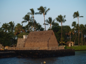
Morning at Ahu'ena Heiau, Kailua Kona Hawaii: Photo by Donnie MacGowan

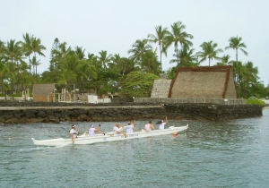
Ahu'ena Heiau and Kamakahonu Beach
Centuries ago the inhabitants of this region built a series of sacred temples, or heiaus, which were originally used for the purpose of sacrificing human beings to their war god, Kuka’ilimoku. This particular archeological site is called Ahu’ena Heiau, which in Hawaiian means “Hill of Fire”.

Built originally in the 15th century and rededicated by Kamehameha the Great in the early 1800s as the main temple of his capital, the current structures seen at Ahu’ena Heiau were re-built in 1975 under the auspices of the Bishop Museum with financial help from the Hotel King Kamehameha and are constructed to 1/3 the original scale. There are restrooms and showers located on the pier near the beach. Adjacent Old Kailua Town is a treasure of shops, restaurants and aloha.

Waimea Town Nestled Against Kohala Mountain: Photo by Donald MacGowan

Waimea Town and Cowboy Country

Snuggled between Mauna Kea and Kohala Volcano in Hawaii's scenic mountain heart, seemingly always shrouded in mist and chilly, Waimea is definitely Hawai’ian cowboy country. Although jeans and flannel shirts appear to be the town uniform, Waimea is very sophisticated, boasting some of the finest shopping and restaurants and the most modern hospital on the island.

From Waimea, Highway 250, the Kohala Mountain Road, spills beautifully through mountain, upland meadow and forest to the "Old Hawaii" town and artist community at Hawi.

Additionally, the cattle industry centers in Waimea. In 1793 British Navigator George Vancouver presented cows to King Kamehameha which were allowed to roam free and soon became a problem. Shortly after horses were brought to Hawaii in 1804, Kamehameha recruited California vaqueros, whom Hawai'ians called "paniolo"--a corruption of the word "Espańol"--to control the wild herds, and the generations-old ranching lifestyle here was born.

The vaqueros also brought their guitars and their love of music. A deeply musical people, the Hawaiians were intensely interested in these, the first stringed instruments they had seen. They quickly learned to work-out their own tunings, called "slack key guitar", which more suited the style of their indigenous music.

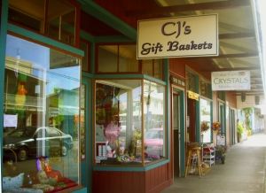
The Main Street of Honoka'a is Lined With Fun and Interesting Shops: Photo by Donald MacGowan

Honoka’a Town

Built in the era of sugar great plantations and left culturally and economically isolated after the industry collapse, until recently Honoka’a was content to drowse along through the decades. A boom in real estate and return of vital human energy to the area has made a literal renaissance of the town. It boasts numerous wonderful restaurants, gift and boutique shops and the highest density of antique shops on the island. Be sure to stop to explore a little on your way to or from Waipi’o Valley…it’s a fun, happening kind of place and always steeped with aloha.

Driving north or south out of Honoka'a, remnants of old sugar mills, fields and wild cane can still be seen. When Captain Cook arrived in 1778, only wild sugar cane was growing; at its height in the mid-1960's one in 12 people were employed in the sugar industry which produced in excess of a million tons of sugar annually. Though the business is gone, what is left are the people who once worked the fields and mills. The melding of the rich cultures of Japanese, Chinese, Filipinos, Portuguese, and others is what gives today's unique Hawaii lifestyle its sweet flavor.

Leg 2) At Honoka’a, turn north on Hwy 240 to Waipi’o Valley.

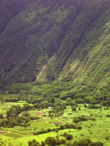
Deep and Mysterious Waipi'o Valley: Photo by Donald MacGowan

Waipi’o Valley

Waipi’o Valley is arguably the most magical place on the Big Island. The steep canyon walls and verdant fields of the valley floor, the mile long black sand beach and numerous immense waterfalls that line the valley walls all call out to the visitor for exploration.

Always listed among the most beautiful spots in the State of Hawai’i, this valley is as hauntingly lovely as it is difficult to see in its entirety.

Tours down into the valley in vans, on horse drawn wagons and ATVs can be booked in Honoka’a. Over-flights in fixed wing aircraft and helicopters also offer fine venues from which to see this amazing piece of Hawai’i. Hiking down and wandering the immense black sand beach, exploring the ironwood copses and sand dunes and discovering the hidden waterfalls is also a popular way to see the canyon. Although the hike down is only a little over 1 mile and a thousand feet elevation loss, the climb back up is sweltering in the ferocious sun and heat. Think twice before hiking down. Facilities at the Scenic Overlook include a pavilion and restrooms; there are none within the valley itself.

Leg 3) From Waipi’o Valley, return to Honoka’a on Hwy 240, get on Hwy 19 and head south.

Leg 4) Take Hwy 19 south to Laupahoehoe then Kolekole, continue south to Hwy 220; west on Hwy 220 to Honomu, then to Akaka Falls.

Laupahoehoe on the Hamakua Coast: Photo by Donald MacGowan

Laupahoehoe Park

A place of great beauty, of awesome displays of oceanic power and of tragic memories, Laupahoehoe Park stands where 20 children and teachers at the Laupahoehoe School were killed in the tsunami of 1946. Inside the park on a small hill overlooking the jetty is a memorial stone inscribed with the names of those who died in the tsunami. There are restrooms, campgrounds, picnic facilities, pit barbecues and ball fields. The pounding of the raw ocean on the jetty reminds one that not every beach in Hawaii is made for swimming, however the fishing here is excellent.

Kolekole Beach Park, Hamakua Coast Hawaii Photo by Donnie MacGowan

Kolekole Beach County Park

The river you saw magnificently jumping with such abandon off the cliff at Akaka Falls ends its journey to the sea by sluicing through this Koa tree-filled canyon and smashing into the surf at Kolekole Beach Park. A wild beach, a jungle canyon and a waterfall swimming hole are fun things to do at Kolekole Park.

The visitor is advised to admire the ocean, but not go in. The currents and tides are lethally treacherous here.

Facilities at Kolekole Beach Park include picnic pavilions and tables, pit barbecues, showers, restrooms and drinking water.

Akaka Falls from the Air: Photo by Donald MacGowan

Akaka Falls

There is a reason that Akaka Falls rates as the most visited tourist site on the Island of Hawai’i. Simply put, the 420 foot, free falling plunge of clear water down a fern festooned cliff is an amazing and beautiful site. Leaving the parking lot, the paved loop trail of about one mile, winds through a wonderful jungle of exotic flowers, ferns, orchids, ginger and bamboo. Two smaller falls are also seen along the way to the stellar Akaka Falls. Akaka Falls has restrooms but no other facilities.

When visiting Akaka Falls, be sure to save some time to explore the shops, galleries and cafes of Honomu on the way back to the highway; it’s unlike anywhere you’ve ever been before…guaranteed.

Leg 5) Return Hwy 220 through Honomu to Hwy 19, then south on Hwy 19 to Old Mamalahoa Highway (or Kulaimano Road to Old Mamalahoa Hwy); this is the Pe’epekeo Scenic Drive. South and east on Old Mamalahoa Hwy to Onomea Bay; continue on Old Mamalahoa Hwy south to southern jct with Hwy 19.

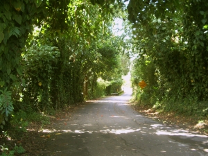
Pe'epekeo Scenic Drive, Hamakua Hawaii: Photo by Donald MacGowan

Pepe'ekeo Scenic Drive

Located just a few minutes north of Hilo on Highway 19, this “Old Road through Old Hawai'i”, a four-mile-half hour scenic wander, parallels Highway 19 but is removed worlds away from the traffic and hustle along the main road. Rolling along old cane fields, jungle-canopied in places, passing waterfalls and crossing creeks, the Pepe’ekeo Scenic Drive is a special treat for the visitor who may be thinking they waited a century too long to visit Hawai'i. On a sunny day, on a rainy day, it doesn’t matter; this scenic drive is a joy. There are no services available along the scenic drive.

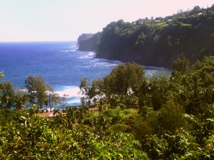
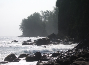
Onomea Bay, Hamakua Coast Hawaii: Photo by Donald MacGowan

Onomea Beach Trail

Only a few miles north of tame and sedate Hilo Bay, Onomea Bay is subject to the full fury and magic of the open Pacific Ocean. Rugged, jagged, majestic, the wickedly sculpted cliffs along the bay belie the easy 15 minute walk down to the beach. Accessible to most walkers of even marginal condition, the trail leads alongside a botanical garden (be sure not to wander through any of their gates unless you are a paying customer) and meanders down to the canyon mouth, past a tiny waterfall at the end of the stream and to the beach. There are awesome opportunities for photo

Leg 6) South on HWY 19 to Hilo; get on Hwy 200 (Waianuenue Avenue), head south-southeast to Rainbow Drive and Rainbow Falls.

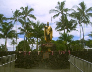
King Kamehameha Statue, Hilo Hawaii: Photo by Kilgore Trout

Hilo Town

Beautiful but wet, metropolitan but decrepit, bustling but laid back, Hilo is a lovely, maddening, heartbreaking, addictive study in contrasts. In can rain all day long for 50 days in a row, yet when the sun does shine, the views of Mauna Loa and Mauna Kea from the Liliuokalani Gardens, or of Hilo Bay as you drive down from the mountains, or the rain-forest and waterfall choked gulches with lovely beaches along the highway north of town, make Hilo one of the most truly, achingly-lovely spots on earth.

More laid back and sleepier than bustling Kailua Kona, Hilo is the largest town on the island, and the county seat. The Imiloa Astronomy Center of Hawaii, Tsunami Museum, Lyman House Missionary Museum and the Panaewa Rainforest Zoo are all wonderful places to learn about various aspects of Hawaii. There are numerous shopping districts, two large malls and the Historic Old Hilo downtown shops to browse through, a variety of sprawling green parks, a fabulous tropical arboretum right downtown and a mile-long black-sand beach fronting the bay to explore. Hilo's Farmer's Market is a "must see" for any visitor who is spending time on this side of the island.

Rainbow Falls, Hilo Hawaii: Photo by Prescott Ellwood

Rainbow Falls and Wailuku River Park

The subject of recent and ancient legend, Rainbow Falls is the lovely emblem of Hilo town. The characteristic wishbone shape of Rainbow Falls is best seen at moderate river flows…too little water and only a single drizzle remains, too much runoff and the falls merge into a single, roaring flume. At any time, however, it’s a beautiful place and worthwhile to visit. The rainbows within the falls are best seen in the mid to late morning. Follow the trail to the left along the river bank to delightful swimming and wandering; please note, however, that swimming in rivers and near falling water is dangerous. Don’t go in if the current is swift or if recent rains have swollen the river.

Restrooms are by the parking lot and a souvenir shop is located across the street.

Leg 7) Return Hwy 200 (Waianuenue Road) to HWY 19, then east on 19 to Jct with Kamehameha Ave; Kamehameha Ave east to jct with Kalanianaole Ave to Richardson Beach Park.

Richardson Beach Park, Hilo Hawaii: Photo by Donnie MacGowan

Richardson Beach Park

Richardson Beach Park, with its towering palms, fresh water pools, delightful surf, secluded and calm tidepools, lawns and general ambiance of tropical paradise, is almost certainly very close to what most visitors expect from Hawai’i—hence it popularity.

Views of Mauna Kea at sunrise and sunset from this beach are unparalleled. The snorkeling here along the small black sand beach is the best of the Hilo area and the surf is a busy mix of beginner to intermediate level waves. Restrooms, showers, water, picnic tables and a lifeguard round-out the amenities of this wonderful place. There is also a Hawai'i County Police Department substation here.

Leg 8) Return on Kalanianaole Ave to Kamehameha Ave to Hwy 19; take Hwy 19 north to Honoka’a and jct with Hwy 190; drive Hwy 190 west to Kailua Kona.

Off the Pier in Old Kailua Town: Photo by Donnie MacGowan

For more information on traveling to Hawaii in general and touring the Big Island in particular, please also visit www.tourguidehawaii.com and www.lovingthebigisland.wordpress.com. For information about the author, please go here.

All media copyright 2009 by Donald B. MacGowan; all rights reserved.
Monday, August 17, 2009

Best Scenic Drives on Hawaii #1: The Saddle Road...Kona to the Summit of Mauna Kea, Kaumana Cave and Hilo

Across the Roof of Hawaii

by Donnie MacGowan

Recent improvements to the Saddle Road make it no longer the grinding, intimidating drive it once was and open hundreds of square miles of unimaginably beautiful, strange and wondrous landscape to the Hawaii Island Visitor.

Approximate minimum time start to finish (to see every site): 12 hours

From Kona take Highway 190 to Highway 200 in 45 minutes of driving. Saddle Road, which cuts between the "saddle" of Mauna Loa on the south and Mauna Kea to the north, passes through ranch lands and the Pohakuloa Military Training Facility, for another 45 minutes, to the turn for Mauna Kea Access Road (John Burns Way). Nearby, Kipuka Huluhulu, or "shaggy hill", is a 20 minute hike to the top and back. From here it is a 30 minute drive to the Mauna Kea Visitor Information Center. The small village is home to scientists and astronomers that work in the observatories and an amazing place to learn what their research tells us about our universe. Returning to Hwy 200, drive 45 minutes to the amazing Kaumana Cave lava tube, a short hike and a wonderful exploration. A further 30 minutes down Hwy 200 brings one to downtown Hilo, where there are shops, restaurants, fine museums, gorgeous waterfront beach parks and a fabulous Farmers Market. From Hilo, it is approximately three hours to return to Kailua Kona over Hwy 200; alternately one can take the faster though less scenic Hwy 19 to Waimea and then Hwy 190 into Kailua Kona, about a 2 1/2 hour drive.

Ahu'ena Heiau, Kailua Kona Hawaii: Photo by Donnie MacGowan

Leg 1) In Kailua Kona, start at Ahu’ena Heiau; take Palani Road east to Hwy 190; take Hwy 190 to jct with Hwy 200, The Saddle Road

Ahu'ena Heiau and Kamakahonu Beach

Centuries ago the inhabitants of this region built a series of sacred temples, or heiau, which were originally used for the purpose of sacrificing human beings to their war god, Kuka’ilimoku. This particular archeological site is called Ahu’ena Heiau, which in Hawaiian means “Hill of Fire”.

Built originally in the 15th century and rededicated by Kamehameha the Great in the early 1800s as the main temple of his capital, the current structures seen at Ahu’ena Heiau were re-built in 1975 under the auspices of the Bishop Museum with financial help from the Hotel King Kamehameha and are constructed to 1/3 the original scale. There are restrooms and showers located on the pier near the beach. Adjacent Old Kailua Town is a treasure of shops, restaurants and aloha.

Hualalai Volcano from Saddle Road, Big Island Hawaii: Photo by Donnie MacGowan

Leg 2) Take Hwy 200, The Saddle Road, east to jct with John Burns Way (also called Mauna Kea Access Road).

Looking West from Highway 190 to Haualai Volcano Halfway between Kona and Waimea, Big Island of Hawaii: Photo by Donald B. MacGowan
Looking West from Highway 190 to Hualalai Volcano Halfway between Kona and Waimea, Big Island of Hawaii: Photo by Donald B. MacGowan

Saddle Road

Crossing the spectacular saddle between the towering bulk of the volcanoes Mauna Kea and Mauna Loa at about 6600 feet, The Saddle Road runs through brush, grass and forest lands, over lava fields and through some of the wildest and most breath-taking scenery on the Island. From this roadway, four of the 5 principal volcanoes that form The Big Island may be seen: Hualalai, Kohala, Mauna Loa, and Mauna Kea. Because the western half of the road is in notoriously poor condition and consists, in reality, of only one operable lane for much of its descent from the saddle to the Mamalahoa Highway.

However, this road provides the only road access to the Mauna Kea Summit Area and Visitor Information Center, Mauna Kea State Park, Pohakuloa Training Area, Mauna Kea Astronomical Observatory Complex, Waiki'i Ranch and the Kilohana Girl Scout Camp. The Saddle Road also provides the only access to thousands of acres of public forest and open grass lands. Connecting Hilo from about milepost 7.8 on the Hawai’i Belt Road to the Mamalahoa Highway approximately 6 miles south of Waimea, the Saddle Road is widely used by island residents for cross-island travel, despite its somewhat poor condition and undeserved, evil reputation.

Mauna Kea From Mauna Kea State Park; Note V-Shaped Stream Valleys and Glacial Cirques: Photo by Donald B. MacGowan

The Saddle Road frequently has perfect weather, but also fairly routine are patches of intense rain, fog and high winds. It’s takes about 2 ½ to 3 hours straight driving time, depending upon weather, to make the full traverse from Kailua Kona to Hilo; however, one should be sure to leave time in the schedule to drive up to Mauna Kea Visitor Information Station or hike the Pu’u Huluhulu nature trails.

Along its entire 53 mile length between the turn-off from the highway just 6 miles west of Waimea and where it meets Hawaii Belt Road just north of Hilo, there is no gas and there are no services available; plan accordingly. Some food, water and restrooms may be available at the Mauna Kea Visitor Information Station which is a 30 minute drive up a side road off the Saddle Road about half way.

Kipuka Huluhulu from Saddle Road: Photo by Donald MacGowan

Leg 3) Off a Spur road at the jct of John Burns Way and Hwy 200, on the south side, is Kipuka Huluhulu ("Shaggy Hill") Nene Sanctuary.

Pu’u Huluhulu Nature Trails/Kipuka Aina Hou

Frequently described as simultaneously the most noticeable and the most overlooked landmark along the Saddle Road, Kipuka Pu'u Huluhulu rises more than 200 feet out of the surrounding lava flows. It’s name meaning “furry hill”, this forested cinder cone has multiple trails winding up through rare native koa trees to breathtaking 360° views of Hualalai, Mauna Kea and Mauna Loa at the top, where you can also wander a meadow of native Hawaiian plants recently reintroduced in this protected natural habitat. By whatever trail, the summit of Kipuka Huluhulu is only about 20 minutes walk from the car.

Owing to the encapsulated nature of the kipuka, bird watching here is particularly fabulous; the Ā'akepa, Nene and the Ā'akiapola Ā'au, as well as the Kalij pheasants, pueo, i’o and turkeys are among the rare, endangered or just plain beautiful birds you will see here. The numerous roads and trails through the hundreds of square miles of adjacent lava flows makes for interesting, if hot and dry, mountain biking and hiking.

Parking and a unisex pit toilet are the only amenities available at Kipuka Pu’u Huluhulu.

Mauna Kea From Kipuka Huluhulu Nene Sanctuary: Photo by Donald MacGowan
Looking South from Mauna Loa to Mauna Kea from Near Lake Wai'au: Photo by Donnie MacGowan

Leg 4) Go north on John Burns Way to Mauna Kea Visitor Information Station.


Mauna Kea Visitor Information Station

The Visitor Information Station is open daily from 8 a.m. to 5 p.m. During the day there are interactive computer exhibits about Mauna Kea, the observatories and astronomical research, plus there are video presentations and nature trails to hike. Many evenings after dark National Park personnel and astronomers put on public programs and discuss what the latest astronomical findings tell us about the nature of our universe. The souvenir shop has some food items, including hot chocolate, coffee and hot soup, for sale.

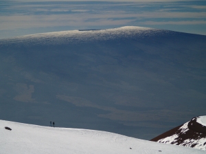
Hikers on Mauna Kea Summit Looking at Mauna Loa Summit: Photo by Donnie MacGowan

Leg 5) John Burns Way to Mauna Kea Summit

Mauna Kea Summit

Before you decide to go to the summit of Mauna Kea, stop, think, plan. Are you prepared for cold and high altitude? Do you understand the nature and dangers of altitude sickness and UV radiation? Are you experienced at traveling icy dirt roads? Is you car safe for the trip (many car rental agencies on the island forbid you to drive this road)? The Rangers at the Visitor's center can brief you on altitude sickness, UV radiation preparedness, the condition of the road and all other information you need to decide whether to visit the summit (see a video here).

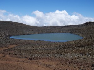
Lake Wai'au--the Seventh Highest Lake in the US--Whose Name Means "Swirling Water", Perches Near the Summit of Mauna Kea On The Big Island of Hawaii: Photo by Donnie MacGowan

The summit of Mauna Kea is truly an amazing place. Beautiful, awe-inspiring, 360 degree views of the entire Big Island, the summit is also culturally and religiously important to the native Hawai’ians and is home to several, world-class astronomical observatories and their support buildings. Because of the extremity of the altitude and the poor quality of the road above the Visitor's Center, it is advised that extreme caution be exercised in deciding to visit Mauna Kea's Summit. From the road's end very near the summit, a short, 10 minute trail leads up Pu'u Weiku cinder cone to the actual mountain top and a Hawaiian religious shrine. Also near the summit is the 1-mile hike to Lake Waiau, the 7th highest lake in the US, as well as numerous archeological sites. Moving at altitude is strenuous, so conserve energy. Do not over-tax yourself, be sure to drink plenty of fluids and protect yourself from the sun, wind and cold. Leave the summit area and return to the paved road long before you are tired.

Kaumana Cave, Hilo Hawaii: Photo by Donnie MacGowan

Leg 6) Return John Burns Way to Hwy 200; take Hwy 200 east to Kaumana Caves

Kaumana Caves

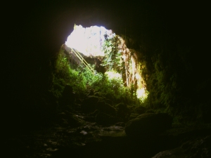
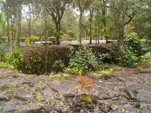
A skylight opening to 25-mile long Kaumana Cave is located at the county park near the 4-mile marker on the Hilo side of the Saddle Road. Concrete stairs take you down through the rain forest jungle to the bottom of a collapse pit forming two entrances to the cave. Most people are drawn to the entrance on the right, a large, opening leading to cavernous rooms. In this entrance, graffiti from hundreds of years ago to the present is preserved, scratched into the rocks. The entrance on the left, however, is more interesting, leading through squeezes and low spots to numerous rooms with fascinating speleo-architecture and cave formations. Both caves go to true dark in fewer than 300 feet in either direction. There are more than 2 miles of easily accessible, wild cave to explore here, but if you intend more than just a cursory inspection near the entrances, bring a hard hat, water and at least 3 sources of light. A quick tour of the caves takes fewer than 20 minutes.

Kaumana Cave's Skylight Entrance: Photo by Donnie MacGowan

Parking for the caves is located across the highway from the park; extreme care should be taken when crossing he road. Public restrooms, water and picnic tables are available at the park. As you approach Hilo from Kaumana Caves, Hwy 200 becomes variously called Kaumana Drive, then Waianuenue Avenue.

Astronomical Observatories on the Summit of Mauna Kea, From Downtown Hilo: Photo by Donnie MacGowan

Leg 7) Take Hwy 200 into Hilo Town.

Hilo Town

Beautiful but wet, metropolitan but decrepit, bustling but laid back, Hilo is a lovely, maddening, heartbreaking, addictive study in contrasts. In can rain all day long for 50 days in a row, yet when the sun does shine, the views of Mauna Loa and Mauna Kea from the Liliuokalani Gardens, or of Hilo Bay as you drive down from the mountains, or the rain-forest and waterfall choked gulches with lovely beaches along the highway north of town, make Hilo one of the most truly, achingly-lovely spots on earth.

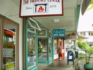
Hilo's Charming Bayfront Shops: Photo by Donald MacGowan

More laid back and sleepier than bustling Kailua Kona, Hilo is the largest town on the island, and the county seat. The Imiloa Astronomy Center of Hawaii, Tsunami Museum, Lyman House Missionary Museum and the Panaewa Rainforest Zoo are all wonderful places to learn about various aspects of Hawaii. There are numerous shopping districts, two large malls and the Historic Old Hilo downtown shops to browse through, a variety of sprawling green parks, a fabulous tropical arboretum right downtown and a mile-long black-sand beach fronting the bay to explore. Hilo's Farmer's Market is a "must see" for any visitor who is spending time on this side of the island.

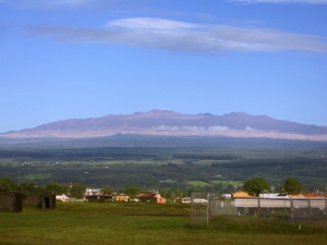
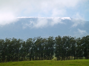
Mauna Kea's Summit  from Highway 19 Near Waimea Town: Photo by Donald MacGowan
Mauna Kea's Summit from Highway 19 Near Waimea Town: Photo by Donald MacGowan

Leg 8) Return Waianuenue Avenue to Kaumana Drive to Hwy 200; take Hwy 200 west to jct with Hwy 190; take Hwy 190 west to Kailua Kona.

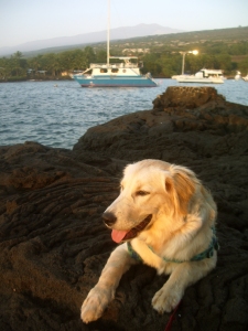
Trogdor at Keauhou Bay, Kona Hawaii: Photo by Donnie MacGowan

For more information on traveling to Hawaii in general and touring the Big Island in particular, please visit www.tourguidehawaii.com and www.lovingthebigisland.wordpress.com Information about the author is available here.

All media copyright 2009 by Donald B. MacGowan


Casino Bonus no Deposit