Saturday, October 17, 2009

Frank's Big Island Travel Hints #13: Hawaii Volcanoes National Park: Chain of Craters Road

Frank's Big Island Travel Hints #13: Hawaii Volcanoes National Park: Chain of Craters Road
by Frank Burgess, brought to you by Tour Guide Hawaii

Frank  Learns About Ancient Hawaiian Culture With Tour Guide Hawaii at Pu'u Honua O Honaunau: Kona Coast, Hawaii: Photo by Donnie MacGowan

Frank Learns About Ancient Hawaiian Culture With Tour Guide Hawaii at Pu'u Honua O Honaunau: Kona Coast, Hawaii: Photo by Donnie MacGowan

Tour Guide Hawaii is proud to announce the release of their new iPhone and iPod Touch App available at iTunes...this App will help you plan your trip to Hawaii, help you decide what you want to see, how you want to see it and help you get there with GPS, interactive maps and on-board driving instructions. The Tour Guide App presents hours of interesting videos and information about places of historical, cultural and recreational interest, giving you a sense of the people, the natural history and the unique specialness of each destination. The information is so comprehensive and complete they even tell you where all the public restrooms are! What else will Tour Guide help you find? Let's look at a trip down Chain of Craters Road in Hawaii Volcanoes National Park...Tour Guide will not only help you find many amazing sights along the way, it will tell you all about them, what to take and what to expect.

Today's hints cover the area down Chain of Craters Road from the very top of cliff, down to the lava plain along the sea and on to the end of the road. in Hawaii Volcanoes National Park. Driving through The Park there several fantastic places to stop and explore, but there is also a lot of lovely, open countryside for several miles, so enjoy the panoramic views. Your Tour Guide download from iTunes will give you more detailed information about this area.

Hawaii Volcanoes National Park is one of the great natural wonders, as well the most studied volcanoes, on earth. Few places can the visitor get as many diverse climates, flora, fauna and geologic dreamlands as inside the park’s boundaries.

Continuing down the Chain of Craters Road, there are numerous turnouts with panoramas that stretch the imagination. Tour Guide adds to the excitement with all the information about what is being seen. Take a quick stop at Alanui Kahiko. The words in Hawaiian mean old road. Here you will see portions of the old Chain of Craters Road, some 12 miles worth above and below this lookout, buried under 300 feet of lava by the 1972 eruptions. This spectacle alone is testament to the awesome destructive powers of Madam Pele, the volcano’s Fire Goddess.

A few miles further down the mountain is the Pu’u Loa Petroglyph field. It can be found along the side of the Ka’u-Puna Trail, a trail used by ancient Hawaiians. This is believed to be the largest petroglyph field in Polynesia, containing more that 15,000 carvings. The path to the petroglyphs is marked from the parking lot by cairns. Tour Guide will show you where to park and explain some of the carving’s meanings at this phenomenal spot.

At about the 19 mile marker is the current End of the Road, the location where the lava cut off the road in 1983. A year ago, you could park here and trek across the barren fields to where the lava was entering the ocean. Now, however, the lava has changed course and is sometimes entering from the Puna side of the park. There is still a ranger’s station here and many placards telling about the flows and safety precautions for hiking in the desolate area. Restrooms are available.

Walking down to the ocean at the End of the Road are some beautiful formations, most notably, the Holei Sea Arch. Tour Guide will tell you how arches and stacks are formed when the waves pound against the sea cliffs and chisel into the various lava densities. The cliff around this arch is some ninety feet, so use caution as you photograph this amazing sight.

Looking back up the mountain gives one the perspective of the destruction, yet the immaculate life giving beauty, of the fire goddess Pele who is in constant battle her sister, the ocean. Each takes life, and gives it. We as humans can stand in awe at the majesty and wonder of these two great forces, respecting each on its own terms.

As you travel back up the Chain of Craters Road, don’t forget to stop at some of the vista points and take photos and videos of the landscape, the memories and the people that are like nowhere else on earth, the Island of Hawaii.

To see the new iPhone/iPod Touch App, please visit http://www.tourguidehawaii.com/iphone.html. The best of Tour Guide Hawaii's free content about traveling to, and exploring, the Big island, can be found here. For more information on traveling to Hawaii in general and on touring the Big Island in particular, please also visit www.tourguidehawaii.com and www.lovingthebigisland.wordpress.com.

Copyright 2009
by Frank Burgess; photography copyright 2009 by Donald B. MacGowan. All rights reserved.


Friday, October 16, 2009

Hiking to Captain Cook Monument, on the Kona Coast of Hawaii

Hawaii is, in fact, an island that is served by very few roads, that many people come to visit each year and that makes most of its wealth from the tourism industry. Given this, it's quite surprising how hard it can be to find useful, reliable and up-to-date information about anything from "is your favorite restaurant still in business" to "how's the snorkeling this month?".

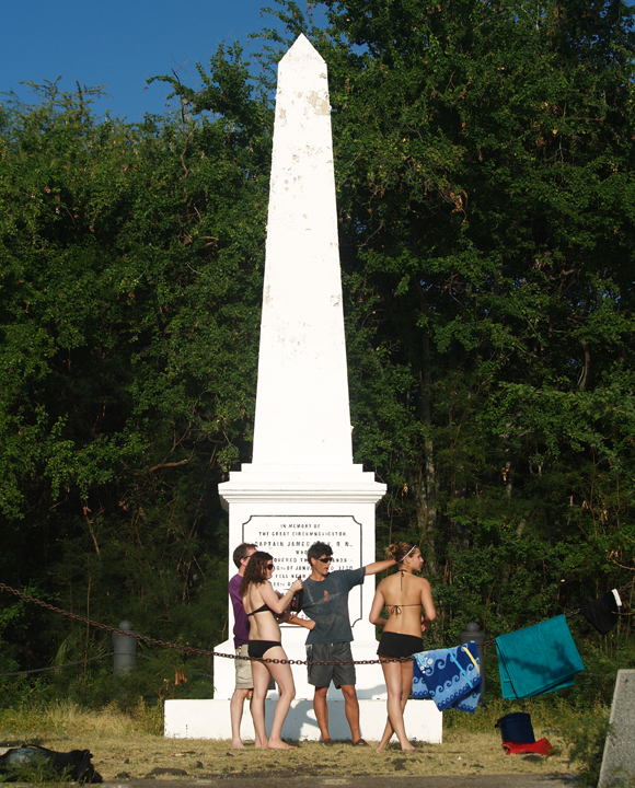
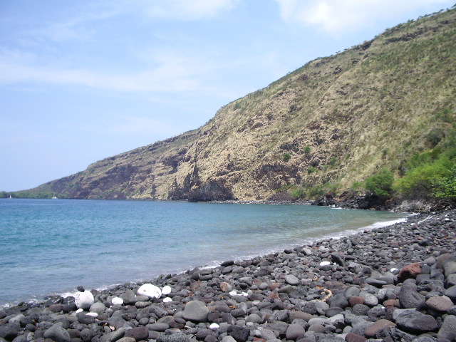
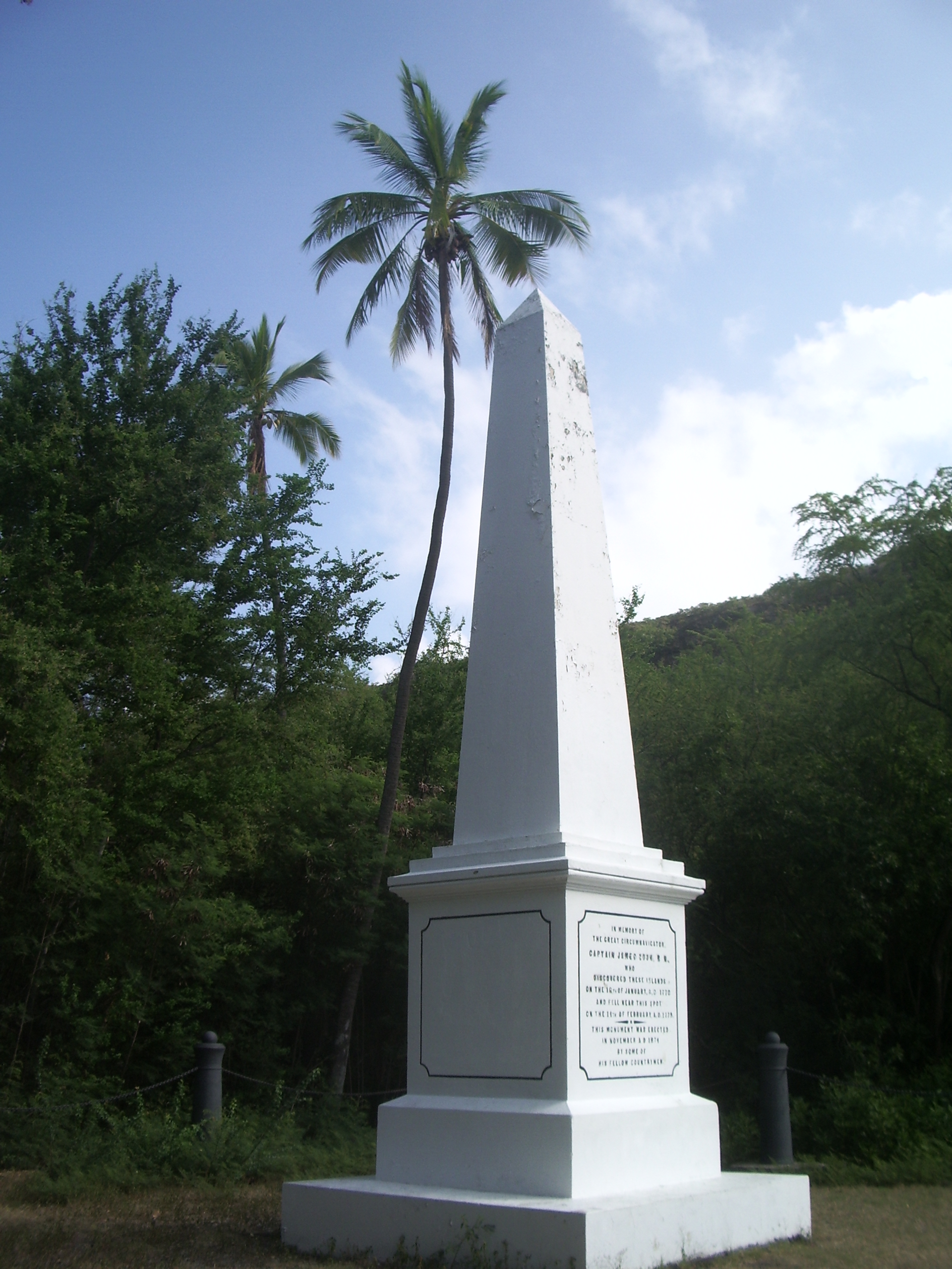
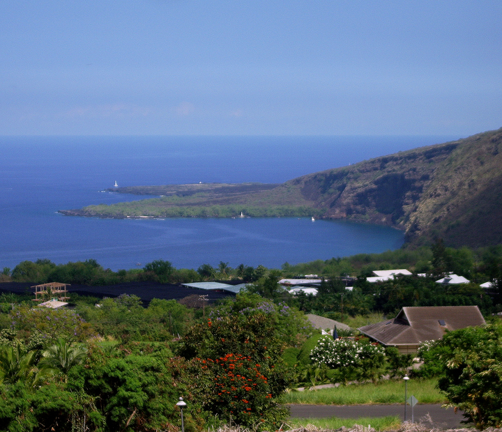
The Captain Cook Monument, Kealakekua Bay on the Kona Coast of Hawaii: Photo by Donnie MacGowan

Road names are in the unfamiliar Hawaiian language; friendly locals give helpful directions, but in rapid-fire pigeon English using landmarks unfamiliar to the visitor and many guidebooks are either woefully out of date or flat wrong. The first time visitor to Hawaii may be overwhelmed when bombarded by advertising disguised as visitor information, overzealous salespeople from rapacious time-share resorts and racks and racks of of advertising for tours, attractions and restaurants.

Even the experienced Hawaii traveler may find it difficult to ferret out the information he needs to find a unique, secluded or unusual experience in Paradise. Finding current, reliable information on hikes on the Big Island can be equally frustrating.

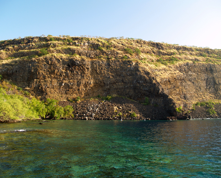
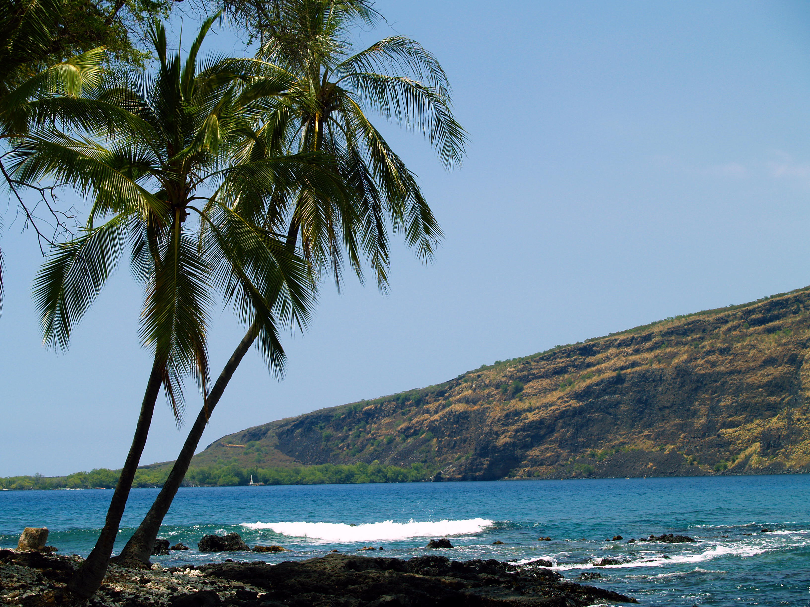
Across Kealakekua Bay to Cook Monument from Manini Beach, Kona Coast: Photo by Donnie MacGowan

Clearly, the visitor to Hawaii can use some help finding special places in general and information about, and help getting to, the best hikes on Hawaii Island.

To help you find the more secluded, wild and exotic destinations in particular, and to help you get more out of your Hawaii vacation in general, Tour Guide Hawaii has released a brand new iPhone/iPod Touch App . This "must have" travel app is packed with hours of informative video on the most interesting places on Hawaii; helps navigate you to all the most popular visitor destinations, the most interesting attractions, the most romantic and secluded beaches; helps you effortlessly find hikes, snorkel spots, historical and cultural landmarks, shopping and dining. And of course, our new App includes directions to, and rating of, all the public restrooms! Learn all about the App, here.

But first, let's talk about one of the finest short hikes on the Island of Hawaii.

Hiking to Captain Cook Monument, on the Kona Coast of Hawaii

View of Monument from Napo'opo'o Road Near the Trail Head: Photo by Donald B. MacGowan

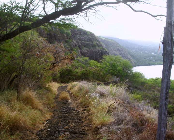
This hike is a fine walk through tall grass, open lava fields and dense, dryland forest, opening onto one of the most pristine ocean beaches in the world. Hiking down to the Captain Cook’s Monument from Highway 11 is a great deal of fun—great scenery, wonderful trail that involves complete immersion in Hawai’ian pre- and post-contact history and offers the opportunity for some of the finest snorkeling anywhere on the planet. However, the return hike is hot, thirsty and strenuous; but it is also highly rewarding, granting panoramic views all up and down the Kona Coast.

Along the Cook Monument Trail: Photo by Donald B. McGowan

The trail leaves the Napo’opo’o Road just 500 feet below where it drops off Highway 11 near a large avocado tree, right across from a group of three coconut trees, right at telephone pole number 4; parking is tight, but safe. The parking spots and trailhead will show signs of obvious use, usually in the form of recently deposited horse apples from the many trail riders frequenting the area.

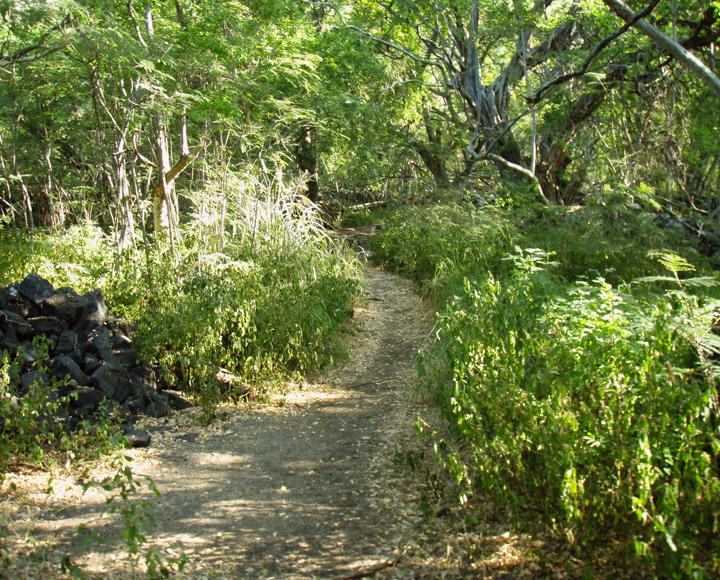
The Trail Follows the Historic Carriage Road to Cook Monument: Photo by Donnie MacGowan

The first avocado tree is the harbinger of wonderful things to come, as the trail passes through an area rich in guava, mango, papaya and avocado that are free for the gathering. The 2.5-mile hike takes about 1-1 1/2 hours to descend, somewhat more time to come back up.

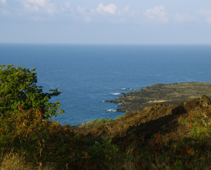
View of the Kona Coast from the Cook Monument Trail:Photo by Donald B. MacGowan

After following a jeep road for about 50 feet, the trail turns left when the jeep road turns right onto private property. Although overgrown by tall grass for the next half mile, the trail runs more or less straight down the left side of a rock wall to the sea.

Ka'awaloa Village Path Near the Cook Monument: Photo by Donnie MacGowan

As the pitch straightens out, keep to the left when the trail first forks and proceed to the beach. You will strike shore several hundred feet northwest of the monument—stroll through the remains of Ka’awaloa Village along the beach on your way to pay homage to Europe’s most prolific explorer, James Cook.

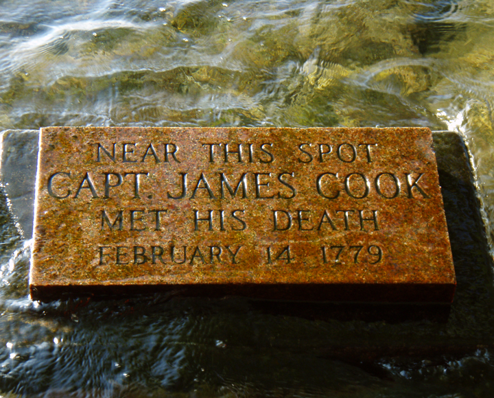
Marker Where James Cook Was Killed: Photo by Donnie MacGowan

Many people fail to notice the small concrete marker in the tidal zone marking the place where Cook skirmished with the Natives and Was killed, however, this marker lies at the spot where the trail breaks through the underbrush at the ocean's edge.

Kealakekua Bay at Cook Monument: Photo by Donnie MacGowan

Remember to be respectful of the remains of the Hawaiian Village--it contains numerous spots still sacred to the natives; do not disturb or deface rock wall, temple pavements. It is best to simply view the ruins from the trail and move along. There are no facilities for garbage, used toilet paper, etc; remember to pack out everything you packed in--this includes your toilet paper. The bay is home to a beleaguered coral habitat--so not touch or stand on the coral when snorkeling. There are also sea turtles and numerous dolphin in the bay--do not approach or harass them--this is not only illegal, it's dangerous. For more information of how to treat coral wild animals in the snorkeling environment, please go here.

The Captain Cook Monument on Kealakekua Bay, Hawaii: Photo by Donnie MacGowan

There is no drinking water or toilet facilities available at the monument, so come prepared. It's also a good idea to bring about 1/2 gallon of fresh water per person to rinse off with after snorkeling, and dry short to change into--hiking uphill in wet, salty clothes is extremely unpleasant.

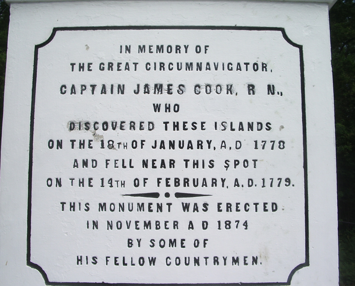
Inscription on the Captain Cook Monument, Kealakekua Bay, Hawaii: Photo by Donald B. MacGowan

Remember to bear right at the trail junction when returning uphill, or you will face a long, hot and unpleasant time wandering the a’a fields of Napo’opo’o.

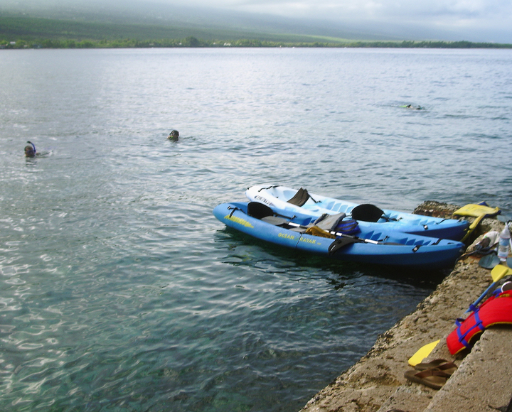
The Old Pier at the Captain Cook Monument, Kealakekua Bay, Hawaii: Photo by Donnie MacGowan

It is also possible, but much less pleasant, to hike most of the way to the monument along the shoreline from Napo’opo’o. This hike is an uninteresting exercise in scrambling over boulders along the beach and contains at least two places that have to be swum in rough water; as such, the safety of this trek is totally at the whim of ocean tides and swells. Highly not recommended.

Looking from Hikiau Heiau to Cook Monument; the Cliffs and Boulders Make Hiking Along the Shoreline to the Monument Both Difficult and Extremely Dangerous--DO NOT ATTEMPT THIS: Photo by Donnie MacGowan

To see the new iPhone/iPod Touch App, please visit http://www.tourguidehawaii.com/iphone.html. The best of Tour Guide Hawaii's free content about traveling to, and exploring, the Big island, can be found here. For more information on traveling to Hawaii in general and on touring the Big Island in particular, please also visit www.tourguidehawaii.com and www.lovingthebigisland.wordpress.com.

Copyright 2009
by Frank Burgess; photography copyright 2009 by Donald B. MacGowan. All rights reserved.


Thursday, October 15, 2009

Frank's Big Island Travel Hints #12: More fun in Hawaii Volcanoes National Park, Big Island, Hawaii

Frank's Big Island Travel Hints #12: More fun in Hawaii Volcanoes National Park, Big Island, Hawaii
by Frank Burgess, brought to you by Tour Guide Hawaii

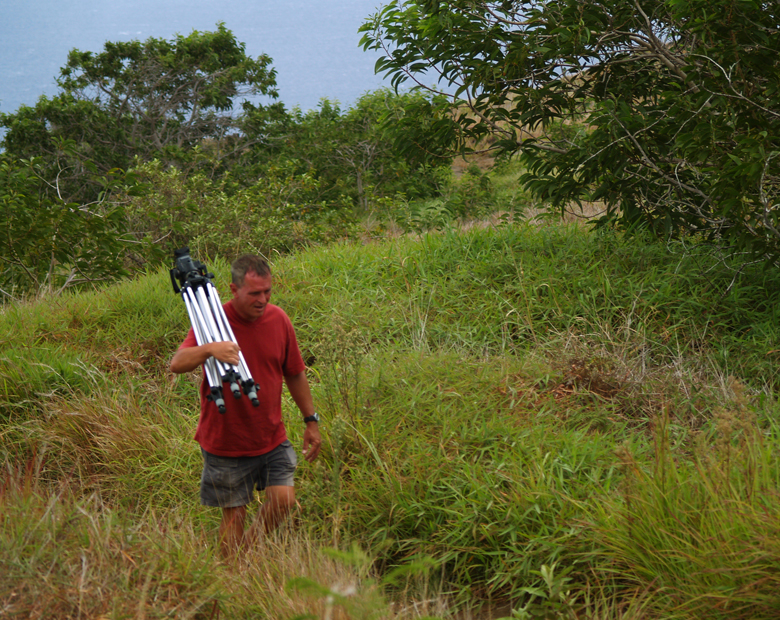
Frank Burgess at Hilina Pali Overlook: Photo by Donnie MacGowan

Tour Guide Hawaii is proud to announce the release of their new iPhone and iPod Touch App available at iTunes...this App will help you plan your trip to Hawaii, help you decide what you want to see, how you want to see it and help you get there with GPS, interactive maps and on-board driving instructions. The Tour Guide App presents hours of interesting videos and information about places of historical, cultural and recreational interest, giving you a sense of the people, the natural history and the unique specialness of each destination. The information is so comprehensive and complete they even tell you where all the public restrooms are! What else will Tour Guide help you find? Let's look at a trip down Chain of Craters Road in Hawaii Volcanoes National Park...Tour Guide will not only help you find many amazing sights along the way, it will tell you all about them, what to take and what to expect.

Today's hints cover the area along the very top of Chain of Craters Road in Hawaii Volcanoes National Park. Driving through The Park there several fantastic places to stop and explore, but there is also a lot of lovely, open countryside for several miles, so enjoy the panoramic views. Your Tour Guide download from iTunes will give you more detailed information about this area.

Deeper and Deeper into Hawaii Volcanoes National Park

As you continue driving around and exploring Hawaii Volcanoes National Park you will find many great hiking and bicycling opportunities. Tour Guide has some 50 sights to see in the park and has details such as, parking, food and water and restroom facilities along the way.

One of the best day hikes in the park is the Kilauea Iki Crater Trail. This four mile round trip hike, about three hours at a nominal pace, will descend into the crater itself. From the floor of the crater, you will see fern, o'hia, and tropical rainforest crowding right up to the rim. The floor itself is stark desert, by comparison, as the trail takes you across and then up the other side. Make sure to bring plenty of water and maybe even some snacks for this hike.

To see even more of the parks wonders, we at Tour Guide suggest a drive down the Chain of Craters Road. This drive unlocks dozens more sights, hikes and vistas from high mountain rainforest to the barren lava landscapes and scenic ocean views below. Along this road are a number of overlooks for some fabulous photography. It ends at the sea where waves crash and spew against cliffs with steam clouds in the distance where lava reaches the ocean. Let’s see what this stunning area has to offer.

Lua Manu is a pit crater formed before written records were kept of the eruptive activity in the park. You will notice no cinder around the rim. This indicates no eruption here but a lava lake that formed inside the pit. As it drained, the pit collapsed, the latest of which was in 1974.

There are several more pit craters to see along this route and then you will come to Hilina Pali Road. This nine mile road takes you to some of the most magical views of the National Park. From forest down to the coast, the breathtaking scenery with leave you with the awe and majesty of Mother Nature and Madam Pele. For the hearty campers, Tour Guide will lead you to Kulanaokuaiki Campground. There are restrooms here but no water is available. At the end of Hilina Pali Road is an overlook not to be missed.

Back on Chain of Craters Road, Tour Guide brings you to Pauahi Crater, a large hourglass shaped crater that has held lava from many different flows over the years. Most recently, the 1979 earthquakes opened the south rift of the crater and issued steam and lava fountains. Though this episode only lasted one day, it was precursor to the current flows from Pu’u O’o in 1983 that destroyed hundreds of homes and businesses miles away in the Puna District.

Tour Guide will guide you to Kipuka Kahali’i. A kipuka is a hole or space where the lava surrounded forest or grassland but did not burn it. This one was partially devastated by the 1969 hot ash eruption of Mauna Ulu. The tallest trees survived and some hearty species of plants have returned.

To see the new iPhone/iPod Touch App, please visit http://www.tourguidehawaii.com/iphone.html. The best of Tour Guide Hawaii's free content about traveling to, and exploring, the Big island, can be found here. For more information on traveling to Hawaii in general and on touring the Big Island in particular, please also visit www.tourguidehawaii.com and www.lovingthebigisland.wordpress.com.

Copyright 2009
by Frank Burgess; photography copyright 2009 by Donald B. MacGowan. All rights reserved.
Tuesday, October 13, 2009

Frank's Big Island Travel Hints # 11: Exploring Deeper Into Hawaii Volcanoes National Park, Big Island, Hawaii

Frank's Big Island Travel Hints #11: Exploring Deeper Into Hawaii Volcanoes National Park, Big Island, Hawaii
by Frank Burgess, brought to you by Tour Guide Hawaii

Frank Burgess Filming the Wiley Wild Petroglyphs at Pu'u Loa in Hawaii Volcanoes National Park: Photo by Donald B. MacGowan

Tour Guide Hawaii is proud to announce the release of their new iPhone and iPod Touch App available at iTunes...this App will help you plan your trip to Hawaii, help you decide what you want to see, how you want to see it and help you get there with GPS, interactive maps and on-board driving instructions. The Tour Guide App presents hours of interesting videos and information about places of historical, cultural and recreational interest, giving you a sense of the people, the natural history and the unique specialness of each destination. The information is so comprehensive and complete they even tell you where all the public restrooms are! What else will Tour Guide help you find? Let's look at a trip around the upper Crater Rime in Hawaii Volcanoes National Park...Tour Guide will not only help you find many amazing sights along the way, it will tell you all about them, what to take and what to expect.

Today's hints cover the area along the very top of Crater Rim Drive in Hawaii Volcanoes National Park. Driving through The Park there several fantastic places to stop and explore, but there is also a lot of lovely, open countryside for several miles, so enjoy the panoramic views. Your Tour Guide download from iTunes will give you more detailed information about this area.

As you continue around the Crater Rim Drive, at Volcanoes National Park, there are dozens of great sights. A more recent crater, erupting with fire curtains in 1974, is Keanakako’i Crater. The pebbles around the rim were formed by froth from the lava as it was blasted into the air and cooled as they fell to the ground. This crater is a bit off-the-beaten-path, but Tour Guide shows the way.

Right along the Crater Rim Drive is the Devastation Trail (video here) formed by Kilauea Iki. When the Pu’u Pai vent erupted in 1959 it spewed pumice cinder and scalding ash burying the rainforest some ten feet deep. This caused the forested area to die leaving a barren wasteland where little has grown since. Tour Guide will take you on the three quarter mile paved hike, along the edge of this moonscaped region, and give more historical information as well.

At the end of the Devastation Trail is the Pu’u Pai overlook. This spot affords a view of Pu’u Pai (gushing hill) and Kilauea Iki (little Kilauea) (video here and here) and skirts the edge of the desert and rainforest as if some drew a line separating the two. Tour Guide gives the fascinating stories of 1900 foot lava fountains during this episode.

Super Tip: Bring plenty of water. I can’t stress this enough. There are few facilities available on the drives and hikes around the park, so make sure you stock up before leaving the Visitor’s Center. Besides, good hydration will keep you energized for all your fun activities. To your health.

On the east side of Crater Rim Drive is a delightful stop not to be missed, Thurston Lava Tube (video here). Tour Guide will tell you how lava tubes are formed when magma flows underground. It eventually empties leaving cave-like formations. Most lava tubes are very small; however Thurston Lava Tube is quite large. The National Park Service has paved a pathway through the tube, and installed lighting, to make this a 300 yard spelunking adventure for everyone to enjoy. The cave circles so that the entrance and exit end at the parking area. The giant ferns here invited the songs of exotic birds, many of which are found nowhere else in the world. This is one of the few locations where restrooms are available.

One of the best hiking and biking routes is the Escape Road (video here). Built for just what its name implies an alternate road for when the lava will inevitably cut the Chain of Crater Road, it makes a lovely down hill walk or bike ride. Tour Guide will show where to start at the Thurston Lava Tube parking area and end at the Mauna Ulu parking lot. This road meanders through some of the most cool and pristine rainforest to be found.

At the other end of the Escape Road is Mauna Ulu (video here), also accessible from Chain of Craters Road. This spot was formed by numerous eruptions between 1969 and 1974. A few yards down the road, you see the different types of lava formations left from these flows. Tour Guide will explain these types of lava in great detail. Across the expanse lies Pu’u Huluhulu, or shaggy hill. For those that are ready hike, there is a tree mile round trip hike to the top of Pu’u Huluhulu marked by cairns. From the summit, the views of the lava flows and coastline are indescribable.

To see the new iPhone/iPod Touch App, please visit http://www.tourguidehawaii.com/iphone.html. The best of Tour Guide Hawaii's free content about traveling to, and exploring, the Big island, can be found here. For more information on traveling to Hawaii in general and on touring the Big Island in particular, please also visit www.tourguidehawaii.com and www.lovingthebigisland.wordpress.com.

Copyright 2009
by Frank Burgess; photography copyright 2009 by Donald B. MacGowan. All rights reserved.
Monday, October 12, 2009

Volcano Watch: Hualalai is third most active volcano in Hawai`i

Reprinted from here. Brought to you by Tour Guide and our new, comprehensive GPS/Internet/3G navigation App for iPhones and iPod Touch available today at iTunes!

View of Hualalai Volcano, Hawai`i, looking SE.  Photograph by J. Kauahikaua on December 30, 1996.
View of Hualalai Volcano, Hawai`i, looking SE.
Photograph by J. Kauahikaua on December 30, 1996.

The West Hawai`i Today issue for September 11, 2009, contained a letter to the editor titled "Hualalai is a real and present threat." The writer's main point was that "Hualalai is the 'secret in the closet' that nobody wants to talk about," that Hualalai is under-monitored, and that, should Hualalai erupt, there is no evacuation plan.

The letter writer's concerns about Hualalai were valid, but he was not aware of HVO's current efforts and plans to improve the monitoring of Hualalai. We hope to shed some light on recent and future activities planned for Hualalai.

Hualalai is the third most active volcano on Hawai`i Island behind Kīlauea and Mauna Loa, according to the Hawaiian Volcano Observatory's (HVO) Web site (http://hvo.wr.usgs.gov/), and attained national ranking of "High Threat" for active volcanoes in the U.S. (see http://pubs.usgs.gov/of/2005/1164/).

In the ranking, there were 37 volcanoes nation-wide that were highest-priority targets for improved monitoring; Kīlauea and Mauna Loa were included in this group. Furthermore, 21 additional volcanoes were found to be under-monitored and were regarded high priority for improved monitoring; Hualalai is in this group.

What is the basis for this ranking? Hualalai has erupted three times in the last 1,000 years, the most recent eruption occurring in 1801. An intense and damaging seismic swarm in 1929 marked a failed eruption. In the same interval, Mauna Loa and Kīlauea have each erupted more than 150 times, and Haleakala has erupted at least 10 times. Hualalai was rated a higher threat than Haleakala, due to the extent of development (airport, power station, etc.) and the larger population living on the volcano's flanks.

Is Hualalai under-monitored? In 2005, HVO and the Pacific Tsunami Warning Center (PTWC) each had one seismometer on the volcano, and bi-annual deformation surveys were conducted by our staff. With the permission of Kamehameha Schools, a continuous GPS receiver was installed near the summit in late 2006. In 2009, HVO still has one seismometer and uses two instruments operated by PTWC for eruption monitoring, and we continue the bi-annual surveys. Plans for the next two years include upgrading our seismic site and adding a new one.

We routinely scrutinize all available satellite imagery daily, including visual and thermal images to indicate any significant visual and temperature changes, or increased gas emissions. Moreover, radar scans several times each year can pinpoint any ground deformation that may be a precursor to volcanic activity. The radar scans are so sensitive that several small areas of subsidence were detected after the October 15, 2006, Kiholo earthquakes.

The conclusion from evaluating all of these data is that there have been no signs of swelling, major subsidence, temperature changes, gas emissions, or unusual seismic activity on Hualalai that would indicate volcanic activity in the near future. Nevertheless, we continue to look for any changes.

If the rankings were done today, Hualalai would be nearly fully monitored.

We agree with the letter writer that "the more people know about Hualalai, the more will be prepared." In 2004, University of Hawai`i at Manoa (UHM) scientists published two studies on Kona community's perception of volcanic risk and preparedness for lava flows from Hualalai and Mauna Loa. They concluded that "current community understanding and preparedness… falls short of that required for a volcanic crisis, particularly for those eruptions with short onset and high effusion rates on steep slopes that would impact Kona in just a few hours…"

There are several reasons for the lack of understanding, but foremost may be the constant influx of new residents who haven't educated themselves about volcanic hazards. The primary mission of the U.S. Geological Survey's Hawaiian Volcano Observatory is to monitor the active volcanoes in the State of Hawai`i. Through our Web site, public forums, and newspaper articles, we strive to disseminate information on the volcanoes and their hazards.

The people of Kona should know that we are keeping an eye on Hualalai and that if there are any changes (in its eruption status), we will let the public know!

Kīlauea Activity Update

Lava continues to erupt from the TEB vent, on Kīlauea's east rift zone and flow through tubes to the ocean at Waikupanaha. A deflation-inflation cycle this past week resulted in a reduction of lava supply for several days, followed by a resumption of flow on Wednesday, Sept. 30. Breakouts from the tube system started at that time, and these surface flows remain active at the top of Royal Gardens subdivision. The flows are mostly staying close to the breakout point along the east margin of the flow field.

Faint glow above the vent at Kīlauea's summit has been visible at night. A portion of the Halema`uma`u vent cavity collapsed on Saturday, Sept. 26, followed by the appearance of an active lava pond deep within the vent cavity on the night of Tuesday, Sept. 29. Volcanic gas emissions remain elevated, resulting in high concentrations of sulfur dioxide downwind.

Four earthquakes beneath Hawai`i Island were reported felt this past week. A magnitude-2.3 earthquake occurred at 12:30 p.m., H.s.t., on Friday, September 25, 2009, beneath Kilauea's summit at a depth of 6 km (4 miles). Two earthquakes occurred on Sunday, September 27-a magnitude-2.1 earthquake at 9:52 a.m., H.s.t., located 7 km (4.3 miles) N of Kailua at a depth of 8 km (5 miles) and a magnitude-2.3 earthquake at 10:22 p.m., H.s.t., located 7 km (4.3 miles) ENE of Honaunau at a depth of 6 km (3.7 miles). A 1.6-magnitude earthquake at 7:11 p.m. H.s.t., on Wednesday, September 30, was located 15 km (10 miles) NW of Mauna Kea's summit at a depth of 25 km (16 miles).

Visit our Web site (http://hvo.wr.usgs.gov) for detailed Kīlauea and Mauna Loa activity updates, recent volcano photos, recent earthquakes, and more; call (808) 967-8862 for a Kīlauea activity summary; email questions to askHVO@usgs.gov.

-------------

Planning on visiting the Big Island Volcanoes, hiking the beautiful summits or going to see the flowing lava? Tour Guide Hawaii is proud to announce the release of their new iPhone and iPod Touch App available at iTunes...this App will help you plan your trip to Hawaii, help you decide what you want to see, how you want to see it and help you get there with GPS, interactive maps and on-board driving instructions. In addition to concentrating on Hawaii's volcanoes, beaches and waterfalls, the Tour Guide App presents hours of interesting videos and information about many other places of historical, cultural and recreational interest, giving you a sense of the people, the natural history and the unique specialness of each destination. The information is so comprehensive and complete they even tell you where all the public restrooms are!

We highly recommend all Big Island visitor's who have iPhones or an iPod Touch check out our App on iTunes; we think you'll agree it's far better than old-fashioned, cumbersome maps or expensive guide books that seem to be out of date before they are printed. See it today!

Sunday, October 11, 2009

Frank's Big Island Travel Hints #10: Hawaii Volcanoes National Park

Frank's Big Island Travel Hints #10: Hawaii Volcanoes National Park
by Frank Burgess, brought to you by Tour Guide Hawaii


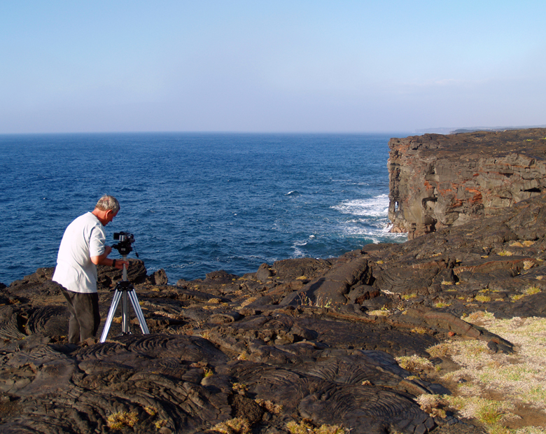
Frank Burgess Filming at the End of Chain of Craters Road, Hawaii Volcanoes National Park: Photo by Donald B. MacGowan

Tour Guide Hawaii is proud to announce the release of their new iPhone and iPod Touch App available at iTunes...this App will help you plan your trip to Hawaii, help you decide what you want to see, how you want to see it and help you get there with GPS, interactive maps and on-board driving instructions. The Tour Guide App presents hours of interesting videos and information about places of historical, cultural and recreational interest, giving you a sense of the people, the natural history and the unique specialness of each destination. The information is so comprehensive and complete they even tell you where all the public restrooms are! What else will Tour Guide help you find? Let's look at a trip south from Kona along the Hawaii Belt Road to Hawaii Volcanoes National Park...Tour Guide will not only help you find many amazing sights along the way, it will tell you all about them, what to take and what to expect.

Today's hints cover the area from Kona to Hawaii Volcanoes National Park, and the first few sites of interest within the Park. Driving along the Kona Coast and then south east through Ka'u, through tropical rainforest, across mysterious savanna and recent lava flows, there several fantastic places to stop and explore, but there is also a lot of lovely, open countryside for several miles, so enjoy the panoramic views. Your Tour Guide download from iTunes will give you more detailed information about this area.

Let's Go to Hawaii Volcanoes National Park!

About a two hour straight drive from Kona, going south, brings you to the Hawaii Volcanoes National Park. If you have a Golden Eagle Pass your entrance is free. If not, it is only $10.00 per carload to enter the park. The rangers at the gate will give you detailed maps of the area.

Super tip: Your receipt will give you free access to the National Park for seven days.

My first suggestion is to go to the Kilauea Visitors Center and the Jagger Museum. This will give you a nice overview of the park and rangers are there to answer questions. This spot also looks over the majestic Halemaumau Crater. Tour Guide will get you to the park and lead you to more than 50 sites. It is also possible that our state bird, the Nene Goose, will be huddled in the parking lots. They are protected as an endangered species, so be careful when parking nearby.

Another great place to visit is the Volcano Art Center. It may seem a strange, but the Volcano Art Center boasts one of the best collections of art in the whole state. World renowned artist in various media are on display as well as theatrical and musical performances.

There is only one restaurant in the park proper, and that is the Volcano House. Built as a lodge in the mid 1800’s, the Volcano House has hosted dignitaries, politicians, sports heroes and movie stars from all over the world. This grand edifice sits right on the lip of Halemaumau Crater and the views from her restaurant are stunning. Tour Guide will give a complete history of how it came to be. The food is good and the prices are reasonable. Bicycle rentals are also available near the lodge.

Crater Rim Drive is a great driving introduction to the park. It encircles the Halemaumau Crater and, for only an 11 mile drive, passes through several dramatic climate zones. You will encounter arid desert, grass savannah, and into tropical rainforest; this loop can easily be done in forty minutes. However, you will want to take more time to appreciate the beauty and majesty of one nature’s most awesome wonders. Tour Guide will suggest short to medium hikes and bicycle trails as well as over 50 historic and geologic sites to visit within the park.

If you are up for some hiking, Tour Guide will lead you to the trail for Waldron Ledge Overlook. This short hike is through the Ohia and fern jungles, shaded most of the way, and can be done on bicycle as well. From this vantage point one can see the active vent, Kilauea Iki, and breathtaking views of the coast.

Along the Crater Rim Drive you will also see many steam vents and the Sulfur Banks. This is where water seeps into crevices and meets the molten magma about a half mile below the surface, is super heated, and returns to the surface as steam. These vents are often accompanied by a “rotten egg” smell common where sulfur is rising with the steam, turning the ground around the vents hues of yellow, green and white.

To see the new iPhone/iPod Touch App, please visit http://www.tourguidehawaii.com/iphone.html. The best of Tour Guide Hawaii's free content about traveling to, and exploring, the Big island, can be found here. For more information on traveling to Hawaii in general and on touring the Big Island in particular, please also visit www.tourguidehawaii.com and www.lovingthebigisland.wordpress.com.

Copyright 2009
by Frank Burgess; photography copyright 2009 by Donald B. MacGowan. All rights reserved.
Saturday, October 10, 2009

Hilo Askance

by Donald B. MacGowan

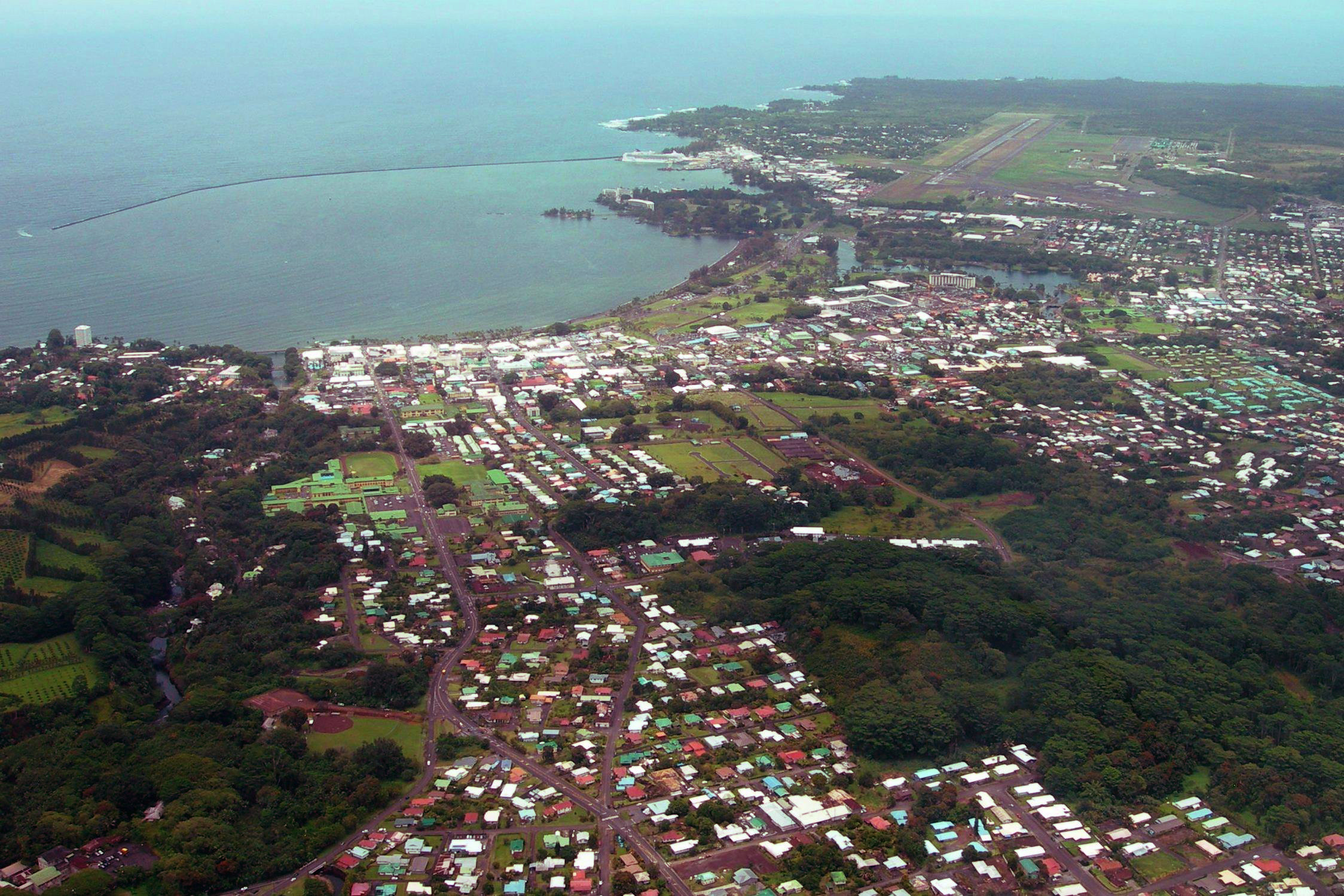
Hilo From the Air: Photo by Donnie MacGowan

Beautiful but wet, metropolitan but decrepit, bustling but laid back, Hilo is a lovely, maddening, heartbreaking, addictive study in contrasts.

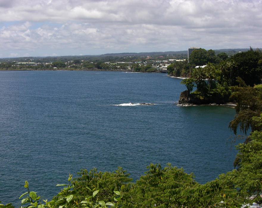
In can rain all day long for 50 days in a row, yet when the sun does shine, the views of Mauna Loa and Mauna Kea from the Liliuokalani Gardens, or of Hilo Bay as you drive down from the mountains on Kaumana Drive, or the waterfall and flower choked jungle gulches leading to lovely small beaches along the highway north of town, make Hilo one of the most truly, achingly lovely spots on earth.

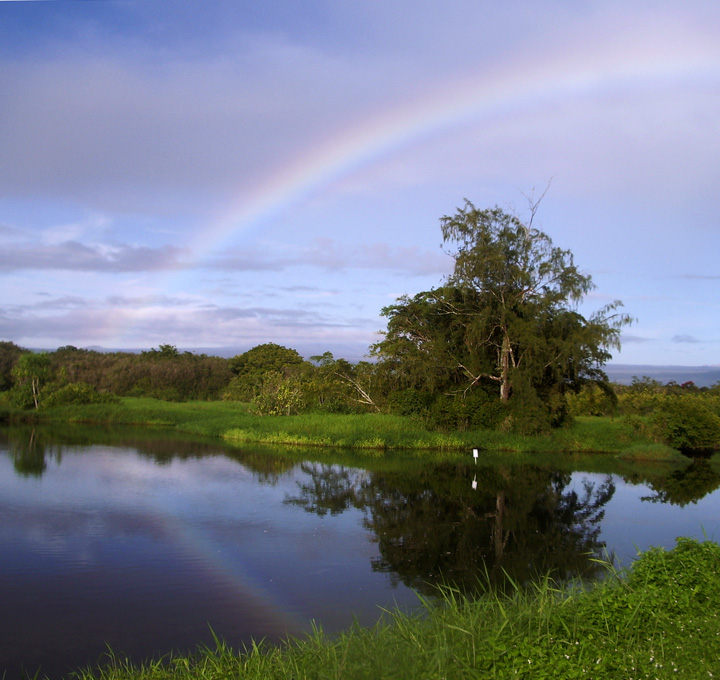
Rainbow at Lokawaka Fishpond, Hilo: Photo by Donnie MacGowan

The wettest city in America, Hilo is about rain; Hilo is humid and moldy. Hilo is poor; Hilo is dirty, littered and unkempt.

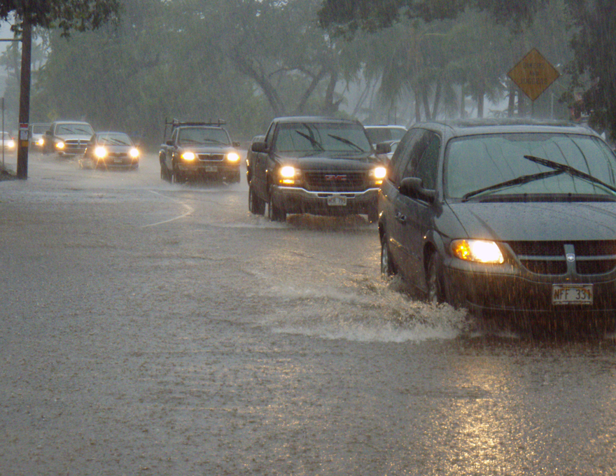
In Hilo, the Skies Just Open...For Days at a Time: Photo by Donald B. MacGowan

Even where tourists are expected to congregate, street trash blows, drug merchants abound and mildew, flapping tin roofs and peeling paint are omnipresent. Hilo's public restrooms, on the whole, are a disgrace.

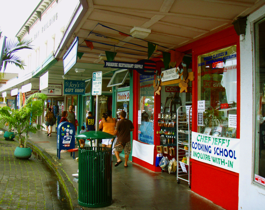
Although it Boasts a Modern Mall and Small Downtown Shopping District, Much of Hilo's Commercial District Are Fairly Disreputable Looking: Photo by Donnie MacGowan

The Hilo area's reputation was so bad among early native Hawaiian that when Kamehameha the Great wanted to build a fleet of 10,000 war canoes in secret to invade Maui, he looked around Hawaii to see where such massive construction could be undertaken without danger of spies or locals seeing. The Hilo area was so universally shunned and abjectly empty that her bay was the perfect place to build and hide the largest fleet of warships the central Pacific Ocean would see until the Second World War.

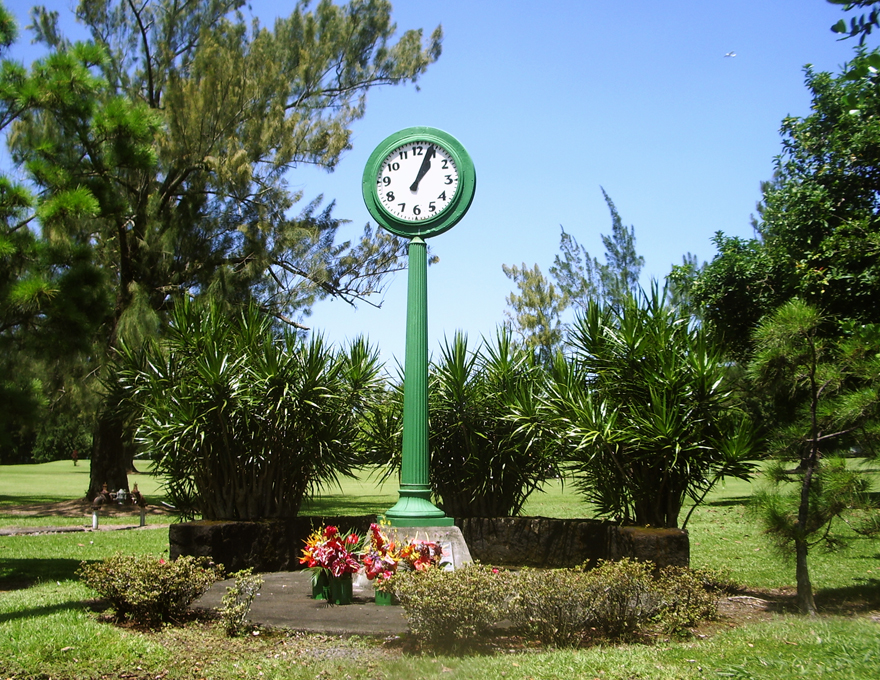
The Deadly Tsunami of 1960 Stopped This Clock in Hilo; The Clock Now Stands As A Memorial To those Who Lost Their Lives: Photo by Donnie MacGowan

Hilo bears the scars of killer tsunamis and racial intolerance.

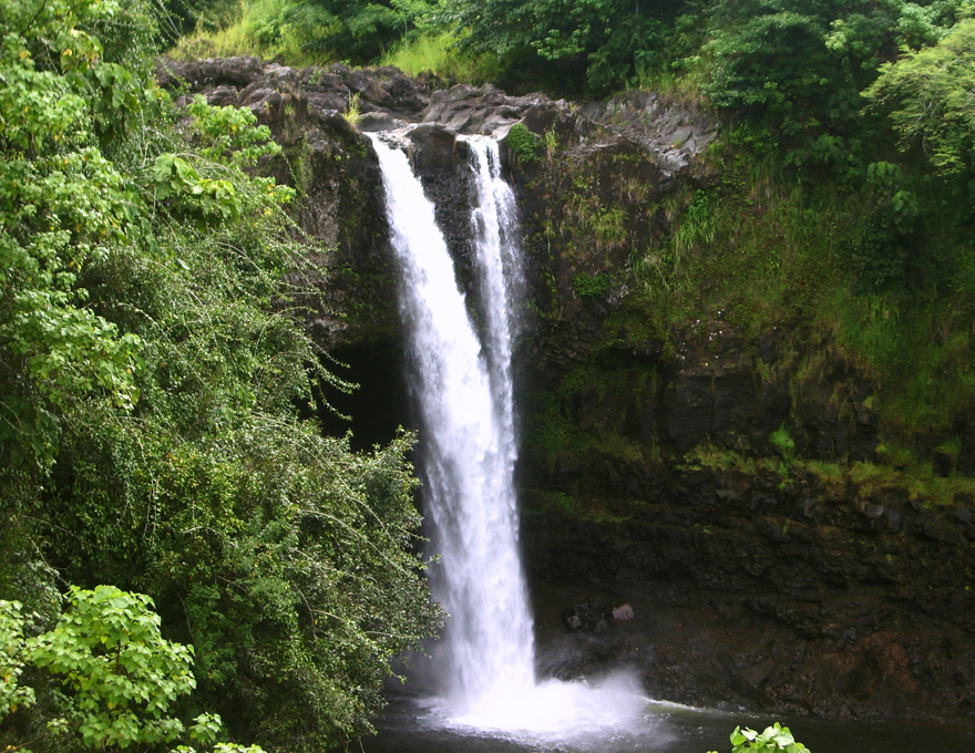
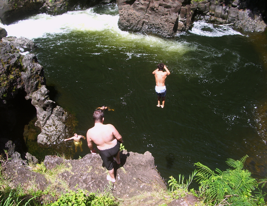
Hilo's Numerous Waterfall, Beach and Open Space Parks Are Inviting and Attractive: Photo by Donnie MacGowan

Hilo was built by the sweat of immigrants, threatened by volcanoes, destroyed by tsunami and built again. Hilo deeply reflects the passion, mystery and flavors of her imported cultures; like her fiercely loyal citizens, Hilo's culture represents a broad mix rather than pointed differences. Hilo is about family and love and fun. Under festive lights, Hilo's streets echo with the sound of neighborhood parties, backyard jam sessions, laughter. The mind-blowing fusion of multi-ethnic musical styles boils over in Hilo's unique and varied local music scene. A bit like Nashville, in Hilo everybody seems to play an instrument, everybody seems to be recording an album—and they are all magnificent joys. How is this possible?

Hilo is About Fun; Boiling Pots at Wailuku River Rark:Photo by Donnie MacGowan

Hilo has one of the best small-town farmer's market in the United States of America.

Hilo Has One of the Most Amazing Farmer's Market's of Any Small Town in the US: Photo by Donnie MacGowan

You will not eat a better meal in the Pacific than those had in many of the tiny family restaurants in Hilo's Old town...nor will you find a more varied palette of cuisines in any major US city than in Hilo.

Hilo's Bay Front Shopping and Dining District is a Bright Spot of Prosperity Surrounded by Urban Blight: Photo by Donald B. MacGowan
Hilo's Downtown Bay Front Shopping and Dining District is a Bright Spot of Prosperity Surrounded By Urban Blight: Photo by Donald B. MacGowan

Hilo has among the most stunning waterfalls and loveliest beach parks in the world within her city limits.

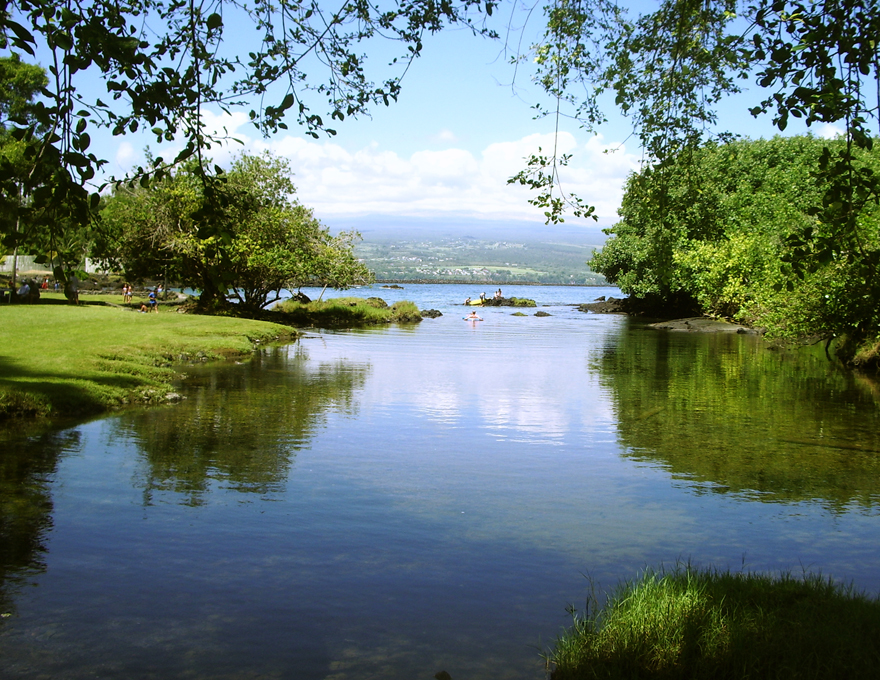
Hilo is Justly Famous for its Many Gorgeous Bay Front and Ocean Beach Parks: Photo by Donald B. MacGowan

On some days, people say the shadows appear a bit deeper and it feels like Hilo is made of steam and myth and half-remembered visions. One gets the feeling, even after living in Hilo for years, that there is vague intrigue boiling, a dimly heard dance or beating heart, just below the surface. You should trust these feelings.

Even the Longtime Resident Sometimes Catches the Vague Whiff of Mysterious, Secret and Hidden Things Afoot in Hilo--Not All of Which Go On at Apuni Center: Photo by Donald B. MacGowan

The seat of political power in Hawai’i County, Hilo is experiencing a long, painful slide into economic and physical decline. Having long since lost the war of social vigor, the battle for tourists and the struggle for attracting new residents and industry to Hawai’i’s newer, cleaner and much sunnier West Side, Hilo seems content to sit back on her mildewing laurels as the once-prosperous center of the sugar industry in an era long gone by, dictating policy and politics to the rest of the island while consuming the vast majority of Hawaii's resources and swallowing the lion's share of the taxes.

Hilo From the Northwest, Over the Bay: Photo by Prescott Ellwood

Yet, even in her dissipation and decay, Hilo is lovely, interesting and intriguing. Like a courtesan in her declining years, who, having squandered her riches, is forced to live off the charity of her wealthier relations, Hilo is still presentable, but far more notable for her raucous, and slightly ribald, tales of past glory.

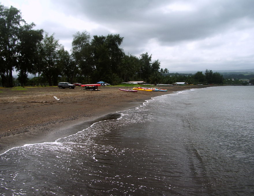
Hilo's Lovely Black Sand Beach Was Once Over A Mile Long Until They Covered It With A Highway: Photo by Donald B. MacGowan
Hilo's Mile Long Black Sand Beach Was a Scenic Wonder, a Huge Tourist Magnet and an International Marvel Until they Covered Most of it with a Highway: Photo by Donnie MacGowan

For more information on traveling to Hawaii in general, and exploring the Big Island in particular, please also visit www.tourguidehawaii.com and www.lovingthebigisland.wordpress.com. To see a demonstration of Tour Guide's new, interactive, GPS-enabled video tour of the Big Island for the iPhone and iPod Touch, please visit here. For more information about the author, please go here.

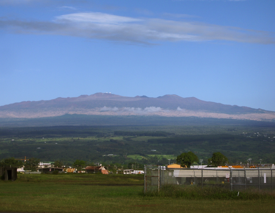
Mauna Kea from Hilo Airport: Photo by Donnie MacGowan
 

Casino Bonus no Deposit