Showing posts with label Captain Cook. Show all posts

Friday, October 16, 2009

Hiking to Captain Cook Monument, on the Kona Coast of Hawaii

Hawaii is, in fact, an island that is served by very few roads, that many people come to visit each year and that makes most of its wealth from the tourism industry. Given this, it's quite surprising how hard it can be to find useful, reliable and up-to-date information about anything from "is your favorite restaurant still in business" to "how's the snorkeling this month?".

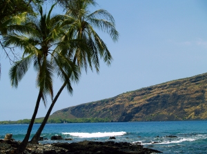
The Captain Cook Monument, Kealakekua Bay on the Kona Coast of Hawaii: Photo by Donnie MacGowan

Road names are in the unfamiliar Hawaiian language; friendly locals give helpful directions, but in rapid-fire pigeon English using landmarks unfamiliar to the visitor and many guidebooks are either woefully out of date or flat wrong. The first time visitor to Hawaii may be overwhelmed when bombarded by advertising disguised as visitor information, overzealous salespeople from rapacious time-share resorts and racks and racks of of advertising for tours, attractions and restaurants.

Even the experienced Hawaii traveler may find it difficult to ferret out the information he needs to find a unique, secluded or unusual experience in Paradise. Finding current, reliable information on hikes on the Big Island can be equally frustrating.

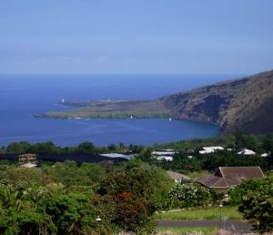
Across Kealakekua Bay to Cook Monument from Manini Beach, Kona Coast: Photo by Donnie MacGowan

Clearly, the visitor to Hawaii can use some help finding special places in general and information about, and help getting to, the best hikes on Hawaii Island.

To help you find the more secluded, wild and exotic destinations in particular, and to help you get more out of your Hawaii vacation in general, Tour Guide Hawaii has released a brand new iPhone/iPod Touch App . This "must have" travel app is packed with hours of informative video on the most interesting places on Hawaii; helps navigate you to all the most popular visitor destinations, the most interesting attractions, the most romantic and secluded beaches; helps you effortlessly find hikes, snorkel spots, historical and cultural landmarks, shopping and dining. And of course, our new App includes directions to, and rating of, all the public restrooms! Learn all about the App, here.

But first, let's talk about one of the finest short hikes on the Island of Hawaii.

Hiking to Captain Cook Monument, on the Kona Coast of Hawaii

View of Monument from Napo'opo'o Road Near the Trail Head: Photo by Donald B. MacGowan

This hike is a fine walk through tall grass, open lava fields and dense, dryland forest, opening onto one of the most pristine ocean beaches in the world. Hiking down to the Captain Cook’s Monument from Highway 11 is a great deal of fun—great scenery, wonderful trail that involves complete immersion in Hawai’ian pre- and post-contact history and offers the opportunity for some of the finest snorkeling anywhere on the planet. However, the return hike is hot, thirsty and strenuous; but it is also highly rewarding, granting panoramic views all up and down the Kona Coast.

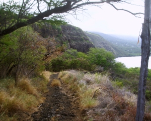
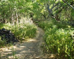
Along the Cook Monument Trail: Photo by Donald B. McGowan

The trail leaves the Napo’opo’o Road just 500 feet below where it drops off Highway 11 near a large avocado tree, right across from a group of three coconut trees, right at telephone pole number 4; parking is tight, but safe. The parking spots and trailhead will show signs of obvious use, usually in the form of recently deposited horse apples from the many trail riders frequenting the area.

The Trail Follows the Historic Carriage Road to Cook Monument: Photo by Donnie MacGowan

The first avocado tree is the harbinger of wonderful things to come, as the trail passes through an area rich in guava, mango, papaya and avocado that are free for the gathering. The 2.5-mile hike takes about 1-1 1/2 hours to descend, somewhat more time to come back up.

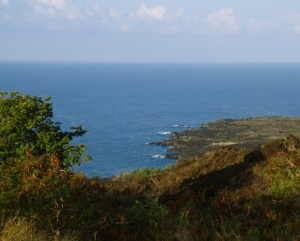
View of the Kona Coast from the Cook Monument Trail:Photo by Donald B. MacGowan

After following a jeep road for about 50 feet, the trail turns left when the jeep road turns right onto private property. Although overgrown by tall grass for the next half mile, the trail runs more or less straight down the left side of a rock wall to the sea.

Ka'awaloa Village Path Near the Cook Monument: Photo by Donnie MacGowan

As the pitch straightens out, keep to the left when the trail first forks and proceed to the beach. You will strike shore several hundred feet northwest of the monument—stroll through the remains of Ka’awaloa Village along the beach on your way to pay homage to Europe’s most prolific explorer, James Cook.

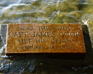
Marker Where James Cook Was Killed: Photo by Donnie MacGowan

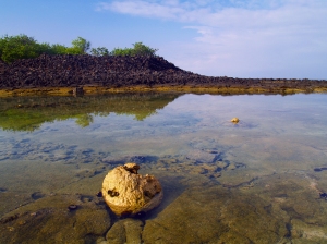
Many people fail to notice the small concrete marker in the tidal zone marking the place where Cook skirmished with the Natives and Was killed, however, this marker lies at the spot where the trail breaks through the underbrush at the ocean's edge.

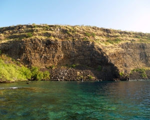
Kealakekua Bay at Cook Monument: Photo by Donnie MacGowan

Remember to be respectful of the remains of the Hawaiian Village--it contains numerous spots still sacred to the natives; do not disturb or deface rock wall, temple pavements. It is best to simply view the ruins from the trail and move along. There are no facilities for garbage, used toilet paper, etc; remember to pack out everything you packed in--this includes your toilet paper. The bay is home to a beleaguered coral habitat--so not touch or stand on the coral when snorkeling. There are also sea turtles and numerous dolphin in the bay--do not approach or harass them--this is not only illegal, it's dangerous. For more information of how to treat coral wild animals in the snorkeling environment, please go here.

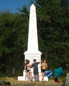
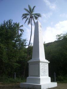
The Captain Cook Monument on Kealakekua Bay, Hawaii: Photo by Donnie MacGowan

There is no drinking water or toilet facilities available at the monument, so come prepared. It's also a good idea to bring about 1/2 gallon of fresh water per person to rinse off with after snorkeling, and dry short to change into--hiking uphill in wet, salty clothes is extremely unpleasant.

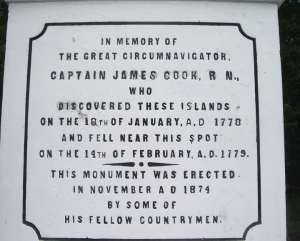
Inscription on the Captain Cook Monument, Kealakekua Bay, Hawaii: Photo by Donald B. MacGowan

Remember to bear right at the trail junction when returning uphill, or you will face a long, hot and unpleasant time wandering the a’a fields of Napo’opo’o.

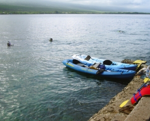
The Old Pier at the Captain Cook Monument, Kealakekua Bay, Hawaii: Photo by Donnie MacGowan

It is also possible, but much less pleasant, to hike most of the way to the monument along the shoreline from Napo’opo’o. This hike is an uninteresting exercise in scrambling over boulders along the beach and contains at least two places that have to be swum in rough water; as such, the safety of this trek is totally at the whim of ocean tides and swells. Highly not recommended.
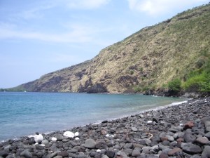
Looking from Hikiau Heiau to Cook Monument; the Cliffs and Boulders Make Hiking Along the Shoreline to the Monument Both Difficult and Extremely Dangerous--DO NOT ATTEMPT THIS: Photo by Donnie MacGowan

To see the new iPhone/iPod Touch App, please visit http://www.tourguidehawaii.com/iphone.html. The best of Tour Guide Hawaii's free content about traveling to, and exploring, the Big island, can be found here. For more information on traveling to Hawaii in general and on touring the Big Island in particular, please also visit www.tourguidehawaii.com and www.lovingthebigisland.wordpress.com.

Copyright 2009
by Frank Burgess; photography copyright 2009 by Donald B. MacGowan. All rights reserved.


Wednesday, March 4, 2009

Big Island Day Trips # 3: Kona Coast to South Point and Ka'u

Trip 3: South Kona, Ka’u and Puna: Wild Southern Coastline, Immense Volcanic Mountains and Mysterious South Point

Approximate minimum time start to finish (to see every site): 12 hours.

Headed south from Kona, connect to Highway 11 and drive 20 minutes to sample Kona Coffee. Numerous farms offer tours to discover the history and processing of this highly prized beverage. In this region are Kealakekua Bay and the Captain Cook Monument, the locations where Hawai'ian history was forever changed and the best snorkeling in the state. Follow the beach road 10 minutes to Pu'u Honua 'O Honaunau National Historic Park. Discover why this spiritual complex was a "place of refuge". Continuing south 1 hour, after some beach time and a short hike, is South Point Road. This is where early Polynesians arrived and started a village based on the rich fishing grounds offshore. Nearby is the trail for a 3 hour round trip hike to a Green Sand Beach (bring drinking water). Then drive 30 minutes south to visit endangered Hawksbill Sea Turtles at Punalu'u Black Sand Beach. From Punalu'u it is a 2 hour drive back to Kona.

Leg 1) Start at north end of Keauhou Historic District on Ali’i Drive, head south on Ali’i Drive to jct with Kamehameha II Hwy; east on Kamehameha III to Hwy 11. Take Hwy 11 south to jct with Hwy 160, just south of the town of Captain Cook. Head downhill on Hwy 160 to Napo’opo’o Village, turn north on Pu’uhonua Beach Road to Kealakekua Bay State Historical Park at end of road; this is where you view the Captain Cook Monument.

From Hapaialii Heiau to Keeku Heiau, Keauhou Historic District, Kona Hawaii: Photo by Donnie MacGowan

Keauhou Historic District and Kona Coffee

For almost 400 years, temples and palaces along the Kona coastline served as a kind of "Rome of the Pacific", a great political, religious and cultural center in Polynesia, until the capital was moved to Honolulu in 1850 by Kamehameha III. The most important, interesting and best preserved historical and cultural sites lie within the Keauhou Historic District, between Kahalu'u Beach Park in Kailua running south 6 miles to Kuamo'o Bay in Keauhou. The District contains perhaps a dozen fascinating sites that are easy to walk to, well maintained and quite interesting.

To see the numerous fascinating and important archaeological sites in the Keauhou Historic District, it is necessary to park your car in the free parking at either Kahalu’u Beach Park or the Keauhou Beach Resort and explore on foot.

Just uphill from the Historic District is the Kona Coffee District. Hawaii is the only state in the union which produces coffee, and Kona coffee is perhaps the finest in the world. Over 2 millions pounds of coffee a year are produced on about 600, 2-3 acre farms; tours of coffee farms and roasteries are available.

Captain Cook Monument and Kealakekua Bay from Manini Beach at Napo'opo'o, Kona Hawaii: Photo by Donald MacGowan

Kealakekua Bay Historical District and Captain Cook Monument

A place of both dramatic historic events and unparalleled scenery, beautiful and now peaceful Kealakekua Bay (Pathway of the Gods) opens beneath steep, beetling cliffs on the ancient surfing beach along the shoreline of Napo’opo’o Village. The site of arguably the most important event in the history of Polynesia, home to pods of frolicking dolphins, providing some truly breathtaking snorkeling, Kealakekua Bay is one of the most magical spots in the State of Hawai’i.

Across the bay from Napo’opo’o stands the solitary white obelisk that marks the lonely Captain Cook Monument. It was in this broad bay that Captain James Cook made his deepest impression on, and longest visit with, native Hawai’ians when he first arrived late in November of 1778; and it was here where he met his tragic end in February 1779 during his second visit. At the State Park at the end of the road in Napo'opo'o are picnic facilities, pavilions and restrooms.

Pu'u Hounua O Hounaunau, The Place of Refuge: Photo by Donald MacGowan

Place of Refuge: Pu’u Honua O Honaunau National Historic Park

A beautiful, peaceful, restful piece of Old Hawai’i, Pu’u Honua O Honaunau is a place of ease and regeneration for weary and jaded souls. Of enormous historical and cultural significance, the sacred grounds at Honaunau are the best-preserved remaining Pu’u Honua, or Place of Refuge, complex in Hawai’i. It is also a wonderful area to wander, snorkel, relax and picnic. For anyone who had any doubts about what Old Hawai’i was like, a trip to Honaunau will fill your imagination, your camera and your spirit.

A complex and strict order of law, known as the kapu system, controlled and governed everything in ancient Hawai’i. Under this system, judgment was death, immediate and final, unless the accused could escape to one of the designated places of refuge. There the accused would undergo a cleansing ceremony, be absolved of all crimes, and allowed to return to his family free of onus. The National Park has a Visitor's Center and bookshop, full picnic and restroom facilities. Although no swimming or snorkeling is allowed within the Park, adjacent is Two-Step Beach on Hounaunau Bay, one of the premiere snorkeling spots on the Island.

Leg 3) Return to Hwy 11 via south leg of Hwy 160, continue south on Hwy 11 to Ho’okena Beach Road; Ho’okena Beach Road west to Ho’okena Beach.

Ho'okena Beach, South Kona: Photo by Donald MacGowan

Ho’okena Beach County Park

Brilliant snorkeling, decent boogie boarding, passable shell collecting and wonderful camping—it’s a wonder Ho’okena Beach is not more popular with visitors. Nestled alongside the ruins of Ho’okena Village, this beach is a wonderful place to spend a morning or a weekend.

Frequented by dolphin, stuffed full of pelagic and reef fish and turtles and boasting crystal clear, warm and calm waters, Ho’okena is a must-see beach for avid snorkelers and divers as well as sea kayakers. During the winter months, female Humpback whales and their babies frequent the waters off this bay.

Wonderful beach camping, new showers and restrooms, picnic tables and abundant fresh water make this county park a gem. Camping is by permit only on a first come-first served basis.

Leg 4) Return to Hwy 11 via Ho’okena Beach Road; continue south on Hwy 11 to Miloli’i Road; Miloli’i Road to Miloli’i Beach Park; trail to Honomalino Beach.

Honomalino Beach, South Kona, Hawaii: Photo by Donald MacGowan

Honomalino Bay

A true gem of West Hawai’i and rarely crowded, Honomalino Bay is reached by a 20 minute hike from the south end of Miloli’i Beach County Park. The hike starts between the bathrooms and a yellow church and is always along the right fork of the trail, in and out of the surf line, to avoid private property.

Snorkeling is very interesting on the north side in the rocks, when the surf is low. The water, though very clear, is sometimes quite cold due to spring discharge in the sand on the beach. There are no services here, leave no valuables in your car.

Leg 5) Return to Hwy 11 via Miloli’i Road and continue south on Hwy 11 to South Point Road; South Point Road to South Point.

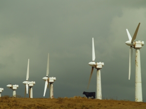
Cow and Windfarm: South Point--Ka Lae--Ka'u Hawaii: Photo by Donnie MacGowan

South Point (Ka Lae)

Haunting, windswept, wild, empty, beautiful. Imagine the gratitude and wonder of the first Polynesians who, after voyaging at sea without sight of land for more than a month, finally made land here at Ka Lae. Polynesians established a thriving colony based upon the incredibly rich fishing grounds just offshore. South Point is the farthest point south in the entire United States. The road to Ka Lae from the Hawai’i Belt Road is infamous although greatly improved in recent years; check your rental agreement before driving here. There are no services…plan and act accordingly.

Leg 6) Head back north on South Point Road to Kaulana Boat Launch Road; take road to boat launch, Green Sand Beach trail to Green Sand Beach.

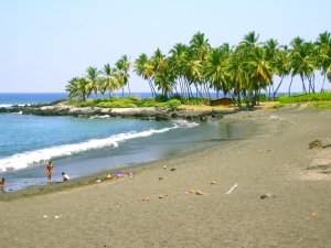
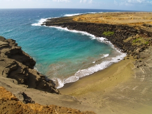
Mahana Green Sand Beach, South Point Hawaii: Photo by Donnie MacGowan

Trail to Green Sand Beach

Absolutely unique to the island of Hawai’i are the handful of green sand beaches composed of crystals of the semi-precious mineral olivine (also known as peridot). The green sand beach at South Point is the best known, largest and most accessible of these. The bizarre color of the water shrieks for underwater photographs. Watch for strong currents; do not go out far nor if the surf is high or there are strong winds.

To get there, follow signs to Kaulana boat launch; park left (south) of the boat launch. Hiking distance is 2 ¼ miles each way along rolling tropical prairie. Stay in sight of the shore and you cannot get lost. Although tricky to spot on the way down, from the beach looking up the way back to the crater rim is easy to follow. There are no services here; plan and act accordingly.

Leg 7) Return from Kaulana Boat Launch Road to South Point Road to Hwy 11; proceed southeast on Hwy 11 to Punalu’u Road; Punalu’u Road to Punalu’u Black Sand Beach Park.

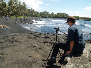
Bradford MacGowan Filming at Punalu'u Black Sand Beach, Ka'u Hawaii: Photo by Donald MacGowan

Punalu’u Black Sand Beach Park

A truly remarkable place of great peace, beauty and spiritual healing, Punalu’u’s black sand beach is world-renowned. Endangered Hawai’ian Green Sea Turtles swim the waters here and bask on the beach. The wildness of the ocean and the serenity of the freshwater fishpond and coconut palm-shaded beaches make this an ideal place to spend some soul-recharge time. The ocean here can be rough, so use caution when swimming.

Available services include water, picnic tables, restrooms, electrical outlets, and pavilions, parking; camping is by permit only. During peak tourist time, there is a souvenir stand with some packaged food items and canned drinks for sale, otherwise the nearest food, gasoline and other services are in either Pahala or Na'alehu.

Leg 8) Return Punalu’u Road to Hwy 11; take Hwy 11 west and north to Kailua Kona.

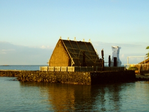
Sunrise at Ahu'ena Heiau in Kailua Kona, Hawaii: Photo by Donald MacGowan

For more information on traveling to Hawaii in general and touring on the Big Island in particular, please visit www.tourguidehawaii.com and www.lovingthebigisland.wordpress.com.

Wednesday, March 12, 2008

Hike to Captain Cook's Monument: Kealakekua, Big Island of Hawaii


This hike, on the Big Island of Hawaii, is a fine walk through tall grass, open lava fields and dense, dryland forest, opening onto one of the most pristine ocean beaches in the world. Hiking down to the Captain Cook's Monument from Highway 11 is a great deal of fun—great scenery, wonderful trail that involves complete immersion in Hawai'ian pre- and post-contact history and offers the opportunity for some of the finest snorkeling anywhere on the planet. However, the return hike is hot, thirsty and strenuous; but it is also highly rewarding, granting panoramic views all up and down the Kona Coast. The trail leaves the Napo'opo'o Road just 500 feet below where it drops off Highway 11 near a large avocado tree, right across from a group of three coconut trees, right at telephone pole number 4; parking is tight, but safe. The parking spots and trailhead will show signs of obvious use, usually in the form of recently deposited horse apples from the many trail riders frequenting the area.

The first avocado tree is the harbinger of wonderful things to come, as the trail passes through an area rich in guava, mango, papaya and avocado that are free for the gathering. The 2.5-mile hike takes about 1-1 1/2 hours to descend, somewhat more time to come back up. After following a jeep road for about 50 feet, the trail turns left when the jeep road turns right onto private property. Although overgrown by tall grass for the next half mile, the trail runs more or less straight down the left side of a rock wall to the sea. As the pitch straightens out, keep to the left when the trail first forks and proceed to the beach. You will strike shore several hundred feet northwest of the monument—stroll through the remains of Ka'awaloa Village along the beach on your way to pay homage to Europe's most prolific explorer, James Cook. Remember to bear right at the trail junction when returning uphill, or you will face a long, hot and unpleasant time wandering the a'a fields of Napo'opo'o.

It is also possible, but much less pleasant, to hike most of the way to the monument along the shoreline from Napo'opo'o. This hike is an uninteresting exercise in scrambling over boulders along the beach and contains at least two places that have to be swum in rough water; as such, the safety of this trek is totally at the whim of ocean tides and swells. Highly not recommended.

For more information, visit www.tourguidehawaii.com
 

Casino Bonus no Deposit