Showing posts with label guide. Show all posts

Friday, October 23, 2009

Exploring the Summit hikes of Mauna Kea, Hawaii

by Donald B. MacGowan

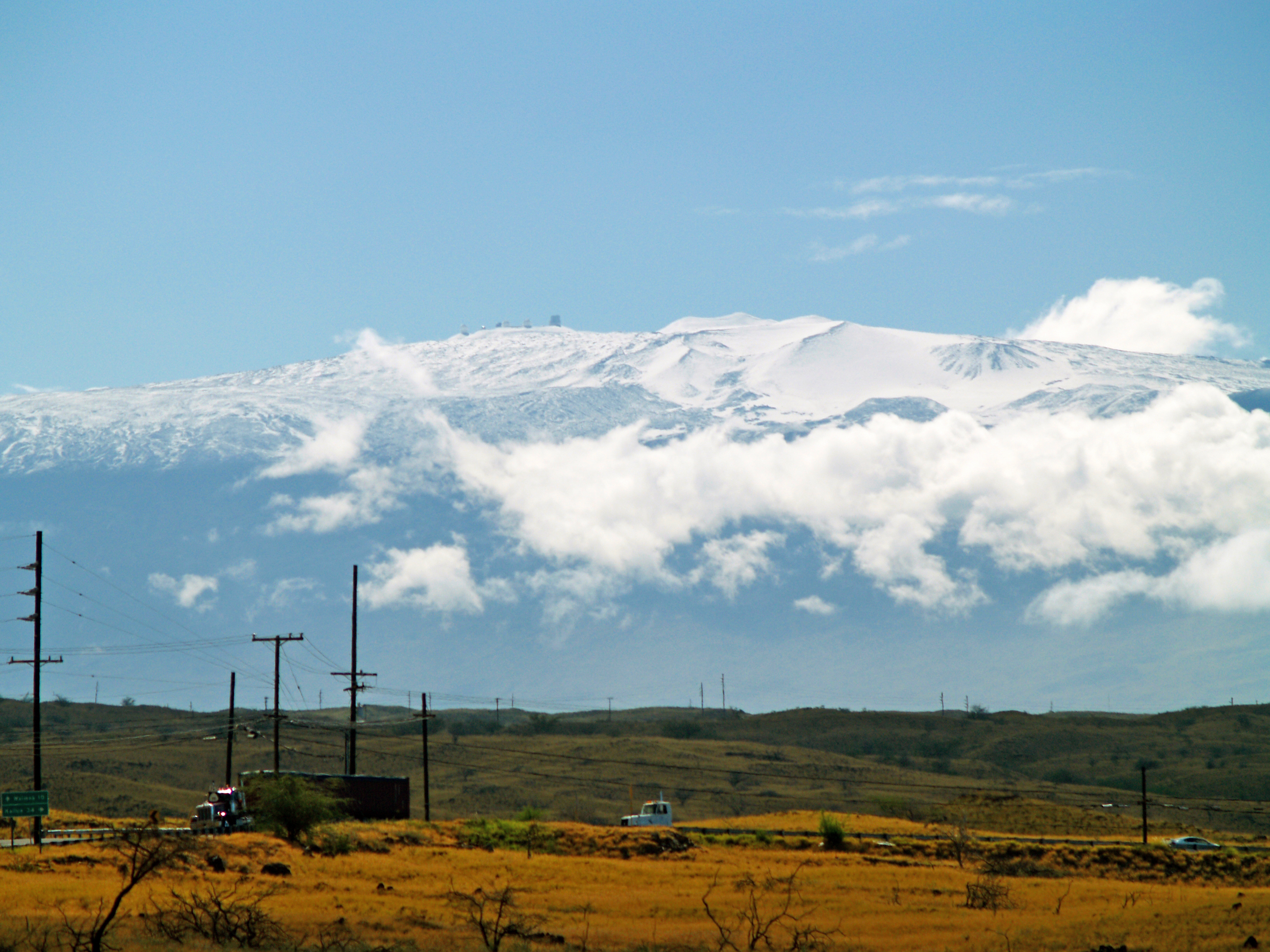
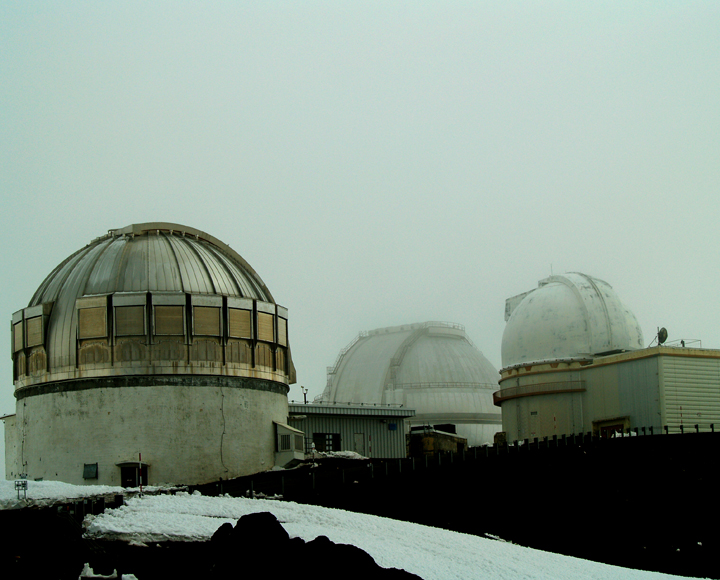
Astronomical Observatories on the Summit of Mauna Kea from Pu'u Koholo: Photo by Donnie MacGowan

Whether you visit the Big Island for a few days, a couple weeks or a few months, you want to make the most of your time in Paradise. With such a wide variety of natural and commercial attractions, it is natural for the visitor to get a little overwhelmed in the “Option Overload” and not be able to make a balanced and informed decision on what they want to do and how best to spend their time.

Even choosing which beach you want to spend time on, or where you want to hike can be an exercise in confusion and conflicting advice. Clearly, visitors to Hawaii could use help making quality decisions about how best to spend their time.

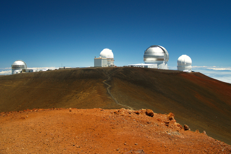
Huddle of Telescopes on Mauna Kea: Photo by Donnie MacGowan
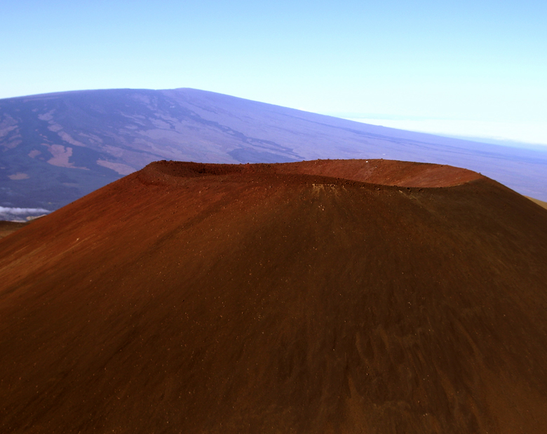
From Mauna Kea Summit to Mauna Loa: Photo by Donnie MacGowan

Tour Guide Hawaii is excited and proud to announce the release of their new GPS/WiFi enabled App for iPhone and iPod that helps you navigate your trip to Hawaii with hours of informative, location-aware video and information. Although our video guide will lead you to dozens of unusual, untamed and unspoiled spots, let's look at couple hikes you might otherwise miss if you did not have Tour Guide Hawaii's new App.

Donnie's Mauna Kea

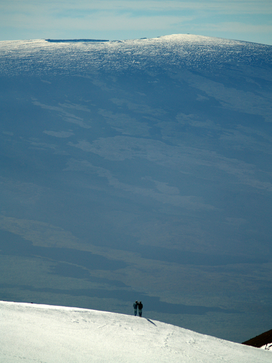
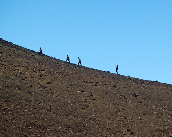
Mauna Kea Summit Hikers: Photo by Donnie MacGowan
Today, I'd like to take you to the top of Mauna Kea. At 13, 796 feet above sea level, Mauna Kea's summit is the highest point in the State of Hawaii; since its base lies at 19000 feet below sea level, its has a base-to-summit height of 33,000 feet, making it the tallest mountain on earth. It's also one of my most favorite places on earth.
Mauna Kea Icy Summit Warning: Photo by Donald B. MacGowan
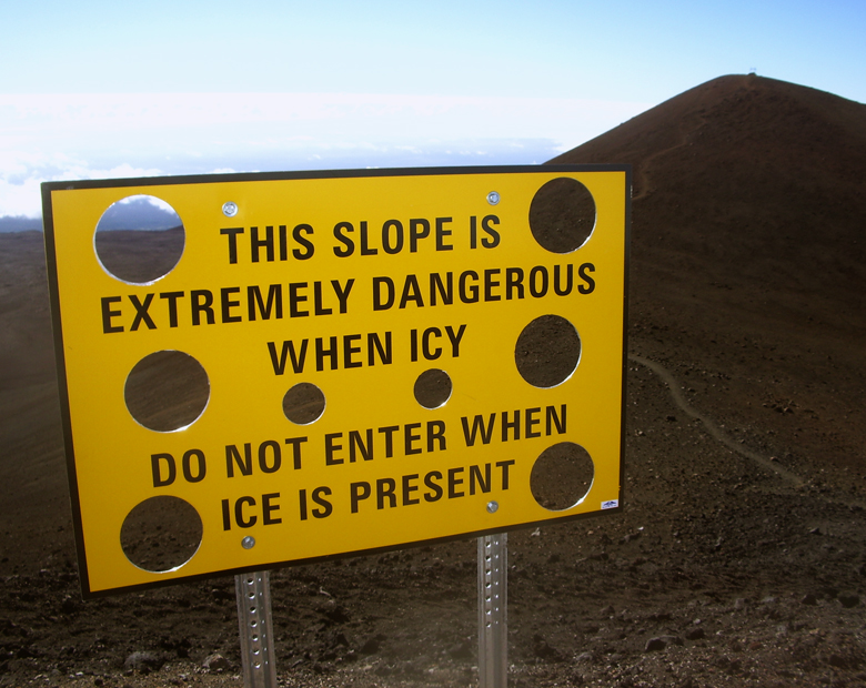

Mauna Kea began forming on the sea floor about one million years ago. Its name means "White Mountain" in the Hawaiian language and it is snowcapped much of the winter, and the summit is covered with permafrost 35 feet deep. During the ice ages, Mauna Kea's summit was glaciated 3 times, starting about 200000 years ago and ending only 11000 years ago. One can see the U-shaped valleys and cirques, striated bedrock, glacial tills covering the summit area and remnants of ice-damned lava flows from those times. There are even the remains of extinct rock glaciers near the summit.

Eric Carr, Master Cameraman, Filming on Mauna Kea: Photo by Donnie MacGowan
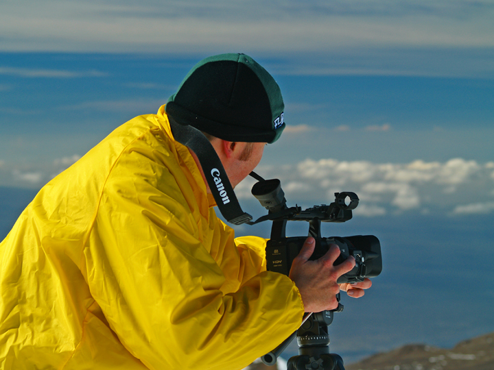

The Visitor's Center and summit are reached via a road which turns off Saddle Road at about 6600 feet elevation near the 28 mile marker and tortuously stumbles its way up the south side of Mauna Kea to the Visitor Information Station at about 9300 feet. The road, though steep, is paved to the Visitor's Center. Above that, the road is graded dirt for about 5 miles, returning to asphalt paving for the final sprint to the rim of the summit crater. Road conditions for the summit road are available at 808.935.6263.

Mauna Kea Moon From the Visitor's Information Station: Photo by Donald MacGowan
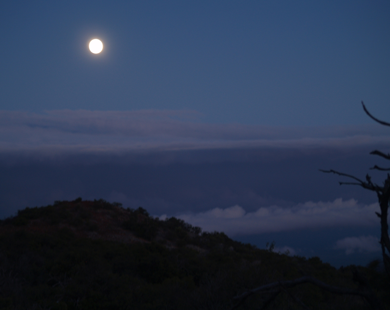

The visitor's center is open from 9 a.m. until 10 p.m. 365 days a year. Informational multimedia presentations, souvenirs, and some food items are available here, as well as clean restrooms and drinking water. Every evening after dark the center allows visitors to stargaze through several telescopes and informational talks by visiting scientists are occasionally scheduled. Saturday and Sunday Center staff lead escorted summit field trips, but visitors must provide their own vehicle. Call 808.961.2180 for information. It is suggested that summit-bound visitors stop at the Visitor's Center for at least half an hour before heading to the summit so they can acclimate.

Above the Visitor Information Station there are no public accommodations, no water or food and no gasoline service; the observatory buildings are closed to the public and usually locked. There are neither public telephones nor restrooms, only port-a-potties. An emergency phone is located in the entrance to the U of H 2.2 meter Telescope building.

Mauna Kea Summit Road: Photo by Donnie MacGowan
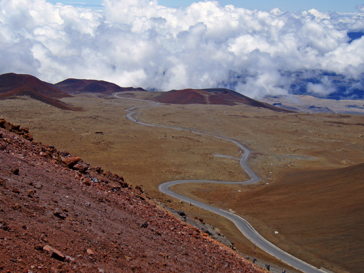

Driving the summit road to the very top of Mauna Kea is neither as dangerous as the car rental companies want you to believe, nor as casual as many Big Island residents will tell you. True, the summit road is unpaved most of the way, it is steep and winding with limited view planes; the road is extremely hazardous when wet or icy, which is often, and it’s subject to frequent dense clouds, snow, rain and fog obscuring all vision. Also, balmy summer conditions may turn into lethal winter rages in minutes with little or no warning.

Cinder Cones and a Radio Telescope on Mauna Kea: Photo by Donald B. MacGowan
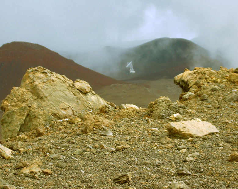

However, the road is generously wide, routinely graded and poses no real threat to the cautious driver. The safe driver can expect to reach the summit in about ½ an hour after leaving the Visitor Information Station. Remember, it’s not the roughness of the road that will impede your car; it’s the elevation that will starve it for oxygen. To be safe, take as much time winding your way back down the mountain as you took coming up, using the lowest gear to save wear on brakes. Check your car rental agreement--many forbid you to drive this road. If you go anyway, your insurance is void, and you do so at considerable financial risk. Remember, people DO crater their cars on occasion.

The Weather Can Change in an Instant on Mauna Kea: Photo by Donnie MacGowan
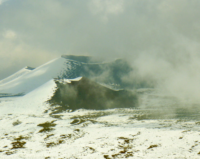

If the weather turns frightful, simply head down immediately. Relax, be calm and drive carefully; you can be confident that, even if you have to slow to 10 miles per hour in places, you'll be down to the safety of the Visitor's Center in a mere 40 minutes or so.

Superstition to Science; An Ancient Hawaiian Temple Shares The Summit With The Most Modern Astronomical Obsdervatories on Pu'u Weiku Summit, Mauna Kea Photo by Donald B MacGowan
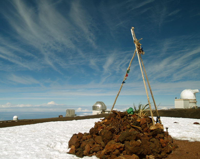

The summit of Mauna Kea, hosting the largest assemblage of astronomical instruments and telescopes in the world, is truly an amazing place; a seductive juxtaposition of icy heights raised up from steaming tropical jungle; the age-old altars of sacred Hawai’ian gods alongside edifices of the most modern of sciences; of frigid landscapes carved during ancient ice-ages alongside fiery volcanic landforms; all wrapped around a fabulous trip with a wee rumor of danger, just for spice! Beautiful, awe-inspiring, 360 degree views of the entire Big Island also include the islands of Maui, Kaho’olawe and Lana’i on clear days. The glow from Kilauea Volcano can be seen on clear nights. Although daytime temperatures during the summer can peak in the 60s, it is generally cold-to-frigid, frequently wet and very windy on the summit. Plan and dress accordingly.

View from Mauna Kea Summit to Mauna Loa: Photo by Donnie MacGowan
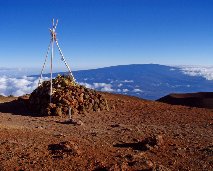

The summit area is also culturally and religiously important to the native Hawai’ians, hosting many religious Heiau, an obsidian adze quarry and numerous other archaeological sites. Remember this landscape, and the archeological sites upon them, are sacred; take nothing but photographs, don't even leave footprints.

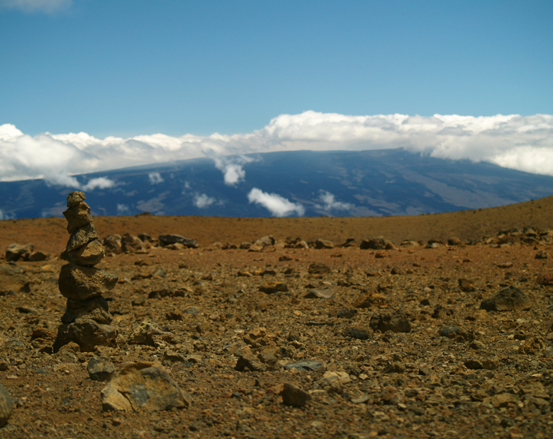
Mauna Kea Summit Trail: Photo by Donald MacGowan

Parking is limited, but the hike from the top of the road to the actual summit is a must for any who have ventured this far and are in good shape. A stone altar and a USGS survey point mark the actual summit of the mountain, about a 15 minute walk up a cinder trail from the top of the road. A trail leading around the summit crater takes about 30 minutes to trek and traverses some very wild country with amazing views. Be sure to bring plenty of drinking water and hydrate frequently to help stave off altitude sickness. Do not leave the safety of the parking lot if you are feeling ill or the weather is at all chancy—in fact, in deteriorating or poor weather, or at the onset of queasiness, one should leave the summit immediately and descend.

Justly Famous Videographer Frank Burgess at Mauna Kea Summit: Photo by Donnie MacGowan
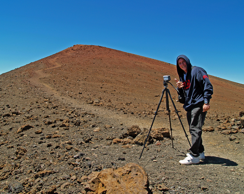

Alternately, for those in excellent physical condition, one can hike to the summit from the Visitor's center. Featuring unparalleled views, wild landscapes, archeological sites and more, the hike is about 6 miles in length, gains about 4500 feet in elevation and takes 6 to 10 hours to get up, depending on the hiker. There is no water available anywhere above the Visitor's Center, so take enough to get up, and back down. Frankly, many people opt to hitch-hike down the mountain after hiking up. In fact, for folks short on time, or for whom scenery and not summit-conquering are the main goals, catching a ride to the summit and hiking down is a great alternative, and takes only about 3 1/2 hours.

Gary Burton and His Ddaughter Nearing Mauna Kea Summit: Photo by Donald B. MacGowan
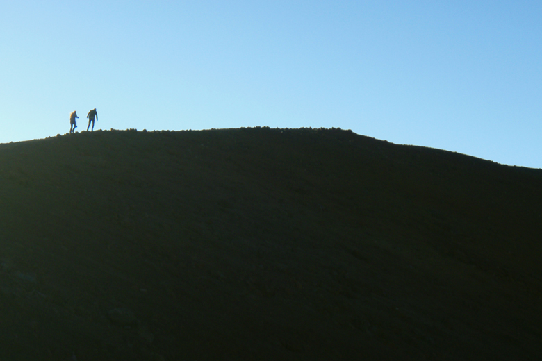

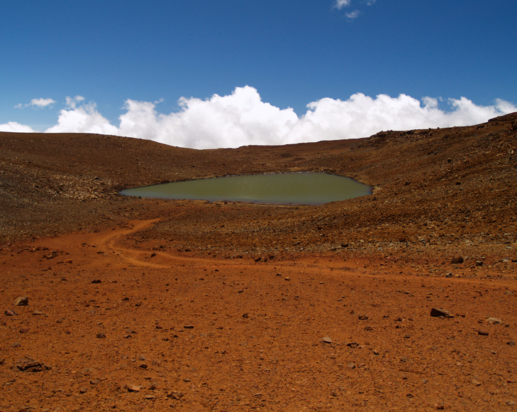
Another absolutely stunning hike in the summit area, one that is accessible to nearly anybody in reasonable condition, is to Lake Wai'au. Park at either the lot at about 12000 feet, near the 5 mile marker, or the lot at about 13000 feet, near the 7 mile marker. Needless to say, one hike is uphill in and the other is uphill out; but both are less than a mile long and have similar elevation changes. I prefer the upper trail because the view of the summit astronomical complex on the hike out is phenomenal. An absolute jewel of an alpine tarn in its own right, at 13,020 feet Lake Wai'au is one of the highest permanent lakes in the world...permafrost seals the lake bed in the loose tephra and glacial drift on which it sits. It's about 300' by 150' by 8 feet deep and, yes, I personally can vouch for its having been snorkeled. Not much to see in there, though.

Lake Wai'au on Mauna Kea: Photo by Donnie MacGowan

There are a few health concerns about visiting the summit of Mauna Kea as well. In brief: children under 16, pregnant women, and people with respiratory, heart, or severe overweight conditions are advised not to go higher than the Visitors Information Station. Scuba divers must wait at least 24 hours after their last dive before traveling to the summit.

Mauna Kea's Snowy Summit: Photo by Donnie MacGowan
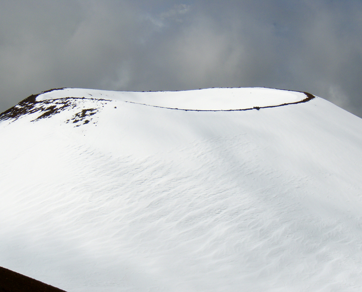

Acute mountain sickness, resulting from exposure to high altitude, includes nausea, headache, drowsiness, shortness of breath, and poor judgment. Aspirin and lots of water are palliatives for altitude sickness, but the cure is immediate and rapid descent. Sufferers will notice almost complete cessation of symptoms upon regaining The Saddle. Altitude sickness can be dangerous, even life threatening, and rapid onset of comatose condition, or even death, may be unexpectedly swift.

On the Way Up on Mauna Kea: Photo by Donnie MacGowan

Finally, there is severe risk of serious sunburn and eye damage, particularly when there is snow on the ground. Be sure to wear sunglasses rated to at least 90% IR and 100% UV (both UVA and UVB); wear sunscreen rated to at least SPF 30. Long sleeves and pants help reduce the susceptibility to sunburn.

Mauna Kea's Vanishingly Rare Silver Sword Plants: Photo by Donald B. MacGowan

Most visits to Mauna Kea's summit are extremely pleasant experiences, encompassing easy adventures which may feature mild altitude euphoria, fabulous views and a great sense of relief at reaching the paved road and public restrooms at the Visitor’s Information Station after leaving the summit.

Mauna Kea Science Huddle: Photo by Donnie MacGowan

To see the new iPhone/iPod Touch App, please visit http://www.tourguidehawaii.com/iphone.html. The best of Tour Guide Hawaii's free content about traveling to, and exploring, the Big island, can be found here. For more information on traveling to Hawaii in general and on touring the Big Island in particular, please also visit www.tourguidehawaii.com and www.lovingthebigisland.wordpress.com.
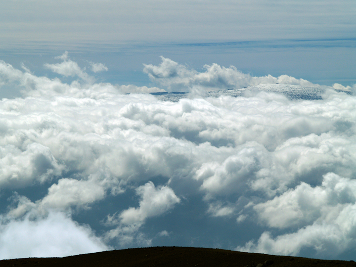
Mauna Loa Summit from Mauna Kea Summit: Photo by Donnie MacGowan

Copyright 2009 by Donald B. MacGowan. All rights reserved.

From Mauna Kea's Summit Trail to Mauna Loa: Photo by Donnie MacGowan

Wednesday, October 21, 2009

Kiholo Bay Beach Hike

by Donald B. MacGowan

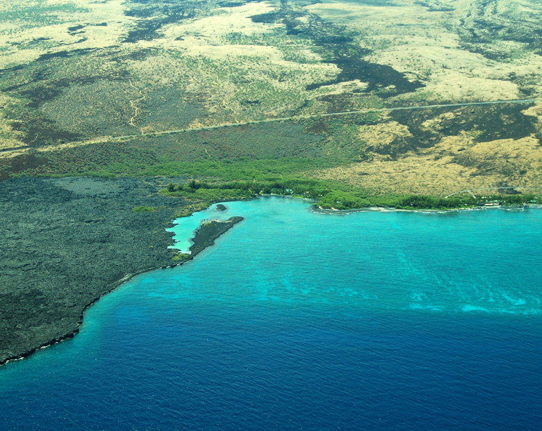
Aerial View of Kiholo Bay, Kohala Coast, Hawaii: Photo by Donnie MacGowan

Whether you visit the Big Island for a few days, a couple weeks or a few months, you want to make the most of your time in Paradise. With such a wide variety of natural and commercial attractions, it is natural for the visitor to get a little overwhelmed in the “Option Overload” and not be able to make a balanced and informed decision on what they want to do and how best to spend their time.

Sunset View of Haleakala on Maui From Kiholo Bay: Photo by Donald B. MacGowan

Even choosing which beach you want to spend time or where you want to hike can be an exercise in confusion and conflicting advice. Clearly, visitors to Hawaii could use help making quality decisions about how best to spend their time.

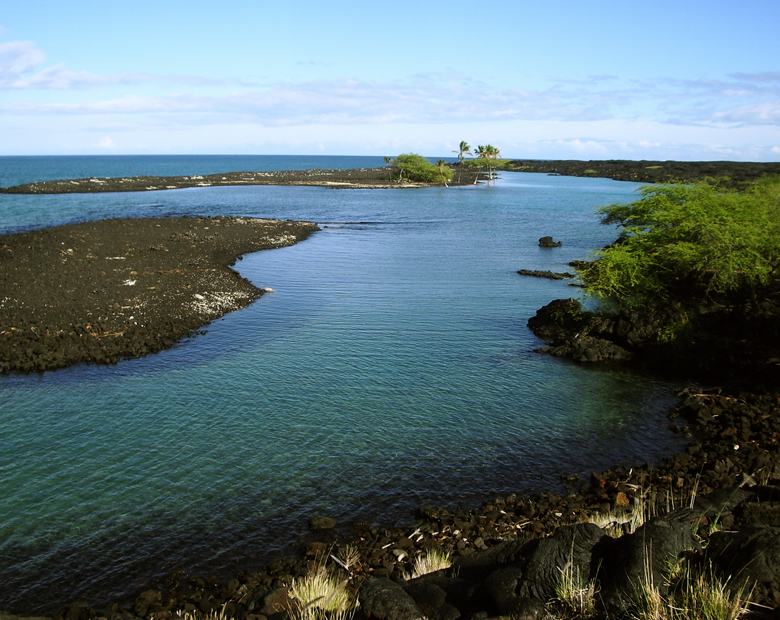
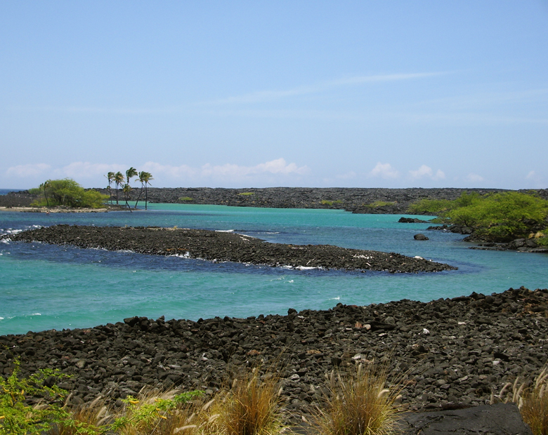
All that remains of a mile-long fishpond that was destroyed by flowing lava are these gorgeous, turquoise brackish ponds: Photo by Donald B. MacGowan

Tour Guide Hawaii is excited and proud to announce the release of their new GPS/WiFi enabled App for iPhone and iPod that helps you navigate your trip to Hawaii with hours of informative, location-aware video and information. Although our video guide will lead you to dozens of unusual, untamed and unspoiled spots, let's look at one, hidden but gorgeous, beach hike you would otherwise not find if you did not have Tour Guide Hawaii's new App.

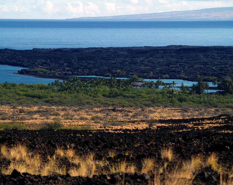
Kiholo Bay on the Kohala Coast of the Big Island of Hawaii: Photo by Donnie MacGowan

Kiholo Bay Beach Hike

Snorkeling, country music history ancient fish ponds and medical science…what more could anyone ask for? One of West Hawaii's best kept secret is gorgeous, amazing Kiholo Bay, those heavenly, turquoise waters and swaying palms you can't quite glimpse clearly from the overlook at mile marker 82 on the Hawaii Belt Road.

The View of Kiholo Bay From the Hawaii Belt Road: Photo  by Donald B. MacGowan
The View of Kiholo Bay From the Hawaii Belt Road: Photo by Donald B. MacGowan

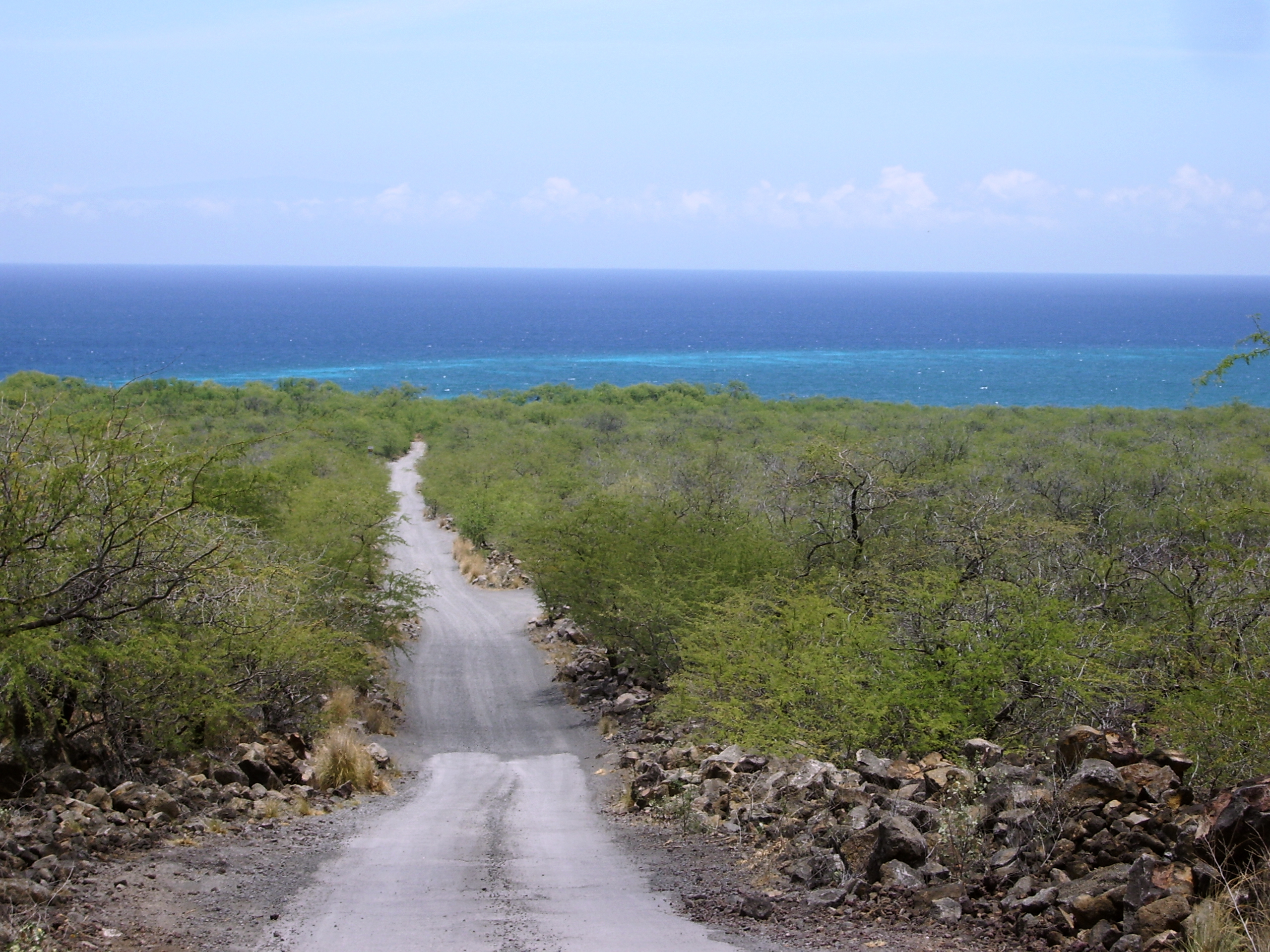
Dirt road into Kiholo Bay, just south of the 82 mile marker on the Hawaii Belt Road: Photo by Donnie MacGowan

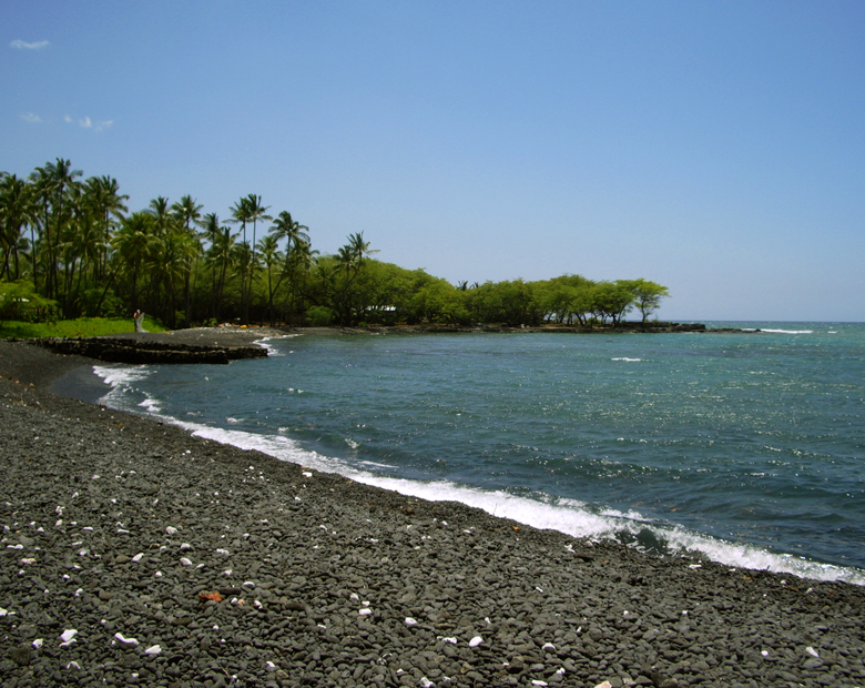
This remarkable, beautiful and sadly popular area is accessed in two ways; first, by a gravel road going ocean-ward from the highway immediately south of the Overlook pullout at mile marker 82. This road is only open from 8 a.m. to 6 p.m., but accesses the south end of the bay, a pebbly beach terminated in austere a’a flows to the south. The round house on the beach was built by country and western singer Loretta Lynn, but was condemned and taken by the State when it created the beach park. Swimming and boogie boarding here are excellent in low to moderate surf, but beware of current and surginess; if the surf is high, do not go in.

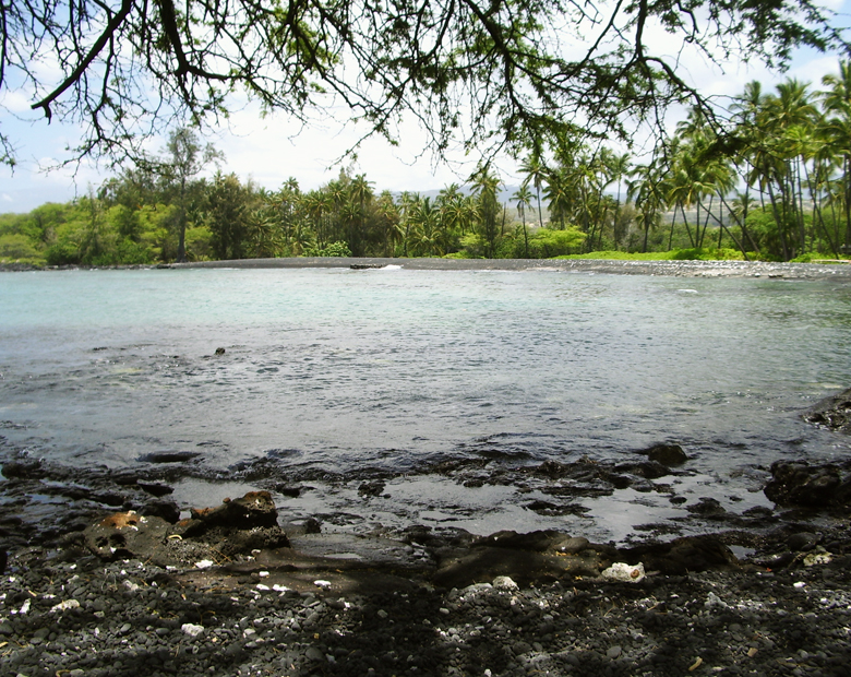
Kiholo Bay, Kohala Coast, Hawaii: Photo by Donnie MacGowan

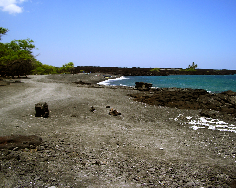
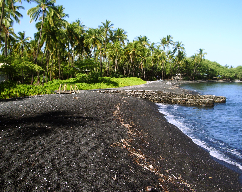
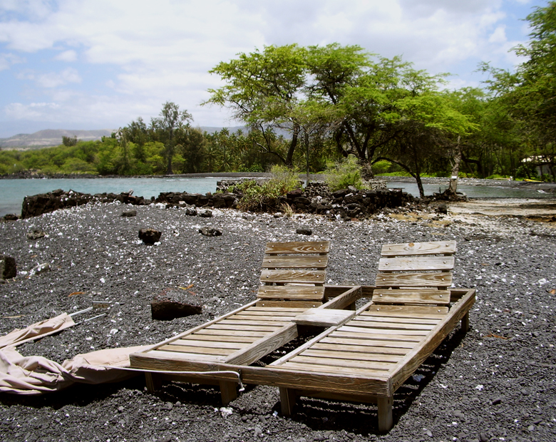
A trail south below the big mansion on the headland leads about three quarters of a mile to a tiny black sand beach with an amazing coral garden. This little beach is my favorite snorkeling secret on the island.

The road south from Kiholo Bay dead ends at an elaborate mansion; from there a trail can be taken around the headland to a remarkable black sand cove that provide gorgeous, if exposed, snorkeling: Photo by Donald B. MacGowan

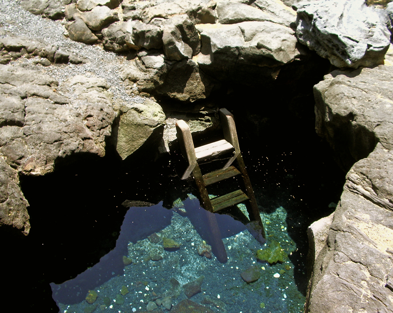
A 4WD road/trail continues north along the black pebble beach and cliffs to Kiholo Bay proper. This part of the Kiholo Area can also be accessed via a trail (used to be a dirt road) that leaves the parking lot immediately south of mile marker 81. Along the 4WD trail, on the mauka (uphill) side, is a freshwater spring and pond in a lava tube (Keanalele Water-hole), a great place to rinse off after swimming or hiking along the beach. Please rinse off excess suncream in the ocean before enjoying this refreshing pool.

Keanalele Water-hole, a freshwater Queen's Basth in a lava tube, near Kiholo Bay, Hawaii: Photo by Donald B. MacGowan

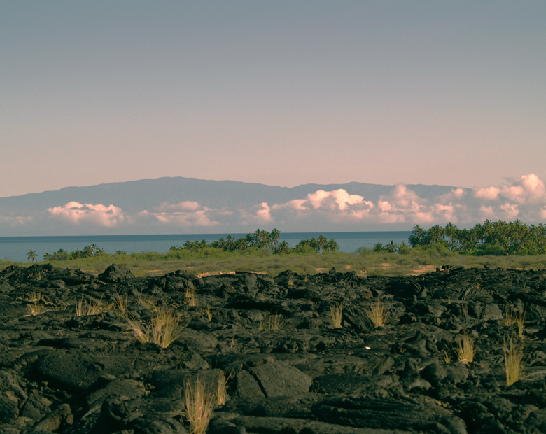
Also along this portion of the beach are a number of mansions, most notably the Bali House (oh, you’ll know it when you see it) and the home of Earl Bakken, the billionaire inventor of the pace maker. Believe the no trespassing signs you see here. On clear days, views of Mauna Kea from this part of the beach are stunning.

There are some amazing multi-million dollar mansions along the beach; believe the "no-trespassing" signs: Photo by Donald B. MacGowan

Just north of Kiholo Bay is a beautiful, turquoise brackish lagoon, all that remains of a 2-mile long fishpond erected by Kamehameha the Great around 1810, which was destroyed by the Mauna Kea lava flow of 1859. The water can be a might cloudy for snorkeling, but it's full of turtles and, on calm days, has one amazing attribute. If wind is not driving surge-mixing of these ponds, lighter, fresh water from springs will float on top of the heavier salt water. This fresh/salt water interface produces a refractive lens that creates interesting and amazing optical tricks for the snorkeler.

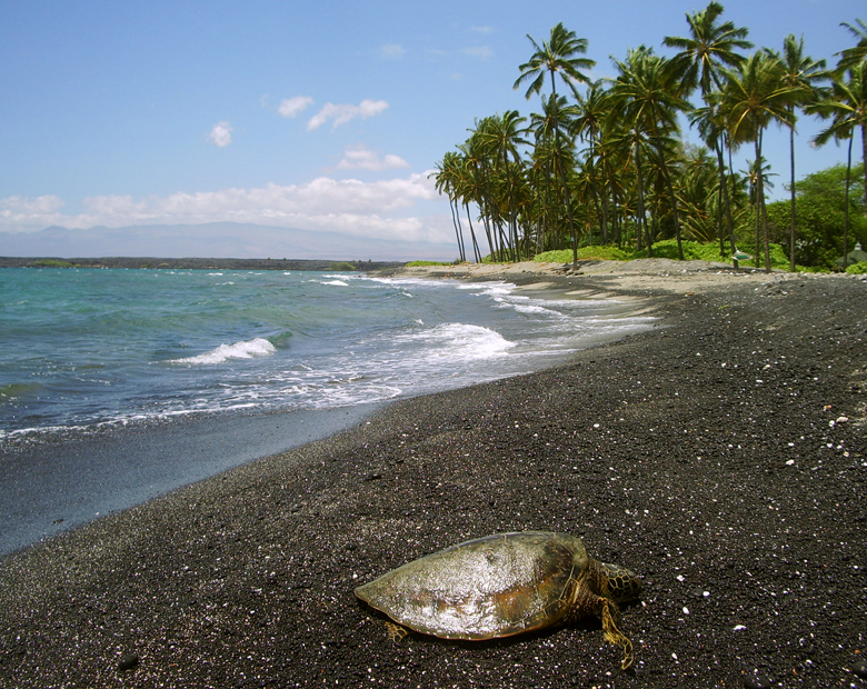
A Hawaiian Green Sea Turtle, or Honu, Suns Herself at Kiholo Bay on the Kohala Coast of Hawaii: Photo by Donald B. MacGowan

Full of turtles, beautiful to swim and a wonderful place to learn to surf, Kiholo Bay proper has it all. In addition, the sweat required to reach it has the added bonus of weeding out the undesirables. Please remember not to approach or harass the turtles. Dolphin (and humpback whale in season) frequent this bay—it is also illegal (and stupid) to harass them. Be careful to pack out everything you packed in, and help the environment by picking up that other guy's litter, as well.

The Brackish Lagoons of Kiholo Bay: Photo by Donald B. MacGown
The Brackish Lagoons of Kiholo Bay: Photo by Donald B. MacGowan

As of this writing, camping is not being allowed at Kiholo Bay, although many people do camp here...be advised that the road is locked at night and you will not be able to leave.

A relaxed lifestyle is enjoyed by the few, but extremely wealthy, residents of Kiholo Bay: Photo by Donald B. MacGowan

To see the new iPhone/iPod Touch App, please visit http://www.tourguidehawaii.com/iphone.html. The best of Tour Guide Hawaii's free content about traveling to, and exploring, the Big island, can be found here. For more information on traveling to Hawaii in general and on touring the Big Island in particular, please also visit www.tourguidehawaii.com and www.lovingthebigisland.com.

The View of Mauna Kea From Kiholo Bay, Kohala Coast, Hawaii: Photo by Donnie MacGowan

Copyright 2009 by Donald B. MacGowan. All rights reserved.

Sunday, October 18, 2009

Hiking Hawaii's Magnificent Waipi'o Valley

by Donald B. MacGowan
Waipio Beach Bums_edited-2
Fabulously rewarding, the hike into Waipi'o Valley may be short on miles, but it's long on elevation loss and gain. Hikers should be in good condition to attempt the hike and carry lots of drinking water--none is available anywhere on the åhike: Photo by Donnie MacGowan

Hawaii is, in fact, an island that is served by very few roads, that many people come to visit each year and that makes most of its wealth from the tourism industry. Given this, it's quite surprising how hard it can be to find useful, reliable and up-to-date information about anything from "is your favorite restaurant still in business" to "how's the snorkeling this month?".

Road names are in the unfamiliar Hawaiian language; friendly locals give helpful directions, but in rapid-fire pigeon English using landmarks unfamiliar to the visitor and many guidebooks are either woefully out of date or flat wrong. The first time visitor to Hawaii may be overwhelmed when bombarded by advertising disguised as visitor information, overzealous salespeople from rapacious time-share resorts and racks and racks of of advertising for tours, attractions and restaurants.

eWaipio Beach_edited-1
The mile-long black sand beach, backed by ironwood forest and jungle at Waipi'o, call to the visitor to explore: Photo by Donald B. MacGowan

Even the experienced Hawaii traveler may find it difficult to ferret out the information he needs to find a unique, secluded or unusual experience in Paradise. Finding current, reliable information on hikes on the Big Island can be equally frustrating.

Clearly, the visitor to Hawaii can use some help finding special places in general and information about, and help getting to, the best hikes on Hawaii Island.

To help you find the more secluded, wild and exotic destinations in particular, and to help you get more out of your Hawaii vacation in general, Tour Guide Hawaii has released a brand new iPhone/iPod Touch App . This "must have" travel app is packed with hours of informative video on the most interesting places on Hawaii; helps navigate you to all the most popular visitor destinations, the most interesting attractions, the most romantic and secluded beaches; helps you effortlessly find hikes, snorkel spots, historical and cultural landmarks, shopping and dining. And of course, our new App includes directions to, and rating of, all the public restrooms! Learn all about the App, here.

The Waipi'o Region is filled with some of the highest waterfalls in the United States: Photo by Donald B. MacGowan

But first, let's talk about one of the finest short hikes on the Island of Hawaii.

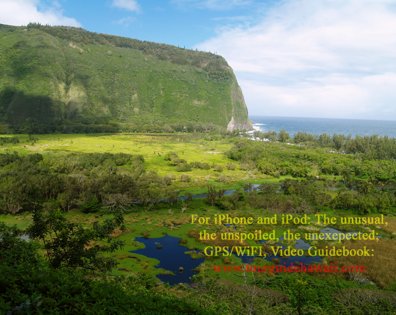
Waipi'o Valley From About Half-way Down the Road: Photo by Donnie MacGowan

Waipi’o Valley Hike

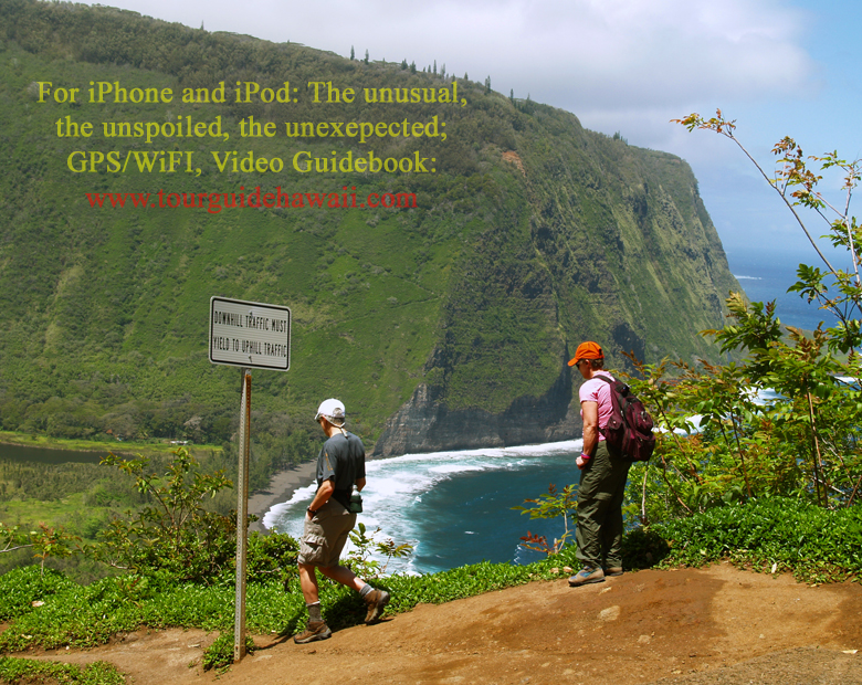
Day Hikers at the top, just starting down into Waipi'o Valley: Photo by Donald B. MacGowan

Waipi’o Valley is arguably the most magical place on the Big Island. Hawai’ian myths hold that the fastness of Waipi’o Valley is guarded by Night Marchers, legendary ghosts of Kamehameha’ long-dead armies, and that the impossibly steep, incredibly beautiful valley was excavated by a bragging warrior using his club to demonstrate his strength. While the geologic explanation is more prosaic and certainly much less colorful, that doesn’t detract from Waipi’o Valley’s charm and allure. Always listed among the most beautiful spots in the State of Hawai’i, this valley is as hauntingly lovely as it is distressingly difficult to see in its entirety.

Frank Burgess hiking down Waipi'o Valley: Photo by Donald B. MacGowan

The steep canyon walls and verdant fields of the valley floor, the mile long black sand beach and numerous immense waterfalls that line the valley walls all call out to the visitor for exploration, but this can prove challenging.

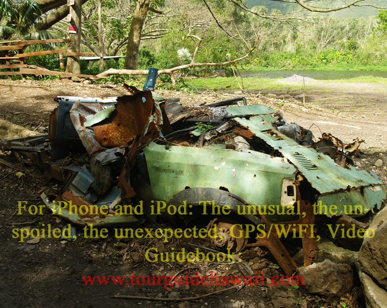
At Waipi'o Valley, numerous carcasses of cars that just couldn't hack the road lie along the jungle slope below the road: Photo by Donald B. MacGowan

There is a four-wheel drive jeep road down into the valley but you really (and I mean REALLY) do not want to drive it, even in a four-wheel drive vehicle. The road is constantly steep (25% grade!!!), poorly paved, always narrow and winding, unbelievably hazardous and tricky, deceitful and populated by local drivers who really do not want you on their road. Really. Tours down into the valley in vans, on horse drawn wagons and ATVs can be booked in Honoka’a. Over-flights in fixed wing aircraft and helicopters also offer fine venues from which to see this amazing piece of Hawai’i.

Once the Waipi'o Valley Road reaches the valley floor, it becomes a mystical, marvelous tree-tunnel through the jungle: Photo by Donnie MacGowan

Perhaps the most satisfying way to see Waipi’o Valley, however, is the way the ancient Hawai’ians did, by walking forthrightly down into it and then creeping, wheezily, back out. However, if you attempt this hike, don’t be deceived by the numbers. The hike may entail less than a thousand foot elevation loss (and subsequent gain to climb out) and fewer than 2 miles actual walking, but it feels much longer; it is hard, hot, dry, steep and, oh yes, did we mention hard? Really, really hard; no one who is not in very good physical condition should attempt this hike—better to pay for the van tour or flight. But the views and the photographs to be had by making this difficult hike are well worth the price of sweat and time.

An Enormous Waterfall at Mouth Waipi'o Valley: Photo by Donald B. MacGowan

The hike down into the valley takes about ½ an hour. Allow twice that again for exploration of the valley floor and beach and at least an hour to walk back up. Be ever vigilant when walking on the road; local drivers will not deign to give you right of way and tourist drivers are notoriously at the very edge of loosing control. To reach the beach, simply stroll down the road; near where the road hits the valley floor, there is an intersection...take the road to your right (toward the ocean) which goes along public access to the beach and a spectacular 300 foot waterfall.

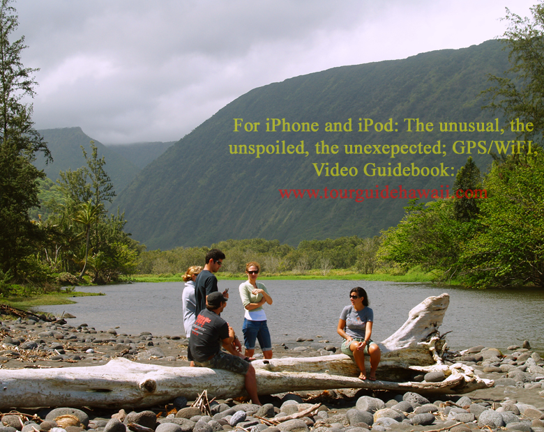
Hikers at the Stream in Waipi'o Valley: Photo by Donnie MacGowan

Once on the valley floor head to the beach where you may wander through ironwood and fir copses along the black sand beach, bask in the cool mist of waterfalls or hike across the ridge into the next valley. Do not attempt to hike past the headland cliffs into adjacent valleys—it may seem passable, even tempting, but it is in fact impossible and extremely dangerous.

The mouth of the stream in Waipi'o Valley: Photo by Donnie MacGowan

Camping at Waipi'o is not currently permitted, but free permits to camp at Waimanu Beach, the next valley over, are available from the State of Hawaii Department of Land and Natural Resources. The trail to Waimanu Valley starts were Waipi'o Beach meets the far (western) canyon wall and zig-zags its way up and out of the canyon, across the ridge and down into Waimanu Valley...it doesn't look far, but it's an all-day proposition to do this as a backpacking trip. There is one small bed and breakfast establishment, in Waipi'o Valley, but it is generally booked many months in advance.

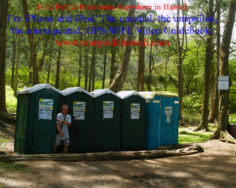
There are porta-potties and litter barrels for visitor's convenience at the bottom of Waipi'o Valley: Photo by Donald B. MacGowan

If you do go down into the valley, no fresh drinking water is available, so take lots. All fresh water in Waipi'o Valley is infected with leptospirosis—do not drink it, do not get it into unhealed cuts. Be especially careful when playing near waterfalls or fording the shallow water at the stream's mouth...the rocks are very slippery and there sometimes is quicksand. Be forewarned, swimming and surfing in the ocean here are for experts only, due to the strong currents and big waves.

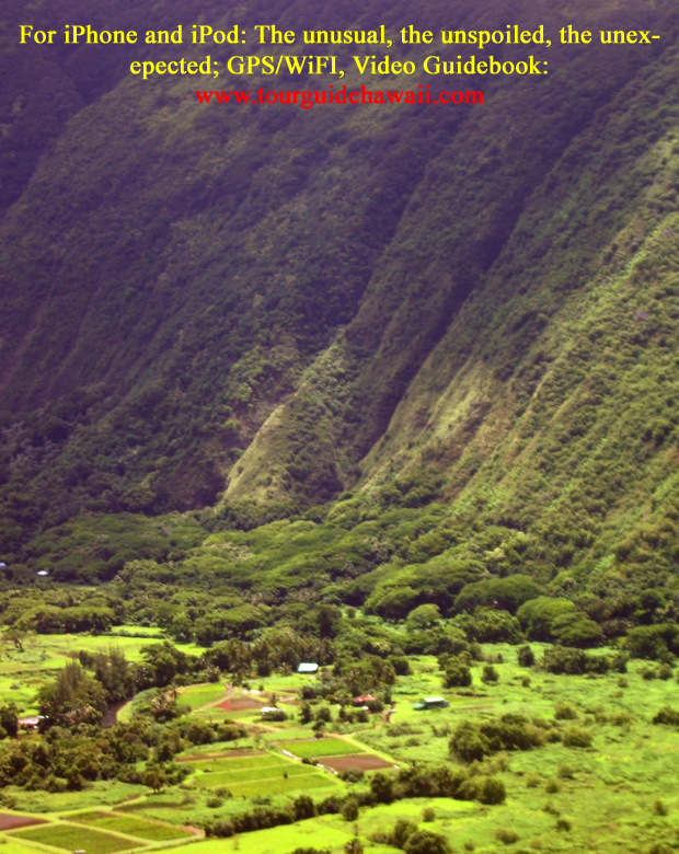
Taro Farms in Waipi'o Valley: Photo by Donald B. McGowan

You will hear tales of the marvels which lie back in the recesses of Waipi'o Valley...fabulous jungle, aery, lace-like waterfalls of breath-taking height, calm pools for skinny dipping. All this is true...but you must trespass across private land in order to reach them—and you should have permission to drive or walk there. Many of the land owners are less than thrilled at the number of tourists invading their secluded homes...they live down here for a reason. So hop into Honoka'a Town and sign up for one of the many tour options down that jungle road, into the back of the canyon, to the numerous, enormous, crazy waterfalls and scenery like you will see no where else on earth...Waipi’o Valley is a magical place that defies the powers of written description or photographs to do justice.

Another victim of Waipi'o Valley's harsh driving environment: Photo by Donald B. MacGowan

To see the new iPhone/iPod Touch App, please visit http://www.tourguidehawaii.com/iphone.html. The best of Tour Guide Hawaii's free content about traveling to, and exploring, the Big island, can be found here. For more information on traveling to Hawaii in general and on touring the Big Island in particular, please also visit www.tourguidehawaii.com and www.lovingthebigisland.wordpress.com.


Copyright 2009
by Donald B. MacGowan. All rights reserved.
 

Casino Bonus no Deposit