Showing posts with label beach. Show all posts

Wednesday, October 21, 2009

Kiholo Bay Beach Hike

by Donald B. MacGowan

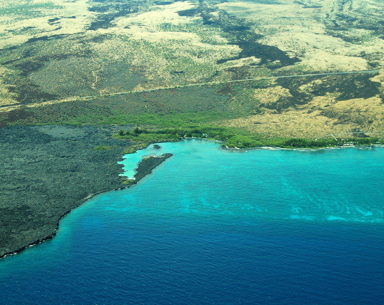
Aerial View of Kiholo Bay, Kohala Coast, Hawaii: Photo by Donnie MacGowan

Whether you visit the Big Island for a few days, a couple weeks or a few months, you want to make the most of your time in Paradise. With such a wide variety of natural and commercial attractions, it is natural for the visitor to get a little overwhelmed in the “Option Overload” and not be able to make a balanced and informed decision on what they want to do and how best to spend their time.

Sunset View of Haleakala on Maui From Kiholo Bay: Photo by Donald B. MacGowan

Even choosing which beach you want to spend time or where you want to hike can be an exercise in confusion and conflicting advice. Clearly, visitors to Hawaii could use help making quality decisions about how best to spend their time.

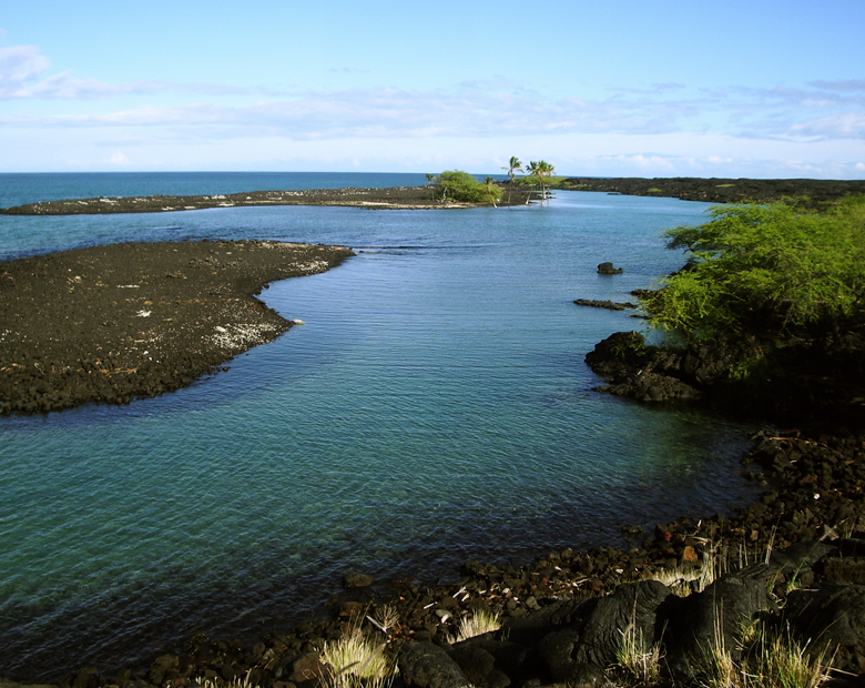
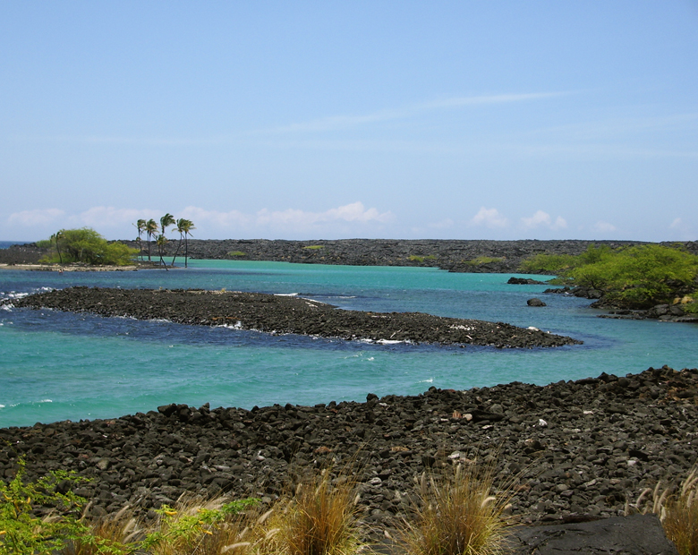
All that remains of a mile-long fishpond that was destroyed by flowing lava are these gorgeous, turquoise brackish ponds: Photo by Donald B. MacGowan

Tour Guide Hawaii is excited and proud to announce the release of their new GPS/WiFi enabled App for iPhone and iPod that helps you navigate your trip to Hawaii with hours of informative, location-aware video and information. Although our video guide will lead you to dozens of unusual, untamed and unspoiled spots, let's look at one, hidden but gorgeous, beach hike you would otherwise not find if you did not have Tour Guide Hawaii's new App.

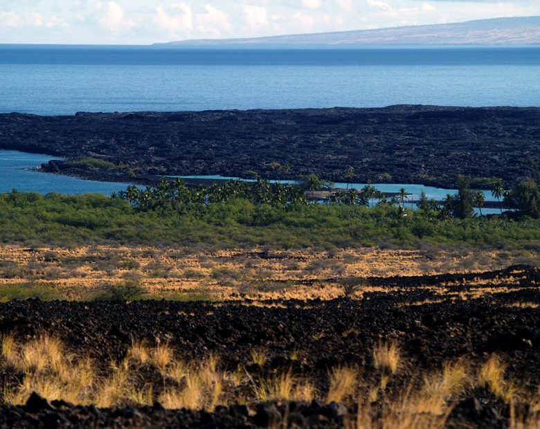
Kiholo Bay on the Kohala Coast of the Big Island of Hawaii: Photo by Donnie MacGowan

Kiholo Bay Beach Hike

Snorkeling, country music history ancient fish ponds and medical science…what more could anyone ask for? One of West Hawaii's best kept secret is gorgeous, amazing Kiholo Bay, those heavenly, turquoise waters and swaying palms you can't quite glimpse clearly from the overlook at mile marker 82 on the Hawaii Belt Road.

The View of Kiholo Bay From the Hawaii Belt Road: Photo  by Donald B. MacGowan
The View of Kiholo Bay From the Hawaii Belt Road: Photo by Donald B. MacGowan

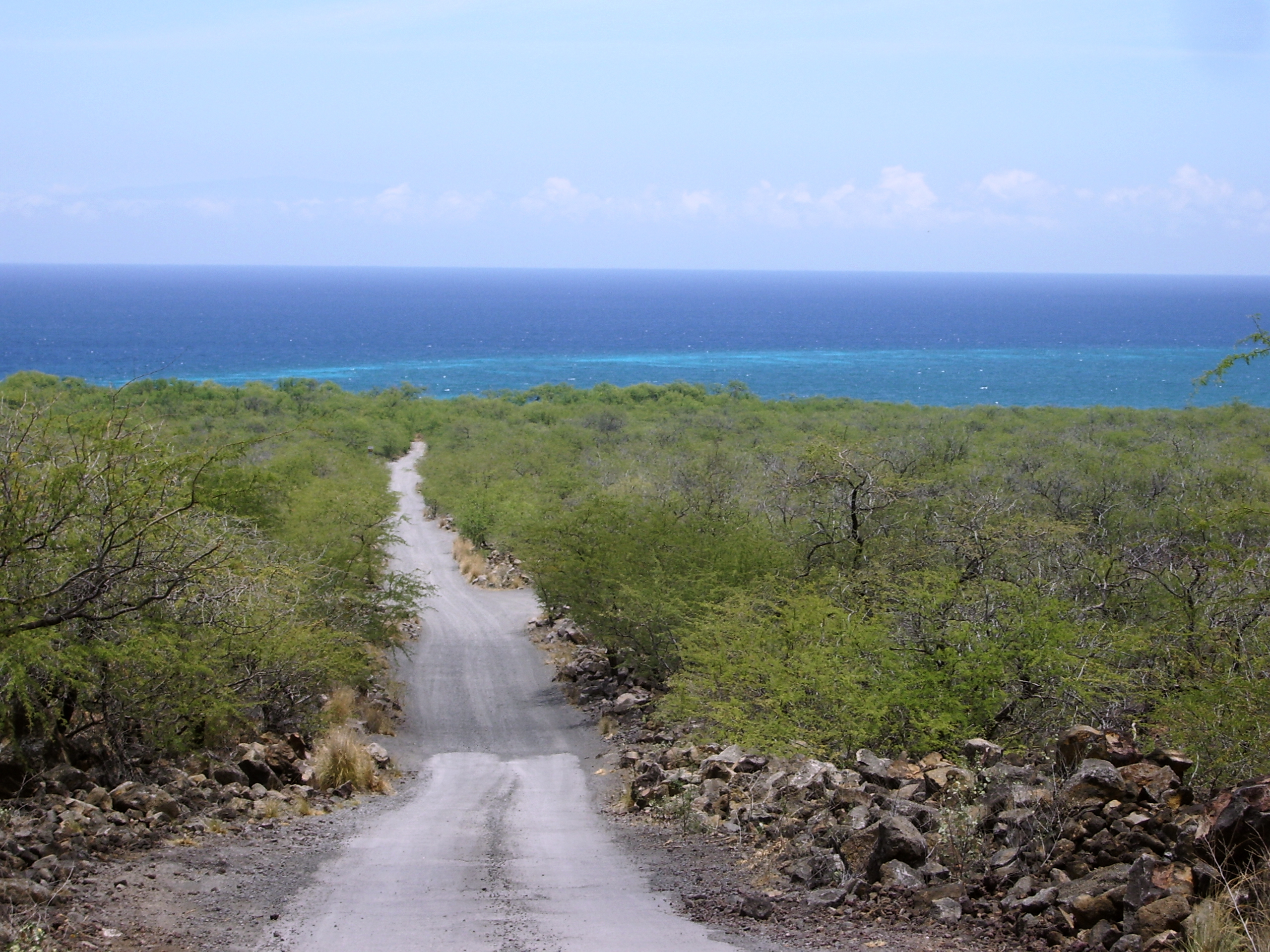
Dirt road into Kiholo Bay, just south of the 82 mile marker on the Hawaii Belt Road: Photo by Donnie MacGowan

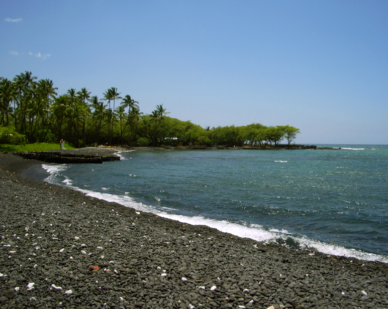
This remarkable, beautiful and sadly popular area is accessed in two ways; first, by a gravel road going ocean-ward from the highway immediately south of the Overlook pullout at mile marker 82. This road is only open from 8 a.m. to 6 p.m., but accesses the south end of the bay, a pebbly beach terminated in austere a’a flows to the south. The round house on the beach was built by country and western singer Loretta Lynn, but was condemned and taken by the State when it created the beach park. Swimming and boogie boarding here are excellent in low to moderate surf, but beware of current and surginess; if the surf is high, do not go in.

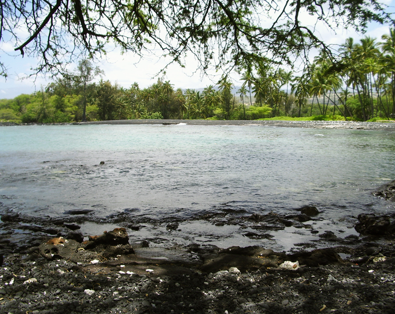
Kiholo Bay, Kohala Coast, Hawaii: Photo by Donnie MacGowan

A trail south below the big mansion on the headland leads about three quarters of a mile to a tiny black sand beach with an amazing coral garden. This little beach is my favorite snorkeling secret on the island.

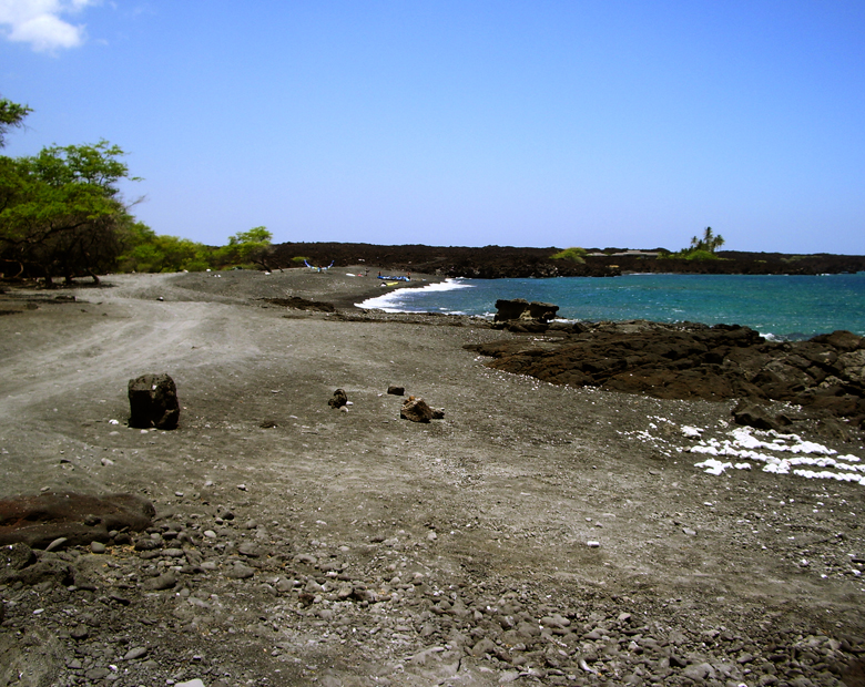
The road south from Kiholo Bay dead ends at an elaborate mansion; from there a trail can be taken around the headland to a remarkable black sand cove that provide gorgeous, if exposed, snorkeling: Photo by Donald B. MacGowan

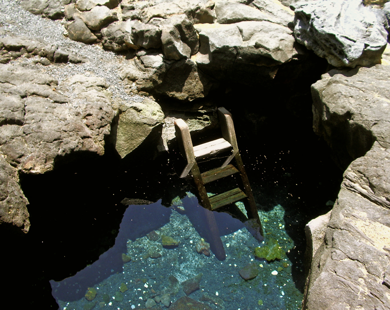
A 4WD road/trail continues north along the black pebble beach and cliffs to Kiholo Bay proper. This part of the Kiholo Area can also be accessed via a trail (used to be a dirt road) that leaves the parking lot immediately south of mile marker 81. Along the 4WD trail, on the mauka (uphill) side, is a freshwater spring and pond in a lava tube (Keanalele Water-hole), a great place to rinse off after swimming or hiking along the beach. Please rinse off excess suncream in the ocean before enjoying this refreshing pool.

Keanalele Water-hole, a freshwater Queen's Basth in a lava tube, near Kiholo Bay, Hawaii: Photo by Donald B. MacGowan

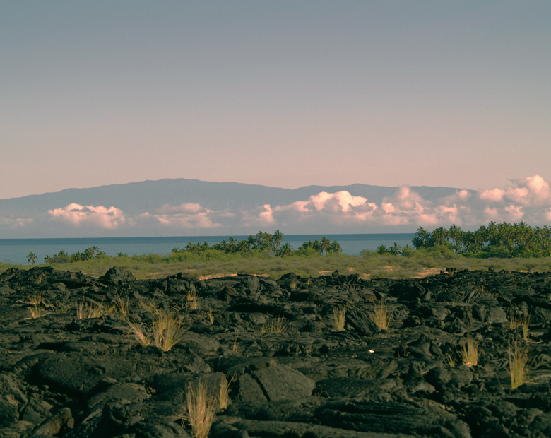
Also along this portion of the beach are a number of mansions, most notably the Bali House (oh, you’ll know it when you see it) and the home of Earl Bakken, the billionaire inventor of the pace maker. Believe the no trespassing signs you see here. On clear days, views of Mauna Kea from this part of the beach are stunning.

There are some amazing multi-million dollar mansions along the beach; believe the "no-trespassing" signs: Photo by Donald B. MacGowan

Just north of Kiholo Bay is a beautiful, turquoise brackish lagoon, all that remains of a 2-mile long fishpond erected by Kamehameha the Great around 1810, which was destroyed by the Mauna Kea lava flow of 1859. The water can be a might cloudy for snorkeling, but it's full of turtles and, on calm days, has one amazing attribute. If wind is not driving surge-mixing of these ponds, lighter, fresh water from springs will float on top of the heavier salt water. This fresh/salt water interface produces a refractive lens that creates interesting and amazing optical tricks for the snorkeler.

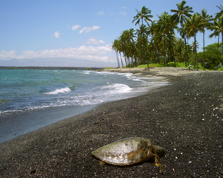
A Hawaiian Green Sea Turtle, or Honu, Suns Herself at Kiholo Bay on the Kohala Coast of Hawaii: Photo by Donald B. MacGowan

Full of turtles, beautiful to swim and a wonderful place to learn to surf, Kiholo Bay proper has it all. In addition, the sweat required to reach it has the added bonus of weeding out the undesirables. Please remember not to approach or harass the turtles. Dolphin (and humpback whale in season) frequent this bay—it is also illegal (and stupid) to harass them. Be careful to pack out everything you packed in, and help the environment by picking up that other guy's litter, as well.

The Brackish Lagoons of Kiholo Bay: Photo by Donald B. MacGown
The Brackish Lagoons of Kiholo Bay: Photo by Donald B. MacGowan

As of this writing, camping is not being allowed at Kiholo Bay, although many people do camp here...be advised that the road is locked at night and you will not be able to leave.

A relaxed lifestyle is enjoyed by the few, but extremely wealthy, residents of Kiholo Bay: Photo by Donald B. MacGowan

To see the new iPhone/iPod Touch App, please visit http://www.tourguidehawaii.com/iphone.html. The best of Tour Guide Hawaii's free content about traveling to, and exploring, the Big island, can be found here. For more information on traveling to Hawaii in general and on touring the Big Island in particular, please also visit www.tourguidehawaii.com and www.lovingthebigisland.com.

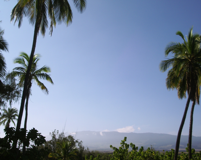
The View of Mauna Kea From Kiholo Bay, Kohala Coast, Hawaii: Photo by Donnie MacGowan

Copyright 2009 by Donald B. MacGowan. All rights reserved.

Tuesday, June 23, 2009

Hawaii Island's Unusual, Uncrowded and Untamed Southern Beaches

by Donald B. MacGowan

Sometimes lost in the shuffle between visiting the mile-long sugar-sand beaches of Kohala and the spectacular snorkeling at the Kona-side beaches, the southern beaches of Hawaii Island are by no means second class, poor cousins. Beautiful and alluring in their own right, many are highly unique, offering unusual conditions and rare scenery, and all are well worth visiting. Here is a smattering of the best of the Southern Beaches of Hawaii Island. All these beaches are a bit off the beaten track and, with the exception of Punalu'u, aren't on any standard tour of the island. Many of these are remote, none are crowded.

We always advise visitors to be careful with their possessions and leave no valuable in the cars. The locals are friendly and open, so smile, talk story with them and open yourself to an adventure that only begins with visiting the beaches.

Mahana Green Sand Beach

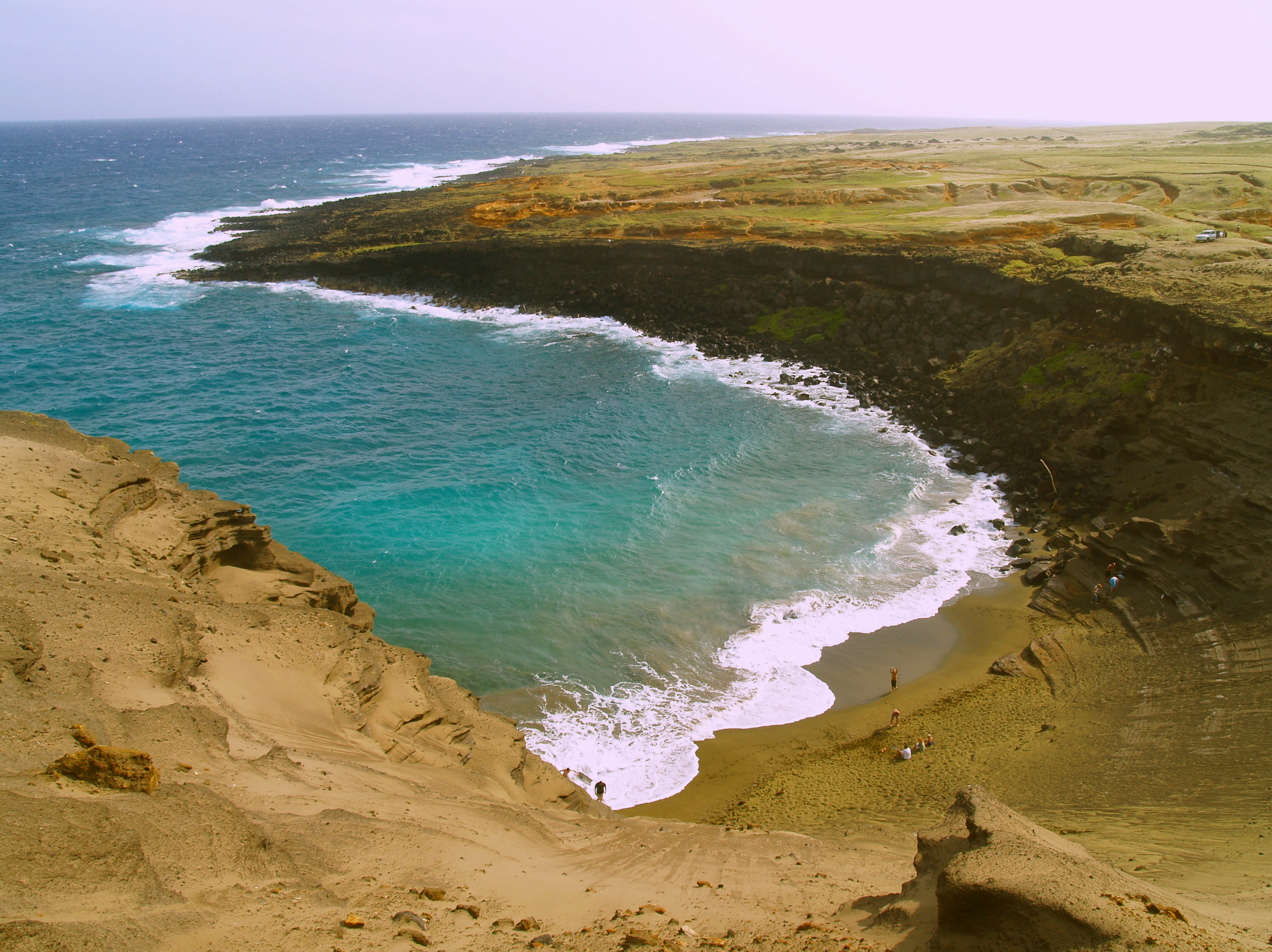
The Beautiful Green Sand Beach at South Point of the Island of Hawaii is Reached by an Easy 2 1/4 Mile Hike: Photo by Donald B. MacGowan

Absolutely unique to the island of Hawai’i, beautiful and strange, are the handful of green sand beaches composed of crystals of the semi-precious mineral olivine (also known as peridot). The green sand beach at South Point is the best known, largest and most accessible of these. The sand grains on this beach are formed from olivine crystals weathering out of the lava and cinders from the cone over an eruptive vent that has been partially breached by the sea. The beach lies in the interior of the cone, and the somewhat protected cove formed by the remnant of the cone makes for a wonderful swimming/snorkeling spot. Be very wary of currents and do not go out far nor in at all if the surf is high or there are strong winds. The bizarre color of the water shrieks for color photographs, particularly underwater photographs taken while snorkeling.

To get here drive to South Point and, when the road splits, take the Mahana Boat Ramp branch of the road. Park just above the boat ramp for the 2 1/4 mile hike to the Green Sand Beach. Road conditions along the road to the beach vary dramatically from week to week and the road becomes impassable with even a gentle rain; therefore we do not suggest driving it at all but enjoy the short, pleasant hike. There are no services or facilities here. At all. None. And a goodly long way to drive to get to any…plan and act accordingly.

Punalu’u Black Sand Beach Park

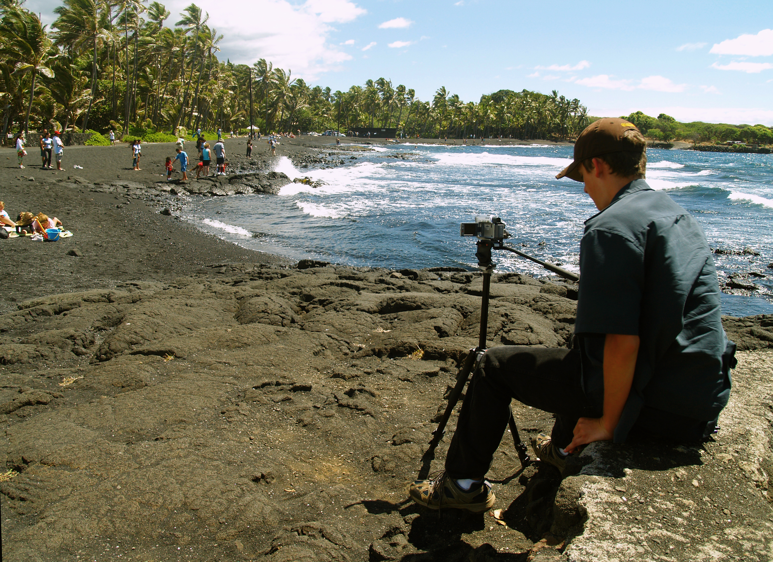
Bradford MacGowan Filming at Punalu'u Beach: Photo By Donnie MacGowan

A truly remarkable place of great peace, beauty and spiritual healing, Punalu’u’s black sand-lined coves and beaches are world-renowned. Dozens of endangered Hawai’ian Green Sea Turtles swim the waters of Kuhua Bay, Ninole Cove and Punalu’u Harbor and frequently bask on Kaimu Beach here. The wildness of the ocean and the serenity of the freshwater fishpond and coconut palm-shaded beaches make this an ideal place to spend some soul-recharge time. Snorkeling, picnicking and camping, or just relaxing on the beach, are major destination pass-times here.

Punalu’u means “springs you swim to”; it is the abundance of these fresh water springs just offshore that makes swimming at Punalu’u so cold and this settlement site so important to the ancient Hawai’ians. In pre-contact times, due to the scarcity of fresh water along the Ka’u coast, Hawaiians would swim out into Kuhua Bay with stoppered gourds, dive down on top the springs, unstopper the gourds and, by upending them underwater, fill them with the fresh spring water emanating from the floor of the bay. These springs are one of the very few sources of fresh water on this entire end of the island.

Available services include water, picnic tables, restrooms, electrical outlets, and pavilions, parking; camping is by permit only. During peak tourist time, there is a souvenir stand with some packaged food items and canned drinks for sale. Due to chilly waters, off-shore winds, strong currents and a fearsome rip, swimmers and snorkelers should use caution when swimming at Punalu’u, but it’s hard to resist getting in and swimming with all those turtles.

Kaimu Black Sand Beach

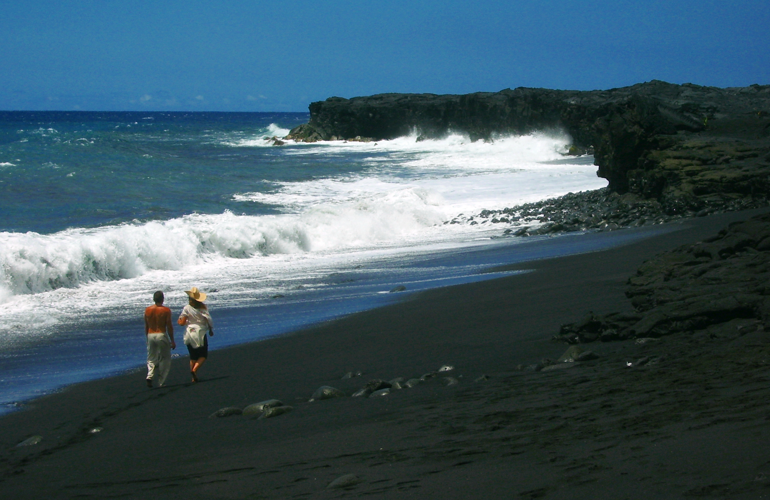
Kaimu Black Sand Beach near the Village of Kalapana: Photo by Donald B. MacGowan

The state’s newest black sand beach, Kaimu Beach, is a barren crescent of sand fronting an unforgiving expanse of lava from the 1990 flows. The old beach and the fishing village of Kalapana that stood along it are long gone, buried under 50-75 feet of lava. The palm trees growing along this trail are the result of one woman’s commitment not to allow her community, her beach, her culture to die under the lava. Planting thousands of palm sprouts, she encouraged her community, school children state wide and hundreds of others to plant the young trees. Today, the realization of her vision of rebirth is in the growing palm groves out on the barren lava plain. The trail to the new black sand beach is marked with these young palms.

Near the parking area along the path are exposed fossils, lava casts of palm trees and other plants…keep a sharp eye out, they are everywhere. Swimming is hazardous at the new beach, so is surfing, the ocean currents being strong and treacherous. But take some time to relax, wade, feel the sand beneath your feet and contemplate the drive of one dying woman to rebuild a world she loved from a devastation few of us can imagine. From the lava hillocks along the trail are nice views of the eruption plume at Pu’u O’o, on the flank of Kilauea as well as the steam clouds where the lave enters the sea at Waikupanaha. This is one of the few places where both can be seen easily and at the same time.

Kehena Beach

Kehena in Puna is a Gorgeous Gem of a Beach; Frequently Clothing Optional, There Is a Sense of Both Community and Welcome Here: Photo by Donnie MacGowan

When the eruption of 1955 created this beautiful black sand beach, the County was swift to capitalize on it and, creating a wonderful beach park, built stone steps down the cliff to the beach. When the beach dropped a full 3 feet during an earthquake in 1975 the stairs were shattered. Like so much else around this island, these stairs were never rebuilt and today terminate about ten feet above the current level of the beach—if you want to get down to the beach, therefore, you must take the dirt path that goes out of the left side of the parking lot.

Once on the beach the first thing that may strike you is that many of the locals who frequent this park have forgotten to put on proper beach attire…or any other attire whatsoever, for that matter. The second thing that will strike you is what a lovely, wonderful spot this is. In the shade of palms and ironwood this wonderful beach is generally sunny even when the rest of Puna is rainy. Swimming here is great, but ocean currents are strong and dangerous not far from shore. The locals are friendly but frisky, so don’t leave valuables in your car.

Pohoiki Beach at Isaac Hale Beach Park

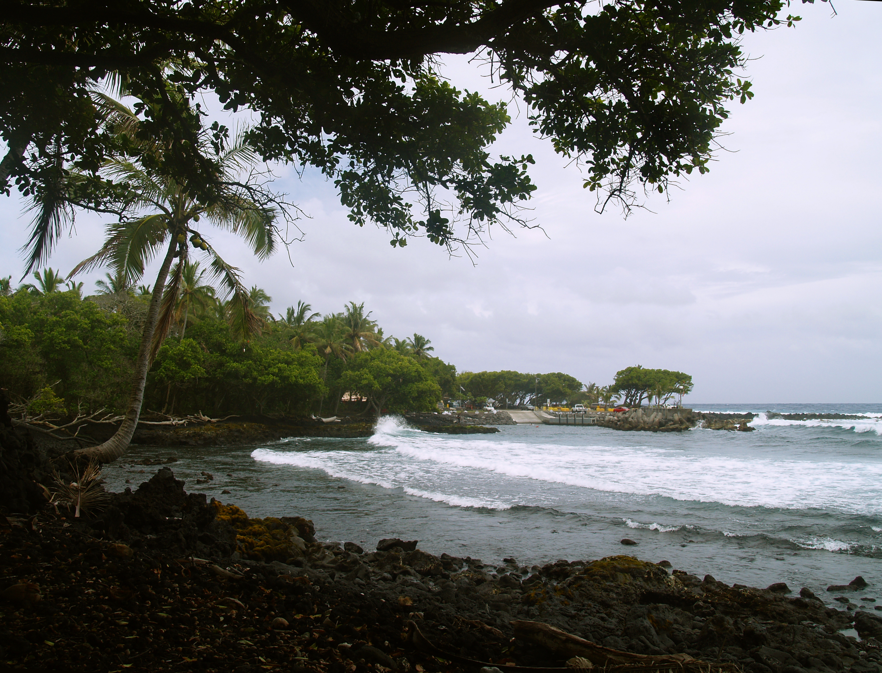
Looking Across Pohoiki Beach to Isaac Hale County Beach Park: Photo by Donald B. MacGowan

A lovely black sand beach with an expert surf break, Pohoiki Beach is one of the very few real beaches and boat ramps in Puna District; as such this park sees a lot of traffic. It is also the site of the best surfing and some of the wildest snorkeling and scuba diving in Puna. If you do get in the ocean here, go in left of the boat ramp—be alert to bodacious boat traffic (they won’t be alert for you) and for fairly dangerous ocean currents. Understandably, given the crowded nature of this small place, some locals are less than welcoming of visitors. Graciously share this ocean treasure with the residents, but and leave no valuables in your car.

A short path along the shoreline leads from the parking lot, past a house with abundant “No Trespassing” signs, just a few minutes stroll then turns about 20 yards into the jungle to a secluded, perfectly lovely natural hot spring that is wonderful for soaking. Locals usually don’t bother with swimwear here, you shouldn’t feel required to, either.

The facilities at Isaac Hale Park Beach Park have been recently rebuilt, refurbished, upgraded and expanded considerably—this once run-down park is now a quite well-appointed. The facilities include of expanded parking, soccer fields, picnic tables, showers and port-a-potties. Camping is allowed with a Hawaii County permit.

Kapoho Tide Pools

The Kapoho Tide Pools Offer a Unique, Fascinating Snorkeling Experience: Photo by Donnie MacGowan

Stuffed with abundant sea life, this sprawling basin of lava tidal pools is a remarkable treasure for snorkelers of all abilities from the starkly frightened to the seasoned veteran. Moorish idols, yellow tangs, various wrasses and eels, sea urchins and sea cucumbers abound and there are even some nice corals in the deeper pools. The largest pool is called “Wai Opae”, which means “fresh water shrimp”. Keeping to the left of the main channel keeps one away from most of the ocean currents, which can be surprisingly strong, even in small channels, where ponds empty into the ocean.

An amazing place to spend the day, Kapoho Tide Pools has wonderful snorkeling for people of all levels as well as other general beach activities, including just plain beach exploring, shell collecting, swimming and fishing. No real facilities exist here beyond the parking lot, so come prepared.

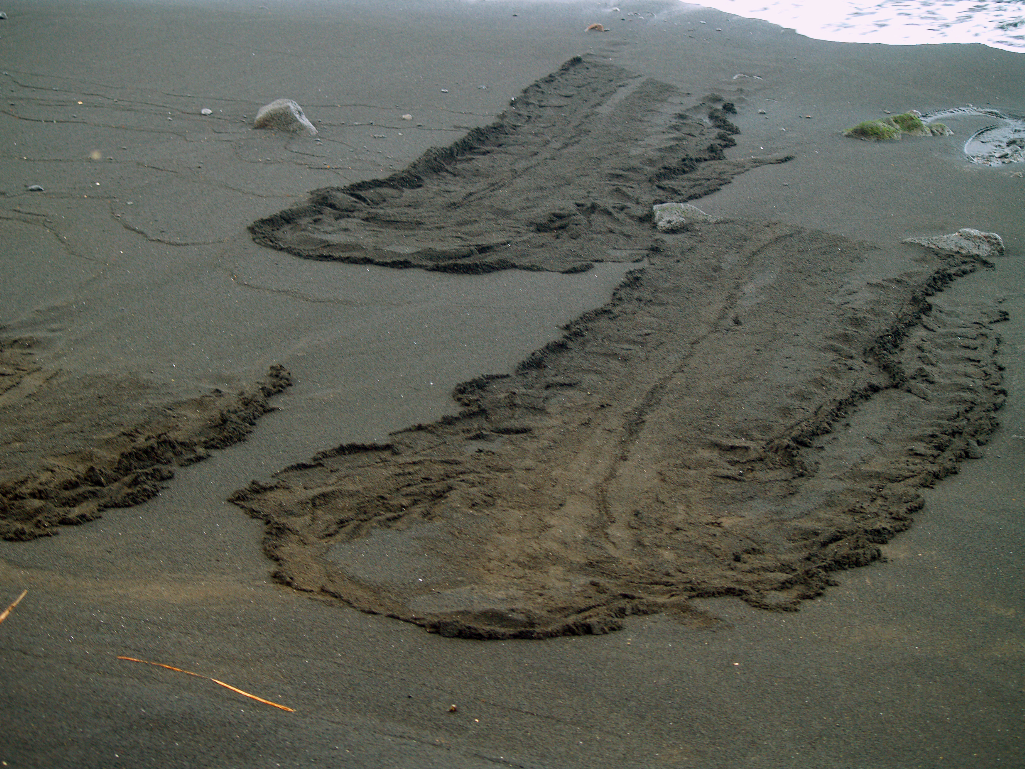
Hawaii's Beaches Offer Much More Than Just Sunbathing and Snorkeling--Many Are Associated With Cultural or Historical Sights and Have Intersting Tidepools and Wildlife.  Here, Endangered Green Sea Turtles Leave Enigmatic Tracks In The Sand At Punalu'u Beach: Photo by Donnie MacGowan
Hawaii's Beaches Offer Much More Than Just Sunbathing and Snorkeling--Many Are Associated With Cultural or Historical Sights and Have Interesting Tidepools and Wildlife. Here, Endangered Green Sea Turtles Leave Enigmatic Tracks In The Sand At Punalu'u Beach: Photo by Donnie MacGowan

For more information about traveling to Hawaii in general and exploring the Big Island in particular, please also visit www.tourguidehawaii.com and www.lovingthebigisland.wordpress.com. Information about the author can be found here.

All media copyright 2009 by Donald B. MacGowan

Thursday, June 18, 2009

Sunny West Hawaii Beaches: Main Kohala Coast

Imagine yourself, as it rains, sleets, and snows through the long winter, lying under cerulean blue skies bathed in healing sunlight on a warm golden sand beach, playing in bath-temperature water, and snorkeling among the brightly colored tropical fish and placid, but amazing sea turtles. Sound too good to be true? In West Hawaii, this soothing daydream is our day-to-day reality.

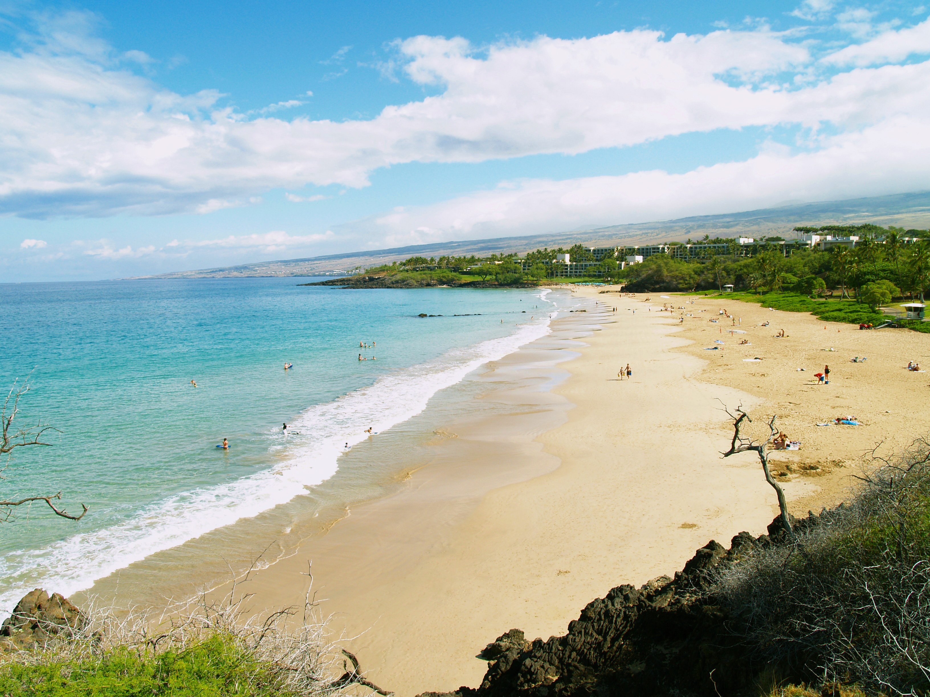
Hapuna Beach, One Of Hawaii's Most Popular, Is Frequently Quite Empty: Photo by Donnie MacGowan

Lying in the rain shadow of two enormous volcanoes reaching from sea level to almost 14,000 feet in the sky, the weather year-round on the west coasts of the Big Island are universally gorgeous, reliably warm, and indescribably delicious.

Our beaches range from wide, mile-long golden swaths of sands bounded by turquoise waters on one side and stands of palms and mangroves on the other to the tiny patches of white sand plunked down in the middle of town where everybody gathers to cool off in the afternoon and gaze at West Hawaii’s unbelievable sunsets. Let’s take a quick tour of just a sampling of the unbelievably fabulous, romantic, relaxing, beautiful beaches of West Hawaii. Our trip starts on the north end of the Kohala Coast and proceeds south tthrough the Kohala Coast beaches.

Beaches of Kohala

Hapuna Beach

Hapuna Beach, One Of Hawaii's Most Popular, Is Frequently Quite Empty: Photo by Donnie MacGowan
At Hapuna It's a 7 Minute Walk From The Car To The Beach...Be Sure To Bring Everything You Need: Photo by Donnie MacGowan

Always rated in the top ten of American beaches, Hapuna Beach is the premiere beach destination on the Island of Hawaii. Long, wide, and phenomenally sandy, it has everything one dreams of in a Hawaiian beach: abundant sun, surf, clean, clear and quiet snorkeling water, shade, and well-maintained facilities.

There are lifeguards, several pavilions, barbecues, picnic tables, restrooms, showers, and a small café. The center of the beach is for wave play and boogie boarding; the north and south coves are quieter, for snorkeling or gentle floating.

Waialea Beach (Beach 69)

69 West Side Beaches 1_edited-1
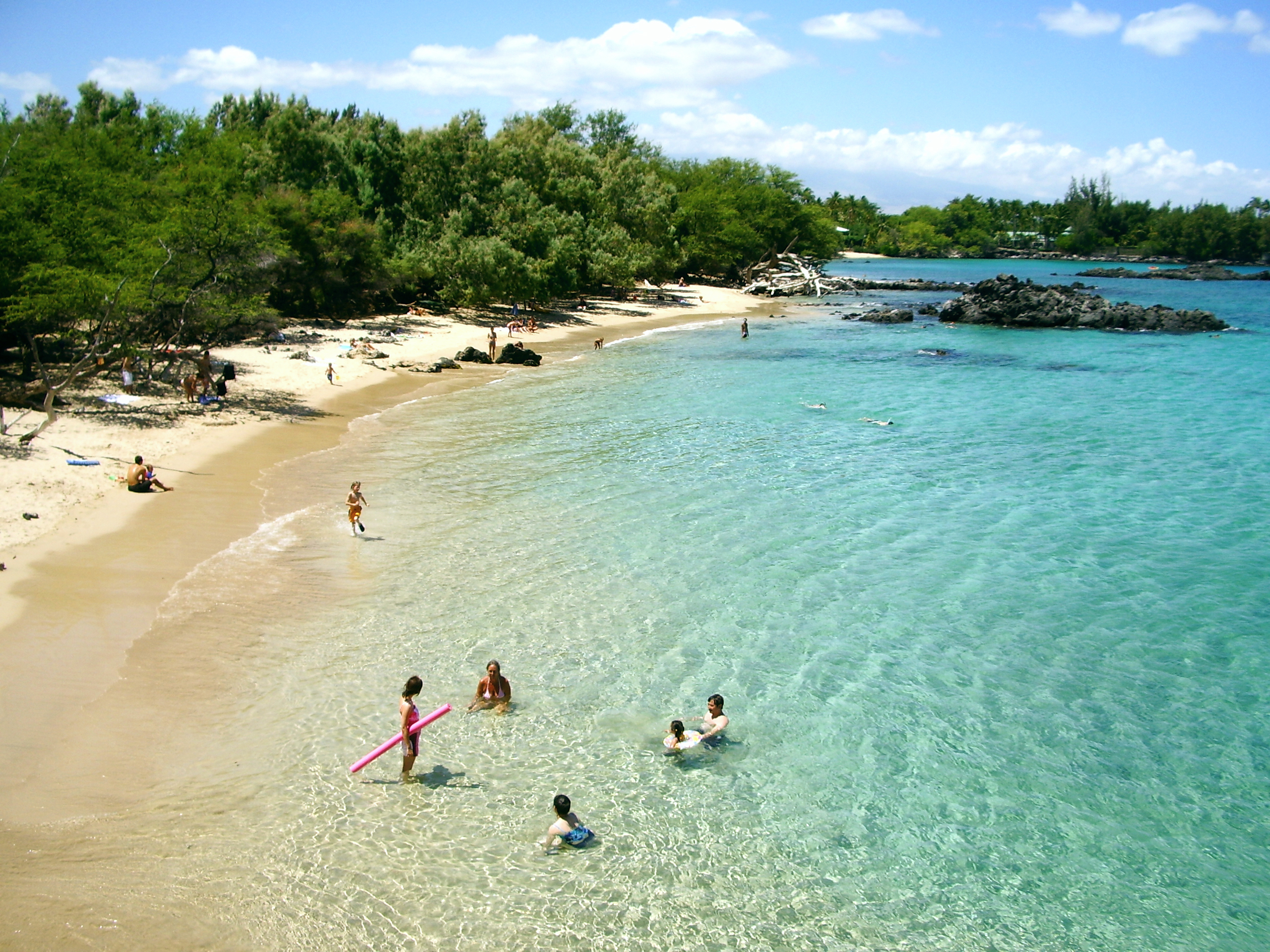
Wailea Beach (Beach 69) Is An Ideal Family Beach and Is Almost Always Uncrowded: Photo by Donald B. MacGowan

A perfect crescent of golden sand backed by abundant shade at the edge of the beach makes this an ideal, though little known, family beach. After about 10 in the morning and on windy days, the water in the bay is a tad murkier than ideal for snorkeling, but most of the visitors to this beach don’t seem to mind. A chain of tiny islands and pinnacles leads northward to crystalline water and a long coral reef for some of the most outrageous snorkeling and shore diving anywhere in the state.

A trail over the north headland leads to a secluded (often clothing optional) cove and then onward to Hapuna Beach. Although most of the shore is relatively free of currents, only experienced snorkelers who are strong swimmers will want to snorkel around the north end of Waialea, past the cove and the reef, past the sea arch, and on to Hapuna—a long, but rewarding swim with some of the most incredible underwater vistas available to the snorkeler in the world.

Take the Puako Road exit from the highway and turn north toward Hapuna. Near Pole 71, an obvious, newly paved road and parking lot indicate the start of the short trail to the beach. Restrooms, picnic tables, water, and showers round out the facilities.

Anaeho’omalu Bay
The most photographed sunset view on the Island of Hawaii, Anaeho’omalu Bay is the icon of what most visitors envision Hawaii to be like before they get here—swaying palm trees, a clean beach fronting warm, safe, swimmable ocean, and hordes of eager beach boys bearing large, tropical drinks with comical names like “Malahini Wahine Wahoo.” Here at the bay, one can rent snorkel or surfing gear, sign-up for sailing trips, snorkel tours, windsurfing lessons or scuba dives, order food and drinks, or just lounge pleasantly in the niumalu (shade of the coconut palms).

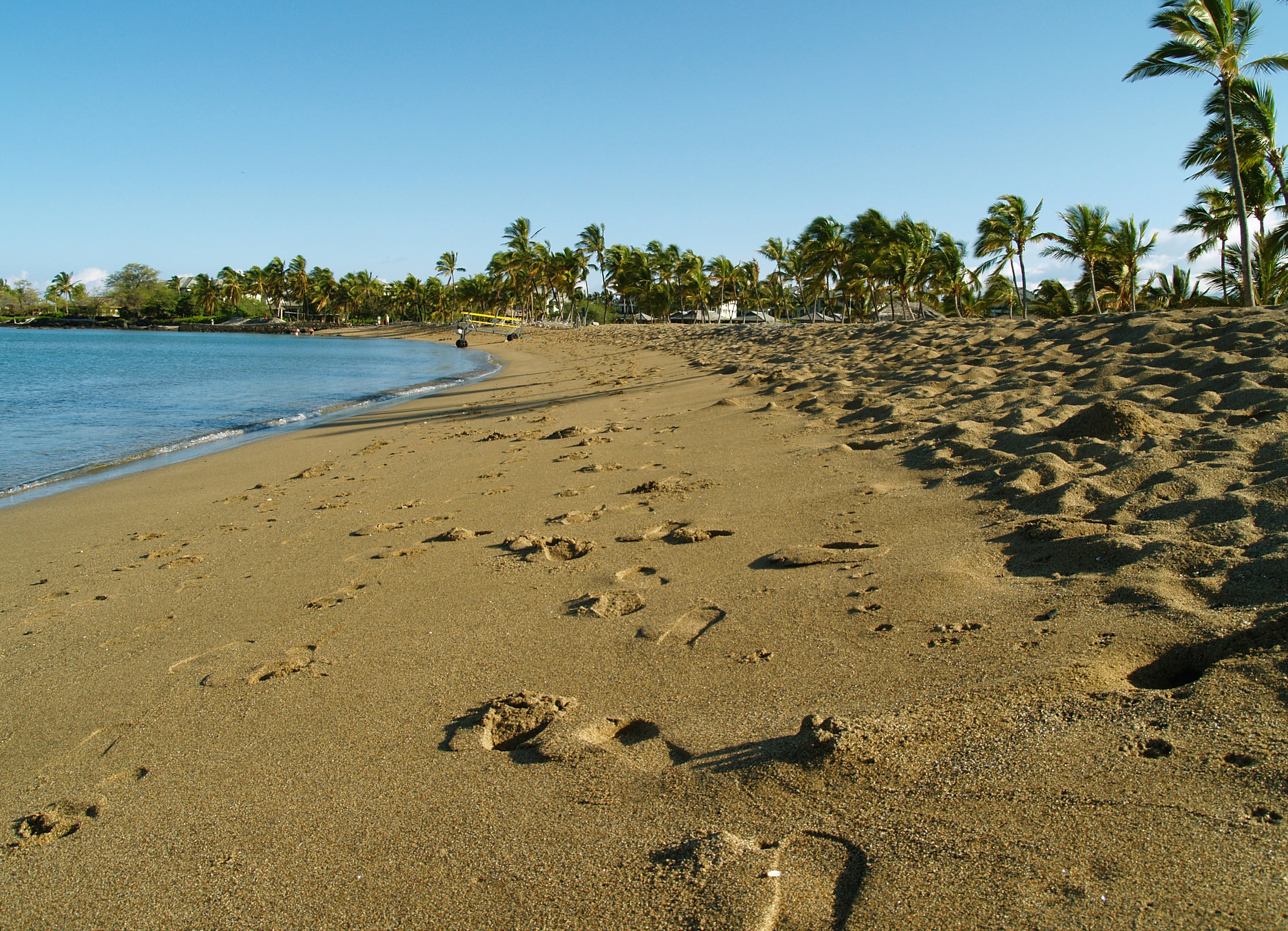
The Justly Famous Anaeho'omalu Beach is a Long Crescent of Gorgeous Sand: Photo by Donnie MacGowan

Named for the ancient fishponds behind the beach, from the words anae (“mullet”) and ho’malu (“to protect”), Anaeho’omalu Bay is known as “A-Bay” to locals. In addition to swimming, snorkeling, diving, windsurfing, and just plain hanging out, the area around A-Bay is also rich with archaeological sites, including section of the Ala Ali’i (King’s Trail), fish ponds, heiau (temples), and petroglyphs.

Walking the trail south from A-Bay to Kapalaoa Beach will take one along not only vistas of incomparable beauty and wildness, but also reveal numerous rarely visited petroglyphs. There is good snorkeling along the farthest south pocket of sand on Kapalaoa Beach. One can follow this tail several miles all the way south to Pueo Bay and Ke-awa-iki Beach along lava flows and shoreline, but it is a long, hot hike with no water for drinking available.

Walking north along the trail (shoes required) over sand, lava, and coral, to the Hilton Waikoloa Resort is an unforgettable sunset stroll, and a good introduction to the wild beauty of the Kohala Coast. There are numerous tidepools, a couple with resident Honu, Hawaiian Green Sea Turtles.

Follow the Mauna Lani Resort road to the left turn clearly marked Anaeho’omalu Bay, turn and proceed to the end of the road. Facilities and services are available at A-Bay and on the Resort Grounds.

Kiholo Bay Area
Snorkeling, country music, history, ancient fish ponds, and medical science … what more could anyone ask for?

This remarkable, beautiful, and sadly popular area is accessed in two ways: first, by a gravel road going ocean-ward from the highway immediately south of the Overlook pullout at mile 82. This road is only open from 8 a.m. until 6 p.m., but accesses the south end of the bay, a pebbly beach terminated in austere a’a flows to the south. The round house on the beach was built by country and western singer Loretta Lynn, but was condemned and taken by the State when it created the beach park. Swimming and boogie boarding here are excellent in low to moderate surf, but beware of current and surginess; if the surf is high, do not go in. A trail south below the big mansion on the headland leads about three quarters of a mile to a tiny black sand beach with an amazing coral garden. This little beach is my favorite snorkeling secret on the island.

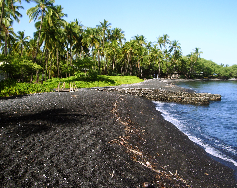
A Hawaiian Green Sea Turtle Suns Herself on the Long, Sinuous Kiholo Beach Which Alternates equal Portions of Bedrock, Pebble and Black Sand: Photo by Donald B. MacGowan

A 4WD road/trail continues north along the black pebble beach and cliffs to Kiholo Bay proper. This part of the Kiholo Area can also be accessed via a newly rebuilt dirt road that leaves the parking lot immediately south of mile marker 81.

Along the beach, on the mauka side, is a freshwater spring and pond in a lava tube (Keanalele Waterhole), a great place to rinse off after swimming or hiking along the beach. Please rinse off excess sunscreen in the ocean before enjoying this refreshing pool. Also along this portion of the beach are a number of mansions, most notably the Bali House (oh, you’ll know it when you see it) and the home of Earl Bakken, the billionaire inventor of the pacemaker. Believe the no trespassing signs you see here.

Full of turtles, beautiful to swim, and a wonderful place to learn to surf, Kiholo Bay proper has it all. In addition, the sweat required to reach it has the added bonus of weeding out the undesirables. Just north of Kiholo Bay is a beautiful, turquoise brackish lagoon, all that remains of a 2-mile long fishpond erected by Kamehameha the Great around 1810, which was destroyed by the Mauna Kea lava flow of 1859.

At Kiholo, as with other beaches on the Island of Hawaii, it is quite usual to see several sea turtles basking on the sand. If, however, you see dozens and dozens of turtles out of the water on the beach, you may properly suspect something big enough and with strong enough jaws to eat a 6-foot diameter turtle is cruising the nearby waters—a good clue that perhaps this is not a day for casual swimming.

eHappy Bathers_edited-1

Here at Waialea Beach, The Near Perfect Year Round Weather, Turquiose-Bath-Temperature-Waters And Relative Lack of Crowds Illustrate Why the Kohala Coast Beaches of Hawaii Island Are Among the World's Favorites: Photo By Donnie MacGowan

For more information on touring Hawaii in general and exploring the Big Island's beaches in particular, please also visit www.tourguidehawaii.com and www.lovingthebigisland.wordpress.com.

All media copyright 2009 by Donald B. MacGowan

Thursday, May 7, 2009

Pu'u Kohola National Historic Park and Spencer Beach Park, Big Island Hawaii


Pu'u Kohola National Historic Park and Spencer Beach Park are two of the most interesting and fun visitor attractions on the Kohala Coast of the Big Island of Hawaii.


Produced by Donnie MacGowan and Frank Burgess and presented by Tour Guide Hawaii...Aloha!

For more information, visit www.tourguidehawaii.com or www.lovingthebigisland.wordpress.com.


All media copyright 2009 by Frank Burgess and Donald B. MacGowan

Tuesday, April 21, 2009

Hidden Secrets of Hawaii: The Golden Ponds of Ke-awa-iki

Hiking Ke-awa-iki Beach, the Golden Ponds, Pueo Bay and Weliweli Point, Kohala Hawaii

by Donnie MacGowan

Donnie MacGowan amongst the Golden Ponds of Ke-awa-iki, Big Island Hawaii: Photo by Bart Hunt


Want to find a beautiful beach not even many locals know about?  Don’t mind walking about 15 minutes over a lava road and a’a?  This tiny mostly black-sand and gravel beach has good snorkeling on the south (left as you face the water) side, where there is still a pocket of white sand.  

This Black and White Sand Piebald Beach is Aboslutely Unique on the Island of Hawaii...Maybe in the World: Photo by Donald MacGowan

This unique black and white sand beach was created after the 1859 eruption of Mauna Kea, when lava reached the north end of the beach, where the black sand is today.  Further south along the beach, the recent black sand has not had time to thoroughly mix with the pre-existing white sand.  


If one continues south there are numerous tide pools to explore.

The North End of Ke-awa-iki Beach Turns to a Delightfully Weird Moonscape: Photo by Donald B. MacGowan

Hiking north, one passes along the wild and open Kohala Coastline to Pueo Bay (Pueo mean "owl" in Hawaiian), where many freshwater springs make the snorkeling interesting but weird, due to large temperature and salinity gradients. There are numerous trails to make your way back to the car or Ke-awa-iki Beach. 

Bart Hunt and the Curious Lone Palm Tree a Keawaiki Beach, Hualalai Volcano in the Background: Photo by Donnie MacGowan
From Pueo Bay Looking North to Weliweli Point: Photo by Donald B. MacGowan

However, if one takes the trail running east behind Pueo Bay (intersection marked with coral), one comes to a pair of lovely golden pools, which can be seen for quite a distance, as they support a growth of hala trees. 

Golden Ponds at Ke-awa-iki Spring Amazingly from the Seeming Lifeless A'a Lava Flow: Photo by Donnie MacGowan

A golden algae growing on the lava lends these pools their distinctive color.

Golden Algae Growing in the Hidden Freshwater Ponds at Ke-awa-iki: Photo by donald B. MacGowan

If you bring an underwater camera, you can take spectacular photos of this gorgeous biologic wonder.

Golden Algae Growing in the Hidden Freshwater Ponds at Ke-awa-iki: Photo by Donald B. MacGowan

 
Feel free to frolic in the ponds before finishing the hike—just be sure not to damage the growth by walking on it too much.

Another interesting trail to thread are the many roads and trails leading to Weliweli Point from the Ponds or Pueo Bay, essentially just keep parallel to the coastline and they all converge at a private residence near the point--on clear days, unsurpassed views of Kohala Mountain and Haleakala on Maui can be seen here.

Weliweli to Haleakala on Maui: Photo by Donnie MacGowan

Return by taking the major dirt road back towards the highway, taking the millennia old King's Trail south when that intersection is reached. Out in the a'a flow it's hard to get lost, you can almost always see where you parked your car, and the trails all eventually lead there.
  

There is much to see here besides the beaches and the Golden Ponds.

Bart Hunt at the Sacred Pond at Ke-awa-iki: Photo by Donald MacGowan

There are remains of ancient heiau (temples) and villages.

Bart Hunt Explores and Ancient Heiau (temple) at Ke-awa-iki: Photo by Donnie MacGowan

And although no green sand beach is know to have formed, vesicular basalts in the area around Weliweli Point have abundant olivine (peridot) crystals.

Olivine Phenocrysts in Vesicular Basalt Near Ke-awa-iki: Photo by Donald MacGowan


Depending on how you thread the trails, it's approximately 4 miles, round trip.

To Find the wonders of Ke-awa-iki: Drive just north of Mile 79, park where boulders block a gravel road. Take gravel road/trail towards the ocean, hike along the road, fence and trail 15 minutes to Ke-awa-iki Beach.  No facilities.

A video about Ke-awa-iki is available here.

For more information about traveling around Hawaii in general and touring the Big Island in particular, please visit www.tourguidehawaii.com and www.lovingthebigisland.wordpress.com.

All media copyright 2009 by Donald B. MacGowan; all rights reserved.

Friday, March 6, 2009

Big Island Day Trips #4: Kailua Kona to Hawaii Volcanoes National Park, Puna and Lava Viewing

Trip 4: Hawaii Volcanoes National Park and Lava Viewing Approximate minimum time start to finish (to see every site): 14 hours (return drive in the dark).

From Kona, connect to Highway 11 south 2 1/2 hours to Ka'u Desert Trail. A 40 minute round trip hike leads to footprints of ancient warriors who where caught in a sudden, ferocious eruption. Continue on Highway 11 to Hawai'i Volcanoes National Park. Park Rangers at the Visitor Center will have the latest lava information. Chain of Craters Road has numerous craters, tons of hiking trails and several breathtaking vistas for great photographs. Upon exiting the Park, continue to Kea'au and Highway 130 (food stop). Proceed to Pahoa and the junction to Highway 132 and Lava Trees State Park. Here trees were inundated with fast flowing lava. When the trees rotted, it left these Lava Trees. Then on to Highway 137, following the coast to Kalapana and a 20 minute hike to the lava viewing area at Waikupanaha. (Arrive about dusk for optimal viewing.) From Kalapana back to Kona is a 3 1/2 hour drive (after dark).

Leg 1) Start at north end of Keauhou Historic District on Ali’i Drive, head south on Ali’i Drive to jct with Kamehameha II Hwy; east on Kamehameha III to Hwy 11. Take Hwy 11 south to Ka’u Desert/Warrior Footprints Trail.

Evening Light on Hualalai and Kailua Kona: Photo by Donnie MacGowan

Keauhou Historic District and Kona Coffee

For almost 400 years, temples and palaces along the Kona coastline served as a kind of "Rome of the Pacific", a great political, religious and cultural center in Polynesia, until the capital was moved to Honolulu in 1850 by Kamehameha III.

The most important, interesting and best preserved historical and cultural sites lie within the Keauhou Historic District, between Kahalu'u Beach Park in Kailua running south 6 miles to Kuamo'o Bay in Keauhou. The District contains perhaps a dozen fascinating sites that are easy to walk to, well maintained and quite interesting. To see the numerous fascinating and important archaeological sites in the Keauhou Historic District, it is necessary to park your car in the free parking at either Kahalu’u Beach Park or the Keauhou Beach Resort and explore on foot.

Just uphill from the Historic District is the Kona Coffee District. Hawaii is the only state in the union which produces coffee, and Kona coffee is perhaps the finest in the world. Over 2 millions pounds of coffee a year are produced on about 600, 2-3 acre farms; tours of coffee farms and roasteries are available.

Mauna Loa Rises Above the Ka'u Desert at Warriror Footprints: Photo by Donald B. MacGowan

Ka’u Desert Trail and Warrior Footprints, Hawai’i Volcanoes National Park

Just where Hawai’i Belt Road enters Hawaii Volcanoes National Park from the West, is a small parking strip that is the gateway to a host of wonders within the Ka’u Desert section of Hawaii Volcanoes National Park. Although eruptions here are generally characterized by leisurely outpouring of lava, it is not unknown for Kilauea to violently erupt in a blast of steam and ash. It is this ash that preserves some human footprints, believed to have been formed in 1790 when enemies of Kamehameha the Great were caught by one such massive, explosive eruption. Perhaps as many as 400 men died in this eruption. An emergency phone is available here; there are no other services. Do not venture from your car here without carrying water.

Leg 2) Continue south on Hwy 11 to Hawaii Volcanoes National Park Entrance and jct with Crater Rim Drive; Crater Rim Drive west to Kilauea Visitor’s Center to Jagger Museum, then back around Crater Rim Drive to Kilauea Iki Crater.

Kilauea Crater and the Current Halema'uma'u Eruption As Seen from Waldron Ledge, Hawaii Volcanoes National Park: Photo by Donnie MacGowan

Hawai’i Volcanoes National Park

Hawai’i Volcanoes National Park is a magical, spiritual, wondrous, strange and beautiful place comprised of great contrasts and contradictions: dry as dust desert to teeming tropical jungle; frigid sub-arctic wasteland to steaming black sand beaches to rivers of flowing lava.

The star attractions in the Park are a pair of active volcanoes; Mauna Loa is the largest mountain on earth and Kilauea is most active volcano on earth. However, there are numerous other wonders from lava tubes to crawl down, black sand beaches with sea turtles to watch, mysterious petroglyph fields to explore, tropical jungles to hike through, endangered bird species to find, happy-face spiders to amuse and an otherworldly volcanic landscape so fresh it’s still steaming.

Hawaii Volcanoes National Park is open 24 hours a day, 365 days a year. During daylight hours, an access fee is charged. The Visitor Center has a 24-hour information line at 808.985.7017 and there is a 24-hour eruption hotline at 808.985.6000. Within the Park tune to A.M. radio 530 for continuous information broadcast. There tourist items available for sale and one restaurant and in the park, however generally shopping, restaurants and gasoline are only available in the nearby village of Volcano.

Kilauea Visitors Center at Hawaii Volcanoes National Park: Photo by Kilgore Trout

Kilauea Visitor Center

Newly remodeled and updated, the Kilauea Visitor’s Center is an outstanding resource of information on Hawaii’s volcanoes and the National Park; the not-to-be-missed first stop in the park you must make. The Center is run by enthusiastic and knowledgeable staff that has the most up-to-date information on viewing the eruption, hiking and camping, bird watching, stargazing and just about any other topic of interest to Park visitors.

Available for sale in the Center are maps, guidebooks, books and videos about the volcanoes, Hawai’iana, history, plants and every topic you can imagine pertinent to the Park, even souvenirs. There are free brochures and pamphlets on various trails, attractions, hiking safety and lava viewing hazards and precautions. The Visitor Center is open daily from 7:45 a.m. to 5 p.m.; there are public restrooms, water and pay phones available. Starting at 9 a.m. and showing every hour on the hour is a 20 minute informative movie about the Park; the film changes from time to time, but always contains spectacular footage of eruptions, information on volcanology and the natural and human history of the Park.

View of Halema'uma'u from Jagger Museum, HVNP: Photo by Donald MacGowan

Jagger Museum and Hawai’i Volcano Observatory

Famed for its fabulous views of Mauna Loa and Kilauea as much as for its interesting exhibits, The Jagger Museum (named for geologist Thomas A. Jagger) is open daily from 8:30a.m. to 5:00p.m. Exhibits include murals by Herb Kawainui Kane, seismograph charts of eruptions and earthquakes, geological displays and display about the natural and human history of the Park.

When entering the parking lot of the Museum/Observatory, be especially careful of the Federally-protected Hawaii Goose, the Nene, who seem to congregate here. The Nene is the State Bird of Hawai’i, and this parking lot and its surrounding area constitute one of the best places for viewing them.

Frank Burgess On Kilauea Iki Trail: Photo by Donnie MacGowan

Kilauea Iki Trail

Perhaps the finest short day hike in the park, a four-mile, 2-3 hour trip down into, across and back out of Kilauea Iki Crater gives one an intimate feel for volcanoes, Hawaiian-Style. Along one side, thick fern and ohi’a forest skirts along the rim and on the other, lush tropical rainforest crowds to the very brink of the crater; bleak volcanic desert lines the crater walls and covers the floor. The start and finish of the hike are along well marked, wide trails. The remainder is an easily followed, well marked trail with stone ahu (cairns) over the crater floor. As always when hiking in the Park, it is wise to avoid the noonday sun, and to remember that afternoon showers are common, especially near where this hike meets the crater rim.

Leg 3) Crater Rim Drive to intersection with Chain of Craters Road; Chain of Craters Road to End of Road.

Hiking from the End of Chain of Craters Road to the Lava Ocean Entry at La'epuki: Photo by Donald MacGowan

End of Chain of Craters Road

The end of Chain of Craters Road is currently at the 19 mile marker near the Holei Sea Arch. This is where the road was cut off by flowing lava and destroyed the 2 million dollar visitor center. When the lava is near the road, one can walk right up to it. There are displays about the volcano and natural history of the area, as well as a wealth of information on hiking to, and viewing, the lava, available here.

Hiking all the way out to the active flows is one of the most spiritually rewarding, awe-inspiring, curiosity quenching and amazing things one can do anywhere in the world—but it is neither for the physically unfit nor the meek of spirit. It is a long, hot hike (currently seven miles) over broken ground and glass-sharp rocks; the heat from the volcano is savage; the weather, if clear, is sweltering…frequent squalls blow in off the ocean and the rain and wind can get pretty wild out on the lava plain where there is absolutely no cover or shelter to protect you. No water or shade is available anywhere along the hike.

Leg 4) Follow Chain of Craters Road back uphill to Crater Rim Drive, follow Crater Rim Drive back to Park Entrance and then to Hwy 11. Go east on Hwy 11 to jct with Hwy 130 at Kea’au; take Hwy 130 south to Pahoa.

In Hawaiian, "Puna" means "Spring" and Puna District in General, and the Area Around Pahoa in Particular, Is Dotted With Hot, Warm and Cold Springs: Photo by Donnie MacGowan

Puna District and Pahoa Town

Uncrowded, off the beaten track and largely undiscovered by tourists, Puna District is a magnificent wonderland; from incredible tree-tunneled roads, geothermal fields of steam vents, lovely beach parks, hot ponds, hikes on raw lava flows and jungle trails, and unequaled snorkeling, the land cries out for the visitor to explore a little bit.

At the center of Puna is Pahoa Town; wild, untamed and even a bit unruly, with its false-front, western-style buildings and raised wooden sidewalks, Pahoa looks more like it belongs in Wyoming. But Wild West isn’t the only subculture evident here…tie-dye banners and the general “flower-power” ambience some businesses and citizens lend Pahoa give it a decidedly “’60’s” feel.

It has been said of Pahoa that if it weren’t for counter-cultural influences, it would have no cultural influences at all. The charm and allure of this way of living is evident when you consider that the region around Pahoa is the fastest growing portion of the island. Pahoa has some of the best restaurants on the island, THE best natural foods store and a great public pool.

Leg 5) At Pahoa, get on Hwy 132 to Lava Trees State Park.

Lava Trees State Park: Photo by Donnie MacGowan

Lava Trees State Monument

Under a lacey canopy of monkeypod trees, casts of ohi'a trees stand as monuments to a fast-moving pahoehoe lava flow that passed through here in 1790. When the lava hit the water-saturated ohi'a trees, it cooled and began to congeal around them. The original ohi'a trees burned away but the quickly cooled lava around them stands here today, hollow, with imprints of the tree bark inside. Lava Trees Park offers trails to hike and a restful, bird-filled jungle to sit and listen to. You can spend between 20 minutes to an hour wandering the trails, here, exploring and discovering. Be careful, however, the area is riddled with hidden cracks in the ground which can make exploring hazardous. You may wish to avail yourself of the restrooms here; they are the last public facilities for some distance.

Leg 6) From lava Trees State Park take Hwy 132 to jct with Hwy 137 at Kapoho; take Hwy 137 southwest to Ahalanui Pond then to Kaimu Black Sand Beach and Kalapana Disaster of 1990.

Ahalanui Hot Pond: Photo by Donald MacGowan

Ahalanui Pond

Also called “Secrets Beach”, this spring and ocean-fed, manmade pool was initially constructed when the springs ran chilly cold. Eruptions in Puna during the ‘50s and 60’s reworked the subterranean waterworks and now the springs run hot and the pool is a comfortably warm 90-95 degrees. The open connection to the ocean, keeps the water fresh. With the gentle aloha breezes, swaying palms and surf whooshing against the, it can be really hard to drag oneself out. Soak for a while. Picnic tables, pavilions, pit barbecues, showers, lawns and all the pleasantries of a civilized park are available at Ahalanui Pond. Leave no valuables in your car and be vigilant if you stay soaking here, after dark.

Kaimu Beach near Kalapana, Puna Hawaii: Photo by Donnie MacGowan

Kalapana Disaster of 1990/Kaimu Black Sand Beach

In 1990 the volcano goddess Pele determined it was time for some serious housecleaning in Puna. Lava flows from Kilauea’s East Rift engulfed the villages of Royal Gardens, Kaimu and Kalapana, destroying virtually everything.

Buried were a centuries old fishing village and a world famous black sand beach. When the lava came, it wiped out not just material possessions; it wiped out a way of life and a landscape cherished by generations. The Big Island's newest black sand beach, Kaimu Beach, is a lovely if barren crescent of sand at the end of an unforgiving expanse of lava from the 1990 flows. The trail to the new black sand beach is marked with hundreds of young palms, numerous lava casts which include palms, pandanas fruit and even some fish that were caught in tide pools.

From the lava hillocks along the trail you can get nice views of the eruption plume at Pu’u O’o, up on the flank of Kilauea, as well as the steam clouds down a few miles along the coast where the lava enters the sea. Restrooms and fast food are available at the end of the road.

Leg 7) From Kalapana, take Hwy130 (Ahia Road) just a tweak to the jct with old HWY 130; go west on old the highway to Waikupanaha Lava Viewing.

Lava Viewing At Waikupanaha, Puna Hawaii: Photo by Donald MacGowan

Lava Viewing Near Kalapana

Nowhere else can you see lava flowing from a volcano into the sea; no Big Island visit is complete without seeing this awe-inspiring show. Currently lava is only flowing into the sea outside the Park. Drive south on Highway 130 through Pahoa to the 20 mile marker and take the right branch about two miles to the parking area. Port-a-potties are available here. The road is open from 2 p.m. until 10; no cars allowed in after 8. Lava viewing information is available from Hawaii County at 808.961.8093; check conditions before you go.

The easy trail, a 20 minute stroll to the viewing area, is well-marked. The viewing varies as lava flows nearer or farther from the trail. Viewing is best at dusk so bring flashlights for the hike out. Take close-toed walking shoes and a hat, long pants and long-sleeved shirt, at least 2 liters of water and sun block and a rain jacket and camera. Remember food and gas are not available anywhere nearby after dark, so fill up BEFORE you park, bring snacks and drinks. There are port-a-potties available at the parking lot.

Leg 8) Return to Hwy 130; Hwy 130 north through Pahoa to Kea’au and jct with Hwy 11. Hwy 11 west to Kailua Kona. Take Hwy 11 west to Kailua Kona.

For more information on visiting Hawaii in general and touring the Big Island in particular, please visit www.touruidehawaii.com and www.tourguidehawaii.blogspot.com.

Sunset Over Oneoneo Bay, Kailua Kona Hawaii: Photo by Donald MacGowan


Casino Bonus no Deposit