Showing posts with label beaches. Show all posts

Tuesday, October 27, 2009

Tour Guide Hawaii Presents The Incredible New iPhone and iPod App: The Greatest App for Travel in the History of Forever!

The most innovative way to travel in the history of Forever. Get the Tour Guide iPhone and iPod App here today!

Say Goodbye To Cumbersome Maps and Guide Books That Are Obsolete Before They Are Printed!

Tour Guide Hawaii iPod and iPhone App puts the magic, mystery and romance of Hawaii in the palm of your hand. It's like having a friend from Paradise sitting in your car, telling you where to go, what to do and all the island secret spots...
>Tour Guide Hawaii iPod and iPhone App puts the magic, mystery and romance of Hawaii in the palm of your hand. It's like having a friend from Paradise sitting in your car, telling you where to go, what to do and all the island secret spots...

>Over 3 1/2 hours of in-depth video presentations about the most popular, most spectacular and most secluded spots!

>Day by Day scenic drive and road trip suggestions!

>Fascinating discussions on Hawaiian culture and history!

>Bonus features on seeing lava flows, snorkeling, language and culture, what to bring to Hawaii and getting around Hawaii!

> Uses GPS for turn-by turn driving instruction, Google Maps for navigation with iPod, or on-board interactive maps with embedded audio driving directions if no Wi-Fi, 3G or GPS connection is available--you literally can't get lost!!!

> All the public restrooms, located and rated for your convenience and protection!

Tour Guide Hawaii iPod and iPhone App puts the magic, mystery and romance of Hawaii in the palm of your hand. It's like having a friend from Paradise sitting in your car, telling you where to go, what to do and all the island secret spots...

Available from the Apple App Store, or by clicking here.

For more information on Tour Guide Hawaii's fabulous new iPhone and iPod App, please go here, here and here.

For more information on traveling to Hawaii in general or exploring the Big Island in particular, please also visit www.tourguidehawaii.com and www.lovingthebigisland.wordpress.com.

Monday, October 26, 2009

Hawaii Vacations Come Alive in the Palm of Your Hand with Tour Guide Hawaii's Fabulous, New, Amazing iPhone and Ipod Touch App

THE must have iPhone / iPod Touch app for all residents and visitors to the Big Island of Hawaii. Get the Tour Guide iPhone and iPod App here today!


For more information on Tour Guide Hawaii's fabulous new iPhone and iPod App, please go here, here and here.

For more information on traveling to Hawaii in general, or details on how to buy the iPhone/iPod App, please go to www.tourguidehawaii.com.

Monday, October 19, 2009

Hiking to Honomalino Bay, Big Island, Hawaii

by Donald B. MacGowan

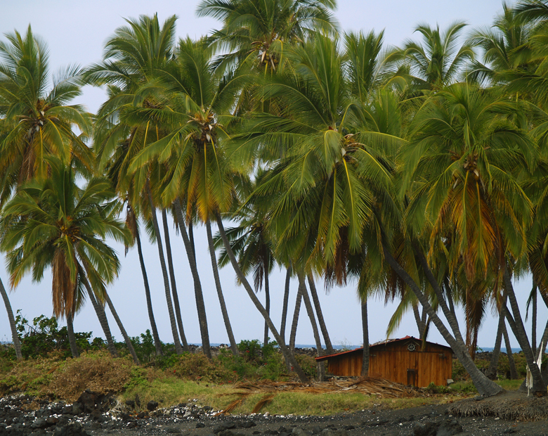
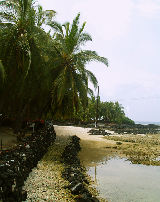
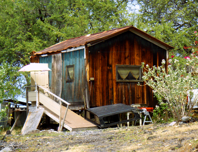
The area around Miloli'i and Honomalino Beach are infused with the je nais se quois of Old Hawaii: Photo by Donald B. MacGowan

Whether you visit the Big Island for a few days, a couple weeks or a few months, you want to make the most of your time in Paradise. With such a wide variety of natural and commercial attractions, it is natural for the visitor to get a little overwhelmed in the “Option Overload” and not be able to make a balanced and informed decision on what they want to do and how best to spend their time.

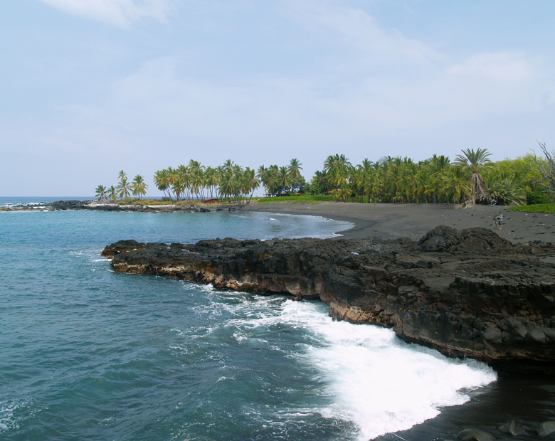
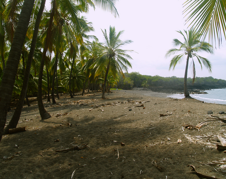
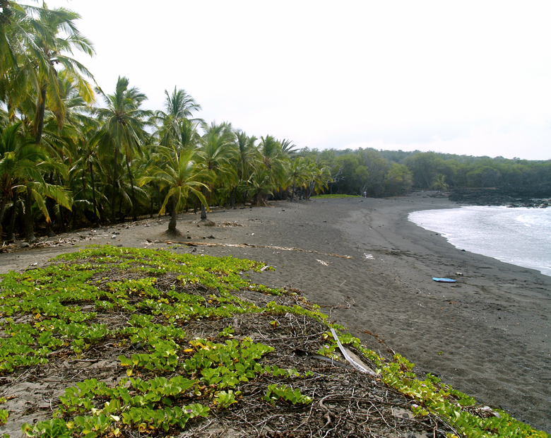
View of Honomalino Bay, Looking North: Photo by Donald B. MacGowan

Even choosing the beach you want to spend time on...which beach? How do you find the right beach for your particular needs? Are you going just to relax and sunbathe? Or is the trip to snorkel, boogie board or to explore? Do you want a beach that's alive with fun people or one hidden, secluded and empty? Do you want a beach near your resort or one that's at the end of a day of delicious wandering?

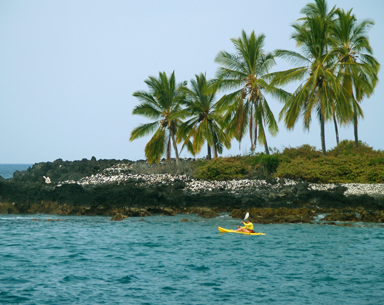
The Kona Coast Near Miloli'i: Photo by Donnie MacGowan

Tour Guide Hawaii is excited and proud to announce the release of their new GPS/WiFi enabled App for iPhone and iPod that helps you navigate your trip to Hawaii with hours of informative, location-aware video and information. Although our video guide will lead you to dozens of unusual, untamed and unspoiled spots, let's look at one, hidden but gorgeous, beach hike you would otherwise not find if you did not have Tour Guide Hawaii's new App.

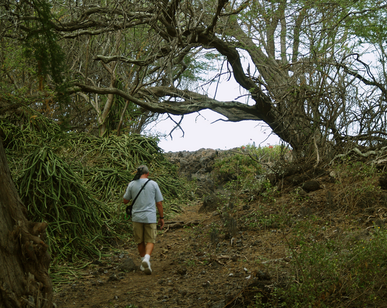
Along the Honomalino Trail: Phto by Donald B. MacGowan
Along the Honomalino Trail: Photo by Donald B. MacGowan

A true gem of West Hawai’i, and rarely crowded, Honomalino Bay lies on the southeast flanks of Mauna Loa along the southernmost Kona Coast. The beach is reached by a 20 minute hike starting in the Old Hawaiian Fishing Village of Miloli'i, which is perhaps the last, truly Hawai’ian fishing village in West Hawai’i. Miloli’i is a tightly knit local community who are perhaps best left to themselves by the casual visitor. Though the surfing and the snorkeling here are excellent, the beach lovely and the facilities in good repair, the visitor may not find the aloha for outsiders terribly abundant. Especially on weekends.

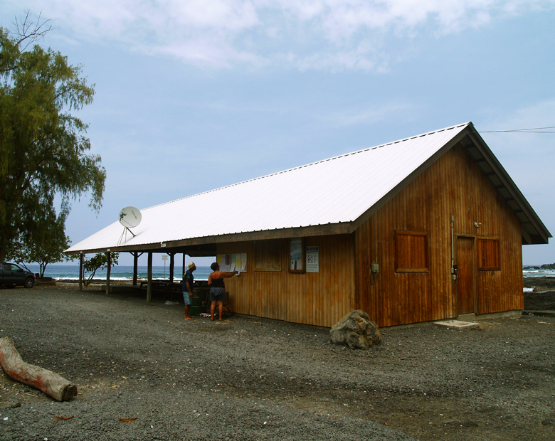
Parking for the Hike is at the Miloli'i County Park Pavilion: Photo by Donald MacGowan
Parking for the Hike is at the Miloli'i County Beach Park Pavilion: Photo by Donnie MacGowan
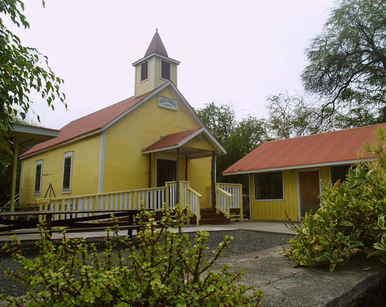
The Hike to Honomalino Beach Starts between the County Park Restrooms and this Yellow Church: Photo by Donald MacGowan
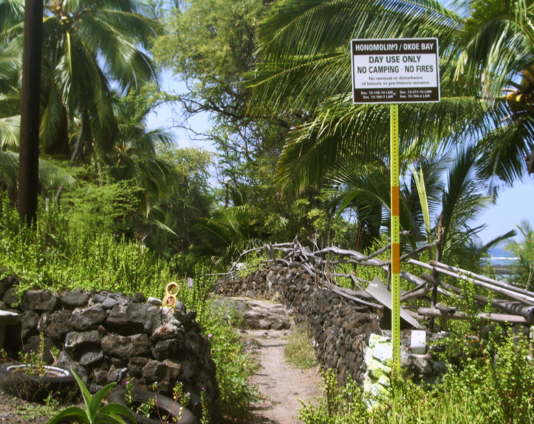
The Trailhead for the Honomalino Bay Hike: Photo by Donnie MacGowan

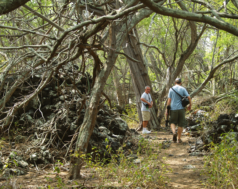
However, by hiking south to Honomalino Bay, the causal visitor finds everything they are looking for in a quiet, secluded beach. Park at the Miloli'i County Beach Park; the hike begins at an obvious trailhead near the end of the road, between the restrooms and the yellow church. The trail wanders along the coast, in and out of the surf line, to the wild and untamed Honomalino Bay—a wonderful place to picnic, snorkel or kayak.

When Hiking to Honomalino Beach, Stay on the Trail, Avoid Private Property and When in Doubt, Take the Right Fork: Photo by Donald B. MacGowan
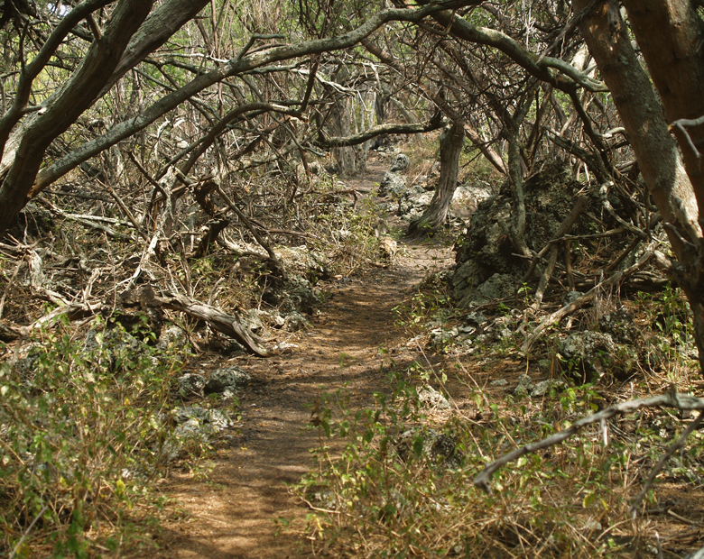
Keawe Thickets along the Honomalino Beach Trail Mean You Should Wear Sturdy Shoes to Avoid the Ginormous Thorns: Photo by Donald B. MacGowan

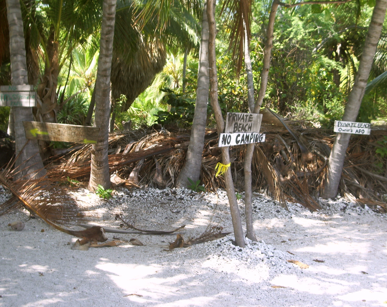
As the trail to Honomalino Beach Winds Toward the Shore, It Passes Several Private Residences and Private Property; Be Sure To Respect These People's Property and Privacy: Photo by Donald B. MacGowan

On the hike in, be sure to keep always to the right at any fork in the trail to avoid trespassing on private property. Honomalino Beach itself is fronted by private property and dwellings, so be respectful of these peoples' homes and privacy.

The Honomalino Beach Trail Squeezes Between Private Residences and a Private Beach: Photo by Donnie MacGowan

Snorkeling is most interesting on the north side in the rocks, or the extreme southern reach of the bay. Go in only when the surf is low; be cautious of the open ocean currents and rip tides. The water, though very clear, is sometimes quite cold due to spring discharge in the sand on the beach.

Behind the Berm, in the Back Dunes of Honomalino Beach, Is a Shady Paradise on Hot Days: Photo by Donald B. MacGowan

Exploring on foot in the area of the bay and further south provides many wonders and archeological treasures, from abandoned temples and villages to the largest holua, or sledding track, in Hawaii. Remember to respect the Hawaiian natives, their culture and their sacred sites...take noting but pictures, don't even leave footprints, stay on established roads and trails.

Superb Snorkeling Exists on the North Side of the Bay by the Rocks: Photo by Donald B. MacGowan

There is no fresh water anywhere along this hike, so be sure to bring plenty of drinking water. It's also nice to bring a couple of extra quarts of water to rinse off after swimming, and dry clothes to hike out in.

There are no provisions for restrooms or trash disposal, either, so wait until you are back at the county park for restrooms and remember to hike out with everything you brought in, including trash.

Honomalino Beach Looking South and East Into the Morning Sun: Photo by Donald B. MacGowan

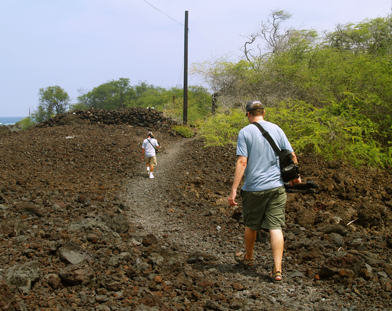
As the trail crosses significant swathes of both sharp a'a lava fields and thick keawe tree copses (with there numerous, impressive and painful thorns), it is imperative that you wear at least running shoes, if not hiking boots, to protect your feet.

Hiking Back to Miloli'i You'll Be Glad of Sturdy Shoes to Fend Off the Huge Keawe Thorns: Photo by Donnie MacGowan

No services at all are available at the beach, and there are no commercial services available in Miloli'i. Please leave no valuables in your car.

Sharp a'a Lava Along the Honomalino Trail Makes You Glad You Wore Real Shoes!: Photo by Donnie MacGowan

To see the new iPhone/iPod Touch App, please visit http://www.tourguidehawaii.com/iphone.html. The best of Tour Guide Hawaii's free content about traveling to, and exploring, the Big island, can be found here. For more information on traveling to Hawaii in general and on touring the Big Island in particular, please also visit www.tourguidehawaii.com and www.lovingthebigisland.wordpress.com.

Could You Have Found This Without Tour Guide? The House in Miloli'i Where Elvis Presley Lived in the Movie "Girls Girls Girls": Photo by Donnie MacGowan

Copyright 2009 by Donald B. MacGowan. All rights reserved.

Tuesday, October 13, 2009

Frank's Big Island Travel Hints # 11: Exploring Deeper Into Hawaii Volcanoes National Park, Big Island, Hawaii

Frank's Big Island Travel Hints #11: Exploring Deeper Into Hawaii Volcanoes National Park, Big Island, Hawaii
by Frank Burgess, brought to you by Tour Guide Hawaii

Frank Burgess Filming the Wiley Wild Petroglyphs at Pu'u Loa in Hawaii Volcanoes National Park: Photo by Donald B. MacGowan

Tour Guide Hawaii is proud to announce the release of their new iPhone and iPod Touch App available at iTunes...this App will help you plan your trip to Hawaii, help you decide what you want to see, how you want to see it and help you get there with GPS, interactive maps and on-board driving instructions. The Tour Guide App presents hours of interesting videos and information about places of historical, cultural and recreational interest, giving you a sense of the people, the natural history and the unique specialness of each destination. The information is so comprehensive and complete they even tell you where all the public restrooms are! What else will Tour Guide help you find? Let's look at a trip around the upper Crater Rime in Hawaii Volcanoes National Park...Tour Guide will not only help you find many amazing sights along the way, it will tell you all about them, what to take and what to expect.

Today's hints cover the area along the very top of Crater Rim Drive in Hawaii Volcanoes National Park. Driving through The Park there several fantastic places to stop and explore, but there is also a lot of lovely, open countryside for several miles, so enjoy the panoramic views. Your Tour Guide download from iTunes will give you more detailed information about this area.

As you continue around the Crater Rim Drive, at Volcanoes National Park, there are dozens of great sights. A more recent crater, erupting with fire curtains in 1974, is Keanakako’i Crater. The pebbles around the rim were formed by froth from the lava as it was blasted into the air and cooled as they fell to the ground. This crater is a bit off-the-beaten-path, but Tour Guide shows the way.

Right along the Crater Rim Drive is the Devastation Trail (video here) formed by Kilauea Iki. When the Pu’u Pai vent erupted in 1959 it spewed pumice cinder and scalding ash burying the rainforest some ten feet deep. This caused the forested area to die leaving a barren wasteland where little has grown since. Tour Guide will take you on the three quarter mile paved hike, along the edge of this moonscaped region, and give more historical information as well.

At the end of the Devastation Trail is the Pu’u Pai overlook. This spot affords a view of Pu’u Pai (gushing hill) and Kilauea Iki (little Kilauea) (video here and here) and skirts the edge of the desert and rainforest as if some drew a line separating the two. Tour Guide gives the fascinating stories of 1900 foot lava fountains during this episode.

Super Tip: Bring plenty of water. I can’t stress this enough. There are few facilities available on the drives and hikes around the park, so make sure you stock up before leaving the Visitor’s Center. Besides, good hydration will keep you energized for all your fun activities. To your health.

On the east side of Crater Rim Drive is a delightful stop not to be missed, Thurston Lava Tube (video here). Tour Guide will tell you how lava tubes are formed when magma flows underground. It eventually empties leaving cave-like formations. Most lava tubes are very small; however Thurston Lava Tube is quite large. The National Park Service has paved a pathway through the tube, and installed lighting, to make this a 300 yard spelunking adventure for everyone to enjoy. The cave circles so that the entrance and exit end at the parking area. The giant ferns here invited the songs of exotic birds, many of which are found nowhere else in the world. This is one of the few locations where restrooms are available.

One of the best hiking and biking routes is the Escape Road (video here). Built for just what its name implies an alternate road for when the lava will inevitably cut the Chain of Crater Road, it makes a lovely down hill walk or bike ride. Tour Guide will show where to start at the Thurston Lava Tube parking area and end at the Mauna Ulu parking lot. This road meanders through some of the most cool and pristine rainforest to be found.

At the other end of the Escape Road is Mauna Ulu (video here), also accessible from Chain of Craters Road. This spot was formed by numerous eruptions between 1969 and 1974. A few yards down the road, you see the different types of lava formations left from these flows. Tour Guide will explain these types of lava in great detail. Across the expanse lies Pu’u Huluhulu, or shaggy hill. For those that are ready hike, there is a tree mile round trip hike to the top of Pu’u Huluhulu marked by cairns. From the summit, the views of the lava flows and coastline are indescribable.

To see the new iPhone/iPod Touch App, please visit http://www.tourguidehawaii.com/iphone.html. The best of Tour Guide Hawaii's free content about traveling to, and exploring, the Big island, can be found here. For more information on traveling to Hawaii in general and on touring the Big Island in particular, please also visit www.tourguidehawaii.com and www.lovingthebigisland.wordpress.com.

Copyright 2009
by Frank Burgess; photography copyright 2009 by Donald B. MacGowan. All rights reserved.

Saturday, October 10, 2009

Hilo Askance

by Donald B. MacGowan

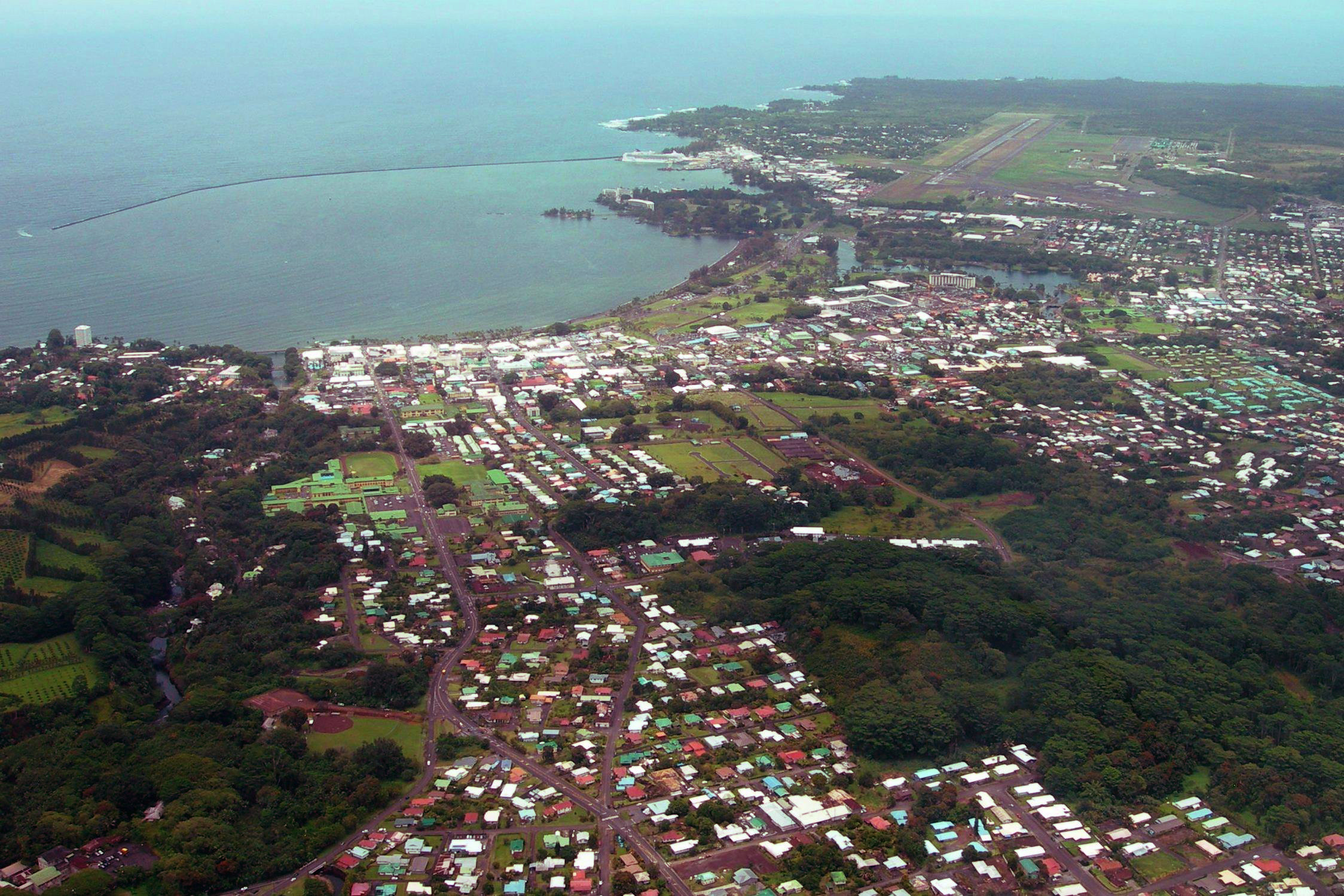
Hilo From the Air: Photo by Donnie MacGowan

Beautiful but wet, metropolitan but decrepit, bustling but laid back, Hilo is a lovely, maddening, heartbreaking, addictive study in contrasts.

In can rain all day long for 50 days in a row, yet when the sun does shine, the views of Mauna Loa and Mauna Kea from the Liliuokalani Gardens, or of Hilo Bay as you drive down from the mountains on Kaumana Drive, or the waterfall and flower choked jungle gulches leading to lovely small beaches along the highway north of town, make Hilo one of the most truly, achingly lovely spots on earth.

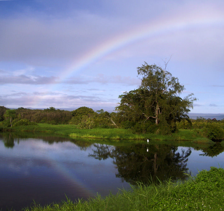
Rainbow at Lokawaka Fishpond, Hilo: Photo by Donnie MacGowan

The wettest city in America, Hilo is about rain; Hilo is humid and moldy. Hilo is poor; Hilo is dirty, littered and unkempt.

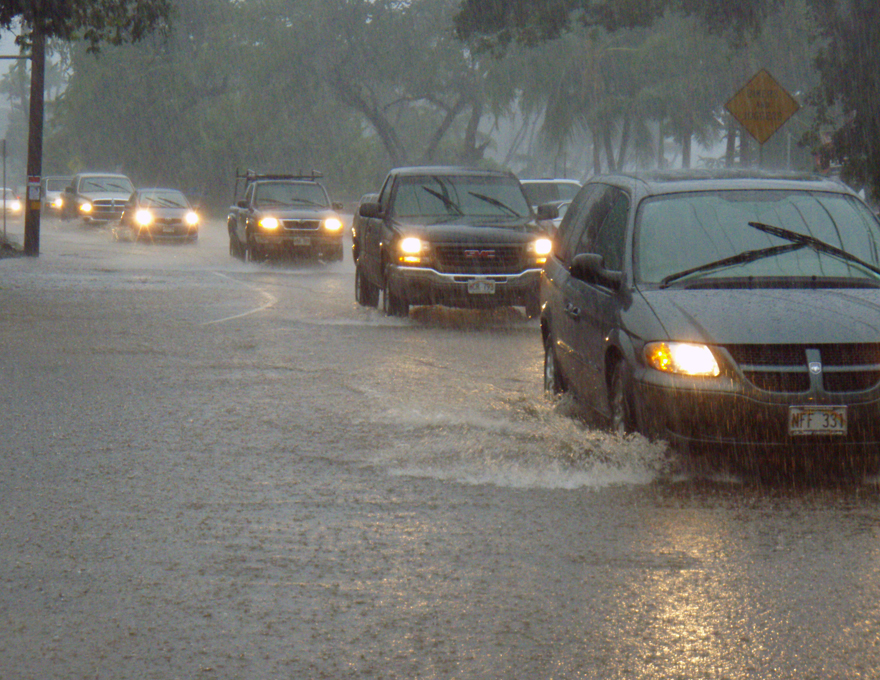
In Hilo, the Skies Just Open...For Days at a Time: Photo by Donald B. MacGowan

Even where tourists are expected to congregate, street trash blows, drug merchants abound and mildew, flapping tin roofs and peeling paint are omnipresent. Hilo's public restrooms, on the whole, are a disgrace.

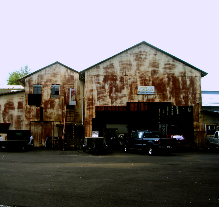
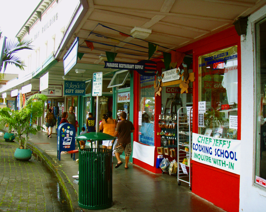
Although it Boasts a Modern Mall and Small Downtown Shopping District, Much of Hilo's Commercial District Are Fairly Disreputable Looking: Photo by Donnie MacGowan

The Hilo area's reputation was so bad among early native Hawaiian that when Kamehameha the Great wanted to build a fleet of 10,000 war canoes in secret to invade Maui, he looked around Hawaii to see where such massive construction could be undertaken without danger of spies or locals seeing. The Hilo area was so universally shunned and abjectly empty that her bay was the perfect place to build and hide the largest fleet of warships the central Pacific Ocean would see until the Second World War.

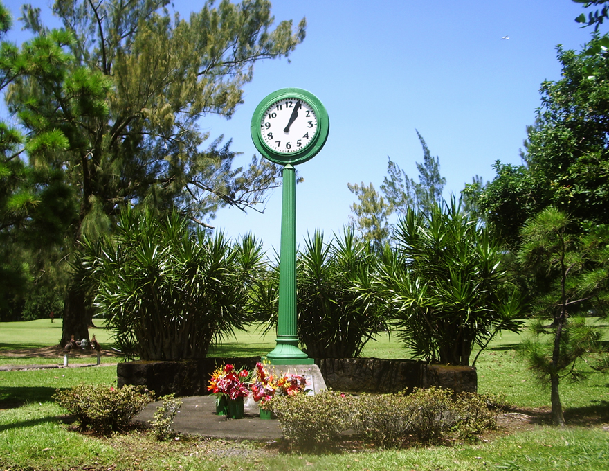
The Deadly Tsunami of 1960 Stopped This Clock in Hilo; The Clock Now Stands As A Memorial To those Who Lost Their Lives: Photo by Donnie MacGowan

Hilo bears the scars of killer tsunamis and racial intolerance.

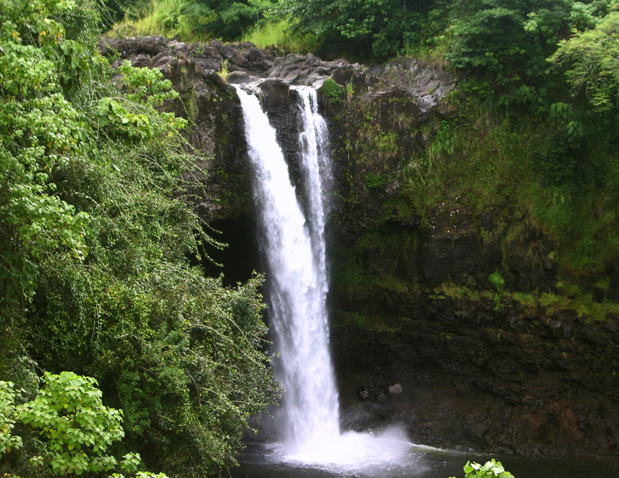
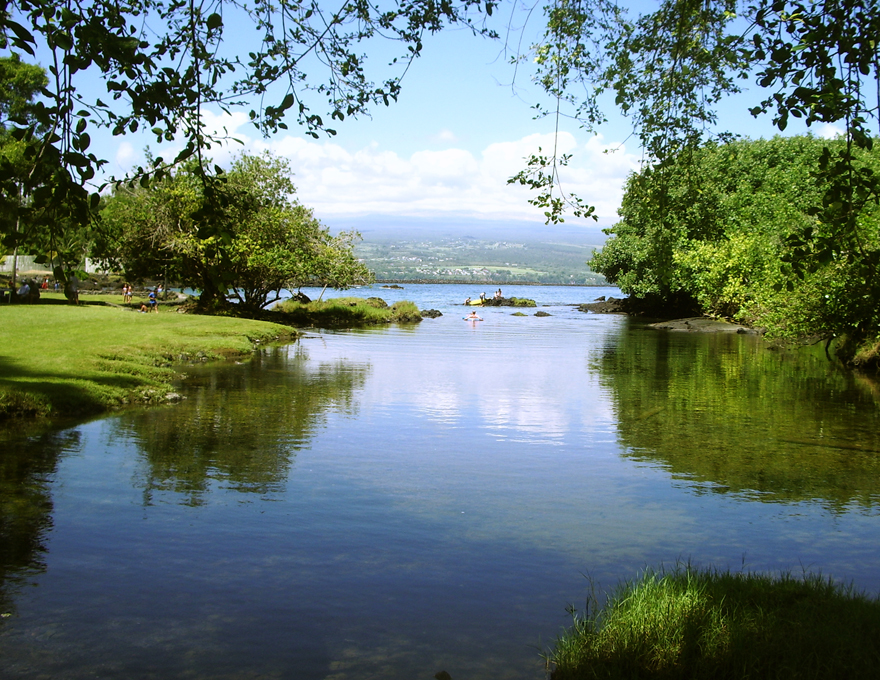
Hilo's Numerous Waterfall, Beach and Open Space Parks Are Inviting and Attractive: Photo by Donnie MacGowan

Hilo was built by the sweat of immigrants, threatened by volcanoes, destroyed by tsunami and built again. Hilo deeply reflects the passion, mystery and flavors of her imported cultures; like her fiercely loyal citizens, Hilo's culture represents a broad mix rather than pointed differences. Hilo is about family and love and fun. Under festive lights, Hilo's streets echo with the sound of neighborhood parties, backyard jam sessions, laughter. The mind-blowing fusion of multi-ethnic musical styles boils over in Hilo's unique and varied local music scene. A bit like Nashville, in Hilo everybody seems to play an instrument, everybody seems to be recording an album—and they are all magnificent joys. How is this possible?

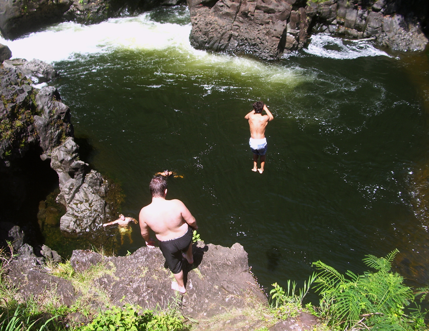
Hilo is About Fun; Boiling Pots at Wailuku River Rark:Photo by Donnie MacGowan

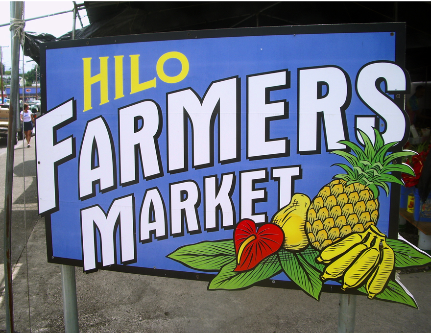
Hilo has one of the best small-town farmer's market in the United States of America.

Hilo Has One of the Most Amazing Farmer's Market's of Any Small Town in the US: Photo by Donnie MacGowan

You will not eat a better meal in the Pacific than those had in many of the tiny family restaurants in Hilo's Old town...nor will you find a more varied palette of cuisines in any major US city than in Hilo.

Hilo's Bay Front Shopping and Dining District is a Bright Spot of Prosperity Surrounded by Urban Blight: Photo by Donald B. MacGowan
Hilo's Downtown Bay Front Shopping and Dining District is a Bright Spot of Prosperity Surrounded By Urban Blight: Photo by Donald B. MacGowan

Hilo has among the most stunning waterfalls and loveliest beach parks in the world within her city limits.

Hilo is Justly Famous for its Many Gorgeous Bay Front and Ocean Beach Parks: Photo by Donald B. MacGowan

On some days, people say the shadows appear a bit deeper and it feels like Hilo is made of steam and myth and half-remembered visions. One gets the feeling, even after living in Hilo for years, that there is vague intrigue boiling, a dimly heard dance or beating heart, just below the surface. You should trust these feelings.

Even the Longtime Resident Sometimes Catches the Vague Whiff of Mysterious, Secret and Hidden Things Afoot in Hilo--Not All of Which Go On at Apuni Center: Photo by Donald B. MacGowan

The seat of political power in Hawai’i County, Hilo is experiencing a long, painful slide into economic and physical decline. Having long since lost the war of social vigor, the battle for tourists and the struggle for attracting new residents and industry to Hawai’i’s newer, cleaner and much sunnier West Side, Hilo seems content to sit back on her mildewing laurels as the once-prosperous center of the sugar industry in an era long gone by, dictating policy and politics to the rest of the island while consuming the vast majority of Hawaii's resources and swallowing the lion's share of the taxes.

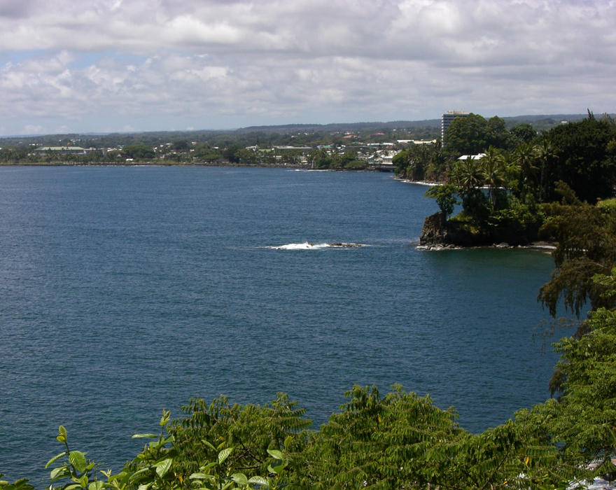
Hilo From the Northwest, Over the Bay: Photo by Prescott Ellwood

Yet, even in her dissipation and decay, Hilo is lovely, interesting and intriguing. Like a courtesan in her declining years, who, having squandered her riches, is forced to live off the charity of her wealthier relations, Hilo is still presentable, but far more notable for her raucous, and slightly ribald, tales of past glory.

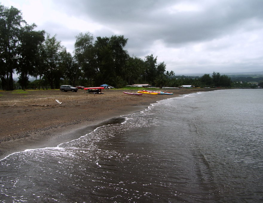
Hilo's Lovely Black Sand Beach Was Once Over A Mile Long Until They Covered It With A Highway: Photo by Donald B. MacGowan
Hilo's Mile Long Black Sand Beach Was a Scenic Wonder, a Huge Tourist Magnet and an International Marvel Until they Covered Most of it with a Highway: Photo by Donnie MacGowan

For more information on traveling to Hawaii in general, and exploring the Big Island in particular, please also visit www.tourguidehawaii.com and www.lovingthebigisland.wordpress.com. To see a demonstration of Tour Guide's new, interactive, GPS-enabled video tour of the Big Island for the iPhone and iPod Touch, please visit here. For more information about the author, please go here.

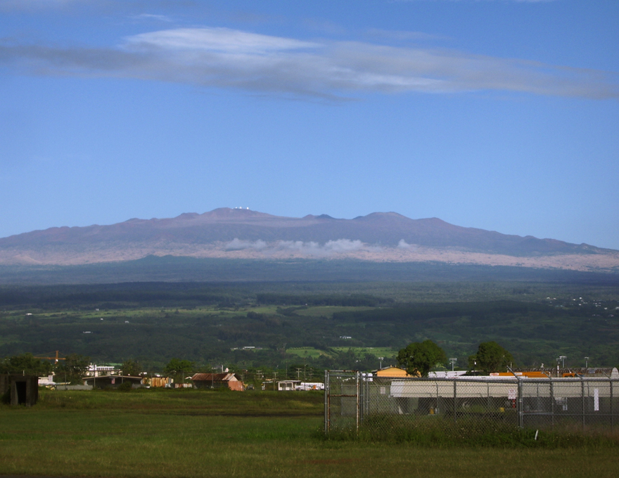
Mauna Kea from Hilo Airport: Photo by Donnie MacGowan

Thursday, October 8, 2009

Frank's Big Island Travel Hints #8: Mysterious Puna!

Frank's Big Island Travel Hints #8: Mysterious Puna!
by Frank Burgess, brought to you by Tour Guide Hawaii


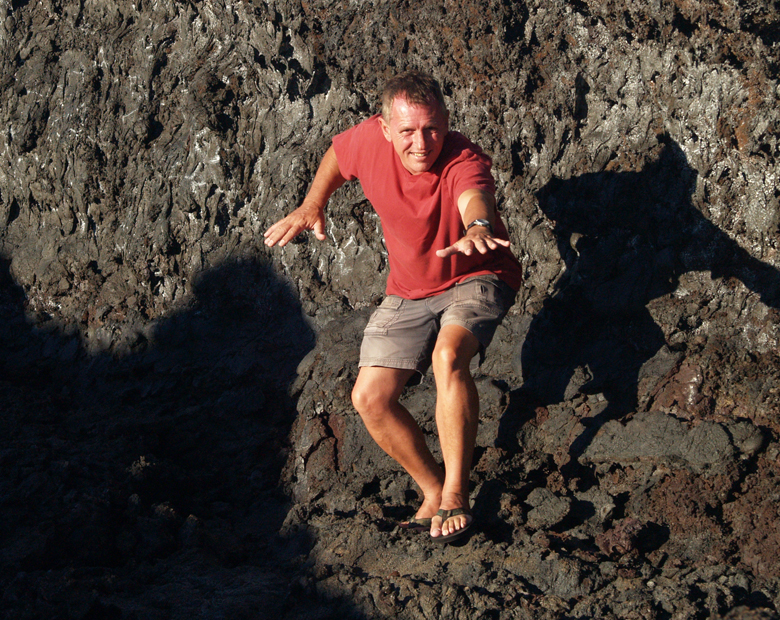
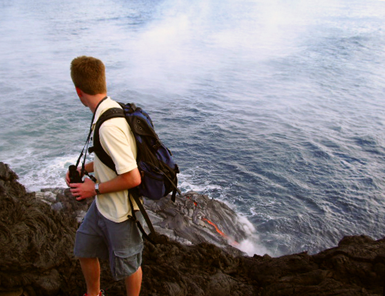
Frank Burgess lava surfing at Muliwai O Pele, Hawai Volcanoes National Park: Photo by Donnie MacGowan

Tour Guide Hawaii is proud to announce the release of their new iPhone and iPod Touch App available at iTunes...this App will help you plan your trip to Hawaii, help you decide what you want to see, how you want to see it and help you get there with GPS, interactive maps and on-board driving instructions. The Tour Guide App presents hours of interesting videos and information about places of historical, cultural and recreational interest, giving you a sense of the people, the natural history and the unique specialness of each destination. The information is so comprehensive and complete they even tell you where all the public restrooms are! What else will Tour Guide help you find? Let's look at a trip north from Kona along the Hawaii Belt Road to the Waikoloa area...Tour Guide will not only help you find many amazing sights along the way, it will tell you all about them, what to take and what to expect.

Today's hints cover the area from Kona to Puna District. Driving south along the Kona Coast, through Ka'u and into Puna there several fantastic places to stop and explore, but there is also a lot of lovely, open countryside for several miles, so enjoy the panoramic views. Your Tour Guide download from iTunes will give you more detailed information about this area.

Exploring Mysterious Puna...

For your next day of driving, let’s go south on Highway 11 headed for the Puna District. Leave early and expect to get back just after dark because this area is furthest from Kona and contains some of the most beautiful, yet hidden, wonders on the Big Island. It is from Puna that, currently, the only up-close viewing of flowing lava is possible. You may want to pack a cooler for this day trip.

As you’re passing through Kainaliu, just south of Kona, a quick stop at Kona Joe’s Coffee Plantation, for some great Kona Coffee, will jump start your day. See their ad in the sponsors section in your Tour Guide. If you are driving straight to Puna, plan on about 3½ hrs drive time to get to the first sights in this discussion. If you have missed any sights that you wanted to see on the southern route, refer to Frank’s Travel Hints #1 and #2 and catch them on the way...just don't forget to allow for extra time.

Along the way you will pass Hawaii Volcanoes National Park. This is a fascinating place and not to be missed, but we will reserve discsussing it for as a full day trip in a later post.

The first turn is about 20 minutes past the park entrance at the town of Kea’au. Look for the stop light on the highway and the Highway 130 sign. The Kea’au Shopping Center has some great places to eat, like Paradise Bar and Grill, and is a good restroom break.

The first stop, in the Puna district, is the town of Pahoa. You will think you have just stepped back into the Wild West as Pahoa has a unique atmosphere like nowhere else on the island. Cute shops, and a great farmer’s market on Sundays, lends to picture taking and shopping. Tour Guide will suggest that parking is easiest at the Community Pool just a block from downtown, and there are public restrooms here.

Continue driving further into Puna on Highway 132 through the lovely tree tunnels to a magical stop at Lava Trees State Park. This gorgeous rainforest park is filled with birds and tropical plants and flowers. What makes this park so intriguing is the lava trees. Tour Guide will tell you how old lava flows surrounded the trees, leaving spires of hardened lava, giving it an eerie look. There are trails for hiking and bird watching is spectacular. This is also a good place for a restroom break as it will be a good while before the next restrooms are available. Highway 132 leads you to Highway 137, the Kapoho-Kalapana Road--the only road in America that is named for two towns buried by a volcano.

Turning toward Kapoho on Highway 137, the next stop is the Kapoho Tide Pools where you can experience great shoreline shell collecting and fantastic snorkeling amongst vibrant corals and tropical fish in protected tidepools. Though hard to find on your own, Tour Guide again knows the way to this secluded sanctuary and ancient village. Port-a-potties and showers are the only facilities here.

Just a few miles down Highway 137 is Ahalanui Hot Pond. This tropical park is centered around a hot spring that mixes with ocean water to create one of the most relaxing and soul recharging oases anywhere. Tour Guide gives you the history of what this area meant to the ancient Hawaiians. Picnicking, hiking, swimming and “expert only” surfing are some of the things to do here. There are restrooms, showers and water available also.

As you continue along the coast road, you will next encounter McKenzie State Park. Here the Ironwood trees create an unusual ambience of a pine tree forest. The sheer cliffs and majesty of the ocean beg for photographing. Swimming would be near impossible here, but the hiking is spectacular. Tour Guide will give more information about this other- worldly park. A permit is required for camping and the facilities are a bit run down.

Not far away is Kahena Beach. This beautiful black sand beach involves a bit of a scamper to get down the cliff, but is well worth the effort. Tour Guide will give you the easiest path to take. You may notice that this beach is “clothing optional”, thus it’s popularity. Swimming here is good, but currents can be strong if you get too far from shore.

Highway 137 used to become the Chain of Craters Road in Hawaii Volcanoes National Park, but it has been cut by several miles of intervening lava flows. Today, it ultimately ends at Highway 130, the road back to Kea'au and the Hawaii Belt Highway. At the intersections of Highways 137 and 130 are the remnants of the town of Kalapana, buried in the 1960 eruption of Kilauea. Tour Guide will tell you all about the eruption, the heroic recovery efforts, and lead you on a brief hike to Kaimu Black Sand Beach, the newest beach on the Island of Hawaii. From the end of the road you can frequently see the both the eruption cloud over Pu'u O'o Vent and the steam plume where lava is entering the ocean, both several miles distant. At night, the glow from streams of lava pouring down the pali can sometimes be seen from here. Although hiking to the lava can be an experience to cherish, it is dangerous and hard work. The best, and most consistent, viewing is by taking an air tour, such as Big Island Air or Paradise Helicopter Tours.

Heading back from Kalapana, you will want to take Highway 130 toward Pahoa and Kea'au, you pass the famous "Painted Church". Tour Guide can tell you the history of this fascinating place. Just a little farther north is the intersection of Highway 130 with the road to Royal Gardens Estates, which currently leads to the Hawaii County-maintained lava viewing area. Call the Lava Hotline at 808.961.8093 for current eruption updates, lava viewing information and times of road openings and closures. As you continue towards Kea'au you will pass the Steam Rooms--a field of steam vents in small craters where locals go to take steam baths. Tour Guide has information on finding these craters and how to safely enjoy the wonders of natural, volcanic steam baths.

Upon returning to the Hawaii Belt Highway at Kea'au, one can proceed in either direction back to Kona, north through Hilo, a bit shorter and faster, or west through Hawaii Volcanoes National Park which, though longer, is much more scenic. If time permits, you may want to stop in Volcano Village, just off the highway, for some food, gasoline, shopping or maybe even some wine tasting. This may be the last gasoline available until you get back to Kona as it is many times hard to find an open gas station in the rural part of Hawaii Island after dark. Find your hotel in your Tour Guide and get turn-by-turn directions right to the door.

To see the new iPhone/iPod Touch App, please visit http://www.tourguidehawaii.com/iphone.html. The best of Tour Guide Hawaii's free content about traveling to, and exploring, the Big island, can be found here. For more information on traveling to Hawaii in general and on touring the Big Island in particular, please also visit www.tourguidehawaii.com and www.lovingthebigisland.wordpress.com.

Copyright 2009
by Frank Burgess; photography copyright 2009 by Donald B. MacGowan. All rights reserved.

Friday, September 18, 2009

New iPhone/iPod Touch App Helps you Explore Hawaii's Hidden, Romantic and Mysterious Places: The South Coast of Hawaii

Many people, flying along the highway from Kona to Hawaii Volcanoes National Park, dash through South Hawaii as quickly as possible to reach the park without realizing they are missing some of the best, and least visited, places in the whole state. This southern end of the island is where the Polynesians first landed and began their colonization of the Hawaiian Islands; it is home to the beaches where most of the endangered green sea turtles breed and lay their eggs in the main Hawaiian chain, and it is home to some of the most amazing history and awesome history anywhere in the world.

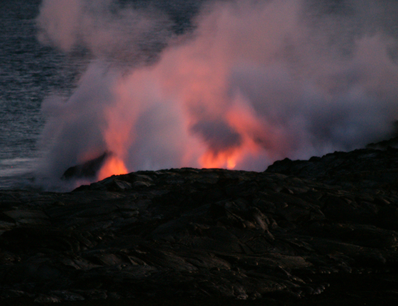
Ghostly Steam and Glow of Lava at Waikupanaha: Photo by Donald B. MacGowan

Clearly, the visitor to Hawaii can use some help finding the more secluded, wild and exotic destinations and attractions. To help you get more out of your Hawaii vacation, Tour Guide Hawaii has released a brand new iPhone/iPod Touch App which navigates you to all the most popular visitor destinations, the most interesting attractions, the most romantic and secluded beaches; helps you effortlessly find hikes, snorkel spots, historical and cultural landmarks, shopping and dining. And of course, our new App includes directions to, and rating of, all the public restrooms! Learn all about it, here.

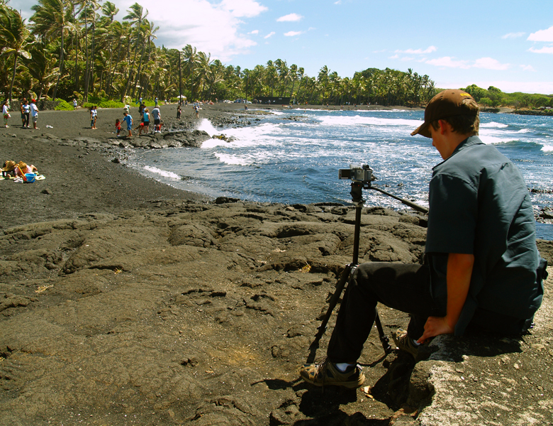
Bradford MacGowan Filming at Punalu'u Beach: Photo by Donnie MacGowan

In addition to real GPS navigation, this app also allows you to navigate using Google Maps or, if no internet or phone service available, with on-board maps and driving directions! Our App is crammed full of entertaining and informative video presentations about how and where to snorkel, the best trails and beaches, what to pack to bring to Hawaii, cultural orientation and language tips!

Before you rush off to buy our new App on iTunes...let's take a few minutes and explore some of the fabulous and fantastic things to see and do along the Hawaii Belt Road through South Hawaii that you might not miss if you weren't using our fabulous App. Of course, our App has much more detail in its video content than we can present here, but this will serve as an indication of what you might otherwise miss.

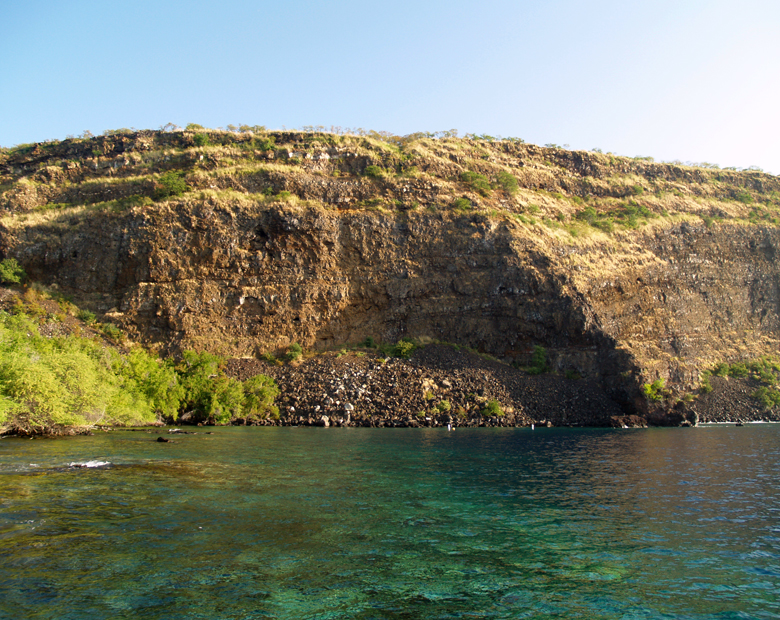
Huge Portions of Hawaii Island Have Simply Broken Off and Slid Into The Sea in Giant Landslides; Here is the Escarpment from Onesuch Landslide on Kealakekua Bay: Photo by Donald B. MacGowan
Huge Portions of Hawaii Island Have Simply Broken Off and Slid Into The Sea in Giant Landslides; Here is the Escarpment from One-such Landslide on Kealakekua Bay: Photo by Donald B. MacGowan

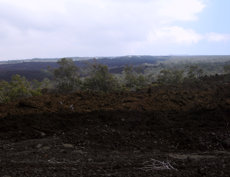
Mauna Loa South Flank Land Slides: The flanks of the Hawai'ian volcanoes are unusually unstable because of their extreme youth, rapid growth and because the flows are very thin, discontinuous and are comprised of loosely stacked a'a lava, air-fall material, pahoehoe lava with the loose rubble that forms when the lava flows into the sea. Because of this instability, many extremely large landslides in the past have broken loose, and this is the reason for the steep topography on the lower southern flanks of Mauna Loa. The angle of repose of Hawaiian lava flows (how steeply the land must tilt to get the lava to flow) is roughly 6 degrees, and looking at the gentle slopes of Mauna Kea and Mauna Loa, one sees that they come very close to this angle. Therefore, topography on the island that is steeper than about 6 degrees represents either faulting, erosion due to water movement or to landslides. One such twenty-mile long landslide, from about Mile 109 on Highway 11 to just north of Miloli'i, slid away about 120,000 years ago. One can see the scar from where the landslide broke loose along Kealakekua Bay and the precipitous cliffs that enfold the Captain Cook Monument as well as the steep hills of South Kona and northwest Ka'u. This landslide generated a tsunami wave of sufficient height to completely wash over the 1427-foot tall summit of Kaho'olawe and wash high up on the mountains of Lana'i. Coral rubble deposited by this tsunami can be found to this day on top of Kaho'olawe and at altitudes in excess of 1000 feet on Lana'i.

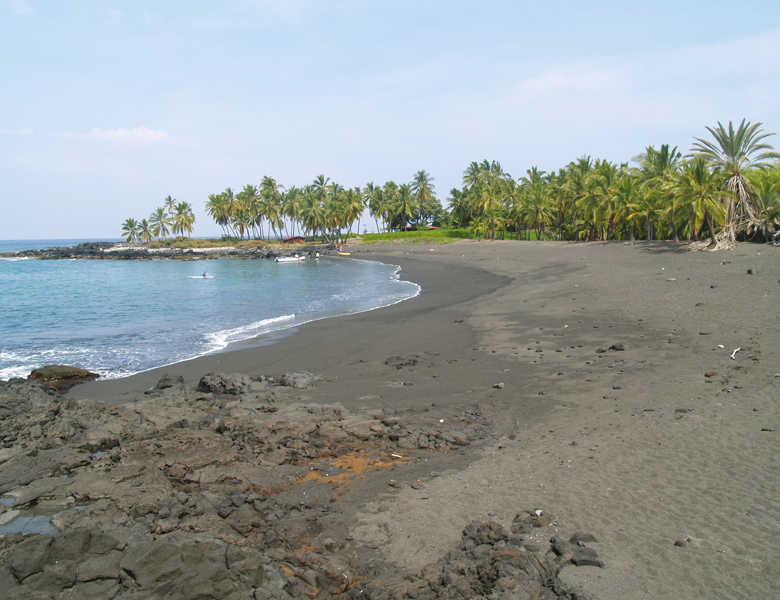
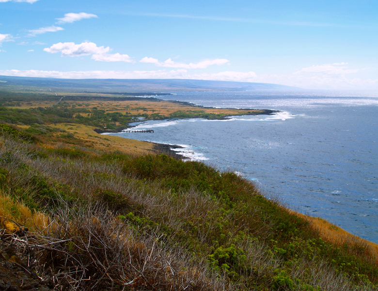
Secluded, Romantic, Beautiful Honomalino Beach: Photo by Donald B. MacGowan

Honomalino Bay: As the highway creeps along the edge of the land slide escarpments on Mauna Loa, every so often an opportunity to turn downhill and explore what's “over the edge” presents itself...one such spot is just south of the 89 mile marker...the turnoff to Miloli'i fishing village and Honomalino Beach. The village and villagers of Miloli'i itself are a very insular Hawaiian community, wary of outsiders, and best treated with aloha and respect, from a distance. However, one of the true gems of West Hawai’i is Honomalino Beach. Rarely crowded, this lovely beach is is reached by a 20 minute hike from the south end of Miloli’i Beach County Park.

Drive slowly through their ocean-front village past the wreckage of the sea water desalinization plant, past the house inhabited by Elvis Presley in the movie “Girls, Girls, Girls” to the Miloli'i County Park. Park in the lot by the covered pavilion. The hike starts between the bathrooms and a yellow church and is always along the right fork of the trail, in and out of the surf line, to avoid private property. An interesting hike in and of itself, wandering along the beaches, through the dryland forest and over aa lava flows, it wanders about a mile and a quarter to the palm-lined beach. Snorkeling is very interesting on the north side of the beach, along the rocks, when the surf is low. The water, though crystalline and clear, can sometimes be a bit chilly in spots doe to freshwater spring discharge through the sand.

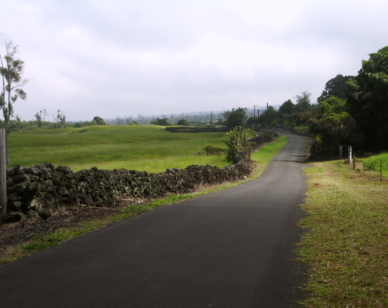
The Old Mamalahoa Highway Rolls Through The Rural South Coast of Hawaii: Photo by Donald B. MacGowan

Old Mamalahoa Highway: A scenic stretch of the old Mamalahoa Highway between mileposts 88 and 86 offers a glimpse into what life in Old Hawai'i was like. This rough old road remnant rolls through macadamia orchard and wild countryside and is worth the detour. Driving this stretch of road, remember that to Island residents, the Hawai'i Belt Highway is relatively new; many people living in Hilo will tell you they haven't been to Kona in 20 years or more because the road is just too hard to drive, you know they are remembering the old highway like this, as it used to be, not as it exists today.

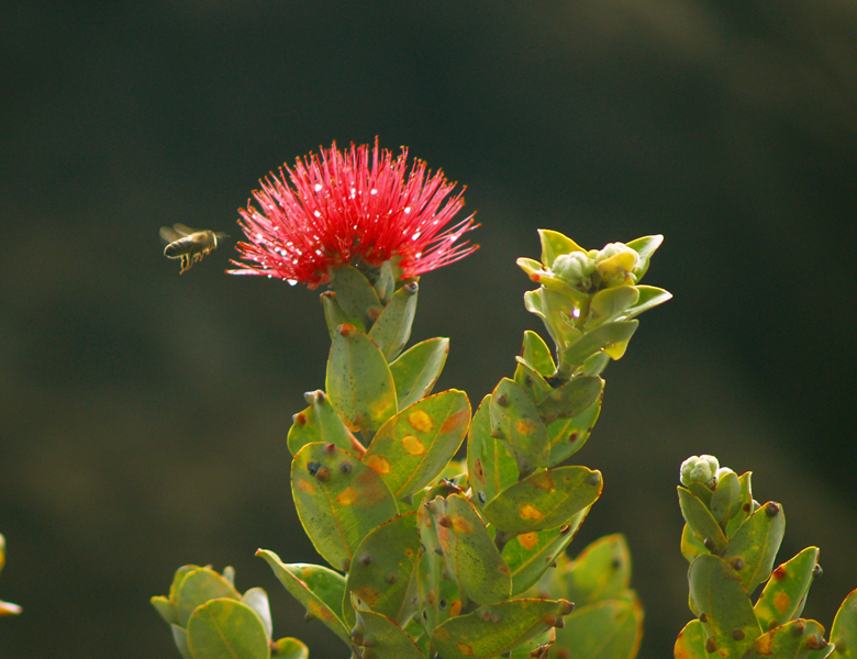
Lehua Blossom and Bee in an Upland Ohia Forest: Photo by Donald B. MacGowan

Manuka State Park: An easy 1-2 hour stroll, a great place for a picnic or a break from driving The Belt Highway, Manuka State Natural Area Reserve and Manuka State Wayside Park lie between the 82 and 81 mile markers and offers the unique setting of both lush wet, and dry-land, forest. The arboretum around the parking lot was planted of native and trees first introduced during the 1930s to the 1950s. The hike, which circles through the forest to a pit crater, takes 1-2 hours and has well-marked nature points of interest along the way. The trail also winds over both newer and older lava flows, so it's easy to see how the forest develops through stages as the lava ages and weathers. Although an easy walk, some of the footing is loose, so sturdy shoes should be worn; no water is available along the trail, so you should carry a quart per person. This also is a very pleasant place to observe some of Hawai'i's unique forest birds at dawn and sunset. The cool, inviting and fragrant Wayside Park has ample parking, picnic tables, restrooms and water available. There is a small covered pavilion at which "by permit-only" camping is allowed.

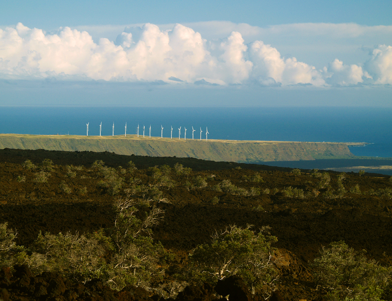
View Across HOVE to the Windmills at South Point, Big Island Hawaii: Photo by Donnie MacGowan

Hawai'ian Ocean View Estates (H.O.V.E.): Check your gas gauge, check your canteen, check your lunch box! Hawai'i Ocean View Estates is the last outpost of civilization for miles around. Hawai'ian Ocean View Estates is the world's largest residential subdivision. As such, it lacks only three things: water, electrical power and, most importantly, residents. Built in the 1960s, ownership of the subdivision has passed from hand to hand, but lack of utilities has kept residence numbers low. Despite this, a hardy settlement has sprung up with a great sense of community, even though many residents rely strictly on catchment for water and personal generators for electricity. The climate in Ocean View is perfect year round, but there are no public beaches or cultural amenities, so it hasn't flourished as a town. Ocean View boasts a few stores, restaurants, churches and a post office. Public restrooms are available below the Post Office.

Disaster of 1868 Lava Flows, South Flank of Mauna Loa: Photo by Donald B. MacGowan

Disaster of 1868/Kahuku Village: Ferocious earthquakes! Floods of glowing lava! Tsunamis swallowing hapless survivors! Between the 71 and 72 mile markers of Highway 11, just west of the South Point Turn-off, is the wild scene of a natural disaster the proportions of a Cecil B. DeMille film. The only remaining reminders of the disaster are the lava flow of 1868 exposed here, and the ruins of Kahuku Village which lie beneath it. Starting on March 27, 1868 and continuing for five relentless days, earthquakes shook the Ka'u region, including the worst earthquake recorded in Hawai'ian history, one of 7.9 magnitude on the Richter scale. Hundreds of landslides were loosed, cinder cones collapsed and small tsunamis continuously licked the Ka'u coastline. On the second of April, after a massive convulsion, a giant river of lava burst through from underneath, inundating everything in its path. A giant tsunami washed over the coastline, swallowing whole villages and canoe fleets, killing 46 people. Massive landslides flowed across the land, burying parts of Punalu'u and Ninole and ultimately killing 31 people.

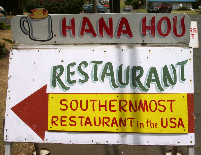
Kae Lae, the Southern Most Point in the US: Photo by Donnie MacGowan

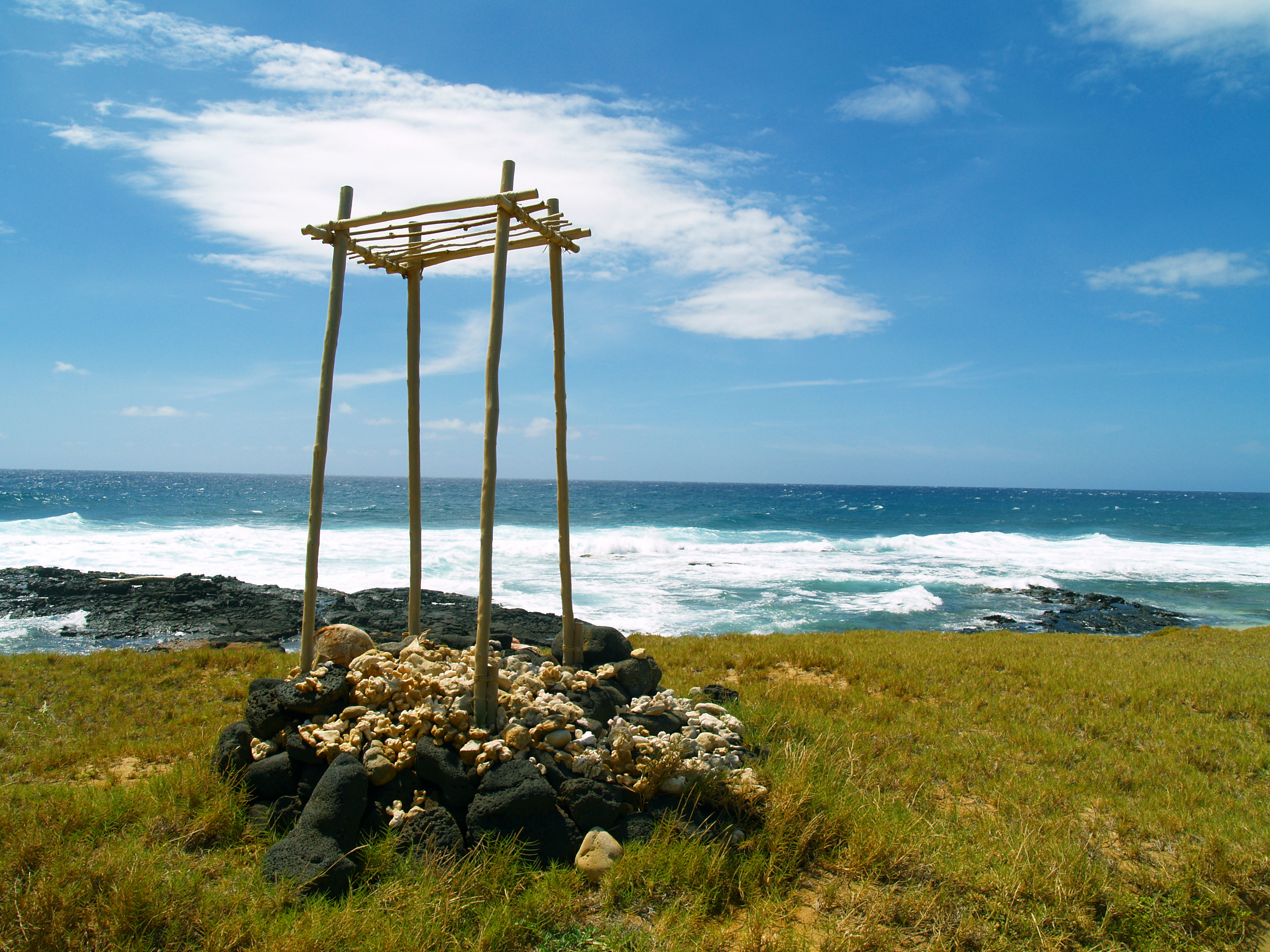
South Point: This sweeping landscape arches openly and inviting from the tumultuous shore break at Ka Le to the icy heights of Mauna Kea's summit almost 14,000 feet above. The farthest point south in the entire United States, South Point is haunting, windswept, wild, empty, beautiful. Although still only 1-lane wide in many places, the road to Ka Lae from the Hawai'i Belt Road has been greatly improved in recent years. The roads, beaches, boat launching facilities and parking are all free and on public land, contrary to what some signs and unsavory characters might try to tell you. Just don't leave valuables in your car, and be sure to lock it up. The brooding and dilapidated wind turbines of the Kamaoa Wind Farm are along the road to Ka Lae. This wind farm, when all of the turbines are operating, can generate enough electricity to power 100 homes; unfortunately, usually 1/3 to ½ of the turbines are out of service at any given time. The surreal setting on the green plain with the cows grazing unconcernedly, coupled with the eerie, "sci-fi" sound of the generators makes this a unique place to stop, look and listen.

The waters at South Point are wild, crystalline turquoise and wicked. It is obvious from the surf and the currents that swimming is right out along most of this coastline. The only recommended snorkeling is at the Kaulana boat launch and at the green sand beach...and then it is recommended only in calm seas. But it is beautiful; perhaps as beautiful and wild a spot to snorkel as anywhere in Hawai'i.

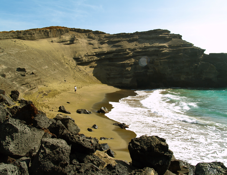
Mahana Bay and the Green Sand Beach at South Point: Photo by Donnie MacGowan

Hike to Green Sand Beach: Unique and special, Hawai'i's green sand beaches are as beautiful as they are strange. The beach sands are composed of crystals of the semi-precious mineral olivine (also known as peridot). The green sand beach at South Point, the best known, is reached by turning left onto a signed, patchy-paved and dirt road immediately when you arrive in the Ka Lae area. Follow signs to the Kaulana boat launch and park just to the left (south) of it. The dirt road that leads along the shore to the green sand beach is sometimes gated and locked. Hiking distance is 2 ¼ miles each way along rolling tropical prairie (and if you cannot envision that, you really need to do this hike). Despite the multiplicity of dirt roads, you really cannot get lost as you are never out of sight of the shore. When you arrive above the beach on the crater rim, there is a faint track to scramble safely and easily to the beach. One can also easily scramble down from the middle (easternmost) of the cone, but this can be slippery. Although tricky to spot on the way down, from the beach looking up the way back to the crater rim is easy to follow. When visiting here, plan and act as if there were no services, and no rescue available.

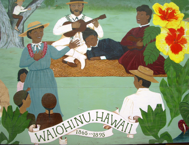
A Community-Painted Mural on the Waiohinu General Store: Photo by Donald B. MacGowan

Waiohinu/Mark Twain Monkey Pod Tree: Waiohinu is a for-real Old-Hawaii town, as are it's neighbors Na'alehu and Pahala. Waiohinu boasts a gas station and store, public restrooms, a small hotel and numerous bed and breakfasts as well as Margo's Corner, a privately-operated campground. It is always wise to fill your gas tank at the first opportunity when traveling on the Southern Coast because there are no service stations operating at regular, predictable hours, or at all after dark, in most of these tiny towns. Waiohinu has another more historic distinction. It is here that Sam Clemens (Mark Twain) planted a Monkey Pod so he'd have a shady spot to sit and write. Although the original tree blew down in a hurricane in 1957, a new tree has sprung-up from the surviving roots and can be seen in the center of town by the State Historical Society Marker commemorating Mark Twain's visit.

Downtown Na'alehu, Hawaii: Photo by Donald B. MacGowan

Na'alehu: Lovely, scenic, sleepy Na'alehu, the southernmost town in America is the not-so-bustling mercantile hub the southern end of Hawai'i Island. Here is the Na'alehu Fruit Stand, the source of wonderful fresh fruit and the best pizza on the Island; the Punalu'u Bakeshop, known Island-wide for its malasadas and Portuguese Sweet Bread. The Union 76 gas station is your best bet for after-dark gas in South Hawai'i, but don't bet the farm on it being open on any given night. Especially during fishing season. The Na'alehu Police station, on the east end of town, is the only outpost of law and order constabulary between Captain Cook and Volcano.

Whittington Beach Park, Tucked Into a Small Cove Along A Portion of the Hawaii Coastline Reminescent of Big Sur: Photo by Donald B. MacGowan
Whittington Beach Park, Tucked Into a Small Cove Along A Portion of the Hawaii Coastline Reminiscent of Big Sur: Photo by Donald B. MacGowan

Whittington Beach Park/Honuapo Bay: The wild, ragged southern coastline of Ka'u, reminiscent of Big Sur, reaches its apogee here at Honuapo Bay. Although the County Beach Park is in poor repair and frequented by a less-than-desirable element, the raw sense of connection to the ravenous ocean, the eerie mood of the collapsed Pahala Sugar Co. wharf and the joy of ever-renewing life in the many tidepools and ponds that dot this shoreline make this Park a must-see stop. There are two, perhaps not conflicting, but interesting interpretations to the name Honuapo in Hawai'ian. If the reading is "honu apo", it means "caught turtle", a reference to the many dozens of Hawai'ian Green Sea Turtles who make this bay their home. However, if you read the words as "honua po" it means "land of the gods"; clearly in such a wildly beautiful, stark and powerful landscape, this is an apt name, as well. The true meaning is lost to the mists of time and depredation on native culture made by the missionaries, but knowing how modern speakers of Polynesian delight in the multiplicity of puns and double entendres their tongue is mother to, it is not far fetched to imagine the ancient Hawai'ians giving the bay this name with both meanings intended.

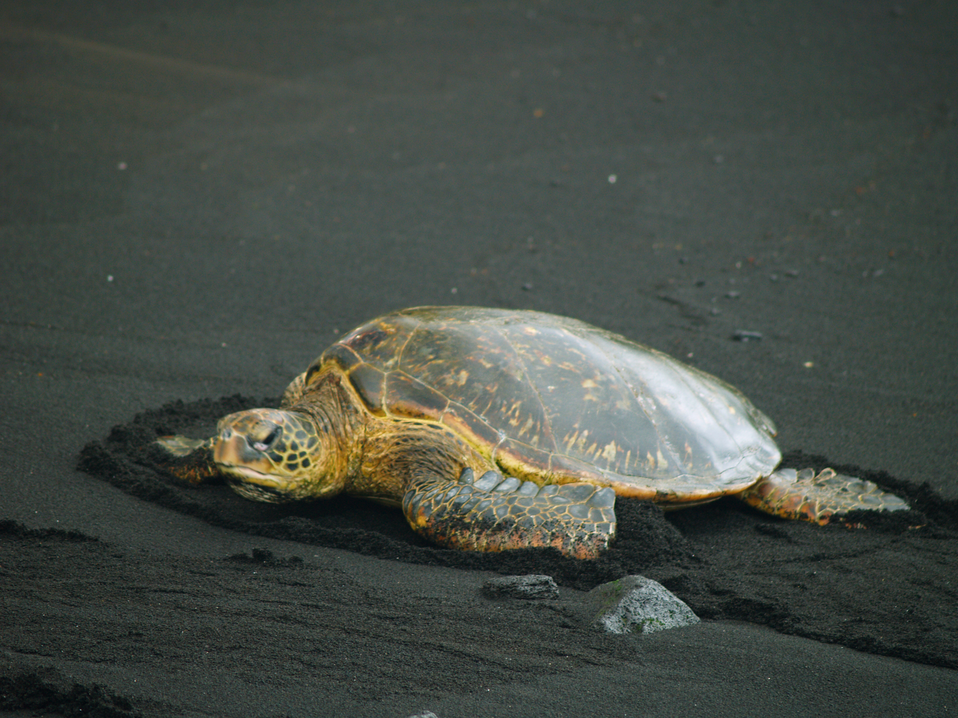
Enangered Hawaiian Green Sea Turtle on Punalu'u's Famous Black Sand Beach: Photo by Donnie MacGowan
Endangered Hawaiian Green Sea Turtle on Punalu'u's Famous Black Sand Beach: Photo by Donnie MacGowan

Punalu'u Black Sand Beach Park: Punalu'u's black sand beach, a truly remarkable place of great peace, beauty and spiritual healing is home to dozens of endangered Hawai'ian Green Sea Turtles. The wildness of the ocean and the serenity of the freshwater fishpond and coconut palm-shaded beaches make this an ideal place to spend some soul-recharge time. Snorkeling, picnicking and camping, or just relaxing on the beach, are major destination pass-times here. Due to chilly waters, off-shore winds, strong currents and a fearsome rip, swimmers and snorkelers should use caution when swimming at Punalu'u, but it's hard to resist getting in and swimming with all those turtles. Camping is permitted around the pavilions by permit only and can be a windy, but wild and elemental, exercise in campcraft. Due to the exposed nature of the terrain, however, there is little privacy.

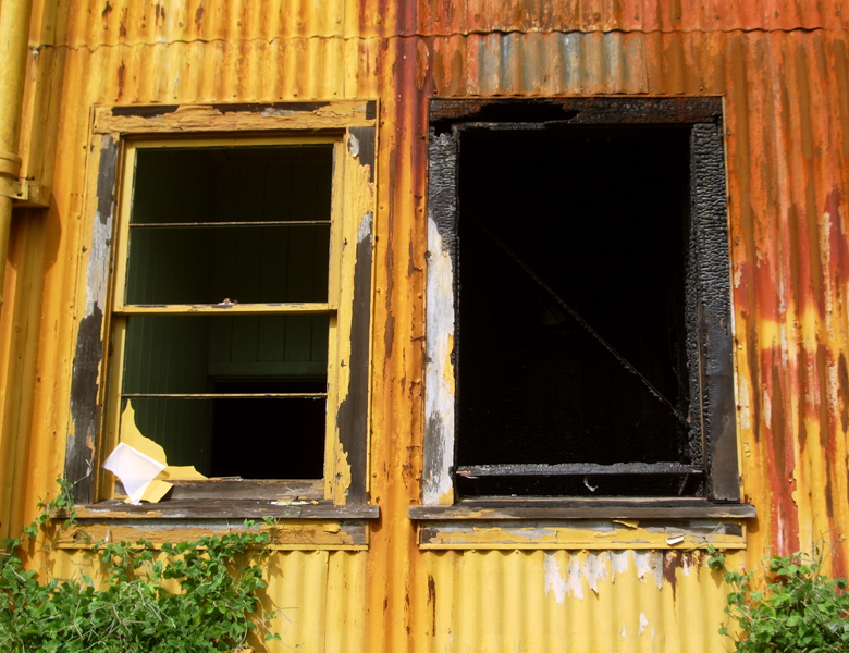
The Burnout Shell of A Sugar Refining Warehouse in Pahala: Phoito by Donald B. MacGowan
The Burned-out Shell of A Sugar Refining Warehouse in Pahala: Photo by Donald B. MacGowan

Pahala: Friendly, clean, quiet, scenic; Pahala seems a perfect community. Twenty years ago Pahala was a bustling center of activity for the Pahala Sugar Company, but with the demise of the sugar industry, Pahala residents have either moved on to other towns seeking new employment, or hunkered down the await what future may come. There are a few good art galleries and the old Plantation House Inn, which offer the traveler a look into post-plantation life in South Hawai'i. Pahala is also the only outpost for groceries, gasoline, banking, post-office and restaurant activities between Na'alehu and Volcano; one should be careful, however, as business hours tend to be irregular and never extend much past dark. The causal traveler should also be wary of a couple of bad speed traps on either side of Pahala. A re-birth, of a sort, is underway in Pahala and other small towns in Hawai'i; because of the extremely undervalued real estate, compared with the extremely over-valued real estate elsewhere in Hawai'i, mainlanders and retirees are buying up land as residents finally sell. This has caused a small renaissance in service-sector employment, but it will take a generation or two for these tiny towns to rebuild and return to their former bustling selves.

In Peaceful and Serene Wood Valley You Will Feel Insulated From the Hustle and Bustle of Western Civilization: Photo by Donald B. MacGowan

Wood Valley: A few miles upslope of Pahala into the macnut groves is the tiny community of Wood Valley. There are no services available here, except for a couple of bed and breakfast establishments and the Nechung Dorje Drayang Ling Buddhist Temple, which serves as a place of teaching and retreat. If time permits, it' is a very worthwhile way to spend a lunch hour by procuring a take-away meal in Pahala, then driving the short way up into Wood Valley to enjoy lunch in the utter tranquility that steeps this community.

Lava from Kilauea Flows Smoothly into the Ocean at La'epuki in Hawaii Volcanoes National Park: Photo by Donnie MacGowan

Hawai'i Volcanoes National Park: Hawai'i Volcanoes National Park is a magical, spiritual, wondrous, strange and beautiful place comprised of great contrasts and contradictions: dry as dust desert to teeming tropical jungle; frigid sub-arctic wasteland to steaming black sand beaches to rivers of flowing lava. The star attractions in the Park are a pair of active volcanoes; Mauna Loa is the largest mountain on earth and Kilauea is most active volcano on earth. However, there are numerous other wonders from lava tubes to crawl down, black sand beaches with sea turtles to watch, mysterious petroglyph fields to explore, tropical jungles to hike through, endangered bird species to find, happy-face spiders to amuse and an otherworldly volcanic landscape so fresh it's still steaming. Famed for its fabulous views of Mauna Loa and Kilauea as much as for its interesting exhibits,

The Jagger Museum (named for geologist Thomas A. Jagger) is open daily from 8:30a.m. to 5:00p.m. Exhibits include murals by Herb Kawainui Kane, seismograph charts of eruptions and earthquakes, geological displays and display about the natural and human history of the Park.

Perhaps the finest short day hike in the park, a four-mile, 2-3 hour trip down into, across and back out of Kilauea Iki Crater gives one an intimate feel for volcanoes, Hawaiian-Style. Along one side, thick fern and ohi'a forest skirts along the rim and on the other, lush tropical rainforest crowds to the very brink of the crater; bleak volcanic desert lines the crater walls and covers the floor. The start and finish of the hike are along well marked, wide trails. The remainder is an easily followed, well marked trail with stone ahu (cairns) over the crater floor. As always when hiking in the Park, it is wise to avoid the noonday sun, and to remember that afternoon showers are common, especially near where this hike meets the crater rim.

Hawaii Volcanoes National Park is open 24 hours a day, 365 days a year. During daylight hours, an access fee is charged. The Visitor Center has a 24-hour information line at 808.985.7017 and there is a 24-hour eruption hot-line at 808.985.6000. Within the Park tune to A.M. radio 530 for continuous information broadcast. Whether returning to Kona or to Hilo after visiting the Park, remember that after dark except for perhaps in Kea'au, there is little or no food and no gas available on the south end of Hawaii Island after dark.

Gas Stations, Stores and Restaurants Close Early Along the South Coast, Be Sure You Have Everything You Need Before Leaving Volcano Village!: Photo by Donnie MacGowan

Volcano Village: One should plan ahead and expect to fill the gas tank and tummy in Volcano Village, across the highway from Hawaii volcanoes National Park. Gas prices are not, contrary to what you may have heard, any more confiscatory in expense than anywhere else on the island and Volcano is home to some first class restaurants, bakeries, interesting shops and even the island's only winery. Plan on staying a while and enjoying the aloha in this mountain town while you recharge yourself from your busy day in South Hawaii.

Could You Have Found This Without Tour Guide?  Here is the House Elvis Presley Lived in in the Movie "Girls, Girls, Girls": Photo by Donnie MacGowan
Could You Have Found This Without Tour Guide? Here is the House Elvis Presley Lived in in the Movie "Girls, Girls, Girls": Photo by Donnie MacGowan

Remember to check out our new for touring all of Hawaii...using the Tour Guide Hawaii iPhone/iPod Touch App will save you time, save you money and allow you to see and do more with your Hawaii vacation; this quick video tells you how.

Sunrise on Mauna Loa from Jagger Museum: Photo by Donnie MacGowan

For more information on traveling to Hawaii in general and visiting the Big Island in particular, visit www.tourguidehawaii.com and www.lovingthebigisland.wordpress.com. For information about the author, please go here.

All Media copyright 2009 by Donald B. MacGowan



Casino Bonus no Deposit