Showing posts with label lava. Show all posts

Tuesday, October 27, 2009

Tour Guide Hawaii Presents The Incredible New iPhone and iPod App: The Greatest App for Travel in the History of Forever!

The most innovative way to travel in the history of Forever. Get the Tour Guide iPhone and iPod App here today!

Say Goodbye To Cumbersome Maps and Guide Books That Are Obsolete Before They Are Printed!

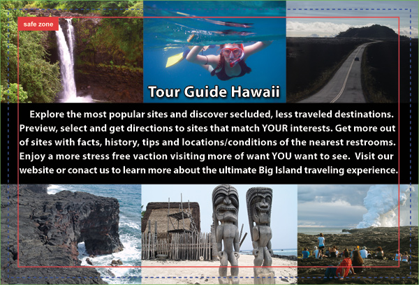
Tour Guide Hawaii iPod and iPhone App puts the magic, mystery and romance of Hawaii in the palm of your hand. It's like having a friend from Paradise sitting in your car, telling you where to go, what to do and all the island secret spots...
>Tour Guide Hawaii iPod and iPhone App puts the magic, mystery and romance of Hawaii in the palm of your hand. It's like having a friend from Paradise sitting in your car, telling you where to go, what to do and all the island secret spots...

>Over 3 1/2 hours of in-depth video presentations about the most popular, most spectacular and most secluded spots!

>Day by Day scenic drive and road trip suggestions!

>Fascinating discussions on Hawaiian culture and history!

>Bonus features on seeing lava flows, snorkeling, language and culture, what to bring to Hawaii and getting around Hawaii!

> Uses GPS for turn-by turn driving instruction, Google Maps for navigation with iPod, or on-board interactive maps with embedded audio driving directions if no Wi-Fi, 3G or GPS connection is available--you literally can't get lost!!!

> All the public restrooms, located and rated for your convenience and protection!

Tour Guide Hawaii iPod and iPhone App puts the magic, mystery and romance of Hawaii in the palm of your hand. It's like having a friend from Paradise sitting in your car, telling you where to go, what to do and all the island secret spots...

Available from the Apple App Store, or by clicking here.

For more information on Tour Guide Hawaii's fabulous new iPhone and iPod App, please go here, here and here.

For more information on traveling to Hawaii in general or exploring the Big Island in particular, please also visit www.tourguidehawaii.com and www.lovingthebigisland.wordpress.com.

Monday, October 26, 2009

Hawaii Vacations Come Alive in the Palm of Your Hand with Tour Guide Hawaii's Fabulous, New, Amazing iPhone and Ipod Touch App

THE must have iPhone / iPod Touch app for all residents and visitors to the Big Island of Hawaii. Get the Tour Guide iPhone and iPod App here today!


For more information on Tour Guide Hawaii's fabulous new iPhone and iPod App, please go here, here and here.

For more information on traveling to Hawaii in general, or details on how to buy the iPhone/iPod App, please go to www.tourguidehawaii.com.

Monday, October 12, 2009

Volcano Watch: Hualalai is third most active volcano in Hawai`i

Reprinted from here. Brought to you by Tour Guide and our new, comprehensive GPS/Internet/3G navigation App for iPhones and iPod Touch available today at iTunes!

View of Hualalai Volcano, Hawai`i, looking SE.  Photograph by J. Kauahikaua on December 30, 1996.
View of Hualalai Volcano, Hawai`i, looking SE.
Photograph by J. Kauahikaua on December 30, 1996.

The West Hawai`i Today issue for September 11, 2009, contained a letter to the editor titled "Hualalai is a real and present threat." The writer's main point was that "Hualalai is the 'secret in the closet' that nobody wants to talk about," that Hualalai is under-monitored, and that, should Hualalai erupt, there is no evacuation plan.

The letter writer's concerns about Hualalai were valid, but he was not aware of HVO's current efforts and plans to improve the monitoring of Hualalai. We hope to shed some light on recent and future activities planned for Hualalai.

Hualalai is the third most active volcano on Hawai`i Island behind Kīlauea and Mauna Loa, according to the Hawaiian Volcano Observatory's (HVO) Web site (http://hvo.wr.usgs.gov/), and attained national ranking of "High Threat" for active volcanoes in the U.S. (see http://pubs.usgs.gov/of/2005/1164/).

In the ranking, there were 37 volcanoes nation-wide that were highest-priority targets for improved monitoring; Kīlauea and Mauna Loa were included in this group. Furthermore, 21 additional volcanoes were found to be under-monitored and were regarded high priority for improved monitoring; Hualalai is in this group.

What is the basis for this ranking? Hualalai has erupted three times in the last 1,000 years, the most recent eruption occurring in 1801. An intense and damaging seismic swarm in 1929 marked a failed eruption. In the same interval, Mauna Loa and Kīlauea have each erupted more than 150 times, and Haleakala has erupted at least 10 times. Hualalai was rated a higher threat than Haleakala, due to the extent of development (airport, power station, etc.) and the larger population living on the volcano's flanks.

Is Hualalai under-monitored? In 2005, HVO and the Pacific Tsunami Warning Center (PTWC) each had one seismometer on the volcano, and bi-annual deformation surveys were conducted by our staff. With the permission of Kamehameha Schools, a continuous GPS receiver was installed near the summit in late 2006. In 2009, HVO still has one seismometer and uses two instruments operated by PTWC for eruption monitoring, and we continue the bi-annual surveys. Plans for the next two years include upgrading our seismic site and adding a new one.

We routinely scrutinize all available satellite imagery daily, including visual and thermal images to indicate any significant visual and temperature changes, or increased gas emissions. Moreover, radar scans several times each year can pinpoint any ground deformation that may be a precursor to volcanic activity. The radar scans are so sensitive that several small areas of subsidence were detected after the October 15, 2006, Kiholo earthquakes.

The conclusion from evaluating all of these data is that there have been no signs of swelling, major subsidence, temperature changes, gas emissions, or unusual seismic activity on Hualalai that would indicate volcanic activity in the near future. Nevertheless, we continue to look for any changes.

If the rankings were done today, Hualalai would be nearly fully monitored.

We agree with the letter writer that "the more people know about Hualalai, the more will be prepared." In 2004, University of Hawai`i at Manoa (UHM) scientists published two studies on Kona community's perception of volcanic risk and preparedness for lava flows from Hualalai and Mauna Loa. They concluded that "current community understanding and preparedness… falls short of that required for a volcanic crisis, particularly for those eruptions with short onset and high effusion rates on steep slopes that would impact Kona in just a few hours…"

There are several reasons for the lack of understanding, but foremost may be the constant influx of new residents who haven't educated themselves about volcanic hazards. The primary mission of the U.S. Geological Survey's Hawaiian Volcano Observatory is to monitor the active volcanoes in the State of Hawai`i. Through our Web site, public forums, and newspaper articles, we strive to disseminate information on the volcanoes and their hazards.

The people of Kona should know that we are keeping an eye on Hualalai and that if there are any changes (in its eruption status), we will let the public know!

Kīlauea Activity Update

Lava continues to erupt from the TEB vent, on Kīlauea's east rift zone and flow through tubes to the ocean at Waikupanaha. A deflation-inflation cycle this past week resulted in a reduction of lava supply for several days, followed by a resumption of flow on Wednesday, Sept. 30. Breakouts from the tube system started at that time, and these surface flows remain active at the top of Royal Gardens subdivision. The flows are mostly staying close to the breakout point along the east margin of the flow field.

Faint glow above the vent at Kīlauea's summit has been visible at night. A portion of the Halema`uma`u vent cavity collapsed on Saturday, Sept. 26, followed by the appearance of an active lava pond deep within the vent cavity on the night of Tuesday, Sept. 29. Volcanic gas emissions remain elevated, resulting in high concentrations of sulfur dioxide downwind.

Four earthquakes beneath Hawai`i Island were reported felt this past week. A magnitude-2.3 earthquake occurred at 12:30 p.m., H.s.t., on Friday, September 25, 2009, beneath Kilauea's summit at a depth of 6 km (4 miles). Two earthquakes occurred on Sunday, September 27-a magnitude-2.1 earthquake at 9:52 a.m., H.s.t., located 7 km (4.3 miles) N of Kailua at a depth of 8 km (5 miles) and a magnitude-2.3 earthquake at 10:22 p.m., H.s.t., located 7 km (4.3 miles) ENE of Honaunau at a depth of 6 km (3.7 miles). A 1.6-magnitude earthquake at 7:11 p.m. H.s.t., on Wednesday, September 30, was located 15 km (10 miles) NW of Mauna Kea's summit at a depth of 25 km (16 miles).

Visit our Web site (http://hvo.wr.usgs.gov) for detailed Kīlauea and Mauna Loa activity updates, recent volcano photos, recent earthquakes, and more; call (808) 967-8862 for a Kīlauea activity summary; email questions to askHVO@usgs.gov.

-------------

Planning on visiting the Big Island Volcanoes, hiking the beautiful summits or going to see the flowing lava? Tour Guide Hawaii is proud to announce the release of their new iPhone and iPod Touch App available at iTunes...this App will help you plan your trip to Hawaii, help you decide what you want to see, how you want to see it and help you get there with GPS, interactive maps and on-board driving instructions. In addition to concentrating on Hawaii's volcanoes, beaches and waterfalls, the Tour Guide App presents hours of interesting videos and information about many other places of historical, cultural and recreational interest, giving you a sense of the people, the natural history and the unique specialness of each destination. The information is so comprehensive and complete they even tell you where all the public restrooms are!

We highly recommend all Big Island visitor's who have iPhones or an iPod Touch check out our App on iTunes; we think you'll agree it's far better than old-fashioned, cumbersome maps or expensive guide books that seem to be out of date before they are printed. See it today!

Wednesday, October 7, 2009

Volcano Watch: Ancient Hawaiians: Plenty of Oars but No Ores

Reprinted form here.

Ancient Hawaiians: Plenty of Oars but No Ores

A September 25, 2009 photo showing Pu`u `Ō `ō fuming in the foreground (note the dense white fume from a vent in the east wall) and Halema`umau fuming in the distance.
A September 25, 2009 U.S.G.S. photo showing Pu`u `Ō `ō fuming in the foreground (note the dense white fume from a vent in the east wall) and Halema`umau fuming in the distance.

Most accounts of Captain Cook's first arrival in Hawai`i describe the Hawaiians' fascination with metal objects. The crew soon found that an iron nail could be traded for any number of goods or services. The fascination with metal stemmed from its novelty. Although Hawaiians had encountered metal before Cook arrived—either from other European ships or from debris washed ashore—it was, at best, exceedingly rare.

Naturally occurring or "native" metals, such as gold, silver, and copper are rare anywhere on earth, and are beyond rare in Hawai`i—they don't exist. Nickel-iron meteorites are also rare everywhere, but Hawai`i has an equal opportunity to receive them. So it's possible that meteoric iron was known to the ancient Hawaiians.

Though native metal is rare, metal combined with other elements is as common as rock itself. For example, about one-third of Hawaiian basalt is iron oxide, aluminum oxide, and calcium oxide, in roughly equal proportions.

To obtain metal in quantity, however, it must be smelted—separated from the other elements with which it is combined. To be suitable for smelting, a rock must contain a much higher proportion of a single metal-bearing mineral than would be found in common rock. Rocks suitable for smelting are called ores.

Many different mineral-concentrating processes are known to produce ore deposits. Placer deposits form when weathering releases mineral grains from rocks and flowing water segregates the minerals according to their densities. Minerals with high densities—most ore minerals—will tend to stay put while less dense minerals are carried away by the current. Placer deposits thus form along streams, rivers or the sea shore. The mineral olivine, heavy but not an ore mineral, was concentrated in this way to form the Green Sand Beach.

Some ores are produced in association with large intrusions of basalt—great blobs of magma that are injected into the earth's crust but that don't reach the surface. Instead they slowly cool deep underground. The slow cooling allows mineral grains to grow and to rise if they are less dense than the magmatic liquid or to sink if they are more dense than the liquid. The dense ore minerals collect in layers on the bottom of the intrusion. Essentially, all of the world's chromium ores and some platinum, nickel, and copper ores formed in this fashion.

Other ores are produced around the roots of volcanoes, where magma gives off heat, chemical-rich solutions, and vapors to surrounding rocks. These products mix with the groundwater-the water found in fractures and cavities in the rock virtually everywhere. The hot mixture is less dense than normal ground water so it migrates upward through fractures. The hot solutions can selectively dissolve low-concentration minerals contained in the country rock. As this witch's brew rises it cools and experiences a pressure reduction. The temperature and pressure reduction reduces the solubility of the various dissolved substances until they eventually crystallize on the fracture surfaces. In this way, metallic minerals that were in low concentrations in the country rock can become highly concentrated in the fractures to form veins. Vein ores yield copper, lead, zinc, gold, silver, tin, and other metals.

Given that ores are commonly associated with igneous processes—that is, with volcanism and magmatic intrusions—you might expect Hawai`i to have some metallic ores. But in fact, ore deposits are unknown in Hawai`i. This may be because they never formed, because they are just not exposed at the surface, or because they have not yet had time to form. Deep erosion is required to bring to the surface ores formed at great depths. So if metallic ore exists within Hawaiian volcanoes, erosion has not been deep enough to bring it to the surface.

The Hawaiians had learned to exploit wood, fiber, stone, and bone to the fullest, so why hadn't they developed the ability to mine, smelt, and work metals? Well, you can't exploit a non-existent resource. "Paradise" didn't come equipped with the raw material to produce metals.

Kīlauea Activity Update

Lava continues to erupt from the TEB vent, on Kīlauea's east rift zone and flow through tubes to the ocean at Waikupanaha. A small lava breakout on the rootless shield complex was active for a few days this week, but has now stagnated. A lava breakout from the tube near the top of the Royal Gardens subdivision has been active throughout the past week. The flows are mostly staying close to the breakout point and are building a broad shield-shaped mound of lava.

Faint glow above the vent at Kīlauea's summit has been visible at night. Volcanic gas emissions remain elevated, resulting in high concentrations of sulfur dioxide downwind.

Two earthquakes beneath Hawai`i Island were reported felt this past week. A magnitude-2.5 earthquake occurred at 5:56 a.m., H.s.t., on Monday, September 21, 2009, and was located 9 km (6 miles) northeast of Waiki`i at a depth of 26 km (16 miles). A magnitude-2.3 earthquake occurred at 7:28 a.m. on the same day and was located in the same area at a depth of 25 km (16 miles).

Visit our Web site (http://hvo.wr.usgs.gov) for detailed Kīlauea and Mauna Loa activity updates, recent volcano photos, recent earthquakes, and more; call (808) 967-8862 for a Kīlauea activity summary; email questions to askHVO@usgs.gov.

For all the information you need about seeing Hawaii's volcanoes, including everything from viewing flowing lava to touring Hawaii Volcanoes National Park or getting to the top of Mauna Kea, please see Tour Guide Hawaii's new iPhone/iPod Touch application here. For more information about traveling to Hawaii in general and visiting the Big Island in particular, please also see www.tourguidehawaii.com and www.tourguidehawaii.blogspot.com.

Wednesday, September 16, 2009

New at iTunes: Hawaii Dream Vacation iPhone/iPod Touch App Puts the Magic of Hawaii in the Palm of Your Hand

Tour Guide Hawaii is excited and proud to announce the launch of their incredible, affordable, fabulous new Hawaii Travel iPhone/iPod Touch App

Tour Guide Hawaii's Brand New iPhone/iPod Touch App Puts Paradise in the Palm of Your Hand!

Navigate to all the most popular visitor destinations, the most interesting attractions, the most romantic and secluded beaches; effortlessly find hikes, snorkel spots, historical and cultural landmarks, shopping and dining. And of course, our new App includes directions to, and rating of, all the public restrooms! Learn all about it, here. In addition to real GPS navigation, this app also allows you to navigate using Google Maps or, if no internet or phone service available, with on-board maps and driving directions! Our App is crammed full of entertaining and informative video presentations about how and where to snorkel, the best trails and beaches, what to pack to bring to Hawaii, cultural orientation and language tips!

Using the Tour Guide Hawaii iPhone/iPod Touch App will save you time, save you money and allow you to see and do more with your Hawaii vacation; this quick video tells you how.

Interested in seeing what kind of information our App contains? In celebration of the release of our new App, we proudly present this list of blogs and web articles on Hawaii Travel, with URLs, of the unique and comprehensive Tour Guide Hawaii content. Enjoy this free information at your leisure, and order your App from iTunes, today!

Tour Guide Hawaii proudly presents the best, the most interesting, the most comprehensive material on Hawaii travel ever gathered in one place!

Best About Planning Your Hawaii Trip

What To Pack And Take To Hawaii: What You Need, What You Want, What You Can Leave Out Of Your Luggage: http://lovingthebigisland.wordpress.com/2009/07/13/what-to-pack-and-take-to-hawaii-what-you-need-what-you-want-what-you-can-leave-out-of-your-luggage/

Getting To Hawaii, Getting Around Hawaii, Getting the Most From Hawaii: http://lovingthebigisland.wordpress.com/2009/06/04/getting-to-and-getting-around-the-big-island-of-hawaii/

Frank's Guide to Pronouncing Hawaiian Words: http://lovingthebigisland.wordpress.com/2009/07/01/franks-guide-to-pronouncing-the-hawaiian-langauge/

Best Beaches on Hawaii

A Quick Guide to The Best Beaches of Hawaii Island: Sun, Surf, Solitude: http://lovingthebigisland.wordpress.com/2009/06/25/the-top-beaches-of-hawaii-island/

The Best Beaches in Hawaii: Part 1, The Main Kohala Coast: http://lovingthebigisland.wordpress.com/2009/08/03/the-best-beaches-in-hawaii-part-1-the-main-kohala-coast/

The Best Beaches in Hawaii: Part 2, The Kona and South Kohala Coasts: http://lovingthebigisland.wordpress.com/2009/08/05/the-best-beaches-in-hawaii-part-2-the-kona-and-south-kohala-coasts/

Best Beaches in Hawaii: Part 3, Unusual, Uncrowded and Untamed Beaches of South Hawaii: http://lovingthebigisland.wordpress.com/2009/08/07/best-beaches-in-hawaii-part-3-unusual-uncrowded-and-untamed-beaches-of-south-hawaii/

Best Beaches in Hawaii: Part 4, Wilderness Beaches of the Big Island: http://lovingthebigisland.wordpress.com/2009/08/09/best-beaches-in-hawaii-part-4-wilderness-beaches-of-the-big-island/

Best Beaches in Hawaii Part 5--Best Beaches for Snorkeling: http://lovingthebigisland.wordpress.com/2009/08/11/best-beaches-in-hawaii-part-5-best-beaches-for-snorkeling/

Best Scenic Drives on Hawaii

My Favorite Scenic Drive: Hawaii's Wild and Scenic Saddle Road!: http://lovingthebigisland.wordpress.com/2009/09/02/my-favorite-scenic-drive-hawaiis-wild-and-scenic-saddle-road/

Big Island Whirlwind Road Trip: I have to see the whole Big Island all in one day!http://lovingthebigisland.wordpress.com/2009/09/15/big-island-whirlwind-road-trip-i-have-to-see-the-whole-big-island-all-in-one-day/

Kona Heritage Corridor Scenic Drive: An Exceptional Day Trip Exploration of Historical, Lovely, Up-Country Kona!:http://lovingthebigisland.wordpress.com/2009/06/14/kona-heritage-corridor-scenic-drive-an-exceptional-day-trip-exploration-of-historical-lovely-up-country-kona/

Best Scenic Drives on Hawaii #1: The Saddle Road...Kona to the Summit of Mauna Kea, Kaumana Cave and Hilo:http://lovingthebigisland.wordpress.com/2009/08/17/best-scenic-drives-on-hawaii-1-the-saddle-road-kona-to-the-summit-of-mauna-kea-kaumana-cave-and-hilo/

Best Scenic Drives on Hawaii #2: North Kona and Kohala, Ancient History, Sumptuous Beaches: http://lovingthebigisland.wordpress.com/2009/08/21/best-scenic-drives-on-hawaii-2-north-kona-and-kohala-ancient-history-sumptuous-beaches/

Best Scenic Drives on Hawaii #3: Kona to Hamakua and Hilo: http://lovingthebigisland.wordpress.com/2009/08/23/best-scenic-drives-on-hawaii-3-kona-to-hamakua-and-hilo/

Best Scenic Drives in Hawaii #4: Kona Coast to South Point and Ka'u http://lovingthebigisland.wordpress.com/2009/08/26/best-scenic-drives-in-hawaii-4-kona-coast-to-south-point-and-kau/

Best Scenic Drives in Hawaii #5: Kailua Kona to Hawaii Volcanoes National Park, Puna and Lava Viewing: http://lovingthebigisland.wordpress.com/2009/08/30/best-scenic-drives-in-hawaii-5-kailua-kona-to-hawaii-volcanoes-national-park-puna-and-lava-viewing/

What Do I Do on the Big Island? Explore Hawaii's Incomparable, Fantastic and Wild South Coast!: http://lovingthebigisland.wordpress.com/2008/12/20/what-do-i-do-on-the-big-island-explore-hawaiis-incomparable-fantastic-and-wild-south-coast/

Road Trip Through Keauhou Historic District, Big Island, Hawaii: http://lovingthebigisland.wordpress.com/2008/07/10/wwwtourguidehawaicom-presents-a-road-trip-through-keauhou-historic-district-big-island-hawaii/

Best About Hiking:

The Best Short Hikes on Hawaii Island: http://lovingthebigisland.wordpress.com/2009/06/29/the-best-short-hikes-on-hawaii-island/

The Adventure and Romance of Hiking To Kilauea Volcano's Active Lava Flows: http://lovingthebigisland.wordpress.com/2008/07/20/tour-guide-hawaii-presents-the-adventure-and-romance-of-hiking-to-kilauea-volcanos-active-lava-flows/

Historic Kailua Kona Town on the Big Island of Hawaii: A Walking Tour: http://lovingthebigisland.wordpress.com/2009/05/03/historic-kailua-kona-town-on-the-big-island-of-hawaii-a-walking-tour/

Hiking and Camping at Hawaii's Last Wilderness Beach: La'amaomao the Wind God and Makalawena Beach: Advice: http://lovingthebigisland.wordpress.com/2009/02/21/hiking-and-camping-at-hawaiis-last-wilderness-beach-laamaomao-the-wind-god-and-makalawena-beach/

Driving and Hiking to the Summit of Mauna Kea, Big Island of Hawaii: http://lovingthebigisland.wordpress.com/2009/07/26/advice-driving-and-hiking-to-the-summit-of-mauna-kea-big-island-of-hawaii/

Hidden Secrets of Hawaii: The Golden Ponds of Ke-awa-iki: http://lovingthebigisland.wordpress.com/2009/04/21/hidden-secrets-of-hawaii-the-golden-ponds-of-ke-awa-iki/

Hiking at Kilauea Volcano on the Big Island of Hawaii: http://lovingthebigisland.wordpress.com/2009/01/07/hiking-at-kilauea-volcano-on-the-big-island-of-hawaii/

Best About Snorkeling

The Best Snorkeling Spots on Hawaii Island: http://lovingthebigisland.wordpress.com/2009/06/27/the-best-snorkeling-spots-on-hawaii-island/

Hawaii Island Snorkeling Tips, Part I: Gear: http://lovingthebigisland.wordpress.com/2009/05/16/hawaii-island-snorkeling-tips-part-i-gear-2/

Hawaii Island Snorkeling Tips, Part II: Technique : http://lovingthebigisland.wordpress.com/2009/05/18/hawaii-island-snorkeling-tips-part-ii-technique-2/

Hawaii Island Snorkeling Tips, Part III: Protecting the Reef and Reef Animals: http://lovingthebigisland.wordpress.com/2009/05/20/hawaii-island-snorkeling-tips-part-iii-reef-etiquette-2/

Hawaii Island Snorkeling Tips, Part IV: Snorkeling Safety: http://lovingthebigisland.wordpress.com/2009/05/26/hawaii-island-snorkeling-tips-part-iv-snorkeling-safety-2/

Hawaii Island Snorkeling Tips, Part V: Best Snorkeling Beaches of the Big Island: http://lovingthebigisland.wordpress.com/2009/05/28/hawaii-island-snorkeling-tips-part-v-best-snorkeling-beaches-of-the-big-island-2/

Hawaii Island Snorkeling Tips Part VI: Wilderness Beaches of the Big Island!: http://lovingthebigisland.wordpress.com/2009/05/30/hawaii-island-snorkeling-tips-part-vi-wilderness-beaches-of-the-big-islanda/

Frank's Big Island Travel Hints

Frank's Big Island Travel Hints #1: North Kona and Kohala, Ancient History, Sumptuous Beaches: http://lovingthebigisland.wordpress.com/2009/02/28/kona-day-trips-1-north-kona-and-kohala-ancient-history-sumptuous-beaches/

Frank's Big Island Travel Hints #2: Kona to Hamakua and Hilo: http://lovingthebigisland.wordpress.com/2009/03/02/big-island-day-trips-2-kona-to-hamakua-and-hilo/

Frank's Big Island Travel Hints # 3: Kona Coast to South Point and Ka'u: http://lovingthebigisland.wordpress.com/2009/03/04/big-island-day-trips-3-kona-coast-to-south-point-and-kau/

Frank's Big Island Travel Hints #4: Kailua Kona to Hawaii Volcanoes National Park, Puna and Lava Viewing: http://lovingthebigisland.wordpress.com/2009/03/06/big-island-day-trips-4-kailua-kona-to-hawaii-volcanoes-national-park-puna-and-lava-viewing/

Frank's Big Island Travel Hints #5: A Trip From Kona Across the Top of Hawaii; Mauna Kea Summit, Kaumana Cave and Hilo via the Saddle Road: http://lovingthebigisland.wordpress.com/2009/03/08/big-island-day-trips-5-a-trip-from-kona-across-the-top-of-hawaii-mauna-kea-summit-kaumana-cave-and-hilo-via-the-saddle-road/

Frank's Big Island Travel Hints #6: Waimea and the Hamakua Coast: http://lovingthebigisland.wordpress.com/2009/03/13/franks-big-island-travel-hints-6-waimea-and-the-hamakua-coast-3/

Frank's Big Island Travel Hints # 7: Around Hilo: http://lovingthebigisland.wordpress.com/2009/03/26/franks-big-island-travel-hints-7-around-hilo-3/

Frank's Big Island Travel Hints #8: Mysterious Puna!: http://lovingthebigisland.wordpress.com/2009/04/03/franks-travel-hints-8-mysterious-puna-3/

Frank's Big Island Travel Hints #9: Made for Adventure: The Jungles, Volcanoes, Hot Springs and Tidepools of Puna!: http://lovingthebigisland.wordpress.com/2008/10/26/franks-hawaii-travel-tips-9-made-for-adventure-the-jungles-volcanoes-hot-springs-and-tidepools-of-puna-2/

Frank's Big Island Travel Hints #10: Hawaii Volcanoes National Park: http://lovingthebigisland.wordpress.com/2009/04/19/franks-travel-tips-10-hawaii-volcanoes-national-park/

Frank's Travel Hints # 11: Exploring Deeper Into Hawaii Volcanoes National Park, Big Island, Hawaii: http://lovingthebigisland.wordpress.com/2009/04/27/franks-travel-hints-11-exploring-deeper-into-hawaii-vocanoes-national-park-big-island-hawaii-2/

Frank's Big Island Travel Hints #12: More fun in Hawaii Volcanoes National Park, Big Island, Hawaii: http://lovingthebigisland.wordpress.com/2009/06/12/franks-big-island-travel-hints-12-more-fun-in-hawaii-volcanoes-national-park-big-island-hawaii-3/

Frank's Big Island Travel Hints #13: Hawaii Volcanoes National Park: Chain of Craters Road: http://lovingthebigisland.wordpress.com/2009/06/16/franks-big-island-travel-hints-13-4/

Best Interesting Stories and General Reading about Hawaii

The Beautiful, Enigmatic and Cryptic Petroglyphs of Hawaii Island: http://lovingthebigisland.wordpress.com/2009/04/23/the-beautiful-enigmatic-and-cryptic-petroglyphs-of-hawaii-island/

Hawaii's Amazing Lava Fossils: http://lovingthebigisland.wordpress.com/2009/08/24/hawaiis-amazing-lava-fossils/

The Sugar Industry in Hawaii: Kona Sugar Company and West Hawai’i Railway Company: http://lovingthebigisland.wordpress.com/2009/04/25/the-sugar-industry-in-hawaii-kona-sugar-company-and-west-hawai%E2%80%99i-railway-company/

Captain Cook's Legacy: Exploring the History and Waters of Kealakekua Bay: http://lovingthebigisland.wordpress.com/2009/04/07/949/

Kilauea's Eruption Just Keeps Getting More Fantastic!: http://lovingthebigisland.wordpress.com/2008/07/31/wwwtourguidehawaiicom-presents-new-video-of-kilauea-volcano-erupting/

Kalapana, Hawaii: From the Fires of Hades to the Eden of Rebirth: http://lovingthebigisland.wordpress.com/2009/01/17/kalapana-hawaii-from-the-fires-of-hades-to-the-eden-of-rebirth/

Pu'u Loa Petroglyph Field, Hawaii Volcanoes National Park: http://lovingthebigisland.wordpress.com/2009/03/17/823/

Hawaiian Green Sea Turtles: Honu of the Big Island: http://lovingthebigisland.wordpress.com/2009/01/09/hawaiian-green-sea-turtles-honu-of-the-big-island-2/

A Brief History of Ranching in Hawaii: http://lovingthebigisland.wordpress.com/2009/05/24/rodeo-to-rock-and-roll-a-brief-history-of-ranching-in-hawaii/

Rising From The Past: The Rebirth of Hapaiali'i Heiau, a Hawaiian Temple for Honoring Royalty: http://lovingthebigisland.wordpress.com/2009/05/01/1118/

The Hawaiian Snow Goddess Poliahu and the Summit of Mauna Kea...: http://lovingthebigisland.wordpress.com/2009/02/05/the-hawaiian-snow-goddess-poliahu-and-the-summit-of-mauna-kea/

Mo'okini Heiau: Warrior Kings and Human Sacrifice on Hawai'i: http://lovingthebigisland.wordpress.com/2009/01/03/mookini-heiau-warrior-kings-and-human-sacrifice-on-hawaii-2/

The Call of Aloha...:http://lovingthebigisland.wordpress.com/2009/08/13/the-call-of-aloha/

Why I love Hawaii...: http://lovingthebigisland.wordpress.com/2009/01/13/why-i-love-hawaii/

Conjuring Visions of Paradise: http://lovingthebigisland.wordpress.com/2009/02/19/conjuring-visions-of-paradise/

Volcano Art Center—A Kipuka of Creativity on the Rim of Madam Pele's Home: http://lovingthebigisland.wordpress.com/2009/06/01/volcano-art-center-hawaii-volcanoes-national-park/

Jagger Museum, Hawaii Volcanoes National Park: http://lovingthebigisland.wordpress.com/2009/04/01/jagger-museum-hawaii-volcanoes-national-rark/

Tuesday, September 15, 2009

Big Island Whirlwind Road Trip: I have to see the whole Big Island all in one day!

Approximate minimum time start to finish (to see every site): 14 hours.

Ahu'ena Heiau, Kailua Kona Hawaii: Photo By Donnie MacGowan

We do not generally recommend trying to see the Big Island all in one day...there is a good reason it is called "The Big Island". However, vacation schedules and group interests vary and a surprising number of visitors evince a keen desire to tour the entire island in a single day. *sigh*. They rarely attempt it twice. However, if we were to recommend a day trip round the island, commencing at Kailua Kona, the itinerary below would probably be your best bet at hitting the greatest number of highlights in the shortest possible time.

At 14 hours driving and touring time, there is little time for dilly-dally and the unhurried visitor will of necessity trim this ambitious schedule. Easy ways to shorten the itinerary if you find yourself falling behind include skipping legs 5-7 (i.e., follow Hwy 11 all the way from Hawaii Volcanoes National Park into Hilo; time savings of about 2 1/2 hours) or skipping legs 12-13 (i.e., traveling along Hwy 19 from Hilo through Honoka'a directly to Waimea; time savings about 2 1/2 hours). You may also choose simply to skip any individual site anywhere along this route; for instance, Leg 1, Upcountry Kona, can easily be done on another morning from Kailua Kona and can be omitted from this trip simply by driving Hwy 11 straight to Punalu'u, saving you perhaps an hour.

However ambitious, this schedule will allow you, if you start out about 6 in the morning and proceed apace, to circumnavigate the island seeing everything and arrive at Hapuna Beach in time for a delightful picnic dinner (no food available at beach, so stop and buy take-away in Waimea) and an absolutely unforgettable sunset.

If you are serious about undertaking this one-day, whirl-wind tour, we highly recommend you purchase AND USE Tour Guide Hawaii's newly released iPhone/iPod App...it uses GPS, Google Maps with driving directions and has onboard maps and driving directions where cell phone service and internet are not available. It plays a video presentation with all kinds of information about history, culture, safety and the natural history about all the most fascinating sites on the island, including the whereabouts of all the public restrooms! The iPhone App gives you detailed, accurate information on where to go, what to bring, what to expect when you get there and what to do next. Available here, the App will give you much, much more detailed information than this blog post.

So what are you doing waiting around reading this for? It's a BIG ISLAND you are trying to explore and you've got to hustle! Even though you are the one who decided to try it all in one day, remember that we warned you it would be a long, long day!

Leg 1) Start at north end of Keauhou Historic District on Ali'i Drive, head south on Ali'i Drive to jct with Kamehameha II Hwy; east on Kamehameha III to Hwy 11. Take Hwy 11 south to jct with Hwy 160, just south of the town of Captain Cook. Head downhill on Hwy 160 to Napo'opo'o Village, turn north on Pu'uhonua Beach Road to Kealakekua Bay State Historical Park at end of road; this is where you view the Captain Cook Monument.

Hapaiali'i Heiau in the Keauhou Historic District, Kona Hawaii: Photo by Donnie MacGowan

Keauhou Historic District and Kona Coffee

For almost 400 years, temples and palaces along the Kona coastline served as a kind of "Rome of the Pacific", a great political, religious and cultural center in Polynesia, until the capital was moved to Honolulu in 1850 by Kamehameha III. The most important, interesting and best preserved historical and cultural sites lie within the Keauhou Historic District, between Kahalu'u Beach Park in Kailua running south 6 miles to Kuamo'o Bay in Keauhou. The District contains perhaps a dozen fascinating sites that are easy to walk to, well maintained and quite interesting.

To see the numerous fascinating and important archaeological sites in the Keauhou Historic District, it is necessary to park your car in the free parking at either Kahalu'u Beach Park or the Keauhou Beach Resort and explore on foot.

Just uphill from the Historic District is the Kona Coffee District. Hawaii is the only state in the union which produces coffee, and Kona coffee is perhaps the finest in the world. Over 2 millions pounds of coffee a year are produced on about 600, 2-3 acre farms; tours of coffee farms and roasteries are available.

Captain Cook Monument at Kealakekua Bay, Kona Hawaii: Photo by Donnie MacGowan

Kealakekua Bay Historical District and Captain Cook Monument

A place of both dramatic historic events and unparalleled scenery, beautiful and now peaceful Kealakekua Bay (Pathway of the Gods) opens beneath steep, beetling cliffs on the ancient surfing beach along the shoreline of Napo'opo'o Village. The site of arguably the most important event in the history of Polynesia, home to pods of frolicking dolphins, providing some truly breathtaking snorkeling, Kealakekua Bay is one of the most magical spots in the State of Hawai'i.

Across the bay from Napo'opo'o stands the solitary white obelisk that marks the lonely Captain Cook Monument. It was in this broad bay that Captain James Cook made his deepest impression on, and longest visit with, native Hawai'ians when he first arrived late in November of 1778; and it was here where he met his tragic end in February 1779 during his second visit. At the State Park at the end of the road in Napo'opo'o are picnic facilities, pavilions and restrooms.

Leg 2) Return south on Pu'uhonua Beach Road to jct with Hwy 160; Hwy 160 south to Pu'u Honua O Hounaunau National Historical Park-this is the Place of Refuge.

Place of Refuge at Hounaunau, Kona Hawaii: Photo by Donald MacGowan

Place of Refuge: Pu'u Honua O Honaunau National Historic Park

A beautiful, peaceful, restful piece of Old Hawai'i, Pu'u Honua O Honaunau is a place of ease and regeneration for weary and jaded souls. Of enormous historical and cultural significance, the sacred grounds at Honaunau are the best-preserved remaining Pu'u Honua, or Place of Refuge, complex in Hawai'i. It is also a wonderful area to wander, snorkel, relax and picnic. For anyone who had any doubts about what Old Hawai'i was like, a trip to Honaunau will fill your imagination, your camera and your spirit.

A complex and strict order of law, known as the kapu system, controlled and governed everything in ancient Hawai'i. Under this system, judgment was death, immediate and final, unless the accused could escape to one of the designated places of refuge. There the accused would undergo a cleansing ceremony, be absolved of all crimes, and allowed to return to his family free of onus. The National Park has a Visitor's Center and bookshop, full picnic and restroom facilities. Although no swimming or snorkeling is allowed within the Park, adjacent is Two-Step Beach on Hounaunau Bay, one of the premiere snorkeling spots on the Island.

Leg 3) Return to Hwy 11 via Hwy 160; continue south on Hwy 11 to Punalu'u Road; Punalu'u Road to Punalu'u Black Sand Beach Park.

Bradford Thomas Macgowan Filming at Punalu'u Beach, Ka'u Hawaii: Photo by Donald Bradford MacGowan

Punalu'u Black Sand Beach Park

A truly remarkable place of great peace, beauty and spiritual healing, Punalu'u's black sand beach is world-renowned. Endangered Hawai'ian Green Sea Turtles swim the waters here and bask on the beach. The wildness of the ocean and the serenity of the freshwater fishpond and coconut palm-shaded beaches make this an ideal place to spend some soul-recharge time. The ocean here can be rough, so use caution when swimming.

Available services include water, picnic tables, restrooms, electrical outlets, and pavilions, parking; camping is by permit only. During peak tourist time, there is a souvenir stand with some packaged food items and canned drinks for sale, otherwise the nearest food, gasoline and other services are in either Pahala or Na'alehu.

Leg 4) Return to Hwy 11 on Punalu'u road; continue east on Hwy 11 to Hawaii Volcanoes National Park Entrance and jct with Crater Rim Drive; take Crater Rim Drive west to Kilauea Visitor's Center to Jagger Museum.

Pu'u O'o Vent on Kilauea Volcano, Hawaii Volcanoes National Park: Photo by Frank Burgess' friend whose name momentarily escapes me

Hawai'i Volcanoes National Park

Hawai'i Volcanoes National Park is a magical, spiritual, wondrous, strange and beautiful place comprised of great contrasts and contradictions: dry as dust desert to teeming tropical jungle; frigid sub-arctic wasteland to steaming black sand beaches to rivers of flowing lava.

The star attractions in the Park are a pair of active volcanoes; Mauna Loa is the largest mountain on earth and Kilauea is most active volcano on earth. However, there are numerous other wonders from lava tubes to crawl down, black sand beaches with sea turtles to watch, mysterious petroglyph fields to explore, tropical jungles to hike through, endangered bird species to find, happy-face spiders to amuse and an otherworldly volcanic landscape so fresh it's still steaming.

Hawaii Volcanoes National Park is open 24 hours a day, 365 days a year. During daylight hours, an access fee is charged. The Visitor Center has a 24-hour information line at 808.985.7017 and there is a 24-hour eruption hotline at 808.985.6000. Within the Park tune to A.M. radio 530 for continuous information broadcast. There tourist items available for sale and one restaurant and in the park, however generally shopping, restaurants and gasoline are only available in the nearby village of Volcano.

Kilauea Visitors' Center, Hawaii Volcanoes National Park: Photo by Donnie MacGowan

Kilauea Visitor Center

Newly remodeled and updated, the Kilauea Visitor's Center is an outstanding resource of information on Hawaii's volcanoes and the National Park; the not-to-be-missed first stop in the park you must make. The Center is run by enthusiastic and knowledgeable staff that has the most up-to-date information on viewing the eruption, hiking and camping, bird watching, stargazing and just about any other topic of interest to Park visitors. Available for sale in the Center are maps, guidebooks, books and videos about the volcanoes, Hawai'iana, history, plants and every topic you can imagine pertinent to the Park, even souvenirs. There are free brochures and pamphlets on various trails, attractions, hiking safety and lava viewing hazards and precautions.

The Visitor Center is open daily from 7:45 a.m. to 5 p.m.; there are public restrooms, water and pay phones available. Starting at 9 a.m. and showing every hour on the hour is a 20 minute informative movie about the Park; the film changes from time to time, but always contains spectacular footage of eruptions, information on volcanology and the natural and human history of the Park.


Halema'uma'u Crater at night from Jagger Museum, Hawaii Volcanoes National Park: Photo by Donnie MacGowan

Jagger Museum and Hawai'i Volcano Observatory

Famed for its fabulous views of Mauna Loa and Kilauea as much as for its interesting exhibits, The Jagger Museum (named for geologist Thomas A. Jagger) is open daily from 8:30a.m. to 5:00p.m. Exhibits include murals by Herb Kawainui Kane, seismograph charts of eruptions and earthquakes, geological displays and display about the natural and human history of the Park.

When entering the parking lot of the Museum/Observatory, be especially careful of the Federally-protected Hawaii Goose, the Nene, who seem to congregate here. The Nene is the State Bird of Hawai'i, and this parking lot and its surrounding area constitute one of the best places for viewing them.

Leg 5) Follow Crater Rim Drive back to Park Entrance and then to Hwy 11. Go east on Hwy 11 to jct with Hwy 130 at Kea'au; take Hwy 130 south to Pahoa.

Hot Ponds Near Pahaoa in Puna District: Photo by Donald MacGowan

Puna District and Pahoa Town

Uncrowded, off the beaten track and largely undiscovered by tourists, Puna District is a magnificent wonderland; from incredible tree-tunneled roads, geothermal fields of steam vents, lovely beach parks, hot ponds, hikes on raw lava flows and jungle trails, and unequaled snorkeling, the land cries out for the visitor to explore a little bit.

At the center of Puna is Pahoa Town; wild, untamed and even a bit unruly, with its false-front, western-style buildings and raised wooden sidewalks, Pahoa looks more like it belongs in Wyoming. But Wild West isn't the only subculture evident here...tie-dye banners and the general "flower-power" ambience some businesses and citizens lend Pahoa give it a decidedly "'60's" feel. It has been said of Pahoa that if it weren't for counter-cultural influences, it would have no cultural influences at all. The charm and allure of this way of living is evident when you consider that the region around Pahoa is the fastest growing portion of the island. Pahoa has some of the best restaurants on the island, THE best natural foods store and a great public pool.

Leg 6) At Pahoa, get on Hwy 130 to Kalapana.

Young Coconut Palms Planted in a Lava Crack Near Kalapana, Puna Hawaii" Photo by Kelly Kuchman

Kalapana Disaster of 1990/Kaimu Black Sand Beach

In 1990 the volcano goddess Pele determined it was time for some serious housecleaning in Puna. Lava flows from Kilauea's East Rift engulfed the villages of Royal Gardens, Kaimu and Kalapana, destroying virtually everything. Buried were a centuries old fishing village and a world famous black sand beach. When the lava came, it wiped out not just material possessions; it wiped out a way of life and a landscape cherished by generations.

The Big Island's newest black sand beach, Kaimu Beach, is a lovely if barren crescent of sand at the end of an unforgiving expanse of lava from the 1990 flows. The trail to the new black sand beach is marked with hundreds of young palms, numerous lava casts which include palms, pandanas fruit and even some fish that were caught in tide pools.

From the lava hillocks along the trail you can get nice views of the eruption plume at Pu'u O'o, up on the flank of Kilauea, as well as the steam clouds down a few miles along the coast where the lava enters the sea. Restrooms and fast food are available at the end of the road.

Leg 7) From Kalapana take Hwy 137 to jct with Hwy 132 at Kapoho; take Hwy 132 northward to Lava Trees State Monument.

Lava Trees State Monument: Photo by Donald MacGowan

Lava Trees State Monument

Under a lacey canopy of monkeypod trees, casts of ohi'a trees stand as monuments to a fast-moving pahoehoe lava flow that passed through here in 1790. When the lava hit the water-saturated ohi'a trees, it cooled and began to congeal around them. The original ohi'a trees burned away but the quickly cooled lava around them stands here today, hollow, with imprints of the tree bark inside.

Lava Trees Park offers trails to hike and a restful, bird-filled jungle to sit and listen to. You can spend between 20 minutes to an hour wandering the trails, here, exploring and discovering. Be careful, however, the area is riddled with hidden cracks in the ground which can make exploring hazardous.

You may wish to avail yourself of the restrooms here; they are the last public facilities for some distance.

Leg 8) Return to Hwy 130; Hwy 130 north through Pahoa to Kea'au and jct with Hwy 11. Hwy 11 North to Hilo.

Hilo Farmer's Market: Photo by Donnie MacGowan

Hilo Town

Beautiful but wet, metropolitan but decrepit, bustling but laid back, Hilo is a lovely, maddening, heartbreaking, addictive study in contrasts. In can rain all day long for 50 days in a row, yet when the sun does shine, the views of Mauna Loa and Mauna Kea from the Lilioukalani Gardens, or of Hilo Bay as you drive down from the mountains, or the rain-forest and waterfall choked gulches with lovely beaches along the highway north of town, make Hilo one of the most truly, achingly-lovely spots on earth.

More laid back and sleepier than bustling Kailua Kona, Hilo is the largest town on the island, and the county seat. The Imiloa Astronomy Center of Hawaii, Tsunami Museum, Lyman House Missionary Museum and the Panaewa Rainforest Zoo are all wonderful places to learn about various aspects of Hawaii. There are numerous shopping districts, two large malls and the Historic Old Hilo downtown shops to browse through, a variety of sprawling green parks, a fabulous tropical arboretum right downtown and a mile-long black-sand beach fronting the bay to explore. Hilo's Farmer's Market is a "must see" for any visitor who is spending time on this side of the island.

Leg 9) In Hilo, go north on Hwy 11 to jct with Hwy 19; take Hwy 19 to jct with Waianuenue Ave; head southwestward on Waianuenue Ave (Hwy 200) to Rainbow Falls.

Rainbow Falls, Hilo Hawaii: Photo by Donald MacGowan

Rainbow Falls and Wailuku River Park

The subject of recent and ancient legend, Rainbow Falls is the lovely emblem of Hilo town. The characteristic wishbone shape of Rainbow Falls is best seen at moderate river flows...too little water and only a single drizzle remains, too much runoff and the falls merge into a single, roaring flume. At any time, however, it's a beautiful place and worthwhile to visit. The rainbows within the falls are best seen in the mid to late morning. Follow the trail to the left along the river bank to delightful swimming and wandering; please note, however, that swimming in rivers and near falling water is dangerous. Don't go in if the current is swift or if recent rains have swollen the river.

Restrooms are by the parking lot and a souvenir shop is located across the street.

Leg 10) Return on Hwy 200 to Hwy 19, head north on Hwy 19 to Hwy 220 at Honomu; continue through Honomu to Akaka Falls.

Akaka Falls, Hamakua Hawaii: Photo by Donnie MacGowan

Akaka Falls

There is a reason that Akaka Falls rates as the most visited tourist site on the Island of Hawai'i. Simply put, the 420 foot, free falling plunge of clear water down a fern festooned cliff is an amazing and beautiful site. Leaving the parking lot, the paved loop trail of about one mile, winds through a wonderful jungle of exotic flowers, ferns, orchids, ginger and bamboo. Two smaller falls are also seen along the way to the stellar Akaka Falls. Akaka Falls has restrooms but no other facilities.

When visiting Akaka Falls, be sure to save some time to explore the shops, galleries and cafes of Honomu on the way back to the highway; it's unlike anywhere you've ever been before...guaranteed.

Leg 11) Return Hwy 220 through Honomu to Hwy 19, then north on Hwy 19 to Honoka'a.

Akaka Falls, Hamakua Hawaii: Photo by Donnie MacGowan

Honoka'a Town

Built in the era of sugar great plantations and left culturally and economically isolated after the industry collapse, until recently Honoka'a was content to drowse along through the decades. A boom in real estate and return of vital human energy to the area has made a literal renaissance of the town. It boasts numerous wonderful restaurants, gift and boutique shops and the highest density of antique shops on the island. Be sure to stop to explore a little on your way to or from Waipi'o Valley...it's a fun, happening kind of place and always steeped with aloha.

Driving north or south out of Honoka'a, remnants of old sugar mills, fields and wild cane can still be seen. When Captain Cook arrived in 1778, only wild sugar cane was growing; at its height in the mid-1960's one in 12 people were employed in the sugar industry which produced in excess of a million tons of sugar annually. Though the business is gone, what is left are the people who once worked the fields and mills. The melding of the rich cultures of Japanese, Chinese, Filipinos, Portuguese, and others is what gives today's unique Hawaii lifestyle its sweet flavor.

Leg 12) At Honoka'a, turn north on Hwy 240 to Waipi'o Valley.

Waipi'o Valley, Hamakua Hawaii: Photo by Donald MacGowan

Waipi'o Valley

Waipi'o Valley is arguably the most magical place on the Big Island. The steep canyon walls and verdant fields of the valley floor, the mile long black sand beach and numerous immense waterfalls that line the valley walls all call out to the visitor for exploration.

Always listed among the most beautiful spots in the State of Hawai'i, this valley is as hauntingly lovely as it is difficult to see in its entirety.

Tours down into the valley in vans, on horse drawn wagons and ATVs can be booked in Honoka'a. Over-flights in fixed wing aircraft and helicopters also offer fine venues from which to see this amazing piece of Hawai'i. Hiking down and wandering the immense black sand beach, exploring the ironwood copses and sand dunes and discovering the hidden waterfalls is also a popular way to see the canyon. Although the hike down is only a little over 1 mile and a thousand feet elevation loss, the climb back up is sweltering in the ferocious sun and heat. Think twice before hiking down. Facilities at the Scenic Overlook include a pavilion and restrooms; there are none within the valley itself.

Leg 13 Return on Hwy 240 to Honoka'a; at Honoka'a turn west on Hwy 19 to Waimea.

Waimea and Kohala Volcano from the Lower Slopes of Mauna Kea: Photo by Donald MacGowan

Waimea Town and Cowboy Country

Snuggled between Mauna Kea and Kohala Volcano in Hawaii's scenic mountain heart, seemingly always shrouded in mist and chilly, Waimea is definitely Hawai'ian cowboy country. Although jeans and flannel shirts appear to be the town uniform, Waimea is very sophisticated, boasting some of the finest shopping and restaurants and the most modern hospital on the island.

From Waimea, Highway 250, the Kohala Mountain Road, spills beautifully through mountain, upland meadow and forest to the "Old Hawaii" town and artist community at Hawi.

Additionally, the cattle industry centers in Waimea. In 1793 British Navigator George Vancouver presented cows to King Kamehameha which were allowed to roam free and soon became a problem. Shortly after horses were brought to Hawaii in 1804, Kamehameha recruited California vaqueros, whom Hawai'ians called "paniolo"--a corruption of the word "Espańol"--to control the wild herds, and the generations-old ranching lifestyle here was born.

The vaqueros also brought their guitars and their love of music. A deeply musical people, the Hawaiians were intensely interested in these, the first stringed instruments they had seen. They quickly learned to work-out their own tunings, called "slack key guitar", which more suited the style of their indigenous music.

Leg 14) At Waimea, continue on Hwy 19 (also called Kawaihae Road) to Kawaihae; at Kawaihae, turn south on Hwy 19 to Hapuna Beach. If you have timed your trip right, you will arrive at Hapuna Beach before sunset. This is a most amazing place to watch the sunset over the Pacific Ocean with Haleakala on Maui looming on the horizon. If it is already dark, proceed on Hwy 19 south to Kailua Kona.

Inviting Hapuna Beach, Always on the List of the Word's Top 10 beaches: Photo by Donnie MacGowan

Hapuna Beach

Always rated in the Top 10 of American beaches, Hapuna Beach is the premiere beach destination on the Island of Hawai'i. Long, wide and phenomenally sandy, it has everything one dreams of in a Hawai'ian beach: abundant sun, surf, clean, clear and quiet snorkeling water, shade and well-maintained facilities.

There are lifeguards, several pavilions, barbecues, picnic tables, restrooms, showers and a small café. The center of the beach is for wave play and boogie boarding, the north and south coves are quieter, for snorkeling or gentle floating. Although most patrons must walk about 100 yards down a path from the parking lot, Handicapped Parking exists right on the beach.

Leg 15) Proceed on Hwy 19 south to Kailua Kona.

Downtown Kailua Town, Kona Hawaii: Photo by Donald MacGowan

For more information on Tour Guide Hawaii's fabulous new iPhone and iPod App, please go here, here and here.

For more information on traveling to Hawaii in general and touring the Big Island in particular, please visit www.tourguidehawaii.com and www.lovingthebigisland.wordpress.com.

 

Casino Bonus no Deposit