Showing posts with label volcano. Show all posts

Monday, October 12, 2009

Volcano Watch: Hualalai is third most active volcano in Hawai`i

Reprinted from here. Brought to you by Tour Guide and our new, comprehensive GPS/Internet/3G navigation App for iPhones and iPod Touch available today at iTunes!

View of Hualalai Volcano, Hawai`i, looking SE.  Photograph by J. Kauahikaua on December 30, 1996.
View of Hualalai Volcano, Hawai`i, looking SE.
Photograph by J. Kauahikaua on December 30, 1996.

The West Hawai`i Today issue for September 11, 2009, contained a letter to the editor titled "Hualalai is a real and present threat." The writer's main point was that "Hualalai is the 'secret in the closet' that nobody wants to talk about," that Hualalai is under-monitored, and that, should Hualalai erupt, there is no evacuation plan.

The letter writer's concerns about Hualalai were valid, but he was not aware of HVO's current efforts and plans to improve the monitoring of Hualalai. We hope to shed some light on recent and future activities planned for Hualalai.

Hualalai is the third most active volcano on Hawai`i Island behind Kīlauea and Mauna Loa, according to the Hawaiian Volcano Observatory's (HVO) Web site (http://hvo.wr.usgs.gov/), and attained national ranking of "High Threat" for active volcanoes in the U.S. (see http://pubs.usgs.gov/of/2005/1164/).

In the ranking, there were 37 volcanoes nation-wide that were highest-priority targets for improved monitoring; Kīlauea and Mauna Loa were included in this group. Furthermore, 21 additional volcanoes were found to be under-monitored and were regarded high priority for improved monitoring; Hualalai is in this group.

What is the basis for this ranking? Hualalai has erupted three times in the last 1,000 years, the most recent eruption occurring in 1801. An intense and damaging seismic swarm in 1929 marked a failed eruption. In the same interval, Mauna Loa and Kīlauea have each erupted more than 150 times, and Haleakala has erupted at least 10 times. Hualalai was rated a higher threat than Haleakala, due to the extent of development (airport, power station, etc.) and the larger population living on the volcano's flanks.

Is Hualalai under-monitored? In 2005, HVO and the Pacific Tsunami Warning Center (PTWC) each had one seismometer on the volcano, and bi-annual deformation surveys were conducted by our staff. With the permission of Kamehameha Schools, a continuous GPS receiver was installed near the summit in late 2006. In 2009, HVO still has one seismometer and uses two instruments operated by PTWC for eruption monitoring, and we continue the bi-annual surveys. Plans for the next two years include upgrading our seismic site and adding a new one.

We routinely scrutinize all available satellite imagery daily, including visual and thermal images to indicate any significant visual and temperature changes, or increased gas emissions. Moreover, radar scans several times each year can pinpoint any ground deformation that may be a precursor to volcanic activity. The radar scans are so sensitive that several small areas of subsidence were detected after the October 15, 2006, Kiholo earthquakes.

The conclusion from evaluating all of these data is that there have been no signs of swelling, major subsidence, temperature changes, gas emissions, or unusual seismic activity on Hualalai that would indicate volcanic activity in the near future. Nevertheless, we continue to look for any changes.

If the rankings were done today, Hualalai would be nearly fully monitored.

We agree with the letter writer that "the more people know about Hualalai, the more will be prepared." In 2004, University of Hawai`i at Manoa (UHM) scientists published two studies on Kona community's perception of volcanic risk and preparedness for lava flows from Hualalai and Mauna Loa. They concluded that "current community understanding and preparedness… falls short of that required for a volcanic crisis, particularly for those eruptions with short onset and high effusion rates on steep slopes that would impact Kona in just a few hours…"

There are several reasons for the lack of understanding, but foremost may be the constant influx of new residents who haven't educated themselves about volcanic hazards. The primary mission of the U.S. Geological Survey's Hawaiian Volcano Observatory is to monitor the active volcanoes in the State of Hawai`i. Through our Web site, public forums, and newspaper articles, we strive to disseminate information on the volcanoes and their hazards.

The people of Kona should know that we are keeping an eye on Hualalai and that if there are any changes (in its eruption status), we will let the public know!

Kīlauea Activity Update

Lava continues to erupt from the TEB vent, on Kīlauea's east rift zone and flow through tubes to the ocean at Waikupanaha. A deflation-inflation cycle this past week resulted in a reduction of lava supply for several days, followed by a resumption of flow on Wednesday, Sept. 30. Breakouts from the tube system started at that time, and these surface flows remain active at the top of Royal Gardens subdivision. The flows are mostly staying close to the breakout point along the east margin of the flow field.

Faint glow above the vent at Kīlauea's summit has been visible at night. A portion of the Halema`uma`u vent cavity collapsed on Saturday, Sept. 26, followed by the appearance of an active lava pond deep within the vent cavity on the night of Tuesday, Sept. 29. Volcanic gas emissions remain elevated, resulting in high concentrations of sulfur dioxide downwind.

Four earthquakes beneath Hawai`i Island were reported felt this past week. A magnitude-2.3 earthquake occurred at 12:30 p.m., H.s.t., on Friday, September 25, 2009, beneath Kilauea's summit at a depth of 6 km (4 miles). Two earthquakes occurred on Sunday, September 27-a magnitude-2.1 earthquake at 9:52 a.m., H.s.t., located 7 km (4.3 miles) N of Kailua at a depth of 8 km (5 miles) and a magnitude-2.3 earthquake at 10:22 p.m., H.s.t., located 7 km (4.3 miles) ENE of Honaunau at a depth of 6 km (3.7 miles). A 1.6-magnitude earthquake at 7:11 p.m. H.s.t., on Wednesday, September 30, was located 15 km (10 miles) NW of Mauna Kea's summit at a depth of 25 km (16 miles).

Visit our Web site (http://hvo.wr.usgs.gov) for detailed Kīlauea and Mauna Loa activity updates, recent volcano photos, recent earthquakes, and more; call (808) 967-8862 for a Kīlauea activity summary; email questions to askHVO@usgs.gov.

-------------

Planning on visiting the Big Island Volcanoes, hiking the beautiful summits or going to see the flowing lava? Tour Guide Hawaii is proud to announce the release of their new iPhone and iPod Touch App available at iTunes...this App will help you plan your trip to Hawaii, help you decide what you want to see, how you want to see it and help you get there with GPS, interactive maps and on-board driving instructions. In addition to concentrating on Hawaii's volcanoes, beaches and waterfalls, the Tour Guide App presents hours of interesting videos and information about many other places of historical, cultural and recreational interest, giving you a sense of the people, the natural history and the unique specialness of each destination. The information is so comprehensive and complete they even tell you where all the public restrooms are!

We highly recommend all Big Island visitor's who have iPhones or an iPod Touch check out our App on iTunes; we think you'll agree it's far better than old-fashioned, cumbersome maps or expensive guide books that seem to be out of date before they are printed. See it today!

Sunday, July 26, 2009

Advice: Driving and Hiking to the Summit of Mauna Kea, Big Island of Hawaii


Aloha! I'm Donnie MacGowan and I live on the Big Island of Hawaii. Today, I'd like to take you to the top of Mauna Kea. At 13, 796 feet above sea level, Mauna Kea's summit is the highest point in the State of Hawaii; since its base lies at 19000 feet below sea level, its has a base-to-summit height of 33,000 feet, making it the tallest mountain on earth. It's also one of my most favorite places on earth.

Mauna Kea began forming on the sea floor about one million years ago. Its name means "White Mountain" in the Hawaiian language and it is snow-capped much of the winter, and the summit is covered with permafrost 35 feet deep. During the ice ages, Mauna Kea's summit was glaciated 3 times, starting about 200000 years ago and ending only 11000 years ago. One can see the U-shaped valleys and cirques, striated bedrock, glacial tills covering the summit area and remnants of ice-damned lava flows from those times. There are even the remains of extinct rock glaciers near the summit.

The Visitor's Information Station and summit are reached via a road which turns off Saddle Road at about 6600 feet elevation near the 28 mile marker and tortuously stumbles its way up the south side of Mauna Kea to the Visitor Information Station at about 9300 feet. The road, though steep, is paved to the Visitor's Information Station. Above that, the road is graded dirt for about 5 miles, returning to asphalt paving for the final sprint to the rim of the summit crater. Road conditions for the summit road are available at 808.935.6263.

The Visitor Information Station is open from 9 a.m. until 10 p.m. 365 days a year. Informational multimedia presentations, souvenirs, and some food items are available here, as well as clean restrooms and drinking water. Every evening after dark the center allows visitors to stargaze through several telescopes and informational talks by visiting scientists are occasionally scheduled. Saturday and Sunday the staff lead escorted summit field trips, but visitors must provide their own vehicle. Call 808.961.2180 for information. It is suggested that summit-bound visitors stop at the Visitor's Information Station for at least half an hour before heading to the summit so they can acclimate. The rangers there can help you decide if you and your vehicle are fit for the trip to the summit.

A wonderful, easy road trip that includes a visit to the summit of Mauna Kea can be made a memorable part of any visit to the Big Island. Directions for a 1-day scenic drive from Kailua Kona to the top of Mauna Kea and on to Hilo (with stops along the way) can be found here. More information on the summit drive and hike is available here; information about the Hawaiian mythology surrounding Mauna Kea can be found here.

Produced by Donnie MacGowan; original musical score written and performed by Donald B. MacGowan; videography by Donnie MacGowan and Frank Burgess.

For more information on visiting Hawaii in general, or touring the Big Island in particular, please visit www.tourguidehawaii.com and www.lovingthebigisland.wordpress.com. Information about the author can be found here.

Wednesday, July 8, 2009

The beginning of a new era—Kilauea's 1952 summit eruption

Reprinted from here.

Halema'uma'u 1952:
Halema'uma'u 1952:

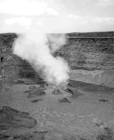
A single low lava fountain emitted a steady stream of gas when photographed by Fred Rackle on July 21, 1952, when Halema`uma`u Crater was more than twice as deep as it is at present. View is to the southwest.

The HVO Web site was recently revamped to make access to our increasing number of Webcams easier for About 20 minutes before midnight on June 27, 1952, almost exactly 57 years ago, Mrs. John Fox walked from the living room of her home on the east rim of Kilauea caldera into an adjoining room. She was instantly startled by a loud, whistling roar coming through an open window. Running back into her living room, she saw a bright orange glow lighting the night sky.

At about the same time, just down the road at Kilauea Military Camp (KMC), Colonel B.W. Rushton pointed out the bright glow to Hawaiian Volcano Observatory (HVO) staff member John Forbes, who quickly called Gordon Macdonald, then Scientist-in-Charge of HVO.

When John Forbes arrived minutes later at HVO, on the edge of Kilauea caldera, he was greeted by the top of a huge lava fountain rising above the rim of Halema`uma`u. The crater was then nearly 245 m (800 ft) deep—more than twice its current depth from the rim to the crater's floor. By the time Gordon Macdonald arrived at HVO some 10 minutes later, the fountain was no longer visible, but incandescent fragments could still be seen arcing out of the crater.

Quickly grabbing the necessary equipment, Macdonald and Forbes set out by car for Halema`uma`u Crater to make detailed observations. As they followed Crater Rim Drive down onto the western floor of Kilauea caldera—the section of road that is closed today due to ongoing summit activity—they encountered a choking, sulfurous fume cloud so thick that they could barely see the road.

The fall of tephra onto the road was so heavy that they were hard-pressed to keep the car moving forward as it plowed through the drifts of pumice. The hail of tephra onto the car, with pieces reaching up to 10 cm (4 inches) across, sand-blasted the car's exterior to the point that it later had to be repainted and have its windshield replaced.

Pressing onward, Macdonald and Forbes passed through the tephra fall and quickly walked to the southeast rim of Halema`uma`u, reaching it about 10 minutes past midnight. When they peered into the crater, they saw a continuous line of lava fountains, 790 m (2,600 ft) in length, crossing the entire crater floor from southwest to northeast and extending part-way up the northeastern crater wall.

For the most part, the individual fountains were 15 to 30 m (50 to 100 ft) in height, but a fountain 120 m (400 ft) high jetted up near the bottom of the southwestern wall of the crater—probably a diminished version of the same fountain, at more than 245 m (800 ft) in height, seen minutes earlier from HVO.

Though views were poor due to the heavy fume, brief glimpses of the crater floor showed that older spatter cones on the floor of Halema`uma`u had already been buried beneath a rising lava lake. This suggested that more than 3 million cubic meters (4 million cubic yards) of lava were erupted in the first half-hour of the eruption. It would take about six days for Kilauea's current east rift zone eruption to pump out that much lava today.

The eruption rate quickly declined after the initial outbreak, but lava fountains continued to play on the surface of the lava lake over the following weeks. By late summer 1952, activity had begun to decline, but the eruption persisted until November 10, when the last fountaining activity was observed.

Having erupted for 136 days, the 1952 summit eruption brought to an end, in grand fashion, any doubts as to whether or not Kilauea was still alive. Prior to 1952, Kilauea had been quiescent since October 1934, when the previous summit eruption had ended, and some had begun to think that Kilauea was dead. But frequent earthquakes and the occasional swelling and shrinking of the volcano over the intervening years told volcanologists otherwise. It was no great surprise, then, when the eruption finally occurred.

Followed by dozens of eruptions in the years since, the 1952 eruption undoubtedly ushered in the current era of volcanic activity at Kilauea. Today's ongoing summit and east rift zone eruptions are just the most recent in the string of eruptions that have followed since Mrs. Fox was surprised by the glow outside her living room window.

Kīlauea Activity Update

Surface flows in the Royal Gardens subdivision may have stagnated early this past week in response to a deflation-inflation (DI) event at Kīlauea's summit. Smoke continues to rise, however, from forested kipuka in the subdivision, indicating that at least some burning continues. At the coast, the Waikupanaha and Kupapa`u ocean entries remain active and continue to produce prominent plumes, accompanied by small littoral explosions, as lava spills into the ocean.

At Kīlauea's summit, the vent within Halema`uma`u Crater is still emitting elevated amounts of volcanic gas, resulting in high concentrations of sulfur dioxide downwind. Glow from the vent was visible at night through the past week, and rare views into the vent by HVO scientists found that the lava surface is still present about 205 m (675 feet) below the floor of Halema`uma`u Crater.

No earthquakes beneath Hawai`i Island were reported felt this past week.

Visit our Web site (http://hvo.wr.usgs.gov) for detailed Kīlauea and Mauna Loa activity updates, recent volcano photos, recent earthquakes, and more; call (808) 967-8862 for a Kīlauea activity summary; email questions to askHVO@usgs.gov. Volcano Watch is a weekly article and activity update written by scientists at the U.S. Geological Survey's Hawaiian Volcano Observatory.

For more information on traveling to Hawaii in general and exploring the Big Island's volcanoes in particular, please also visit www.tourguidehawaii.com and www.lovingthebigisland.wordpress.com.

Sunday, July 5, 2009

Give new life to your old photographs of Hawai`i's volcanoes!

Reprinted from here.

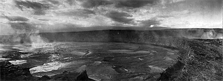
A view of the lava lake within Halema`uma`u Crater on December 27, 1911, with Uwekahuna bluff (where HVO and the Jaggar Museum now stand) and Mauna Loa in the background. The lake level had risen about 120 m (400 ft) since October 1911 and will drop 90 m (300 ft) in January, 1912, the month that HVO was founded by Thomas A. Jaggar's arrival for duty.
The adage "a picture is worth a thousand words" is certainly true, especially when it comes to photographs of Hawaiian eruptions and volcanic landscapes from earlier times.

Long-time readers of "Volcano Watch" might recall our January 20, 2005, article (http://hvo.wr.usgs.gov/volcanowatch/2005/05_01_20.html), which describes an HVO geologist's excitement at finding an 1860s photo of Kilauea's caldera. By comparing the photo to a present-day view of the caldera, he could see the location of volcanic features described in written records (with less than a thousand words) but no longer visible today—a valuable discovery when your job is to decipher a volcano's eruptive history.

Without realizing it, you or a family member may have captured a similarly important historical record of Hawai`i's volcanoes. How? By taking a photo and keeping it.

Your `ohana, like many families, probably has several albums—or shoe boxes—filled with old photographs. Perhaps your great-grandmother took a picture of a long-ago Kilauea summit eruption or your brother snapped a photo of `a`a lava as it flowed down the slopes of Mauna Loa. If you possess photographs that show volcanic landscapes or features, volcanic fume (vog), or any kind of eruptive activity, HVO geologists would like to hear from you and see the photos.

We learn the most from photographs that have some documentation about when and where they were taken. Date and location are essential pieces of information that help us interpret the geologic significance of a photo. If people are recognizable in a photograph, their names should also be included. Any other details you can provide about the image will add to its meaning.

Wide-angle shots are more helpful than close-ups. For example, if a photo is zoomed in on the leading edge of a lava flow and shows nothing else, we cannot determine the size of the flow-or much of anything else—from the image. With wide-angle views, we can see the geographic or geologic context of the eruptive activity or volcanic features shown in the photograph.

If you're interested in sharing your photos with HVO scientists, the first thing you should do is contact us by telephone (808-967-7328) or email us (askHVO@usgs.gov). Geologists are standing by to speak with you. The purpose of this initial conversation is to determine which of your photographs might be beneficial to our research and monitoring efforts on Hawai`i's volcanoes. We will then send you additional information on how we can receive and duplicate photos selected from your collection.

No need to worry about giving up your photographs—you retain ownership of them. We will return your photos to you after duplicating the images selected as most useful. In appreciation of your loaning us the photographs, we will be happy to give you digital copies of the images we scan.

To kick off our effort to expand HVO's photographic collection of Hawai`i's volcanoes, we are asking at this time to see photographs from 1924 and earlier. Those years included frequent lava lake activity in Halema`uma`u Crater and culminated in the explosive eruptions of May 1924.

Pre-1924 photos are of particular interest to us now because they could shed light on Kilauea's current summit eruption. Even if they show no eruptive activity, early photographs of Kilauea's caldera can contribute to a better understanding of the volcano's past and reveal features that are no longer visible. The same is true for early photos of Mauna Loa and Hualalai.

We will initially focus on early historical photographs, but you can contact us about any volcanic images you think might interest us. Although we may not be able to look at photos taken in recent decades right away, we would eventually like to see them. Our ultimate goal is to acquire images from the 1800s through the 20th century.

So, please lend us a hand while taking a trip down memory lane. Look through your family photos and contact HVO if you find images of Hawai`i's volcanoes. Your old photographs could give new life to eruptive events and volcanic landscapes rapidly fading from our visual memories.

Kīlauea Activity Update

Surface flows in the Royal Gardens subdivision remained active as of Thursday, June 18, burning through forested kipuka. Another area of breakouts active higher up on the pali was also reported. The Waikupanaha and Kupapa`u ocean entries remain active and continue to produce prominent plumes as lava spills into the ocean.

At Kīlauea's summit, the vent within Halema`uma`u Crater continues to emit elevated amounts of volcanic gas, resulting in high concentrations of sulfur dioxide downwind. Bright glow from the vent was visible at night through the past week. A collaborative effort last week between HVO and UH-Manoa scientists, using a sophisticated optical remote-sensing technology called LIDAR (Light Detection and Ranging), has measured the lava surface to be about 205 m (675 feet) below the floor of Halema`uma`u Crater.

No earthquakes beneath Hawai`i Island were reported felt this past week.

For more information on traveling to Hawaii in general and exploring the Big Island's volcanoes in particular, please also visit www.tourguidehawaii.com and www.lovingthebigisland.wordpress.com.

Tuesday, May 5, 2009

Sulfur Banks and Steaming Bluff, Hawaii Volcanoes National Park


Sulfur Banks, on the crater side of the road, is just one of hundreds of gas seep on the flanks of the summit crater spewing hydrogen sulfide, sulfur dioxide, carbon dioxide and steam. Hematite, native sulfur and gypsum minerals precipitate out of the gas flux streaming through the rocks, making colorful splashes on the outcrops. Children and people with heat or respiratory conditions, or anybody with a weak stomach should be wary of venturing down the road to see this.

Non-sulfurous steam vents, mostly across the road from the crater and at the aptly named Steaming Bluff, result from rainwater percolating down through the ground being boiled by the hot rock beneath and streaming up vents to the surface. There is a short walk to the Steaming Bluff from the Sulfur Banks parking area which comes to a breathtaking view of the crater and more productive steam vents.

For more information on touring Hawaii in general and the Big Island in particular, please also visit www.tourguidehawaii.com and www.lovingthebigisland.wordpress.com.

Written and produced by Donald B. MacGowan; narrated by Frank Burgess. All media copyright 2009 by Donald B. MacGowan and Frank Burgess.

Thursday, March 26, 2009

Frank's Travel Hints # 10: Hawaii Volcanoes National Park!


Let's Go to Hawaii Volcanoes National Park!

About a two hour straight drive from Kona, going south, brings you to the Hawaii Volcanoes National Park. If you have a Golden Eagle Pass your entrance is free. If not, it is only $10.00 per carload to enter the park. The rangers at the gate will give you detailed maps of the area.

Super tip: Your receipt will give you free access to the National Park for seven days.


My first suggestion is to go to the Kilauea Visitors Center and the Jagger Museum. To see a video of the Jaggar Museum, go here. This will give you a nice overview of the park and rangers are there to answer questions. This spot also looks over the majestic Halemaumau Crater. At the time of this writing, the portion of Crater Rim Drive from Jaggar Museum to Chain of Craters Road is closed due to a gaseous explosion in the Halemaumau Crater. To see video of this eruption, go here. Tour Guide will get you to the park and lead you to the Museum and more than 50 sites. It is also possible that our state bird, the Nene Goose, will be huddled in the parking lots. They are protected as an endangered species, so be careful when parking nearby.

Another great place to visit is the Volcano Art Center. It may seem a strange, but the Volcano Art Center boasts one of the best collections of art in the whole state. World renowned artist in various media are on display as well as theatrical and musical performances.

There is only one restaurant in the park proper, and that is the Volcano House. Built as a lodge in the mid 1800’s, the Volcano House has hosted dignitaries, politicians, sports heroes and movie stars from all over the world. This grand edifice sits right on the lip of Halemaumau Crater and the views from her restaurant are stunning. Tour Guide will give a complete history of how it came to be. The food is good and the prices are reasonable. To see a is a video of the Volcano House go here. Bicycle rentals are also available near the lodge.

Crater Rim Drive is a great driving introduction to the park. It encircles the Halemaumau Crater and, for only an 11 mile drive, passes through several dramatic climate zones. You will encounter arid desert, grass savannah, and into tropical rainforest; this loop can easily be done in forty minutes. However, you will want to take more time to appreciate the beauty and majesty of one nature’s most awesome wonders. Tour Guide will suggest short to medium hikes and bicycle trails as well as over 50 historic and geologic sites to visit within the park.

If you are up for some hiking, Tour Guide will lead you to the trail for Waldron Ledge Overlook. This short hike is through the Ohia and fern jungles, shaded most of the way, and can be done on bicycle as well. From this vantage point one can see the active vent, Kilauea Iki, and breathtaking views of the coast. Video of the overlook at Kilauea Iki is available here; a video about the hike through the bottom of Kilauea Iki is here.

Along the Crater Rim Drive you will also see many steam vents and sulfur banks. This is where water seeps into crevices and meets the molten magma about a half mile below the surface, is super heated, and returns to the surface as steam. These vents are often accompanied by a “rotten egg” smell common where sulfur is rising with the steam, turning the ground around the vents hues of yellow, green and white. A video about the Sulfur Banks is available here.

For more information on visiting Hawaii and the Big Island in general, and touring Hawaii Volcanoes National Park in general, go to tourguidehawaii.com and lovingthebigisland.wordpress.com.

Friday, March 13, 2009

Frank's Travel Hints # 10


Let's Go to Hawaii Volcanoes National Park!

About a two hour straight drive from Kona, going south, brings you to the Hawaii Volcanoes National Park. If you have a Golden Eagle Pass your entrance is free. If not, it is only $10.00 per carload to enter the park. The rangers at the gate will give you detailed maps of the area.

Super tip: Your receipt will give you free access to the National Park for seven days.


My first suggestion is to go to the Kilauea Visitors Center and the Jagger Museum. To see a video of the Jaggar Museum, go here. This will give you a nice overview of the park and rangers are there to answer questions. This spot also looks over the majestic Halemaumau Crater. At the time of this writing, the portion of Crater Rim Drive from Jaggar Museum to Chain of Craters Road is closed due to a gaseous explosion in the Halemaumau Crater. To see video of this eruption, go here. Tour Guide will get you to the park and lead you to the Museum and more than 50 sites. It is also possible that our state bird, the Nene Goose, will be huddled in the parking lots. They are protected as an endangered species, so be careful when parking nearby.

Another great place to visit is the Volcano Art Center. It may seem a strange, but the Volcano Art Center boasts one of the best collections of art in the whole state. World renowned artist in various media are on display as well as theatrical and musical performances.

There is only one restaurant in the park proper, and that is the Volcano House. Built as a lodge in the mid 1800’s, the Volcano House has hosted dignitaries, politicians, sports heroes and movie stars from all over the world. This grand edifice sits right on the lip of Halemaumau Crater and the views from her restaurant are stunning. Tour Guide will give a complete history of how it came to be. The food is good and the prices are reasonable. To see a is a video of the Volcano House go here. Bicycle rentals are also available near the lodge.

Crater Rim Drive is a great driving introduction to the park. It encircles the Halemaumau Crater and, for only an 11 mile drive, passes through several dramatic climate zones. You will encounter arid desert, grass savannah, and into tropical rainforest; this loop can easily be done in forty minutes. However, you will want to take more time to appreciate the beauty and majesty of one nature’s most awesome wonders. Tour Guide will suggest short to medium hikes and bicycle trails as well as over 50 historic and geologic sites to visit within the park.

If you are up for some hiking, Tour Guide will lead you to the trail for Waldron Ledge Overlook. This short hike is through the Ohia and fern jungles, shaded most of the way, and can be done on bicycle as well. From this vantage point one can see the active vent, Kilauea Iki, and breathtaking views of the coast. Video of the overlook at Kilauea Iki is available here; a video about the hike through the bottom of Kilauea Iki is here.

Along the Crater Rim Drive you will also see many steam vents and sulfur banks. This is where water seeps into crevices and meets the molten magma about a half mile below the surface, is super heated, and returns to the surface as steam. These vents are often accompanied by a “rotten egg” smell common where sulfur is rising with the steam, turning the ground around the vents hues of yellow, green and white. A video about the Sulfur Banks is available here.

For more information on visiting Hawaii and the Big Island in general, and touring Hawaii Volcanoes National Park in general, go to tourguidehawaii.com and lovingthebigisland.wordpress.com.

Wednesday, February 25, 2009

Frank's Hawaii Travel Tips #9: Made for Adventure: The Jungles, Volcanoes, Hot Springs and Tidepools of Puna!


Deeper into mysterious Puna!

As you continue along the coast road, you will next encounter McKenzie State Park. Here the Ironwood trees create an unusual ambience of a pine tree forest. The sheer cliffs and majesty of the ocean beg for photographing. Swimming would be near impossible here, but the hiking is spectacular. Tour Guide will give more information about this other- worldly park. A permit is required for camping and the facilities are a bit run down.

Not far away is Kahena Beach. This beautiful black sand beach involves a bit of a scamper to get down the cliff, but is well worth the effort. Tour Guide will give you the easiest path to take. You may notice that this beach is “clothing optional”, thus it’s popularity. Swimming here is good, but currents can be strong if you get too far from shore.

Drive just a few miles further and you come to what used to be the town of Kalapana. Kalapana and Royal Gardens were destroyed in the lava flows during the late1980’s.

What remain are a few homes and businesses where the road now ends. From here one can see the plume of smoke coming from the vent upslope. Sometimes the lava reaches the ocean about 2 miles from this spot.

A short five minute hike will bring you to Kaimu Beach, the newest black sand beach on the island. Tour Guide will give you the rich history of the ancient fishing villages that were here and the touching stories about the palms at Kaimu Beach.

Heading back from Kalapana, you will want to take Highway 130 toward Pahoa. This is your best chance of watching Kilauea erupt. Just a few hundred yards north of Kalapana, is the old turn off to Royal Gardens. This is now the official County of Hawaii Lava Viewing Site. Drive as far as the attendants will allow you, park and walk into where you can safely view the lava flowing into the ocean. Daily updates on the volcano and conditions at site are available at the Hawaii County Lava Viewing Desk, phone number 808.961.8093; more information is here and here.

Farther along the highway to Pahoa, you will see a “scenic turnout” where you can view the Puna Geothermal Vents. Here a company has tapped the natural steam to create electricity from these fumaroles. Tour Guide will show you how, with a short hike off the road, and you can sit in one of these natural sauna vents for some real relaxation.

Now you’re ready to head back to Kona. Take Highway 130 to Highway 11 and go south. If time permits, you may want to stop in Volcano Village, just off the highway, for some food, gasoline, shopping or maybe even some wine tasting. This may be the last gasoline available until you get back to Kona. Find your hotel in your Tour Guide and get turn-by-turn directions right to the door.

For more information on visiting Hawaii in general and touring the Big Island in particular, go here and here.

Monday, February 23, 2009

Volcano Update: Quiescence in 1913 is similar to 2008 events

Reprinted from here.

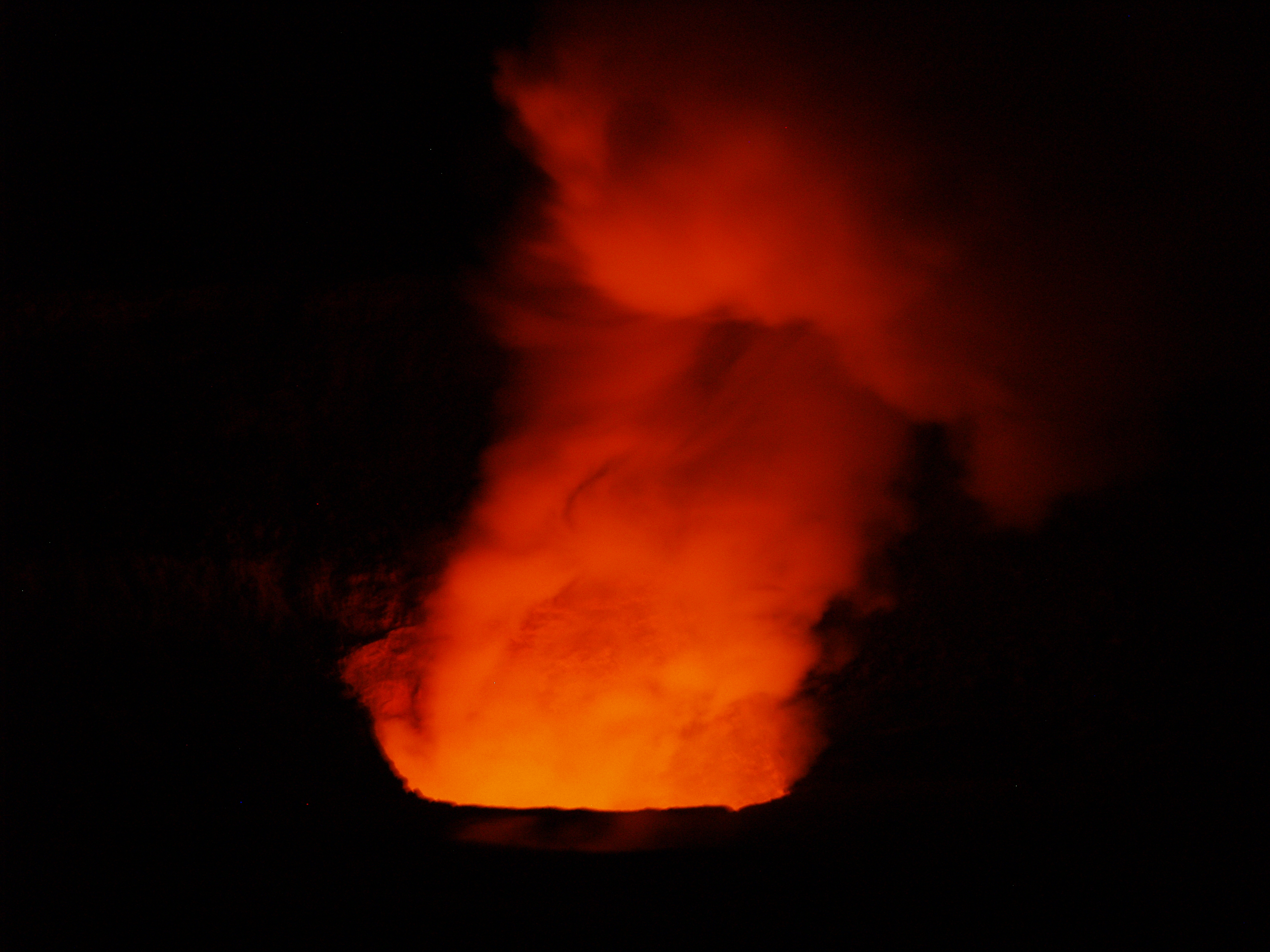
The Eruption of Halema'uma'u as seen from Steaming Bluff, HVNP, August, 2008: Photo by Donald MacGowan

Quiescence in 1913 is similar to 2008 events

In most sciences, processes are investigated by identifying the factors that affect them and varying each factor, in turn, to determine its contribution. In field geology, this is difficult; instead, we compare and contrast events or locations to learn more about the processes. At Kīlauea, there is a long, well-documented history with which to compare and contrast current activities. Summit events at Kīlauea over the last year have been unique since 1924, but bear interesting similarities to lulls in lava lake activity prior to 1924.

It is well known that, until 1924, there was a nearly continuous lake of lava in Halema`uma`u Crater, which was less than half the diameter it is today. But "nearly continuous" means there were periods when the lava lake disappeared. Mid-1913 to late 1914 was one of those periods when the crater was filled with fume, but not lava. Fortunately, regular Hawaiian Volcano Observatory (HVO) reports described this lull.

In 1913, HVO was located where the Volcano House hotel is today. Lacking direct views into Halema`uma`u Crater, observers noted sounds and characteristics of the fume coming from the pit to describe its behavior.

Reports of glow were infrequent, but descriptions of noises from the crate-blowing, coughing, booming, hissing, rumbling, grumbling, puffing, and breathing-were common. Rock slides, which were frequent and audible, sometimes produced dust clouds.

"During the last three months the only marks of activity which have fluctuated have been noises of blowing and rumbling, greater or less suffocating quality to the fumes when breathed, and very rare glimpses of flame seen two or three times at night." (HVO report, August 18, 1913).

Through September, the noises increased in intensity, and some glow was observed. Pele's hair was frequently found downwind of the crater and, when the fumes cleared, glimpses of a lava vent deep in Halema`uma`u Crater could be seen.

By October 20, 1913, Halema`uma`u Crater was considered to be in a minor eruptive phase. The crater was emitting much greater volumes of fume than in August. Sounds resembling "swashing liquid" suggest the continued existence of a lava lake, even when it was obscured by fume. A glow-lit fume cloud was a frequent sight over the crater at night.

Activity decreased through the end of 1913, and Halema`uma`u finished the year in a "semi-dormant" state, with a crater shaped like a huge funnel about 200 m (600 ft) deep and a thickly crusted lava pool in its bottom. Vigorous lava lake activity did not resume until late 1914.

Jump ahead to 2008. HVO reports have been describing many of the same characteristics. Few views of a lava pond have been recorded, but blowing and booming sounds, rock falls, and dust plumes have been common. Explosions were common in much of 2008, and some were energetic enough to erupt material to the crater rim.

The 1913-14 lull in activity and the currently elevated summit activity both result from lava being at similar shallow depths below Halema`uma`u Crater. In the early part of 1913, lava dropped to that level. In early 2008, magma rose to a similar depth.

The 2008 activity produced small amounts of tephra, often including Pele's hair. The 1913-14 lull also produced notable amounts of Pele's hair, but production of other tephra was not recorded.

Throughout both events, progress is highly variable. The overall rise of lava in the crater during 1913 and 1914 was halting, with episodes of rise repeatedly cut short with episodes of subsidence. Similarly, the 2008 activity changes several times a week, with lava interpreted to be rising and falling within the conduit below the vent.

In both cases, shallow magma produced elevated SO2 emissions and glow from the vent. "Fumes continue to pour out without abatement" (HVO report, February 4, 1914). Observers commonly described the fume as being difficult to breathe in 1913. Respiratory protection is required to work in the fume emitted today but probably wasn't necessary in earlier years.

HVO continues to monitor Kīlauea's activities and we hope to learn more by comparing recent events with past volcanic activity.

Activity update

Kīlauea Volcano continues to be active. A vent in Halema`uma`u Crater is emitting elevated amounts of sulfur dioxide gas and producing small amounts of ash. Resulting high concentrations of sulfur dioxide in downwind air have closed the south part of Kīlauea caldera and produced occasional air quality alerts in more distant areas, such as Pahala and communities adjacent to Hawai`i Volcanoes National Park, during kona wind periods. A collapse deep within the vent on Wednesday, February 4 produced a robust brown plume and appeared to reopen the conduit, filled with rubble since early December. Views inside the vent the next day with a thermal camera showed a small, crusted lava pond more than 100 yards below the vent rim.

Pu`u `Ō`ō continues to produce sulfur dioxide at even higher rates than the vent in Halema`uma`u Crater. Trade winds tend to pool these emissions along the West Hawai`i coast, while Kona winds blow these emissions into communities to the north, such as Mountain View, Volcano, and Hilo.

Lava erupting from the Thanksgiving Eve Breakout (TEB) vent at the eastern base of Pu`u `Ō`ō continues to flow to the ocean at Waikupanaha through a well-established lava tube. Breakouts from a western branch of the lava tube were active on the coastal plain near the National Park boundary early in the week and also continued to feed the small ocean entry near Waha`ula. A deflation-inflation cycle beginning February 3 led to a short-term reduction in lava supply to the flow field. Surface flows and ocean entries were inactive on Thursday, February 5, and will probably resume shortly.

Be aware that active lava deltas can collapse at any time, potentially generating large explosions. This may be especially true during times of rapidly changing lava supply conditions. The Waikupanaha delta has collapsed many times over the last several months, with three of the collapses resulting in rock blasts that tossed television-sized rocks up onto the sea-cliff and threw fist-sized rocks more than 200 yards inland.

Do not approach the ocean entry or venture onto the lava deltas. Even the intervening beaches are susceptible to large waves generated during delta collapse; avoid these beaches. In addition, steam plumes rising from ocean entries are highly acidic and laced with glass particles. Call Hawai`i County Civil Defense at 961-8093 for viewing hours.

Mauna Loa is not erupting. No earthquakes were located beneath the summit this past week. Continuing extension between locations spanning the summit indicates slow inflation of the volcano, combined with slow eastward slippage of its east flank.

Three earthquakes beneath Hawai`i Island were reported felt within the past week. A magnitude-3.2 earthquake occurred at 3:37 p.m., H.s.t., on Friday, January 30, 2009, and was located 2 km (1 mile) east of Pahala at a depth of 10 km (6 miles). A magnitude-3.4 and a magnitude-3.5 earthquake occurred at 7:12 and 7:17 p.m., respectively, on the same Friday and were located 7 km (4 miles) west of Kalapana at a depth of 9 km (6 miles).

Visit our Web site (http://hvo.wr.usgs.gov) for daily Kīlauea eruption updates, a summary of volcanic events over the past year, and nearly real-time Hawai`i earthquake information. Kīlauea daily update summaries are also available by phone at (808) 967-8862. Questions can be emailed to askHVO@usgs.gov.

For more information on traveling to Hawaii in general and seeing the volcanoes of the Big Island in particular, please visit www.tourguidehawaii.com and www.tourguidehawaii.blogspot.com.

Tuesday, February 17, 2009

Frank's Hawaii Travel Tips #9: Made for Adventure: The Jungles, Volcanoes, Hot Springs and Tidepools of Puna!


Deeper into mysterious Puna!

As you continue along the coast road, you will next encounter McKenzie State Park. Here the Ironwood trees create an unusual ambience of a pine tree forest. The sheer cliffs and majesty of the ocean beg for photographing. Swimming would be near impossible here, but the hiking is spectacular. Tour Guide will give more information about this other- worldly park. A permit is required for camping and the facilities are a bit run down.

Not far away is Kahena Beach. This beautiful black sand beach involves a bit of a scamper to get down the cliff, but is well worth the effort. Tour Guide will give you the easiest path to take. You may notice that this beach is “clothing optional”, thus it’s popularity. Swimming here is good, but currents can be strong if you get too far from shore.

Drive just a few miles further and you come to what used to be the town of Kalapana. Kalapana and Royal Gardens were destroyed in the lava flows during the late1980’s.

What remain are a few homes and businesses where the road now ends. From here one can see the plume of smoke coming from the vent upslope. Sometimes the lava reaches the ocean about 2 miles from this spot.

A short five minute hike will bring you to Kaimu Beach, the newest black sand beach on the island. Tour Guide will give you the rich history of the ancient fishing villages that were here and the touching stories about the palms at Kaimu Beach.

Heading back from Kalapana, you will want to take Highway 130 toward Pahoa. This is your best chance of watching Kilauea erupt. Just a few hundred yards north of Kalapana, is the old turn off to Royal Gardens. This is now the official County of Hawaii Lava Viewing Site. Drive as far as the attendants will allow you, park and walk into where you can safely view the lava flowing into the ocean. Daily updates on the volcano and conditions at site are available at the Hawaii County Lava Viewing Desk, phone number 808.961.8093; more information is here and here.

Farther along the highway to Pahoa, you will see a “scenic turnout” where you can view the Puna Geothermal Vents. Here a company has tapped the natural steam to create electricity from these fumaroles. Tour Guide will show you how, with a short hike off the road, and you can sit in one of these natural sauna vents for some real relaxation.

Now you’re ready to head back to Kona. Take Highway 130 to Highway 11 and go south. If time permits, you may want to stop in Volcano Village, just off the highway, for some food, gasoline, shopping or maybe even some wine tasting. This may be the last gasoline available until you get back to Kona. Find your hotel in your Tour Guide and get turn-by-turn directions right to the door.

For more information on visiting Hawaii in general and touring the Big Island in particular, go here and here.

Wednesday, February 11, 2009

Volcano Update: Seasonally enhanced aroma briefly fills the air near Halema`uma`u


Reprinted from here.

It seems that something new and different is always cooking at Kīlauea. In December a change in the aroma coming from Pele's kitchen was noticed by the HVO and National Park staffs, along with nearby residents. The biting, choking odor of sulfur dioxide (SO2) from Halema`uma`u that had inundated Volcano Village and the Golf Course subdivision during trade wind disruptions started to change. The pervasive odor of rotten eggs or sewer gas that tainted the air was caused by an increasing appearance of hydrogen sulfide (H2S.)

The presence of H2S at Kīlauea's summit is not unusual in itself. Visitors to Sulphur Bank, located near Kīlauea Visitor Center, have long experienced the characteristic mix of odors. As Mark Twain quipped during his 1866 visit to Kīlauea, "The smell of sulphur is strong, but not unpleasant to a sinner."

Twainian humor aside, H2S gas, like SO2, can be hazardous at concentrations greater than 5-10 parts per million (ppm). Eye irritation and headaches are frequently reported symptoms. The human nose—very sensitive to H2S when first smelled—is able to detect it at concentrations well below 1 part per million. Unlike SO2, however, olfactory fatigue causes a loss of odor sensitivity upon prolonged exposure. The State of Hawai`i hosts a 1-hour ambient air standard for H2S of 0.025 ppm. California enacted a similarly protective standard in 1969, targeted at decreasing odor annoyance. The World Health Organization established a 24-hour average guideline of 0.15 ppm intended to protect human health.

H2S is formed at Sulphur Bank when SO2 escaping from Kīlauea's magma chamber rises and combines with ground water. The resulting chemical reaction, called hydrolysis, produces a mixture of SO2 and H2S at the surface. The amount of gas released is very small, and when the emissions are blown toward Halema`uma`u, they tend to affect only a small section of Crater Rim Drive.

Apart from the background Sulphur Bank gas emissions, HVO scientists have been watching carefully for appreciable H2S coming from the Overlook Vent at Halema`uma`u since the eruption began last March. A substantial increase in this gas, along with other eruptive indicators, might signal that a large amount of water was coming into close proximity of red-hot magma. The subsurface encounter of abundant groundwater and magma was the suspected culprit causing the explosive eruptions of 1924.

The lack of significant H2S presence at Halema`uma`u through late November reflected hot, dry conditions within the vent. And SO2 emissions remained high, as well, despite significant collapses of the vent rim and walls in September and October that added large amounts of rubble to the conduit bringing gas and other eruptive products to the surface.

This situation began to change in early December, when further collapses widened the vent rim to football playing-field size-100 m (110 yards) Accompanying the vent-widening was some seasonally notable rainfall. The gage at HVO recorded over a foot of rain in December, much of it during a single storm late in the month.

Hot, collapsed rim and wall rock accumulating in the vent, combined with the prodigious rainfall, provided good conditions to produce H2S from SO2 within the conduit. By mid-December, the vent had cooled somewhat, and the ratio of H2S to SO2 in the air near Halema`uma`u had climbed to higher levels than seen previously.

Despite the seemingly favorable H2S-producing conditions, the total emissions, while significant, were still less than one tenth those of SO2. HVO staff, however, watched the situation unfold with great interest, wondering what might happen next.

Pele's SO2 exhalations were not to be dampened by a little rainfall, though. By mid-January, the rains had tapered off, and magma heat and gas from below the rubble in the vent appeared to burn through. By late January, faint glow was once again seen in the vent, and the presence of H2S declined to near background as the vent heated up and dried out. And so, for now, it seems that hot liquid rock is once again what's cooking at Kīlauea's summit kitchen. Ah, pungent sinner soup! Can you smell it? Can you taste it?

Activity update

Kīlauea Volcano continues to be active. A vent in Halema`uma`u Crater is emitting elevated amounts of sulfur dioxide gas and producing very small amounts of ash. Resulting high concentrations of sulfur dioxide in downwind air have closed the south part of Kīlauea caldera and produced occasional air quality alerts in more distant areas, such as Pahala and communities adjacent to Hawai`i Volcanoes National Park, during kona wind periods. Variation in glow, gas-rushing sounds, and ash production over the past week may indicate that conduit beneath the vent is periodically being closed with debris.

Pu`u `Ō`ō continues to produce sulfur dioxide at even higher rates than the vent in Halema`uma`u Crater. Trade winds tend to pool these emissions along the West Hawai`i coast, while Kona winds blow these emissions into communities to the north, such as Mountain View, Volcano, and Hilo.

Lava erupting from the Thanksgiving Eve Breakout (TEB) vent at the eastern base of Pu`u `Ō`ō continues to flow to the ocean at Waikupanaha through a well-established lava tube. Breakouts from a western branch of the lava tube were active on the coastal plain near the National Park boundary in the past week and reached the ocean again on January 28. This tiny, new ocean entry is located very close to the long-buried Waha`ula Heiau and National Park visitor center.

Be aware that active lava deltas can collapse at any time, potentially generating large explosions. This may be especially true during times of rapidly changing lava supply conditions. The Waikupanaha delta has collapsed many times over the last several months, with three of the collapses resulting in rock blasts that tossed television-sized rocks up onto the sea-cliff and threw fist-sized rocks more than 200 yards inland.

Do not approach the ocean entry or venture onto the lava deltas. Even the intervening beaches are susceptible to large waves generated during delta collapse; avoid these beaches. In addition, steam plumes rising from ocean entries are highly acidic and laced with glass particles. Call Hawai`i County Civil Defense at 961-8093 for viewing hours.

Mauna Loa is not erupting. Four earthquakes were located beneath the summit this past week. Continuing extension between locations spanning the summit indicates slow inflation of the volcano, combined with slow eastward slippage of its east flank.

One earthquake beneath Hawai`i Island was reported felt within the past week. A magnitude-2.3 earthquake occurred at 1:20 a.m., H.s.t., on Tuesday, January 27, 2009, and was located 9 km (6 miles) northwest of Kukuihaele at a depth of 42 km (26 miles).

Visit our Web site (http://hvo.wr.usgs.gov) for daily Kīlauea eruption updates, a summary of volcanic events over the past year, and nearly real-time Hawai`i earthquake information. Kīlauea daily update summaries are also available by phone at (808) 967-8862. Questions can be emailed to askHVO@usgs.gov.

For more information on traveling to Hawaii in generally and seeing the volcanoes on the Big Island in particular, please visit www.tourguidehawaii.com and www.lovingthebigisland.wordpress.com.

Thursday, February 5, 2009

The Hawaiian Snow Goddess Poliahu and the Summit of Mauna Kea...

The view of Mauna Loa from the Shrine at Pu'u Weiku on the Summit of Mauna Kea: Photo by Donald B. MacGowanPhoto by Donald B. MacGowan

Polynesians encountered the snow goddess, Poliahu, for the first time when they reached the Big Island of Hawaii sometime in the Fourth Century C.E. and beheld the snow-clad summits of the great volcanoes. The eldest daughter of the sky god Kane, Poliahu is said to have created the verdant, tropical beauty of the Hamakua Coast on the Big Island; its lushness, clear, cold streams and lovely waterfalls a perfect playground for her to indulge in her favorite pass-time--cavorting with human men.

Though she regularly visits Haleakala on Maui and Mauna Loa on the Big Island, Mauna Kea--in Hawaiian the "White Mountain"--is rightly considered the home of Poliahu. The prominent surviving myth about the Goddess Poliahu involves her besting the Volcano Goddess, Pele, at the Hawaiian sledding sport of "he'eholua". So angry was Pele at being defeated that she attacked Poliahu with streams of glowing lava. Poliahu retaliated by bringing down storms of snow to freeze the molten rock in place. The goddesses fought each other to a standstill, although the sledding defeat has always rankled Pele. Even now as she dominates at Kilauea, Pele submits to Poliahu's rule on Mauna Kea; still, to this day, Pele is said to dispute with Poliahu over Mauna Loa.


Hikers on the Summit Ridge of Mauna Kea; Mauna Loa in the Background: Photo by Donnie MacGowanPhoto by Donnie MacGowan

Mythology aside, Mauna Kea's summit is an exciting, fascinating place. A dormant shield volcano which hasn't erupted for about 4500 years, Mauna Kea is 13,803 feet tall, the highest point in the state of Hawaii. Because the summit rises some 33,476 feet above its base on the sea floor, Mauna Kea is the tallest mountain on earth. All this mass, this huge bulk of a mountain has grown in fewer than a million years--geologically the blink of an eye. Glaciers covered the summit of Mauna Kea three times between 200,000 and 13,000 years ago, leaving behind many glacial features and a few remnant rock glaciers near the summit. In addition, the summit area is home to Lake Waiau, the seventh highest lake in the United States. Also on the summit block is the largest, and most modern collection of international astronomical observatories located anywhere on earth.

The Summit of Mauna Kea Contains a Small Metropolis of the Most Modern and Sophisticated Astronomical Telescopes and Observatories in the World: Photo by Donnie MacGowan
Photo by Donnie MacGowan

I love visiting the summit of Mauna Kea--whether I spend the day hiking the six-mile trail to the top or I drive to the end of the road for the 10 minute walk up the summit at Pu'u Weiku. I spend hours and hours watching the clouds, listening to the silence, soaking up the island-wide vistas. I'm not sure what draws me out of the tropical torpor of Kona, time and again, to the summit of Mauna Kea--maybe the exhilaration of altitude and the crisp, clean air, or the opportunities for snow-play, solitude; perhaps unconsciously I hope to see one of the legendary cat-fights between Pele and Poliahu, fire and ice.


Secretly, deep down, I suspect that honestly I am just hoping to become yet another in the long, long line of human men that Poliahu has chosen to, ahem, cavort with.


For more information about traveling to the Hawaii in general and touring the Big Island in particular, please visit www.tourguidehawaii.com and lovingthebigisland.com. For a video about hiking up Mauna Kea, go here. For information about the author, please go here.

Sunday, October 5, 2008

Kilauea Eruption Update!

Kīlauea Eruption Status


Reprinted from here.

Photo by Donnie MacGowanPhoto by Donnie MacGowan

Kīlauea Volcano continues to be active. A vent in Halema`uma`u Crater is erupting elevated amounts of sulfur dioxide gas and very small amounts of ash. Resulting high concentrations of sulfur dioxide in downwind air have closed the south part of Kīlauea caldera and produced occasional air quality alerts in more distant areas, such as Pahala and communities adjacent to Hawai`i Volcanoes National Park, during kona wind periods. On September 5, scientists observed a 50-m- (160 ft) diameter lava lake about 100 m (330 ft) below the vent rim on the floor of Halema`uma`u; the lava cannot be seen from the rim of Halema`uma`u Crater or Jaggar Museum Overlook. There have been several small ash-emission events from the vent, lasting only minutes, in the last week.

Pu`u `Ō`ō continues to produce sulfur dioxide at even higher rates than the vent in Halema`uma`u Crater. Trade winds tend to pool these emissions along the West Hawai`i coast, while Kona winds blow these emissions into communities to the north, such as Mountain View, Volcano, and Hilo.

Lava continues to erupt from fissure D of the July 21, 2007, eruption and flows toward the ocean through a well-established lava tube. The ocean entry at Waikupanaha was interrupted twice in the past week in response to back-to-back deflation/inflation (DI) events at Kilauea summit. There were small, short-lived breakouts on the coastal plain early in the week as the eruption recovered from the two pauses in lava supply. The ocean entry had recovered by the second half of the week and hosted frequent small littoral explosions.

Be aware that active lava deltas can collapse at any time, potentially generating large explosions. This may be especially true during times of rapidly changing lava supply conditions. Do not venture onto the lava deltas. Even the intervening beaches are susceptible to large waves generated during delta collapse; avoid these beaches. In addition, steam plumes rising from ocean entries are highly acidic and laced with glass particles. Check Civil Defense Web site (http://www.lavainfo.us) or call 961-8093 for viewing hours.

Mauna Loa is not erupting. Four earthquakes were located beneath the summit this past week. Continuing extension between locations spanning the summit indicates slow inflation of the volcano.

Four earthquakes beneath Hawai`i Island were reported felt within the past week. A magnitude-2.0 earthquake occurred at 8:21 p.m., H.s.t., on Thursday, September 18, 2008, and was located 3 km (2 miles) southeast of Kilauea summit, at a depth of 3 km (2 miles). A magnitude-4.3 earthquake occurred at 5:59 p.m. on Friday, September 19, 2008, and was located 6 km (4 miles) northeast of Ka`ena Point on Kilauea's south flank at a depth of 10 km (6 miles). A magnitude-3.0 earthquake occurred at 7:49 a.m. on Tuesday, September 23, 2008, and was located 32 km (20 mile) northeast of Honoka`a at a depth of 32 km (20 miles). A magnitude-2.2 earthquake occurred at 7:25 a.m. on Wednesday, September 24, 2008, and was located 4 km (3 miles) northeast of Kukuihaele at a depth of 30 km (19 miles).

Visit our Web site (http://hvo.wr.usgs.gov) for daily Kīlauea eruption updates, a summary of volcanic events over the past year, and nearly real-time Hawai`i earthquake information. Kīlauea daily update summaries are also available by phone at (808) 967-8862. Questions can be emailed to askHVO@usgs.gov.

Photo by Donnie MacGowanPhoto by Donnie MacGowan

For more information on touring Hawaii in general and the Big Island in particular, go here and here.

Sunday, September 14, 2008

Frank's Travel Hints # 10


Let's Go to Hawaii Volcanoes National Park!

About a two hour straight drive from Kona, going south, brings you to the Hawaii Volcanoes National Park. If you have a Golden Eagle Pass your entrance is free. If not, it is only $10.00 per carload to enter the park. The rangers at the gate will give you detailed maps of the area.

Super tip: Your receipt will give you free access to the National Park for seven days.


My first suggestion is to go to the Kilauea Visitors Center and the Jagger Museum. To see a video of the Jaggar Museum, go here. This will give you a nice overview of the park and rangers are there to answer questions. This spot also looks over the majestic Halemaumau Crater. At the time of this writing, the portion of Crater Rim Drive from Jaggar Museum to Chain of Craters Road is closed due to a gaseous explosion in the Halemaumau Crater. To see video of this eruption, go here. Tour Guide will get you to the park and lead you to the Museum and more than 50 sites. It is also possible that our state bird, the Nene Goose, will be huddled in the parking lots. They are protected as an endangered species, so be careful when parking nearby.

Another great place to visit is the Volcano Art Center. It may seem a strange, but the Volcano Art Center boasts one of the best collections of art in the whole state. World renowned artist in various media are on display as well as theatrical and musical performances.

There is only one restaurant in the park proper, and that is the Volcano House. Built as a lodge in the mid 1800’s, the Volcano House has hosted dignitaries, politicians, sports heroes and movie stars from all over the world. This grand edifice sits right on the lip of Halemaumau Crater and the views from her restaurant are stunning. Tour Guide will give a complete history of how it came to be. The food is good and the prices are reasonable. To see a is a video of the Volcano House go here. Bicycle rentals are also available near the lodge.

Crater Rim Drive is a great driving introduction to the park. It encircles the Halemaumau Crater and, for only an 11 mile drive, passes through several dramatic climate zones. You will encounter arid desert, grass savannah, and into tropical rainforest; this loop can easily be done in forty minutes. However, you will want to take more time to appreciate the beauty and majesty of one nature’s most awesome wonders. Tour Guide will suggest short to medium hikes and bicycle trails as well as over 50 historic and geologic sites to visit within the park.

If you are up for some hiking, Tour Guide will lead you to the trail for Waldron Ledge Overlook. This short hike is through the Ohia and fern jungles, shaded most of the way, and can be done on bicycle as well. From this vantage point one can see the active vent, Kilauea Iki, and breathtaking views of the coast. Video of the overlook at Kilauea Iki is available here; a video about the hike through the bottom of Kilauea Iki is here.

Along the Crater Rim Drive you will also see many steam vents and sulfur banks. This is where water seeps into crevices and meets the molten magma about a half mile below the surface, is super heated, and returns to the surface as steam. These vents are often accompanied by a “rotten egg” smell common where sulfur is rising with the steam, turning the ground around the vents hues of yellow, green and white. A video about the Sulfur Banks is available here.

For more information on visiting Hawaii and the Big Island in general, and touring Hawaii Volcanoes National Park in general, go to tourguidehawaii.com and lovingthebigisland.wordpress.com.

Tuesday, August 19, 2008

Weekly Volcano Update!

Reprinted from here.

To see recent videos of the Kilauea eruptions, go here, here and here.

In every volcanic paradise, a little vog must fall

Area with vog.
Area with vog.
Locally, the term "vog" has become a household word, with a rash of media articles and even a respectable Wikipedia entry online. After 25 years of nearly continuous eruption on Kīlauea's east rift zone and over six months of increased gas emissions from Kīlauea's summit, most Hawai`i Island residents and many visitors are well acquainted with this volcanic air pollution.

The new vent in Halema`uma`u Crater at the summit of Kīlauea Volcano has created additional challenges for communities in the Ka`u and Kona districts with regard to air quality. During trade winds, which blow 90 percent of the time during the summer months, Pahala, Na`alehu, Ocean View, and other downwind communities are plagued by high concentrations of both sulfur dioxide (SO2) gas and their associated sulfate particles. Communities farther from the volcano, such as those on the Kona coast, are affected predominantly by particles.

The very worst vog days are frequently characterized by exceedences of EPA regulatory standards for SO2 gas and particulate matter. For these pollutants, 24-hour health standards have been set to protect the general population. For SO2 gas there is also a short-term standard meant to protect visibility, property, vegetation, and animals.

Since the new activity at Halema`uma`u began, the EPA standards for SO2 have been exceeded on numerous occasions in Pahala, and for particulate matter they have been exceeded in both Pahala and South Kona. The Pahala air quality monitoring station, which was installed in August 2007, only measured exceedence of SO2 standards after the opening of the Halema`uma`u vent in March 2008. Exceedence data are available at http://Hawaii.gov/health/environmental/air/cab/index.html.

An air quality monitoring site located at the Hawaiian Volcano Observatory (HVO), less than 2 km (1.2 mi) from the vent, offers an interesting perspective. When trade winds are interrupted, gas emissions from the summit and east rift zone are blown toward this station. Data show that, over the past 7 years, the 24-hour health standard was exceeded 1-9 times per year--on average just a handful of days. However, during the first half of 2008, the standard at this site has been exceeded 21 times.

Preliminary data also show that 2008 HVO wind patterns are consistent with those of previous years. This suggests that the larger number of SO2 events is due to the increase in SO2 emissions from Halema`uma`u, rather than to an increase in non-trade wind days.

The total output of SO2 gas from Kīlauea has increased by about 50 percent since the gas vent at Halema`uma`u appeared. Emissions from the summit jumped from a long-term average of about 200 t/d to the current 500-1000 t/d--an increase of 250-500 percent. Pu`u `Ō `ō, on Kīlauea's east rift zone, is still the predominant source of SO2 emissions, but the relative impact of summit emissions has increased significantly.

During prevailing trade winds, the east rift gas plume is generally blown out to sea, where it is dispersed and diluted before being carried back onshore to impact downwind communities. The Halema`uma`u plume remains onshore and is generally blown through the Ka`u desert to directly affect downwind communities.

During trade wind disruptions, which occur as much as 50 percent of the time during winter months, air quality in windward Hawai`i deteriorates. Communities on the east side of the island will continue to be impacted by the east rift plume as they have been for the past two decades. Communities close to the Halema`uma`u vent and to the north, like Kulani Prison, will most strongly experience the additional impact of the summit plume on these days.

Although Kīlauea's dynamic past suggests that the current situation could change suddenly, there is no indication that the summit eruption will end in the near future. Hawai`i residents are practiced at preparing for natural hazards, such as lava flows, tsunami, floods, and earthquakes. Learning about vog and how it can affect specific areas will help individuals adjust their activities to minimize their exposure to volcanic air pollution. For more information, see the new Frequently Asked Questions about Air Quality in Hawai`i at the USGS-HVO Web site (http://hvo.wr.usgs.gov/hazards/FAQ_SO2-Vog-Ash/main.html).

Activity update

Kīlauea Volcano continues to be active. A vent in Halema`uma`u Crater is erupting elevated amounts of SO2 gas and very small amounts of ash. Resulting high concentrations of SO2 in downwind air have closed the south part of Kīlauea caldera and produced occasional air quality alerts in more distant areas, such as Pahala and communities adjacent to Hawai`i Volcanoes National Park, during kona wind periods. There have been several small ash-emission events, lasting only minutes, in the last week. These are preceded by small seismic events and are probably caused by tiny rock falls within the vent.

Pu`u `Ō`ō continues to produce sulfur dioxide at even higher rates than the vent in Halema`uma`u Crater. Trade winds tend to pool these emissions along the West Hawai`i coast, while Kona winds blow these emissions into communities to the north, such as Mountain View, Volcano, and Hilo. Incandescence continues to be observed at night inside Pu`u `Ō`ō and suggests minor activity from vents within the crater.

Lava continues to erupt from fissure D of the July 21, 2007,eruption and flows toward the ocean through a well-established lava tube. A deformation event at Kīlauea's summit, starting on Tuesday, August 5, choked off the supply of lava to the east rift zone eruption site for several days. The Waikupanaha ocean entry had died by Wednesday, August 6 and the lava tube was observed to be empty on Thursday, August 7. Inflation began at the summit on the afternoon of Friday, August 8, resuming the lava supply to the east rift zone. On Saturday, August 9, lava began to overflow from the Thanksgiving Eve Breakout (TEB) vent and reenter the tube system. Breakouts were observed on the morning of Sunday, August 10, at the top of Royal Gardens subdivision and on the coastal plain. The largest of these coastal plain breakouts created a new short-lived ocean entry west of the main Waikupanaha entry and sent a minor flow into a kipuka on the east margin of the flow field. The coastal plain breakouts, and the new western ocean entry, were inactive by Wednesday, August 13. The main Waikupanaha entry reactivated on Sunday, August 10, resuming its characteristic littoral explosions and vigorous plume.

For more information on touring Hawaii in general, or visiting the eruptions in particular, visit www.tourguidehawaii.com and www.lovingthebigisland.wordpress.com.


Casino Bonus no Deposit