Tuesday, April 1, 2008

Today's Weather in Paradise

Point Forecast: Kailua Kona HI
19.63N -156W (Elev. 0 ft)
Last Update: 6:45 am HST Apr 1, 2008
Forecast Valid: 9am HST Apr 1, 2008-6pm HST Apr 7, 2008


Forecast at a Glance
Today

Isolated Showers Chance for Measurable Precipitation 20%
Isolated
Showers
Hi 80°F
Tonight

Isolated Showers Chance for Measurable Precipitation 20%
Isolated
Showers
Lo 73°F
Wednesday

Mostly Sunny
Mostly
Sunny
Hi 77°F
Wednesday
Night

Isolated Showers Chance for Measurable Precipitation 20%
Isolated
Showers
Lo 74°F
Thursday

Mostly Sunny
Mostly
Sunny
Hi 76°F
Thursday
Night

Mostly Clear
Mostly
Clear
Lo 71°F
Friday

Chance Showers Chance for Measurable Precipitation 30%
Chance
Showers
Hi 76°F
Friday
Night

Slight Chance Showers Chance for Measurable Precipitation 20%
Slight Chc
Showers
Lo 72°F
Saturday

Slight Chance Showers Chance for Measurable Precipitation 20%
Slight Chc
Showers
Hi 76°F

Detailed text forecast
Today: Isolated showers before noon. Partly cloudy, with a high near 80. East wind around 14 mph becoming west. Chance of precipitation is 20%.

Tonight: Isolated showers. Partly cloudy, with a low around 73. East wind around 10 mph. Chance of precipitation is 20%.

Wednesday: Mostly sunny, with a high near 77. West wind around 9 mph, with gusts as high as 18 mph.

Wednesday Night: Isolated showers. Partly cloudy, with a low around 74. East wind around 9 mph, with gusts as high as 18 mph. Chance of precipitation is 20%.

Thursday: Mostly sunny, with a high near 76. West wind around 9 mph.

Thursday Night: Mostly clear, with a low around 71. Northeast wind around 9 mph.

Friday: Scattered showers. Mostly cloudy, with a high near 76. West wind around 8 mph. Chance of precipitation is 30%.

Friday Night: A 20 percent chance of showers. Partly cloudy, with a low around 72. East wind around 9 mph.

Saturday: A 20 percent chance of showers. Partly cloudy, with a high near 76. South wind around 8 mph.

Saturday Night: Mostly clear, with a low around 72. East wind around 6 mph.

Sunday: A 20 percent chance of showers. Partly cloudy, with a high near 77. East wind around 6 mph.

Sunday Night: Mostly clear, with a low around 74. Calm wind.

Monday: Sunny, with a high near 77. East wind around 7 mph.


For more information on weather, go here;
for more information on touring the Big Island,
go here and here.

Monday, March 31, 2008

Weekly Volcano Watch

Kilauea Eruption Status

(Reprinted from the U.S. Geological Survey, Hawaii Volcano Observatory webpage)


Kilauea summit and Pu`u `O`o are slowly deflating. Seismic tremor levels at the summit are elevated to nearly moderate levels. Summit sulfur dioxide emission rates have remained elevated at nearly 10 times background levels since early January 2008. Earthquakes were located primarily beneath the general summit area, the southwest rift zone, and the south flank faults.

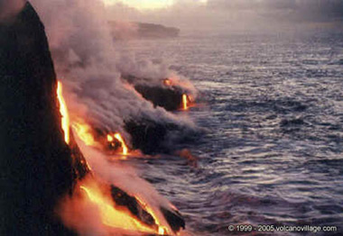
Lava from the 2007 Thanksgiving Eve Breakout (TEB) flow, erupting from fissure D of the July 21 eruption, continues to flow through what remains of the Royal Gardens subdivision and across the coastal plain. On Wednesday, March 5, the flow entered the ocean in the vicinity of Kapa`ahu. The Waikupanaha delta has since grown to a width of about 1,000 m (3,280 ft) and has multiple entry points. On March 15, another branch of the flow reached the ocean farther to the east, within a few hundred meters of the lava viewing area. As of Thursday, March 20, both the Waikupanaha and Ki entries remained active, though the Waikupanaha entry is far more vigorous.

The public should be aware that the ocean entry areas could collapse at any time, potentially generating large explosions in the process. The steam clouds rising from the entry areas are highly acidic and laced with glass particles. Do not venture onto the lava deltas. Even the intervening beaches are susceptible to large waves suddenly generated during delta collapse; these beaches should be avoided. Check the County of Hawai`i Civil Defense website (http://www.lavainfo.us) for information on public access to the coastal plain and ocean entry.

In the past week, sporadic breakouts, some large enough to form channelized `a`a flows, have burst from the lava tube on the steep slopes within the Royal Gardens subdivision. A few of these have reached the base of the pali before stalling. Other breakouts have been spotted at the top of the pali near the upper boundary of the Royal Gardens subdivision. Closer to the TEB vent, an area of persistent breakouts on the northeast side of the shield complex also continues to produce small flows. These northeast-directed flows are restricted to a broad, flat area on the south side of Kupaianaha.

Weak incandescence has been intermittently observed at night in Pu`u `O`o in the past week. As in years past, Pu`u `O`o likely is serving as a large chimney, beneath which lava is briefly stored and substantially degassed on its way to the eruption site.

On March 11, a new fumarole appeared low on the southeast wall of Halema`uma`u Crater, within Kilauea's summit caldera. The new vent is located directly beneath the Halema`uma`u Overlook about 70 m (230 ft) down. Incandescence could be seen at this vent, starting on March 13, and, by March 18 incandescence had grown to cover an area about 30 m (98 ft) across. At 2:58 a.m. on March 19, a small explosion occurred from this fumarole. The explosion scattered rock debris over an area of about 75 acres, covering a narrow section of Crater Rim Drive, the entire Halema`uma`u parking area, and the trail leading to the overlook. The overlook was damaged by rocks that reached up to 90 cm (3 ft) across. No lava was erupted as part of the explosion, suggesting that the activity was driven by hydrothermal or gas sources. The new explosion pit continues to glow at night, with incandescence reflecting on the fume emitted from the vent.

Sulfur dioxide (SO2) emission rates from the summit area have been substantially elevated at 2-10 times background values since early January. During these conditions, SO2 concentrations frequently exceed 1 ppm for much of Crater Rim Drive between Halema`uma`u parking lot and the southwest rift zone. SO2 concentrations exceed 20 ppm for approximately 200 m (650 ft) of the road between the Halema`uma`u parking lot and the south caldera pullout.

The increase in sulfur dioxide emission rates at the summit means that SO2 concentrations are much more likely to be at hazardous levels for visitor areas downwind of Halema`uma`u, especially during weak wind conditions or when winds blow from the south. Most people are sensitive to sulfur dioxide at these levels, especially children, individuals with asthma, chronic obstructive pulmonary disease (COPD), or other breathing problems. Stay informed about SO2 concentrations in continuously monitored areas (Jaggar Museum and Kilauea Visitor Center) by visiting the Kilauea Visitor Center and the web at:
http://www2.nature.nps.gov/air/webcams/parks/havoso2alert/havoalert.cfm. To minimize these potentially harmful effects, the Hawai`i Volcanoes National Park has closed all access to the southern half of Kilauea caldera.

Two earthquakes beneath Hawai`i Island were reported felt within the past week. A magnitude-3.4 earthquake occurred at 2:22 a.m., H.s.t., on Friday, March 14, 2008, and was located 6 km (4 miles south of Mauna Loa summit at a depth of 3 km (2 miles). A magnitude-2.4 earthquake occurred at 2:28 p.m. on Saturday, March 15, and was located 2 km (1 mile) northwest of Pahala at a depth of 13 km (8 miles).

Mauna Loa is not erupting. One earthquake was located beneath the summit. The rate of extension between locations spanning the summit, indicating inflation, has decreased to values below current detection limits.

Visit our Web site (http://hvo.wr.usgs.gov) for daily Kilauea eruption updates and nearly real-time Hawai`i earthquake information. Kilauea daily update summaries are also available by phone at (808) 967-8862.

For maps, photographs, and more current information see Kilauea's eruption update page. Visit The Hawaii Center for Volcanology for captivating eruptive photos and a history of the eruption.


For more information on visiting Hawaii Volcanoes National Park and seeing the volcano, visit www.tourguidehawaii.com.

Wednesday, March 26, 2008

Frank's Travel Hints #8: Mysterious Puna!


Exploring Mysterious Puna...

For your next day of driving, let’s go south on Highway 11 headed for the Puna District. Leave early and expect to get back just after dark because this area is furthest from Kona and contains some of the most beautiful, yet hidden, wonders on the Big Island. It is from Puna that, currently, the only up-close viewing of flowing lava is possible. You may want to pack a cooler for this day trip.

As you’re passing through Kainaliu, just south of Kona, a quick stop at Kona Joe’s Coffee Plantation, for some great Kona Coffee, will jump start your day. See their ad in the sponsors section in your Tour Guide. If you are driving straight to Puna, plan on about 3½ hrs drive time to get to the first sights in this discussion. If you have missed any sights that you wanted to see on the southern route, refer to Frank’s Travel Hints #1 and #2 and catch them on the way...just don't forget to allow for extra time.

Along the way you will pass Hawaii Volcanoes National Park. This is a fascinating place and not to be missed, but we will reserve it for a full day later.

The first turn is about 20 minutes past the park entrance at the town of Kea’au. Look for the stop light on the highway and the Highway 130 sign. The Kea’au Shopping Center has some great places to eat, like Paradise Bar and Grill, and is a good restroom break.

The first stop, in the Puna district, is the town of Pahoa. You will think you have just stepped back into the Wild West as Pahoa has a unique atmosphere like nowhere else on the island. Cute shops, and a great farmer’s market on Sundays, lends to picture taking and shopping. Tour Guide will suggest that parking is easiest at the Community Pool just a block from downtown, and there are public restrooms here.

Continue driving further into Puna on Highway 132 through the lovely tree tunnels to a magical stop at Lava Trees State Park. This gorgeous rainforest park is filled with birds and tropical plants and flowers. What makes this park so intriguing is the lava trees. Tour Guide will tell you how old lava flows surrounded the trees, leaving spires of hardened lava, giving it an eerie look. There are trails for hiking and bird watching is spectacular. This is also a good place for a restroom break as it will be a good while before the next restrooms are available. Highway 132 leads you to Highway 137, the Kapoho-Kalapana Road--the only road in America that is named for two towns buried by a volcano.

Turning toward Kapoho on Highway 137, the next stop is the Kapoho Tide Pools where you can experience great shoreline shell collecting and fantastic snorkeling amongst vibrant corals and tropical fish in protected tidepools. Though hard to find on your own, Tour Guide again knows the way to this secluded sanctuary and ancient village. Port-a-potties and showers are the only facilities here.

Just a few miles down Highway 137 is Ahalanui Hot Pond. This tropical park is centered around a hot spring that mixes with ocean water to create one of the most relaxing and soul recharging oases anywhere. Tour Guide gives you the history of what this area meant to the ancient Hawaiians. Picnicking, hiking, swimming and “expert only” surfing are some of the things to do here. There are restrooms, showers and water available also.

As you continue along the coast road, you will next encounter McKenzie State Park. Here the Ironwood trees create an unusual ambience of a pine tree forest. The sheer cliffs and majesty of the ocean beg for photographing. Swimming would be near impossible here, but the hiking is spectacular. Tour Guide will give more information about this other- worldly park. A permit is required for camping and the facilities are a bit run down.

Not far away is Kahena Beach. This beautiful black sand beach involves a bit of a scamper to get down the cliff, but is well worth the effort. Tour Guide will give you the easiest path to take. You may notice that this beach is “clothing optional”, thus it’s popularity. Swimming here is good, but currents can be strong if you get too far from shore.

Highway 137 used to become the Chain of Craters Road in Hawaii Volcanoes National Park, but it has been cut by several miles of intervening lava flows. Today, it ultimately ends at Highway 130, the road back to Kea'au and the Hawaii Belt Highway. At the intersections of Highways 137 and 130 are the remnants of the town of Kalapana, buried in the 1960 eruption of Kilauea. Tour Guide will tell you all about the eruption, the heroic recovery efforts, and lead you on a brief hike to Kaimu Black Sand Beach, the newest beach on the Island of Hawaii. From the end of the road you can frequently see the both the eruption cloud over Pu'u O'o Vent and the steam plume where lava is entering the ocean, both several miles distant. At night, the glow from streams of lava pouring down the pali can sometimes be seen from here. Although hiking to the lava can be an experience to cherish, it is dangerous and hard work. The best, and most consistent, viewing is by taking an air tour, such as Big Island Air or Paradise Helicopter Tours.

Heading back from Kalapana, you will want to take Highway 130 toward Pahoa and Kea'au, you pass the famous "Painted Church". Tour Guide can tell you the history of this fascinating place. Just a little farther north is the intersection of Highway 130 with the road to Royal Gardens Estates, which currently leads to the Hawaii County-maintained lava viewing area. Call the Lava Hotline at 808.961.8093 for current eruption updates, lava viewing information and times of road openings and closures. As you continue towards Kea'au you will pass the Steam Rooms--a field of steam vents in small craters where locals go to take steam baths. Tour Guide has information on finding these craters and how to safely enjoy the wonders of natural, volcanic steam baths.

Upon returning to the Hawaii Belt Highway at Kea'au, one can proceed in either direction back to Kona, north through Hilo, a bit shorter and faster, or west through Hawaii Volcanoes National Park which, though longer, is much more scenic. If time permits, you may want to stop in Volcano Village, just off the highway, for some food, gasoline, shopping or maybe even some wine tasting. This may be the last gasoline available until you get back to Kona as it is many times hard to find an open gas station in the rural part of Hawaii Island after dark. Find your hotel in your Tour Guide and get turn-by-turn directions right to the door.
Tuesday, March 25, 2008

***Eruption Update***Eruption Update***


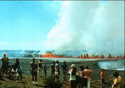
Ash, lava erupt from crater
by Erin Miller
Reprinted from the West Hawaii Today

Tuesday, March 25, 2008 8:08 AM HST
Ash started spewing continuously from Halemaumau Crater Monday following a small eruption Sunday evening, the Hawaiian Volcano Observatory reported Monday afternoon.

"It is significant," Park Ranger Mardie Lane said. "It's a huge ash plume."

The ash is flowing from a new gas vent in the crater, and turned the fume cloud, which previously was white, to a "dusty-brown color," Scientist-in-Charge Jim Kauahikaua said in a prepared statement.
Sunday evening, incandescent particles were seen erupting from the vent below the Halemaumau Overlook; some of the particles were ejected with enough force to be deposited on the rim of the crater, HVO said. Geologists found Pele's hair, Pele's tears and spatter in the overlook area, signs of the first molten lava to erupt from the vent, which is now about 100 feet wide. It is also the first lava to erupt anywhere in Halemaumau since 1982. The largest fragments of spatter were about 4 inches.

The exact significance of the ash plume and changes in emissions levels is something scientists are studying, Mayor Harry Kim said.

"I asked that question, too," said Kim, who is also the acting Hawaii County Civil Defense administrator. "The

answer so far is, we don't know. This is the first time Halemaumau has emitted this amount of sulfur dioxide. The scientists are trying to make an assessment of what's happening."

Kim said a variety of county, state and federal agencies are working together to collect data from the new vent, to determine which warnings need to be issued to county residents. He reminded residents to be watchful of the vog, adding that sulfur dioxide levels could be elevated from normal without the telltale vog cloud, however.


An air space safety warning was issued for private and commercial aircraft, alerting pilots to the possibly safety hazards because of the emissions, Kim said.

Members of the Hawaii National Guard's 93rd Civil Support unit were at the park Monday, helping county agencies measure sulfur dioxide emissions levels at the vent, as well as in other areas affected, Lt. Col. Trey Johnson said.

The team is conducting "hazard and risk assessments, identifying debris, and the location of sulfur dioxide emitting from the lava flow," Johnson said. "It's designed to get some tangible readings in accurate, real time."

The data will be put into a program that, based upon current weather conditions, can show where the plume will drift. Members of the unit also hope to install five permanent monitors near the vent, to help to continue to track emissions, Johnson said.


For more information on seeing the lava or touring Hawaii VOlcanoes National Park, visit www.tourguidehawaii.com.

Weekly Volcano Watch

Something had to change after 25 years


Reprinted from the USGS website.


The Halema`uma`u gas plume at sunrise. March 15, 2008.

2008 will be known as the year that Kilauea Volcano had a mid-life crisis. After 25 years of almost continuous, effusive eruption from its east rift zone, an incandescent gas vent mysteriously appeared in Halema`uma`u Crater sometime on March 11 or 12, and exploded early on the morning of March 19, 2008.

Now that it happened, we are looking back to see whether we missed any precursors to the explosion. We're also trying to piece together exactly what happened. Here's what we know so far:

The event started at 2:55 a.m. with a few seismic events that were either small earthquakes, very small explosions, rockfalls, or a combination of all three. At 2:56 a.m., the steady incandescence of rocky rubble covering the top of the gas vent started to founder. At 2:58 a.m., a second series of even larger explosive earthquakes began.

At 2:59 a.m., the newly opened vent started to vibrate strongly at a frequency too low to hear but recorded by instruments operated by our colleagues at the Infrasound Laboratory of the University of Hawai`i at Manoa. Their sensors detect infrasound, or acoustic energy, that travels through the air. Seismic energy traveling through the ground was also recorded by our seismometer network as increased tremor.

At 3:02 a.m., HVO's automatic earthquake-location software concluded that the combination of energy from the earthquakes and explosions was a magnitude-3.7 earthquake in the upper east rift zone and posted that to our Web site. Several hours later, when an analyst had a chance to look at the signals, he realized that the vibrations were explosions, not earthquakes, and our Web site was updated.

At first light on March 19, scientists rushed to the rim of Halema`uma`u and found the nearby area scattered with angular rock debris that was coarser and thicker closer to the vent. Not surprisingly, the rock debris lay directly beneath the gas plume from the new vent. And that's not all! Some folks in Pahala and Wood Valley found their cars covered with a light coating of fine white grit 30 km (19 miles) downwind probably courtesy of this early-morning Halema`uma`u explosion.

Debris blanketing the area was composed of rock fragments blasted from Halema`uma`u Crater, probably from the rubble pile covering the gas vent. Many of the rock fragments were too hot to touch more than 5 hours after the explosion. But there was no lava. This was an explosive eruption that blasted out old rocks.

The largest rock observed on the rim of Halema`uma`u above the new gas vent was about 90 cm (2.6 ft) in average dimension. Assuming typical rock densities, that rock weighed about 2,000 kg (2.7 tons), and the explosion was powerful enough to propel it more than 72 m (230 feet) into the air!

We are still gathering details and trying to deduce the exact nature of the explosion. One explanation that HVO scientists are discussing is a "throat clearing" hypothesis. In this scenario, hot gas coming up along the east wall of Halema`uma`u Crater progressively undermined the overlying rubble and created an open conduit underneath. Early Wednesday morning, the surface rubble layer collapsed into the underlying open conduit and temporarily blocked gas from escaping. Pressure built up and, two minutes later, reached a level that blasted the rubble from the gas conduit.

Science is a process of asking questions, and the above hypothesis has raised many. The biggest question is whether pressure can build to explosive levels in only two minutes. Another is whether an explosion could happen at all without involving water that explosively flashes into steam as it did during the last series of explosive Kilauea eruptions in 1924.

Once we feel confident that we understand what happened on March 19, we will be able to assess whether future explosive eruptions are likely. Right now, we cannot rule them out.

Activity update

Kilauea summit and Pu`u `O`o are slowly deflating. Seismic tremor levels at the summit are elevated to nearly moderate levels. Summit sulfur dioxide emission rates have remained elevated at nearly 10 times background levels since early January 2008. Earthquakes were located primarily beneath the general summit area, the southwest rift zone, and the south flank faults.

Lava from the 2007 Thanksgiving Eve Breakout (TEB) flow, erupting from fissure D of the July 21 eruption, continues to flow through what remains of the Royal Gardens subdivision and across the coastal plain. On Wednesday, March 5, the flow entered the ocean in the vicinity of Kapa`ahu. The Waikupanaha delta has since grown to a width of about 1,000 m (3,280 ft) and has multiple entry points. On March 15, another branch of the flow reached the ocean farther to the east, within a few hundred meters of the lava viewing area. As of Thursday, March 20, both the Waikupanaha and Ki entries remained active, though the Waikupanaha entry is far more vigorous.

The public should be aware that the ocean entry areas could collapse at any time, potentially generating large explosions in the process. The steam clouds rising from the entry areas are highly acidic and laced with glass particles. Do not venture onto the lava deltas. Even the intervening beaches are susceptible to large waves suddenly generated during delta collapse; these beaches should be avoided. Check the County of Hawai`i Civil Defense website (http://www.lavainfo.us) for information on public access to the coastal plain and ocean entry.

In the past week, sporadic breakouts, some large enough to form channelized `a`a flows, have burst from the lava tube on the steep slopes within the Royal Gardens subdivision. A few of these have reached the base of the pali before stalling. Other breakouts have been spotted at the top of the pali near the upper boundary of the Royal Gardens subdivision. Closer to the TEB vent, an area of persistent breakouts on the northeast side of the shield complex also continues to produce small flows. These northeast-directed flows are restricted to a broad, flat area on the south side of Kupaianaha.

Weak incandescence has been intermittently observed at night in Pu`u `O`o in the past week. As in years past, Pu`u `O`o likely is serving as a large chimney, beneath which lava is briefly stored and substantially degassed on its way to the eruption site.

On March 11, a new fumarole appeared low on the southeast wall of Halema`uma`u Crater, within Kilauea's summit caldera. The new vent is located directly beneath the Halema`uma`u Overlook about 70 m (230 ft) down. Incandescence could be seen at this vent, starting on March 13, and, by March 18 incandescence had grown to cover an area about 30 m (98 ft) across. At 2:58 a.m. on March 19, a small explosion occurred from this fumarole. The explosion scattered rock debris over an area of about 75 acres, covering a narrow section of Crater Rim Drive, the entire Halema`uma`u parking area, and the trail leading to the overlook. The overlook was damaged by rocks that reached up to 90 cm (3 ft) across. No lava was erupted as part of the explosion, suggesting that the activity was driven by hydrothermal or gas sources. The new explosion pit continues to glow at night, with incandescence reflecting on the fume emitted from the vent.

Sulfur dioxide (SO2) emission rates from the summit area have been substantially elevated at 2-10 times background values since early January. During these conditions, SO2 concentrations frequently exceed 1 ppm for much of Crater Rim Drive between Halema`uma`u parking lot and the southwest rift zone. SO2 concentrations exceed 20 ppm for approximately 200 m (650 ft) of the road between the Halema`uma`u parking lot and the south caldera pullout.

The increase in sulfur dioxide emission rates at the summit means that SO2 concentrations are much more likely to be at hazardous levels for visitor areas downwind of Halema`uma`u, especially during weak wind conditions or when winds blow from the south. Most people are sensitive to sulfur dioxide at these levels, especially children, individuals with asthma, chronic obstructive pulmonary disease (COPD), or other breathing problems. Stay informed about SO2 concentrations in continuously monitored areas (Jaggar Museum and Kilauea Visitor Center) by visiting the Kilauea Visitor Center and the web at:
http://www2.nature.nps.gov/air/webcams/parks/havoso2alert/havoalert.cfm. To minimize these potentially harmful effects, the Hawai`i Volcanoes National Park has closed all access to the southern half of Kilauea caldera.

Two earthquakes beneath Hawai`i Island were reported felt within the past week. A magnitude-3.4 earthquake occurred at 2:22 a.m., H.s.t., on Friday, March 14, 2008, and was located 6 km (4 miles south of Mauna Loa summit at a depth of 3 km (2 miles). A magnitude-2.4 earthquake occurred at 2:28 p.m. on Saturday, March 15, and was located 2 km (1 mile) northwest of Pahala at a depth of 13 km (8 miles).

Mauna Loa is not erupting. One earthquake was located beneath the summit. The rate of extension between locations spanning the summit, indicating inflation, has decreased to values below current detection limits.

For complete information on visiting and touring the volcano, visit www.tourguidehawaii.com.


Monday, March 24, 2008

Mo'okini Heiau: Warrior Kings and Human Sacrifice on Hawai'i


Narrated by Frank Burgess; Produced by Donnie MacGowan;
Brought to you by Tour Guide--Our GPS Tours put Hawaii at Your Fingertips!

Have you ever seen anywhere as stark, impressive, primitive and ancient, yet still able to raise the hackles on your neck? Here, untold thousands of people were sacrificed to worship a new god, the war god Ku. Mo'okini Heiau stands today at the north end of Hawai'i, the well preserved remains of a terrible luakini heiau built by the powerful Tahitian kahuna Pa'ao in the 11th or 12th century. This heiau was the first temple of human sacrifice in Hawai'i and the first site in Hawai'i to be preserved as a National Historic Landmark under the Historic Sites Act of 1935. Mo'okini Heiau is now part of Lapakahi State Historic Park; as Mo'okini is an active Heiau and visitors are reminded to stay away if religious observances are being celebrated.

Built on the site of a much smaller heiau, Mo'okini Heiau (lit. "many lineages") is said to have been raised in one night by as many as 15,000-20,000 men passing stones hand to hand from Pololu Valley, 14 miles distant.

Born nearby, Kamehameha the Great was brought to this heiau for his birth rituals.

To reach the enormous but especially well-preserved heiau, drive to near the 20-mile marker and turn onto the road to the Upolu Airport, heading left past the airport at about 2 miles. The unpaved section of the next 1.6 miles of road may require 4WD, but at any rate, one must park at the gate and walk 5 minutes to the heiau. The heiau itself is impressively large, 270 feet long by 140 feet wide by as much as 30 feet high.

This dirt road goes all the way (about 4 miles) to the old Coast Guard Loran Lookout and makes a wonderful beginner's mountain biking trip, especially considering the amazing historical sites along the way.

During the 11th century, warlike Tahitians arrived in the Hawai'ian Islands, conquering, enslaving, sacrificing and largely displacing the descendants of the original Marquesan settlers. Into this bloody landscape came Pa'ao, the terrible and powerful Tahitian kahuna who was affronted at the lack of respect the Hawai'ian Ali'i commanded and at the apparent weakness of the Hawai'ian gods. He sent back to Tahiti for the warrior chief Pili and together they brought worship of the powerful war god Ku to Hawai'i and strengthened the kapu system of laws and power of the Ali'i.

Worship of Ku demanded human sacrifice, which was performed at luakini heiau throughout the parts of Polynesia where Ku was venerated. Pa'ao caused Mo'okini Heiau to be constructed on the site of a previous, smaller heiau, of stones passed hand over hand from Pololu Valley. During this process, if a stone were dropped it was left where it lay to preserve the rhythm of passing; the scattered line of dropped stones can be followed all the way back to Pololu to this day.

The alter stones were brought by war canoe from Pa'ao's home heiau of Taputapuatea (lit. sacrifices from abroad), the most powerful and most feared heiau in Polynesia and the center of Ku worship. Boulders for cornerstones brought hundreds of miles across the sea from Taputapuatea were laid with human sacrifices
Beneath and gave this heiau a formidable power and the air of menace and despair that clings to it to the site to this day.

Outside the heiau walls can be found a large phallic rock and a flat stone with a cup-like depression near the top. Here, on this holehole stone, the baked bodies of human sacrifices were stripped of flesh and the bones saved to be rendered into fishhooks and dagger blades. Not much mention of the fate of the human flesh from these sacrifices is made, but it is universally documented that Polynesians everywhere were cannibals. This is a topic that is very difficult for the modern descendants of these people to come to grips with and one which is best simply accepted and not commented or speculated upon.

There is no counting the tens of thousands of Hawai'ians who were made sacrifice here on this stone at barren, terrible Mo'okini over the centuries, but the sacrificial victims were all gathered by a class of kahuna called the Mu, or "body catcher"; the foundation of the dwelling of the Mu can still be found among the ruins of Mo'okini.

There are no services in the vicinity of Mo'okini Heiau, whatsoever.

For more information, visit here and here.

Sunday, March 23, 2008

Today's Weather in Paradise

Point Forecast: Kailua Kona HI
19.63N -156W (Elev. 0 ft)
Last Update: 4:45 am HST Mar 23, 2008
Forecast Valid: 7am HST Mar 23, 2008-6pm HST Mar 29, 2008


Forecast at a Glance
Today

Chance Showers Chance for Measurable Precipitation 30%
Chance
Showers
Hi 80°F
Tonight

Isolated Showers Chance for Measurable Precipitation 20%
Isolated
Showers
Lo 71°F
Monday

Isolated Showers Chance for Measurable Precipitation 20%
Isolated
Showers
Hi 80°F
Monday
Night

Isolated Showers Chance for Measurable Precipitation 20%
Isolated
Showers
Lo 71°F
Tuesday

Isolated Showers Chance for Measurable Precipitation 20%
Isolated
Showers
Hi 80°F
Tuesday
Night

Isolated Showers Chance for Measurable Precipitation 20%
Isolated
Showers
Lo 71°F
Wednesday

Isolated Showers Chance for Measurable Precipitation 20%
Isolated
Showers
Hi 80°F
Wednesday
Night

Slight Chance Showers Chance for Measurable Precipitation 20%
Slight Chc
Showers
Lo 71°F
Thursday

Slight Chance Showers Chance for Measurable Precipitation 20%
Slight Chc
Showers
Hi 80°F

Detailed text forecast
Today: Scattered showers, mainly after noon. Partly cloudy, with a high near 80. Northwest wind around 9 mph. Chance of precipitation is 30%.

Tonight: Isolated showers. Partly cloudy, with a low around 71. East wind around 9 mph. Chance of precipitation is 20%.

Monday: Isolated showers. Partly cloudy, with a high near 80. Northwest wind around 9 mph. Chance of precipitation is 20%.

Monday Night: Isolated showers. Partly cloudy, with a low around 71. East wind around 9 mph. Chance of precipitation is 20%.

Tuesday: Isolated showers. Partly cloudy, with a high near 80. Northwest wind around 10 mph. Chance of precipitation is 20%.

Tuesday Night: Isolated showers. Partly cloudy, with a low around 71. East wind around 10 mph. Chance of precipitation is 20%.

Wednesday: Isolated showers. Partly cloudy, with a high near 80. Northwest wind around 10 mph. Chance of precipitation is 20%.

Wednesday Night: A 20 percent chance of showers. Partly cloudy, with a low around 71. East wind around 9 mph.

Thursday: A 20 percent chance of showers. Partly cloudy, with a high near 80. Northwest wind around 9 mph.

Thursday Night: A 20 percent chance of showers. Partly cloudy, with a low around 71. East wind around 9 mph.

Friday: A 20 percent chance of showers. Partly cloudy, with a high near 80. Northwest wind around 8 mph.

Friday Night: A 20 percent chance of showers. Partly cloudy, with a low around 71. East wind around 8 mph.

Saturday: A 20 percent chance of showers. Partly cloudy, with a high near 80. Northwest wind around 9 mph.

For more information on weather, go here;
for more information on touring the Big Island,
go here and here.
 

Casino Bonus no Deposit