Friday, October 9, 2009

Frank's Hawaii Travel Hints #9: Made for Adventure: The Jungles, Volcanoes, Hot Springs and Tidepools of Puna!

Frank's Big Island Travel Hints #9: Made for Adventure: The Jungles, Volcanoes, Hot Springs and Tidepools of Puna!
by Frank Burgess, brought to you by Tour Guide Hawaii

Tour Guide Hawaii is proud to announce the release of their new iPhone and iPod Touch App available at iTunes...this App will help you plan your trip to Hawaii, help you decide what you want to see, how you want to see it and help you get there with GPS, interactive maps and on-board driving instructions. The Tour Guide App presents hours of interesting videos and information about places of historical, cultural and recreational interest, giving you a sense of the people, the natural history and the unique specialness of each destination. The information is so comprehensive and complete they even tell you where all the public restrooms are! What else will Tour Guide help you find? Let's look at a trip north from Kona along the Hawaii Belt Road to the Waikoloa area...Tour Guide will not only help you find many amazing sights along the way, it will tell you all about them, what to take and what to expect.

Today's hints cover the area from McKenzie State Park in Puna District back to Kona. Driving along the Puna Coast, through recent lava flows and ageless jungle, through Ka'u and into Puna there several fantastic places to stop and explore, but there is also a lot of lovely, open countryside for several miles, so enjoy the panoramic views. Your Tour Guide download from iTunes will give you more detailed information about this area.

Deeper into mysterious Puna!

As you continue along the coast road, you will next encounter McKenzie State Park. Here the Ironwood trees create an unusual ambience of a pine tree forest. The sheer cliffs and majesty of the ocean beg for photographing. Swimming would be near impossible here, but the hiking is spectacular. Tour Guide will give more information about this other- worldly park. A permit is required for camping and the facilities are a bit run down, but it is secluded, private andbeautiful.

Not far away is Kahena Beach. This beautiful black sand beach involves a bit of a scamper to get down the cliff, but is well worth the effort. Tour Guide will give you the easiest path to take. You may notice that this beach is “clothing optional”, thus it’s popularity. Swimming here is good, but currents can be strong if you get too far from shore.

Drive just a few miles further and you come to what used to be the town of Kalapana. Kalapana and Royal Gardens were destroyed in the lava flows during the late1980’s.

What remain are a few homes and businesses where the road now ends. From here one can see the plume of smoke coming from the vent upslope. Sometimes the lava reaches the ocean about 2 miles from this spot.

A short five minute hike will bring you to Kaimu Beach, the newest black sand beach on the island. Tour Guide will give you the rich history of the ancient fishing villages that were here and the touching stories about the palms at Kaimu Beach.

Heading back from Kalapana, you will want to take Highway 130 toward Pahoa. This is your best chance of watching Kilauea erupt. Just a few hundred yards north of Kalapana, is the old turn off to Royal Gardens. This is now the official County of Hawaii Lava Viewing Site. Drive as far as the attendants will allow you, park and walk into where you can safely view the lava flowing into the ocean. Daily updates on the volcano and conditions at site are available at the Hawaii County Lava Viewing Desk, phone number 808.961.8093; more information is here and here.

Farther along the highway to Pahoa, you will see a “scenic turnout” where you can view the Puna Geothermal Vents. Here a company has tapped the natural steam to create electricity from these fumaroles. Tour Guide will show you how, with a short hike off the road, and you can sit in one of these natural sauna vents for some real relaxation.

Now you’re ready to head back to Kona. Take Highway 130 to Highway 11 and go south. If time permits, you may want to stop in Volcano Village, just off the highway, for some food, gasoline, shopping or maybe even some wine tasting. This may be the last gasoline available until you get back to Kona. Find your hotel in your Tour Guide and get turn-by-turn directions right to the door.

To see the new iPhone/iPod Touch App, please visit http://www.tourguidehawaii.com/iphone.html. The best of Tour Guide Hawaii's free content about traveling to, and exploring, the Big island, can be found here. For more information on traveling to Hawaii in general and on touring the Big Island in particular, please also visit www.tourguidehawaii.com and www.tourguidehawaii.blogspot.com.

Copyright 2009
by Frank Burgess; photography copyright 2009 by Donald B. MacGowan. All rights reserved.

Thursday, October 8, 2009

Frank's Big Island Travel Hints #8: Mysterious Puna!

Frank's Big Island Travel Hints #8: Mysterious Puna!
by Frank Burgess, brought to you by Tour Guide Hawaii


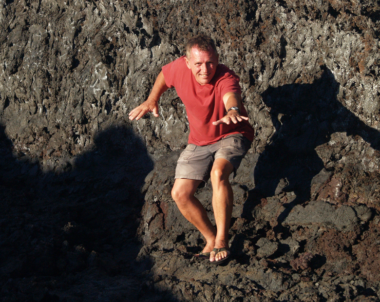
Frank Burgess lava surfing at Muliwai O Pele, Hawai Volcanoes National Park: Photo by Donnie MacGowan

Tour Guide Hawaii is proud to announce the release of their new iPhone and iPod Touch App available at iTunes...this App will help you plan your trip to Hawaii, help you decide what you want to see, how you want to see it and help you get there with GPS, interactive maps and on-board driving instructions. The Tour Guide App presents hours of interesting videos and information about places of historical, cultural and recreational interest, giving you a sense of the people, the natural history and the unique specialness of each destination. The information is so comprehensive and complete they even tell you where all the public restrooms are! What else will Tour Guide help you find? Let's look at a trip north from Kona along the Hawaii Belt Road to the Waikoloa area...Tour Guide will not only help you find many amazing sights along the way, it will tell you all about them, what to take and what to expect.

Today's hints cover the area from Kona to Puna District. Driving south along the Kona Coast, through Ka'u and into Puna there several fantastic places to stop and explore, but there is also a lot of lovely, open countryside for several miles, so enjoy the panoramic views. Your Tour Guide download from iTunes will give you more detailed information about this area.

Exploring Mysterious Puna...

For your next day of driving, let’s go south on Highway 11 headed for the Puna District. Leave early and expect to get back just after dark because this area is furthest from Kona and contains some of the most beautiful, yet hidden, wonders on the Big Island. It is from Puna that, currently, the only up-close viewing of flowing lava is possible. You may want to pack a cooler for this day trip.

As you’re passing through Kainaliu, just south of Kona, a quick stop at Kona Joe’s Coffee Plantation, for some great Kona Coffee, will jump start your day. See their ad in the sponsors section in your Tour Guide. If you are driving straight to Puna, plan on about 3½ hrs drive time to get to the first sights in this discussion. If you have missed any sights that you wanted to see on the southern route, refer to Frank’s Travel Hints #1 and #2 and catch them on the way...just don't forget to allow for extra time.

Along the way you will pass Hawaii Volcanoes National Park. This is a fascinating place and not to be missed, but we will reserve discsussing it for as a full day trip in a later post.

The first turn is about 20 minutes past the park entrance at the town of Kea’au. Look for the stop light on the highway and the Highway 130 sign. The Kea’au Shopping Center has some great places to eat, like Paradise Bar and Grill, and is a good restroom break.

The first stop, in the Puna district, is the town of Pahoa. You will think you have just stepped back into the Wild West as Pahoa has a unique atmosphere like nowhere else on the island. Cute shops, and a great farmer’s market on Sundays, lends to picture taking and shopping. Tour Guide will suggest that parking is easiest at the Community Pool just a block from downtown, and there are public restrooms here.

Continue driving further into Puna on Highway 132 through the lovely tree tunnels to a magical stop at Lava Trees State Park. This gorgeous rainforest park is filled with birds and tropical plants and flowers. What makes this park so intriguing is the lava trees. Tour Guide will tell you how old lava flows surrounded the trees, leaving spires of hardened lava, giving it an eerie look. There are trails for hiking and bird watching is spectacular. This is also a good place for a restroom break as it will be a good while before the next restrooms are available. Highway 132 leads you to Highway 137, the Kapoho-Kalapana Road--the only road in America that is named for two towns buried by a volcano.

Turning toward Kapoho on Highway 137, the next stop is the Kapoho Tide Pools where you can experience great shoreline shell collecting and fantastic snorkeling amongst vibrant corals and tropical fish in protected tidepools. Though hard to find on your own, Tour Guide again knows the way to this secluded sanctuary and ancient village. Port-a-potties and showers are the only facilities here.

Just a few miles down Highway 137 is Ahalanui Hot Pond. This tropical park is centered around a hot spring that mixes with ocean water to create one of the most relaxing and soul recharging oases anywhere. Tour Guide gives you the history of what this area meant to the ancient Hawaiians. Picnicking, hiking, swimming and “expert only” surfing are some of the things to do here. There are restrooms, showers and water available also.

As you continue along the coast road, you will next encounter McKenzie State Park. Here the Ironwood trees create an unusual ambience of a pine tree forest. The sheer cliffs and majesty of the ocean beg for photographing. Swimming would be near impossible here, but the hiking is spectacular. Tour Guide will give more information about this other- worldly park. A permit is required for camping and the facilities are a bit run down.

Not far away is Kahena Beach. This beautiful black sand beach involves a bit of a scamper to get down the cliff, but is well worth the effort. Tour Guide will give you the easiest path to take. You may notice that this beach is “clothing optional”, thus it’s popularity. Swimming here is good, but currents can be strong if you get too far from shore.

Highway 137 used to become the Chain of Craters Road in Hawaii Volcanoes National Park, but it has been cut by several miles of intervening lava flows. Today, it ultimately ends at Highway 130, the road back to Kea'au and the Hawaii Belt Highway. At the intersections of Highways 137 and 130 are the remnants of the town of Kalapana, buried in the 1960 eruption of Kilauea. Tour Guide will tell you all about the eruption, the heroic recovery efforts, and lead you on a brief hike to Kaimu Black Sand Beach, the newest beach on the Island of Hawaii. From the end of the road you can frequently see the both the eruption cloud over Pu'u O'o Vent and the steam plume where lava is entering the ocean, both several miles distant. At night, the glow from streams of lava pouring down the pali can sometimes be seen from here. Although hiking to the lava can be an experience to cherish, it is dangerous and hard work. The best, and most consistent, viewing is by taking an air tour, such as Big Island Air or Paradise Helicopter Tours.

Heading back from Kalapana, you will want to take Highway 130 toward Pahoa and Kea'au, you pass the famous "Painted Church". Tour Guide can tell you the history of this fascinating place. Just a little farther north is the intersection of Highway 130 with the road to Royal Gardens Estates, which currently leads to the Hawaii County-maintained lava viewing area. Call the Lava Hotline at 808.961.8093 for current eruption updates, lava viewing information and times of road openings and closures. As you continue towards Kea'au you will pass the Steam Rooms--a field of steam vents in small craters where locals go to take steam baths. Tour Guide has information on finding these craters and how to safely enjoy the wonders of natural, volcanic steam baths.

Upon returning to the Hawaii Belt Highway at Kea'au, one can proceed in either direction back to Kona, north through Hilo, a bit shorter and faster, or west through Hawaii Volcanoes National Park which, though longer, is much more scenic. If time permits, you may want to stop in Volcano Village, just off the highway, for some food, gasoline, shopping or maybe even some wine tasting. This may be the last gasoline available until you get back to Kona as it is many times hard to find an open gas station in the rural part of Hawaii Island after dark. Find your hotel in your Tour Guide and get turn-by-turn directions right to the door.

To see the new iPhone/iPod Touch App, please visit http://www.tourguidehawaii.com/iphone.html. The best of Tour Guide Hawaii's free content about traveling to, and exploring, the Big island, can be found here. For more information on traveling to Hawaii in general and on touring the Big Island in particular, please also visit www.tourguidehawaii.com and www.lovingthebigisland.wordpress.com.

Copyright 2009
by Frank Burgess; photography copyright 2009 by Donald B. MacGowan. All rights reserved.

Wednesday, October 7, 2009

Volcano Watch: Ancient Hawaiians: Plenty of Oars but No Ores

Reprinted form here.

Ancient Hawaiians: Plenty of Oars but No Ores

A September 25, 2009 photo showing Pu`u `Ō `ō fuming in the foreground (note the dense white fume from a vent in the east wall) and Halema`umau fuming in the distance.
A September 25, 2009 U.S.G.S. photo showing Pu`u `Ō `ō fuming in the foreground (note the dense white fume from a vent in the east wall) and Halema`umau fuming in the distance.

Most accounts of Captain Cook's first arrival in Hawai`i describe the Hawaiians' fascination with metal objects. The crew soon found that an iron nail could be traded for any number of goods or services. The fascination with metal stemmed from its novelty. Although Hawaiians had encountered metal before Cook arrived—either from other European ships or from debris washed ashore—it was, at best, exceedingly rare.

Naturally occurring or "native" metals, such as gold, silver, and copper are rare anywhere on earth, and are beyond rare in Hawai`i—they don't exist. Nickel-iron meteorites are also rare everywhere, but Hawai`i has an equal opportunity to receive them. So it's possible that meteoric iron was known to the ancient Hawaiians.

Though native metal is rare, metal combined with other elements is as common as rock itself. For example, about one-third of Hawaiian basalt is iron oxide, aluminum oxide, and calcium oxide, in roughly equal proportions.

To obtain metal in quantity, however, it must be smelted—separated from the other elements with which it is combined. To be suitable for smelting, a rock must contain a much higher proportion of a single metal-bearing mineral than would be found in common rock. Rocks suitable for smelting are called ores.

Many different mineral-concentrating processes are known to produce ore deposits. Placer deposits form when weathering releases mineral grains from rocks and flowing water segregates the minerals according to their densities. Minerals with high densities—most ore minerals—will tend to stay put while less dense minerals are carried away by the current. Placer deposits thus form along streams, rivers or the sea shore. The mineral olivine, heavy but not an ore mineral, was concentrated in this way to form the Green Sand Beach.

Some ores are produced in association with large intrusions of basalt—great blobs of magma that are injected into the earth's crust but that don't reach the surface. Instead they slowly cool deep underground. The slow cooling allows mineral grains to grow and to rise if they are less dense than the magmatic liquid or to sink if they are more dense than the liquid. The dense ore minerals collect in layers on the bottom of the intrusion. Essentially, all of the world's chromium ores and some platinum, nickel, and copper ores formed in this fashion.

Other ores are produced around the roots of volcanoes, where magma gives off heat, chemical-rich solutions, and vapors to surrounding rocks. These products mix with the groundwater-the water found in fractures and cavities in the rock virtually everywhere. The hot mixture is less dense than normal ground water so it migrates upward through fractures. The hot solutions can selectively dissolve low-concentration minerals contained in the country rock. As this witch's brew rises it cools and experiences a pressure reduction. The temperature and pressure reduction reduces the solubility of the various dissolved substances until they eventually crystallize on the fracture surfaces. In this way, metallic minerals that were in low concentrations in the country rock can become highly concentrated in the fractures to form veins. Vein ores yield copper, lead, zinc, gold, silver, tin, and other metals.

Given that ores are commonly associated with igneous processes—that is, with volcanism and magmatic intrusions—you might expect Hawai`i to have some metallic ores. But in fact, ore deposits are unknown in Hawai`i. This may be because they never formed, because they are just not exposed at the surface, or because they have not yet had time to form. Deep erosion is required to bring to the surface ores formed at great depths. So if metallic ore exists within Hawaiian volcanoes, erosion has not been deep enough to bring it to the surface.

The Hawaiians had learned to exploit wood, fiber, stone, and bone to the fullest, so why hadn't they developed the ability to mine, smelt, and work metals? Well, you can't exploit a non-existent resource. "Paradise" didn't come equipped with the raw material to produce metals.

Kīlauea Activity Update

Lava continues to erupt from the TEB vent, on Kīlauea's east rift zone and flow through tubes to the ocean at Waikupanaha. A small lava breakout on the rootless shield complex was active for a few days this week, but has now stagnated. A lava breakout from the tube near the top of the Royal Gardens subdivision has been active throughout the past week. The flows are mostly staying close to the breakout point and are building a broad shield-shaped mound of lava.

Faint glow above the vent at Kīlauea's summit has been visible at night. Volcanic gas emissions remain elevated, resulting in high concentrations of sulfur dioxide downwind.

Two earthquakes beneath Hawai`i Island were reported felt this past week. A magnitude-2.5 earthquake occurred at 5:56 a.m., H.s.t., on Monday, September 21, 2009, and was located 9 km (6 miles) northeast of Waiki`i at a depth of 26 km (16 miles). A magnitude-2.3 earthquake occurred at 7:28 a.m. on the same day and was located in the same area at a depth of 25 km (16 miles).

Visit our Web site (http://hvo.wr.usgs.gov) for detailed Kīlauea and Mauna Loa activity updates, recent volcano photos, recent earthquakes, and more; call (808) 967-8862 for a Kīlauea activity summary; email questions to askHVO@usgs.gov.

For all the information you need about seeing Hawaii's volcanoes, including everything from viewing flowing lava to touring Hawaii Volcanoes National Park or getting to the top of Mauna Kea, please see Tour Guide Hawaii's new iPhone/iPod Touch application here. For more information about traveling to Hawaii in general and visiting the Big Island in particular, please also see www.tourguidehawaii.com and www.tourguidehawaii.blogspot.com.

Tuesday, October 6, 2009

Frank's Big Island Travel Hints #7: Hilo Side: Akaka Falls to Panaewa Rainforest Zoo

Frank's Big Island Travel Hints #7: Hilo Side: Akaka Falls to Panaewa Rainforest Zoo
by Frank Burgess, brought to you by Tour Guide Hawaii


Tour Guide Hawaii is proud to announce the release of their new iPhone and iPod Touch App available at iTunes...this App will help you plan your trip to Hawaii, help you decide what you want to see, how you want to see it and help you get there with GPS, interactive maps and on-board driving instructions. The Tour Guide App presents hours of interesting videos and information about places of historical, cultural and recreational interest, giving you a sense of the people, the natural history and the unique specialness of each destination. The information is so comprehensive and complete they even tell you where all the public restrooms are! What else will Tour Guide help you find? Let's look at a trip north from Kona along the Hawaii Belt Road to the Waikoloa area...Tour Guide will not only help you find many amazing sights along the way, it will tell you all about them, what to take and what to expect.

Today's hints cover the area from Akaka Falls to Hilo Town. Driving south along the Hamakua Coast there several fantastic places to stop and explore, but there is also a lot of lovely, open countryside for several miles, so enjoy the panoramic views. Your Tour Guide download from iTunes will give you more detailed information about this area.

On your way back to the highway from Akaka Falls, stop in Honomu for some local-style shopping and a snack. Handmade curios and ice creams will delight your senses. Once back on Highway 19, turn right toward Hilo, about 10 minutes away.

Hilo is one of the wettest cities in the U.S. averaging around 200 inches per year. This old-style Hawaii town is quaint and bustling. Lots of great shops line the waterfront drive and the largest farmer’s market on the island is situated there as well. Tour Guide will take you right into the heart of town and give you history and attractions, such as the Pacific Tsunami Museum, and the Imiloa Astronomy Center at the University of Hawaii, Hilo Campus. A little farther along the coast are some beautiful beach parks like Richardson and Onekahakaha. Great picnicking, swimming and some good snorkeling can be found here. The Suisan Fish Market is famous for the early morning old-style fish auction. Be sure to take your time in Hilo as the shopping food options are immense.

In Hilo, you will turn north onto Highway. 11 at the intersection near Ken’s Pancake House, a landmark eatery. You will see the airport and Prince Kuhio Plaza on your way out of town. Stop in and visit the mall and shop and eat if you missed it in town. Just a few miles north of the mall is the Panaewa Rainforest Zoo. Tour Guide will tell you how this is the only rainforest zoo in North America. It is also free.

Super Tip: Gasoline in Hilo is typically 6-10 cents per gallon cheaper because it is the main port on the island. It is wise to fill up before heading back to Kona.

This completes this drive day. I suggest returning north through Hilo and back up the Hamakua Coast, through Waimea, and Highway 190 back to Kona.

To see the new iPhone/iPod Touch App, please visit http://www.tourguidehawaii.com/iphone.html. The best of Tour Guide Hawaii's free content about traveling to, and exploring, the Big island, can be found here. For more information on traveling to Hawaii in general and on touring the Big Island in particular, please also visit www.tourguidehawaii.com and www.lovingthebigisland.wordpress.com.

Copyright 2009
by Frank Burgess; photography copyright 2009 by Donald B. MacGowan. All rights reserved.

Sunday, October 4, 2009

Frank's Big Island Travel Hints #6: Waimea and the Hamakua Coast

Frank's Big Island Travel Hints #6: Waimea and the Hamakua Coast
by Frank Burgess, brought to you by Tour Guide Hawaii

Tour Guide Hawaii is proud to announce the release of their new iPhone and iPod Touch App available at iTunes...this App will help you plan your trip to Hawaii, help you decide what you want to see, how you want to see it and help you get there with GPS, interactive maps and on-board driving instructions. The Tour Guide App presents hours of interesting videos and information about places of historical, cultural and recreational interest, giving you a sense of the people, the natural history and the unique specialness of each destination. The information is so comprehensive and complete they even tell you where all the public restrooms are! What else will Tour Guide help you find? Let's look at a trip north from Kona along the Hawaii Belt Road to the Waikoloa area...Tour Guide will not only help you find many amazing sights along the way, it will tell you all about them, what to take and what to expect.

Today's hints cover the area from Kona to Akaka Falls and Hilo, over the roof of Hawaii at Waimea along along the Justly famous Hamakua Coast. Driving north and east on Hwy 19 there several fantastic places to stop and explore, but there is also a lot of lovely, open countryside for several miles, so enjoy the panoramic views. Your Tour Guide download from iTunes will give you more detailed information about this area.

For a third day of driving, it’s time to explore the east side of the Big Island. Hilo is known to be one of the wettest cities in the U.S and tropical rainforest extends from the Puna district, south of Hilo, all the way to the northern tip of the island. Here, Tour Guide will show you the favorite sights and the out-of-the-way places as well.

Super tip: For this leg of your tour you should bring some rain gear. Umbrellas or panchos are the easiest ways to get a little protection. It tends to rain off and on throughout to day on the east side.

Leaving Kona, take Hwy 190 up the mountain for some panoramic views of the Kohala Coast. It’s about a 45 minute drive to Waimea, which is a good place to stop for breakfast or at the grocery store if you haven’t stocked your cooler already. Tour Guide will have all the info on museums, an arboretum as well as shopping and up-country activities in Waimea. Here you’ll also connect to Hwy 19.

Continue on Hwy 19 north and view the scenic rolling pasturelands of the Parker Ranch, one of the largest privately owned ranches in the U.S. About 20 minutes drive brings you to the town of Honoka’a. Turning left, and going through town, you’ll find more great shops, antique stores and restaurants. Nine miles on Hwy 240 brings you to Waipi’o Valley. This is one of the most photographed areas in the state. This 20 mile stretch between Waipi’o and Pololu is often called “Hawaii untouched”, boasting the largest waterfalls in the state, but can only be viewed by air tours or multi-day hikes. Tour Guide will tell you why this area was sacred to the ancient Hawaiians. You can also find out about air tours in Tour Guide’s activities section.

Head back toward Honoka'a Hwy 19 and turn southbound toward Hilo along the Hamakua Coast. This area was once all sugar cane fields but now many diversified agricultural crops are grown here. The first crop you will see is eucalyptus. Acres and acres of this fragrant tree yield sap for medicines and perfumeries all around the world. There is a rainforest preserve, Kalopa Park, just 3 miles upslope from the hwy. It’s tricky to find, but Tour Guide will show you the way to this peaceful cabin camp spot with horseback riding and bird watching.

As you continue driving south, you cross many bridges over gorges and valleys, many of which have viewable waterfalls and rivers that empty into the ocean. Don’t forget to stop and get some pictures this unique scenery. The terrain is lush and green with a huge variety of tropical flowers. Other crops also come into view such as mangoes, papayas, ginger and bananas. Tour Guide will tell you about the trains that used to transport sugar cane to the mills near Hilo and you can stop and see the train museum along the way.

Next up is one of the most famous and beautiful waterfalls in Hawaii, Akaka Falls, a 420 ft. fall, which is just 3 miles off the hwy, but worlds away. The one mile hike on a paved trail through the rainforest will pass two smaller waterfalls as well as orchid, heleconia, plumeria and other tropical plants. Tour Guide will tell the history of this area as well.

To see the new iPhone/iPod Touch App, please visit http://www.tourguidehawaii.com/iphone.html. The best of Tour Guide Hawaii's free content about traveling to, and exploring, the Big island, can be found here. For more information on traveling to Hawaii in general and on touring the Big Island in particular, please also visit www.tourguidehawaii.com and www.lovingthebigisland.wordpress.com.

Copyright 2009
by Frank Burgess; photography copyright 2009 by Donald B. MacGowan. All rights reserved.


Saturday, October 3, 2009

Frank's Big Island Travel Hints # 5: Hawi to Kona, via Kohala Mountain Road, Waimea and Waikoloa

Frank's Big Island Travel Hints # 5: Hawi to Kona, via Kohala Mountain Road, Waimea and Waikoloa
by Frank Burgess, brought to you by Tour Guide Hawaii

Frank Burgess Filming at Hilina Pali Overlook: Photo by Donnie MacGowan
Frank Burgess at Hilina Pali Overlook: Photo by Donnie MacGowan

Tour Guide Hawaii is proud to announce the release of their new iPhone and iPod Touch App available at iTunes...this App will help you plan your trip to Hawaii, help you decide what you want to see, how you want to see it and help you get there with GPS, interactive maps and on-board driving instructions. The Tour Guide App presents hours of interesting videos and information about places of historical, cultural and recreational interest, giving you a sense of the people, the natural history and the unique specialness of each destination. The information is so comprehensive and complete they even tell you where all the public restrooms are! What else will Tour Guide help you find? Let's look at a trip north from Kona along the Hawaii Belt Road to the Waikoloa area...Tour Guide will not only help you find many amazing sights along the way, it will tell you all about them, what to take and what to expect.

Today's hints cover the area from Hawi to Waimea along along the fabulous Kohala Mountain Road and then down to Waikoloa. Driving north on Hwy 11 there several fantastic places to stop and explore, but there is also a lot of lovely, open countryside for several miles, so enjoy the panoramic views. Your Tour Guide download from iTunes will give you more detailed information about this area.

Driving south on Hwy 270, just past the town of Hawi, you will see the turn off for Hwy 250 on the mountain side of the road. This hwy will take you over Kohala Mountain to the town of Waimea. This hwy is rated by AAA Travel as one of the top 10 most scenic highways in the U.S. Along the way you will pass through beautiful pasture lands, areas for horseback riding, ranch style dinners, ATV tours and Hummer tours. Tour Guide will give the history of this area as well as activities offered here.

At the other end of Hwy 250 is Waimea. This town is known for the paniolo, the Hawaiian word for cowboy, and the Parker Ranch. At 3500 ft elevation, the cooler climate is perfect for growing all sorts of fruits and vegetables as well as a variety of livestock. There are also some fabulous restaurants featuring some of the best chefs in the world. Tour Guide will tell you about the storied history, museums, tours, shopping and dining. For such a small town there is a lot to do here.

From Waimea, it’s time to head south on Hwy 190 on our way back to Kona. Along the way is Waikoloa Village. This is mostly a residential town but is built around the Waikoloa Village Golf Course. This Robert Trent Jones Jr. designed course has some stunning views from the 2000 ft elevation. Tour Guide will show you where there is a shopping center with grocery, restrooms, restaurants and a gas station.

Super Tip: Finding restrooms on the road can be difficult when you are driving in unfamiliar territory. Tour Guide has a special feature that helps you to find the nearest public restroom anywhere you are on the island. This is super handy when touring with the family.

Along the way back to Kona, you will pass some of the finest beaches and most interesting historical and cultural spots on the Kona-Kohala Coast. Tour Guide can tell you all about these fascinating places, as well as opportunities here for whale watching, wild-life viewing, hiking and sight-seeing.

From Waikoloa Village, continue driving south on Hwy 190, about 30 minutes, until you arrive back in Kona. Tour Guide will give you turn-by-turn directions to your resort to end you’re second day of touring by car.

To see the new iPhone/iPod Touch App, please visit http://www.tourguidehawaii.com/iphone.html. The best of Tour Guide Hawaii's free content about traveling to, and exploring, the Big island, can be found here. For more information on traveling to Hawaii in general and on touring the Big Island in particular, please also visit www.tourguidehawaii.com and www.lovingthebigisland.wordpress.com.

Copyright 2009 by Frank Burgess; photography copyright 2009 by Donald B. MacGowan. All rights reserved.

Thursday, October 1, 2009

Frank's Big Island Travel Hints #4: Waikoloa to Pololu Valley

Frank's Big Island Travel Hints #4: Waikoloa to Pololu Valley
by Frank Burgess, brought to you by Tour Guide Hawaii


Tour Guide Hawaii is proud to announce the release of their new iPhone and iPod Touch App available at iTunes...this App will help you plan your trip to Hawaii, help you decide what you want to see, how you want to see it and help you get there with GPS, interactive maps and on-board driving instructions. The Tour Guide App presents hours of interesting videos and information about places of historical, cultural and recreational interest, giving you a sense of the people, the natural history and the unique specialness of each destination. The information is so comprehensive and complete they even tell you where all the public restrooms are! What else will Tour Guide help you find? Let's look at a trip north from Kona along the Hawaii Belt Road to the Waikoloa area...Tour Guide will not only help you find many amazing sights along the way, it will tell you all about them, what to take and what to expect.

Today's hints cover the area from the Waikoloa Beach Resorts to Pololu Valley along the gorgeous Hamakua Coast. Driving north on Hwy 11 there several fantastic places to stop and explore, but there is also a lot of lovely, open countryside for several miles, so enjoy the panoramic views. Your Tour Guide download from iTunes will give you more detailed information about this area.

Driving north past the Waikoloa Beach resorts, the next turn off will take you to the Mauna Lani Resorts. This area has 5 Star to 5 Diamond resorts. It also has some great petroglyph fields near the Orchid at Mauna Lani Resort and some relaxing beaches which are open to the public. Tour Guide gives you turn-be-turn directions to find these wonders easily. The Shops at Mauna Lani offers high end shopping and fine dining.

Another 10 minutes north, on Hwy 19, brings us to a three-way intersection where you’ll make a left turn (north) onto hwy 270 and drive along the Kohala Coast. This northern tip of the island is less populated and less traveled. The first left turn takes you to Pu’ukohola Heiau and Spencer Beach Park.

Pu’ukohola National Historic Park is a large reconstructed heiau (a Hawaiian temple site) with a visitor center and self-guided tour. Your Tour Guide will have all the history and stories about this legendary spot.

Spencer Beach Park is a favorite family beach with lots of facilities. Camping is available, by permit only, and the “no wave” sandy beach is great for young children. It is also a fabulous snorkel spot if you have your own equipment. Tour Guide will tell you about where to get camping permits, snorkel rentals and all the facilities that are available here.

As we continue driving north on Hwy 270, there are several smaller parks along the way. Tour Guide will tell you about all of them and their facilities. For history buffs, Lapahkahi State Park is a must stop. This re-creation of an ancient Hawaiian village is fascinating and free. Here you can see how a typical village was laid out and the huts that were used for housing. Whale watching from shore, during the winter months, is also very popular.


Super Tip: When driving in less populated areas, where there are less stores and restaurants, you will save money and frustration by bringing your own food and water. In these locations, even when you do find a store or diner, the items may cost much more. In addition, hours at gas stations vary by day of the week and time of year. It is wise to never let your gas tank get under half-full here. It is also wise to avail yourself of Public restrooms where you find them. Many of the restrooms in the smaller parks have been closed since the earthquake of 2006 and there are none available past the King Kamehameha Statue in the little town of Kapa'au.

Driving just a few minutes farther north, you’ll come to the town of Hawi (pronounced Haw VEE). A cute town with art galleries, souvenir stores, snacks shops and restaurants
(but not much more), Hawi is old Hawaii personified. Just a few minutes northbound brings you to the famous King Kamehameha statue in the small town of Kapa'au (kah pah OW). This is the birthplace of the storied first king to unite all the Hawaiian Islands under one rule. Tour Guide will present tons of info about the shops and restaurants in Hawi and Kapa'au, as well as about King Kamehameha himself.

Drive about 10 more minutes, to the end of the road, to view the Pololu Valley, one of Hawaii's great scenic wonders. From the parking lot at the end of the road you can get some gorgeous photos. If you’re up for some hiking, the trail down to the valley floor is about a 20 minute hike. Bring plenty of water because the hike back up is a hot 45 minutes. Tour Guide will give you more info about what to bring, what to wear and what to expect in the valley itself.

To see the new iPhone/iPod Touch App, please visit http://www.tourguidehawaii.com/iphone.html. The best of Tour Guide Hawaii's free content about traveling to, and exploring, the Big island, can be found here. For more information on traveling to Hawaii in general and on touring the Big Island in particular, please also visit www.tourguidehawaii.com and www.lovingthebigisland.wordpress.com.

Copyright 2009
by Frank Burgess; photography copyright 2009 by Donald B. MacGowan. All rights reserved.


Casino Bonus no Deposit