Showing posts with label hike. Show all posts

Thursday, September 24, 2009

Hiking the Kilauea Iki Trail: New iPhone/iPod Touch App Helps you find all the unique, secluded, unusual destinations on Hawaii

by Donnie MacGowan

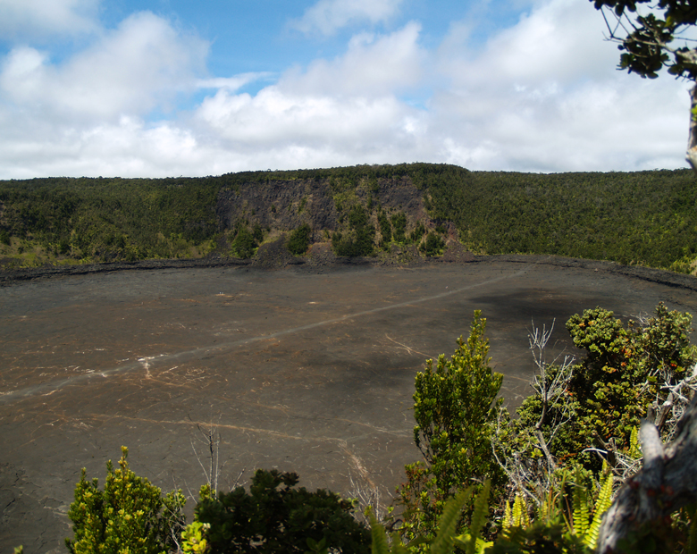
Looking Across Kilauea Iki to Halema'uma'u Eruption; The Kilauea Iki Trail Can Be Seen Etched Across the Floor of the Crater: Photo by Donald MacGowan

Hawaii is, in fact, an island that is served by very few roads, that many people come to visit each year and that makes most of its wealth from the tourism industry. Given this, it's quite surprising how hard it can be to find useful, reliable and up-to-date information about anything from "is your favorite restaurant still in business" to "how's the snorkeling this month?".

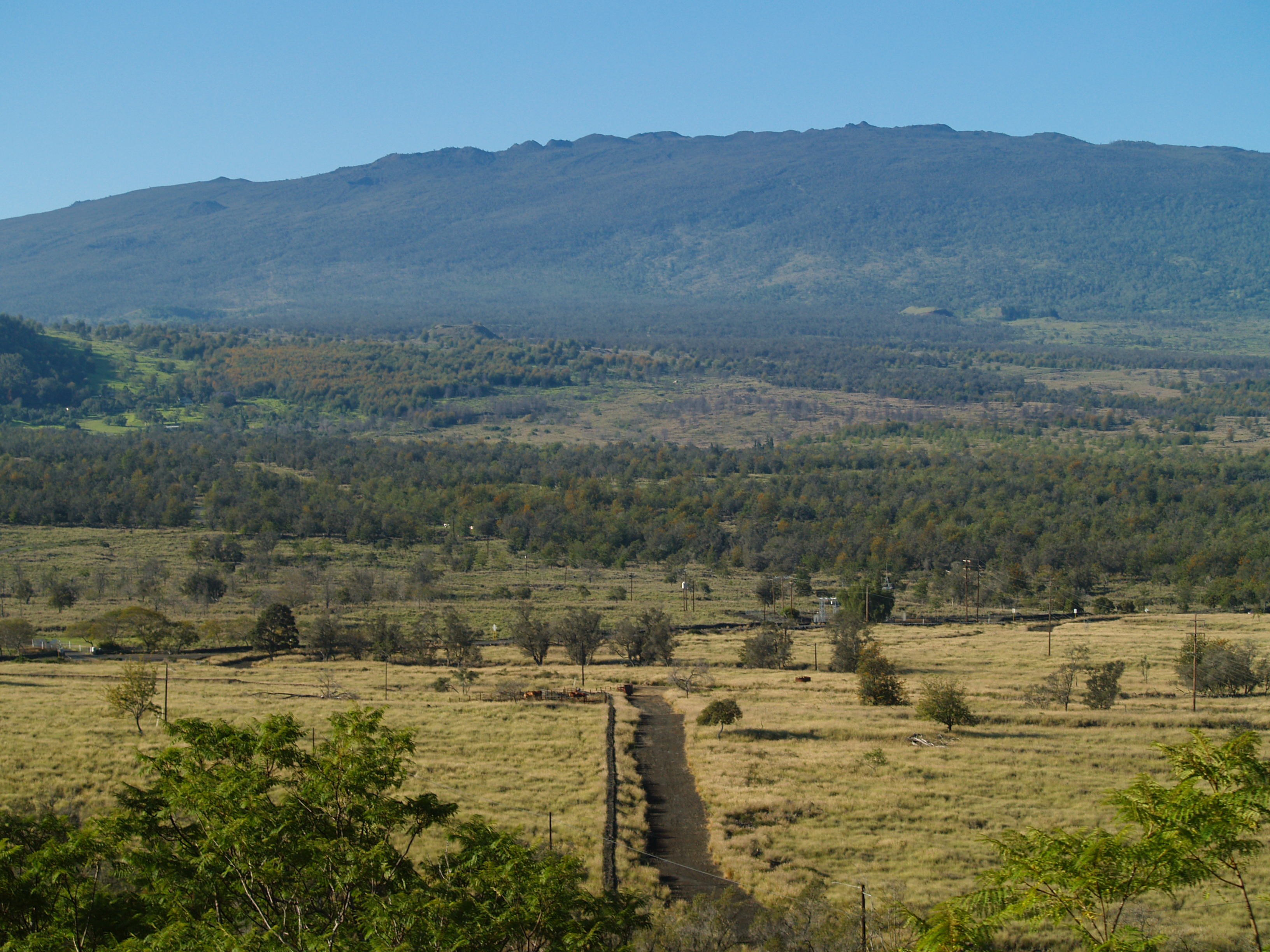
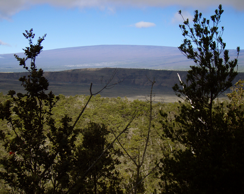
A Morning Glimpse of Mauna Loa Behind Kilauea Iki Crater: Photo by Donald B. MacGowan

Road names are in the unfamiliar Hawaiian language; friendly locals give helpful directions, but in rapid-fire pigeon English using landmarks unfamiliar to the visitor and many guidebooks are either woefully out of date or flat wrong. The first time visitor to Hawaii may be overwhelmed when bombarded by advertising disguised as visitor information, overzealous salespeople from rapacious time-share resorts and racks and racks of of advertising for tours, attractions and restaurants.

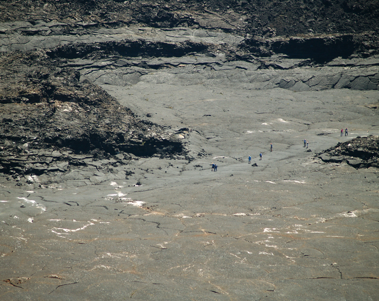
Looking Down From the Rim of Kilauea Iki Crater as Hikers Cross the Floor of the Lava Lake: Photo by Donnie MacGowan

Even the experienced Hawaii traveler may find it difficult to ferret out the information he needs to find a unique, secluded or unusual experience in Paradise. Finding current, reliable information on hikes on the Big Island can be equally frustrating.

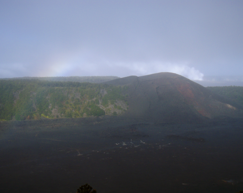
Misty View of Kilauea Iki Crater and Rainbow: Photo by Donald B. MacGowan

Clearly, the visitor to Hawaii can use some help finding special places in general and information about, and help getting to, the best hikes on Hawaii Island. To help you find the more secluded, wild and exotic destinations in particular, and to help you get more out of your Hawaii vacation in general, Tour Guide Hawaii has released a brand new iPhone/iPod Touch App. This "must have" travel app is packed with hours of informative video on the most interesting places on Hawaii; helps navigate you to all the most popular visitor destinations, the most interesting attractions, the most romantic and secluded beaches; helps you effortlessly find hikes, snorkel spots, historical and cultural landmarks, shopping and dining. And of course, our new App includes directions to, and rating of, all the public restrooms! Learn all about the App, here.

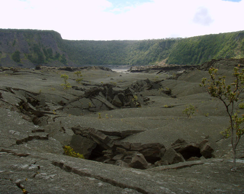
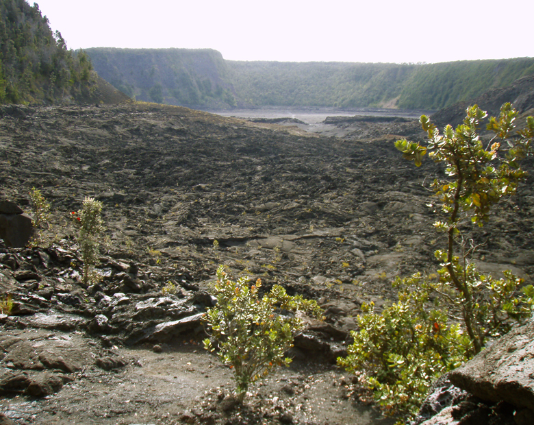
The Jumbled floor of Kilauea Iki Crater Lava Lake: Photo by Donnie MacGowan

But first, let's talk about what is arguably the finest short hike on the Island of Hawaii.

Kilauea Iki Crater Trail

Frank Burgess Along the Kilauea Iki Trail: Photo by Donald B. MacGowan

Perhaps the finest short day hike in Hawaii Volcanoes National Park—and one of Hawaii Island's best hikes, this four-mile, 2-3 hour trip climbs down into, across and back out of Kilauea Iki Crater. Crossing the crater floor on this surface provides one of the most interesting hikes in the Park. Looking up from the bottom of the crater, one can see the distinctive “ring around the crater” marking the high point of the lava lake during the last eruption. The four mile loop-hike descends from the rim in two places and crosses the crater floor in about three hours hiking at a nominal pace, giving one an intimate feel for volcanoes, Hawaiian-Style.

Along the Kilauea Iki Crater Rim Trail: Photo by Donald B. MacGowan

Along one side, thick fern and ohi’a forest skirts along the rim and on the other, lush tropical rainforest crowds to the very brink of the crater; bleak volcanic desert lines the crater walls and covers the floor. The start and finish of the hike are along well marked, wide trails following the rim with handrails and stairs in some spots as you begin to descend into the crater. The remainder is an easily followed, well marked trail with stone ahu (cairns) over the crater floor.

Pu'u Pua'i From Kilauea Iki Crater Rim Trail: Photo by Donnie MacGowan

The hiker should keep their eyes open for Pele’s Hair and Pele’s Tears (fine, thread-like and bead-like deposits of volcanic glass), gaseous vents and other marvels of the living lava mountain. Bore-hole measurements taken in 1988 indicated that roiling molten lava was lying only 230 feet beneath the skin of the caldera at that time; today it is unknown what amount of liquid may be left, but the temperature just a couple hundred feet beneath your hiking boots is in excess of 1000 degrees.

On this hike you should take plenty of water, light rain gear, suncream, a map and compass. In addition, you should wear sturdy hiking shoes or boots and be in fairly good physical condition. As always when hiking in the Park, it is wise to avoid the noonday sun, and to remember that afternoon showers are common, especially along the crater rims. Remember that the start and finish of this hike are at an elevation of over 4000 feet...take it easy and enjoy the incredible views.

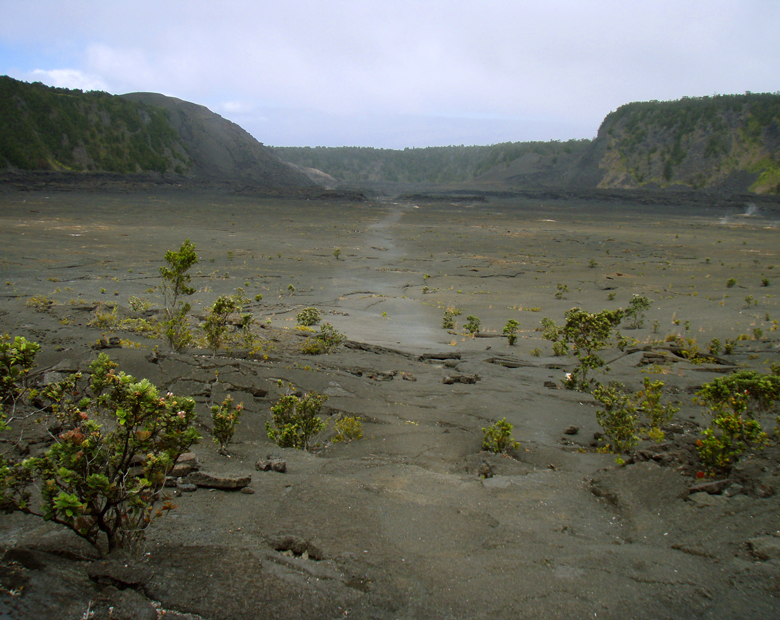
Looking Straight Across Kilauea Iki Crater: Photo by Donnie MacGowan

A video about this hike is available here.

Looking Out of the Forest Across Kilauea Iki Crater: Photo by Donnie MacGowan

For more information on traveling to Hawaii in general, hiking the Big Island in particular, or about our new iPhone/iPod Touch App, please also visit www.tourguidehawaii.com and www.tourguidehawaii.blogspot.com. For information about the author, please go here.

All media copyright 2009 by Donald B. MacGowan. All rights reserved.

Kilaue Iki Crater and Trail from Pu'u Pua'i Overlook: Photo by Donald B. MacGowan
Kilauea Iki Crater and Trail from Pu'u Pua'i Overlook: Photo by Donald B. MacGowan

Monday, August 17, 2009

Best Scenic Drives on Hawaii #1: The Saddle Road...Kona to the Summit of Mauna Kea, Kaumana Cave and Hilo

Across the Roof of Hawaii

by Donnie MacGowan

Recent improvements to the Saddle Road make it no longer the grinding, intimidating drive it once was and open hundreds of square miles of unimaginably beautiful, strange and wondrous landscape to the Hawaii Island Visitor.

Approximate minimum time start to finish (to see every site): 12 hours

From Kona take Highway 190 to Highway 200 in 45 minutes of driving. Saddle Road, which cuts between the "saddle" of Mauna Loa on the south and Mauna Kea to the north, passes through ranch lands and the Pohakuloa Military Training Facility, for another 45 minutes, to the turn for Mauna Kea Access Road (John Burns Way). Nearby, Kipuka Huluhulu, or "shaggy hill", is a 20 minute hike to the top and back. From here it is a 30 minute drive to the Mauna Kea Visitor Information Center. The small village is home to scientists and astronomers that work in the observatories and an amazing place to learn what their research tells us about our universe. Returning to Hwy 200, drive 45 minutes to the amazing Kaumana Cave lava tube, a short hike and a wonderful exploration. A further 30 minutes down Hwy 200 brings one to downtown Hilo, where there are shops, restaurants, fine museums, gorgeous waterfront beach parks and a fabulous Farmers Market. From Hilo, it is approximately three hours to return to Kailua Kona over Hwy 200; alternately one can take the faster though less scenic Hwy 19 to Waimea and then Hwy 190 into Kailua Kona, about a 2 1/2 hour drive.

Ahu'ena Heiau, Kailua Kona Hawaii: Photo by Donnie MacGowan

Leg 1) In Kailua Kona, start at Ahu’ena Heiau; take Palani Road east to Hwy 190; take Hwy 190 to jct with Hwy 200, The Saddle Road

Ahu'ena Heiau and Kamakahonu Beach

Centuries ago the inhabitants of this region built a series of sacred temples, or heiau, which were originally used for the purpose of sacrificing human beings to their war god, Kuka’ilimoku. This particular archeological site is called Ahu’ena Heiau, which in Hawaiian means “Hill of Fire”.

Built originally in the 15th century and rededicated by Kamehameha the Great in the early 1800s as the main temple of his capital, the current structures seen at Ahu’ena Heiau were re-built in 1975 under the auspices of the Bishop Museum with financial help from the Hotel King Kamehameha and are constructed to 1/3 the original scale. There are restrooms and showers located on the pier near the beach. Adjacent Old Kailua Town is a treasure of shops, restaurants and aloha.

Hualalai Volcano from Saddle Road, Big Island Hawaii: Photo by Donnie MacGowan

Leg 2) Take Hwy 200, The Saddle Road, east to jct with John Burns Way (also called Mauna Kea Access Road).

Looking West from Highway 190 to Haualai Volcano Halfway between Kona and Waimea, Big Island of Hawaii: Photo by Donald B. MacGowan
Looking West from Highway 190 to Hualalai Volcano Halfway between Kona and Waimea, Big Island of Hawaii: Photo by Donald B. MacGowan

Saddle Road

Crossing the spectacular saddle between the towering bulk of the volcanoes Mauna Kea and Mauna Loa at about 6600 feet, The Saddle Road runs through brush, grass and forest lands, over lava fields and through some of the wildest and most breath-taking scenery on the Island. From this roadway, four of the 5 principal volcanoes that form The Big Island may be seen: Hualalai, Kohala, Mauna Loa, and Mauna Kea. Because the western half of the road is in notoriously poor condition and consists, in reality, of only one operable lane for much of its descent from the saddle to the Mamalahoa Highway.

However, this road provides the only road access to the Mauna Kea Summit Area and Visitor Information Center, Mauna Kea State Park, Pohakuloa Training Area, Mauna Kea Astronomical Observatory Complex, Waiki'i Ranch and the Kilohana Girl Scout Camp. The Saddle Road also provides the only access to thousands of acres of public forest and open grass lands. Connecting Hilo from about milepost 7.8 on the Hawai’i Belt Road to the Mamalahoa Highway approximately 6 miles south of Waimea, the Saddle Road is widely used by island residents for cross-island travel, despite its somewhat poor condition and undeserved, evil reputation.

Mauna Kea From Mauna Kea State Park; Note V-Shaped Stream Valleys and Glacial Cirques: Photo by Donald B. MacGowan

The Saddle Road frequently has perfect weather, but also fairly routine are patches of intense rain, fog and high winds. It’s takes about 2 ½ to 3 hours straight driving time, depending upon weather, to make the full traverse from Kailua Kona to Hilo; however, one should be sure to leave time in the schedule to drive up to Mauna Kea Visitor Information Station or hike the Pu’u Huluhulu nature trails.

Along its entire 53 mile length between the turn-off from the highway just 6 miles west of Waimea and where it meets Hawaii Belt Road just north of Hilo, there is no gas and there are no services available; plan accordingly. Some food, water and restrooms may be available at the Mauna Kea Visitor Information Station which is a 30 minute drive up a side road off the Saddle Road about half way.

Kipuka Huluhulu from Saddle Road: Photo by Donald MacGowan

Leg 3) Off a Spur road at the jct of John Burns Way and Hwy 200, on the south side, is Kipuka Huluhulu ("Shaggy Hill") Nene Sanctuary.

Pu’u Huluhulu Nature Trails/Kipuka Aina Hou

Frequently described as simultaneously the most noticeable and the most overlooked landmark along the Saddle Road, Kipuka Pu'u Huluhulu rises more than 200 feet out of the surrounding lava flows. It’s name meaning “furry hill”, this forested cinder cone has multiple trails winding up through rare native koa trees to breathtaking 360° views of Hualalai, Mauna Kea and Mauna Loa at the top, where you can also wander a meadow of native Hawaiian plants recently reintroduced in this protected natural habitat. By whatever trail, the summit of Kipuka Huluhulu is only about 20 minutes walk from the car.

Owing to the encapsulated nature of the kipuka, bird watching here is particularly fabulous; the Ā'akepa, Nene and the Ā'akiapola Ā'au, as well as the Kalij pheasants, pueo, i’o and turkeys are among the rare, endangered or just plain beautiful birds you will see here. The numerous roads and trails through the hundreds of square miles of adjacent lava flows makes for interesting, if hot and dry, mountain biking and hiking.

Parking and a unisex pit toilet are the only amenities available at Kipuka Pu’u Huluhulu.

Mauna Kea From Kipuka Huluhulu Nene Sanctuary: Photo by Donald MacGowan
Looking South from Mauna Loa to Mauna Kea from Near Lake Wai'au: Photo by Donnie MacGowan

Leg 4) Go north on John Burns Way to Mauna Kea Visitor Information Station.


Mauna Kea Visitor Information Station

The Visitor Information Station is open daily from 8 a.m. to 5 p.m. During the day there are interactive computer exhibits about Mauna Kea, the observatories and astronomical research, plus there are video presentations and nature trails to hike. Many evenings after dark National Park personnel and astronomers put on public programs and discuss what the latest astronomical findings tell us about the nature of our universe. The souvenir shop has some food items, including hot chocolate, coffee and hot soup, for sale.

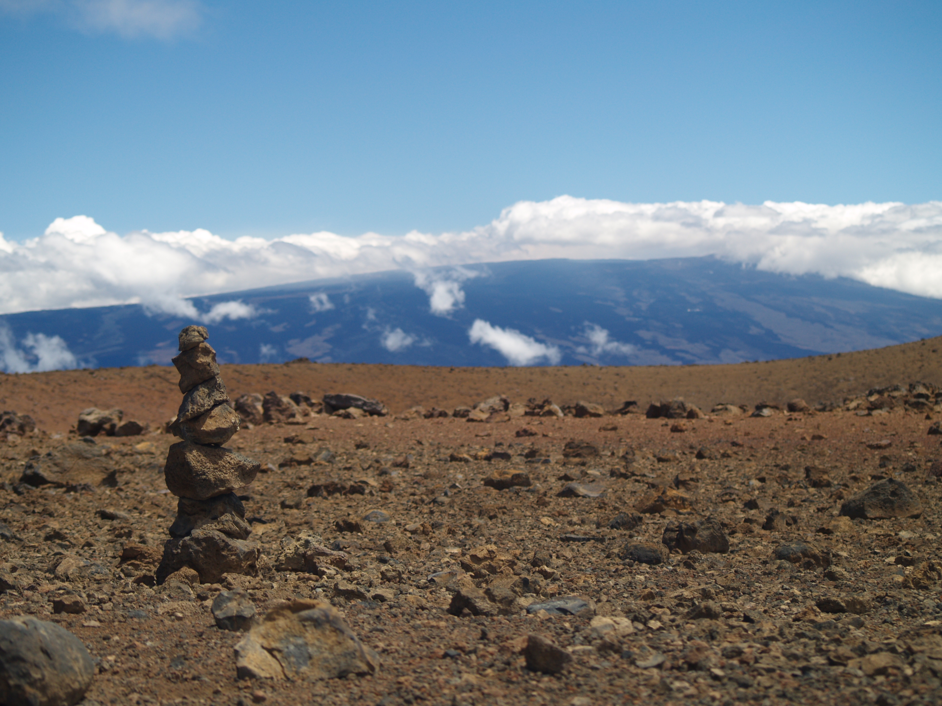
Hikers on Mauna Kea Summit Looking at Mauna Loa Summit: Photo by Donnie MacGowan

Leg 5) John Burns Way to Mauna Kea Summit

Mauna Kea Summit

Before you decide to go to the summit of Mauna Kea, stop, think, plan. Are you prepared for cold and high altitude? Do you understand the nature and dangers of altitude sickness and UV radiation? Are you experienced at traveling icy dirt roads? Is you car safe for the trip (many car rental agencies on the island forbid you to drive this road)? The Rangers at the Visitor's center can brief you on altitude sickness, UV radiation preparedness, the condition of the road and all other information you need to decide whether to visit the summit (see a video here).

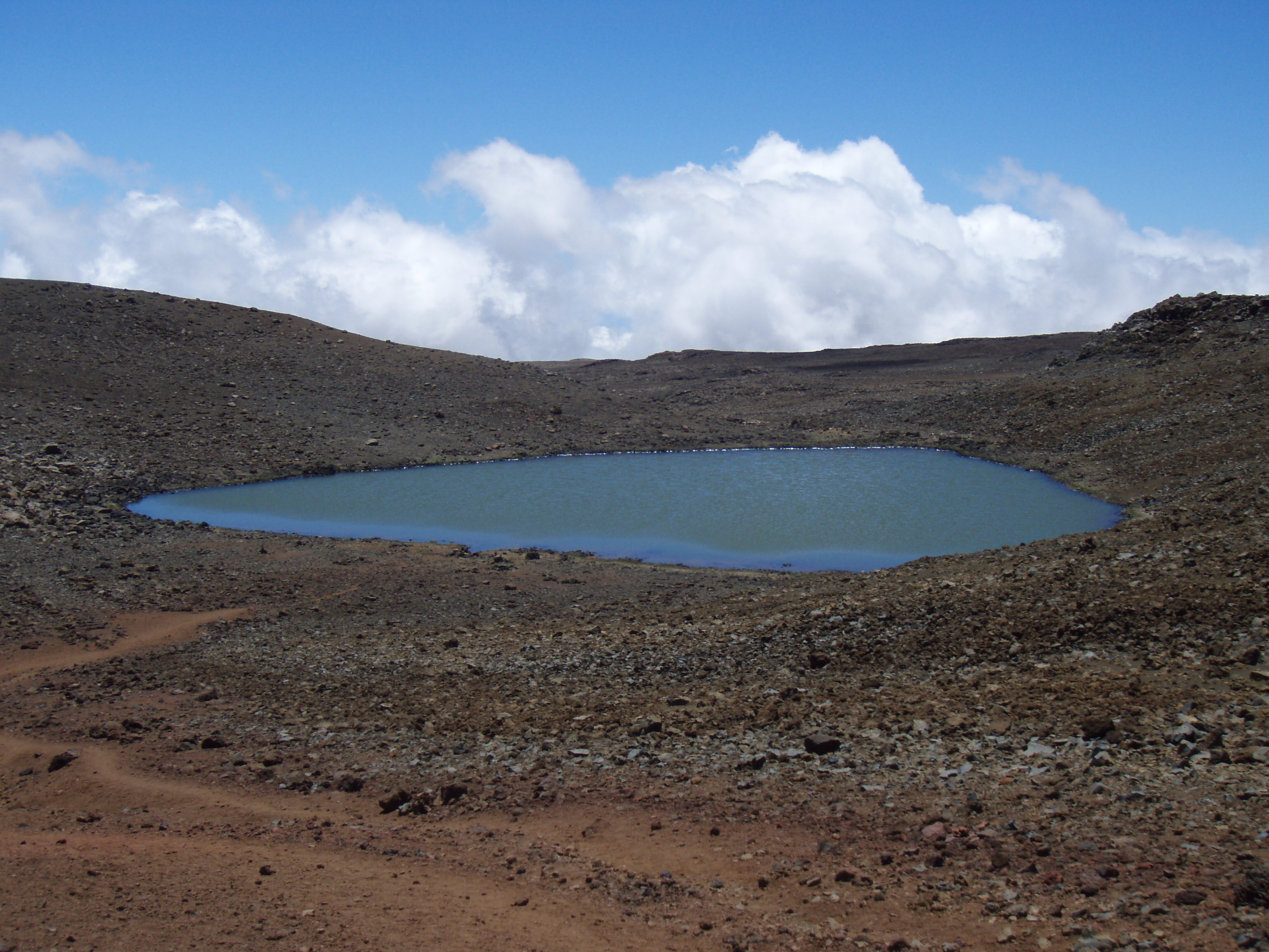
Lake Wai'au--the Seventh Highest Lake in the US--Whose Name Means "Swirling Water", Perches Near the Summit of Mauna Kea On The Big Island of Hawaii: Photo by Donnie MacGowan

The summit of Mauna Kea is truly an amazing place. Beautiful, awe-inspiring, 360 degree views of the entire Big Island, the summit is also culturally and religiously important to the native Hawai’ians and is home to several, world-class astronomical observatories and their support buildings. Because of the extremity of the altitude and the poor quality of the road above the Visitor's Center, it is advised that extreme caution be exercised in deciding to visit Mauna Kea's Summit. From the road's end very near the summit, a short, 10 minute trail leads up Pu'u Weiku cinder cone to the actual mountain top and a Hawaiian religious shrine. Also near the summit is the 1-mile hike to Lake Waiau, the 7th highest lake in the US, as well as numerous archeological sites. Moving at altitude is strenuous, so conserve energy. Do not over-tax yourself, be sure to drink plenty of fluids and protect yourself from the sun, wind and cold. Leave the summit area and return to the paved road long before you are tired.

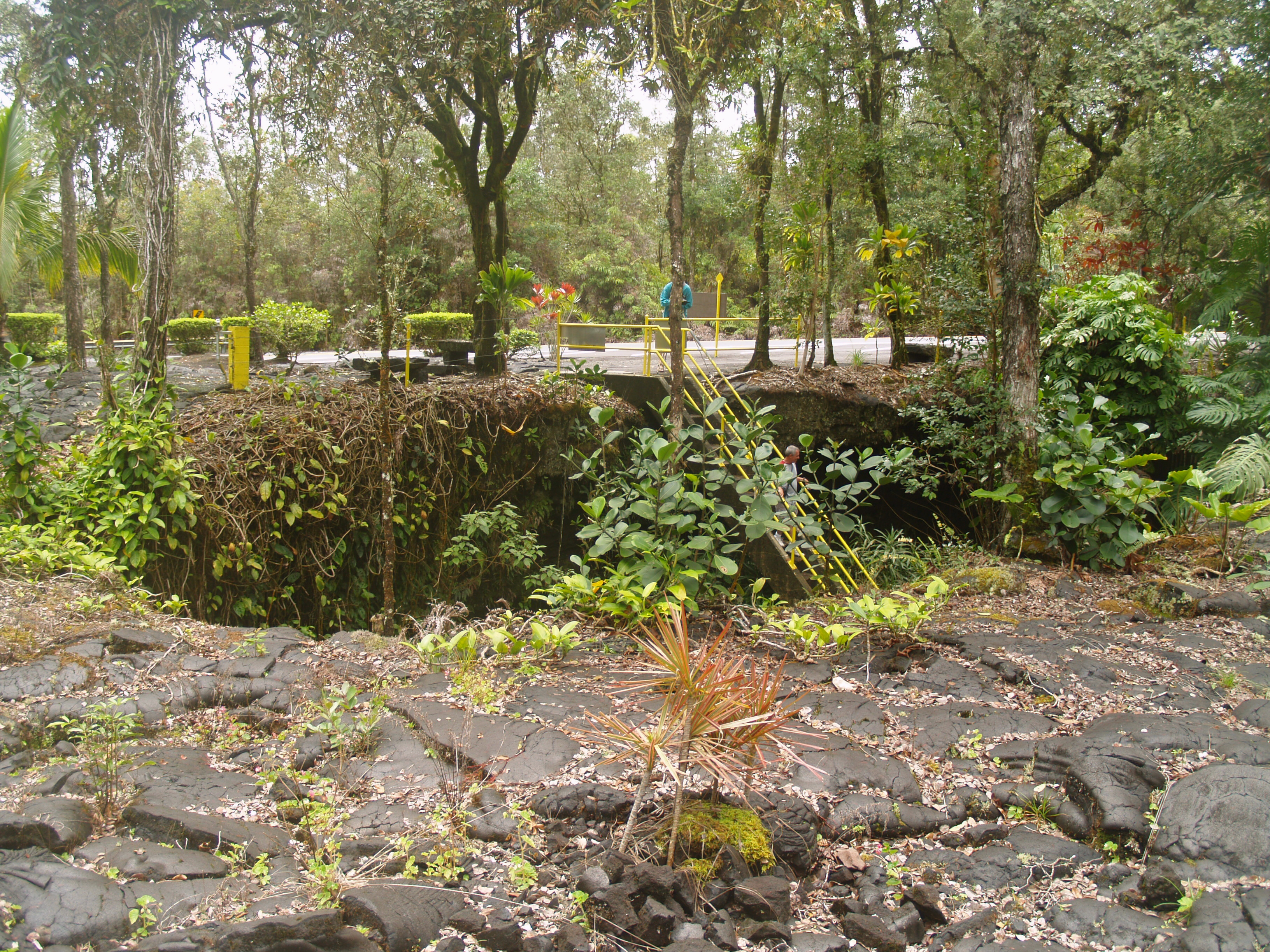
Kaumana Cave, Hilo Hawaii: Photo by Donnie MacGowan

Leg 6) Return John Burns Way to Hwy 200; take Hwy 200 east to Kaumana Caves

Kaumana Caves

A skylight opening to 25-mile long Kaumana Cave is located at the county park near the 4-mile marker on the Hilo side of the Saddle Road. Concrete stairs take you down through the rain forest jungle to the bottom of a collapse pit forming two entrances to the cave. Most people are drawn to the entrance on the right, a large, opening leading to cavernous rooms. In this entrance, graffiti from hundreds of years ago to the present is preserved, scratched into the rocks. The entrance on the left, however, is more interesting, leading through squeezes and low spots to numerous rooms with fascinating speleo-architecture and cave formations. Both caves go to true dark in fewer than 300 feet in either direction. There are more than 2 miles of easily accessible, wild cave to explore here, but if you intend more than just a cursory inspection near the entrances, bring a hard hat, water and at least 3 sources of light. A quick tour of the caves takes fewer than 20 minutes.

Kaumana Cave's Skylight Entrance: Photo by Donnie MacGowan

Parking for the caves is located across the highway from the park; extreme care should be taken when crossing he road. Public restrooms, water and picnic tables are available at the park. As you approach Hilo from Kaumana Caves, Hwy 200 becomes variously called Kaumana Drive, then Waianuenue Avenue.

Astronomical Observatories on the Summit of Mauna Kea, From Downtown Hilo: Photo by Donnie MacGowan

Leg 7) Take Hwy 200 into Hilo Town.

Hilo Town

Beautiful but wet, metropolitan but decrepit, bustling but laid back, Hilo is a lovely, maddening, heartbreaking, addictive study in contrasts. In can rain all day long for 50 days in a row, yet when the sun does shine, the views of Mauna Loa and Mauna Kea from the Liliuokalani Gardens, or of Hilo Bay as you drive down from the mountains, or the rain-forest and waterfall choked gulches with lovely beaches along the highway north of town, make Hilo one of the most truly, achingly-lovely spots on earth.

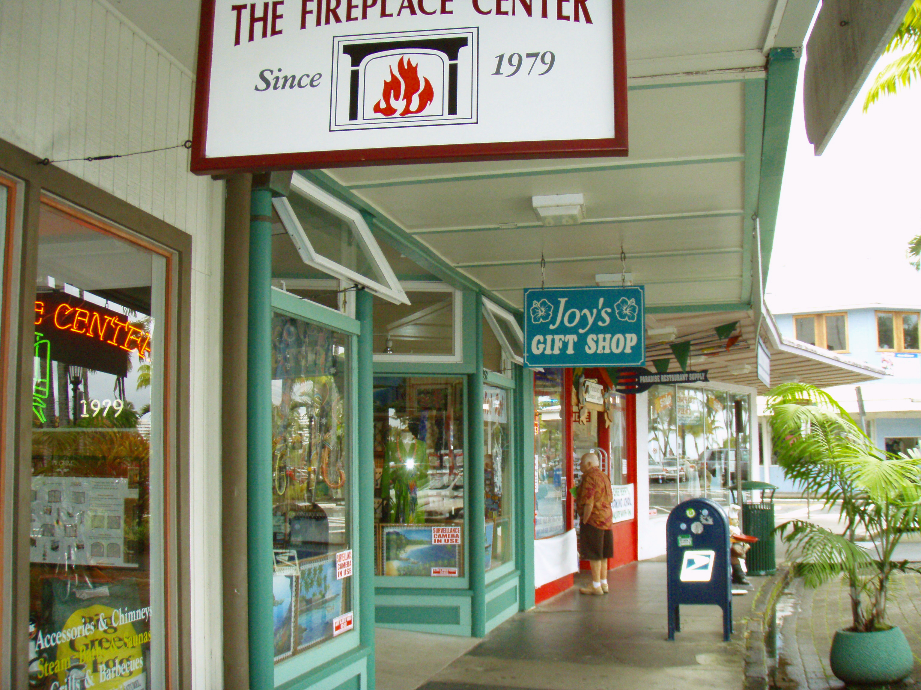
Hilo's Charming Bayfront Shops: Photo by Donald MacGowan

More laid back and sleepier than bustling Kailua Kona, Hilo is the largest town on the island, and the county seat. The Imiloa Astronomy Center of Hawaii, Tsunami Museum, Lyman House Missionary Museum and the Panaewa Rainforest Zoo are all wonderful places to learn about various aspects of Hawaii. There are numerous shopping districts, two large malls and the Historic Old Hilo downtown shops to browse through, a variety of sprawling green parks, a fabulous tropical arboretum right downtown and a mile-long black-sand beach fronting the bay to explore. Hilo's Farmer's Market is a "must see" for any visitor who is spending time on this side of the island.

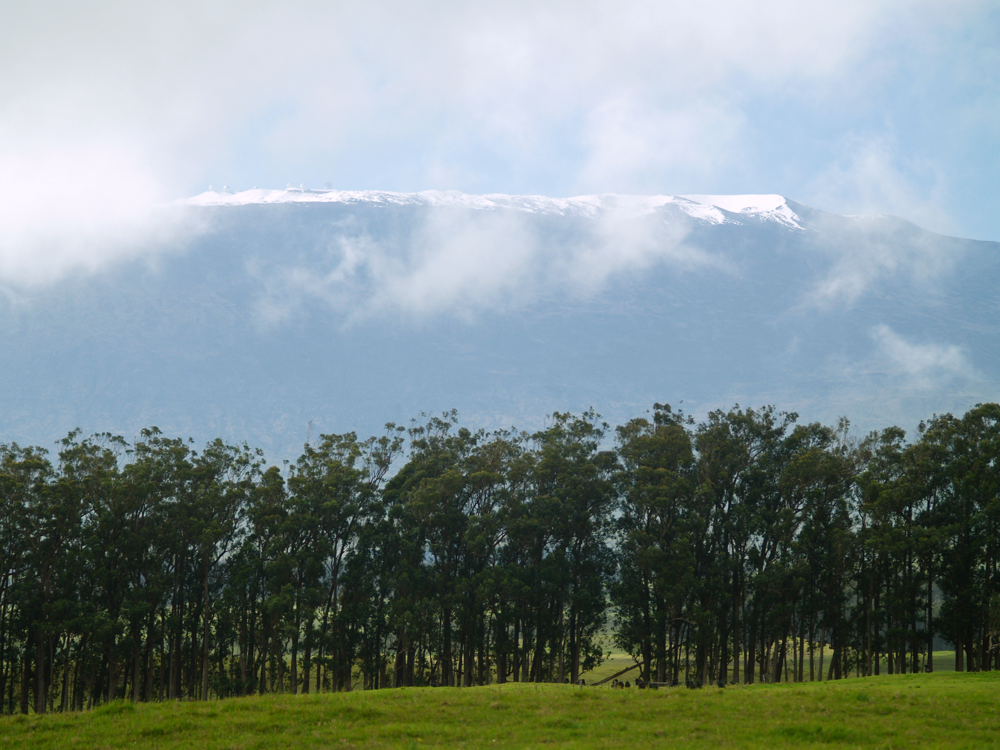
Mauna Kea's Summit  from Highway 19 Near Waimea Town: Photo by Donald MacGowan
Mauna Kea's Summit from Highway 19 Near Waimea Town: Photo by Donald MacGowan

Leg 8) Return Waianuenue Avenue to Kaumana Drive to Hwy 200; take Hwy 200 west to jct with Hwy 190; take Hwy 190 west to Kailua Kona.

Trogdor at Keauhou Bay, Kona Hawaii: Photo by Donnie MacGowan

For more information on traveling to Hawaii in general and touring the Big Island in particular, please visit www.tourguidehawaii.com and www.lovingthebigisland.wordpress.com Information about the author is available here.

All media copyright 2009 by Donald B. MacGowan


Wednesday, August 5, 2009

The Best Beaches in Hawaii: Part 2, The Kona and South Kohala Coasts

by Donnie MacGowan

Imagine yourself in your home; it rains, sleets and snows through the long winter. Now imagine you are lying under cerulean blue skies bathed in healing sunlight on a warm golden sand beach, playing in bath-temperature water, and snorkeling among the brightly colored tropical fish and placid, but amazing sea turtles. Sound too good to be true? In West Hawaii, this soothing daydream is our day-to-day reality

Beaches of South Kohala and the Kona Coast

Kua Bay

Kua Bay on the Southern Kohala Coast is a Gem of a Little Beach: Photo by Donnie MacGowan

The site of West Hawaii’s newest beach park, this is a lovely white sand beach. Although there is little shade, the swimming and boogie boarding in the crystalline waters is primo. Strong currents and large waves call for respect, here; if the surf is up, don’t go in. Also, sometimes winter storm surf removes the sand to offshore, leaving a rocky shelf that is less fun than the sandy beach. A strong onshore wind can cause strong rip tides and influx of jellies.

Behind the beach on the north end is a small, inviting fresh-water pool. Don’t be seduced—it is bottomed by foul-smelling quicksand and is extremely nasty. There are sacred, native Hawaiian sites and ruins to the north of the beach. Please do not disturb them.

Park facilities include parking, picnic tables, restrooms, and water. Wild goats are frequently seen in this area.

Makalawena Beach

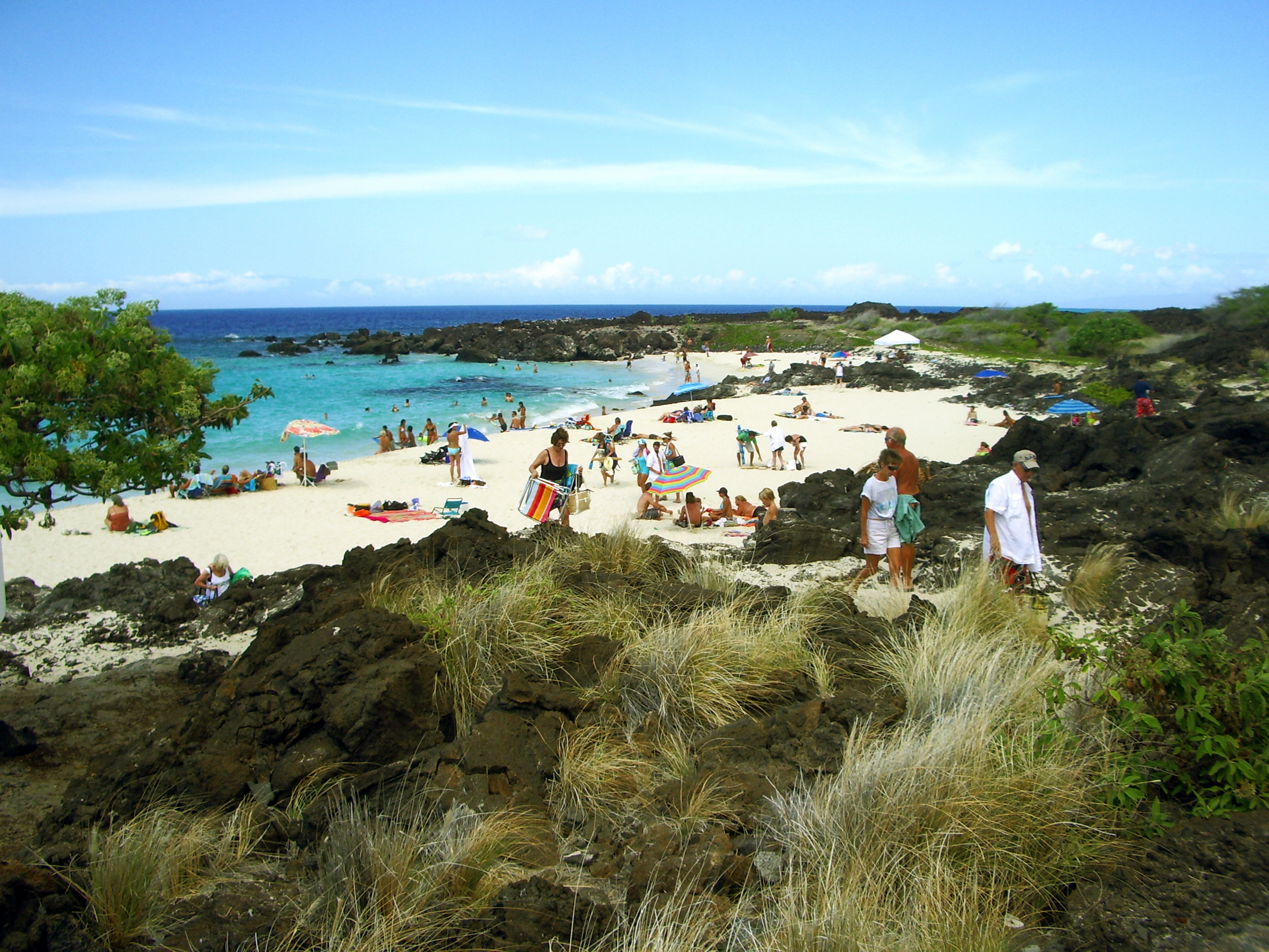
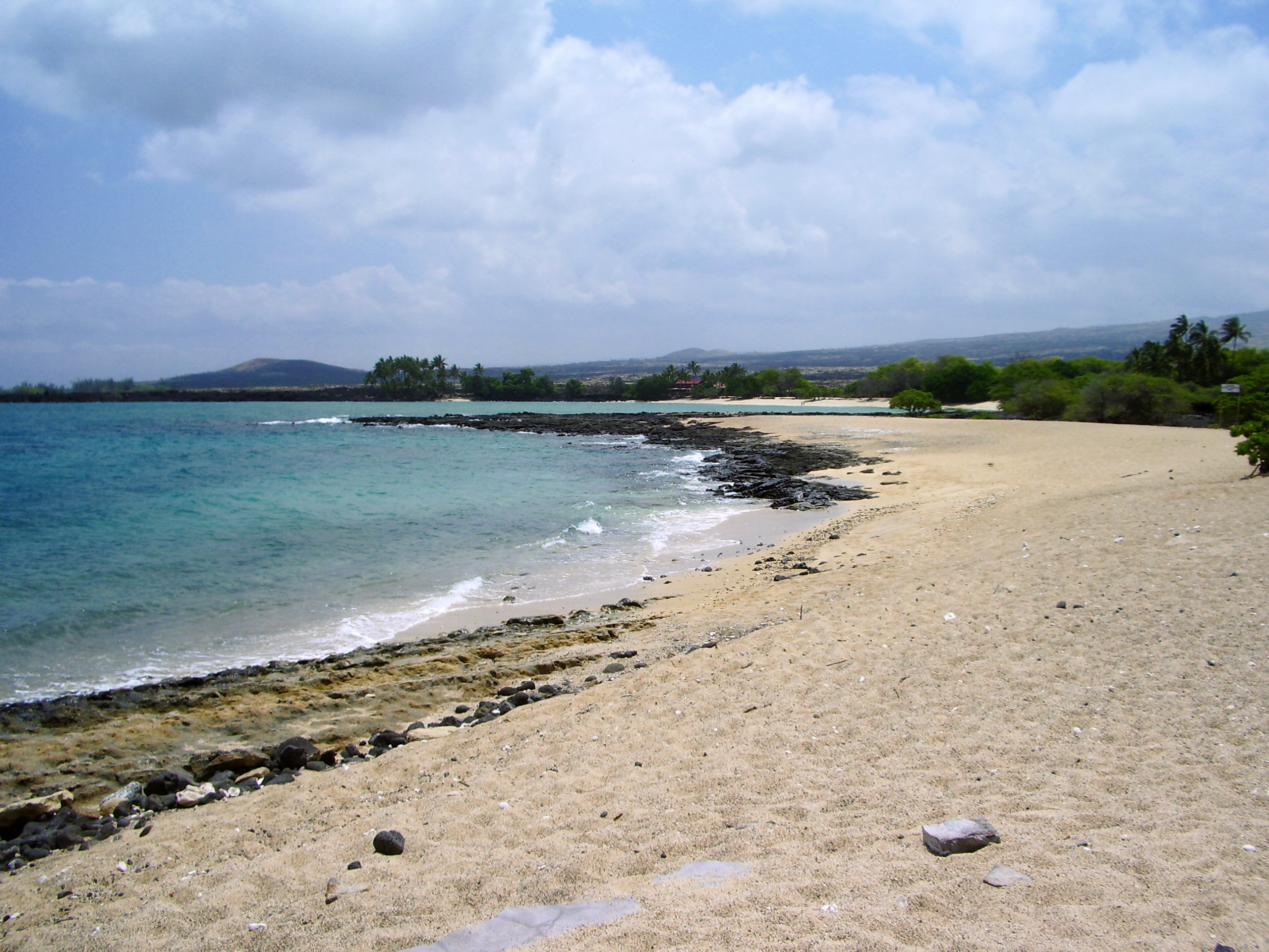
Long, Lonely and Wholly Wonderful Makawena Beach in Kehakai State Park: Photo by Donald MacGowan
Long, Lonely and Wholly Wonderful Makalawena Beach in Kekaha Kai State Park: Photo by Donald MacGowan

One of the last, large, wilderness beaches in Polynesia, frankly, Makalawena is the finest beach on the island and the most beautiful beach setting to boot. This is the amazing beach you flew over just before you landed at Kona International Airport. This beach sports a series of coves, refreshing shade, big sand dunes, and a nice freshwater pond to rinse off in.

This beach is reached either by traveling the (extremely) 4WD road from the highway between mile markers 88 and 89, or by hiking about 15 to 20 minutes along an easy trail from Kekaha Kai State Park. The trail goes over rough pahoehoe and a’a flows and through keawe breaks, so shoes are required.

The land fronting the beach is owned by Bishop Estate/Kamehameha Schools and is slated to be turned into a development of condos and resorts; vigilance and protest on the part of locals and visitors is the only way we can keep this last, wild Kona beach wild.

Kekaha Kai State Park

Kekaha Kai State Park Contains a Series of Brilliant, Huge Sandy Beaches, Yet Because of the Bumpy 2 Mile Drive In, Remains Almost Unknown To Visitors: Photo by Donald B. MacGowan

A superbly wonderful set of beaches and one of Hawaii Island’s gem parks. The northernmost and loveliest beach is Mahai’ula and the smaller, less fine one is Ka’elehuluhulu Beach. The water is fine for swimming and boogie boarding but may be a little murky for ideal snorkeling. There are numerous small springs making the near-shore water a little cold.

The mansion of the original owners, the Magoons, can still be seen on the northern edge of the beach. Tours of the mansion have become scarce to sporadic in recent years; if you are interested, contact the Kona Historical Society.

Turn makai at the State Park sign, between mile markers 90 and 91; the road seems nasty to impassable but in fact, most passenger cars can manage it. Facilities include public restrooms and picnic tables, but no drinking water.

Honl’s Beach

Honl's Beach on the Edge of Old Kailua Town: Photo by Donald B. MacGowan

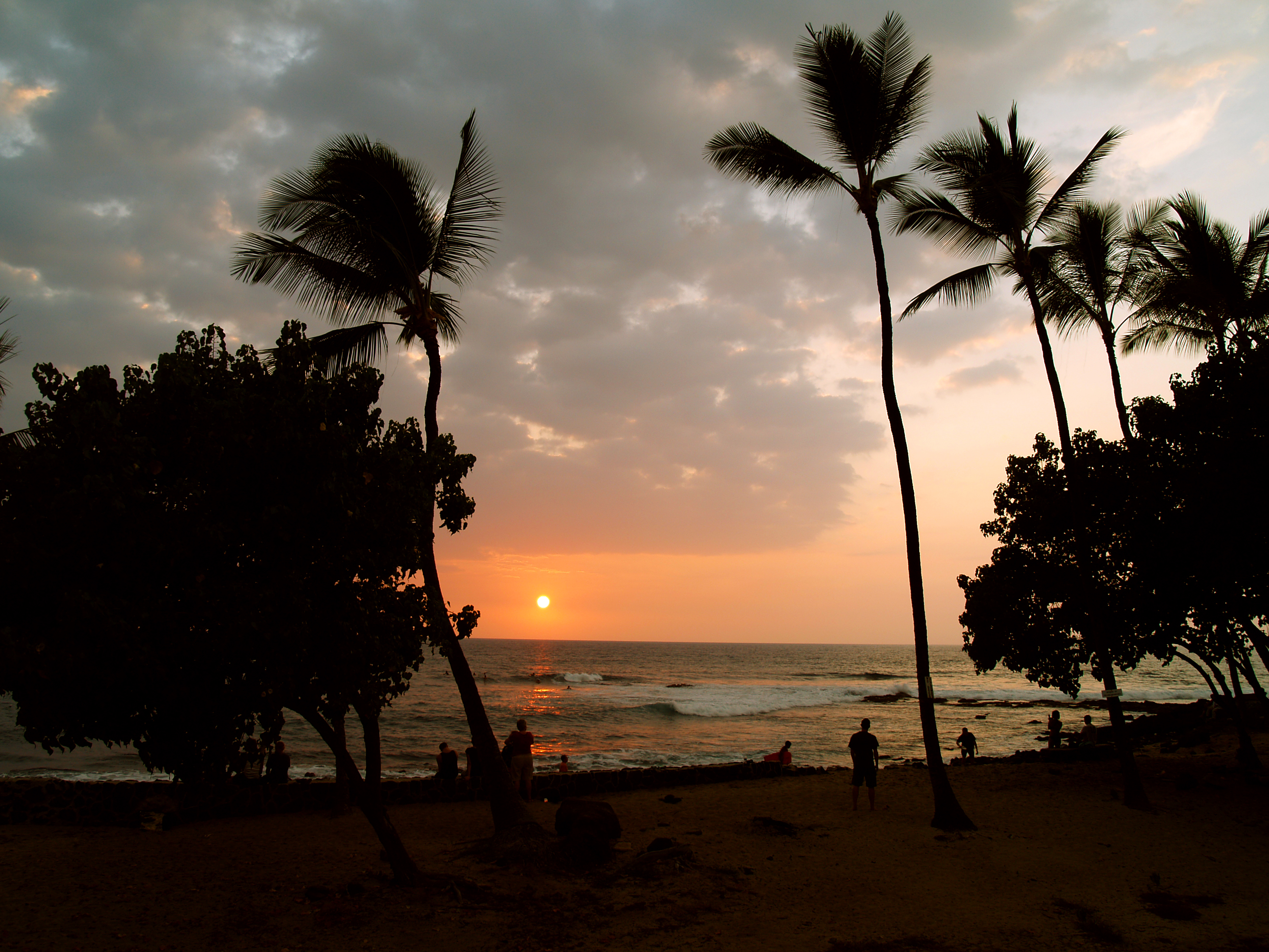
This small beach on the outskirts of Old Kailua Town is a favorite spot for surfers and boogie boarders, but also has very nice snorkeling and is an excellent place to view the sunset and picnic. Remember when going into the water here, there is a fairly strong current to the north, so stay in the shallow reef area close to the beach. Parking is on both sides of Ali’i, but can be tight here during good surf; crossing Ali’i drive can be harrowing at certain times of the day. A new bathroom with running water has recently been constructed on the mauka (mountain) side of the road.

Kahalu’u Beach

Kahalu'u Beach is Kona's Premiere Snorkeling Spot But Is Also A Fabulous Place To Watch Dolphins, Whales and Sunset: Photo by Donnie MacGowan

Loll in sand and sun under swaying palms, watch humpback whales dance in an exotic Kona sunset, snorkel among rainbow-colored fish on a protected reef or ride surf where the Kings of Hawaii defined the sport a thousand years ago! Kahalu’u is the choice destination of Kona Coast County Beach Parks.

Kahalu’u is the most popular snorkeling beach on the Island of Hawaii with good reason; protected from the open ocean by a seawall, the reef is also protected against commercial aquarium fishing. The snorkeling is in calm, shallow water and there is an abundance of fish—perhaps the best display on the island. Dozens of Hawaiian Green Sea Turtles call this bay home, thrilling the snorkelers. Numerous freshwater springs and shallow water bathers make the near-shore snorkeling unpleasantly cloudy, but about 100 feet offshore the water turns crystal clear and the display of coral is nothing short of amazing.

Outside the seawall is an excellent surf break that is for intermediate or better surfers and boogie boarders. There is a fair current north out of the bay and along the coast—swimmers caught in this current should relax and swim with the current, angling towards land.

Most days there is a food wagon selling sandwiches, burgers, shaved ice, and cold drinks at reasonable prices and a vendor renting snorkeling gear and boogie boards.

Two-Step Beach/Honaunau Bay

Two-Step Beach at Hounaunau Bay Has Some of the Finest Snorkeling in the World: Photo by Donald B. MacGowan

Some superb protected snorkeling and shore-diving is located at Two-Step Beach, adjacent to the Place of Refuge National Historic Park. A wonderland of turtles, coral, and fish, with frequent morning visits by dolphins, this snorkeling experience shouldn’t be missed. No swimming is allowed within the Park, as a measure of respect of the sacredness of the Refuge site; however, Two-Step Beach offers a convenient place to enter Honaunau Bay.

One can enter the bay either by walking down the boat ramp, or by stepping off the short cliff into the water. Two-Step beach gets its name from this short hop. Near the center edge of the lava beach there are two ledges serving as steps to the ocean. At low tide, it’s a simple matter of stepping down: “1, 2, OCEAN!” At high tide, one just steps off the edge and in. Getting out, one simply approaches the steps, puts hands palms down and waits for an incoming wave to float you up and onto the bottom step—the process is easier than it sounds. Resist the temptation to put fingers into small holes and pockets in the rocks to haul yourself out—they are filled with spiny sea urchins. Always lay hands on rocks palms down; don’t use fingers.

The best snorkeling is along the cliff edges and the shallows. Remember that you cannot get out of the water within the confines of the Park. Remember dolphin and sea turtles are federally protected species.

Ho’okena Beach County Park

Hookena Beach in South Kona IS a Fabulous Beach Plunked Down in the Middle of Real Old Hawaii: Photo by Donald B. MacGowan

Brilliant snorkeling, decent boogie boarding, passable shell collecting, and wonderful camping—it’s a wonder Ho’okena Beach is not more popular with visitors. Nestled alongside the ruins of Ho’okena Village, this beach is a wonderful place to spend a morning or a weekend.

Frequented by dolphin, stuffed full of pelagic and reef fish and turtles, and boasting crystal clear, warm and calm waters, Ho’okena is a must-see beach for avid snorkelers and divers as well as sea kayakers. Hiking south over the hills and through cow fields brings one to numerous small, sandy beaches where ocean current conditions make shell collecting possible. Hiking north from the park, one finds the remnants of once-thriving Ho’okena Village, in past times the main rival to Kailua for steamer traffic, but now all but lost to the ravages of tsunami, earthquake, and the passing of time. During the winter months, female Humpback whales and their babies frequent the waters off this bay.

Wonderful beach camping, new showers and restrooms, picnic tables, and abundant fresh water make this county park a gem. Camping is by permit only on a first come-first served basis.

Honomalino Bay

Honomalino Beach is a Short Hike From the Old Hawaiian Fishing Village of Miloli'i: Photo by Donald B. MacGowan
Honomalino Beach is a Short Hike From the Old Hawaiian Fishing Village of Miloli

A true gem of West Hawaii and rarely crowded, Honomalino Bay is reached by a 20-minute hike from the south end of Miloli’i Beach County Park. The hiking trail starts between the bathrooms and a yellow church and the path to Honomalino is always along the right fork of the trail, in and out of the surf line, to avoid private property.

Snorkeling is very interesting on the north side in the rocks, when the surf is low. The water, though very clear, is sometimes quite cold due to spring discharge in the sand on the beach.

So now that you are armed with all this information and you’ve had the best-ever, mid-winter, beach daydream you’ve had in years, I just have to ask ... what are you doing sitting there in your cold, wet, winter misery for? C’mon over to West Hawaii and soak up your fair share of the rays!

Monk seal at Honl's Beach near Kailua Kona: Photo by Donald B. MacGowan

For more information on traveling to Hawaii in general and touring the beaches of the Big Island in particular, please also visit www.tourguidehawaii.com and www.lovingthebigisland.wordpress.com. Information about the author can be found here.

All Media Copyright 2009 by Donald B. MacGowan.

Sunday, July 26, 2009

Advice: Driving and Hiking to the Summit of Mauna Kea, Big Island of Hawaii


Aloha! I'm Donnie MacGowan and I live on the Big Island of Hawaii. Today, I'd like to take you to the top of Mauna Kea. At 13, 796 feet above sea level, Mauna Kea's summit is the highest point in the State of Hawaii; since its base lies at 19000 feet below sea level, its has a base-to-summit height of 33,000 feet, making it the tallest mountain on earth. It's also one of my most favorite places on earth.

Mauna Kea began forming on the sea floor about one million years ago. Its name means "White Mountain" in the Hawaiian language and it is snow-capped much of the winter, and the summit is covered with permafrost 35 feet deep. During the ice ages, Mauna Kea's summit was glaciated 3 times, starting about 200000 years ago and ending only 11000 years ago. One can see the U-shaped valleys and cirques, striated bedrock, glacial tills covering the summit area and remnants of ice-damned lava flows from those times. There are even the remains of extinct rock glaciers near the summit.

The Visitor's Information Station and summit are reached via a road which turns off Saddle Road at about 6600 feet elevation near the 28 mile marker and tortuously stumbles its way up the south side of Mauna Kea to the Visitor Information Station at about 9300 feet. The road, though steep, is paved to the Visitor's Information Station. Above that, the road is graded dirt for about 5 miles, returning to asphalt paving for the final sprint to the rim of the summit crater. Road conditions for the summit road are available at 808.935.6263.

The Visitor Information Station is open from 9 a.m. until 10 p.m. 365 days a year. Informational multimedia presentations, souvenirs, and some food items are available here, as well as clean restrooms and drinking water. Every evening after dark the center allows visitors to stargaze through several telescopes and informational talks by visiting scientists are occasionally scheduled. Saturday and Sunday the staff lead escorted summit field trips, but visitors must provide their own vehicle. Call 808.961.2180 for information. It is suggested that summit-bound visitors stop at the Visitor's Information Station for at least half an hour before heading to the summit so they can acclimate. The rangers there can help you decide if you and your vehicle are fit for the trip to the summit.

A wonderful, easy road trip that includes a visit to the summit of Mauna Kea can be made a memorable part of any visit to the Big Island. Directions for a 1-day scenic drive from Kailua Kona to the top of Mauna Kea and on to Hilo (with stops along the way) can be found here. More information on the summit drive and hike is available here; information about the Hawaiian mythology surrounding Mauna Kea can be found here.

Produced by Donnie MacGowan; original musical score written and performed by Donald B. MacGowan; videography by Donnie MacGowan and Frank Burgess.

For more information on visiting Hawaii in general, or touring the Big Island in particular, please visit www.tourguidehawaii.com and www.lovingthebigisland.wordpress.com. Information about the author can be found here.

Thursday, May 7, 2009

Pu'u Kohola National Historic Park and Spencer Beach Park, Big Island Hawaii


Pu'u Kohola National Historic Park and Spencer Beach Park are two of the most interesting and fun visitor attractions on the Kohala Coast of the Big Island of Hawaii.


Produced by Donnie MacGowan and Frank Burgess and presented by Tour Guide Hawaii...Aloha!

For more information, visit www.tourguidehawaii.com or www.lovingthebigisland.wordpress.com.


All media copyright 2009 by Frank Burgess and Donald B. MacGowan

Sunday, April 19, 2009

Frank's Big Island Travel Hints #12: More fun in Hawaii Volcanoes National Park, Big Island, Hawaii


Deeper and Deeper into Hawaii Volcanoes National Park

As you continue driving around and exploringHawaii Volcanoes National Park you will find many great hiking and bicycling opportunities.Tour Guide has some 50 sights to see in the park and has details such as, parking, food and water and restroom facilities along the way.

One of the best day hikes in the park is the Kilauea Iki Crater Trail. This four mile round trip hike, about three hours at a nominal pace, will descend into the crater itself. From the floor of the crater, you will see fern, Ohia, and tropical rainforest crowding right up to the rim. The floor itself is stark desert, by comparison, as the trail takes you across and then up the other side. Make sure to bring plenty of water and maybe even some snacks for this hike. To see a video of this hike, go here.

To see even more of the parks wonders, we at Tour Guide suggest a drive down the Chain of Craters Road. This drive unlocks dozens more sights, hikes and vistas from high mountain rainforest to the barren lava landscapes and scenic ocean views below. Along this road are a number of overlooks for some fabulous photography. It ends at the sea where waves crash and spew against cliffs with steam clouds in the distance where lava reaches the ocean. Let’s see what this stunning area has to offer.

Lua Manu is a pit crater formed before written records were kept of the eruptive activity in the park. You will notice no cinder around the rim. This indicates no eruption here but a lava lake that formed inside the pit. As it drained, the pit collapsed, the latest of which was in 1974.

There are several more pit craters to see along this route and then you will come to Hilina Pali Road. This nine mile road takes you to some of the most magical views of the National Park. From forest down to the coast, the breathtaking scenery with leave you with the awe and majesty of Mother Nature and Madam Pele. For the hearty campers, Tour Guide will lead you to Kulanaokuaiki Campground. There are restrooms here but no water is available. At the end of Hilina Pali Road is an overlook not to be missed.

Back on Chain of Craters Road, Tour Guide brings you to Puahi Crater, a large hourglass shaped crater that has held lava from many different flows over the years. Most recently, the 1979 earthquakes opened the south rift of the crater and issued steam and lava fountains. Though this episode only lasted one day, it was precursor to the current flows from Pu’u O’o in 1983 that destroyed hundreds of homes and businesses miles away in the Puna District.

Tour Guide will guide you to Kipuka Kahali’i. A kipuka is a hole or space where the lava surrounded forest or grassland but did not burn it. This one was partially devastated by the 1969 hot ash eruption of Mauna Ulu. The tallest trees survived and some hearty species of plants have returned.

To see videos of some of the things to see and do along the Chain of Craters Road, go here,here, here, here, here, here and here.


For more information on traveling to Hawaii in general and the Big Island in particular, visit tourguidehawaii.com and lovingthebigisland.wordpress.com.

Sunday, March 8, 2009

Big Island Day Trips #5: A Trip From Kona Across the Top of Hawaii; Mauna Kea Summit, Kaumana Cave and Hilo via the Saddle Road

Trip 5: Kona to Mauna Kea, Kaumana Cave and Hilo via the Saddle Road

Approximate minimum time start to finish (to see every site): 12 hours

From Kona take Highway 190 to Highway 200 in 45 minutes of driving. Saddle Road, which cuts between the "saddle" of Mauna Loa on the south and Mauna Kea to the north, passes through ranch lands and the Pohakuloa Military Training Facility, for another 45 minutes, to the turn for Mauna Kea Access Road (John Burns Way). Nearby, Kipuka Huluhulu, or "shaggy hill", is a 20 minute hike to the top and back. From here it is a 30 minute drive to the Mauna Kea Visitor Information Center. The small village is home to scientists and astronomers that work in the observatories and an amazing place to learn what their research tells us about our universe. Returning to Hwy 200, drive 45 minutes to the amazing Kaumana Cave lava tube, a short hike and a wonderful exploration. A further 30 minutes down Hwy 200 brings one to downtown Hilo, where there are shops, restaurants, fine museums, gorgeous waterfront beach parks and a fabulous Farmers Market. From Hilo, it is approximately three hours to return to Kailua Kona over Hwy 200; alternately one can take the faster though less scenic Hwy 19 to Waimea and then Hwy 190 into Kailua Kona, about a 2 1/2 hour drive.

Ahu'ena Heiau, Kailua Kona Hawaii: Photo by Donnie MacGowan

Leg 1) In Kailua Kona, start at Ahu’ena Heiau; take Palani Road east to Hwy 190; take Hwy 190 to jct with Hwy 200, The Saddle Road

Ahu'ena Heiau and Kamakahonu Beach

Centuries ago the inhabitants of this region built a series of sacred temples, or heiaus, which were originally used for the purpose of sacrificing human beings to their war god, Kuka’ilimoku. This particular archeological site is called Ahu’ena Heiau, which in Hawaiian means “Hill of Fire”.

Built originally in the 15th century and rededicated by Kamehameha the Great in the early 1800s as the main temple of his capital, the current structures seen at Ahu’ena Heiau were re-built in 1975 under the auspices of the Bishop Museum with financial help from the Hotel King Kamehameha and are constructed to 1/3 the original scale. There are restrooms and showers located on the pier near the beach. Adjacent Old Kailua Town is a treasure of shops, restaurants and aloha.

Hualalai Volcano from Saddle Road, Big Island Hawaii: Photo by Donnie MacGowan

Leg 2) Take Hwy 200, The Saddle Road, east to jct with John Burns Way (also called Mauna Kea Access Road).

Saddle Road

Crossing the spectacular saddle between the towering bulk of the volcanoes Mauna Kea and Mauna Loa at about 6600 feet, The Saddle Road runs through brush, grass and forest lands, over lava fields and through some of the wildest and most breath-taking scenery on the Island. From this roadway, four of the 5 principal volcanoes that form The Big Island may be seen: Hualalai, Kohala, Mauna Loa, and Mauna Kea. Because the western half of the road is in notoriously poor condition and consists, in reality, of only one operable lane for much of its descent from the saddle to the Mamalahoa Highway.

However, this road provides the only road access to the Mauna Kea Summit Area and Visitor Information Center, Mauna Kea State Park, Pohakuloa Training Area, Mauna Kea Astronomical Observatory Complex, Waikii Ranch and the Kilohana Girl Scout Camp. The Saddle Road also provides the only access to thousands of acres of public forest and open grass lands. Connecting Hilo from about milepost 7.8 on the Hawai’i Belt Road to the Mamalahoa Highway approximately 6 miles south of Waimea, the Saddle Road is widely used by island residents for cross-island travel, despite its somewhat poor condition and undeserved, evil reputation.

The Saddle Road frequently has perfect weather, but also fairly routine are patches of intense rain, fog and high winds. It’s takes about 2 ½ to 3 hours straight driving time, depending upon weather, to make the full traverse from Kailua Kona to Hilo; however, one should be sure to leave time in the schedule to drive up to Mauna Kea Visitor Information Station or hike the Pu’u Huluhulu nature trails.

Along its entire 53 mile length between the turn-off from the highway just 6 miles west of Waimea and where it meets Hawaii Belt Road just north of Hilo, there is no gas and there are no services available; plan accordingly. Some food, water and restrooms may be available at the Mauna Kea Visitor Information Station which is a 30 minute drive up a side road off the Saddle Road about half way.

Kipuka Huluhulu from Saddle Road: Photo by Donald MacGowan

Leg 3) Off a Spur road at the jct of John Burns Way and Hwy 200, on the south side, is Kipuka Huluhulu ("Shaggy Hill") Nene Sanctuary.

Pu’u Huluhulu Nature Trails/Kipuka Aina Hou

Frequently described as simultaneously the most noticeable and the most overlooked landmark along the Saddle Road, Kipuka Pu'u Huluhulu rises more than 200 feet out of the surrounding lava flows. It’s name meaning “furry hill”, this forested cinder cone has multiple trails winding up through rare native koa trees to breathtaking 360° views of Hualalai, Mauna Kea and Mauna Loa at the top, where you can also wander a meadow of native Hawaiian plants recently reintroduced in this protected natural habitat. By whatever trail, the summit of Kipuka Huluhulu is only about 20 minutes walk from the car.

Owing to the encapsulated nature of the kipuka, bird watching here is particularly fabulous; the Ā'akepa, Nene and the Ā'akiapola Ā'au, as well as the Kalij pheasants, pueo, i’o and turkeys are among the rare, endangered or just plain beautiful birds you will see here. The numerous roads and trails through the hundreds of square miles of adjacent lava flows makes for interesting, if hot and dry, mountain biking and hiking.

Parking and a unisex pit toilet are the only amenities available at Kipuka Pu’u Huluhulu.

Mauna Kea From Kipuka Huluhulu Nene Sanctuary: Photo by Donald MacGowan

Leg 4) Go north on John Burns Way to Mauna Kea Visitor Information Station.

Mauna Kea Visitor Information Station

The Visitor Information Station is open daily from 8 a.m. to 5 p.m. During the day there are interactive computer exhibits about Mauna Kea, the observatories and astronomical research, plus there are video presentations and nature trails to hike. Many evenings after dark National Park personnel and astronomers put on public programs and discuss what the latest astronomical findings tell us about the nature of our universe. The souvenir shop has some food items, including hot chocolate, coffee and hot soup, for sale.

Hikers on Mauna Kea Summit Looking at Mauna Loa Summit: Photo by Donnie MacGowan

Leg 5) John Burns Way to Mauna Kea Summit

Mauna Kea Summit

Before you decide to go to the summit of Mauna Kea, stop, think, plan. Are you prepared for cold and high altitude? Do you understand the nature and dangers of altitude sickness and UV radiation? Are you experienced at traveling icy dirt roads? Is you car safe for the trip (many car rental agencies on the island forbid you to drive this road)? The Rangers at the Visitor's center can brief you on altitude sickness, UV radiation preparedness, the condition of the road and all other information you need to decide whether to visit the summit (see a video here).

The summit of Mauna Kea is truly an amazing place. Beautiful, awe-inspiring, 360 degree views of the entire Big Island, the summit is also culturally and religiously important to the native Hawai’ians and is home to several, world-class astronomical observatories and their support buildings. Because of the extremity of the altitude and the poor quality of the road above the Visitor's Center, it is advised that extreme caution be exercised in deciding to visit Mauna Kea's Summit. From the road's end very near the summit, a short, 10 minute trail leads up Pu'u Weiku cinder cone to the actual mountain top and a Hawaiian religious shrine. Also near the summit is the 1-mile hike to Lake Waiau, the 7th highest lake in the US, as well as numerous archeological sites. Moving at altitude is strenuous, so conserve energy. Do not over-tax yourself, be sure to drink plenty of fluids and protect yourself from the sun, wind and cold. Leave the summit area and return to the paved road long before you are tired.

Kaumana Cave, Hilo Hawaii: Photo by Donnie MacGowan

Leg 6) Return John Burns Way to Hwy 200; take Hwy 200 east to Kaumana Caves

Kaumana Caves

A skylight opening to 25-mile long Kaumana Cave is located at the county park near the 4-mile marker on the Hilo side of the Saddle Road. Concrete stairs take you down through the rain forest jungle to the bottom of a collapse pit forming two entrances to the cave. Most people are drawn to the entrance on the right, a large, opening leading to cavernous rooms. In this entrance, graffiti from hundreds of years ago to the present is preserved, scratched into the rocks. The entrance on the left, however, is more interesting, leading through squeezes and low spots to numerous rooms with fascinating speleo-architecture and cave formations. Both caves go to true dark in fewer than 300 feet in either direction. There are more than 2 miles of easily accessible, wild cave to explore here, but if you intend more than just a cursory inspection near the entrances, bring a hard hat, water and at least 3 sources of light. A quick tour of the caves takes fewer than 20 minutes.

Parking for the caves is located across the highway from the park; extreme care should be taken when crossing he road. Public restrooms, water and picnic tables are available at the park. As you approach Hilo from Kaumana Caves, Hwy 200 becomes variously called Kaumana Drive, then Wainuenue Avenue.

Astronomical Observatories on the Summit of Mauna Kea, From Downtown Hilo: Photo by Donnie MacGowan

Leg 7) Take Hwy 200 into Hilo Town.

Hilo Town

Beautiful but wet, metropolitan but decrepit, bustling but laid back, Hilo is a lovely, maddening, heartbreaking, addictive study in contrasts. In can rain all day long for 50 days in a row, yet when the sun does shine, the views of Mauna Loa and Mauna Kea from the Lilioukalani Gardens, or of Hilo Bay as you drive down from the mountains, or the rain-forest and waterfall choked gulches with lovely beaches along the highway north of town, make Hilo one of the most truly, achingly-lovely spots on earth.

More laid back and sleepier than bustling Kailua Kona, Hilo is the largest town on the island, and the county seat. The Imiloa Astronomy Center of Hawaii, Tsunami Museum, Lyman House Missionary Museum and the Panaewa Rainforest Zoo are all wonderful places to learn about various aspects of Hawaii. There are numerous shopping districts, two large malls and the Historic Old Hilo downtown shops to browse through, a variety of sprawling green parks, a fabulous tropical arboretum right downtown and a mile-long black-sand beach fronting the bay to explore. Hilo's Farmer's Market is a "must see" for any visitor who is spending time on this side of the island.

Leg 8) Return Wainuenue Avenue to Kaumana Drive to Hwy 200; take Hwy 200 west to jct with Hwy 190; take Hwy 190 west to Kailua Kona.

Trogdor at Keauhou Bay, Kona Hawaii: Photo by Donnie MacGowan

For more information on traveling to Hawaii in general and touring the Big Island in particular, please visit www.tourguidehawaii.com and www.lovingthebigisland.wordpress.com.
 

Casino Bonus no Deposit