Rodeo is not likely the first thing that comes to the visitor's mind when they conjure images of tropical Hawaii, but rodeo here is an old and popular tradition. Cows were first introduced to Hawaii in 1793 by George Vancouver and Kamehameha the Great soon imported Mexican vaqueros to teach his people how to handle them. Rodeos were an important part of early ranch life here in Kona. As such, rodeo is much older here in Hawaii than it is in much of the Continental United States; remember, three generations of Hawaiian cowboys lived, worked and died in Hawai'i before cattle were ever driven into Wyoming or Montana, states more typically associated with ranching and rodeo.
The cattle industry in Hawaii began on February 22, 1793, at Kealakekua Bay on the Big Island. British Navigator George Vancouver presented to Kamehameha I four cows, two ewes and a ram he had brought from Monterrey, Mexico. In January of 1794, Vancouver landed many more cattle at Kealakekua and formally requested a kapu against killing them.
Kamehameha ordered cattle pen the first cattle pen in Hawai'i to be built at Lehu'ula. Still in use today, the paddock enclosed over 400 acres. However, many of the cattle ran wild, and with the kapu against killing wild cattle in place, the wild herds became enormous and unmanageable.
Archibald Menzies, ship's surgeon, wrote in his diary in 1793: "When they [the cattle] stampeded, they ran up and down the country to the no small dread and terror of the natives who fled from them with the utmost speed in every direction
For over thirty years the kapu against killing wild cattle was in force and the rapidly growing wild herds destroyed farmland, ate crops, often stampeded through villages destroying homes and claiming numerous lives. June 21, 1804, the first horse and mare were landed on the Kona side of the Island of Hawaii, and the days of the free ranging cattle were coming to a close as the number of mounted men increased and they began to coral and tame the wild herds.
Kamehameha recruited California Vaquero Joachin Armas to help contain the wild cattle and train local cowboys. As the years went by, more Spanish mission vaqueros from California came to work for the burgeoning cattle industry. They brought their trained horses, Spanish saddles, spurs, sombreros and Spanish traditions of cattle ranching, passing them on to the Hawai'ians they trained. They also trained the Hawaiian to work leather, jerk beef and cure hides. Soon, hides and tallow were a major Hawaiian export.
The Hawai'ians called the vaqueros "paniolos" a corruption of the Spanish word "Espanola"; which today remains the island word for Cowboy".
Kamehameha lifted the kapu on killing wild cattle in 1830; the rapid increase in whaling ship traffic about this time had caused a great rise in demand for fresh and salt beef. And soon the wild herds were being thinned to meet this demand.
Cattle born on the Island of Hawaii were often shipped live to other islands and the mainland. In the early days, cows were simply run down into the surf, swum out to longboats and secured to the boat by lashing their horns to the gunwales, then rowed out to the waiting ship. In the late 1800s, piers and docks began to be built at various shipping spots around the island and the cows were unceremoniously hoisted by crane onto the deck of the waiting ships.
Another benefit of this cultural cross-pollination that is not immediately identified with the cattle industry, is the advent of modern Hawaiian music. When the Mexican vaqueros moved to Hawaii, they also brought their guitars and their love of music. A deeply musical people themselves, the Hawaiians were intensely interested in these, the first stringed instruments they had ever seen up close. Fearing the Hawaiians would steal their guitars, the Mexicans would de-tune them after use, making it much more difficult for the curious Hawaiians to unlock their musical secrets. However the Hawaiians were more than clever musically and quickly learned to make their own tunings. Instead of the standard European tunings which require various fingerings to make chords, the Hawaiians worked out their own open chord tunings that more suited the key and style of their indigenous music. Called "slack key guitar" these unique tunings are one of the features that make the sound of Hawaiian music so distinct. The signature Hawaiian musical instrument, the ukulele, was actually introduced by Portuguese settlers. In Hawaiian, "ukulele" means "dancing flea".
For more information on traveling to Hawaii in general and touring the Big Island in particular, visit www.tourguidehawaii.com and www.lovingthebigisland.wordpress.com.
Saturday, December 13, 2008

Thursday, December 11, 2008
What Do I Do on the Big Island? Loll on West Hawaii's Sun-Drenched Beache
Beaches of West Hawaii
Imagine yourself, as it rains, sleets and snows from now until next May, lying under cerulean blue skies bathed in healing sunlight on a warm golden sand beach, playing in bath-water temperature water and snorkeling among brightly cohered tropical fish and placid, but amazing sea turtles. Sound too good to be true? In West Hawaii, this soothing day dream is our day-to-day reality.
Lying in the rain shadow of two enormous volcanoes reaching from sea level to almost 14,000 feet in the sky, the weather year round on the west coasts of the Big Island are universally gorgeous, reliably warm, indescribably delicious. Our beaches range from wide, mile-long golden swaths of sands bounded by turquoise waters on one side and stands of palms and mangroves on the other, the tiny patches of white sand plunked down in the middle of town where everybody gathers to cool off in the afternoon and gaze at West Hawaii's unbelievable sunsets. Let's take a quick tour of just a sampling of the unbelievable fabulous, romantic, relaxing, beautiful beaches of West Hawaii.
Our trip starts on the north end of the Kohala Coast and proceeds south to the southern end of the Kona Coast.
Hapuna Beach
Always rated in the Top 10 of American beaches, Hapuna Beach is the premiere beach destination on the Island of Hawai'i. Long, wide and phenomenally sandy, it has everything one dreams of in a Hawai'ian beach: abundant sun, surf, clean, clear and quiet snorkeling water, shade and well-maintained facilities. There are lifeguards, several pavilions, barbecues, picnic tables, restrooms, showers and a small café. The center of the beach is for wave play and boogey boarding, the north and south coves are quieter, for snorkeling or gentle floating.
Waialea Beach (Beach 69)
A perfect crescent of golden sand backed by abundant shade at the edge of the beach makes this an ideal, though little known, family beach. After about 10 in the morning and on windy days the water in the bay is a tad murkier than ideal for snorkeling, but most of the visitors to this beach don't seem to mind. A chain of tiny islands and pinnacles leads northward to crystalline water and a long coral reef for some of the most outrageous snorkeling and shore diving anywhere in the state. A trail over the north headland leads to a secluded (often clothing optional) cove and then onward to Hapuna Beach. Although most of the shore is relatively free of currents, only experienced snorkelers who are strong swimmers will want to snorkel around the north end of Waialea, past the cove and the reef, past the sea arch and on to Hapuna-a long, but rewarding swim with some of the most incredible underwater vistas available to the snorkeler in the world. Take the Puako Road exit from the highway and turn north toward Hapuna. Near Pole 71, an obvious newly paved road and parking lot indicate the start of the short trail to the beach. Restrooms, picnic tables, water and showers round out the facilities.
Anaeho'omalu Bay
The most photographed sunset view on the Island of Hawai'i, Anaeho'omalu Bay is the icon of what most visitors envision Hawai'i to be like before they get here...swaying palm trees, a clean beach fronting warm, safe, swimmable ocean and hordes of eager beach boys bearing large, tropical drinks with comical names like "Malahini Wahine Wahoo". Here at the bay, one can rent snorkel or surfing gear, sign-up for sailing trips, snorkel tours, windsurfing lessons or scuba dies, order food and drinks, or just lounge pleasantly in the niumalu (shade of the coconut palms). Named for the fishponds from the words anae ("mullet") and ho'malu ("to protect"), Anaeho'omalu Bay is known as "A"-Bay by locals. In addition to swimming, snorkeling, diving, windsurfing and just plain hanging-out, the area around A-Bay is also rich with archaeological sites, including section of the Ala Ali'i (King's Trail), fish ponds, heiau and petroglyphs. Walking the trail south from A-Bay to Kapalaoa Beach will take one along not only vistas of incomparable beauty and wildness, but also reveal numerous rarely-visited petroglyphs. There is good snorkeling along the farthest south pocket of sand on Kapalaoa Beach. One can follow this tail several miles all the way south to Pueo Bay and Ke-awa-iki Beach along lava flows and shoreline, but it is a long, hot hike with no water for drinking available. Walking north along the trail (shoes required) over sand, lava and coral, to the Hilton Waikoloa Resort is an unforgettable sunset stroll, and a good introduction to the wild beauty of the Kohala Coast. There are numerous tidepools, a couple with resident Honu, Hawai'ian Green Sea Turtles. Follow the Mauna Lani Resort road to the left turn clearly marked Anaeho'omalu Bay, turn and proceed to the end of the road. Facilities and services are available at A-Bay and on the Resort Grounds.
Kiholo Bay Area
Snorkeling, country music history ancient fish ponds and medical science...what more could anyone ask for? This remarkable, beautiful and sadly popular area is accessed in two ways; first, by a gravel road going oceanward from the highway immediately south of the Overlook pullout at mile 82. This road is only open from 8 am. to 6 pm., but accesses the south end of the bay, a pebbly beach terminated in austere a'a flows to the south. The round house on the beach was built by country and western singer Loretta Lynn, but was condemned and taken by the State when it created the beach park. Swimming and boogie boarding here are excellent in low to moderate surf, but beware of current and surginess; if the surf is high, do not go in. A trail south below the big mansion on the headland leads about three quarters of a mile to a tiny black sand beach with an amazing coral garden. This little beach is my favorite snorkeling secret on the island. A 4WD road/trail continues north along the black pebble beach and cliffs to Kiholo Bay proper. This part of the Kiholo Area can also be accessed via a newly rebuilt dirt road that leaves the parking lot immediately south of mile marker 81. Along the 4WD trail, on the mauka side, is a freshwater spring and pond in a lava tube (Keanalele Waterhole), a great place to rinse off after swimming or hiking along the beach. Please rinse off excess suncream in the ocean before enjoying this refreshing pool. Also along this portion of the beach are a number of mansions, most notably the Bali House (oh, you'll know it when you see it) and the home of Earl Bakken, the billionaire inventor of the pace maker. Believe the no trespassing signs you see here. Full of turtles, beautiful to swim and a wonderful place to learn to surf, Kiholo Bay proper has it all. In addition, the sweat required to reach it has the added bonus of weeding out the undesirables. Just north of Kiholo Bay is a beautiful, turquoise brackish lagoon, all that remains of a 2-mile long fishpond erected by Kamehameha the Great around 1810, which was destroyed by the Mauna Kea lava flow of 1859.
Kua Bay
The site of Kona's newest beach park, this is a lovely white sand beach. Although there is no shade to speak of, the swimming and boogie boarding in the crystalline waters is primo. Strong current and large waves call for respect, here; if the surf is up, don't go in. Also, sometime in winter the surf removes the sand to offshore, leaving a rocky shelf that is less fun to frolic on than the sandy beach. Behind the beach on the north end is a small, inviting fresh-water pool. Don't be seduced into rinsing off here-it is bottomed by foul-smelling quicksand and is extremely nasty if you jump in. There are sacred, native Hawai'ian sites and ruins to the north of the beach lease do not disturb them. A short hike brings one to the summit of Pu'u Ku'ili, a 342-foot high cinder cone, a romantic spot to watch sunsets and whales and boasting a majestic view of the Kohala coastline. As of this writing, mountain biking along the trail up Pu'u Ku'ili is tolerated by the state Department of Land and Natural Resources. The ride up is short but sweaty, but the blast down is well worth the effort. However, one must be careful to stay on the trail and be wary of tearing up the fragile plants; the erosion which inevitably follows such abuse will quickly ruin this wonderful little pu'u. Because of the actions of some inconsiderate, ignorant and careless mountain bikers and off-road motorbikers, access to riding this cinder cone may shortly be curtailed-so please be mindful of this when riding the trails. Access is via a newly paved road recently opened to the public. Park facilities include parking, picnic tables, restrooms and water. Wild goats are frequently seen in this area.
Makalawena Beach
One of the last, large, wilderness beaches in Polynesia, frankly, Makalawena is the finest swimming and snorkeling beach on the island and the most beautiful beach setting, to boot. This is the amazing beach you flew over just before you landed at Kona International Airport. This beach sports a series of coves, refreshing shade, big sand dunes and a nice freshwater pond to rinse-off in. This beach is reached either by traveling the (extremely) 4WD road that takes-off the highway from between mile markers 88 and 89, or by hiking about 15-20 minutes along an easy trail from Kekaha Kai State Park. The trail goes over rough pahoehoe and a'a and through keawe breaks, so shoes are required. This land fronting the beach is owned by Bishop Estate/Kamehameha Schools and is slated to be turned into a development of condos and resorts; vigilance and protest on the part of locals and visitors is the only way we can keep this last, wild Kona beach wild.
Kekaha Kai State
Park A superbly wonderful set of beaches plunked down in one of Hawai'i Island's gem parks. The northernmost and loveliest beach is Mahai'ula and the smaller, more southerly, less fine one is Ka'elehuluhulu Beach. The water is fine for swimming and boogie boarding but may be a little murky for ideal snorkeling. There are numerous small springs along the entire beach making the near-shore water a little cold. The mansion of the original owners, The Magoons, can still be seen on the northern edge of the beach. Tours of the mansion have become scarce to sporadic in recent years; if you are interested, contact the Kona Historical Society. Turn makai at the State Park sign, between mile markers 90 and 91; the road is nasty to impassable. Facilities include public restrooms and picnic tables, but no drinking water.
Honl's Beach
This small beach on the outskirts of Old Kailua Town is a favorite spot for surfers and boogie boarders, but also has very nice snorkeling and is an excellent place to view the sunset and picnic. Remember when going into the water here, there is a fairly strong current to the north, so stay in the shallow reef area close to the beach. Parking is located on both sides of Ali'i, but can be tight here in times of good surf, and crossing Ali'i drive can be harrowing and dangerous at certain times of the day. A new bathroom with running water has recently been constructed on the mauka (mountain) side of the road.
Kahalu'u Beach
Loll in sand and sun under swaying palms, watch humpback whales dance in an exotic Kona sunset, snorkel among rainbow-colored fish on a protected reef or ride surf where the Kings of Hawai'i defined the sport a thousand years ago! Kahalu'u is the choice destination of Kona Coast County Beach Parks. Kahalu'u is the most popular snorkeling beach on the Island of Hawai'i with good reason; protected from the open ocean by a seawall, the reef is also protected against commercial aquarium fishing. The snorkeling is in calm, shallow water; there is an abundance of fish of an enormous variety...perhaps the best display on the island. Dozens of Hawaiian Green Sea Turtles call this bay home, eating the limu and thrilling the snorkelers. Numerous freshwater springs and shallow water bathers make the near-shore snorkeling unpleasantly cloudy, but about 100 feet offshore the water turns crystal clear and the display of coral is nothing short of amazing. Outside the seawall is an excellent surf break that is for intermediate or better surfers and boogie boarders. There is a fair current north out of the bay and along the coast...swimmers caught in this current should relax and swim with the current, angling towards land. Most days there is a food wagon selling sandwiches, burgers, shave ice and cold drinks at reasonable prices and a vendor renting snorkeling gear and boogie boards.
Two-Step Beach/Honaunau Bay
Some of the finest, protected snorkeling and shore-diving on the Island is located at Two-Step Beach, adjacent to the City of Refuge National Historic Park. A wonderland of turtles, coral and fish, with frequent morning visits by dolphins, this snorkeling experience shouldn't be missed. No swimming is allowed within the Park, as a measure of respect of the sacredness of the Refuge site; however, Two-Step Beach offers a convenient place to enter Honaunau bay. One can enter the bay either by simply walking down the boat ramp, or by stepping off the short cliff into the water. Two-Step beach gets its name from this short hop. Near the center edge of the lava beach there are two ledges that serve as steps down into the ocean. At low tide, it's a simple matter of stepping down these steps 1-2-OCEAN!. At high tide, one simply steps off the edge and in. Getting out, one simply approaches the steps, puts ones hands palms down and waits for an incoming wave to float you up and onto the bottom step-the process is more intuitive and physically easier than it sounds. Resist the temptation to put fingers into small holes and pockets in the rocks to haul yourself out-these are frequently filled with spiny sea urchins. Always lay your hands on the rocks palms down, don't use fingers. The best snorkeling is along the cliff edges and the shallows. Remember that you cannot get out of the water within the confines of the Park. Remember not to harass or approach dolphin or sea turtles; they are federally protected species.
Ho'okena Beach County Park
Brilliant snorkeling, decent boogie boarding, passable shell collecting and wonderful camping-it's a wonder Ho'okena Beach is not more popular with visitors. Nestled alongside the ruins of Ho'okena Village, this beach is a wonderful place to spend a morning or a weekend. Frequented by dolphin, stuffed full of pelagic and reef fish and turtles and boasting crystal clear, warm and calm waters, Ho'okena is a must-see beach for avid snorkelers and divers as well as sea kayakers. Hiking south over the hills and through cow fields brings one to numerous small, sandy beaches where ocean current conditions make shell collecting possible. Hiking north, one finds the remnants of once-thriving Ho'okena Village, once the main rival to Kailua for steamer traffic, but now all but lost to the ravages of tsunami, earthquake and the passing of time. During the winter months, female Humpback whales and their babies frequent the waters off this bay. Wonderful beach camping, new showers and restrooms, picnic tables and abundant fresh water make this county park a gem. Camping by permit only on a first come-first served basis.
Honomalino Bay
A true gem of West Hawai'i and rarely crowded, Honomalino Bay is reached by a 20 minute hike from the south end of Miloli'i Beach County Park. The hike starts between the bathrooms and a yellow church and is always along the right fork of the trail, in and out of the surf line, to avoid private property. Snorkeling is very interesting on the north side in the rocks, when the surf is low. The water, though very clear, is sometimes quite cold due to spring discharge in the sand on the beach. So...now that you are armed with all this information and you've had the best-ever, mid-winter, beach day-dream you've had in years, I just have to ask...what are you doing sitting there in your cold, wet, winter misery for? C'mon over to West Hawaii and soak up your fair share of the rays!
For more information on traveling to Hawaii in general, or visiting the Big Island in particular, go to: www.tourguidehawaii.com and www.lovingthebigisland.wordpress.com.
Imagine yourself, as it rains, sleets and snows from now until next May, lying under cerulean blue skies bathed in healing sunlight on a warm golden sand beach, playing in bath-water temperature water and snorkeling among brightly cohered tropical fish and placid, but amazing sea turtles. Sound too good to be true? In West Hawaii, this soothing day dream is our day-to-day reality.
Lying in the rain shadow of two enormous volcanoes reaching from sea level to almost 14,000 feet in the sky, the weather year round on the west coasts of the Big Island are universally gorgeous, reliably warm, indescribably delicious. Our beaches range from wide, mile-long golden swaths of sands bounded by turquoise waters on one side and stands of palms and mangroves on the other, the tiny patches of white sand plunked down in the middle of town where everybody gathers to cool off in the afternoon and gaze at West Hawaii's unbelievable sunsets. Let's take a quick tour of just a sampling of the unbelievable fabulous, romantic, relaxing, beautiful beaches of West Hawaii.
Our trip starts on the north end of the Kohala Coast and proceeds south to the southern end of the Kona Coast.
Hapuna Beach
Always rated in the Top 10 of American beaches, Hapuna Beach is the premiere beach destination on the Island of Hawai'i. Long, wide and phenomenally sandy, it has everything one dreams of in a Hawai'ian beach: abundant sun, surf, clean, clear and quiet snorkeling water, shade and well-maintained facilities. There are lifeguards, several pavilions, barbecues, picnic tables, restrooms, showers and a small café. The center of the beach is for wave play and boogey boarding, the north and south coves are quieter, for snorkeling or gentle floating.
Waialea Beach (Beach 69)
A perfect crescent of golden sand backed by abundant shade at the edge of the beach makes this an ideal, though little known, family beach. After about 10 in the morning and on windy days the water in the bay is a tad murkier than ideal for snorkeling, but most of the visitors to this beach don't seem to mind. A chain of tiny islands and pinnacles leads northward to crystalline water and a long coral reef for some of the most outrageous snorkeling and shore diving anywhere in the state. A trail over the north headland leads to a secluded (often clothing optional) cove and then onward to Hapuna Beach. Although most of the shore is relatively free of currents, only experienced snorkelers who are strong swimmers will want to snorkel around the north end of Waialea, past the cove and the reef, past the sea arch and on to Hapuna-a long, but rewarding swim with some of the most incredible underwater vistas available to the snorkeler in the world. Take the Puako Road exit from the highway and turn north toward Hapuna. Near Pole 71, an obvious newly paved road and parking lot indicate the start of the short trail to the beach. Restrooms, picnic tables, water and showers round out the facilities.
Anaeho'omalu Bay
The most photographed sunset view on the Island of Hawai'i, Anaeho'omalu Bay is the icon of what most visitors envision Hawai'i to be like before they get here...swaying palm trees, a clean beach fronting warm, safe, swimmable ocean and hordes of eager beach boys bearing large, tropical drinks with comical names like "Malahini Wahine Wahoo". Here at the bay, one can rent snorkel or surfing gear, sign-up for sailing trips, snorkel tours, windsurfing lessons or scuba dies, order food and drinks, or just lounge pleasantly in the niumalu (shade of the coconut palms). Named for the fishponds from the words anae ("mullet") and ho'malu ("to protect"), Anaeho'omalu Bay is known as "A"-Bay by locals. In addition to swimming, snorkeling, diving, windsurfing and just plain hanging-out, the area around A-Bay is also rich with archaeological sites, including section of the Ala Ali'i (King's Trail), fish ponds, heiau and petroglyphs. Walking the trail south from A-Bay to Kapalaoa Beach will take one along not only vistas of incomparable beauty and wildness, but also reveal numerous rarely-visited petroglyphs. There is good snorkeling along the farthest south pocket of sand on Kapalaoa Beach. One can follow this tail several miles all the way south to Pueo Bay and Ke-awa-iki Beach along lava flows and shoreline, but it is a long, hot hike with no water for drinking available. Walking north along the trail (shoes required) over sand, lava and coral, to the Hilton Waikoloa Resort is an unforgettable sunset stroll, and a good introduction to the wild beauty of the Kohala Coast. There are numerous tidepools, a couple with resident Honu, Hawai'ian Green Sea Turtles. Follow the Mauna Lani Resort road to the left turn clearly marked Anaeho'omalu Bay, turn and proceed to the end of the road. Facilities and services are available at A-Bay and on the Resort Grounds.
Kiholo Bay Area
Snorkeling, country music history ancient fish ponds and medical science...what more could anyone ask for? This remarkable, beautiful and sadly popular area is accessed in two ways; first, by a gravel road going oceanward from the highway immediately south of the Overlook pullout at mile 82. This road is only open from 8 am. to 6 pm., but accesses the south end of the bay, a pebbly beach terminated in austere a'a flows to the south. The round house on the beach was built by country and western singer Loretta Lynn, but was condemned and taken by the State when it created the beach park. Swimming and boogie boarding here are excellent in low to moderate surf, but beware of current and surginess; if the surf is high, do not go in. A trail south below the big mansion on the headland leads about three quarters of a mile to a tiny black sand beach with an amazing coral garden. This little beach is my favorite snorkeling secret on the island. A 4WD road/trail continues north along the black pebble beach and cliffs to Kiholo Bay proper. This part of the Kiholo Area can also be accessed via a newly rebuilt dirt road that leaves the parking lot immediately south of mile marker 81. Along the 4WD trail, on the mauka side, is a freshwater spring and pond in a lava tube (Keanalele Waterhole), a great place to rinse off after swimming or hiking along the beach. Please rinse off excess suncream in the ocean before enjoying this refreshing pool. Also along this portion of the beach are a number of mansions, most notably the Bali House (oh, you'll know it when you see it) and the home of Earl Bakken, the billionaire inventor of the pace maker. Believe the no trespassing signs you see here. Full of turtles, beautiful to swim and a wonderful place to learn to surf, Kiholo Bay proper has it all. In addition, the sweat required to reach it has the added bonus of weeding out the undesirables. Just north of Kiholo Bay is a beautiful, turquoise brackish lagoon, all that remains of a 2-mile long fishpond erected by Kamehameha the Great around 1810, which was destroyed by the Mauna Kea lava flow of 1859.
Kua Bay
The site of Kona's newest beach park, this is a lovely white sand beach. Although there is no shade to speak of, the swimming and boogie boarding in the crystalline waters is primo. Strong current and large waves call for respect, here; if the surf is up, don't go in. Also, sometime in winter the surf removes the sand to offshore, leaving a rocky shelf that is less fun to frolic on than the sandy beach. Behind the beach on the north end is a small, inviting fresh-water pool. Don't be seduced into rinsing off here-it is bottomed by foul-smelling quicksand and is extremely nasty if you jump in. There are sacred, native Hawai'ian sites and ruins to the north of the beach lease do not disturb them. A short hike brings one to the summit of Pu'u Ku'ili, a 342-foot high cinder cone, a romantic spot to watch sunsets and whales and boasting a majestic view of the Kohala coastline. As of this writing, mountain biking along the trail up Pu'u Ku'ili is tolerated by the state Department of Land and Natural Resources. The ride up is short but sweaty, but the blast down is well worth the effort. However, one must be careful to stay on the trail and be wary of tearing up the fragile plants; the erosion which inevitably follows such abuse will quickly ruin this wonderful little pu'u. Because of the actions of some inconsiderate, ignorant and careless mountain bikers and off-road motorbikers, access to riding this cinder cone may shortly be curtailed-so please be mindful of this when riding the trails. Access is via a newly paved road recently opened to the public. Park facilities include parking, picnic tables, restrooms and water. Wild goats are frequently seen in this area.
Makalawena Beach
One of the last, large, wilderness beaches in Polynesia, frankly, Makalawena is the finest swimming and snorkeling beach on the island and the most beautiful beach setting, to boot. This is the amazing beach you flew over just before you landed at Kona International Airport. This beach sports a series of coves, refreshing shade, big sand dunes and a nice freshwater pond to rinse-off in. This beach is reached either by traveling the (extremely) 4WD road that takes-off the highway from between mile markers 88 and 89, or by hiking about 15-20 minutes along an easy trail from Kekaha Kai State Park. The trail goes over rough pahoehoe and a'a and through keawe breaks, so shoes are required. This land fronting the beach is owned by Bishop Estate/Kamehameha Schools and is slated to be turned into a development of condos and resorts; vigilance and protest on the part of locals and visitors is the only way we can keep this last, wild Kona beach wild.
Kekaha Kai State
Park A superbly wonderful set of beaches plunked down in one of Hawai'i Island's gem parks. The northernmost and loveliest beach is Mahai'ula and the smaller, more southerly, less fine one is Ka'elehuluhulu Beach. The water is fine for swimming and boogie boarding but may be a little murky for ideal snorkeling. There are numerous small springs along the entire beach making the near-shore water a little cold. The mansion of the original owners, The Magoons, can still be seen on the northern edge of the beach. Tours of the mansion have become scarce to sporadic in recent years; if you are interested, contact the Kona Historical Society. Turn makai at the State Park sign, between mile markers 90 and 91; the road is nasty to impassable. Facilities include public restrooms and picnic tables, but no drinking water.
Honl's Beach
This small beach on the outskirts of Old Kailua Town is a favorite spot for surfers and boogie boarders, but also has very nice snorkeling and is an excellent place to view the sunset and picnic. Remember when going into the water here, there is a fairly strong current to the north, so stay in the shallow reef area close to the beach. Parking is located on both sides of Ali'i, but can be tight here in times of good surf, and crossing Ali'i drive can be harrowing and dangerous at certain times of the day. A new bathroom with running water has recently been constructed on the mauka (mountain) side of the road.
Kahalu'u Beach
Loll in sand and sun under swaying palms, watch humpback whales dance in an exotic Kona sunset, snorkel among rainbow-colored fish on a protected reef or ride surf where the Kings of Hawai'i defined the sport a thousand years ago! Kahalu'u is the choice destination of Kona Coast County Beach Parks. Kahalu'u is the most popular snorkeling beach on the Island of Hawai'i with good reason; protected from the open ocean by a seawall, the reef is also protected against commercial aquarium fishing. The snorkeling is in calm, shallow water; there is an abundance of fish of an enormous variety...perhaps the best display on the island. Dozens of Hawaiian Green Sea Turtles call this bay home, eating the limu and thrilling the snorkelers. Numerous freshwater springs and shallow water bathers make the near-shore snorkeling unpleasantly cloudy, but about 100 feet offshore the water turns crystal clear and the display of coral is nothing short of amazing. Outside the seawall is an excellent surf break that is for intermediate or better surfers and boogie boarders. There is a fair current north out of the bay and along the coast...swimmers caught in this current should relax and swim with the current, angling towards land. Most days there is a food wagon selling sandwiches, burgers, shave ice and cold drinks at reasonable prices and a vendor renting snorkeling gear and boogie boards.
Two-Step Beach/Honaunau Bay
Some of the finest, protected snorkeling and shore-diving on the Island is located at Two-Step Beach, adjacent to the City of Refuge National Historic Park. A wonderland of turtles, coral and fish, with frequent morning visits by dolphins, this snorkeling experience shouldn't be missed. No swimming is allowed within the Park, as a measure of respect of the sacredness of the Refuge site; however, Two-Step Beach offers a convenient place to enter Honaunau bay. One can enter the bay either by simply walking down the boat ramp, or by stepping off the short cliff into the water. Two-Step beach gets its name from this short hop. Near the center edge of the lava beach there are two ledges that serve as steps down into the ocean. At low tide, it's a simple matter of stepping down these steps 1-2-OCEAN!. At high tide, one simply steps off the edge and in. Getting out, one simply approaches the steps, puts ones hands palms down and waits for an incoming wave to float you up and onto the bottom step-the process is more intuitive and physically easier than it sounds. Resist the temptation to put fingers into small holes and pockets in the rocks to haul yourself out-these are frequently filled with spiny sea urchins. Always lay your hands on the rocks palms down, don't use fingers. The best snorkeling is along the cliff edges and the shallows. Remember that you cannot get out of the water within the confines of the Park. Remember not to harass or approach dolphin or sea turtles; they are federally protected species.
Ho'okena Beach County Park
Brilliant snorkeling, decent boogie boarding, passable shell collecting and wonderful camping-it's a wonder Ho'okena Beach is not more popular with visitors. Nestled alongside the ruins of Ho'okena Village, this beach is a wonderful place to spend a morning or a weekend. Frequented by dolphin, stuffed full of pelagic and reef fish and turtles and boasting crystal clear, warm and calm waters, Ho'okena is a must-see beach for avid snorkelers and divers as well as sea kayakers. Hiking south over the hills and through cow fields brings one to numerous small, sandy beaches where ocean current conditions make shell collecting possible. Hiking north, one finds the remnants of once-thriving Ho'okena Village, once the main rival to Kailua for steamer traffic, but now all but lost to the ravages of tsunami, earthquake and the passing of time. During the winter months, female Humpback whales and their babies frequent the waters off this bay. Wonderful beach camping, new showers and restrooms, picnic tables and abundant fresh water make this county park a gem. Camping by permit only on a first come-first served basis.
Honomalino Bay
A true gem of West Hawai'i and rarely crowded, Honomalino Bay is reached by a 20 minute hike from the south end of Miloli'i Beach County Park. The hike starts between the bathrooms and a yellow church and is always along the right fork of the trail, in and out of the surf line, to avoid private property. Snorkeling is very interesting on the north side in the rocks, when the surf is low. The water, though very clear, is sometimes quite cold due to spring discharge in the sand on the beach. So...now that you are armed with all this information and you've had the best-ever, mid-winter, beach day-dream you've had in years, I just have to ask...what are you doing sitting there in your cold, wet, winter misery for? C'mon over to West Hawaii and soak up your fair share of the rays!
For more information on traveling to Hawaii in general, or visiting the Big Island in particular, go to: www.tourguidehawaii.com and www.lovingthebigisland.wordpress.com.
Tuesday, December 9, 2008
Save Time, Save Gas, Save Money With Tour Guide Hawaii's Amazing GPS-Guided, Audio Visual Tours of The Big Island

Heralding a new era in travel and guaranteeing to add immense depth and enjoyment to any trip to the Big Island of Hawaii, Tour Guide Hawaii's unique location-aware, GPS guided audio visual tours are a fabulous way to be your own tour guide! Tour Guide even saves you time and gas and so it saves you money; this allows you to see more of Paradise.
Honestly, this is the most amazing travel product you've seen yet...here's how the magic works: simply turn the unit on and deploy the GPS antenae, then launch the Tour Guide program. That's it! The Tour Guide unit is loaded with over 600 hundred audio visual presentations about sites all over the island: cultural, historical, recreation, the beaches, the snorkeling, the bird watching--heck, they've even loaded in the public restrooms! And the GPS means it always knows where you are on the island, and where you are in relation to all the adventure and discovery, the culture and history, the beaches and the towns. So, as you walk or drive, the three sites nearest to you pop up on the screen--you decide if you want to watch the presentation by simply touching the screen. It's just that simple!
Want to do a special search of how to see the flowing lava, or find secret snorkeling beaches, or perhaps you are interested in ancient temples, or maybe it's lunch time and you're looking for a nearby restaurant...Tour Guide has several handy search modes so you can find exactly what you are looking for by location, by what type of activity you're interested in or you can just browse through the hundreds of fascinating places to go, sights to see, things to do. When you've selected the site you want to visit, the integrated Garmin GPS turn-by-turn software will effortlessly navigate you right to where you want to go--you save time and money...and see more of fabulous Hawaii! You can enjoy hours of informative and interesting commentary on the whole island whether on the road, in the comfort of your hotel, or at the lunch table; plan ahead, explore before you go, be prepared--Tour Guide will give you tips on what to take with you for specific sites and what to expect when you get there.
And did I mention they even have the Public Restrooms? They call it the Big Island for good reason, so this is a VERY handy feature!
Tour Guide Hawaii blends old time Hawaiian storytelling with modern satellite technology and puts the secrets of Hawaii at your fingertips. Enjoy their location-aware, GPS audio-visual tours; they make YOU the guide!
For more information about touring Hawaii in general or visiting the Big Island in particular, go to www.tourguidehawaii.com and lovingthebigisland.wordpress.com.
Monday, December 8, 2008
Explore Hawaii's Magnificent, Open and Wild South Coast!
Many people, flying along the highway from Kona to Hawaii Volcanoes National Park, dash through South Hawaii as quickly as possible to reach the park without realizing they are missing some of the best, and least visited, places in the whole state. This southern end of the island is where the Polynesians first landed and began their colonization of the Hawaiian Island; it is home to the beaches where most o the endangered green sea turtles breed and lay their eggs in the main Hawaiian chain, and it is home to some of the most amazing history and awesome history anywhere in the world...let's take a few minutes and explore some of the fabulous and fantastic things to see and do along the Hawaii Belt Road through South Hawaii.
Mauna Loa South Flank Land Slides
The flanks of the Hawai'ian volcanoes are unusually unstable because of their extreme youth, rapid growth and because the flows are very thin, discontinuous and loosely stack a'a lava, air-fall material, pahoehoe lava with the loose rubble that forms when the lava flows into the sea. Because of this instability, many extremely large landslides in the past have broken loose, and this is the reason for the steep topography on the lower southern flanks of Mauna Loa.
The angle of repose of Hawaiian lava flows (how steeply the land must tilt to get the lava to flow) is roughly 6 degrees, and looking at the gentle slopes of Mauna Kea and Mauna Loa, one sees that they come very close to this angle. Therefore, topography on the island that is steeper than about 6 degrees represents either faulting, erosion due to water movement or to landslides.
One such twenty-mile long landslide, from about Mile 109 on Highway 11 to just north of Miloli'i, slid away about 120,000 years ago. One can see the scar from where the landslide broke loose along Kealakekua Bay and the precipitous cliffs that enfold the Captain Cook Monument as well as the steep hills of South Kona and northwest Ka'u. This landslide generated a tsunami wave of sufficient height to completely wash over the 1427-foot tall summit of Kaho'olawe and wash high up on the mountains of Lana'i. Coral rubble deposited by this tsunami can be found to this day on top of Kaho'olawe and at altitudes in excess of 1000 feet on Lana'i.
Old Mamalahoa Highway
A scenic stretch of the old Mamalahoa Highway between mileposts 88 and 86 offers a glimpse into what life in Old Hawai'i was like. This rough old road remnant rolls through macadamia orchard and wild countryside and is worth the detour. Driving this stretch of road, remember that to Island residents, the Hawai'i Belt Highway is relatively new; many people living in Hilo will tell you they haven't been to Kona in 20 years or more because the road is just too hard to drive, you know they are remembering the old highway like this, as it used to be, not as it exists today.
Manuka State Park
An easy 1-2 hour stroll, a great place for a picnic or a break from driving The Belt Highway, Manuka State Natural Area Reserve and Manuka State Wayside Park lie between the 82 and 81 mile markers and offers the unique setting of both lush wet, and dry-land, forest. The arboretum around the parking lot was planted of native and introduced trees from the 1930s to the 1950s.
The hike, which circles through the forest to a pit crater, takes 1-2 hours and has well-marked nature points of interest along the way. The trail also winds over both newer and older lava flows, so it's easy to see how the forest develops through stages as the lava ages and weathers. Although an easy walk, some of the footing is loose, so sturdy shoes should be worn; no water is available along the trail, so you should carry a quart per person. This also is a very pleasant place to observe some of Hawai'i's unique forest birds at dawn and sunset.
The cool, inviting and fragrant Wayside Park has ample parking, picnic tables, restrooms and water available. There is a small covered pavilion at which "by permit-only" camping is allowed.
Road To The Sea
Miles of empty, savage land, a pair of lovely green and black sand beaches, great fishing and a brilliant frolic in blue-green water-perhaps the most unique and spectacular spot in Ka'u, this is also one of its wildest and least visited. The wind, tide and currents here are also very strong...all in all, a raw, beautiful and elemental spot.
A long, straight and lonely road takes off from Highway 11 between the 79 and 80mile markers (look for the mailboxes) on six miles and forty-five minutes of bone jarring lava road straight from the highway to the sea to Kaupua'a Beach. Four-wheel drive is definitely a necessity on this road; if you are tempted to try this with a two-wheel drive vehicle, don't.
Swimming at the first beach is delectable during periods of calm water, but don't go in if there is surf or surge or if there is a strong onshore breeze (onshore breezes cause riptides that pull you away from shore). There is an amazing, deep, tide pool just to the north of the road.
The second beach, larger and nicer; there are palm trees and some shade at this beach. There is excellent fishing from the cliffs above the Beach, and a heiau rests on the ridge above the beach. There is a beautiful, freshwater (not potable) pool for soaking in, or rinsing salt off, on the north end of the beach. Stay close to shore when swimming to avoid strong currents.
Hawai'ian Ocean View Estates (H.O.V.E.)
Check your gas gage, check your canteen, check your lunch box! Hawai'i Ocean View Estates is the last outpost of civilization for miles around.
Hawai'ian Ocean View Estates is the world's largest residential subdivision. As such, it lacks only three things: water, electrical power and, most importantly, residents. Built in the 1960s, ownership of the subdivision has passed from hand to hand, but lack of utilities has kept residence numbers low.
Despite this, a hardy settlement has sprung up with a great sense of community, even though many residents rely strictly on catchment for water and personal generators for electricity. The climate in Ocean View is perfect year round, but there are no public beaches or cultural amenities, so it hasn't flourished as a town.
Ocean View boasts a few stores, restaurants, churches and a post office. Public restrooms are available below the Post Office.
Disaster of 1868/Kahuku Village
Ferocious earthquakes! Floods of glowing lava! Tsunamis swallowing hapless survivors! Between the 71 and 72 mile markers of Highway 11, just west of the South Point Turn-off, is the scene of a natural disaster of the proportions of a Cecil B. DeMille film, the only remaining reminders of which are the lava flow of 1868 exposed here, and the ruins of Kahuku Village which lie beneath it.
Starting on March 27, 1868 and continuing for five relentless days, earthquakes shook the Ka'u region, including the worst earthquake recorded in Hawai'ian history, one of 7.9 magnitude on the Richter scale. Hundreds of landslides were loosed, cinder cones collapsed and small tsunamis continuously licked the Ka'u coastline. On the second of April, after a massive convulsion, a giant river of lava burst through from underneath, inundating everything in its path. A giant tsunami washed over the coastline, swallowing whole villages and canoe fleets, killing 46 people. Massive landslides flowed across the land, burying parts of Punalu'u and Ninole and ultimately killing 31 people.
South Point
This sweeping landscape arches openly and inviting from the tumultuous shore break at Ka Le to the icy heights of Mauna Kea's summit almost 14,000 feet above. The farthest point south in the entire United States, South Point is haunting, windswept, wild, empty, beautiful.
Although still only 1-lane wide in many places, the road to Ka Lae from the Hawai'i Belt Road has been greatly improved in recent years. The roads, beaches, boat launching facilities and parking are all free and on public land, contrary to what some signs and unsavory characters might try to tell you. Just don't leave valuables in your car, and be sure to lock it up.
The brooding and dilapidated wind turbines of the Kamaoa Wind Farm are along the road to Ka Lae. This wind farm, when all of the turbines are operating, can generate enough electricity to power 100 homes; unfortunately, usually 1/3 to ½ of the turbines are out of service at any given time. The surreal setting on the green plain with the cows grazing unconcernedly, coupled with the eerie, "sci-fi" sound of the generators makes this a unique place to stop, look and listen.
The waters at South Point are wild, crystalline turquoise and wicked. It is obvious from the surf and the currents that swimming is right out along most of this coastline. The only recommended snorkeling is at the Kaulana boat launch and at the green sand beach...and then only, it is recommended only in calm seas. But it is beautiful; perhaps as beautiful and wild a spot to snorkel as anywhere in Hawai'i.
Unique and special, Hawai'i's green sand beaches are as beautiful as they are strange. The beach sands are composed of crystals of the semi-precious mineral olivine (also known as peridot). The green sand beach at South Point,the best known, is reached by turning left onto a signed, patchy-paved and dirt road immediately when you arrive in the Ka Lae area. Follow signs to the Kaulana boat launch and park just to the left (south) of it. The dirt road that leads along the shore to the green sand beach is sometimes gated and locked. Hiking distance is 2 ¼ miles each way along rolling tropical prairie (and if you cannot envision that, you really need to do this hike). Despite the multiplicity of dirt roads, you really cannot get lost as you are never out of sight of the shore.
When you arrive above the beach on the crater rim, there is a faint track to scramble safely and easily to the beach. One can also easily scramble down from the middle (easternmost) of the cone, but this can be slippery. Although tricky to spot on the way down, from the beach looking up the way back to the crater rim is easy to follow.
When visiting here, plan and act as if there were no services, and no rescue available.
Waiohinu/Mark Twain Monkey Pod Tree
Waiohinu is a for-real Old-Hawaii town, as are it's neighbors Na'alehu and Pahala. Waiohinu boasts a gas station and store, public restrooms, a small hotel and numerous bed and breakfasts as well as Margo's Corner privately-operated campground. It is always wise to fill your gas tank at the first opportunity when traveling on the Southern Coast because there is no service station operating at regular, predictable hours, or at all after dark, in any of these tiny towns.
Waiohinu has another more historic distinction. It is here that Sam Clemons (Mark Twain) planted a Monkey Pod so he'd have a shady spot to sit and write. Although the original tree blew down in a hurricane in 1957, but a new tree has sprung-up from the surviving roots and can be seen in the center of town by the Mark Twain Monkey Pod Tree Gift Shop.
Na'alehu
Lovely, scenic, sleepy Na'alehu, the southernmost town in America is the not-so-bustling mercantile hub the southern end of Hawai'i Island. Here is the Na'alehu Fruit Stand, the source of wonderful fresh fruit and the best pizza on the Island; the Punalu'u Bakeshop, known Island-wide for its malasadas and Portuguese Sweet Bread. The Union 76 gas station is your best bet for after-dark gas in South Hawai'i, but don't bet the farm on it being open on any given night. Especially during fishing season. The Na'alehu Police station, on the east end of town, is the only outpost of law and order constabulary between Captain Cook and Volcano.
Whittington Beach Park/Honuapo Bay
The wild, ragged southern coastline of Ka'u, reminiscent of Big Sur, reaches its apogee here at Honuapo Bay. Although the County Beach Park is in poor repair and frequented by a less-than-desirable element, the raw sense of connection to the ravenous ocean, the eerie mood of the collapsed Pahala Sugar Co. wharf and the joy of ever-renewing life in the many tidepools and ponds that dot this shoreline make this Park a must-see stop.
There are two, perhaps not conflicting, but interesting interpretations to the name Honuapo in Hawai'ian. If the reading is "honu apo", it means "caught turtle", a reference to the many dozens of Hawai'ian Green Sea Turtles who make this bay their home. However, if you read the words as "honua po" it means "land of the gods"; clearly in such a wildly beautiful, stark and powerful landscape, this is an apt name, as well. The true meaning is lost to the mists of time and depredation on native culture made by the missionaries, but knowing how modern speakers of Polynesian delight in the multiplicity of puns and double entendres their tongue is mother to, it is not far fetched to imagine the ancient Hawai'ians giving the bay this name with both meanings intended.
.
Punalu'u Black Sand Beach Park
Punalu'u's black sand beach, a truly remarkable place of great peace, beauty and spiritual healing is home to dozens of endangered Hawai'ian Green Sea Turtles. The wildness of the ocean and the serenity of the freshwater fishpond and coconut palm-shaded beaches make this an ideal place to spend some soul-recharge time.
Snorkeling, picnicking and camping, or just relaxing on the beach, are major destination pass-times here.
Due to chilly waters, off-shore winds, strong currents and a fearsome rip, swimmers and snorkelers should use caution when swimming at Punalu'u, but it's hard to resist getting in and swimming with all those turtles.
Camping is permitted around the pavilions by permit only and can be a windy, but wild and elemental, exercise in campcraft. Due to the exposed nature of the terrain, however, there is little privacy.
Pahala
Friendly, clean, quiet, scenic; Pahala seems a perfect community. Twenty years ago Pahala was a bustling center of activity for the Pahala Sugar Company, but with the demise of the sugar industry, Pahala residents have either moved on to other towns seeking new employment, or hunkered down the await what future may come.
There are a few good art galleries and the old Plantation House Inn, which offer the traveler a look into post-plantation life in South Hawai'i. Pahala is also the only outpost for groceries, gasoline, banking, post-office and restaurant activities between Na'alehu and Volcano; one should be careful, however, as business hours tend to be irregular and never extend much past dark. The causal traveler should also be wary of a couple of bad speed traps on either side of Pahala.
A re-birth, of a sort, is underway in Pahala and other small towns in Hawai'i; because of the extremely undervalued real estate, compared with the extremely over-valued real estate elsewhere in Hawai'i, mainlanders and retirees are buying up land as residents finally sell. This has caused a small renaissance in service-sector employment, but it will take a generation or two for these tiny towns to rebuild and return to their former bustling selves.
Wood Valley
A few miles upslope of Pahala into the macnut groves is the tiny community of Wood Valley. There are no services available here, except for a couple of bed and breakfast establishments and the Nechung Dorje Drayang Ling Buddhist Temple, which serves as a place of teaching and retreat. If time permits, it' is a very worthwhile way to spend a lunch hour to procure a take-away meal in Pahala, drive the short way up into Wood Valley and enjoy lunch in the utter tranquility that steeps this community.
Hawai'i Volcanoes National Park
Hawai'i Volcanoes National Park is a magical, spiritual, wondrous, strange and beautiful place comprised of great contrasts and contradictions: dry as dust desert to teeming tropical jungle; frigid sub-arctic wasteland to steaming black sand beaches to rivers of flowing lava.
The star attractions in the Park are a pair of active volcanoes; Mauna Loa is the largest mountain on earth and Kilauea is most active volcano on earth. However, there are numerous other wonders from lava tubes to crawl down, black sand beaches with sea turtles to watch, mysterious petroglyph fields to explore, tropical jungles to hike through, endangered bird species to find, happy-face spiders to amuse and an otherworldly volcanic landscape so fresh it's still steaming.
Famed for its fabulous views of Mauna Loa and Kilauea as much as for its interesting exhibits, The Jagger Museum (named for geologist Thomas A. Jagger) is open daily from 8:30a.m. to 5:00p.m. Exhibits include murals by Herb Kawainui Kane, seismograph charts of eruptions and earthquakes, geological displays and display about the natural and human history of the Park.
Perhaps the finest short day hike in the park, a four-mile, 2-3 hour trip down into, across and back out of Kilauea Iki Crater gives one an intimate feel for volcanoes, Hawaiian-Style. Along one side, thick fern and ohi'a forest skirts along the rim and on the other, lush tropical rainforest crowds to the very brink of the crater; bleak volcanic desert lines the crater walls and covers the floor. The start and finish of the hike are along well marked, wide trails. The remainder is an easily followed, well marked trail with stone ahu (cairns) over the crater floor. As always when hiking in the Park, it is wise to avoid the noonday sun, and to remember that afternoon showers are common, especially near where this hike meets the crater rim.
Hawaii Volcanoes National Park is open 24 hours a day, 365 days a year. During daylight hours, an access fee is charged. The Visitor Center has a 24-hour information line at 808.985.7017 and there is a 24-hour eruption hot-line at 808.985.6000. Within the Park tune to A.M. radio 530 for continuous information broadcast.
Whether returning to Kona or to Hilo after visiting the Park, remember that after dark except for perhaps in Kea'au, there is little or no food and no gas available on the south end of Hawaii Island after dark. One should plan ahead and expect to fill the gas tank and tummy in Volcano Village, across the highway from Hawaii volcanoes National Park. Gas prices are not, contrary to what you may have heard, any more confiscatory in expense than anywhere else on the island and Volcano is home to some first class restaurants, bakeries, interesting shops and even the island's only winery. Plan on staying a while and enjoying the aloha in this mountain town while you recharge yourself from your busy day in South Hawaii.
For more information on traveling to Hawaii in general and visiting the Big Island in particular, visit http://tourguidehawaii.com and www.lovingthebigisland.wordpress.com. |
Saturday, December 6, 2008
Weekly Volcano Watch!
Reprinted form here.
Halema`uma`u engine shifts gears, but keeps on chugging
 | |
| Photos, taken by HVO's webcam on November 17th illustrate the new behavior of the summit eruption plume, which this week began oscillating between strong and robust (left), and weak and wispy (right). | |
For the past month, Kīlauea's summit eruption has been steadily chugging along. Clattering sounds issue from the Halema`uma`u vent as gas pulses forth, forming a thick plume that rolls into white billows high above the caldera. On most days, the plume rises and turns above the summit, gently drifting southward and darkening the Ka`u landscape. In the distance, an endless train of fume wraps around the flanks of Mauna Loa, destined for Kona and other points on the island chain.
Since mid-October, this scene has been relatively steady. But on Monday, November 17th, something changed. The thick white plume that we have become accustomed to seeing suddenly vanished, leaving only transparent trails of fume issuing from the vent. It appeared as though the summit activity had stopped—the chugging engine had seized. But, just as suddenly as it paused, it resumed a few minutes later, and the thick plume returned, puffing high above the caldera. This cycle of robust and wispy plumes occurred several more times on Monday and into the next day.
On Tuesday morning, HVO geologists made their way to the crater's edge and were standing above the vent through four of these plume transitions. Instead of a continuous flow of fume and occasional clatter, they witnessed something far more curious. When the plume became weak and wispy, the faint roar of surf, usually a common sound, was barely audible. Then, suddenly, they heard the loud and intimidating sound of breaking glass, followed by the rushing return of a thick white plume.
During these changes, cameras captured images and instruments recorded temperatures as glow returned to the vent. The glow intensity and associated temperatures were the highest observed since mid-October.
The amount of material ejected onto the crater rim also increased to its highest level since mid-October. This material largely consists of Pele's hair and other glassy fragments suggestive of fresh lava.
So, what is happening at the vent and why has it changed? Our explanations of natural phenomena are always working hypotheses that are refined as more data become available. At this stage, our data suggest that lava may be pistoning (rising and falling) within the vent.
When pistoning occurs, lava rises within the conduit to a level perhaps within 100 meters (300 feet) of the vent rim. As the lava cools, a crust forms on its surface. This crust can impede the flow of gas, causing pressure to build within the lava. When enough pressure is built to break the crust, gas can rush forward. The reduction in gas pressure causes the lava piston to drop down within the vent, and the cycle starts again.
Scientists at HVO have witnessed lava pistoning within vents during other eruptions on Kīlauea. For example, seismic tremor recorded at the summit in recent days is reminiscent of tremor produced at Pu`u O`o several years ago, when lava filled and drained from vents within its crater.
The sound of breaking glass heard within the vent may be caused by shattering of the glassy crust on the lava-piston's surface. The increase in glassy lava fragments deposited on the rim of Halema`uma`u is probably the result of this sequence.
Periods of intense glow observed at night could also be explained by the pistoning. When the crust breaks up and the lava level drops, red-hot molten lava and incandescent vent walls are exposed, increasing the intensity of the glow.
An explanation for changes deep within the volcano causing this pistoning behavior is more ambiguous. Whatever the reasons are for the shift in summit activity, we are sure that the engine is still chugging.
Activity update
Kīlauea Volcano continues to be active. A vent in Halema`uma`u Crater is erupting elevated amounts of sulfur dioxide gas and very small amounts of ash. Resulting high concentrations of sulfur dioxide in downwind air have closed the south part of Kīlauea caldera and produced occasional air quality alerts in more distant areas, such as Pahala and communities adjacent to Hawai`i Volcanoes National Park, during kona wind periods. The have been several small ash-emission events from the vent, lasting only minutes, in the last week. For a few days mid-week, there were several brief periods of decreased plume vigor lasting minutes to hours. During these periods, the plume was the weakest it has been since the vent opened last March.
Pu`u `Ō`ō continues to produce sulfur dioxide at rates higher than the vent in Halema`uma`u Crater. Trade winds tend to pool these emissions along the West Hawai`i coast, while Kona winds blow these emissions into communities to the north, such as Mountain View, Volcano, and Hilo.
Lava continues to erupt from the Thanksgiving Eve Breakout (TEB) vent and flows toward the ocean through a well-established lava tube. Activity at the Waikupanaha ocean entry has fluctuated over the past week, with periods of small littoral explosions and a voluminous plume, followed by periods of no explosions and a wispy plume. Part of these fluctuations may have occurred in response to a deflation-inflation (DI) event at Kilauea's summit on November 16-17. A western branch of the tube, which diverges from the main TEB tube at the top of the pali, continues to supply lava to breakouts on the coastal plain. These breakouts are scattered along the western margin of the TEB flow field and are slowly marching southward toward the National Park boundary.
Be aware that active lava deltas can collapse at any time, potentially generating large explosions. This may be especially true during times of rapidly changing lava supply conditions. Do not venture onto the lava deltas. Even the intervening beaches are susceptible to large waves generated during delta collapse; avoid these beaches. In addition, steam plumes rising from ocean entries are highly acidic and laced with glass particles. Check the Civil Defense Web site (http://www.lavainfo.us) or call 961-8093 for viewing hours.
Mauna Loa is not erupting. Two earthquakes were located beneath the summit this past week. Continuing extension between locations spanning the summit indicates slow inflation of the volcano.
There were no felt earthquakes reported on Hawai`i Island for the past week.
Visit our Web site (http://hvo.wr.usgs.gov) for daily Kīlauea eruption updates, a summary of volcanic events over the past year, and nearly real-time Hawai`i earthquake information. Kīlauea daily update summaries are also available by phone at (808) 967-8862. Questions can be emailed to askHVO@usgs.gov.

For more information on visiting Hawaii in general and touring the Big ISland in particular, go to www.tourguidehawaii.com and www.lovingthebigisland.wordpress.com.
Wednesday, December 3, 2008
What Do I Do On the Big Island? Explore The Incomparable Hamakua Coast!
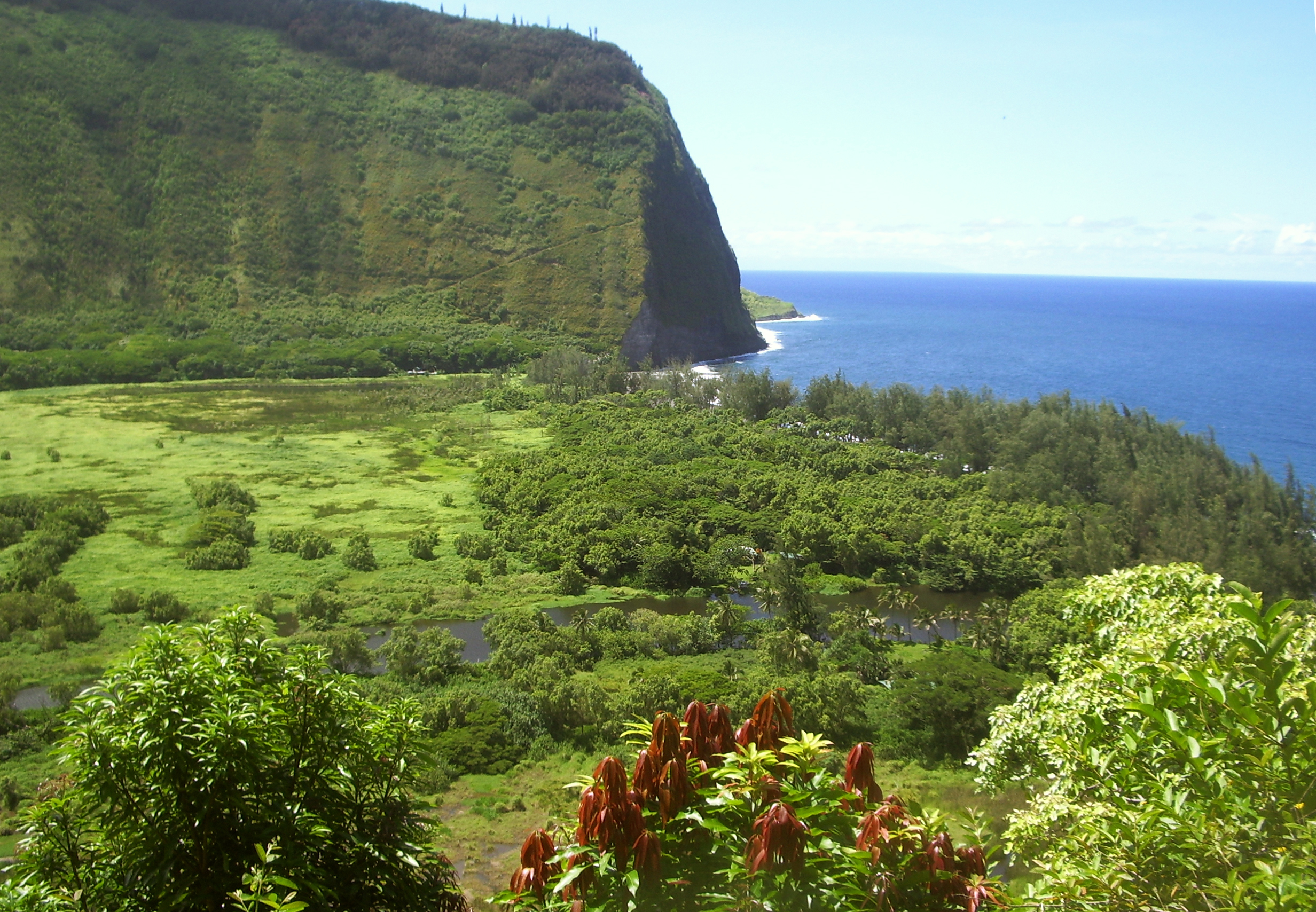
The Hamakua Coast, running up the windward side of the Big Island from just north of Hilo to the north tip island at Upolu Point, is one of the most magical, enchanting and memorable parts of the Big Island. To few people take the time to really see the depth and grandeur of the Hamakua District. Once the center of the sugar industry in Hawaii, Honoka'a, and the rest of District comprised of sweeping farm land, torrid jungle canyons and thousand foot lacy waterfalls, sank into pot-plantation era torpor, alowing the decades to simply wash over it. Experiencing a resurgence of energy, population and interest, Hamakua is remaiking itself as a tourist mecca and growing community of entrepreneurs, Eco-friendly industries and boutique agricultural businesses. You owe it to yourself to discover, explore and fall in love with this unique and special part of the Hawaii's Big Island.
Pepe’ekeo Scenic Drive
Located just a few minutes north of Hilo on Highway 19, this “Old Road through Old Hawai'i”, a four-mile-half hour scenic wander, parallels Highway 11 but is removed worlds away from the traffic and hustle along the main road. Rolling along old cane fields, jungle-canopied in places, passing waterfalls and crossing creeks, the Pepe’ekeo Scenic Drive is a special treat for the visitor who may be thinking they waited a century too long to visit Hawai'i. On a sunny day, on a rainy day, it doesn’t matter; this scenic drive is a joy.A scenic overlook of Onomea Bay, near the head of the trail, reveals the wildly scenic, untamed coastline and canyon mouth, beckons casual hikers to explore Onomea Bay.

Onomea Bay Trail
Only a few miles north of tame and sedate Hilo Bay, Onomea Bay is subject to the full fury and magic of the open Pacific Ocean. Rugged, jagged, majestic, the wickedly sculpted cliffs along the bay belie the easy 15 minute walk down to the beach. Accessible to most walkers of even marginal condition, the trail leads alongside a botanical garden (be sure not to wander through any their gates unless you are a paying customer) and falls forthrightly down to the canon mouth, past a tiny waterfall at the end of the stream and to the beach. A lovely walk and a wildly inspiration place; if you have an extra forty minutes to spare, this walk is well worth the time.The fishing here is great but we don’t recommend swimming here due to the currents and rip-tides.

Akaka Falls
There is a reason that Akaka Falls rates as the most visited tourist site on the island of Hawai’i. Simply put, the 420 foot, free falling plunge of clear water down a fern festooned cliff is an amazing and beautiful site. Leaving the parking lot, the loop trail immediately splits. Going left through fern, ginger, impatiens and bamboo, one reaches Akaka Falls in 5-8 minutes of ambling. If you turn right, the trail loops up and down some hills, through a wonderful jungle of flowers, ferns, heliconia, palms and bamboo to 100 foot tall Kahuna Falls in about 15 minutes of walking; Akaka Falls is then reached by following the same path another 5 minutes and 5-8 minutes after that you are back at the parking lot.Almost every town in Hawai’i has a “Wainuenue street”. From the Hawai’ian syllables “wai” meaning “fresh water” and “nue” meaning “colorful” or “dancing”, the word “wainuenue” refers to the rainbow seen in waterfalls. If you are lucky, and approach Akaka Falls on a sunny morning when the sun shines into to grotto, you may be blessed with seeing this lovely Hawai’ian icon, the wainuenue.
When visiting Akaka Falls, be sure to save some time to explore the shops, galleries and cafes of Honomu on the way back to the highway; it’s unlike anywhere you’ve ever been before…guaranteed.
Hakalau Beach Park
Oh, wow! Most definitely the tropical paradise you dreamed about visiting, this thick, lush jungle canyon is a stunning remnant of Old Hawai'i, leading along a rushing stream to a narrow canyon festooned with tropical blossoms, vines and palms to a sandy beach where the surf is nothing short of amazing.Although locals surf and swim unconcernedly here, the visitor is advised to admire the water, but not go in. Not only are the waves, currents and tides lethally treacherous here, but stream mouths and murky water are prime hunting grounds of Hawai'i’s own tiger, Mano, the shark.
There are no services at Hakalau Beach.
Kolekole Beach Park
The river you saw magnificently leaping with such glorious abandon off the cliff at Akaka Falls ends its journey to the sea by sluicing down through this Koa-tree filled canyon and smashing into the surf at Kolekole Beach Park. Lawns, picnic facilities, a wild beach, a jungle canyon and a water-fall festooned swimming hole round-out the amenities at Kolekole Park.
Laupahoehoe Train Museum
Back in the day, built around the turn of the century, various train lines nearly circumnavigated the Big Island, carrying raw cane to refineries and sacks of sugar to quaysides dotted here and there around the island. The coming of a large military presence during the Second World War was marked by an era of road building which more or less obviated the need for the trains. Tracks and trestles were cannibalized for wood and metal in the war effort and slowly the Big Island train industry was groaning to an ignoble halt when the tidal wave of 1946 destroyed much of the remaining track; today the carcass of Big Island railroading is all but pillaged into oblivion.
Here at Laupahoehoe, preserved alongside the one-time loading platform, is the Laupahoehoe Train Museum, stuffed full of interesting artifacts and photos and staffed with enthusiastic, well-informed, fun--- and did we mention enthusiastic?—docents. Look for “Old Rusty” outside the museum—a restored engine and caboose.
Laupahoehoe Train Museum and its associated gift shop, featuring many handcrafted gift items made by local artisans, are open daily, from 9 am to 4:30 pm on weekdays, and from 10 am to 2 pm on weekends. Public restrooms are available. Admission is $3.00 per adult and $2.00 for students and seniors.
Kalopa Native Forest State Park and Recreation Area
A small park with numerous hiking trails, Kalopa showcases the upland, tropical forest of the northeastern part of Hawai’i Island. Amenities include picnic tables, tent camping and small, if somewhat ragged, cabins for rent, a wonderful forest ambiance and absolute silence. This a great place to escape the rattle and hum of East Hawai’i.Honoka’a Town
Built in the era of great plantations and left culturally and economically isolated after the collapse of the sugar industry, until recently Honoka’a and the Hamakua Coast were content to drowse along through the decades. A boom in real estate and a return of vital human energy to the area has made a literal renaissance of the town of Honoka’a. A bustling hub, it boasts numerous wonderful restaurants, gift and boutique shops and the highest density of antique shops on the island. Be sure to stop to explore a little, have a meal or do some shopping in scenic Honoka’a on your way to or from Waipi’o Valley…it’s a fun, happening kind of place. Just remember, it’s a “happening kind of place” in the Hawai’ian sense—which means a little laid back, and always steeped with aloha.
Waipi’o Valley
Waipi’o Valley is arguably the most magical place on the Big Island. The steep canyon walls and verdant fields of the valley floor, the mile long black sand beach and numerous immense waterfalls that line the valley walls all call out to the visitor for exploration.Always listed among the most beautiful spots in the State of Hawai’i, this valley is as hauntingly lovely as it is difficult to see in its entirety.
Although the mile-long black sand beach is gorgeous, the forest and jungle canyon floor and walls amazing and the numerous, high-flying waterfalls compelling, it's a long and steep hike down in, and an equally long, but much more arduous, hike out. The road is windy and dangerous to drive...we don't recommend it.
Tours down into the valley in vans, on horse drawn wagons and ATVs can be booked in Honoka’a. Over-flights in fixed wing aircraft and helicopters also offer fine venues from which to see this amazing piece of Hawai’i.
For more information on traveling to Hawaii in general or touring the Big Island in particular, visit http://tourguidehawaii.com or www.lovingthebigisland.wordpress.com.
About the Author: Popular television personality and award-winning independent filmmaker Dr. Donald B. MacGowan originally pursued a career in academics, earning two B.Sc. degrees, a dual M.Sc., and a PhD.; co-authoring over 5.2 million dollars in grants, and publishing more than 200 refereed journal articles, abstracts, etc. Gaining sanity somewhere in that process, he quit the academic rat race and began to live. Donnie is an accomplished, prolific alpinist, having climbed on 5 of the seven continents, putting up more than 150 first ascents on rock, ice and snow, and a dozen first ski descents. He has written, directed and produced short and feature length films on health, travel, mountaineering and life in a touring rock band. Donnie records and tours relentlessly with his Celtic Punk fusion band "Fatal Loins"--although nobody much seems to care for their music. A Hawaii resident since 2000, he quietly and humbly inhabits Kailua Kona, doing environmental good works, surfing the be-jeezis out of the local waves and frenetically producing somewhat bizarre and mildly disturbing programs for local television which have recently been lauded as: "Ignorant", "Arrogant" and "Totally Insane". You may say what you wish about him, Donnie does not care. For somewhere underneath those swaying palm trees, in those warm aloha breezes, he is far too busy praying for good surf to hear you...
Monday, December 1, 2008
Volcano House in Hawaii Volcanoes National Park--A Historical Hostel on the Edge of the World's Most Active Volcano!
The grand tradition of hostelling at the edge of Kilauea Volcano began with construction of the first Volcano House in 1846; as such, Volcano House is Hawaiis oldest continuously operated hotel. Famous Guests include Queen Lilioukalani, Samuel Clemens, Theodore Roosevelt and Elvis Presley. Since Polynesians first arrived in Hawaii, temporary grass shacks had been constructed on the lip of Kilauea Crater to shelter kahuna and alii who went there to give praise and worship to Madame Pele. Chiefess Kapiolani, a converted Christian, had a grass hut constructed on the edge of the crater, then filled with a molten lava lake, in 1826 from which she and her retinue held ceremonies to denounce the goddess.
Benjamin Pitmann Sr. built a grass shack he named Volcano House as the first structure to serve solely for the sheltering of kamaaina and tourists visiting the volcano. In 1866, this structure was replaced with one of ohia poles and pili grass. American novelist and humorist Sam Clemens, who stayed at Volcano House in 1866 proclaimed: The surprise of finding a good hotel at such as outlandish spot startled me, considerably more than the volcano did.
In 1877 the first fully wooden Volcano House was built, which featured 6 rooms and a large parlor with a fireplace; this building is now being used as the Volcano Art Center and was moved to its present location in 1941. Although the hotel has continued to grow and change over the years, the fire in Volcano House fireplace has burned continuously for 125 years. In 1940 most of the hotel was destroyed in a boiler fire and Uncle George Lycurgus built the structure that stands as the current hotel in 1941 of wood and stone.
A tour of the Volcano House and small museum should include the parlor with its koa piano, paintings and welcoming fireplace, the restaurant (the only food available in the Park) and the two gift shops as well as the breath-taking view of Kilauea Crater from the back lanai of the main building.
For more information about traveling the Big Island in general and exploring Hawaii Volcanoes National Park in particular, visit www.tourguidehawaii.com and www.lovingthebigisland.wordpress.com.
Produced by Donald B. MacGowan; videography by Frank Burgess and Donald MacGowan; Narrated by Frank Burgess, Original music written and performed by Donnie MacGowan.
Subscribe to:
Posts (Atom)

