Showing posts with label tourguidehawaii. Show all posts

Sunday, May 3, 2009

Historic Kailua Kona Town on the Big Island of Hawaii: A Walking Tour

Evening Sunshine Glows on Old Kailua Town: Photo by Donnie MacGowan

The town of Kailua Kona is the crown jewel on the island of Hawaii and the beating heart of the Kona Coast. A sleepy fishing village not so long ago, Kailua Kona is now the metropolitan center of West Hawaii’s burgeoning economy and exploding population. Founded by King Umi in the 1500’s, Kailua Kona served as the social, religious and political capital of Hawaii for several hundred years. Deeming it the loveliest spot in all the Hawaiian Islands, King Kamehameha the Great ruled his island empire during the final years of his reign from here.

Exploring the downtown area from the King Kamehameha Beach Resort to the Honl’s Beach on the south provides a couple hours pure enjoyment: easy walking along the incomparable turquoise Kona Coast under the warm, sapphire Hawaii sky, past ancient temples, missionary churches, intriguing and unique shops and wonderful restaurants. It is easy, walking here, to understand how one can be completely seduced by the magic of the Big Island.

Kailua Kona is a town made for walking, so start by parking your car. On the north side of town, abundant for-pay parking is available at the King Kamehameha Beach Hotel. Free parking on this end of town is available at Triangle Parking, between Kuakini Highway and Ali’i Drive. About half-way through town, by the Farmer’s Market and Hale Halawai Park, is a large area of free parking. On the south side of town there is abundant free parking at the Coconut Grove shopping area, and at Honl’s Beach.

Let’s start exploring Kailua Kona on the north and work our way south. The thatched structure surrounded by carved wooden idols across from the pier is ‘Ahu’ena Heiau, an ancient and sacred temple site. A temple (or Heiau) has existed on this spot since at least the first millennium, and as recently as the 15th century was occupied by a temple of human sacrifice (or luakini Heiau) dedicated to the war god Kuka’ilimoku. In 1812, King Kamehameha I ordered the heiau enlarged, rebuilt, rededicated as 'Ahu’ena Heiau (“hill of fire”), a temple of peace and prosperity dedicated to the fertility god Lono.

Ahu'ena Heiau, Kailua Kona: Photo by Donald MacGowan

The current structures seen at 'Ahu’ena Heiau were re-built in 1975 under the auspices of the Bishop Museum with financial help from the Hotel King Kamehameha and are constructed to 1/3 the original scale. Here, there is a veritable forest of of carved, wooden sacred images in the “Kona Style”, considered the most refined in all Polynesia.

Three delightful, but tiny, beaches grace the immediate downtown area; from north to south they are named Kamakahonu, Keakaiakua and Niumalu--many locals do not even know thy have names. The snorkeling from these small beaches is spectacular and strangely uncommon. A beautiful coral garden and vibrant reef fish can be seen snorkeling along the shoreline off 'Ahu’ena Heiau where fish, turtles and eels are abundant in Kailua Bay.

Pao Umi Rock and the Moreton Fig Tree in Kailua's Evening Light: Photo by Donnie MacGowan

Pa’o Umi, a point of rock between the pier and Hulihe'e Palace and mostly buried under Ali’i Drive, is where High Chief Umi is thought to have landed when he moved his court from Waipi’o Valley to Kailua in the 1500’s. Umi consolidated and centralized religious and secular power of Hawai’i Island in Kona and built a number of temples, most notably on the current sites of Ahu’ena Heiau, Moku’aikaua Church and Kona Inn. Umi founded the political landscape which ultimately fostered King Kamehameha’s regime and led to the unification of the Hawai’ian Islands into a single nation.

Across Ali’i Drive from Pa’o Umi is a large Moreton Fig tree that appears in photographs of downtown Kailua since before the turn of the last century; as such, this tree is at least 140 years old.

Mokuaikawa; the First Christian Church in Hawaii: Photo by Donald B. MacGowan

During the winter of 1819 to 1820, Congregationalist missionaries from Boston crossed the Atlantic Ocean enduring 5 months of intense stormy weather while headed for a new life in Hawai’i. In March of 1820, the missionaries sailed into the balmy waters of Kailua Bay and landed at Kamakahonu Rock (eye of the turtle"), the “Plymouth Rock” of Hawai’i, which now supports the Kailua Pier..

Mokuaikaua Church, built under the leadership of missionary Asa Thurston between 1835 and 1837, was specifically aligned so that the prevailing breezes would pass through it, but also so that it presented a strong, stone façade to the south and west, the direction from which strong Kona Winds, large storms and hurricanes come. The 112-foot steeple was for many decades the highest structure in Kailua and served as a navigation landmark both for ships at sea and people on land.

The church is constructed of rough-hewn basalt blocks mortared with lime made from burnt coral and bound with kukui nut oil. The corner stones were taken from a heiau built on the same spot by King Umi in the fifteenth century. The interior beams and woodwork are of koa wood. The joints were painstakingly joined with ohi’a wood pins; this is a magnificent example of the architectural style brought to Hawai’i by the missionaries in the 19th century.

The inside of the church is beautiful, cool and inviting, and visitors are welcome between services and on weekdays between sunrise and sunset; admission is free. There is a fascinating mini-museum, small but informative, which is open daily from sunrise to sunset and free tours are conducted from 10 a.m. to noon and 1 to 3:30 p.m. The Museum features exhibits about Hawai’i, the life of the missionaries and contains a scale model of the Brig Thaddeus.

Hulihe'e Palace, Kailua Kona Hawaii: Photo by Donnie MacGowan

Hulihe’e Palace was built by High Chief (later Governor) James Kuakini in 1838 as a home. For many years, the Palace was used by Hawai’ian royalty as an official residence and summer get-away palace, a place of great galas and parties, but was abandoned to ruin in 1914. Since 1928 the Palace has been operated as a museum by the Daughters of Hawai’i. The Palace Gift Store has many fine art items and hard-to-find books on Hawai’iana.

The museum is open Monday-Friday, 9 a.m. to 4 p.m. and Saturday and Sunday, 10 a.m. to 4 p.m. There are friendly and knowledgeable docents who give free tours, which last about 45 minutes. Admission is $5 for adults, $4 for seniors and $1 for students; photographing inside the museum is forbidden. The palace sustained considerable damage during the earthquake of 2007 and is currently undergoing renovation.

Kona Inn Shops: Photo by Donald B. MacGowan

The Kona Inn is of particular historic significance, as it was the first destination resort to open in West Hawai’i and it ushered in the era of tourism along the Kona Coast. Built on the site of Papa ‘Ula (red flats) where a temple of human sacrifice was built by High Chief Umi, today the Kona Inn features many unique and interesting shops and fine restaurants.

The Inn fronts on a large, palm-shaded lawn that leads to a seawall and the ocean. This area is open to the public and is a really grand place for picnicking, watching whales and dolphin and the fabulous Kona sunsets.

The Kailua Farmer’s Market, open Wednesday through Sunday, lies in the parking lot at the corner of Ali’i Drive and Hualalai Road between the Public Library and Hale Halawai Park. The market offers a wide and intriguing variety of fresh produce, hand-made local arts and crafts, Hawai’iana and other types of souvenirs.

Kailua Famer's Market: Photo by Harvey Bird Watching
Kailua Farmer's Market: Photo by Harvey Bird Watching

The grounds and oceanfront of Hale Halawai Park offer a peaceful, shady place for taking a rest from a busy tour of bustling downtown Kailua, or watching whales and dolphin and the unmatched Kona sunsets. Frequently honu (sea turtles) and boogey boarders can be watched from the seawall. Featuring coconut palms, a neatly manicured lawn, picnic tables and a seawall, the large, Polynesian-style pavilion is used for everything from community gatherings to orchid shows to wedding receptions.

Saint Michael the Arch Angel Catholic Church, Kailua Kona Hawaii: Photo by Donnie MacGowan

Historic St. Michael’s Church was the first Catholic Church in West Hawai’i. The church offers services in English and Spanish throughout the week, but is primarily of historic interest; the burial plots in the cemetery date from 1855. In 1940, during less “ecologically aware” times, resident priest Father Benno Evers had his parishioners gather 2500 coral heads to build the grotto in front of the church, which covers the church’s original well. The seafloor in Kailua Bay has yet to recover from this pillaging of coral heads.

Coconut Grove and Waterfront Row cap the southern end of the Kailua Village shopping district along Ali’i Drive, starting next to the Hale Halawai County Park and ending at the Royal Kona Resort. Newer and more metropolitan that its sister shopping district to the north, Coconut Grove and Waterfront Row have almost everything, from tattoos to souvenirs to Hawai’iana, fine art, musical instruments, sundries, groceries and clothing. The range of cuisines available from restaurants here sweeps from local flavor to Thai, the Hard Rock Cafe to poi crepes to pizza and burgers

Public Queensbath Tidepool: Photo by Donald B. MacGowan

Between the Royal Kona Resort and Hale Kona Kai Resort is a fabulous tide pool that is completely protected from all but the most vicious winter surf. It boasts a moderate population of reef fish and even the occasional turtle! The water sometimes can be a bit murky, but it makes a nice place to take small children or beginning snorkelers. Drive into the entrance for the Royal Kona Resort and continue south past it until you see the blue and white Shoreline Access sign; find a place to park, go down the stairs to the tiny beach and enjoy!

Honl's Beach in Kailua Kona: Photo by Donald B. MacGowan

Lovely but compact, Honl’s County Beach Park is a small beach on the southern outskirts of Old Kailua Town. A favorite spot for surfers and boogie boarders it also has very nice snorkeling and is an excellent place to view the sunset and picnic. Remember when going into the water here, there is a fairly strong current to the north, so stay in the shallow reef area close to the beach. Parking is located on both sides of Ali’i Dr., but can be tight here in times of good surf, and crossing Ali’i Dr. drive can be a bit dangerous at certain times of the day. A new bathroom with showers and running water has recently been constructed on the mauka—uphill--side of the road.

Monk Seal on Honl's Beach at Sunset: Photo by Donald B. MacGowan


For more information on traveling to Hawaii in general and touring the Big Island in particular, please also visit www.tourguidehawaii.com and www.lovingthebigisland.wordpress.com.

All media copyright 2009 by Donald B. MacGowan; all rights reserved.


Tuesday, January 13, 2009

Kalapana, Hawaii: From the Fires of Hades to the Eden of Rebirth

Kaimu Black Sand Beach at Kalapana, Hawaii: Photo by Donnie MacGowan


By Donald B. MacGowan

On the southeast coast of the Big Island of Hawaii runs the Kapoho-Kalapana Highway, perhaps the only road in the world named for two cities that have been buried by volcanic eruptions. Before the destruction of these towns, this area harbored some of the last refuges of the native Hawaiian way of life--it was a safe haven from the ravages, temptations and noisome encroachments of western civilization. Here were villages of Hawaiians, living as they have for hundreds of years, fishing, farming and keeping their culture, their way of life, their people, alive and vital.

But life on an active volcano is uncertain. Life on an island with 3 active volcanoes, as Hawaii has, is perilous. And for this particular corner of Hawaiian paradise, Madame Pele, the Goddess of the Volcano, began to have other ideas.

In 1990 Pele determined it was time for some serious geographical reorganization. Lava flows from Kilauea’s East Rift swarmed down the mountain and engulfed the villages of Royal Gardens, Kaimu and Kalapana, destroying virtually everything. Immolated and buried were centuries-old fishing villages and a world famous black sand beach. The road ends today where Kaimu Black Sand Beach once stood, and is now a thousand yards and more inland.

When the lava came, it wiped out not just homes, gardens, crops and material things, it wiped out a way of life and a landscape cherished by generations. Imagine the staggering losses to the community. The coconut grove by the beach where, for a thousand years, the Kahunas had blessed the fishing canoes, was not only wiped away and covered with lava, but the landscape was altered so permanently and completely that none are even sure where it used to be. The spots where generations of fathers taught their sons to fish, gone. The groves where mothers sat with their daughters passing on the arts of weaving along with the family stories, gone. The beach where thousands of young lovers had walked the moonlit surf, arm in arm, for centuries, and where perhaps not a few babies had also been made, gone beneath 50 feet and more of lava. Everything gone; a landscape, a way of life, an entire culture.

It was from her vision of strength and a refusal to let her community die, rather than feelings of loss and desolation, that inspired one local resident to replant and reestablish the area. Not to just replant her land, but the entire village. Inspired, tirelessly, steadily, she worked planting hundreds, then thousands, of sprouted coconut and other palms and encouraged others in her community to join in. Even when she discovered she had a terminal disease, she selflessly redoubled her efforts, continuing her campaign to replant and recover the village, the community pitching in even more after she passed away.

Today there are literally thousands of young trees growing on the no-longer barren lava, and a new geography for new lives and new memories is being born. Her vision of rebirth, now being realized, is a moving testament to the power of love of ones’ community and commitment to ones’ culture. This living vision of young palm trees is an amazing, enduring monument to her optimism, faith and perseverance, and to that of her community. One of the truly most moving stories in the Islands, this place has to be seen to be appreciated.

When you visit Kalapana today, the devastation of 20 years ago is still obvious, but so is the vision of rebirth. Although none are yet as tall as a man, the rebuilt trail to the new black sand beach, Kaimu Beach, is lined with the young palms. You should take time to wander out to the beach, over the acres of new land, and look back at where the village of Kalapana once stood. Near the parking area along the path are fossils, lava casts, of palm trees, coconuts, pandanas fruit and other plants…keep a sharp eye out, they are everywhere. Swimming is hazardous at the new beach, so is surfing, the ocean currents being strong and treacherous. But take some time to relax, wade, feel the sand beneath your feet and amidst the lunar desolation of the fresh lava flows, contemplate the drive of one dying woman to rebuild a world she loved from a devastation few of us can imagine.

From the lava hillocks along the trail you can get nice views of the eruption plume at Pu’u O’o, up on the flank of Kilauea as well as the steam clouds down a few miles along the coast where the lave enters the sea at Waikupanaha. This is one of the few places where both can be seen easily and at the same time.

Back at the parking area at the road’s end, look a bit farther to the west and find Uncle Robert’s House, one that was spared the destruction, where a display of photos of the lava flows and the village in pre-disaster times in a miniature museum can be found, along with an interesting nature trail. The stop is worth your time, and be sure to leave a donation in the offering jar.

The extreme devastation suffered by the people of Kalapana may be a long way from our own life experiences, but we should take inspiration and example from their vision, their optimistic perseverance and their deep love of, and commitment to, their way of life.

Wednesday, January 7, 2009

Eruption! Viewing lava at Hawaii Volcanoes National Park


Written directed and produced by Donald B. MacGowan; Narrated by Frank Burgess; Original Musical Score by Donald B. MacGowan

Can you believe this? It's absolutely outstanding and amazing! You can actually walk right up to flowing lava here; see a volcano erupt before your eyes and the molten rock pour into the sea. This has to be one of the four or five most exciting, amazing, wonderful, mystical experiences on earth...you must not miss this!

Mauna Loa is active but not currently erupting. The summit area is slowly inflating, filling with magma and the flanks are subject to frequent minor earthquakes, but no obvious activity is apparent to the visitor. Kilauea, the most active volcano on Earth, started its current eruptive phase in 1983, the longest eruption in history. Since then it has ejected almost 3 billion cubic meters of lava. Flowing from various vents in the rift, most notably Pu'u O'o, in streams and tubes at over 1000 degrees Celsius, much of the lava makes its way into the sea in fiery, steamy explosions or the incredible incongruity of glowing hot lava pouring directly into the sea with little more apparent than a mere bubbling of the water.

Although surface flows and breakouts are frequent and common, there is no guarantee that over any given trip to the Big Island they will be visible or easily accessible to the casual visitor. Since the flow of lava over the moonscape plains and into the roiling sea can be seen nowhere else on earth, it is certainly the most exciting, unique and moving highlight of any trip to Hawai'i. People stand at the edge of the flow and weep at the majesty and mystery of the earth remaking itself; it is wondrous, remarkable and unforgettable. Before planning a hike to see the lava, check with the Rangers at Hawaii Volcanoes National Park for information on the hike length and location of surface flows and a review of safety information.

The lava seems to glow with only a dull petulance during the day and may be less than inspiring until nightfall brings it alive and the madly glowing, fiery goddess within is revealed. Thus knowledgeable hikers plan their hike to commence in the afternoon, reaching their destination at dusk, and to hike back in the dark. The lava streams and tubes migrate back and forth from time to time over a pali and plain of about 8 miles breadth. Sometimes the hike is a few hundred meters, sometimes a few miles, but it is always over an uneven, rough surface, hot during the day even when it rains, cold at night and navigation can sometimes be counterintuitive. The trail at first is marked with cairns and reflectors, but after the viewpoint overlook at a few hundred meters, you are on your own to navigate the basalt wilderness. Take at least 3 quarts of water for each person and two working (check before you leave!) flashlights per person. It is further recommended that you carry sunscreen, snacks, a first aid kit (that rock is SHARP, cuts are common) and wear sturdy hiking boots and long pants. Remember that you are hiking on a highly active volcano, if flowing streams of lava strand you, no rescue is practical or possible; plan, take care and pay strict attention accordingly.

For more information on viewing the lava, visit www.tourguidehawaii.com and www.lovingthebigisland.wordpress.com.

Monday, November 3, 2008

Waldron Ledge Hike, Hawaii Volcanoes National Park


A short, 20 minute-or-so hike on an abandoned section of Crater Rim Drive through lush fern and ohia forest brings one to spectacular views of the Kilauea Caldera, Waldron Ledge and Pu'u Puai at the mouth of Kilauea Iki Crater. This hike is one of the few places where bicycles are allowed, and the generally shaded road makes for a pleasant, but short, ride or hike. This trail is a great way to get away from noise and traffic and experience the lush, high altitude fern forest firsthand.

Produced by Donald B. MacGowan; videography by Frank Burgess and Donald MacGowan; Narrated by Frank Burgess, Original music written and performed by Donnie MacGowan.

For more information about traveling the Big Island in general and exploring Hawaii Volcanoes National Park in particular, visit www.tourguidehawaii.com and www.lovingthebigisland.wordpress.com.

Tuesday, October 28, 2008

The Weather This Week In Paradise

Reprinted from here.

Point Forecast:
Kailua Kona HI
19.63N 155.95W (Elev. 1217 ft)
Last Update: 4:55 am HST Oct 28, 2008
Forecast Valid: 6am HST Oct 28, 2008-6pm HST Nov 3, 2008


Forecast at a Glance
Today

Isolated Showers Chance for Measurable Precipitation 20%
Isolated
Showers
Hi 82°F
Tonight

Haze
Haze

Lo 68°F
Wednesday

Haze
Haze

Hi 83°F
Wednesday
Night

Haze
Haze

Lo 67°F
Thursday

Isolated Showers Chance for Measurable Precipitation 20%
Isolated
Showers
Hi 83°F
Thursday
Night

Isolated Showers Chance for Measurable Precipitation 20%
Isolated
Showers
Lo 67°F
Friday

Scattered Showers Chance for Measurable Precipitation 30%
Scattered
Showers
Hi 83°F
Friday
Night

Isolated Showers Chance for Measurable Precipitation 20%
Isolated
Showers
Lo 67°F
Saturday

Scattered Showers Chance for Measurable Precipitation 30%
Scattered
Showers
Hi 83°F

Detailed text forecast
Today: Isolated showers after noon. Widespread haze. Cloudy, with a high near 82. South wind around 8 mph. Chance of precipitation is 20%.

Tonight: Widespread haze. Mostly cloudy, with a low around 68. South wind around 8 mph becoming east.

Wednesday: Widespread haze. Increasing clouds, with a high near 83. West wind around 7 mph.

Wednesday Night: Widespread haze. Mostly clear, with a low around 67. East wind around 9 mph becoming south.

Thursday: Isolated showers after noon. Widespread haze. Partly cloudy, with a high near 83. South wind around 8 mph becoming west. Chance of precipitation is 20%.

Thursday Night: Isolated showers before midnight. Widespread haze. Partly cloudy, with a low around 67. East wind around 7 mph. Chance of precipitation is 20%.

Friday: Scattered showers after noon. Widespread haze. Partly cloudy, with a high near 83. West wind around 6 mph. Chance of precipitation is 30%.

Friday Night: Isolated showers. Widespread haze. Partly cloudy, with a low around 67. East wind around 6 mph. Chance of precipitation is 20%.

Saturday: Scattered showers. Widespread haze. Partly cloudy, with a high near 83. West wind around 7 mph. Chance of precipitation is 30%.

Saturday Night: Isolated showers. Widespread haze. Partly cloudy, with a low around 67. South wind around 6 mph. Chance of precipitation is 20%.

Sunday: Scattered showers. Widespread haze. Partly cloudy, with a high near 83. West wind around 7 mph. Chance of precipitation is 30%.

Sunday Night: Isolated showers. Widespread haze. Partly cloudy, with a low around 67. East wind around 7 mph. Chance of precipitation is 20%.

Monday: Scattered showers. Widespread haze. Partly cloudy, with a high near 82. West wind around 7 mph. Chance of precipitation is 30%.

For more information on touring Hawaii in general and visiting the Big Island in particular, please go to tourguidehawaii.com and lovingthebigisland.wordpress.com.

Friday, October 24, 2008

Mauna Ulu, Hawaii Volcanoes National Park, Big Island Hawaii


Mauna Ulu, or growing mountain is a tall, sloping, shield-shaped hill formed by numerous eruptions along the rift between 1969 and 1974; Mauna Ulu is best seen by walking a few yards past the road beyond the parking lot to where the end of road is covered in fresh lava flows. At Mauna Ulu, visitors can get an intimate look at both pahoehoe and aa lava flow types. Pahoehoe, the less viscous and generally hotter liquid flow, moves fluidly like a river or glacier, the surface folding and molding, like poured taffy, into a ropy structure. Pahoehoe forms generally flat, fairly smooth, hard surfaces. Aa, on the other hand, is much cooler and has exolved much of its dissolved gas, so it is much more viscous, causing the upper surface to fracture into clinker-like boulders and fragments. Flowing aa sounds and looks like a moving pile of hot glass shards; when it cools, it leaves behind rubbly piles of sharp fragments. Fields of pahoehoe and aa make a landscape that look as if Madame Pele has bulldozed her land to flat surfaces, but left these acres of boulder piles here and there.

Pu'u Huluhulu (shaggy hill) is a 150 foot tall cinder cone formed in pre-contact times between Mauna Ulu and Pauahi Crater. There is a fascinating 3 mile round trip hike from the Mauna Ulu parking lot to the top of Pu'u Huluhulu that is marked by cairns (or ahu). From the vantage point of Pu'u Huluhulu's summit, one can see Pu'u O'o (hill of the bird) about 5 miles away. From Pu'u Huluhulu are fine views of Mauna Loa, Kilauea, Mauna Kea, the coastline and Pu'u O'o. Pu'u O'o is a spatter cone built by the fire-fountains erupting along Kilauea's rift zone between 1983 and 1986. Since 1986, the center of eruption has moved about 2 miles further down the rift to a vent called Kupaianaha, or mysterious in Hawaiian. The round trip hike from Mauna Ulu Parking lot to Pu'u Huluhulu and return takes about an hour and a half to two hours.

The hike to the summit of Mauna Ulu is a long, dry, serious hike with some dangers and should only be undertaken by those in good physical condition and experienced at hiking cross-country across broken and hazardous ground.

Written and produced by Donnie MacGowan; videography by Frank Burgess and Donald MacGowan; narrated by Frank Burgess; original musical score written and performed by Donnie MacGowan.

For more information on touring Hawaii in general and visiting the Big Island in particular, please go to tourguidehawaii.com and lovingthebigisland.wordpress.com.

Tuesday, October 21, 2008

Kilauea Visitor's Center, Hawaii Volcanoes National Park


Newly remodeled and updated, the Kilauea Visitors Center is an outstanding resource of information on Hawai'i's volcanoes and the National Park; the not-to-be-missed, definitely first stop in the park you must make. The Center is run by enthusiastic and knowledgeable staff that has the most up-to-date information on viewing the eruption, hiking and camping, bird watching, stargazing and just about any other topic of interest to Park visitors. Available for sale in the Center are maps, guidebooks, books and videos about the volcanoes, Hawai'iana, history, plants and every topic you can imagine pertinent to the Park, even souvenirs. There are free brochures and pamphlets on various trails, attractions, hiking safety and lava viewing hazards and precautions. Starting at 9 a.m. and showing every hour on the hour is a 20 minute informative movie about the Park; the film changes from time to time, but always contains spectacular footage of eruptions, information on Volcanology and the natural and human history of the Park.

The Visitor Center is open daily from 7:45 a.m. to 5 p.m.; there are public restrooms, water and pay phones available. Tuesday evenings the Center is open until 9 p.m. for their After Dark In The Park series of free lectures that start at 7 p.m. Lecture topics range from natural history to geology to topics of local and regional importance and are presented by experts and community leaders. Call 808.985.6017 for the schedule of presentations.

Written and produced by Donnie MacGowan; narrated by Frank Burgess; videography by Donald MacGowan and Frank Burgess; original musical score written and performed by Donnie MacGowan.

For more information about touring Hawaii in general or visiting the Big Island in particular, go to www.tourguidehawaii.com and lovingthebigisland.wordpress.com.

Sunday, October 19, 2008

Kipuka Kahalihi, Hawaii Volcanoes National Park


Kipukas are holes between lava flows where vegetation is saved from being incinerated or buried. At Kipuka Kahalihi, however, much of the vegetation was buried in hot cinders blown here from the 1969 Mauna Ulu fire fountains. Only the tall vegetation was preserved from ash burial and only very hardy species have grown back since the eruption.

Written and produced by Donnie MacGowan; videography by Frank Burgess and Donnie MacGowan. Narrated by Frank Burgess; original musical score written and performed by Donnie MacGowan.

For more information on seeing Hawaii in general and touring the Big Island in particular, visit tourguidehawaii.com and lovingthebigisland.wordpress.com.

Friday, October 17, 2008

Muliwai O Pele, Hawaii Volcanoes National Park

The platform overlooks the remains of a trench that flowed full of lava at the time of the eruption, delivering million of gallons of molten fluid. When trenches such as these become roofed over, they are called lava tubes and the cooled remains are preserved as caves, such as Nahuku, or Thurston Lava Cave up on Crater Rim Drive. When the vent supplying the lava stops producing, these structures drain empty and cool. Large lava cascades may flow at a velocity of several to tens of miles per hour, however, in Hawaii, most flows can easily be outdistanced on foot.

Written and produced by Donnie MacGowan; narrated by Frank Burgess; videography by Donald MacGowan and Frank Burgess; original musical score written and performed by Donnie MacGowan.

For more information on touring Hawaii in general or visiting the Big Island in particular, go to www.tourguidehawaii.com and lovingthebigisland.wordpress.com.

Wednesday, October 15, 2008

Devastation Trail, Hawaii Volcanoes National Park


When Kilauea Iki erupted from vents on Pu'u Pua'i in November of 1959, several feet of hot ash and cinder-sized pieces of pumice fell on the lush fern forest downwind. Devastation trail follows the edge of this inundation, linking the Kilauea Iki Overlook Parking lot with another parking lot at the intersection of Crater Rim Drive with Chain of Craters Road in a wonderful and interesting 0.7 mile, 30 to 45 minute) hike.

During the eruption, fire fountains of molten lava shot up as high as 1900 feet tall from the eruptive rifts. For a sense of scale, the worlds tallest building, the Taipei 101 which is 101 stories tall and 1667 feet high, would be dwarfed by these fire fountains. These immense fountains spread ash, pumice and spatter all around the area, as well as fed liquid lava to the lava pond within Kilauea Iki crater. The spatter was hot and plastic enough to weld together into the spatter cones you see on Pu'u Pua'i, however, the tephra and ash pumice spread out and fell downwind, depositing an immensely thick (as much as 3 meters) blanket when the eruption column collapsed between fountains. This pumice buried lush forest, which is preserved on the eastern side of Devastation Trail. On the west side of the trail is the sterile, moon-like devastation surface of pumice. A few ohia trees, dead and bleached, poke up through the pumice and very gradually some ohia, ohelo and ferns are beginning to recolonize the dead zone. Look for numerous tree molds along the trail in the section about a third of the way from Pu'u Pua'i to the Devastation Trail parking lot.

Pumice results when there is a lot of gas and water dissolved in the liquid lava. As the lava is erupted, pressure is released, the melt begins to cool quickly and the gas is rapidly exolved from the liquid lava—much the way carbon dioxide is exolved as a bubbly froth when you shake a can of soda pop. The spatter and lava in the ponds cool slowly enough for all the gas to escape, and the resultant rock is very dense when it finally solidifies. The pumice, however, chills so rapidly it forms a glass-like, frothy substance because it traps the bubbles. This is why pumice has a low enough density to float on water.

Written and produced by Donald MacGowan. Narrated by Frank Burgess. Videography by Donnie MacGowan and Frank Burgess; original musical score by Donnie MacGowan.

For more information on touring Hawai'i in general and visiting the Big Island in particular, go to www.tourguidehawaii.com and www.lovingthebigisland.wordpress.com.

Thursday, October 9, 2008

Hi'iaka Crater, Hawaii Volcanoes National Park


Hi'iaka Crater is a smallish collapse feature that formed in 1968 and was further modified in 1973 by lava that flowed from both nearby vents and a vent that opened within the lower south wall of the crater. Although the crater itself is uninteresting, there are many fascinating features to be seen by wandering around Hi'iaka and the lava flow, such as tree molds formed where pahoehoe lava backed-up behind trees and formed compression ribbons like poured taffy. By walking about 300 feet southwest from the turnout, one can find the large Koa'e Fault scarp, where it acted as a dam to flows coming out of Hi'iaka Crater in 1973.


Form more information on traveling to Hawaii in general or visiting the Big Island in particular, go to www.tourguidehawaii.com or www.lovingthebigisland.wordpress.com.

Sunday, October 5, 2008

Kilauea Eruption Update!

Kīlauea Eruption Status


Reprinted from here.

Photo by Donnie MacGowanPhoto by Donnie MacGowan

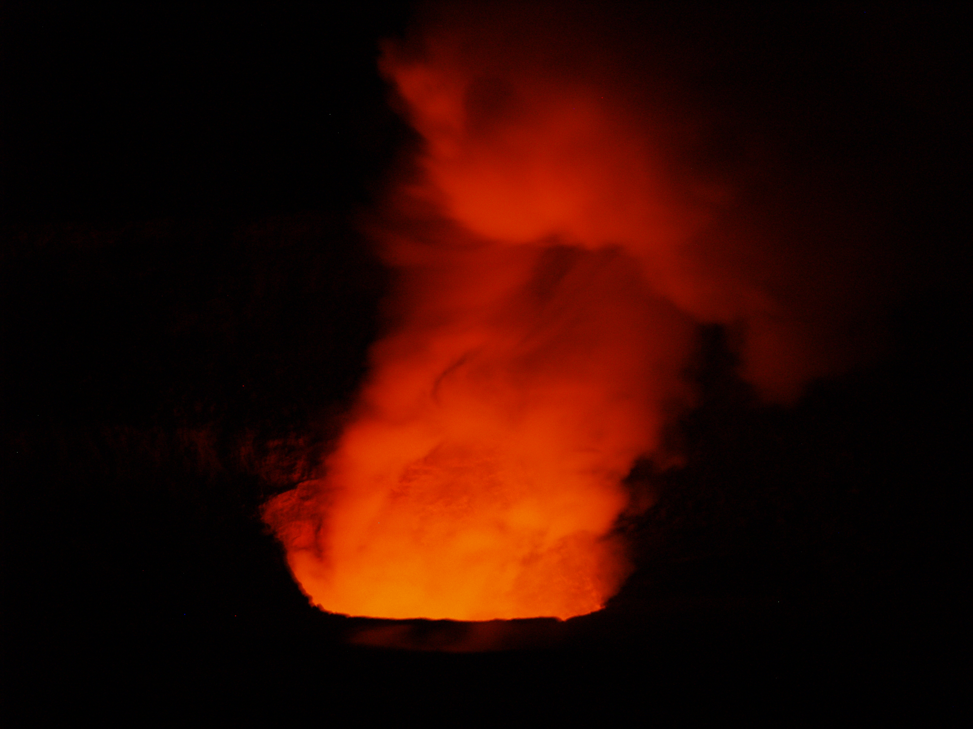
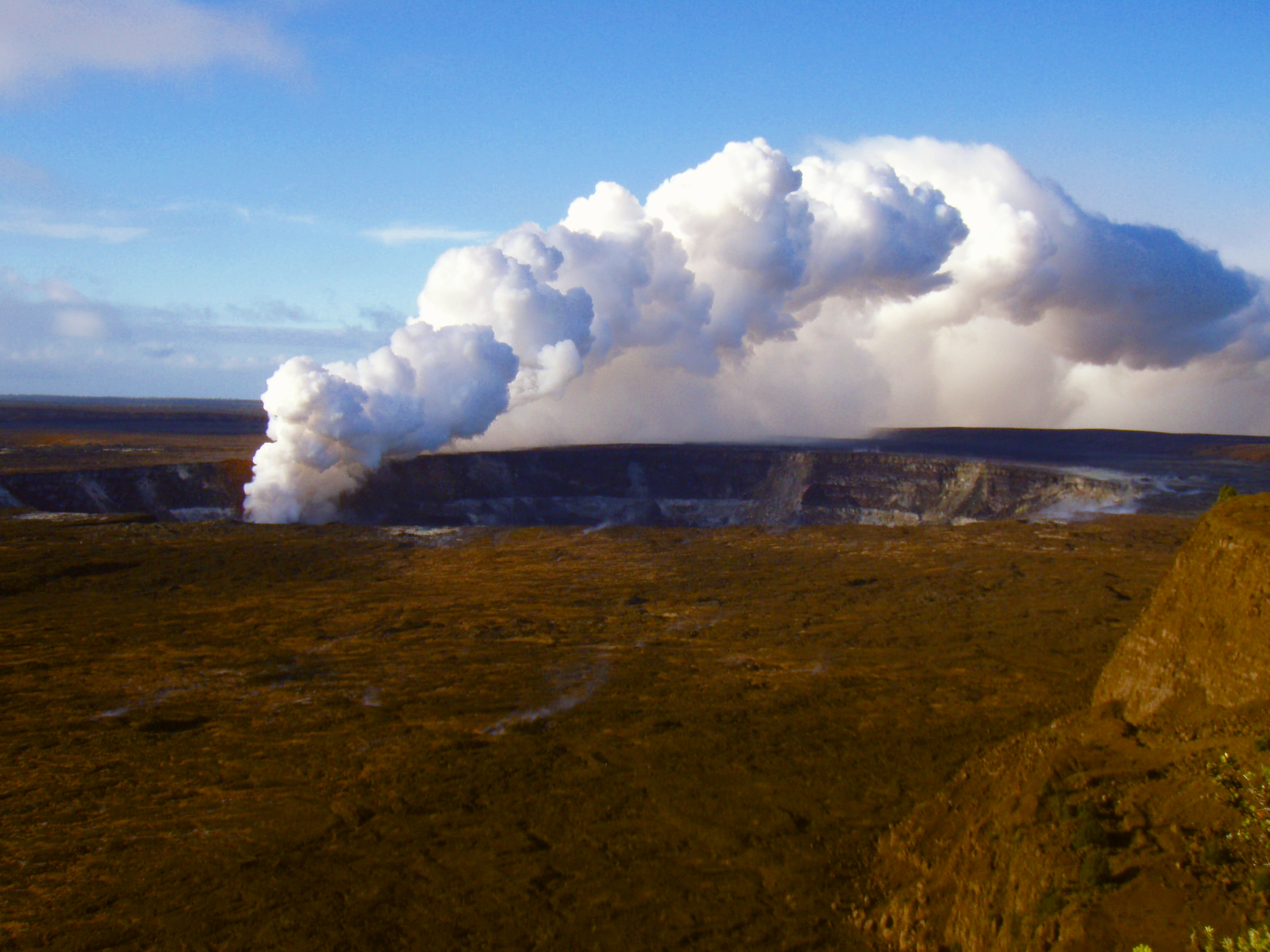
Kīlauea Volcano continues to be active. A vent in Halema`uma`u Crater is erupting elevated amounts of sulfur dioxide gas and very small amounts of ash. Resulting high concentrations of sulfur dioxide in downwind air have closed the south part of Kīlauea caldera and produced occasional air quality alerts in more distant areas, such as Pahala and communities adjacent to Hawai`i Volcanoes National Park, during kona wind periods. On September 5, scientists observed a 50-m- (160 ft) diameter lava lake about 100 m (330 ft) below the vent rim on the floor of Halema`uma`u; the lava cannot be seen from the rim of Halema`uma`u Crater or Jaggar Museum Overlook. There have been several small ash-emission events from the vent, lasting only minutes, in the last week.

Pu`u `Ō`ō continues to produce sulfur dioxide at even higher rates than the vent in Halema`uma`u Crater. Trade winds tend to pool these emissions along the West Hawai`i coast, while Kona winds blow these emissions into communities to the north, such as Mountain View, Volcano, and Hilo.

Lava continues to erupt from fissure D of the July 21, 2007, eruption and flows toward the ocean through a well-established lava tube. The ocean entry at Waikupanaha was interrupted twice in the past week in response to back-to-back deflation/inflation (DI) events at Kilauea summit. There were small, short-lived breakouts on the coastal plain early in the week as the eruption recovered from the two pauses in lava supply. The ocean entry had recovered by the second half of the week and hosted frequent small littoral explosions.

Be aware that active lava deltas can collapse at any time, potentially generating large explosions. This may be especially true during times of rapidly changing lava supply conditions. Do not venture onto the lava deltas. Even the intervening beaches are susceptible to large waves generated during delta collapse; avoid these beaches. In addition, steam plumes rising from ocean entries are highly acidic and laced with glass particles. Check Civil Defense Web site (http://www.lavainfo.us) or call 961-8093 for viewing hours.

Mauna Loa is not erupting. Four earthquakes were located beneath the summit this past week. Continuing extension between locations spanning the summit indicates slow inflation of the volcano.

Four earthquakes beneath Hawai`i Island were reported felt within the past week. A magnitude-2.0 earthquake occurred at 8:21 p.m., H.s.t., on Thursday, September 18, 2008, and was located 3 km (2 miles) southeast of Kilauea summit, at a depth of 3 km (2 miles). A magnitude-4.3 earthquake occurred at 5:59 p.m. on Friday, September 19, 2008, and was located 6 km (4 miles) northeast of Ka`ena Point on Kilauea's south flank at a depth of 10 km (6 miles). A magnitude-3.0 earthquake occurred at 7:49 a.m. on Tuesday, September 23, 2008, and was located 32 km (20 mile) northeast of Honoka`a at a depth of 32 km (20 miles). A magnitude-2.2 earthquake occurred at 7:25 a.m. on Wednesday, September 24, 2008, and was located 4 km (3 miles) northeast of Kukuihaele at a depth of 30 km (19 miles).

Visit our Web site (http://hvo.wr.usgs.gov) for daily Kīlauea eruption updates, a summary of volcanic events over the past year, and nearly real-time Hawai`i earthquake information. Kīlauea daily update summaries are also available by phone at (808) 967-8862. Questions can be emailed to askHVO@usgs.gov.

Photo by Donnie MacGowanPhoto by Donnie MacGowan

For more information on touring Hawaii in general and the Big Island in particular, go here and here.

Friday, October 3, 2008

The Weather in Paradise This Week

Reprinted from here.
Point Forecast:
Kailua Kona HI
19.63N 155.95W (Elev. 1217 ft)
Last Update: 5:00 am HST Oct 3, 2008
Forecast Valid: 7am HST Oct 3, 2008-6pm HST Oct 9, 2008


Forecast at a Glance
Today

Isolated Showers Chance for Measurable Precipitation 20%
Isolated
Showers
Hi 80°F
Tonight

Haze
Haze

Lo 66°F
Saturday

Isolated Showers Chance for Measurable Precipitation 20%
Isolated
Showers
Hi 80°F
Saturday
Night

Isolated Showers Chance for Measurable Precipitation 20%
Isolated
Showers
Lo 66°F
Sunday

Isolated Showers Chance for Measurable Precipitation 20%
Isolated
Showers
Hi 80°F
Sunday
Night

Haze
Haze

Lo 66°F
Monday

Isolated Showers Chance for Measurable Precipitation 20%
Isolated
Showers
Hi 80°F
Monday
Night

Haze
Haze

Lo 66°F
Tuesday

Isolated Showers Chance for Measurable Precipitation 20%
Isolated
Showers
Hi 80°F

Detailed text forecast
Today: Isolated showers after noon. Widespread haze. Partly cloudy, with a high near 80. West wind between 6 and 8 mph. Chance of precipitation is 20%.

Tonight: Widespread haze. Mostly clear, with a low around 66. South wind around 7 mph becoming east.

Saturday: Isolated showers after noon. Widespread haze. Partly cloudy, with a high near 80. West wind between 5 and 7 mph. Chance of precipitation is 20%.

Saturday Night: Isolated showers before midnight. Widespread haze. Partly cloudy, with a low around 66. South wind around 7 mph becoming east. Chance of precipitation is 20%.

Sunday: Isolated showers after noon. Widespread haze. Partly cloudy, with a high near 80. West wind between 6 and 8 mph. Chance of precipitation is 20%.

Sunday Night: Widespread haze. Mostly clear, with a low around 66. South wind around 7 mph becoming east.

Monday: Isolated showers after noon. Widespread haze. Partly cloudy, with a high near 80. West wind between 5 and 8 mph. Chance of precipitation is 20%.

Monday Night: Widespread haze. Mostly clear, with a low around 66. South wind around 8 mph becoming east.

Tuesday: Isolated showers. Widespread haze. Partly cloudy, with a high near 80. West wind around 7 mph. Chance of precipitation is 20%.

Tuesday Night: Widespread haze. Mostly clear, with a low around 66. South wind around 7 mph becoming east.

Wednesday: Isolated showers. Widespread haze. Partly cloudy, with a high near 80. West wind between 6 and 8 mph. Chance of precipitation is 20%.

Wednesday Night: Widespread haze. Mostly clear, with a low around 66. South wind around 7 mph becoming east.

Thursday: Isolated showers. Widespread haze. Partly cloudy, with a high near 80. West wind between 5 and 8 mph. Chance of precipitation is 20%.

For more information on touring Hawaii in general, and the Big Island in particular, visit here and here.

Tuesday, September 16, 2008

Sloshing lava lake viewed within Halema'uma'u vent

Reprinted from here.

This near-vertical view reveals a vigorously bubbling lava surface below the rim of the vent within Halema`uma`u crater. Continuous spattering was casting globs of lava across the lake surface and onto the conduit walls.

For the first time since the new vent opened in Halema'uma'u Crater on March 19, HVO scientists in a helicopter hovering over the crater were able to see the surface of a sloshing 50 m (160 ft) diameter lava lake about 100 m (330 ft) below the vent rim. HVO scientists have speculated that a lava pond existed a few hundred meters below the vent, but have not been able to get visual confirmation until this morning.

A second viewing early this afternoon revealed a roiling pond with multiple bursting bubbles changing into a central upwelling circulation pattern. The lake level dropped slightly before the cycle restarted. This behavior has been witnessed before, most recently in Pu'u 'O'o vents and the July 21 lava ponds on Kilauea's east rift zone, and is known as "gas pistoning." One model explains pistoning as small gas bubbles coalescing into larger bubbles beneath a crust on a lava pond, rising to the surface, and then bursting. The released pulse of hot gas carries rock dust from the collapsing vent walls, bits of the lava lake crust, and small amounts of spatter.

The Halema'uma'u vent has produced six significant explosive eruptions in the past 5.5 months, most recently on September 2, 2008 at 8:13 p.m. H.s.t., during which noteworthy amounts of fresh lava spatter and lithic material (rock fragments and dust) were ejected on to the crater rim. Just prior to this event, incandescence from the vent was almost nonexistent except for brief pulses of glow.

Nearly eight hours later, Kilauea's summit abruptly inflated, signaling the end of 39 hours of deflation. Summit deflation-inflation (DI) events have been observed at least 20 times since the Halema'uma'u vent opened. Each DI event has been interpreted as the fall and subsequent rise in magma levels beneath the summit.

Less than 8 hours after inflation started, episodic tremor bursts began which are visible at night as pulses of bright incandescence every 5-6 minutes. Episodic tremor bursts have been a nearly constant feature of the Halema'uma'u vent over the past few months and were one of the early pieces of evidence pointing toward a gas pistoning source.

This unusually bright incandescence over the past two nights and the volume of material erupted on September 2 are consistent with a lava surface at relatively shallow depths beneath the vent. Molten lava is not directly visible from the Jaggar Museum overlook, but that vantage point provides excellent views of the glowing vent at night.

For more information on traveling to Hawaii in general and visiting the Big Island in particular, visit www.tourguidehawaii.com and www.lovingthebigisland.wordpress.com.

Friday, September 12, 2008

Kilauea Iki Trail, Hawaii Volcanoes National Park


Perhaps the finest short day hike in the park, a four-mile, 2-3 hour trip down into, across and back out of Kilauea Iki Crater gives one an intimate feel for volcanoes, Hawaiian-Style. Crossing the crater floor on this surface provides one of the most interesting hikes in the Park. Looking up from the bottom of the crater, one can see the distinctive ring around the crater marking the high point of the lava lake during the last eruption. The four mile loop-hike descends from the rim in two places and crosses the crater floor in about three hours hiking at a nominal pace. Along one side, thick fern and ohia forest skirts along the rim and on the other, lush tropical rainforest crowds to the very brink of the crater; bleak volcanic desert lines the crater walls and covers the floor. The start and finish of the hike are along well marked, wide trails following the rim with handrails and stairs in some spots as you begin to descend into the crater. The remainder is an easily followed, well marked trail with stone ahu (cairns) over the crater floor. Recent bore-hole measurements indicate that roiling molten lava is lying beneath the skin of the caldera only 230 feet beneath your hiking boots. Keep your eyes open for Peles Hair and Peles Tears (fine, thread-like and bead-like deposits of volcanic glass), gaseous vents and other marvels of the living lava mountain. This hike requires you to take plenty of water, rain gear, suncream, a map and compass, to wear sturdy hiking shoes or boots and to be in fairly good physical condition. As always when hiking in the Park, it is wise to avoid the noonday sun, and to remember that afternoon showers are common, especially at the crater rims.

For more information on visiting Hawaii in general or touring the Big Island in particular, visit tourguidehawaii.com and lovingthebigisland.wordpress.com.
 

Casino Bonus no Deposit