Showing posts with label discover. Show all posts

Sunday, January 11, 2009

Frank's Big Island Travel Hints # 7: Around Hilo


Hilo Side: Akaka Falls to Panaewa Rainforest Zoo

On your way back to the highway from Akaka Falls, stop in Honomu for some local-style shopping and a snack. Handmade curios and ice creams will delight your senses. Once back on Highway 19, turn right toward Hilo, about 10 minutes away.

Hilo is one of the wettest cities in the U.S. averaging around 200 inches per year. This old-style Hawaii town is quaint and bustling. Lots of great shops line the waterfront drive and the largest farmer’s market on the island is situated there as well. Tour Guide will take you right into the heart of town and give you history and attractions, such as the Pacific Tsunami Museum, and the Imiloa Astronomy Center at the University of Hawaii, Hilo Campus. A little farther along the coast are some beautiful beach parks like Richardson and Onekahakaha. Great picnicking, swimming and some good snorkeling can be found here. The Suisan Fish Market is famous for the early morning old-style fish auction. Be sure to take your time in Hilo as the shopping food options are immense.

In Hilo, you will turn north onto Highway. 11 at the intersection near Ken’s Pancake House, a landmark eatery. You will see the airport and Prince Kuhio Plaza on your way out of town. Stop in and visit the mall and shop and eat if you missed it in town. Just a few miles north of the mall is the Panaewa Rainforest Zoo. Tour Guide will tell you how this is the only rainforest zoo in the United States of America. It is also free.

Super Tip: Gasoline in Hilo is typically 6-10 cents per gallon cheaper because it is the main port on the island. It is wise to fill up before heading back to Kona.

This completes this drive day. I suggest returning north through Hilo and back up the Hamakua Coast, through Waimea, and Highway 190 back to Kona.

For further information, visit www.tourguidehawaii.com and here.

Thursday, January 1, 2009

Frank's Big Island Travel Hints #6: Waimea and the Hamakua Coast


For a third day of driving, it’s time to explore the east side of the Big Island. Hilo is known to be one of the wettest cities in the U.S and tropical rainforest extends from the Puna district, south of Hilo, all the way to the northern tip of the island. Here, Tour Guide will show you the favorite sights and the out-of-the-way places as well.

Super tip: For this leg of your tour you should bring some rain gear. Umbrellas or panchos are the easiest ways to get a little protection. It tends to rain off and on throughout to day on the east side.

Leaving Kona, take Hwy 190 up the mountain for some panoramic views of the Kohala Coast. It’s about a 45 minute drive to Waimea, which is a good place to stop for breakfast or at the grocery store if you haven’t stocked your cooler already. Tour Guide will have all the info on museums, an arboretum as well as shopping and up-country activities in Waimea. Here you’ll also connect to Hwy 19.

Continue on Hwy 19 north and view the scenic rolling pasturelands of the Parker Ranch, one of the largest privately owned ranches in the U.S. About 20 minutes drive brings you to the town of Honoka’a. Turning left, and going through town, you’ll find more great shops, antique stores and restaurants. Nine miles on Hwy 240 brings you to Waipi’o Valley. This is one of the most photographed areas in the state. This 20 mile stretch between Waipi’o and Pololu is often called “Hawaii untouched”, boasting the largest waterfalls in the state, but can only be viewed by air tours or multi-day hikes. Tour Guide will tell you why this area was sacred to the ancient Hawaiians. You can also find out about air tours in Tour Guide’s activities section.

Head back toward Honoka'a Hwy 19 and turn southbound toward Hilo along the Hamakua Coast. This area was once all sugar cane fields but now many diversified agricultural crops are grown here. The first crop you will see is eucalyptus. Acres and acres of this fragrant tree yield sap for medicines and perfumeries all around the world. There is a rainforest preserve, Kalopa Park, just 3 miles upslope from the hwy. It’s tricky to find, but Tour Guide will show you the way to this peaceful cabin camp spot with horseback riding and bird watching.

As you continue driving south, you cross many bridges over gorges and valleys, many of which have viewable waterfalls and rivers that empty into the ocean. Don’t forget to stop and get some pictures this unique scenery. The terrain is lush and green with a huge variety of tropical flowers. Other crops also come into view such as mangoes, papayas, ginger and bananas. Tour Guide will tell you about the trains that used to transport sugar cane to the mills near Hilo and you can stop and see the train museum along the way.

Next up is one of the most famous and beautiful waterfalls in Hawaii, Akaka Falls, a 420 ft. fall, which is just 3 miles off the hwy, but worlds away. The one mile hike on a paved trail through the rainforest will pass two smaller waterfalls as well as orchid, heleconia, plumeria and other tropical plants. Tour Guide will tell the history of this area as well.

For more information on visiting Hawaii in general and touring the Big Island in particular, go to www.tourguidehawaii.com and here.

Wednesday, November 5, 2008

Frank's Big Island Travel Hints #3: Kona North to Waikoloa and the Kohala Coast


For an interesting day of driving, head north out of Kona on Hwy. 19. About 4 miles out of town we come across the Kaloko-Honokohau Historic Park. There is a new visitor center giving info on the significance of this area to ancient Hawaiians. Tour Guide has an extensive narration about this area. The adjacent Honokohau small boat harbor is an excellent spot to find hiking trails, beaches, snorkeling, whale watching and deep sea fishing.

Continue driving north past the Kona International Airport, you will be viewing lava fields dating back to 1802. Another 10 minutes brings you to the turn off for the Hualalai resorts. The Kona Village and Four Seasons resorts are surrounded by the beautiful Hualalai Golf Course, home of the PGA MasterCard Championship. Tour Guide lists every golf course on the Big Island. This whole resort area was built to be nearly invisible from the hwy.

After the Hualali Resorts, there is about 20 minutes of driving to reach the Waikoloa resorts. Tour Guide will you give info on some secluded beaches along the way. For most of these you will have to park on the hwy and hike to the shore. Since these beaches are so secluded, there will be no facilities. My favorite of these is Kua Bay. Here there is parking near the beach, restrooms and water available, but no shade. Since there is no sign on the hwy, Tour Guide will tell you where to turn to find this family friendly beach park.

Super tip: Hawaii is much closer to the equator than you may be used to. Even when it’s cloudy, the sun will burn the skin quickly. Your friendly staff at Tour Guide recommends you use sunscreen liberally and re-apply often, especially after swimming, snorkeling or hiking.

Next, as we head north, is the Waikoloa Beach Resorts. This beautiful resort area is cut right out of the jagged lava rock. It boasts the Marriott and Hilton Waikoloa which have shops and fabulous dining. Many coupons for, and much information about, the restaurants and shops in this are can be found in two Big Island magazines, here and here. Hilton Grand Vacations operates a huge timeshare resort here and there are numerous condos all centered around two championship golf courses. Tour Guide will give turn-by-turn directions to the resorts and golf courses in this area.

The King’s Shops and Queen’s Marketplace, on Waikoloa Beach Drive, offers mid to high end shopping with some famous brand name stores. If an ultimate dining experience is what you’re after, world famous chef’s whip up their culinary delights to tempt your palate. There is also a food court for more casual dining. Tour Guide will take you to all of this, plus family activities like sun bathing, swimming, snorkeling, wind surfing and dinner cruises, focused around the most photographed sunset spot on the island, Anaeho’omalu Bay.


For more information on visiting Hawaii in general and touring the Big Island in particular, go here and here.

Friday, October 24, 2008

Mauna Ulu, Hawaii Volcanoes National Park, Big Island Hawaii


Mauna Ulu, or growing mountain is a tall, sloping, shield-shaped hill formed by numerous eruptions along the rift between 1969 and 1974; Mauna Ulu is best seen by walking a few yards past the road beyond the parking lot to where the end of road is covered in fresh lava flows. At Mauna Ulu, visitors can get an intimate look at both pahoehoe and aa lava flow types. Pahoehoe, the less viscous and generally hotter liquid flow, moves fluidly like a river or glacier, the surface folding and molding, like poured taffy, into a ropy structure. Pahoehoe forms generally flat, fairly smooth, hard surfaces. Aa, on the other hand, is much cooler and has exolved much of its dissolved gas, so it is much more viscous, causing the upper surface to fracture into clinker-like boulders and fragments. Flowing aa sounds and looks like a moving pile of hot glass shards; when it cools, it leaves behind rubbly piles of sharp fragments. Fields of pahoehoe and aa make a landscape that look as if Madame Pele has bulldozed her land to flat surfaces, but left these acres of boulder piles here and there.

Pu'u Huluhulu (shaggy hill) is a 150 foot tall cinder cone formed in pre-contact times between Mauna Ulu and Pauahi Crater. There is a fascinating 3 mile round trip hike from the Mauna Ulu parking lot to the top of Pu'u Huluhulu that is marked by cairns (or ahu). From the vantage point of Pu'u Huluhulu's summit, one can see Pu'u O'o (hill of the bird) about 5 miles away. From Pu'u Huluhulu are fine views of Mauna Loa, Kilauea, Mauna Kea, the coastline and Pu'u O'o. Pu'u O'o is a spatter cone built by the fire-fountains erupting along Kilauea's rift zone between 1983 and 1986. Since 1986, the center of eruption has moved about 2 miles further down the rift to a vent called Kupaianaha, or mysterious in Hawaiian. The round trip hike from Mauna Ulu Parking lot to Pu'u Huluhulu and return takes about an hour and a half to two hours.

The hike to the summit of Mauna Ulu is a long, dry, serious hike with some dangers and should only be undertaken by those in good physical condition and experienced at hiking cross-country across broken and hazardous ground.

Written and produced by Donnie MacGowan; videography by Frank Burgess and Donald MacGowan; narrated by Frank Burgess; original musical score written and performed by Donnie MacGowan.

For more information on touring Hawaii in general and visiting the Big Island in particular, please go to tourguidehawaii.com and lovingthebigisland.wordpress.com.

Tuesday, October 21, 2008

Kilauea Visitor's Center, Hawaii Volcanoes National Park


Newly remodeled and updated, the Kilauea Visitors Center is an outstanding resource of information on Hawai'i's volcanoes and the National Park; the not-to-be-missed, definitely first stop in the park you must make. The Center is run by enthusiastic and knowledgeable staff that has the most up-to-date information on viewing the eruption, hiking and camping, bird watching, stargazing and just about any other topic of interest to Park visitors. Available for sale in the Center are maps, guidebooks, books and videos about the volcanoes, Hawai'iana, history, plants and every topic you can imagine pertinent to the Park, even souvenirs. There are free brochures and pamphlets on various trails, attractions, hiking safety and lava viewing hazards and precautions. Starting at 9 a.m. and showing every hour on the hour is a 20 minute informative movie about the Park; the film changes from time to time, but always contains spectacular footage of eruptions, information on Volcanology and the natural and human history of the Park.

The Visitor Center is open daily from 7:45 a.m. to 5 p.m.; there are public restrooms, water and pay phones available. Tuesday evenings the Center is open until 9 p.m. for their After Dark In The Park series of free lectures that start at 7 p.m. Lecture topics range from natural history to geology to topics of local and regional importance and are presented by experts and community leaders. Call 808.985.6017 for the schedule of presentations.

Written and produced by Donnie MacGowan; narrated by Frank Burgess; videography by Donald MacGowan and Frank Burgess; original musical score written and performed by Donnie MacGowan.

For more information about touring Hawaii in general or visiting the Big Island in particular, go to www.tourguidehawaii.com and lovingthebigisland.wordpress.com.

Sunday, October 19, 2008

Kipuka Kahalihi, Hawaii Volcanoes National Park


Kipukas are holes between lava flows where vegetation is saved from being incinerated or buried. At Kipuka Kahalihi, however, much of the vegetation was buried in hot cinders blown here from the 1969 Mauna Ulu fire fountains. Only the tall vegetation was preserved from ash burial and only very hardy species have grown back since the eruption.

Written and produced by Donnie MacGowan; videography by Frank Burgess and Donnie MacGowan. Narrated by Frank Burgess; original musical score written and performed by Donnie MacGowan.

For more information on seeing Hawaii in general and touring the Big Island in particular, visit tourguidehawaii.com and lovingthebigisland.wordpress.com.

Friday, October 17, 2008

Muliwai O Pele, Hawaii Volcanoes National Park

The platform overlooks the remains of a trench that flowed full of lava at the time of the eruption, delivering million of gallons of molten fluid. When trenches such as these become roofed over, they are called lava tubes and the cooled remains are preserved as caves, such as Nahuku, or Thurston Lava Cave up on Crater Rim Drive. When the vent supplying the lava stops producing, these structures drain empty and cool. Large lava cascades may flow at a velocity of several to tens of miles per hour, however, in Hawaii, most flows can easily be outdistanced on foot.

Written and produced by Donnie MacGowan; narrated by Frank Burgess; videography by Donald MacGowan and Frank Burgess; original musical score written and performed by Donnie MacGowan.

For more information on touring Hawaii in general or visiting the Big Island in particular, go to www.tourguidehawaii.com and lovingthebigisland.wordpress.com.

Thursday, October 9, 2008

Hi'iaka Crater, Hawaii Volcanoes National Park


Hi'iaka Crater is a smallish collapse feature that formed in 1968 and was further modified in 1973 by lava that flowed from both nearby vents and a vent that opened within the lower south wall of the crater. Although the crater itself is uninteresting, there are many fascinating features to be seen by wandering around Hi'iaka and the lava flow, such as tree molds formed where pahoehoe lava backed-up behind trees and formed compression ribbons like poured taffy. By walking about 300 feet southwest from the turnout, one can find the large Koa'e Fault scarp, where it acted as a dam to flows coming out of Hi'iaka Crater in 1973.


Form more information on traveling to Hawaii in general or visiting the Big Island in particular, go to www.tourguidehawaii.com or www.lovingthebigisland.wordpress.com.

Saturday, August 30, 2008

Ke-awa-iki, Big Island: Hidden Beach, Hike and Snorkeling


Tour Guide Hawaii presents a short video on hiking to Kohala's hidden black sand beach with superb snorkeling and the amazing Ke-awa-iki Golden Ponds. Produced by Donnie MacGowan, and starring Frank Burgess and Bart Hunt.

For further information, visit: www.tourguidehawaii.com or www.lovingthebigisland.wordpress.com.

Tuesday, July 22, 2008

Frank's Big Island Travel Hints # 7: Around Hilo


Hilo Side: Akaka Falls to Panaewa Rainforest Zoo

On your way back to the highway from Akaka Falls, stop in Honomu for some local-style shopping and a snack. Handmade curios and ice creams will delight your senses. Once back on Highway 19, turn right toward Hilo, about 10 minutes away.

Hilo is one of the wettest cities in the U.S. averaging around 200 inches per year. This old-style Hawaii town is quaint and bustling. Lots of great shops line the waterfront drive and the largest farmer’s market on the island is situated there as well. Tour Guide will take you right into the heart of town and give you history and attractions, such as the Pacific Tsunami Museum, and the Imiloa Astronomy Center at the University of Hawaii, Hilo Campus. A little farther along the coast are some beautiful beach parks like Richardson and Onekahakaha. Great picnicking, swimming and some good snorkeling can be found here. The Suisan Fish Market is famous for the early morning old-style fish auction. Be sure to take your time in Hilo as the shopping food options are immense.

In Hilo, you will turn north onto Highway. 11 at the intersection near Ken’s Pancake House, a landmark eatery. You will see the airport and Prince Kuhio Plaza on your way out of town. Stop in and visit the mall and shop and eat if you missed it in town. Just a few miles north of the mall is the Panaewa Rainforest Zoo. Tour Guide will tell you how this is the only rainforest zoo in the United States of America. It is also free.

Super Tip: Gasoline in Hilo is typically 6-10 cents per gallon cheaper because it is the main port on the island. It is wise to fill up before heading back to Kona.

This completes this drive day. I suggest returning north through Hilo and back up the Hamakua Coast, through Waimea, and Highway 190 back to Kona.

For further information, visit www.tourguidehawaii.com and here.

Saturday, July 12, 2008

Frank's Big Island Travel Hints #6: Waimea and the Hamakua Coast


For a third day of driving, it’s time to explore the east side of the Big Island. Hilo is known to be one of the wettest cities in the U.S and tropical rainforest extends from the Puna district, south of Hilo, all the way to the northern tip of the island. Here, Tour Guide will show you the favorite sights and the out-of-the-way places as well.

Super tip: For this leg of your tour you should bring some rain gear. Umbrellas or panchos are the easiest ways to get a little protection. It tends to rain off and on throughout to day on the east side.

Leaving Kona, take Hwy 190 up the mountain for some panoramic views of the Kohala Coast. It’s about a 45 minute drive to Waimea, which is a good place to stop for breakfast or at the grocery store if you haven’t stocked your cooler already. Tour Guide will have all the info on museums, an arboretum as well as shopping and up-country activities in Waimea. Here you’ll also connect to Hwy 19.

Continue on Hwy 19 north and view the scenic rolling pasturelands of the Parker Ranch, one of the largest privately owned ranches in the U.S. About 20 minutes drive brings you to the town of Honoka’a. Turning left, and going through town, you’ll find more great shops, antique stores and restaurants. Nine miles on Hwy 240 brings you to Waipi’o Valley. This is one of the most photographed areas in the state. This 20 mile stretch between Waipi’o and Pololu is often called “Hawaii untouched”, boasting the largest waterfalls in the state, but can only be viewed by air tours or multi-day hikes. Tour Guide will tell you why this area was sacred to the ancient Hawaiians. You can also find out about air tours in Tour Guide’s activities section.

Head back toward Honoka'a Hwy 19 and turn southbound toward Hilo along the Hamakua Coast. This area was once all sugar cane fields but now many diversified agricultural crops are grown here. The first crop you will see is eucalyptus. Acres and acres of this fragrant tree yield sap for medicines and perfumeries all around the world. There is a rainforest preserve, Kalopa Park, just 3 miles upslope from the hwy. It’s tricky to find, but Tour Guide will show you the way to this peaceful cabin camp spot with horseback riding and bird watching.

As you continue driving south, you cross many bridges over gorges and valleys, many of which have viewable waterfalls and rivers that empty into the ocean. Don’t forget to stop and get some pictures this unique scenery. The terrain is lush and green with a huge variety of tropical flowers. Other crops also come into view such as mangoes, papayas, ginger and bananas. Tour Guide will tell you about the trains that used to transport sugar cane to the mills near Hilo and you can stop and see the train museum along the way.

Next up is one of the most famous and beautiful waterfalls in Hawaii, Akaka Falls, a 420 ft. fall, which is just 3 miles off the hwy, but worlds away. The one mile hike on a paved trail through the rainforest will pass two smaller waterfalls as well as orchid, heleconia, plumeria and other tropical plants. Tour Guide will tell the history of this area as well.

For more information on visiting Hawaii in general and touring the Big Island in particular, go to www.tourguidehawaii.com and here.

Saturday, June 21, 2008

Frank's Big Island Travel Hints #3: Kona North to Waikoloa and the Kohala Coast


For an interesting day of driving, head north out of Kona on Hwy. 19. About 4 miles out of town we come across the Kaloko-Honokohau Historic Park. There is a new visitor center giving info on the significance of this area to ancient Hawaiians. Tour Guide has an extensive narration about this area. The adjacent Honokohau small boat harbor is an excellent spot to find hiking trails, beaches, snorkeling, whale watching and deep sea fishing.

Continue driving north past the Kona International Airport, you will be viewing lava fields dating back to 1802. Another 10 minutes brings you to the turn off for the Hualalai resorts. The Kona Village and Four Seasons resorts are surrounded by the beautiful Hualalai Golf Course, home of the PGA MasterCard Championship. Tour Guide lists every golf course on the Big Island. This whole resort area was built to be nearly invisible from the hwy.

After the Hualali Resorts, there is about 20 minutes of driving to reach the Waikoloa resorts. Tour Guide will you give info on some secluded beaches along the way. For most of these you will have to park on the hwy and hike to the shore. Since these beaches are so secluded, there will be no facilities. My favorite of these is Kua Bay. Here there is parking near the beach, restrooms and water available, but no shade. Since there is no sign on the hwy, Tour Guide will tell you where to turn to find this family friendly beach park.

Super tip: Hawaii is much closer to the equator than you may be used to. Even when it’s cloudy, the sun will burn the skin quickly. Your friendly staff at Tour Guide recommends you use sunscreen liberally and re-apply often, especially after swimming, snorkeling or hiking.

Next, as we head north, is the Waikoloa Beach Resorts. This beautiful resort area is cut right out of the jagged lava rock. It boasts the Marriott and Hilton Waikoloa which have shops and fabulous dining. Many coupons and much 9information of the restaurants and shops in this are can be found in two Big Island magazines, here and here. Hilton Grand Vacations operates a huge timeshare resort here and there are numerous condos all centered around two championship golf courses. Tour Guide will give turn-by-turn directions to the resorts and golf courses in this area.

The King’s Shops and Queen’s Marketplace, on Waikoloa Beach Drive, offers mid to high end shopping with some famous brand name stores. If an ultimate dining experience is what you’re after, world famous chef’s whip up their culinary delights to tempt your palate. There is also a food court for more casual dining. Tour Guide will take you to all of this, plus family activities like sun bathing, swimming, snorkeling, wind surfing and dinner cruises, focused around the most photographed sunset spot on the island, Anaeho’omalu Bay.


For more information on visiting Hawaii in general and touring the Big Island in particular, go here and here.

Saturday, May 3, 2008

Kilauea; Weekly Volcano Watch from the U.S. Geological Survey

Professor Jaggar would have loved this view

From the USGS Volcano Watch Site, published April 24, 2008.

Gas geochemist Jeff Sutton does a duty shift in the HVO tower keeping an eye on the Halema`uma`u vent.

Unusual, tantalizing, mesmerizing. Adrenaline-spiking, mid-life crisis(?). These words have been used in our recent Volcano Watch reports as we present our observations and describe Kilauea Volcano's behaviors related to and following the explosion that occurred at Halema`uma`u on March 19. The event has definitely been unique in our modern era of volcano watching.

It is important to recognize that the recent explosions on March 19, April 9, and April 16 are all quite small, compared to Halema`uma`u's previous explosive sequence in 1924. We also need to understand that Halema`uma`u prior to 1924 was quite different from now, as it then contained an active lava lake.

At the same time, what we are experiencing is exactly why Thomas Jaggar established HVO at Kilauea in 1912.

The offices and labs of the U S Geological Survey's Hawaiian Volcano Observatory - modernized in 1987 and named the Reginald T Okamura Building in 2002 - are perched at cliff's edge, overlooking Kilauea's summit caldera with a view into Halema`uma`u.

Perhaps the most recognized feature of the Okamura Building is its tower providing a 360° view around HVO. Interestingly, the current Halema`uma`u activity is the first opportunity to observe and study an eruption from the tower since it was built,. Since March 19, HVO staff have maintained a round-the-clock caldera watch to observe and record changes occurring in Halema`uma`u. Visiting scientists Wendy McCausland, Mike Doukas, and Dan Dzurisin (former HVO staffer) from the USGS's Cascades Volcano Observatory have provided crucial support by coming to HVO and manning the tower through the long midnight shift.

Time-lapse and video cameras have been mounted in the tower to record any visible changes at the vent. Images from the webcam are available on HVO's public website at http://hvo.wr.usgs.gov/cam3/ along with Kilauea eruption updates at http://volcano.wr.usgs.gov/kilaueastatus.php . The most fun piece of equipment is a tripod-mounted, 2-foot-long pair of binoculars.

Also set up in the tower since March 19 is a computer with network access to all of HVO's monitoring data streams. Displays of photographic, gas, geodetic, seismic, and thermal data are only a few mouse clicks and keystrokes away. Besides the obvious convenience, being able to look at diverse data on a single computer terminal - instead of running different programs on a number of different computers - affords the opportunity to develop more integrated and timely volcanological interpretations.

None of the above should be read to imply that HVO is simply looking at data that are automatically collected and piped into our computers. Important keys to eventually understanding what happened on March 19, as well as what we might reasonably expect to follow at Halema`uma`u, come from field sampling of both the gaseous and the solid emissions spewed from the vent.

Car traverses in the caldera are driven at least once per day when winds allow measurement of the gas composition of the Halema`uma`u plume. Also, once per day, ash and lava samples are carefully and systematically retrieved from numerous ash collectors placed on the caldera floor. Assessments of both the amount and compositions of these samples provide insights into what lies beneath the caldera and why Kilauea is behaving as we observe.

While HVO's monitoring networks are already dense around Halema`uma`u, HVO scientists have deployed additional instruments to complement the permanent instrumentation. A continuously operating gravimeter is recording signals that might reflect increases or decreases in the magma mass stored beneath Kilauea caldera, and additional GPS receivers near Halema`uma`u are intended to improve resolution of smaller-scale ground surface movements around the vent. Groups of borrowed portable seismometers were temporarily deployed in small antenna-like arrays to help locate ultra-small earthquakes beneath the new vent.

As Halema`uma`u continues to entertain and intrigue, we maintain our enhanced observing. With contingency and continuity-of-operations plans in place, we expect that if Halema`uma`u should explode more violently; we will be doing much of the same - only not so close to ground-zero. Please continue to share our web postings at: http://hvo.wr.usgs.gov.

Activity update

Kilauea summit and Pu`u `O`o continued to deflate after completing two DI tilt events this past week. Sulfur dioxide emission rates and seismic tremor levels have remained elevated at several times background levels. Earthquakes were located primarily beneath Halema`uma`u Crater and the adjacent areas, the southwest rift zone, and the south flank faults.

Lava from the 2007 Thanksgiving Eve Breakout (TEB) flow, erupting from fissure D of the July 21 eruption, continues to flow through what remains of the Royal Gardens subdivision and across the coastal plain. On Wednesday, March 5, the flow entered the ocean (Waikupanaha entry) in the vicinity of Kapa`ahu. The Waikupanaha delta has since grown to a width of about 1,000 m (3,280 ft) and has multiple entry points. On March 15, another branch of the flow reached the ocean (Ki entry) farther to the east, within a few hundred meters of the lava viewing area. During the past week, lava supply to the Ki entry ceased, though the Waikupanaha entries remain fully active.

The public should be aware that the ocean entry areas could collapse at any time, potentially generating large explosions in the process. The steam clouds rising from the entry areas are highly acidic and laced with glass particles. Do not venture onto the lava deltas. Even the intervening beaches are susceptible to large waves suddenly generated during delta collapse; these beaches should be avoided. Check the County of Hawai`i Civil Defense website (http://www.lavainfo.us) for information on public access to the coastal plain and ocean entry.

The surface flows active last week on TEB shield complex were stalled by Saturday, April 19, and no other surface flows in the shield complex area have been observed this week. Throughout the past week small breakouts from the tube system have been observed in the Royal Gardens subdivision.

No incandescence was observed at night in Pu`u `O`o in the past week, though minor incandescence has been sporadically present throughout the past few months. As in years past, Pu`u `O`o likely is serving as a large chimney, beneath which lava is briefly stored and substantially degassed on its way to the eruption site.

On March 11, a new fumarole appeared low on the southeast wall of Halema`uma`u Crater, within Kilauea's summit caldera. The new vent is located directly beneath the Halema`uma`u Overlook about 70 m (230 ft) down. At 2:58 a.m. on March 19, a small explosion occurred from this fumarole. The explosion scattered rock debris over an area of about 75 acres, covering a narrow section of Crater Rim Drive, the entire Halema`uma`u parking area, and the trail leading to the overlook. The overlook was damaged by rocks that reached up to 90 cm (3 ft) across. No lava was erupted as part of the explosion, suggesting that the activity was driven by hydrothermal or gas sources. On April 9 another small explosion occurred, depositing dense blocks and particles of fresh lava on the overlook area. Last week, another small explosion from the vent occurred at 3:57am on April 16, producing a dusting of pale-red ash west of the crater. The new explosion pit continues to vigorously vent gas and ash, with the plume alternating between brown (ash-rich) and white (ash-poor). Fresh lava spatter, Pele's tears and Pele's hair have been collected at the rim, indicating that magma resides at shallow depths in the new conduit.

Sulfur dioxide (SO2) emission rates from the summit area have been substantially elevated up to 10 times background values since early January; the emission rates for the past week have been decreasing but are still elevated. The increase in sulfur dioxide emission rates at the summit means that SO2 concentrations are much more likely to be at hazardous levels for visitor areas downwind of Halema`uma`u, especially during weak wind conditions or when winds blow from the south. Most people are sensitive to sulfur dioxide at these levels, especially children, individuals with asthma, chronic obstructive pulmonary disease (COPD), or other breathing problems. Stay informed about SO2 concentrations in continuously monitored areas (Jaggar Museum and Kilauea Visitor Center) by visiting the Kilauea Visitor Center and the web at:
http://www2.nature.nps.gov/air/webcams/parks/havoso2alert/havoalert.cfm. To minimize these potentially harmful effects, Hawai`i Volcanoes National Park has closed all access to the southern half of Kilauea caldera.

One earthquake beneath Hawai`i Island was reported felt within the past week. A magnitude-3.3 earthquake occurred at 7:08 p.m., and was located 10 km (6 miles) northwest of Pahala at a depth of 10 km (6 mile).

Mauna Loa is not erupting. One earthquake was located beneath the summit. Extension between locations spanning the summit, indicating inflation, has resumed following a few months of stagnation.

Visit our Web site (http://hvo.wr.usgs.gov) for daily Kilauea eruption updates and nearly real-time Hawai`i earthquake information. Kilauea daily update summaries are also available by phone at (808) 967-8862.

To see video of exploring the lava flow, go here and here; for more information on exploring the Big Island, go here and here; for information on renting GPS-guided tours of the Big Island, go here to see a video demonstration of GPS-guided tours of the Big Island, go here.

skip past bottom navigational bar

Friday, May 2, 2008

Frank's Big Island Travel Hints #12: More fun in Hawaii Volcanoes National Park, Big Island, Hawaii

Deeper and Deeper into Hawaii Volcanoes National Park

As you continue driving around and exploring Hawaii Volcanoes National Park you will find many great hiking and bicycling opportunities. Tour Guide has some 50 sights to see in the park and has details such as, parking, food and water and restroom facilities along the way.

One of the best day hikes in the park is the Kilauea Iki Crater Trail. This four mile round trip hike, about three hours at a nominal pace, will descend into the crater itself. From the floor of the crater, you will see fern, Ohia, and tropical rainforest crowding right up to the rim. The floor itself is stark desert, by comparison, as the trail takes you across and then up the other side. Make sure to bring plenty of water and maybe even some snacks for this hike.

To see even more of the parks wonders, we at Tour Guide suggest a drive down the Chain of Craters Road. This drive unlocks dozens more sights, hikes and vistas from high mountain rainforest to the barren lava landscapes and scenic ocean views below. Along this road are a number of overlooks for some fabulous photography. It ends at the sea where waves crash and spew against cliffs with steam clouds in the distance where lava reaches the ocean. Let’s see what this stunning area has to offer.

Lua Manu is a pit crater formed before written records were kept of the eruptive activity in the park. You will notice no cinder around the rim. This indicates no eruption here but a lava lake that formed inside the pit. As it drained, the pit collapsed, the latest of which was in 1974.

There are several more pit craters to see along this route and then you will come to Hilina Pali Road. This nine mile road takes you to some of the most magical views of the National Park. From forest down to the coast, the breathtaking scenery with leave you with the awe and majesty of Mother Nature and Madam Pele. For the hearty campers, Tour Guide will lead you to Kulanaokuaiki Campground. There are restrooms here but no water is available. At the end of Hilina Pali Road is an overlook not to be missed.

Back on Chain of Craters Road, Tour Guide brings you to Puahi Crater, a large hourglass shaped crater that has held lava from many different flows over the years. Most recently, the 1979 earthquakes opened the south rift of the crater and issued steam and lava fountains. Though this episode only lasted one day, it was precursor to the current flows from Pu’u O’o in 1983 that destroyed hundreds of homes and businesses miles away in the Puna District.

Tour Guide will guide you to Kipuka Kahali’i. A kipuka is a hole or space where the lava surrounded forest or grassland but did not burn it. This one was partially devastated by the 1969 hot ash eruption of Mauna Ulu. The tallest trees survived and some hearty species of plants have returned.

Friday, April 25, 2008

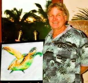
Internationally Exhibited Artist Aelbert Aehegma Kailua Kona Art Exhibit Spnsored by Tour Guide Hawaii


Aelbert MC Aehegma and Tour Guide Hawaii cordially invite the public to his exhibit, Thursday-Saturday afternoons and evenings through May, 2008.

Tour Guide Hawaii is sponsoring a showing by Internationally Exhibited artist Aelbert MC Aehegma at their rental shack on Thursday, Friday and Saturday afternoons and evenings through the month of May. Tour Guide Hawaii, a local company and the industry leader in GPS-guided tours, is located n Ali'i Drive at the south end of Kailua Village in a coffee shack on the lawn in front of Huggo's Restaurant (see map here). The artist will be available at the showings.

Aelbert M.C. Aehegma has been exhibited in over a dozen countries and major art cities, including New York City, Geneva, Paris, Washington D.C. and Honolulu. Countries his works have been exhibited in include Spain, New Zealand, Greece, France, Norway, Sweden, Italy, Switzerland and the U.S, as well as the First Art Show in Space aboard The MIR Space Station. His luminous, post-impressionist paintings and stone and wood sculptures are in notable private collections around the world; his works intrigue a broad section of art collectors. His works are included in collections as broad as the hostess of the Playboy Show on T.V. to President George W. Bush.

Aelbert is from a family of many generations of artists. His mission is to share the artist's vision of man's connection to nature, to share the simple beauty naturally within all nature including our own nature. His playful nature beings and the joy of life illuminating from his canvases is alive with myriad color affects, and bathed in light & love.

Aelbert's current exhibits include Museo Angel Orensantz, Spain; American Express Tourism Center, Hilton Waikoloa Village, Hawaii; Hooked Art Gallery, Waimea, Hawaii; Artist-in-Residence, Kona Coast Resort, Hawaii; Artist-in-Residence at Tour Guide Hawaii (Sponsor), Hawaii.

He carves marble and other stones with some hand tools made by his great grandfather over two-hundred years ago, and used by generations in his family.

Aelbert has also worked with metal, wood and other materials. Currently, he is accepting commissions for murals for homes and businesses, as well as monumental indoor and outdoor friezes and sculptures.

Commissions are now being accepted for 2008-2009. Inquires are accepted. Please Call directly to 808 895-7107 Pacific Art Design. Complimentary Consultation and Appraisals are now being offered. To contact by E-mail: pacifictalent@yahoo.com.

Inquires for sample images of special genres such as seascapes, mountainscapes, lavascapes, etc. will be sent by e-mail if requested.

Commissions accepted include: single, couple or group portraits, boat and animal portraits, home, business and estate renderings.

More information on Internationally Exhibited Artist Aelbert MC Aehegma is available here. More information on Tour Guide Hawaii is available here and here.

Internatoanlly Exhibited Artist Aelbert Aehegma

Friday, March 14, 2008

Frank's Big Island Travel Hints # 7: Around Hilo


Hilo Side: Akaka Falls to Panaewa Rainforest Zoo

On your way back to the highway, stop in Honomu for some local-style shopping and a snack. Handmade curios and ice creams will delight your senses. Once back on Highway 19, turn right toward Hilo, about 10 minutes away.

Hilo is one of the wettest cities in the U.S. averaging around 200 inches per year. This old-style Hawaii town is quaint and bustling. Lots of great shops line the waterfront drive and the largest farmer’s market on the island is situated there as well. Tour Guide will take you right into the heart of town and give you history and attractions, such as the Pacific Tsunami Museum, and the Imiloa Astronomy Center at the University of Hawaii, Hilo Campus. A little farther along the coast are some beautiful beach parks like Richardson and Onekahakaha. Great picnicking, swimming and some good snorkeling can be found here. The Suisan Fish Market is famous for the early morning old-style fish auction. Be sure to take your time in Hilo as the shopping food options are immense.

In Hilo, you will turn north onto Highway. 11 at the intersection near Ken’s Pancake House, a landmark eatery. You will see the airport and Prince Kuhio Plaza on your way out of town. Stop in and visit the mall and shop and eat if you missed it in town. Just a few miles north of the mall is the Panaewa Rainforest Zoo. Tour Guide will tell you how this is the only rainforest zoo in North America. It is also free.

Super Tip: Gasoline in Hilo is typically 6-10 cents per gallon cheaper because it is the main port on the island. It is wise to fill up before heading back to Kona.

This completes this drive day. I suggest returning north through Hilo and back up the Hamakua Coast, through Waimea, and Highway 190 back to Kona.

For further information, visit www.tourguidehawaii.com.

Saturday, March 1, 2008

Frank's Big Island Travel Hints #6: Waimea and the Hamakua Coast


For a third day of driving, it’s time to explore the east side of the Big Island. Hilo is known to be one of the wettest cities in the U.S and tropical rainforest extends from the Puna district, south of Hilo, all the way to the northern tip of the island. Here, Tour Guide will show you the favorite sights and the out-of-the-way places as well.

Super tip: For this leg of your tour you should bring some rain gear. Umbrellas or panchos are the easiest ways to get a little protection. It tends to rain off and on throughout to day on the east side.

Leaving Kona, take Hwy 190 up the mountain for some panoramic views of the Kohala Coast. It’s about a 45 minute drive to Waimea, which is a good place to stop for breakfast or at the grocery store if you haven’t stocked your cooler already. Tour Guide will have all the info on museums, an arboretum as well as shopping and up-country activities in Waimea. Here you’ll also connect to Hwy 19.

Continue on Hwy 19 north and view the scenic rolling pasturelands of the Parker Ranch, one of the largest privately owned ranches in the U.S. About 20 minutes drive brings you to the town of Honoka’a. Turning left, and going through town, you’ll find more great shops, antique stores and restaurants. Nine miles on Hwy 240 brings you to Waipi’o Valley. This is one of the most photographed areas in the state. This 20 mile stretch between Waipi’o and Pololu is often called “Hawaii untouched”, boasting the largest waterfalls in the state, but can only be viewed by air tours or multi-day hikes. Tour Guide will tell you why this area was sacred to the ancient Hawaiians. You can also find out about air tours in Tour Guide’s activities section.

Head back toward Honoka'a Hwy 19 and turn southbound toward Hilo along the Hamakua Coast. This area was once all sugar cane fields but now many diversified agricultural crops are grown here. The first crop you will see is eucalyptus. Acres and acres of this fragrant tree yield sap for medicines and perfumeries all around the world. There is a rainforest preserve, Kalopa Park, just 3 miles upslope from the hwy. It’s tricky to find, but Tour Guide will show you the way to this peaceful cabin camp spot with horseback riding and bird watching.

As you continue driving south, you cross many bridges over gorges and valleys, many of which have viewable waterfalls and rivers that empty into the ocean. Don’t forget to stop and get some pictures this unique scenery. The terrain is lush and green with a huge variety of tropical flowers. Other crops also come into view such as mangoes, papayas, ginger and bananas. Tour Guide will tell you about the trains that used to transport sugar cane to the mills near Hilo and you can stop and see the train museum along the way.

Next up is one of the most famous and beautiful waterfalls in Hawaii, Akaka Falls, a 420 ft. fall, which is just 3 miles off the hwy, but worlds away. The one mile hike on a paved trail through the rainforest will pass two smaller waterfalls as well as orchid, heleconia, plumeria and other tropical plants. Tour Guide will tell the history of this area as well.

Monday, February 18, 2008

Frank's Big Island Travel Hints #3: Kona North to Waikoloa and the Kohala Coast


For an interesting day of driving, head north out of Kona on Hwy. 19. About 4 miles out of town we come across the Kaloko-Honokohau Historic Park. There is a new visitor center giving info on the significance of this area to ancient Hawaiians. Tour Guide has an extensive narration about this area. The adjacent Honokohau small boat harbor is an excellent spot to find hiking trails, beaches, snorkeling, whale watching and deep sea fishing.

Continue driving north past the Kona International Airport, you will be viewing lava fields dating back to 1802. Another 10 minutes brings you to the turn off for the Hualalai resorts. The Kona Village and Four Seasons resorts are surrounded by the beautiful Hualalai Golf Course, home of the PGA MasterCard Championship. Tour Guide lists every golf course on the Big Island. This whole resort area was built to be nearly invisible from the hwy.

After the Hualali Resorts, there is about 20 minutes of driving to reach the Waikoloa resorts. Tour Guide will you give info on some secluded beaches along the way. For most of these you will have to park on the hwy and hike to the shore. Since these beaches are so secluded, there will be no facilities. My favorite of these is Kua Bay. Here there is parking near the beach, restrooms and water available, but no shade. Since there is no sign on the hwy, Tour Guide will tell you where to turn to find this family friendly beach park.

Super tip: Hawaii is much closer to the equator than you may be used to. Even when it’s cloudy, the sun will burn the skin quickly. Your friendly staff at Tour Guide recommends you use sunscreen liberally and re-apply often, especially after swimming, snorkeling or hiking.

Next, as we head north, is the Waikoloa Beach Resorts. This beautiful resort area is cut right out of the jagged lava rock. It boasts the Marriott and Hilton Waikoloa which have shops and fabulous dining. Many coupons and much 9information of the restaurants and shops in this are can be found in two Big Island magazines, here and here. Hilton Grand Vacations operates a huge timeshare resort here and there are numerous condos all centered around two championship golf courses. Tour Guide will give turn-by-turn directions to the resorts and golf courses in this area.

The King’s Shops and Queen’s Marketplace, on Waikoloa Beach Drive, offers mid to high end shopping with some famous brand name stores. If an ultimate dining experience is what you’re after, world famous chef’s whip up their culinary delights to tempt your palate. There is also a food court for more casual dining. Tour Guide will take you to all of this, plus family activities like sun bathing, swimming, snorkeling, wind surfing and dinner cruises, focused around the most photographed sunset spot on the island, Anaeho’omalu Bay.


Casino Bonus no Deposit